


Most Recent Visit: August 2024
The Roman city of Carsulae seems to have been founded around 220 BCE, when a branch of the Via Flaminia was built through the region between Rome and Ariminum. The exact date of foundation is not known, though. Prior to 3rd century BCE, the city was in the territory of the Umbri, an Italic people. Following their support of the Samnites in the late 4th century/early 3rd century BCE, they were subjected to a period of integration into Roman hegemony. The details of this integration and any force that may have been needed to coerce it are unclear. The construction of the Via Flaminia through the territory of the Umbri was done partially as a means to finalize this process. The presence of an Umbrian settlement at or in the vicinity of Carsulae is unclear from an archaeological standpoint, though the etymology of the name seemingly rooted in Proto-Indo European rather than Latin would likely indicate a place name originating prior to the Roman arrival. The Umbrian town would likely have been situated in the hills above Carsulae to the east.
The selection of the particular site for Carsulae may have had to do with the high calcium spring located there. The later association with the site for healing during and after the Roman period could have preceded the Roman settlement. A bottling plant for Sangemeni mineral water is today located just down the road from the archaeological site. Carsulae doesn’t feature much in the historical record. Sometime during the reign of Augustus, it seems as though Carsulae was given municipium. It was also during this time that a number of monumental public works were initiated in the city and it seems to have become somewhat of a tourist destination for the elite of Rome. In the midst of the civil wars of 69 CE, the forces of Vespasian are noted by Tacitus as having stopped and regrouped at Carsulae.
The city began to enter a period of decline starting in the 4th century CE. This is thought to have occurred due to the lack of defensive fortifications, leaving the city vulnerable to the increasing Germanic incursions into Italy. An earthquake is also cited as a possible reason for the depopulation of the city. A later eastern branch of the Via Flaminia, the Via Flaminia Nova, deviated to the east of Carsulae. It ran from Narnia (modern Narni) to Fulginiae (modern Foligno) via Spoletium (modern Spoleto) rather than through Carsulae. In the 4th century CE, it seems as though this branch was favored over that which ran through Carsulae, probably contributing to the decline of the city. Though there is evidence to suggest some settlement on a much smaller scale between the 5th and 12th centuries CE, the city was largely abandoned at some point in the early 5th century CE.
Getting There: The archaeological park for Carsulae is relatively isolated and is best reached by private transport. There are a couple of buses from Terni, the E618 and E619 lines that run from the train and bus station in Terni to Acquaforte, which is where the mineral water bottling plant is located. From there it’s about a 20 minute walk to the archaeological park. There are only a few departures a day, spread out primarily in the early morning, early afternoon, and late afternoon. The trip is about 45 minutes each way. Updated schedules can be found here.
The entirety of the excavated remains of the city are contained within the Area Archeologica Carsulae (though there are a few nearby bridges from the Via Flaminia). The parking for the site is located along Strada Provinciale 22 about 2 kilometers north of Pozzo Azzuano. The site is open in the summer (April through October) from 8:30 to 19:30 everyday, except for Monday when the site is closed. The rest of the year it is open from 8:30 to 17:30 and is again closed on Monday. Admission is 5 Euros.
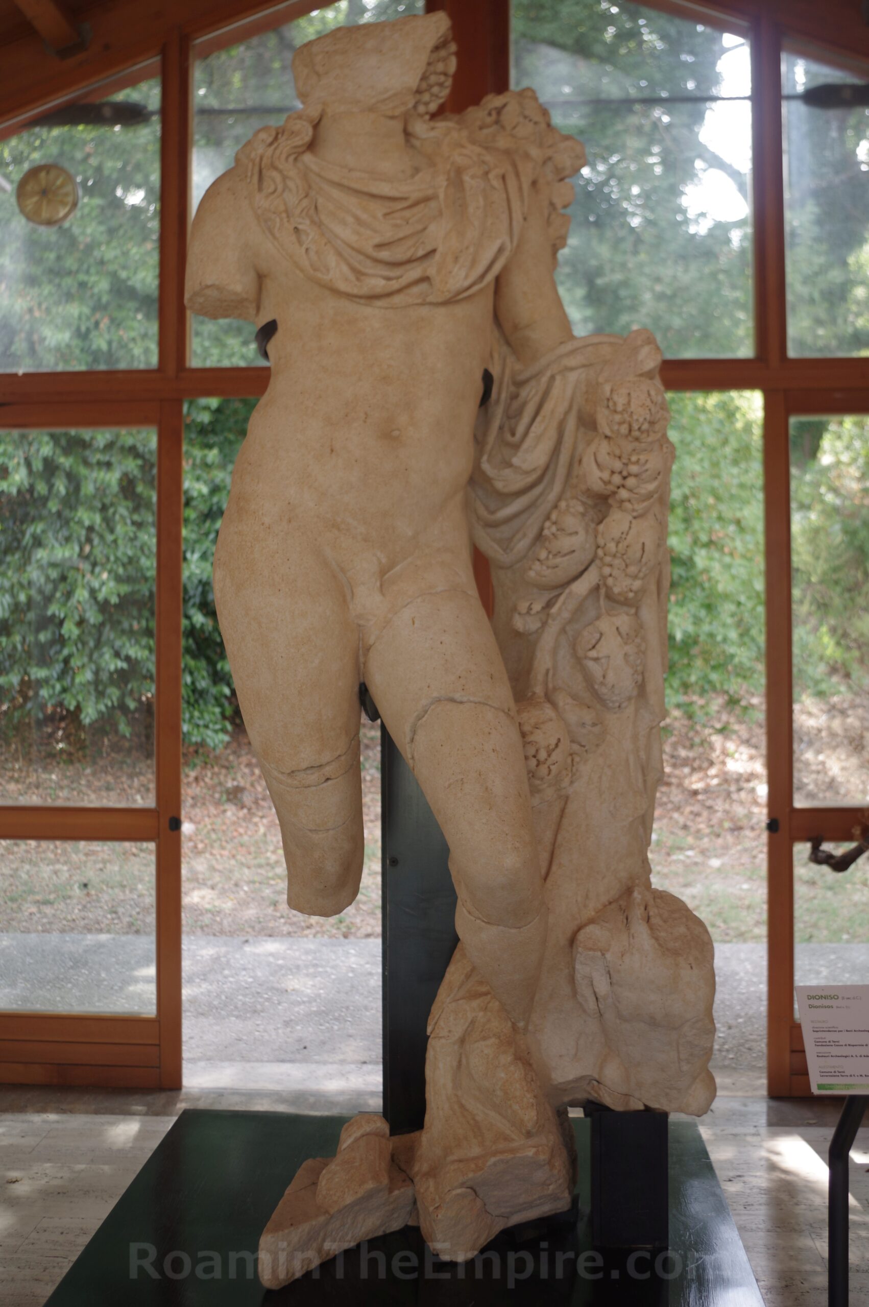
At the entrance to the archaeological park is a small on-site museum/visitor’s center. There isn’t really any information in the museum that is particularly important for the enjoyment or context of the site, so it can be visited prior to visiting the site or after, as I did. The artifacts in the museum were all found in the excavations at Carsulae. A large part of the collection are sarcophagi and funerary stele. There are a few statues and fragments of statues, the highlight being the bulk of a statue of Dionysus. Also present in the collection are some smaller finds; terracotta lamps and antefixa and a even few fragmentary graffiti inscriptions on plaster and an incised game board. Again, it’s not a particularly large collection, it only took me around 20 minutes to go through it.
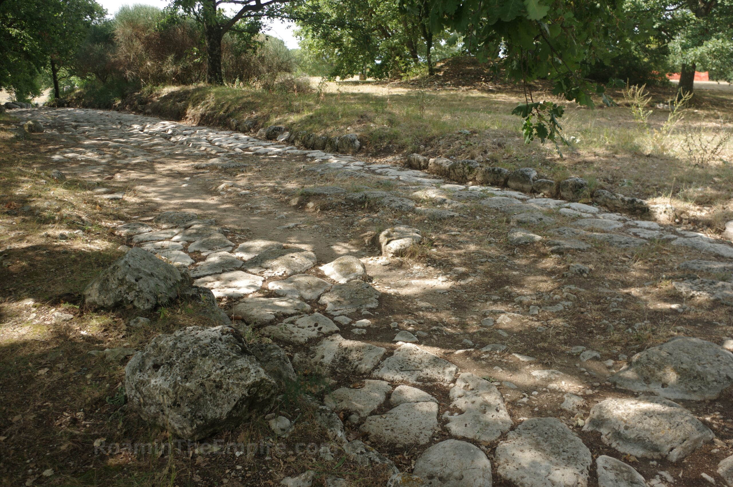
The remnants of the city are located starting about 100 meters northwest from the entrance and visitor’s center. The first point of interest encountered is a section of the Via Flaminia, which ran through the city and functioned as the cardo maximus within the Carsulae, south of the city center. Located in a trench, there isn’t a whole lot remaining, though there are a couple portions here where several courses of the stone pavement are still visible together. Most of the rest of this part of the Via Flaminia, however, is just scattered stones. The trench follows the path up to where it eventually becomes more prominent in the center of the city.
About 70 meters to the southwest of the southern portions of the Via Flaminia excavations are a large bathing complex beneath a modern protective roof. These baths are believed to have been constructed in 1st century CE with at least one other subsequent major phase of construction, though the date of this phase is unknown. Unfortunately, when I visited nearly the entirety of the baths were covered up with tarps, despite the protective ceiling. The only thing really visible were some of the pilae stacks from the hypocaust system in the southern corner.
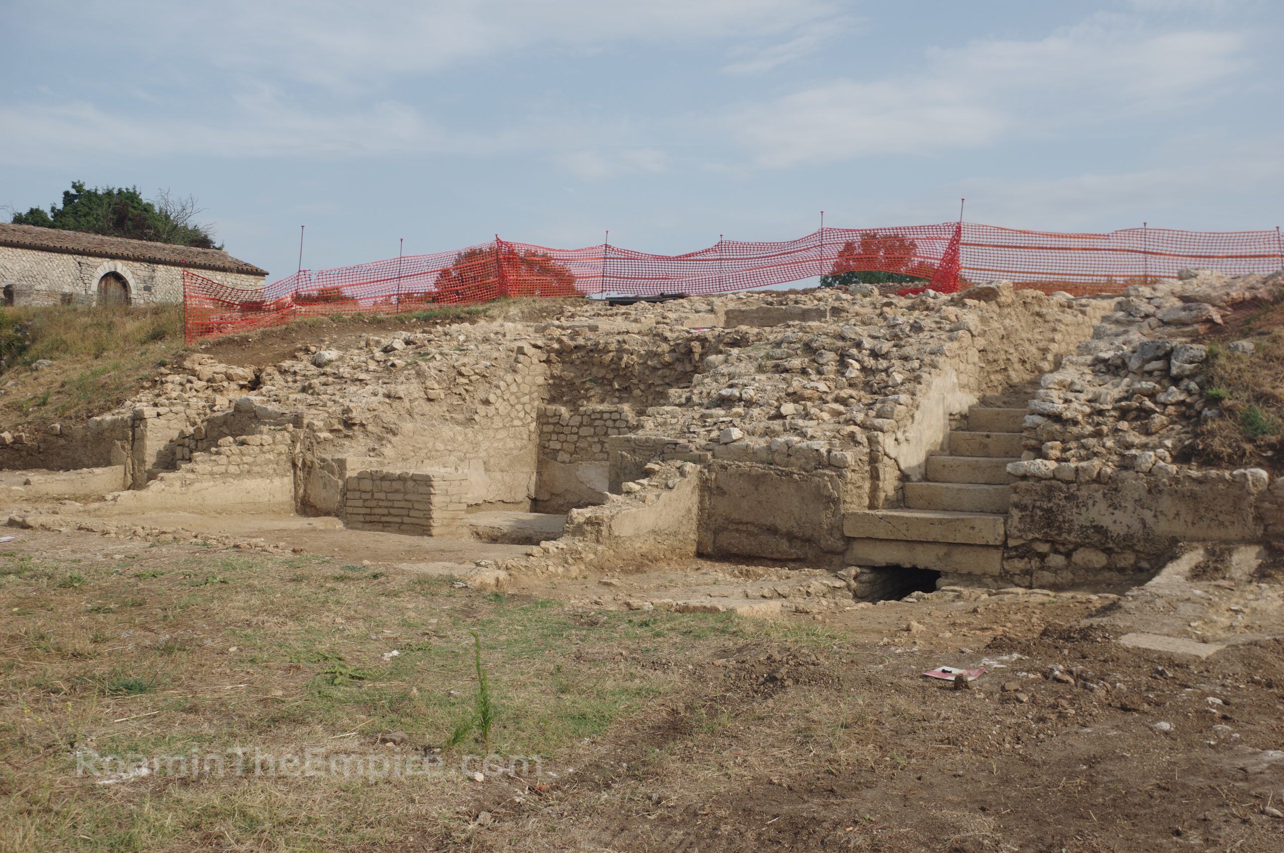
Heading back to the Via Flaminia and taking the path toward the city, there’s an excavated area on the slope of the hill just to the west of the road about 25 meters. This seems to be a relatively recently excavated area, it’s not on any of the site maps and looked to be in the midst of active excavation. In the side of the slope is a well-preserved staircase, under which emanates a small channel. Next to that is a square room structure, and further to the west another small channel leading out from beneath a wall, behind which is a much larger channel. Atop the hill, one can see a very large chamber, perhaps a cistern given the adjacent channels below on the slope. A series of square stones, perhaps column pads, extends eastward for several meters from roughly the bottom of the staircase. It would seem that this structure may be a nymphaeum given the heavy usage of water features.
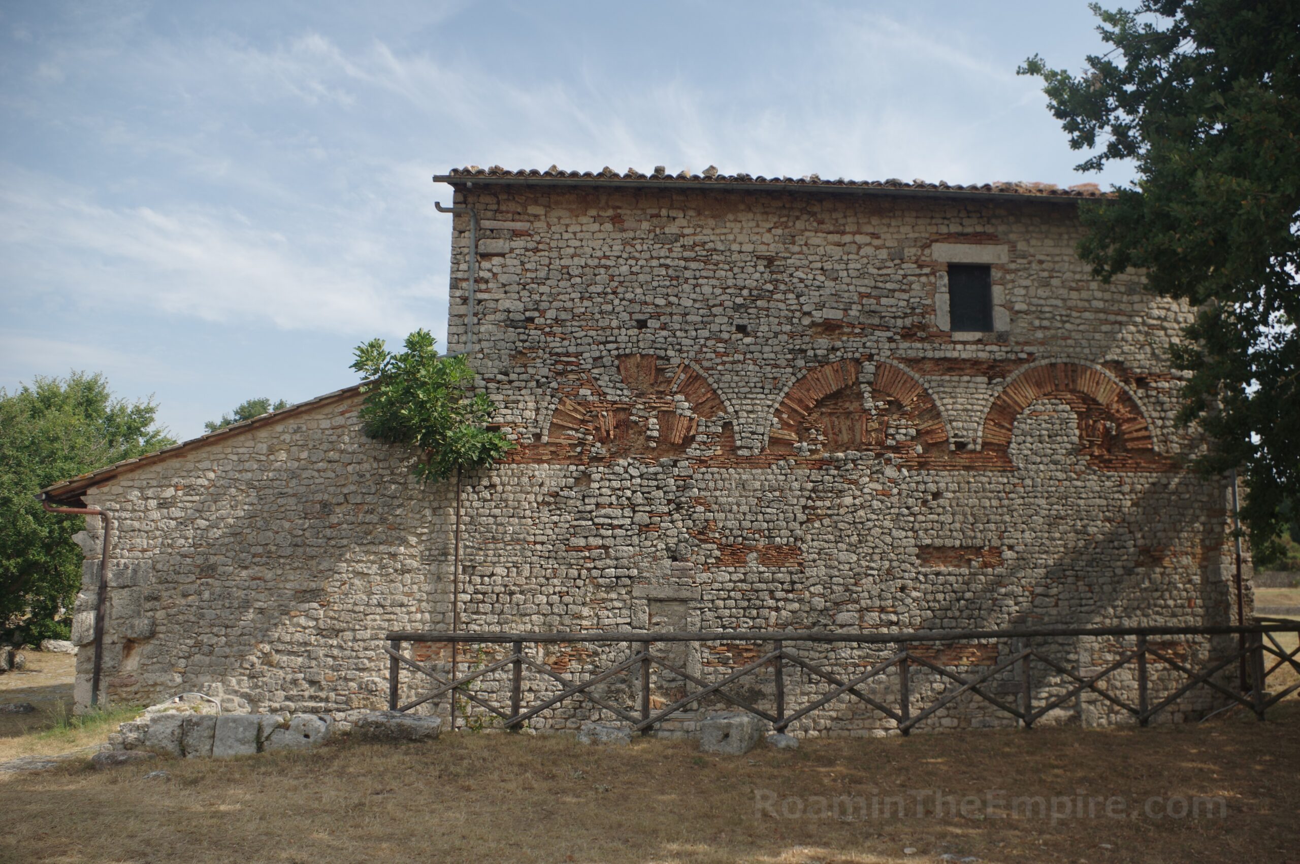
Back to the Via Flaminia, the road climbs up a gentle slope and the paving stones become more frequent as the road takes a more recognizable shape. At the top of the slope, on the east side is the Chiesa di Santi Cosma e Damiano. The church itself was originally constructed in the 6th century CE, but was constructed within and on the remnants of a Roman building of uncertain use (but possibly the macellum) dating to the 1st or 2nd century CE. Parts of this or another ancient building are also visible on the south side of the church. The church was also constructed using spolia from the surrounding Roman buildings. This is particularly apparent at the front of the church. Inside there is more spolia as well as a few inscriptions on display and some marble slabs taken from the floor of a building on the north side of the forum.
Across from the Chiesa Santi Cosma e Damiano is a mostly unexcavated insula. There are a few visible elements along the east side of this block, but most of what has been excavated is along the north side. These are identified as potentially being tabernae. On the north side of the church are some mostly non-descript remnants of buildings. These are located at a lower level than the church and are identified as two distinct buildings; the south building being a trade or commercial related building and the north structure being a residence of some sort. The structure has also been proposed to have been a hospitium. It is believed that these buildings may have later been repurposed for a monastery associated with the church.
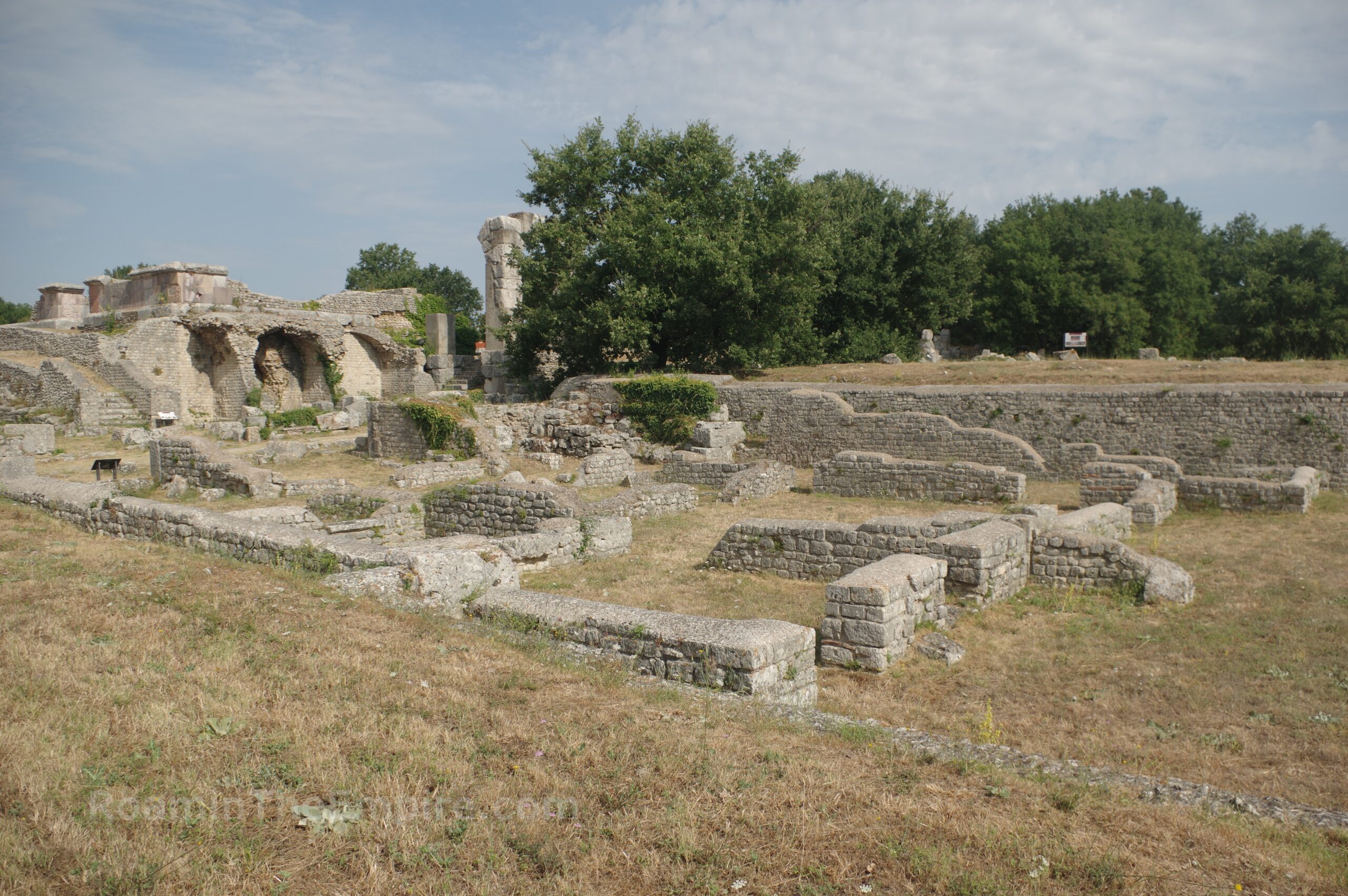
Continuing north on the Via Flaminia, one enters the core of the forum area of Carsulae. At the right (just to the north of the commercial and residential complex) is the civic basilica. The basilica was constructed in the early imperial era, likely part of the monumental works that occurred during the reign of Augustus, when the city was given municipium. The internal part of the basilica is pretty sparse. Only a little bit of the western wall and some scattered column pads from the internal colonnades of the building remain. The raised platform on which the basilica was constructed is well preserved, though. The basilica is about a meter higher than the buildings to the south of it and the area to the east of it. On the east side, the form of the apse is clearly visible as part of the retaining wall, though nothing above that foundation survives.
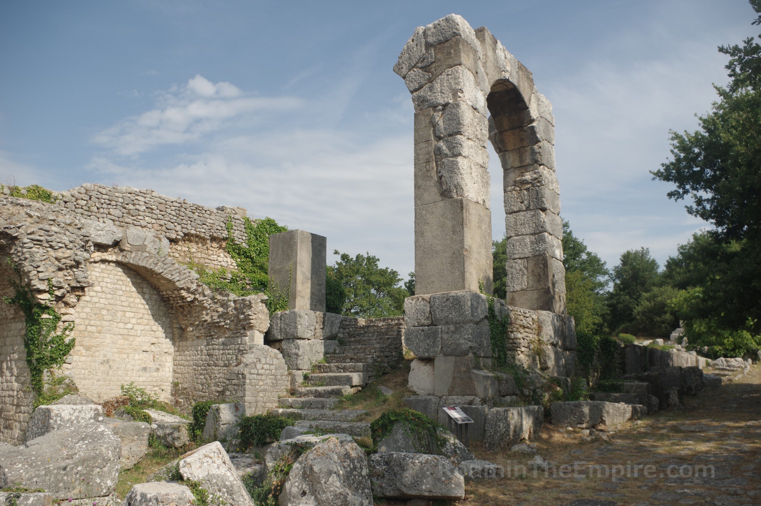
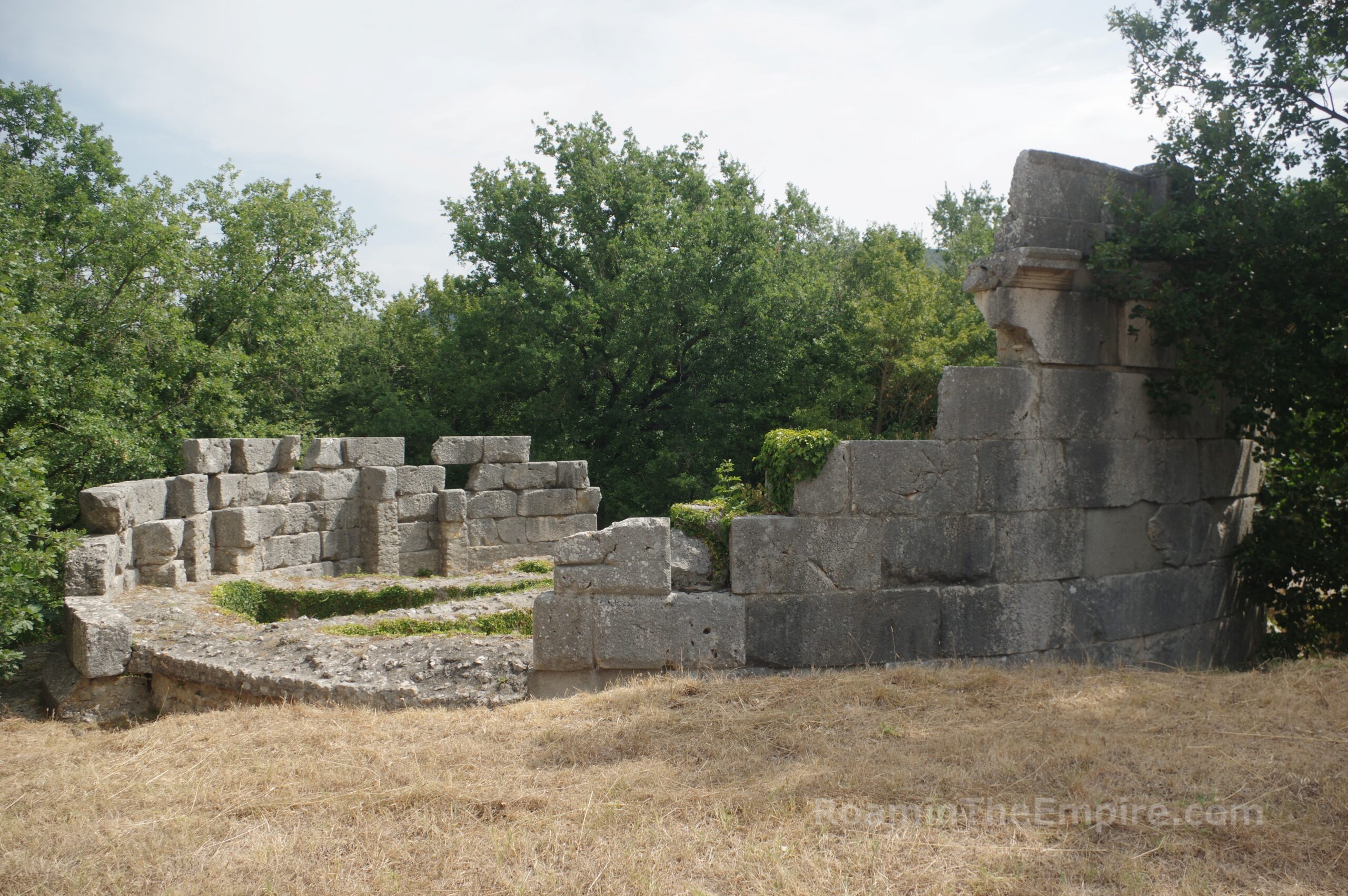
Opposite the entrance area of the basilica is a raised arch. This is one of two quadrifrons arches that served as monumental entrances on the east side of the forum. Only a single complete/reconstructed arch of the four that made up the structure is standing. At this point, the forum was constructed at a noticeably higher level than the Via Flaminia to adjust for the slope of the site. A stairway leads up and through the arch to access the forum. To the left are several vaulted niches in the platform that was used to construct a pair of temples on the south side of the forum. These niches seemed to have served as tabernae. Originally, there was a fourth, but it was removed for the construction of the quadrifrons arch. A second staircase leads up the platform to the rear of the temples on the south side of the vaulted tabernae.
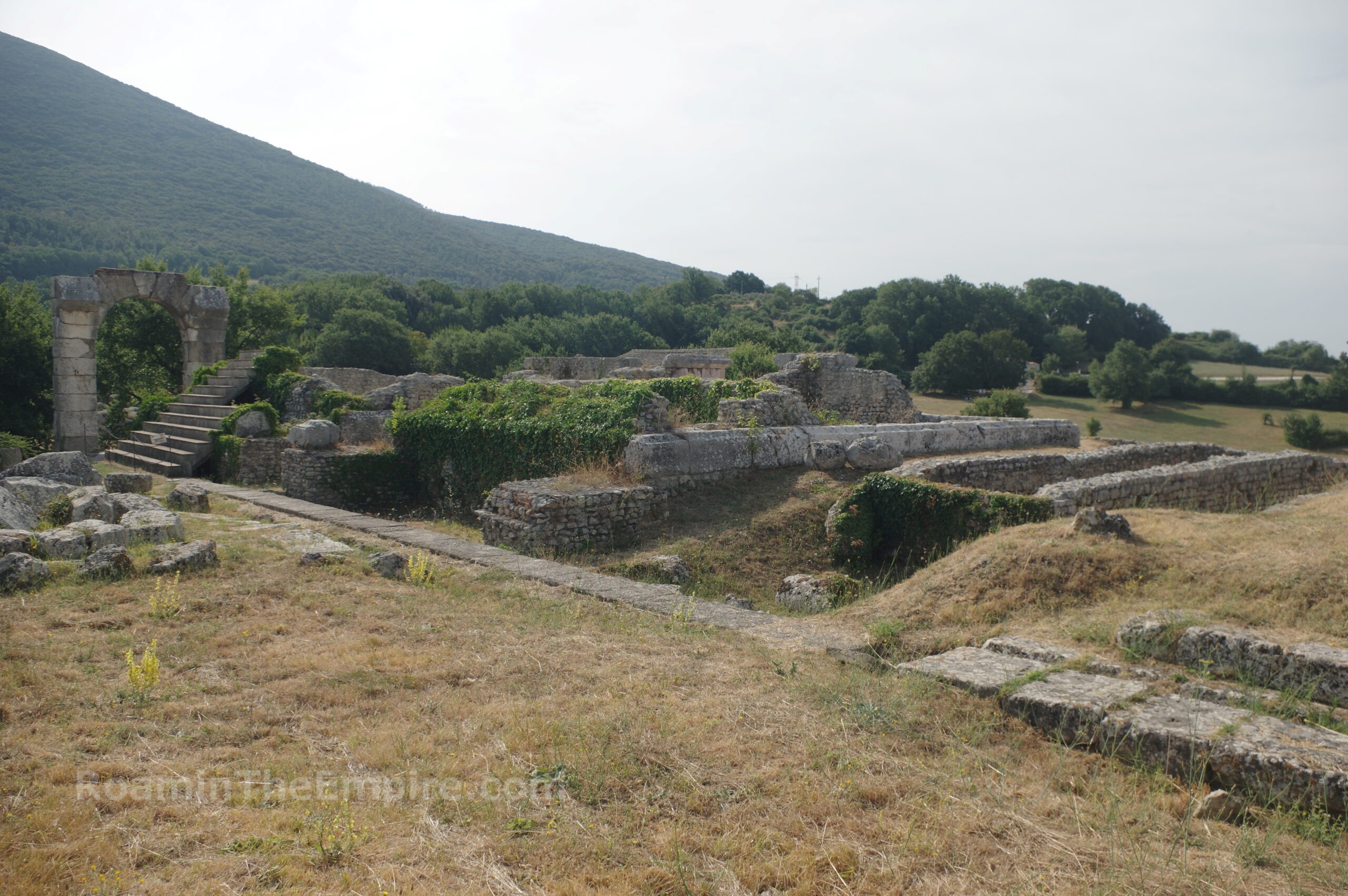
Ascending the staircase through the quadrifrons arch again leads to the forum of Carsulae and to the front of a pair of temples, referred to as the Templi Gemelli, or the twin temples. Like much of the rest of the remnants of the forum area, the temples date to the Julio-Claudian period. Unfortunately, no evidence has been found to indicate to which deities the temples are dedicated. Their identical nature and the healing associations with the site have led some to theorize that the temples may be dedicated to Castor and Pollux. The podiums of the temples are fairly intact. A pink granite was used to face the podia, some of which is visible on the rear of the temples (which can be accessed by a path between the two). The eastern temple has a reconstructed staircase (100% modern), but it is inaccessible.
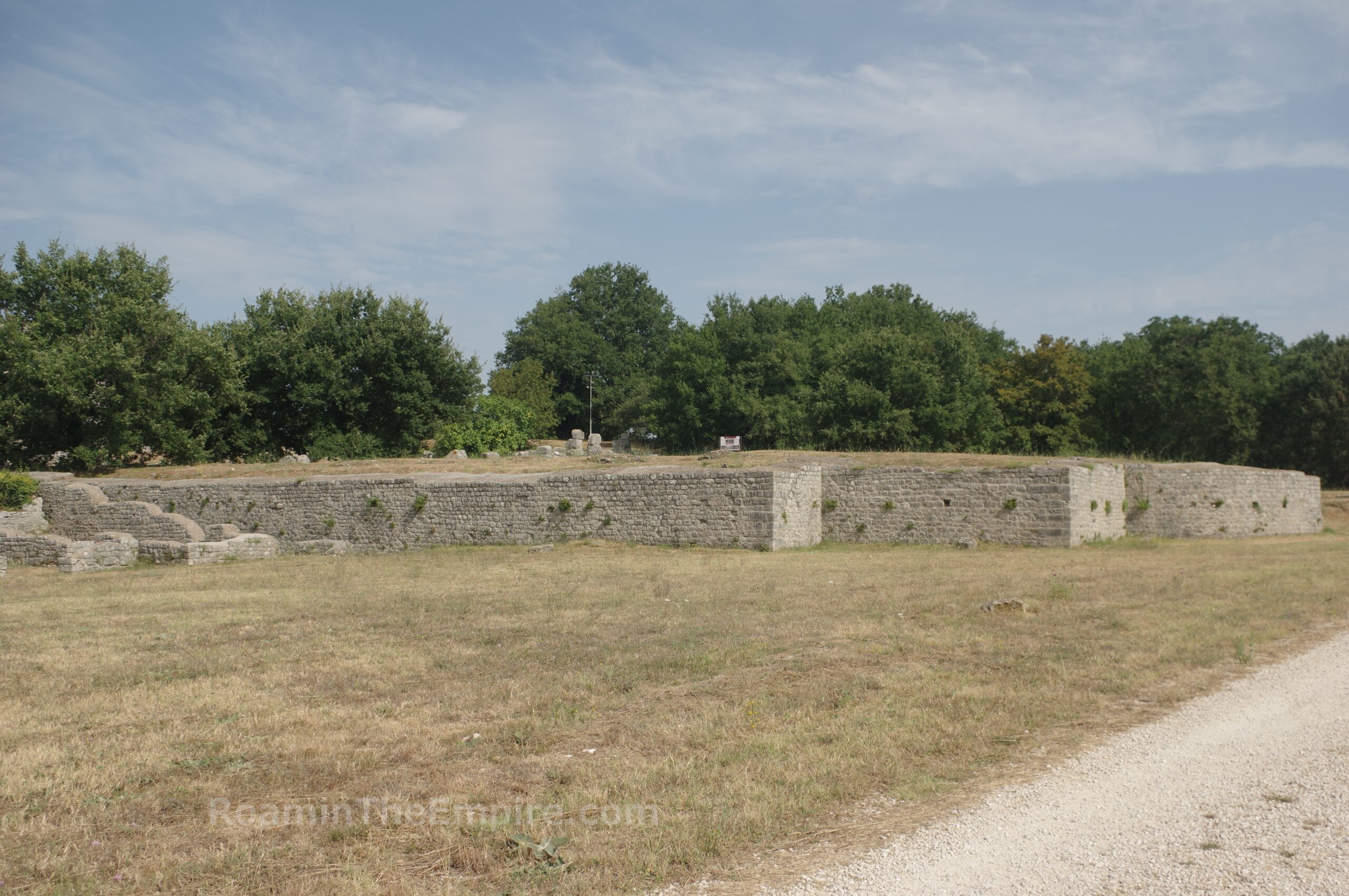
The forum itself has a trapezoidal shape, rather than the more classic rectangular shape. The west side of the forum is shorter than the east side. Nothing really remains of the paving of the open area of the forum. To the west of the temples, part of the crepidoma of the southern border of the forum is preserved. Located at this point, which would have been the southwestern corner of the forum are some excavations of a large building referred to as the Domus dei Mosaici. Unfortunately, the mosaics that give the building its name are covered. Rather than a private residence, this seems to be a public building of some sort. Perhaps the seat of a collegium or priesthood. With the mosaics covered, there isn’t much to see at this stop other than a few wall foundations indicating some rectilinear rooms. The possible nymphaeum from the new excavations west of the Via Flaminia may be attached to this complex.
Continued in Carsulae, Umbria Part II


Sources:
Smith, William. Dictionary of Greek and Roman Geography. Walton & Murray, 1870.
Stillwell, Richard, William L. MacDonald, and Marian Holland. McAllister. The Princeton Encyclopedia of Classical Sites. Princeton, NJ: Princeton U Press, 1976.
Tacitus. Historiae, 3.60.