


Continued from Lugdunum Part I
Theater/Odeon Archaeological Area
Adjacent to the museum is a complex that includes the theater, odeon, a sanctuary of Cybele, and a few other miscellaneous remains. This park is open every day from 7:00 to 21:00 during the summer (April 15 to September 15) and from 7:00 to 19:00 the rest of the year. There is no admission fee. There are also a few public points where the archaeological park can be viewed the exterior outside those hours.
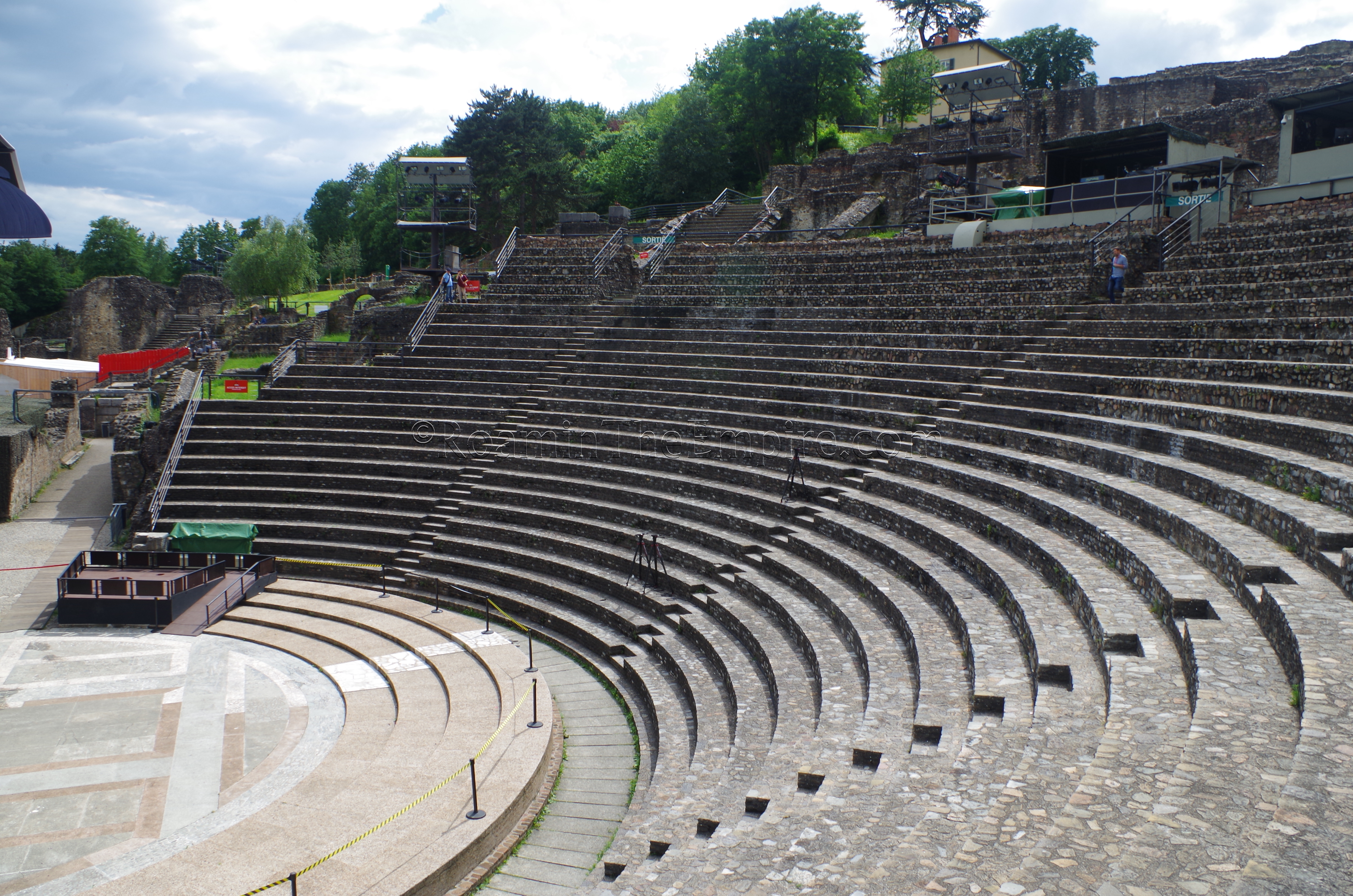
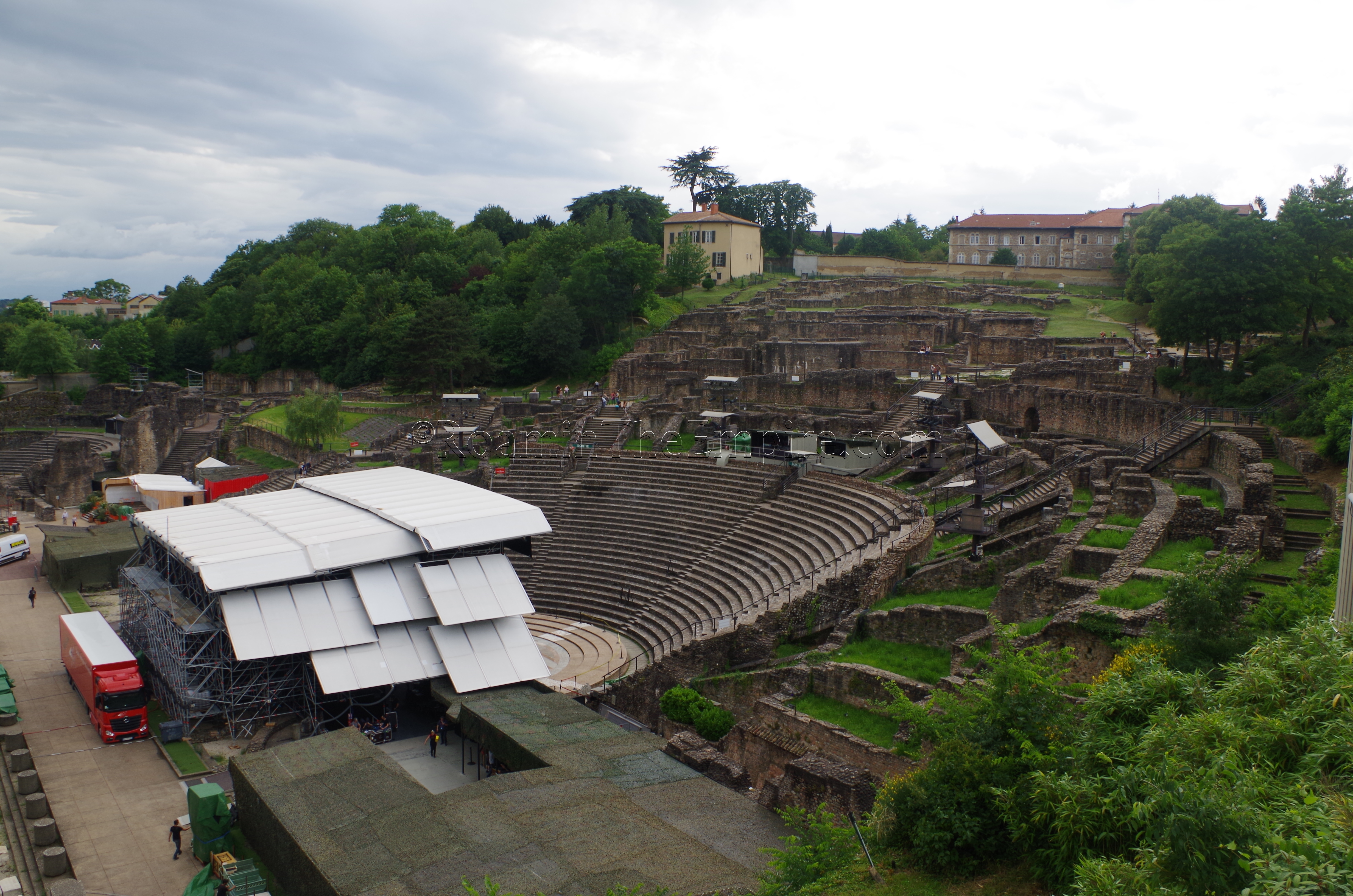
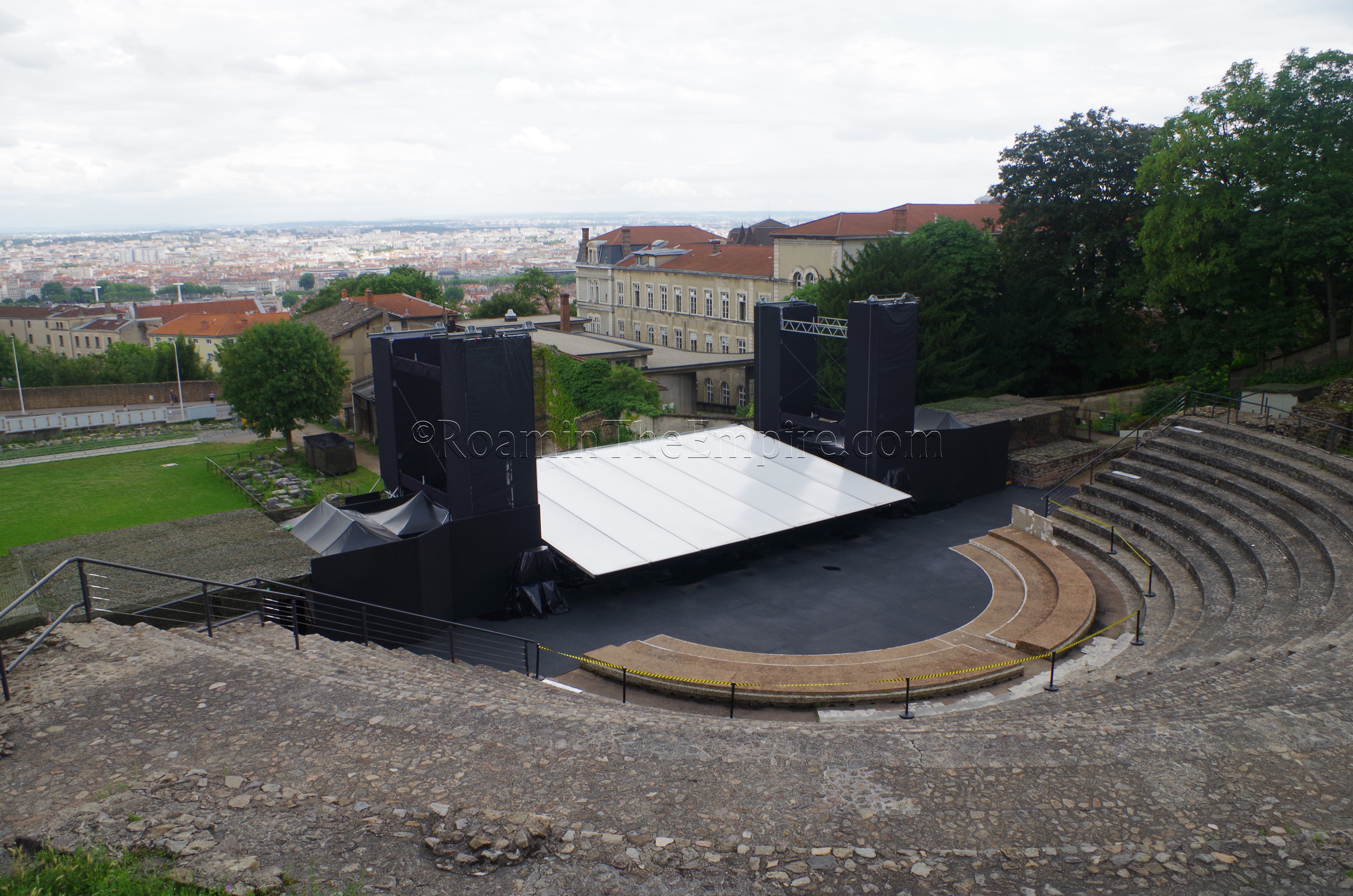
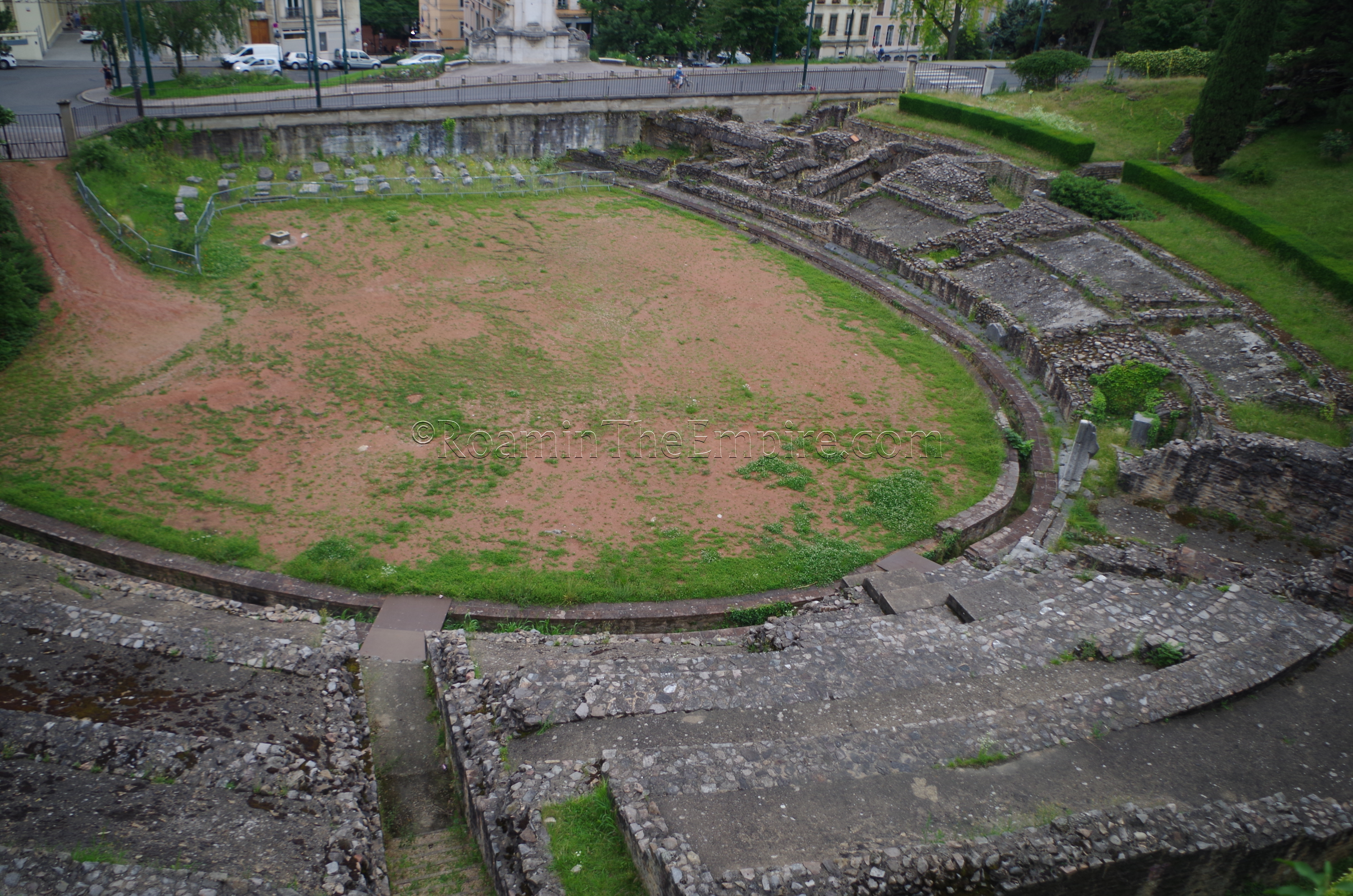
The centerpiece of the park is the Gallo-Roman Theater. The theater was originally constructed around 15 BCE, making it the oldest Roman theater in Gaul. Built with two tiers of seating, it likely held about 5,000 spectators. During the reign of Hadrian, the theater was enlarged with a third tier of seating, effectively doubling the capacity to about 10,700 spectators. Constructed with stone from Glanum, the expanded theater was the largest in Gaul along with those at Augustodunum (Autun) and nearby Vienna (Vienne). Parts of the stage were also renovated and expanded at that time. During the summer, performances are held in the theater, so, at that time of the year, access to the theater itself is limited at times due to activities related to performance preparation. This also means that the stage area is covered by modern constructions, so the ancient constructions are not visible or are limited in their visibility.
Next to the theater is the smaller odeon. Lugdunum and its neighbor, Vienna, are the only two cities in Gaul to have had both a theater and odeon. The odeon is appreciably smaller than even the original version of the theater, with a capacity of about 3,000 people. Like the expanded theater, the odeon was built during the reign of Hadrian. It too, was set up for performances, which, unfortunately covered up the marble paved orchestra area. The marble here, still in-situ, is notable for having Egyptian porphyry and other marbles from Greece, Tunisia, Egypt, and Turkey. There are also fragments of wall painting intact in the rooms of the lower portico, on the southern part of the odeon complex. Though the foundations of the upper level of seating are present, though the remains of the actual cavea are no longer extant. Above the odeon (to the north) are the remains of a street and portico with shops, as well as some fragmentary remains of houses that were demolished when the odeon was built in the 2nd century CE.
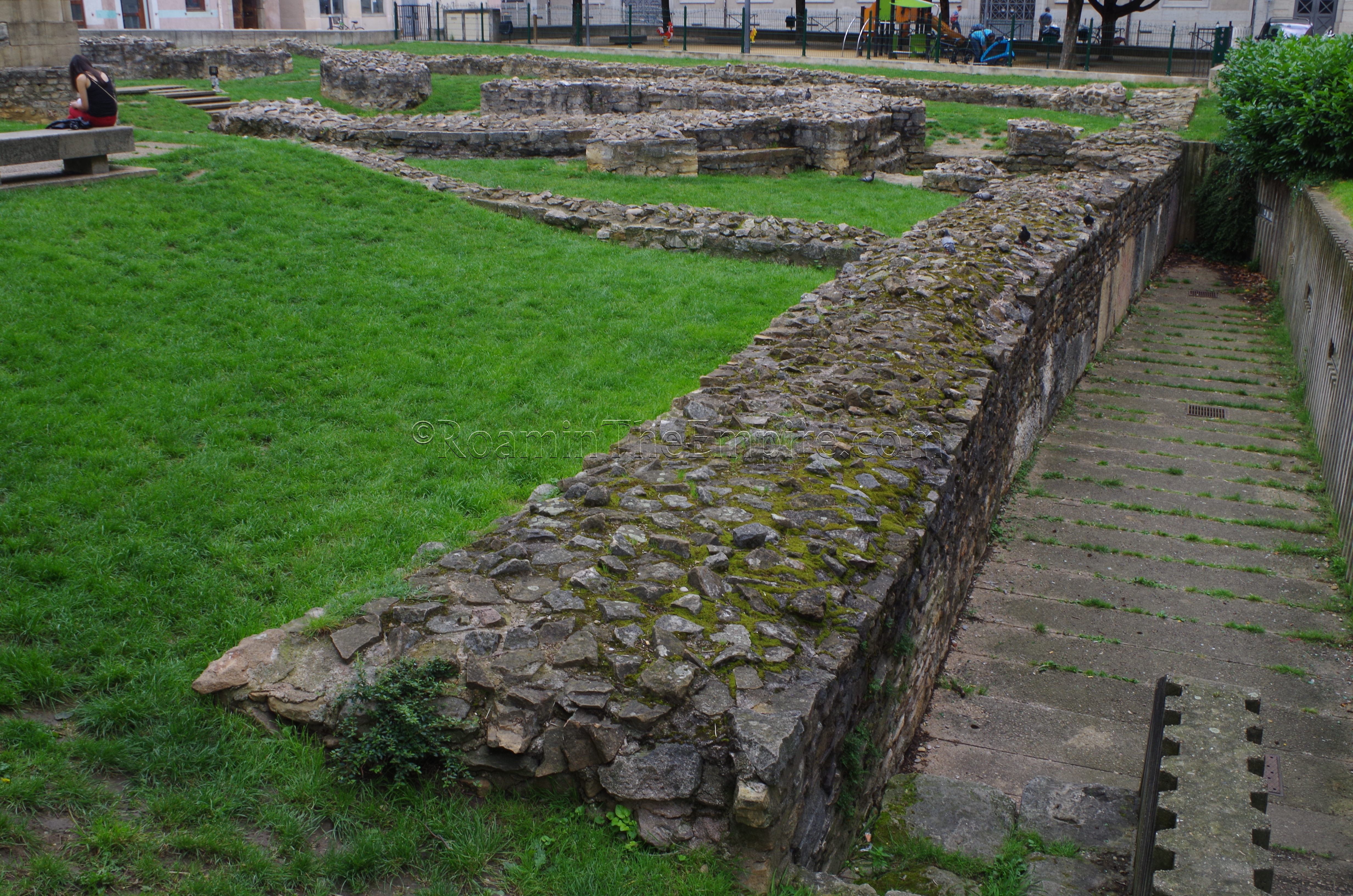
The other main set of remains in the archaeological park is the sanctuary of Cybele. The on-site signage indicates that the structure is of unknown use, but, everywhere else it is pretty widely interpreted to be a sanctuary to the goddess. The sanctuary to Cybele seems to have been built in the middle of the 2nd century CE. An altar found there, and displayed in the nearby museum, indicates a taurobolium sacrifice made for the dedication of the sanctuary on December 9th 160 CE to the health of Emperor Antoninus Pius. Interestingly, the taurobolium itself seems to have taken place in Rome, but the skull and genitals of the bull were taken to Lugdunum for the sacrifice at the sanctuary. The position of this sanctuary overlooking the theater was probably not incidental, as Cybele’s festival, the megalesia, included ludi scaenici that were often performed on the theater-like steps of her temple. It’s reasonable to conclude that the proximity of the sanctuary to the theater might have served the same purpose.
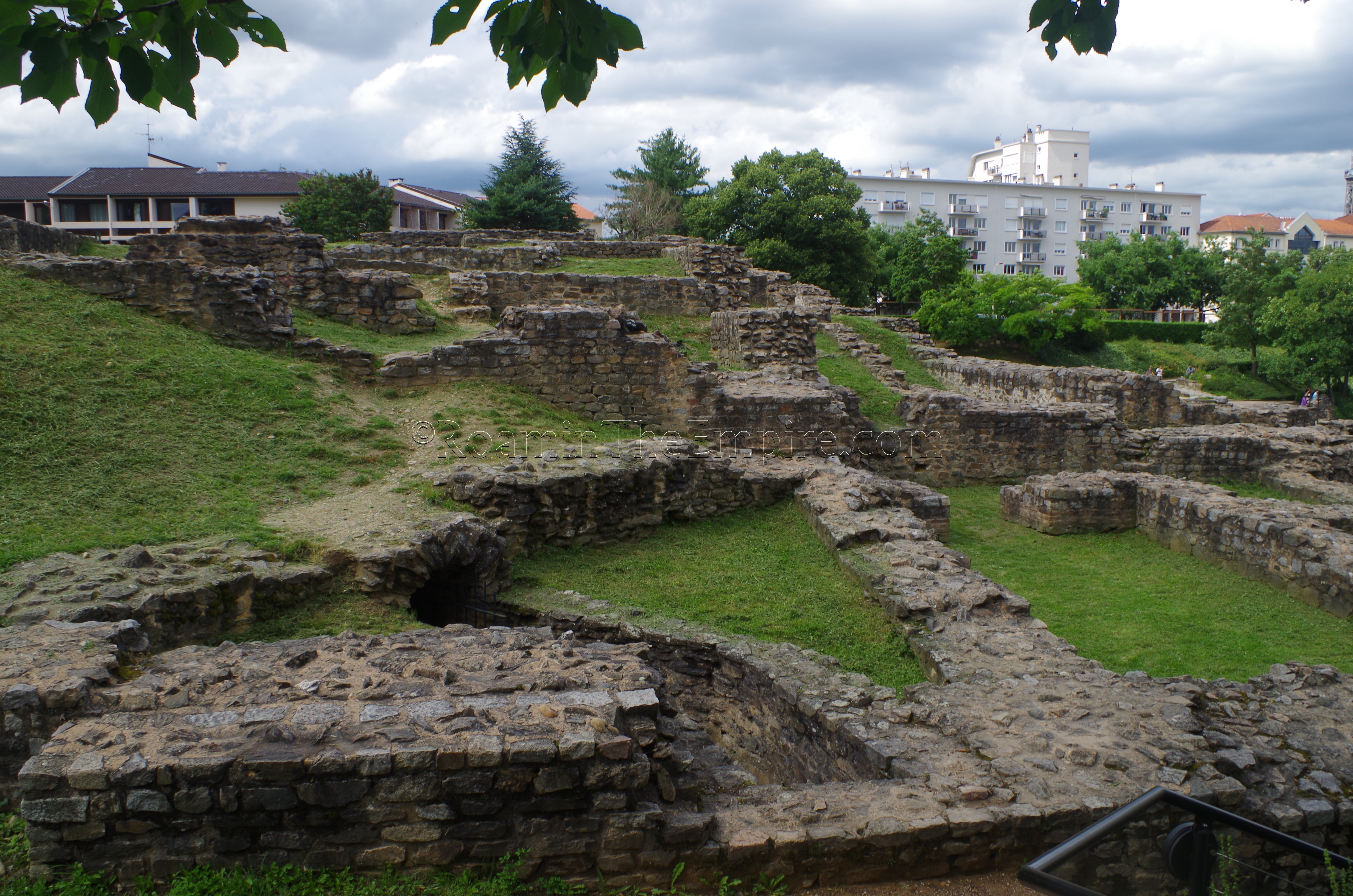
The plan of the sanctuary is difficult to see from the ground, especially as there isn’t much contextual information given and the remains are not preserved at exactly the same level. From above, though, it’s clear to see the rectangular plan of the sanctuary, which is mostly comprised of smaller chambered rooms. There are a few of these rooms with some remaining mosaic pavement, and even one with the remains of a hypocaust system. In the center of the complex are the remains of two large cisterns. The northern part of the sanctuary complex, from the cisterns on, is fenced off and inaccessible. A few large water channels also branch out to the south from either end of the cisterns.
Across the street (Rue Cleberg) from the archaeological museum, just past the eastern end of the museum, is a large, walled greenspace belonging to the residences on that side of the street. Set about 20 meters back from the street, and only visible from the south side of Rue Cleberg, is a large, stone terracing wall. The lower portions of this wall are apparently dated to the Roman period. One of the two forums in the city was located on this upper terrace of the Fourvière Hill, and so a terracing wall was needed here in antiquity to serve the same function as it does today. In the intervening centuries, though, only the lower portion survived and the upper parts of the wall have been replaced in subsequent eras.
Aqueducts
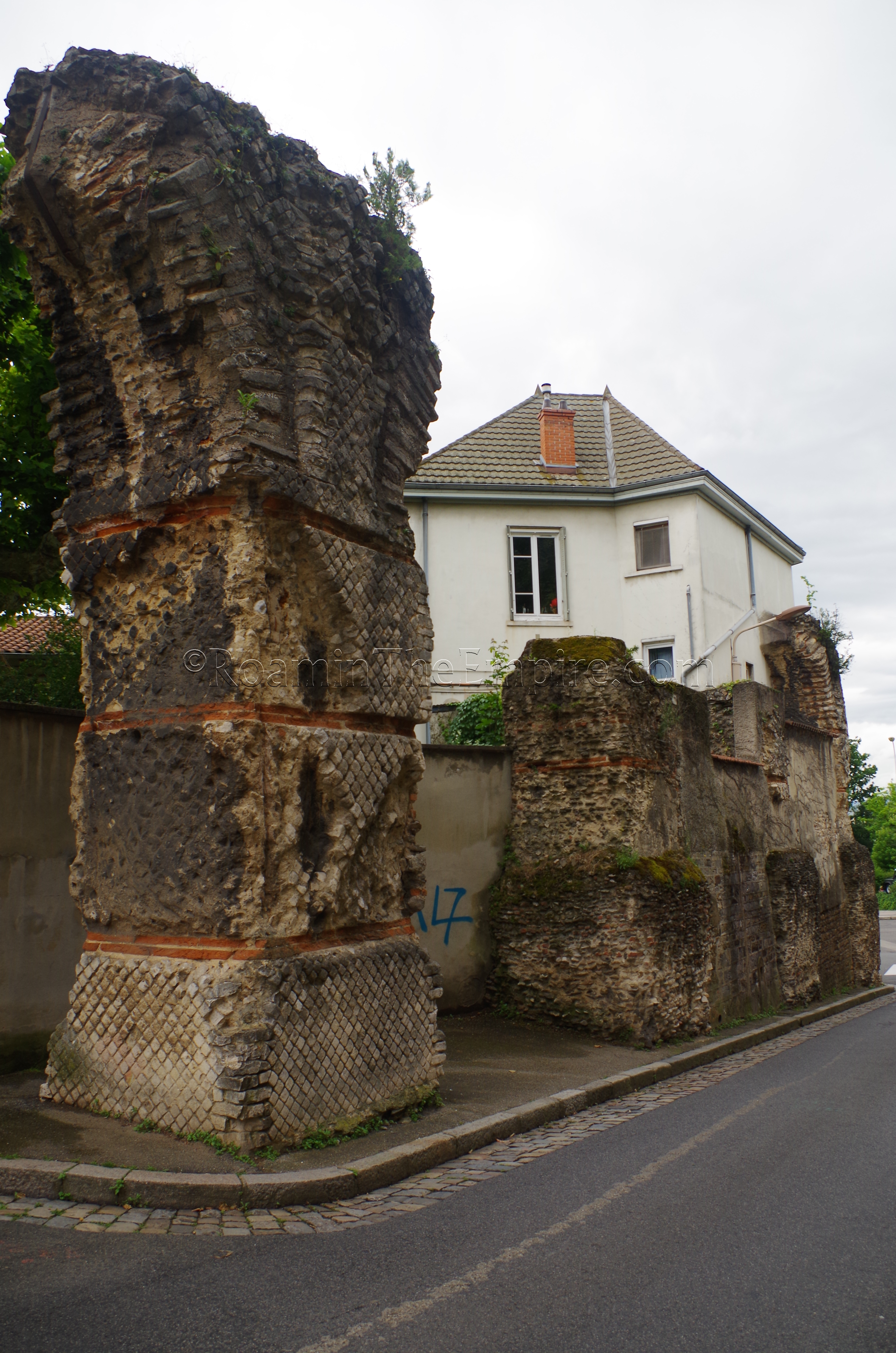
A total of four aqueducts fed the city of Lugdunum at its height, and today, the remains of two of those can be seen in Lyon. Just down the Rue Roger Radisson, to the southwest of the archaeological museum, is the remains of one of those, the Aqueduc du Gier, so named for its source, the Gier River, a tributary of the Rhône River that runs on the slopes of Mont Pilat about 40 kilometers to the southwest of the city. The aqueduct dates perhaps the late 1st century BCE, or first half of the 1st century CE. Significant remains of the aqueduct can be seen along its 75 kilometer course between the Gier and Lugdunum, which apparently employed inverted siphons to traverse valleys, rather than large aqueduct bridges. Only a few arches from the aqueduct remain within the city, about 20 meters northeast of the intersection of Rue Roger Radisson and Rude du Cardinal Gerlier.
About 2.5 kilometers to the west of the theater are the remains of one of the tanks and siphons of the Aqueduc de la Brévenne. This aqueduct, dating to about the time of Claudius, ran about 70 kilometers between the Brévenne River and Lugdunum. Because of a combination of its distance from the city center, the weather, and time, I was not able to visit these remains. I made an attempt one day, but, I missed the bus I needed to be able to make a timely roundtrip, so I abandoned the endeavor. They are, however, very clearly there and publicly visible, so I feel confident in pinning the point on the map. Bus 46 runs right by the aqueduct, but the turnaround point of the line is just past the aqueduct, so, it makes the bus schedule timing important if you don’t want to be stuck there for a while. A map of the transit system can be found here.
Thermes Antiques de Lyon
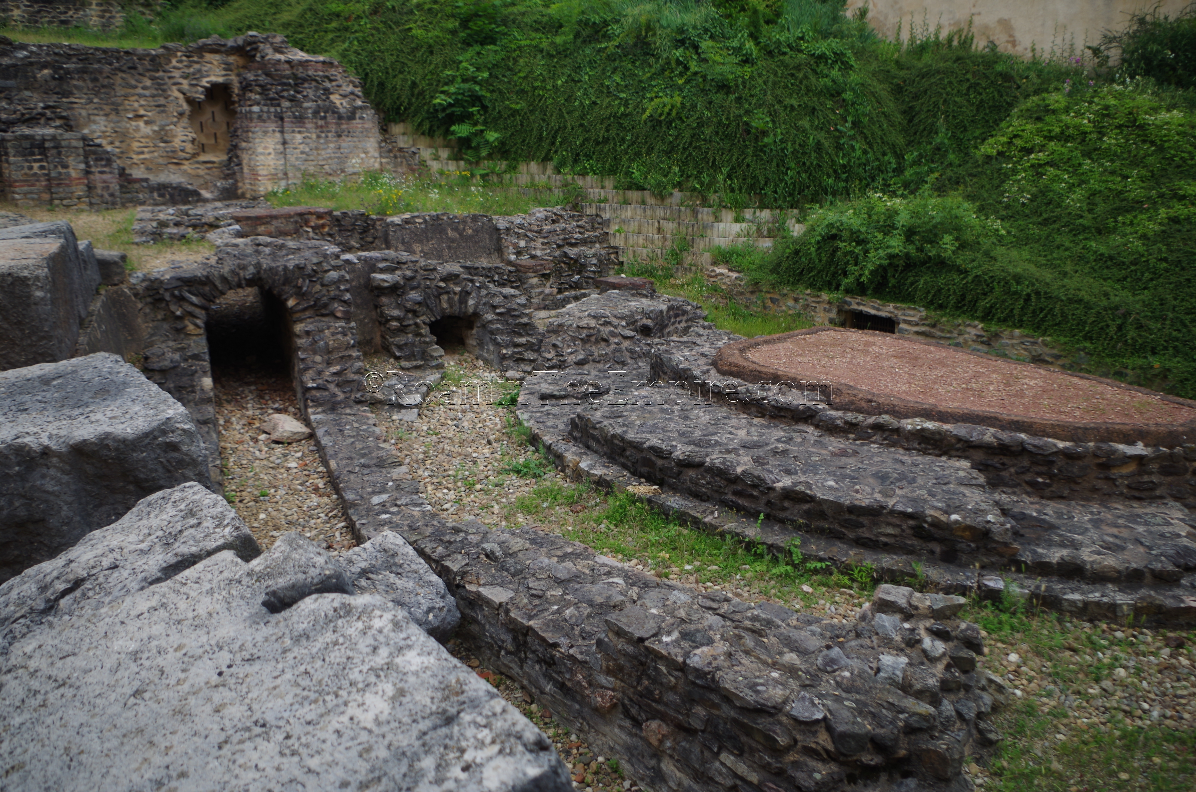
To the south of the theater and odeon complex are the remains of a bathing complex, the Thermes Antiques de Lyon. There is no entrance or hours, but, it is a bit tucked away and easy to miss if you don’t know it’s there. On the north side of Rue des Frages, just east of the intersection with Place de l’Abbé Larue, there is a residential complex with shops along the bottom floor. There are a couple open breezeways that lead to the rear of the property (one is at about 6 Rue des Frages), and in the rear of the property are the remains of the baths, as well as part of the remains of a residence. The bathing complex dates to the 1st century CE and seems to have been in use through the 3rd century CE. The remains sit on two terraces, with the upper terrace containing the remains of a road (though no paving stones are visible) and part of a house. On the lower terrace is a small portion of a bathing complex. Several water channels are visible and remain, including a large one as part of the terrace wall, as well as parts of two heated rooms. The rest of the bathing complex and another house were uncovered at one point, but modern buildings now cover those areas. There is one informational sign in French and English that describes the remains.
Saint-Just Basilica and Necropolis
To the southeast of the baths at 13 Rue des Macchabées are a complex known as the Saint-Just Basilica and Necropolis. When I visited, the area was fenced off as there were improvements being made to the park. Normally, the park is open access with no restricted entrance or admission. At this site are the remains of a 1st century CE Gallo-Roman domestic structure, and the remains of the first two in a series of successive churches dating to the 4th and 6th centuries CE. Prior to the church, there was a mausoleum at that location, theorized to have been that of Saint Justus, the bishop of Lyon, which would have given rise to his namesake church on that spot.
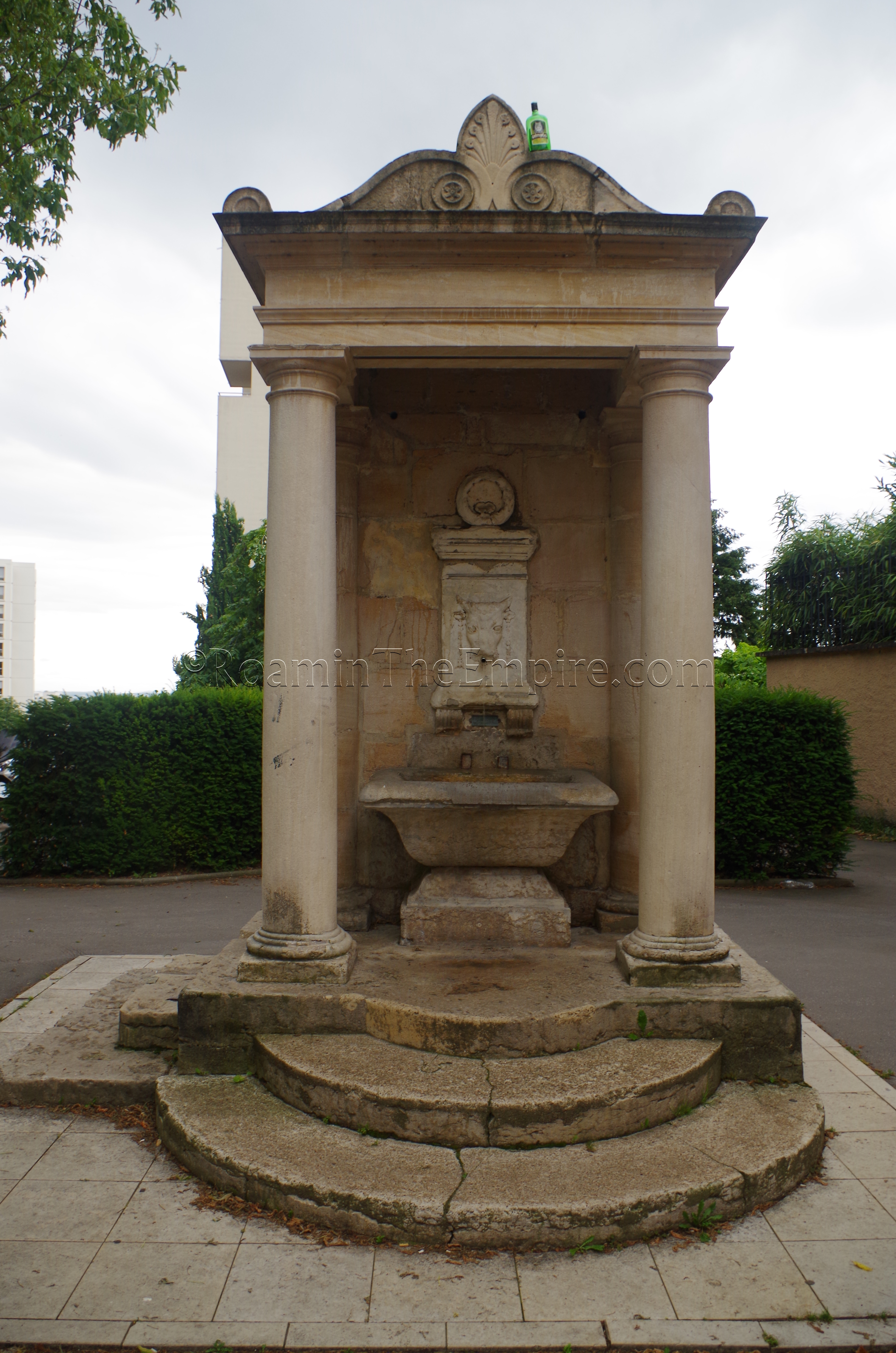
In the small square off of Rue des Macchabées, right next to the Saint-Just Basilica, is a small fountain, the Fontaine du Taurobole, a 19th century fountain. Incorporated in the fountain is what is believed to be a taurobolium altar, adorned with a bull’s head.
Tombeau de Turpio and Fontaine de Claude
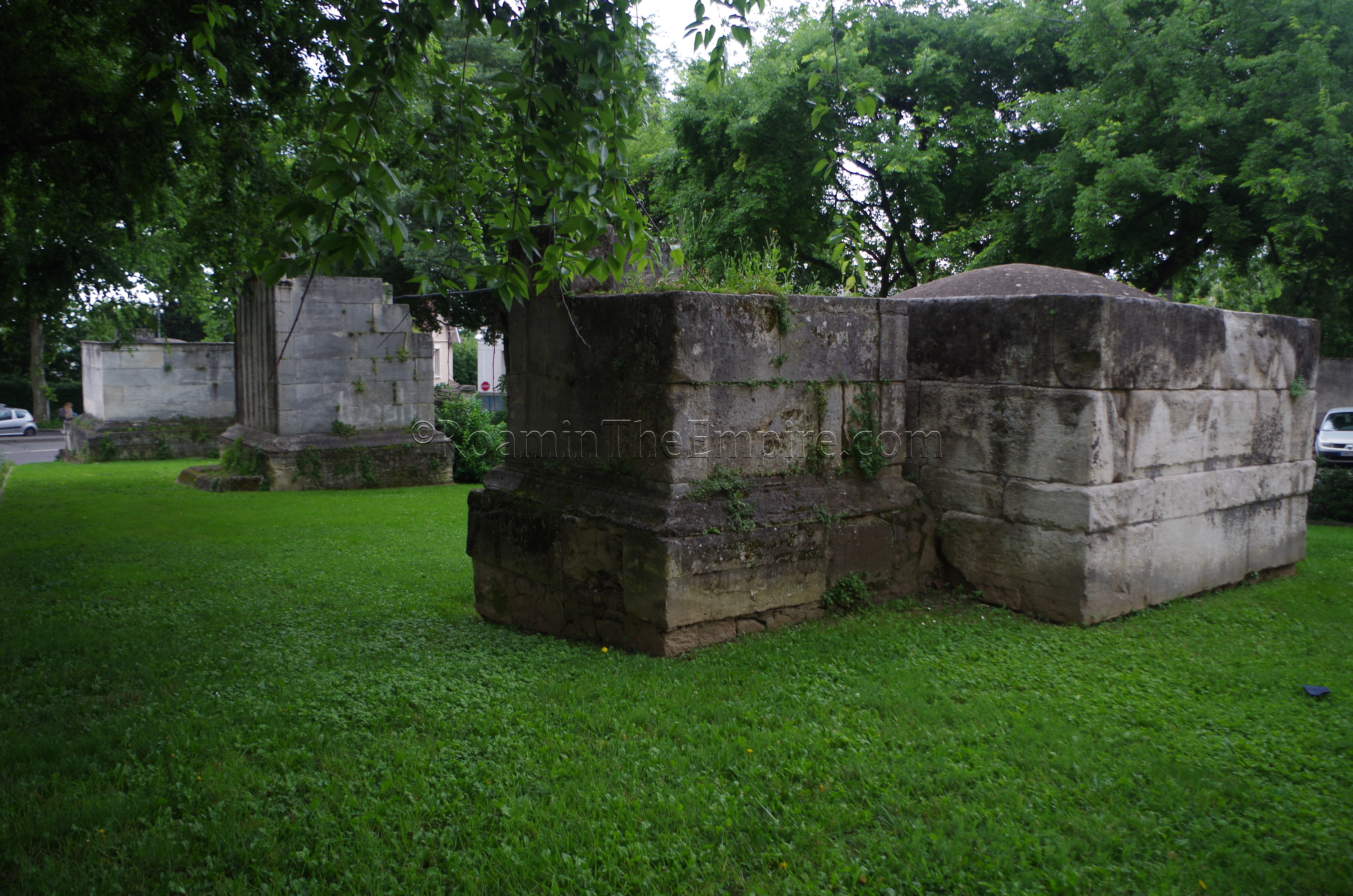
A bit further on, to the southwest, are some additional remains of the necropolis that abutted the city limits of Lugdunum on the southwest. At place Place Eugène Wernert are the remains of three funerary monuments from the 1st century CE, originally found with an additional 7 tombs closer to the Basilica of Saint Just, but removed and reassembled in this public greenspace in the 19th century. The middle of the three is the most famous, the tomb of Quintus Calvius Turpio, a freedman of Quintus. It is so identified from an inscription that survives on the south side of the monument and is estimated to be the oldest of the three funerary monuments. The southernmost monument is identified as belonging to a Satrius, and part of the cornice with bull’s heads and discs is preserved. The northernmost of the three is a triple mausoleum with three separate chambered tombs. These three tombs are attributed to a Julius Severianus, a Quintus Valerius, and Julia. As it is a public square, there is no admission and nothing limiting access at any hour.
To the north, up Montée de Choulans at Place de Trion is the Fontaine de Claude. I was not able to visit due to some unclear directions I had prior to visiting Lyon, but, with some additional research I’ve found it. This fountain is most definitely here, so, again, I feel confident in putting it here despite not confirming it on the ground. The fountain consists of a large basin that possibly dates to the Roman period, and is capped by a limestone block with the inscription CLAVD AVG, for the emperor Claudius, which most definitely dates to the Roman period.
Jardin Archéologique
Moving off of the Fourvière Hill, on the west bank of the Saône is the Cathédrale Saint-Jean-Baptiste. Adjacent to the cathedral, on the north side, is the Jardin Archéologique. Most of what remains here does not date to the first incarnations of the early Christian churches that stood here in the 4th and 5th centuries CE. The prior layers of the Saint-Jean-Baptiste church are, as one might expect, below the currently standing church. The remains of the second church, the church of Saint-Croix, of which a large arch is reconstructed, seem to date to the medieval period, and none of the earlier layers are presently visible. The baptismal font of the third church, the Baptistery of Saint-Etienne, though, dates to the 4th century CE. On the easternmost side of the park is a robust wall that was the riverfront wall during the Roman occupation of the area. This wall, however, is apparently entirely reconstructed, with the original Roman building materials being removed and preserved elsewhere.
Amphithéâtre des Trois Gaules
The final vestiges of Lugdunum are a bit away from the core of the city where most of the remains are found. Across the Saône from the Fourvière Hill, to the northeast, is the Croix-Rousse Hill, and it is on the slopes of this hill that the amphitheater is located. The Amphithéâtre des Trois Gaules, the Amphitheater of the Three Gauls, is so named because of its proximity to the Sanctuary of the Three Gauls, which was believed to have been located immediately to the west of the amphitheater. The street in this area bears the name Rue des Tables Claudiennes, marking the area where the bronze tablets of Claudius’ speech, displayed in the museum, were found. According to an inscription, the amphitheater was constructed in 19 CE and paid for by Gaius Julius Rufus, who was a priest of the cult of Roma and Augustus in the attached Sanctuary of the Three Gauls. Gaius Julius Rufus was descended from Epotsorovidos, a Gallic aristocrat in Aquitaine, and is also identified as having paid for the triumphal arch in Mediolanum Santonum (modern Saintes), which is where he was originally from. Rufus also seems to have held the office of praefectus fabrorum in the army. The original form of the amphitheater was much smaller, with only a single level of seating, all reserved for the Gallic tribes, whose names were inscribed on the podium (again, some of which are preserved in the museum). Improvements were made on the podium and parapet around 50 CE. During the reign of Hadrian, the amphitheater was enlarged by Gaius Julius Celsus, increasing the capacity to 20,000 spectators. According to Suetonius, Caligula held oratory contests in Lugdunum, and the amphitheater seems to be the venue where that would have taken place.
The amphitheater is currently inaccessible; there is no entrance into it or the immediate surroundings. It can be viewed from the south on Rue Lucien Sportisse, or from the north on Rue des Tables Claudiennes. A walkway along the eastern side of the amphitheater that allows for viewing. Interestingly, the amphitheater is dug into the slope of the hill, using the natural terrain contour to support the seating on the north side, and uncommon occurrence for amphitheaters, especially those which are built later. There is a sign in French off of Rue Lucien Sportisse that explains some about the amphitheater, but, there is no English information present.


Sources:
Audin, Amable. “Cybèle à Lugdunum.” Latomus, Vol. 35, No. 1, 1976, pp. 55-70.
Bromwich, James. The Roman Remains of Northern and Eastern France: A Guidebook. London: Routledge, 2003.
Cassius Dio, Historia Romana, 54.32, 75.3, 76.6.
Drinkwater, J.F. “Lugdunum: ‘Natural Capital’ of Gaul?” Britannia, Vol. 6, 1975, pp. 133-140.
Fishwick, Duncan. “The Dedication of the ‘Ara Trium Galliarum.’” Latomus, Vol. 55, No. 1, 1996, pp. 87-100.
Fishwick, Duncan. “The Temple of the Three Gauls.” The Journal of Roman Studies, Vol. 62, 1972, pp. 46-52.
Graham, A.J. “The Numbers at Lugdunum.” Historia: Zeitschrift für Alte Geschichte, Vol. 27, No. 4, 1978, pp. 625-630.
King, Anthony. Roman Gaul and Germany. University of California Press, 1990.
Livy, Periochae, 139.
Pliny the Elder, Naturalis Historiae, 4.31.
Pseudo-Plutarch, De Fluviorum et Montium Nominibus, VI.
Scullard, Howard Hayes. From the Gracchi to Nero: A History of Rome From 133 B.C. to A.D. 68. Menthuen, 1966.
Stillwell, Richard, William L. MacDonald, and Marian Holland. McAllister. The Princeton Encyclopedia of Classical Sites. Princeton, NJ: Princeton U Press, 1976.
Strabo, Geographica, 1.1, 1.11.
Suetonius, Life of Caligula, 17, 20, 39.
Suetonius, Life of Claudius, 2.
Tacitus, Annals, 1.51 1.65, 3.41.