


Most Recent Visit: June 2025
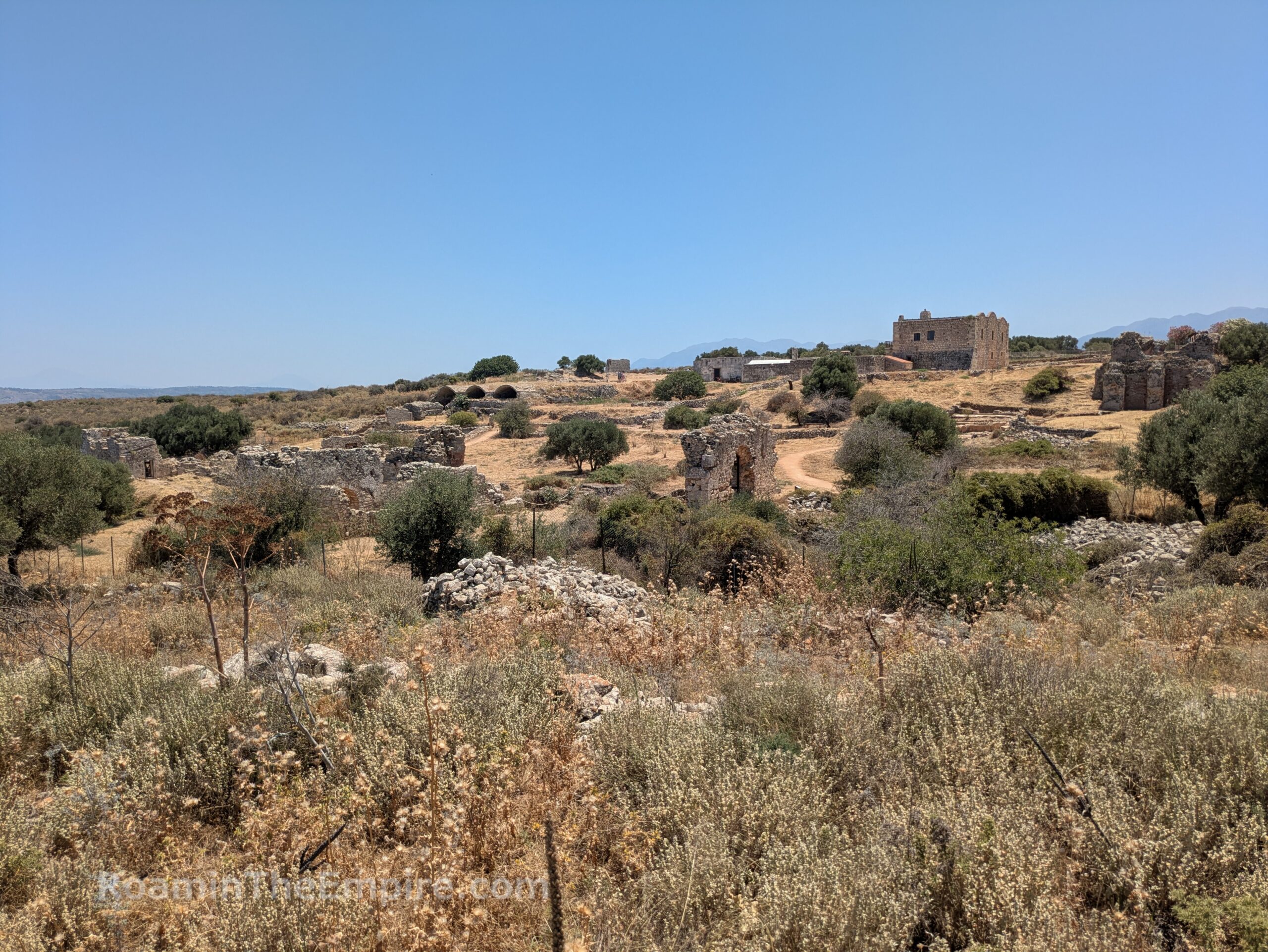
The ancient city of Aptera (or Aptara) was located on a strategic plateau above the south side of the mouth of the Souda Bay in northwestern Crete. One derivation given for the name is from the mythological singing contest between the Sirens and the Muses that was said to have taken place at the location. Having won the contest over the Sirens, the Muses took the feathers from the wings of the Sirens to make their victory crowns. The name of Aptera is literally “wingless” or “featherless” in Ancient Greek, in reference to the featherless wings of the Sirens and was named so to commemorate the victory. The foundation of the city is sometimes legendarily attributed to Glaukos of Cyrene or Pteras of Delphi, who is sometimes credited as constructed the second Temple of Apollo at Delphi; another possible origin of the city’s name. The Aptera aspect of Artemis, the patron goddess of the city is additionally cited as having been the source of the name.
Aptera is first referenced in Linear B tablets found at Knossos dating to the 14th or 13th century BCE. The Minoan/Mycenean era town does not seem to have been located on the plateau, though, but rather a couple kilometers southwest at Azoires Stylou. Archaeological evidence suggests the city was moved to the plateau in the 8th century BCE. The archers of Aptera were famed, and were often recruited as mercenaries. During the Second Messenian War circa 660-650 BCE, Apteraian archers fought with the Spartans. They were again employed by the Spartans in 273 BCE, and the archer Oryssos of Aptera is credited with killing Ptolemy, the son of Pyrrhus of Epirus. The city fought with Sparta and Ptolemy II against Macedonia during the Chremonidean War in the middle of the 3rd century BCE. Aptera was allied with Knossos at the start of the Lyttian War in 220 BCE, but following the destruction of Lyttos, was besieged and forced to abandon the alliance.
The rise in prominence of nearby Cydonia (modern Chania) at the west end of the Souda Bay in the 2nd century CE led to a decline in Aptera, and also led the city to seek support outside of Crete. It was one of 31 cities that signed an alliance with Eumenes II of Pergamon in 183 BCE. When the Romans began their conquest of Crete, Aptera surrendered without a fight, possibly after having established friendly relations with the Romans prior to their arrival. The whole of Crete came under Roman control shortly thereafter in 67 BCE. Under Roman hegemony, the city reached a period of prosperity in the 1st and 2nd centuries CE before again entering a period of decline in the 3rd century CE. An earthquake in 365 CE devastated Aptera and led to partial abandonment of the site. There was still some significant habitation until the 7th century CE, when another earthquake and continuing raids on the city resulted in Aptera being largely abandoned.
Getting There: Getting to Aptera via public transport is a bit tricky. There is a stop on the bus line that runs between Chania and Rethymno/Heraklion that drops off about 2.5 kilometers from the site along the Europaikos Odos 75; but from there, there is no public transport for the remaining 2.5 kilometers (with about 220 meters elevation gain). The buses run pretty regularly between the cities, but you have to ask to be let off at Aptera and have to flag the bus down on your way back; which did take a while when I used this method the first time I visited Aptera in 2014, as several buses did not stop. Tickets are about 2.70 Euros each way and the site is about half an hour from Chania by bus or about an hour coming from Rethymno. Schedules can be found here.
The approach to the ancient site, whether by foot or vehicle, passes through the modern town of Aptera. At the eastern edge of the modern town, about 200 meters west of the western gate of the ancient city, is a small portion of an excavated necropolis, one of two identified from the city. There is no access and the area is fenced, but a number of tombs cut into the rock are visible from the road. This necropolis was first used starting in the 8th century BCE and continued to be used through the Roman period. The second necropolis, located to the southeast of Aptera is neither easily accessible nor well excavated.
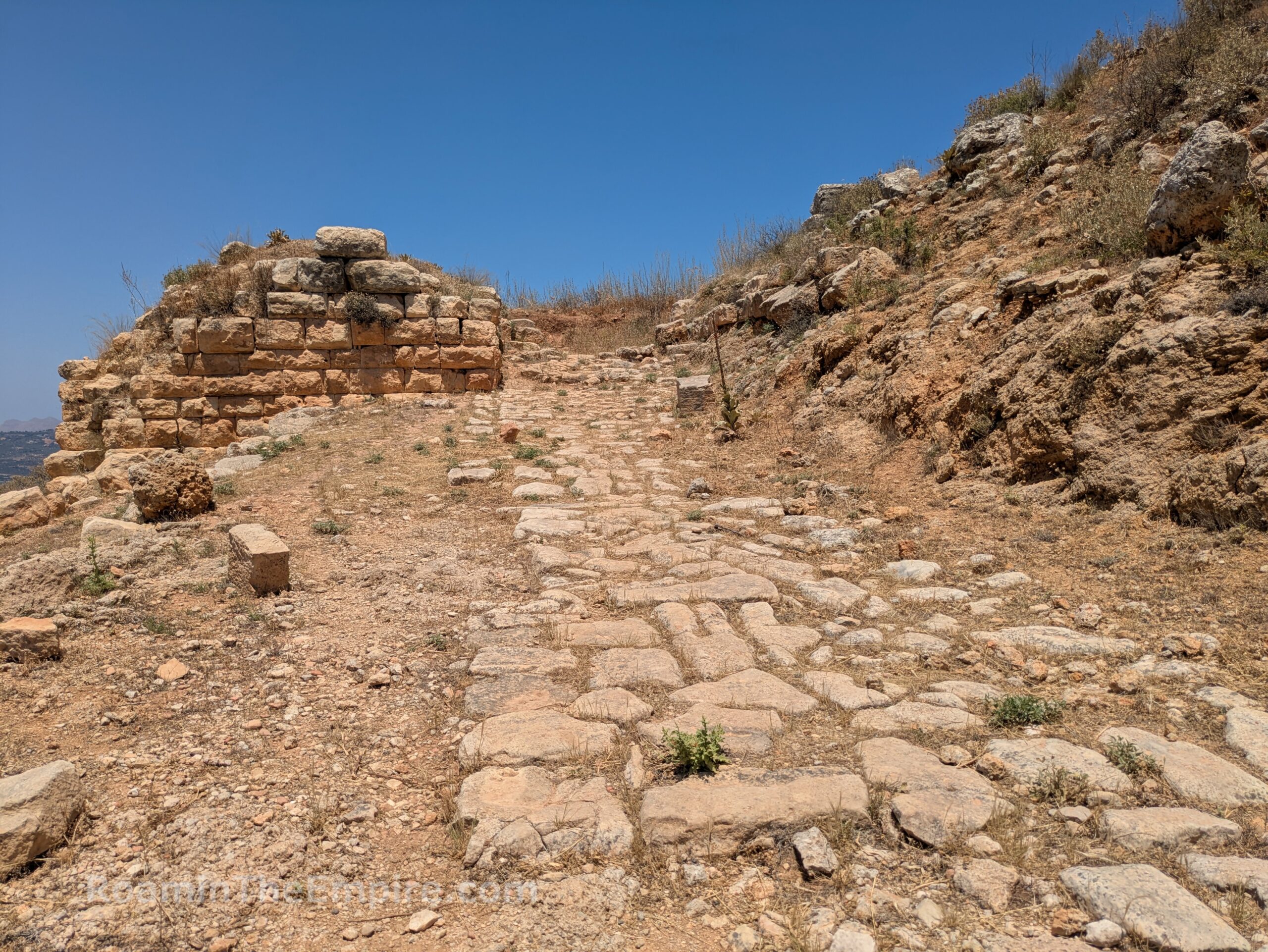
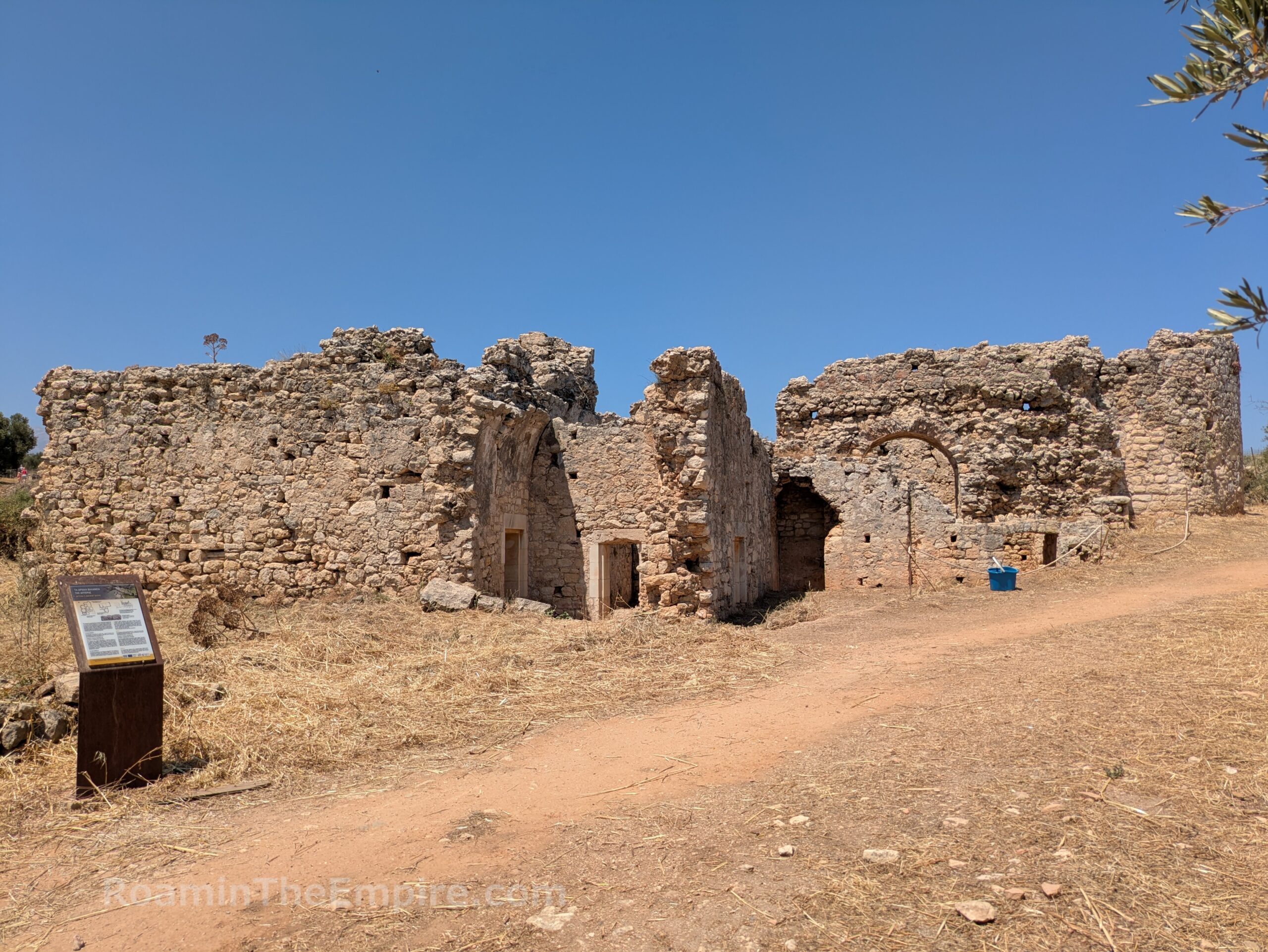
Continuing east on the road to the site, one shortly arrives at the main entrance of Aptera, the largest and most elaborate of three gates in the western circuit of walls. The main gate and the adjacent fortifications were constructed in the first half of the 4th century BCE. The gate itself is at the north side of this particular area. The remnants of the road leading into the city climb up the slope to where the gate was located, with the foundations of a tower located atop the slope to the west of the road. The gate seems to have been blocked up sometime in the Hellenistic period or afterward. The fortification walls of the city then wrap around along the east side of the excavations here and then cut across to the southwest.
At the bottom of the slope, in the space bounded by the walls to the east and south were numerous funerary monuments that were constructed over the years following the construction of the gate. To the west of the road leading up to the gate, abutting the hill and the wall, was a heroon. The heroon consisted of 11 graves dating from the Classical period to the 3rd century CE. Several inscriptions dating to the 1st and 2nd century CE, at least one of which is visible from the road, note that important citizens of Aptera were buried in the heroon. A second group of cist graves dating to the 6th and 7th century CE were found adjacent to the heroon.
East of the heroon, in the corner formed when the walls adjacent to the gate cut to the south, are the stepped bases of two large funerary monuments. The northern of these two was built in the 1st century CE and contained 10 burial shafts. It was looted and destroyed in the 7th century CE. An inscription from the architrave of the tomb is dated to the 2nd century BCE and notes that it was constructed by Soterios, son of Protogenes, who was from Eleutherna. Finds indicate the tomb was in use until the 2nd century CE, but was then destroyed in the earthquake of 365 CE. A series of cist graves were then built using spolia from the tomb in the 5th and 6th century CE. Above this area, a few rectangular tombs are cut into the rock along the north, outside the wall. These date to the Roman imperial period. An informational sign in Greek and English is posted on site.
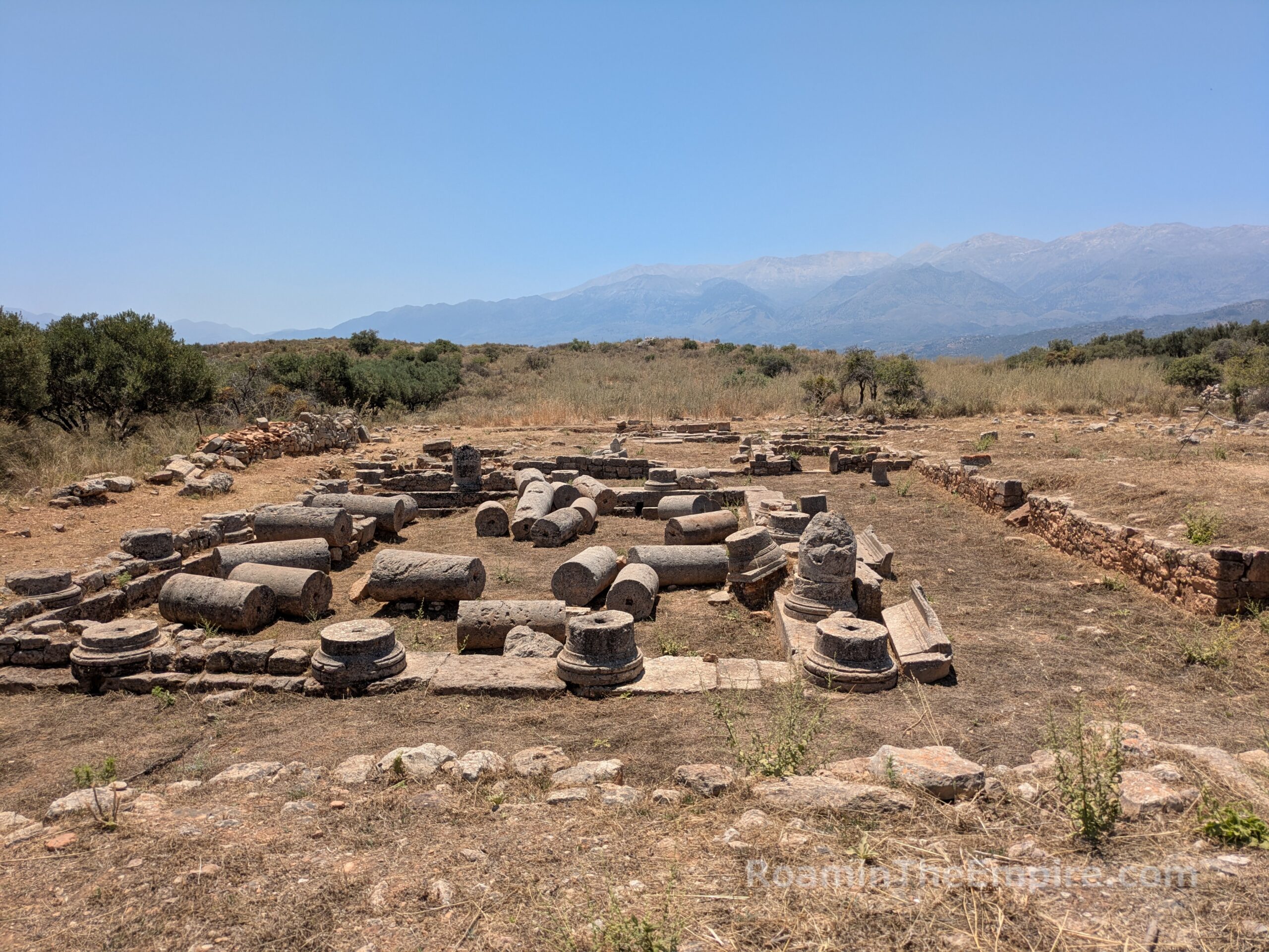
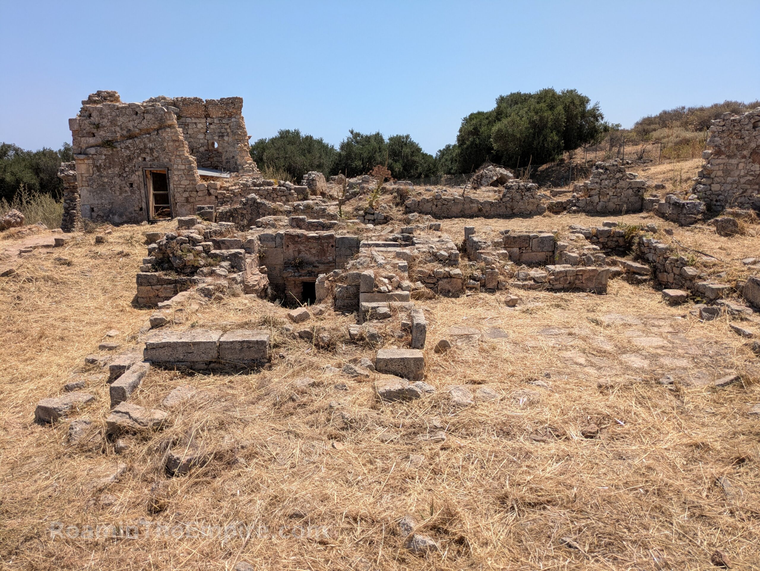
The main road continues to the entrance of the site. There’s also a small path that leads from the western gate area. When I last visited it was fenced off, but that was pretty easily bypassed. Along the path, or a short walk from the parking lot for the main site, is another path that leads south to the remnants of a wealthy residence. Constructed in the first years of Roman hegemony, it underwent significant alterations in late antiquity before being abandoned in the 4th century CE; likely following the earthquake of 365 CE. Most prominent is the peristyle courtyard in the north of the excavations; the remnants of robust doric columns are littered among the interior of the space. There are a few more excavated rooms to the south of the courtyard, but nothing noteworthy is visible. The whole space is roped off and there is no information about the house at the location.
Back out to the entry of the actual Archaeological Area of Aptera, the site is open April through August from 8:00 to 20:00. Over September and October, the closing time is drawn back half an hour every 15 days until it reaches 18:00 at the end of October. Then November through March it is open 8:00 to 18:00 daily except for Tuesdays, when it is closed year-round. Admission to the archaeological area is 10 Euros.
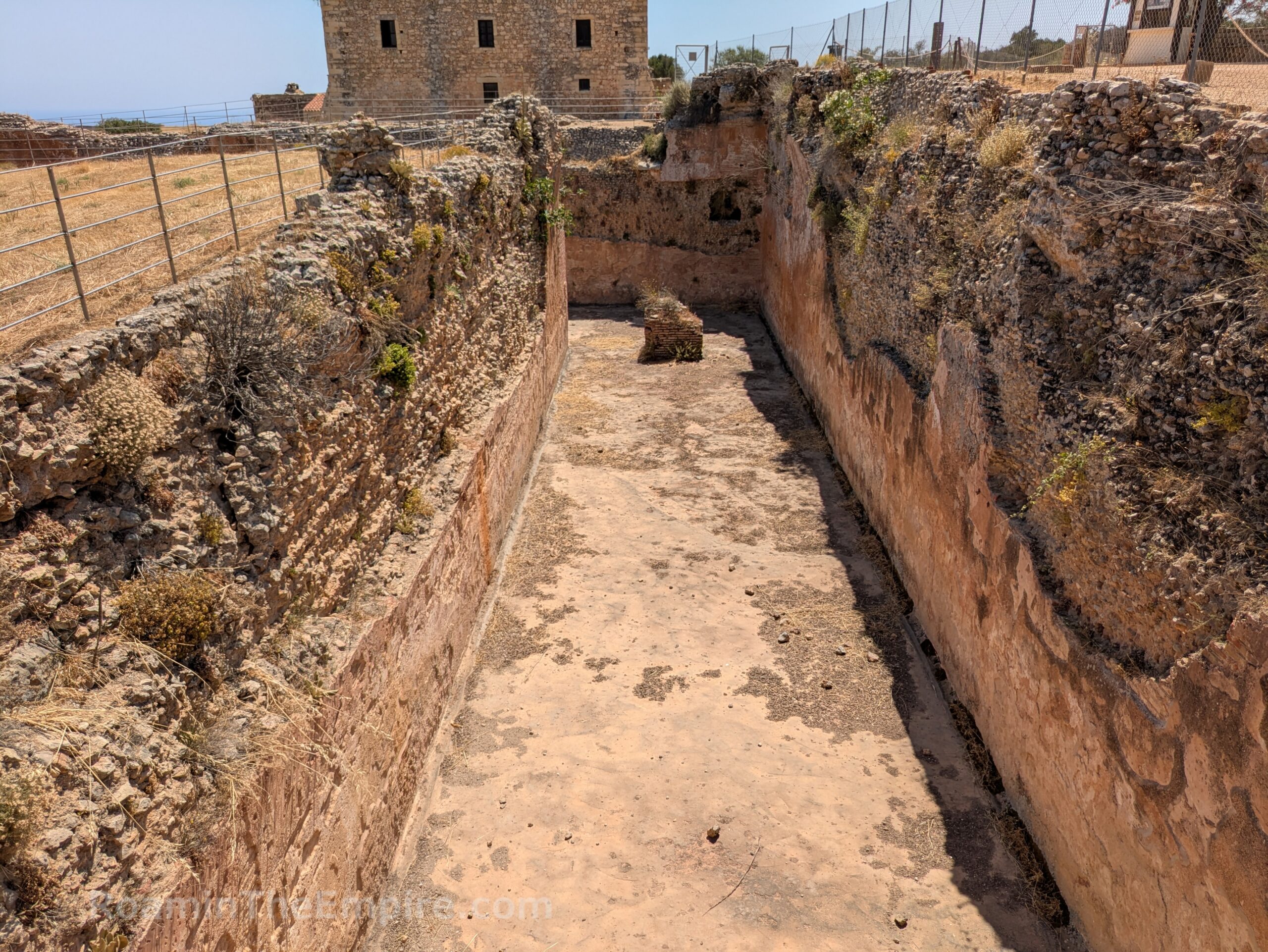
Visible from outside the archaeological area and immediately inside the entrance to the north is a massive L-shaped cistern. Due to a lack of freshwater sources on the plateau on which Aptera was constructed, water storage was integral to the site. This cistern was constructed sometime in the Roman period. It was built partially into the bedrock of the area with the north end requiring some above ground construction that is supported with large buttresses. The cistern is 90 meters in length and is estimated to have held about 9,000 cubic meters of water. None of the interior is accessible, but ground level is at the top of the cistern for much of the length.
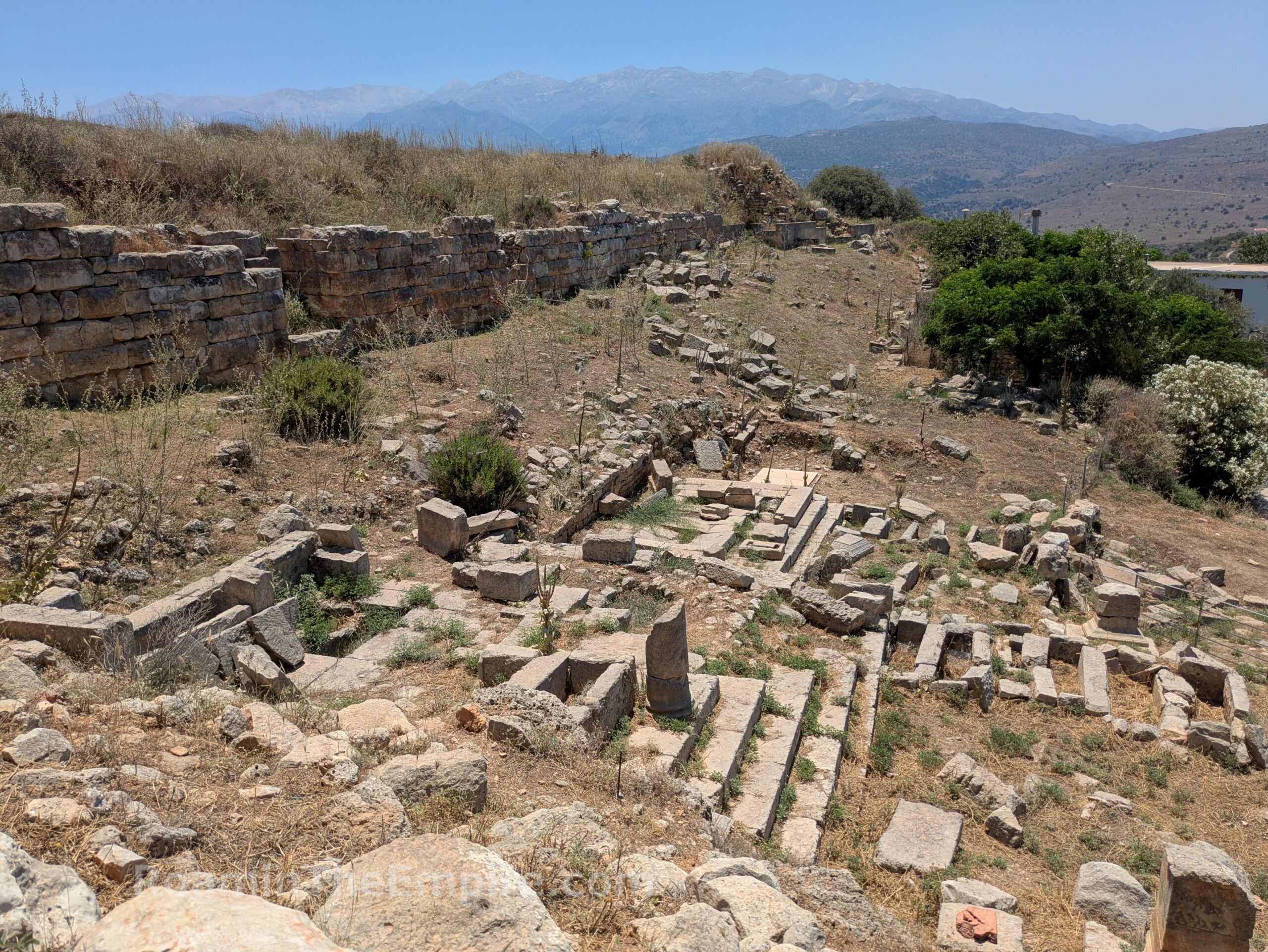
Just to the north of the cistern is an excavated area that includes a Hellenistic road and a couple of Roman era buildings. The Hellenistic road is distinctive among the Roman elements of this area in its use of smaller smooth stones as paving. A small section runs along the east side of a Roman building of indeterminate use in the north part of the area with steps that lead further north. Along the southeast quadrant of the area, closer to the cistern, are the stepped crepidoma and the doorway of a Roman era temple. From finds made here, it is believed that the temple was dedicated to the imperial cult. A later, low wall constructed of spoliated elements cuts across this part of the site, seemingly leading from the cistern.
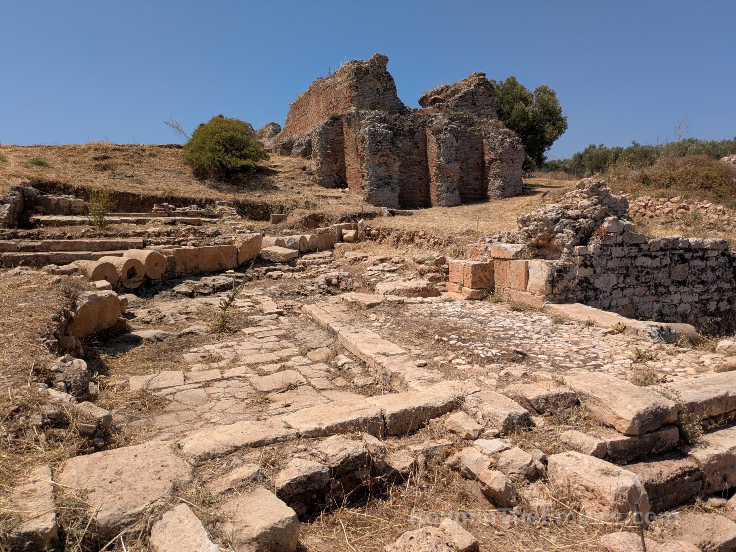
About 30 meters to the north, northeast of the Hellenistic road and Roman buildings are the remnants of a bathing complex dating to the Roman period. These baths, of which eight rooms have been identified, were directly connected to the L shaped cistern. The walls are preserved to a significant height in some of the rooms, to a degree where in some places the curve of the vaulted ceilings remains. These baths seem to date to the 1st century CE and appear to have been destroyed in the 365 CE earthquake. Though elements like pebble floors and water basins are visible in the apsidal room in the north part of the complex, the baths are generally not well studied and most rooms have not had their function conclusively identified. The baths are open access and all the rooms can be visited.
Another 50 meters to the southwest of these baths (Baths II) I another bathing complex (Baths I). An inscription found here dates the construction of this complex to the 1st century CE or early 2nd century CE. It notes the patron of the construction as one Varius Lucius Lampadis of Athens. Overall these baths are in a poorer state than the other complex, but it has been better excavated and more distinctive elements remain to identify usage within them. Remnants of hypocaust systems survive to indicate the heated rooms, including a small room with basins in the northwest part of the complex and a room preserved within a later structure built on the site in the northeast. These baths were supplied by cisterns located to the south.
Continued In Aptera Part II


Sources:
Ninious-Kinteli, Vanna. Aptera. Ministry of Culture 25th Ephorate of Prehistoric and Classical Antiquities,
Pausanias. Hellados Periegesis, 4.20.8, 9.34.3.
Pliny the Elder. Historia Naturalis, 4.59.
Polybius. Historia, 4.55.3.
Smith, William. Dictionary of Greek and Roman Geography. Walton & Murray, 1870.
Strabo. Geographica, 10.4.13.
Stillwell, Richard, William L. MacDonald, and Marian Holland. McAllister. The Princeton Encyclopedia of Classical Sites. Princeton, NJ: Princeton U Press, 1976.
Tzanakaki, Katerina. Aptera, a City of Crete. Hellenic Ministry of Culture and Sports, 2019.