


Continued From Salona, Dalmatia – Part III
While the majority of the archaeological remains of ancient Salona are contained within the archaeological park, there are a few things worth seeing outside the park as well. The easiest one to get to from the entrance of the archaeological park Marusinac cemetery complex. Marusinac is located about a 10 minute walk northwest from the Salona parking lot or a few minutes’ drive. Parking is pretty iffy in the streets around it, so honestly a walk isn’t the worst idea. In theory, the archaeological area is open and accessible 24 hours a day with no ticketed entrance.
On August 26, 304 CE, the Christian martyr Anastasius, a fuller originally from Aquileia, was said to have been executed for carving or painting a cross over the door of his fullonica. He was executed by being tossed into the sea with a rock or grinding stone tied around his neck. A local Roman matrona named Asclepia had his body clandestinely removed from the sea and brought to her family’s private mausoleum, which was located at the present site of Marusinac.
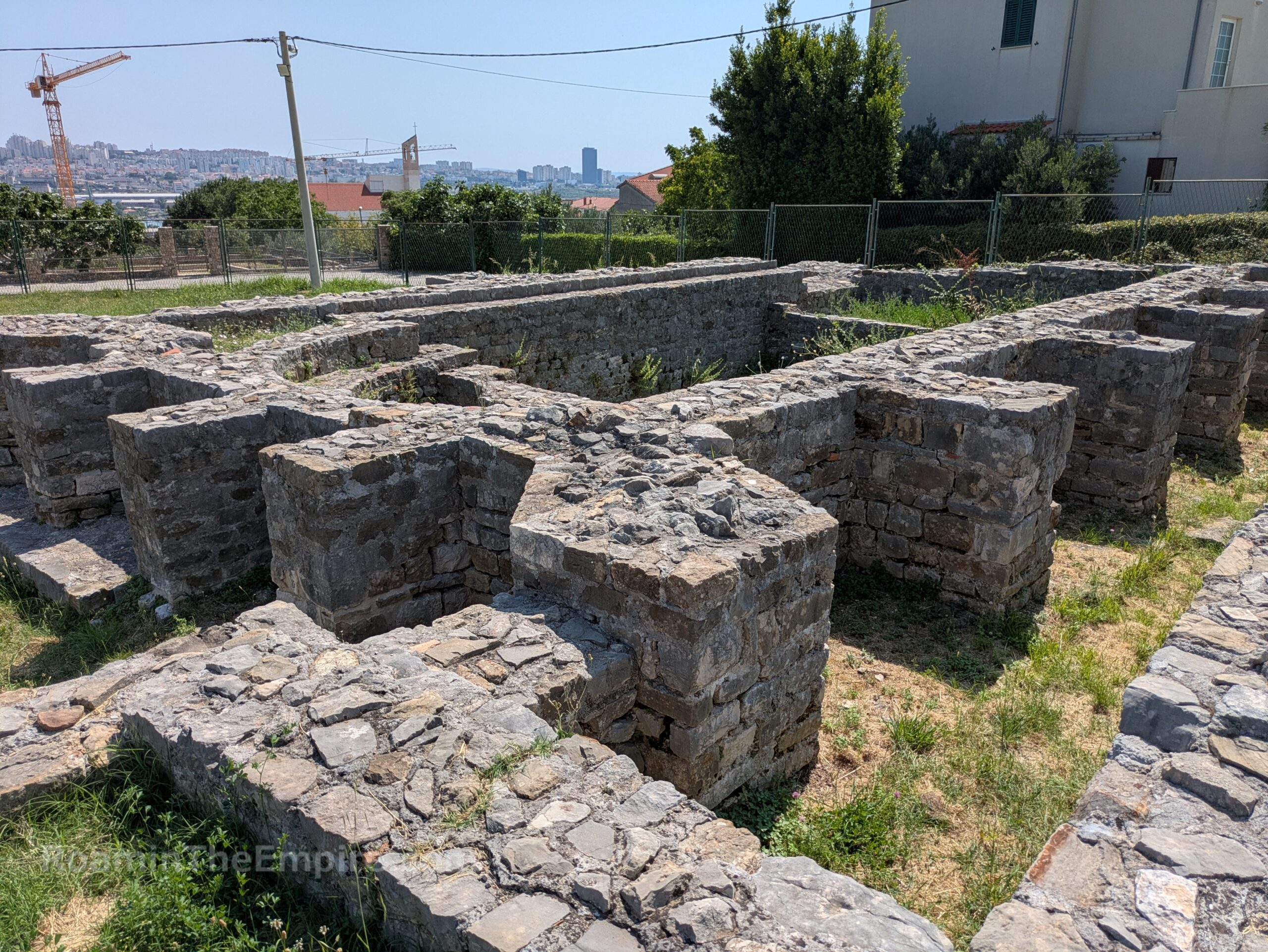
The mausoleum of Aslcepia’s family is the buttressed rectangular construction at the far western end of the site. It was originally constructed in the early 4th century CE, presumably in the few years of the century before Anastasius’ death. His body was placed in the crypt of the apse, located at the east end of the building. Asclepia and her husband were later interred in the main part of the mausoleum. As persecutions against Christianity waned, the presence of Anastasius’ burial here attracted other Christian burials to the immediate area.
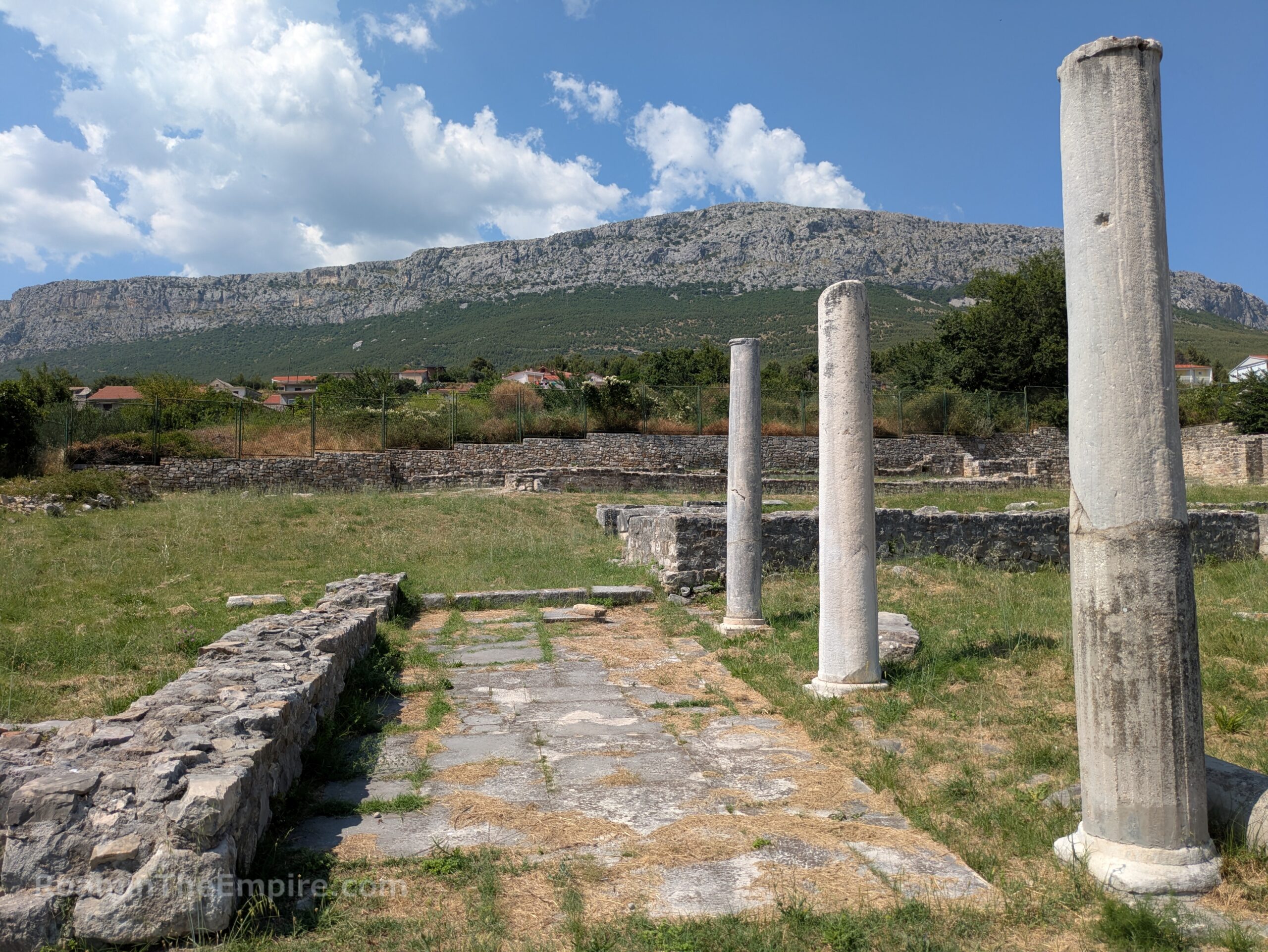
In the first half of the 5th century CE, the basilica complexes were constructed on the site. A porticoed atrium was built to the south of the mausoleum, which connected the mausoleum with a three aisled basilica that was constructed to the east. Little remains of the atrium, part of which is cut by the modern roads, aside from a little bit of the foundations and a few columns that have been re-erected. The footprint of the basilica is still pretty prevalent, also with some columns from the north aisle standing. At this time, the sarcophagus of Anastasius was removed from the mausoleum and placed in the presbytery of the basilica, located in the apse at the east end of the building. A couple of other burials within the basilica have been excavated.
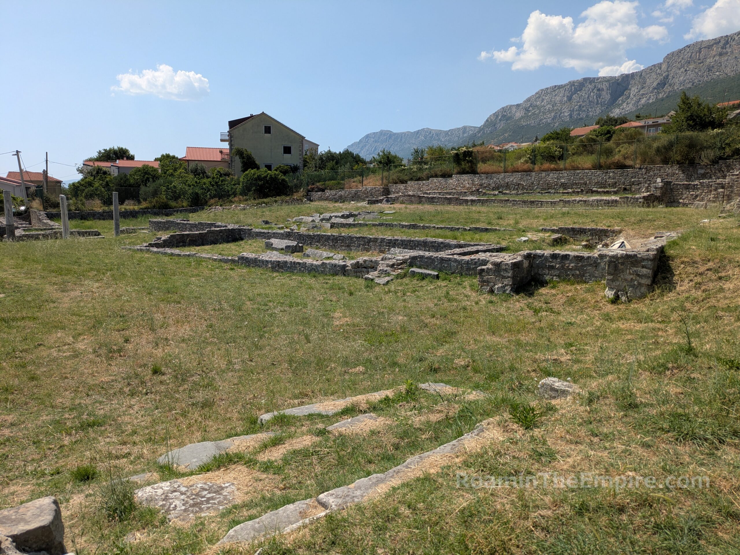
North of the basilica connected to the mausoleum, at a slightly different orientation, a second basilica was constructed. It was originally thought that this may have been an open aired basilica, a so-called basilica discoperta, though more recent scholarship has cast some doubt on this. Like the southern basilica, there are several internal burials within the basilica; though the information does not differentiate whether these predate the basilica or were interred while the basilica was functioning. There are two informational panels on site with diagrams and text in English and Croatian. As of the summer of 2025, they were in pretty rough shape from the sun, but most of the text was still legible.
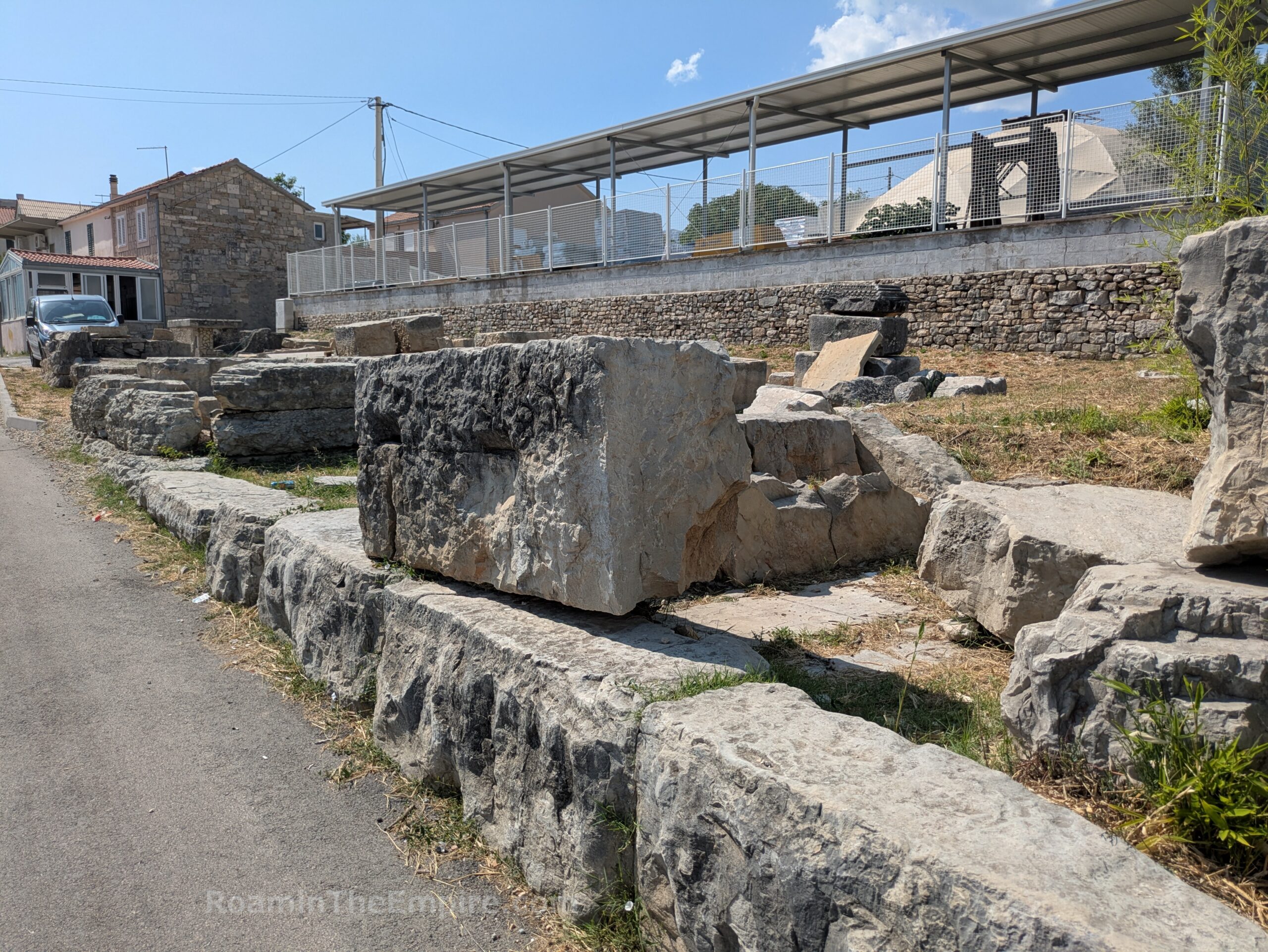
Though only about 200 meters southwest of the amphitheater of Salona, the remains of the western necropolis of the city are cut off from the rest of the site by the Ivana Pavala II highway/boulevard. To get there by walking or vehicle is actually a 2 kilometer detour. Three sections of the cemetery are excavated along Draškovićeva ul. in an industrial area of the city among depots and just 100 meters from a large industrial train yard. The west necropolis is sometimes called the Necropolis in Horti Metrodori, referencing an inscription found there. It was in use from the 1st through the 4th century CE, and lined the road to Tragurium (modern Trogir). Before the western expansion of the city, the necropolis had extended into what would later be enclosed in the fortifications. This required the dismantling and moving of funerary monuments.
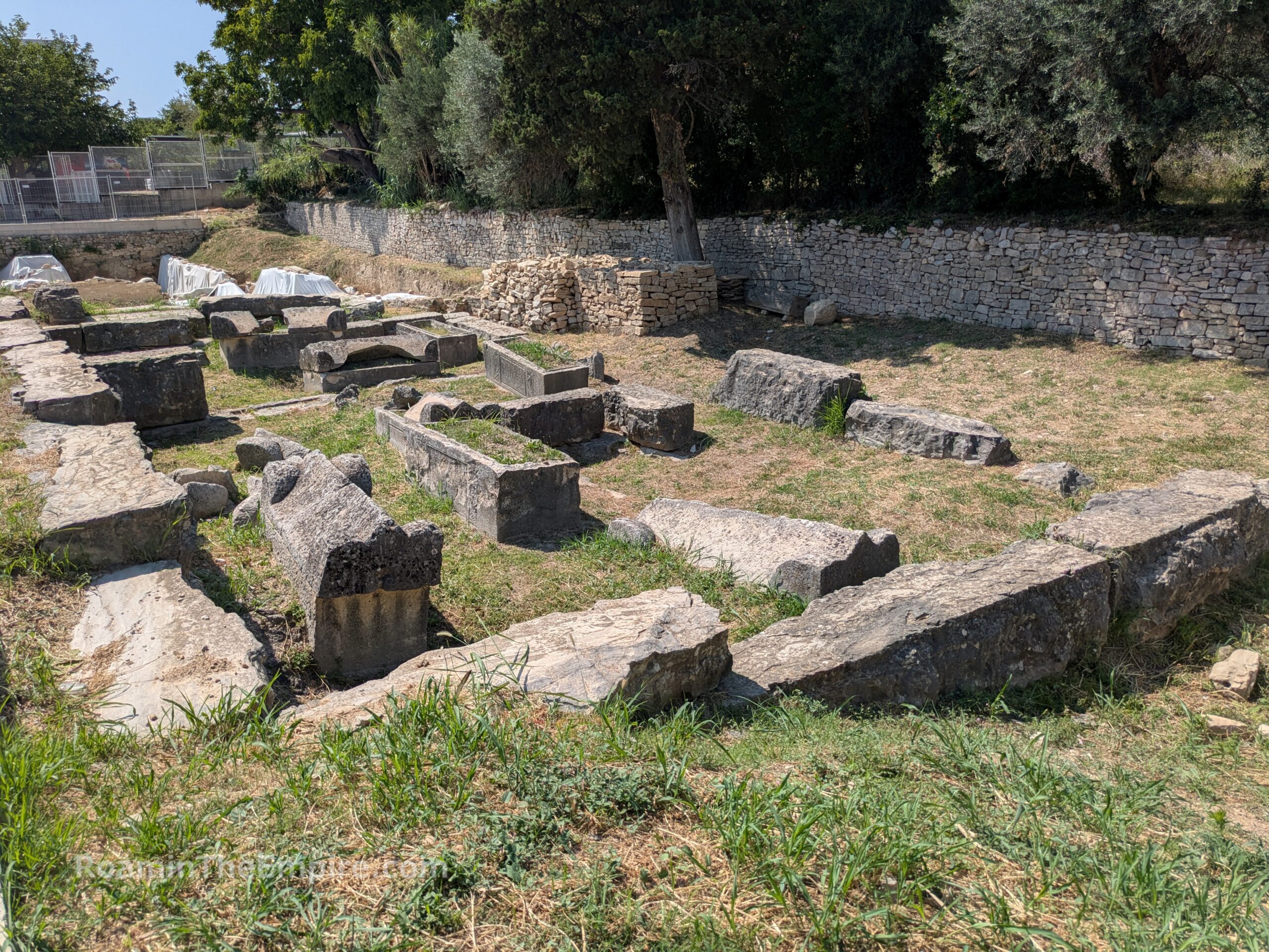
The first section is just to the west of a parking lot at the intersection of Draškovićeva ul. and the highway access road, Salonitanska, on the north side of Draškovićeva. In the eastern part of this plot is a rectangular construction made of large blocks and a number of sarcophagi. The cemetery contained a variety of burials, but what remains are mostly sarcophagi. Many of these sarcophagi have legible inscriptions. The west part of the plot seems to be the subject of recent excavations with smaller block walls prevalent. Most of this area was covered with tarps when I visited, though. About 45 meters west on Draškovićeva ul. is another small excavated area. Though there are no sarcophagi here, there is a construction of large blocks, perhaps associated with the road to Tragurium or a large funerary monument.
The final area of the necropolis is just a few more meters down the street. Again, there are a lot of large blocks in linear alignments, seemingly indicating something to do with the road or perhaps enclosures in the necropolis. A couple of inscribed sarcophagi are also displayed here. Aside from the recent excavations, there doesn’t seem to be much investment in the necropolis. There are no informational signs and it is basically open access without any barriers. The vegetation does at least seem to be maintained and kept clear to some degree.
Continuing counterclockwise around the outside of the archaeological park, about 1.7 kilometers east, as the crow flies (about 2 kilometers walking or driving), is the Gradina Solin. The Gradina Solin itself is a roughly square fortress originally built in the 14th century CE. What stands today was built in the 16th century CE, though. Within the fortress is a church dedicated to the Virgin Mary and originally dating to the reign of Justinian in the 6th century CE (though it was reconstructed several times in the subsequent centuries). All of this overlays constructions from the Roman period. In fact, it seems as though this was the point where the aqueduct from the Salon (modern Jadro River) to Salona started. A channel a few meters outside the western and northern walls of the fortress apparently belong to the aqueduct. Unfortunately, though, the Gradina Solin seems to be largely inaccessible outside of events held here, as the fortress is used as an entertainment venue. Aside from these events, though, there do not seem to be any opening hours or means to access the grounds.
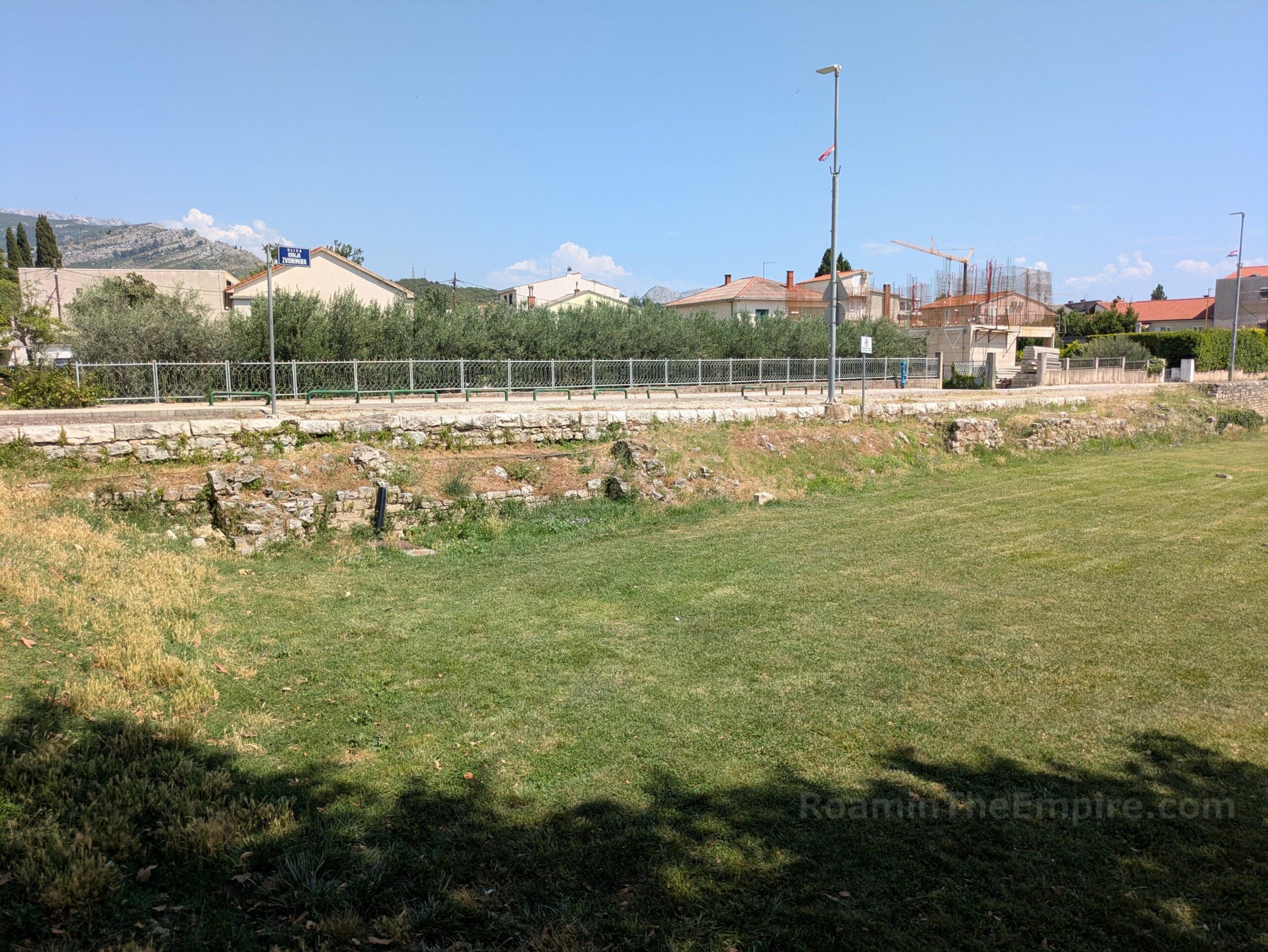
About 300 meters to the north of the Gradina Solin is the triangular greenspace, Park kod Policije. The park is bounded by Ul. Stjepana Radića across the northwest and Ul. Kralja Zvonimira on the south and east sides. Along the park side of the western branch of Ul. Kralja Zvonimira are the remnants of part of the eastern circuit of the city walls of Solona. Mostly just the interior face of the walls, as the road seems to somewhat overlay the walls. The northern part of this section seems to be more or less as preserved, while the southern part of these walls is largely reconstructed, perhaps to indicate what is actually present at this location. These are basically just open access in the park and along the street, though there is no information or indication of their presence.
The final stop around the exterior of the archaeological park is the Porta Andetria. This city gate was located at the northeastern side of the 2nd century CE extension of the fortifications to the east. It led out of the city and into the hinterland of Salona from a road branching out from the original eastern gate of the city (part of an internal wall after the 2nd century CE expansion), the Porta Caeserea. It is located at what is just about probably the major intersection of modern Solin; where Ul. Stjepana Radića intersects with a number of roads, including Put Majdana. Just to the west of this intersection, along the dirt road/path of Put Salone.
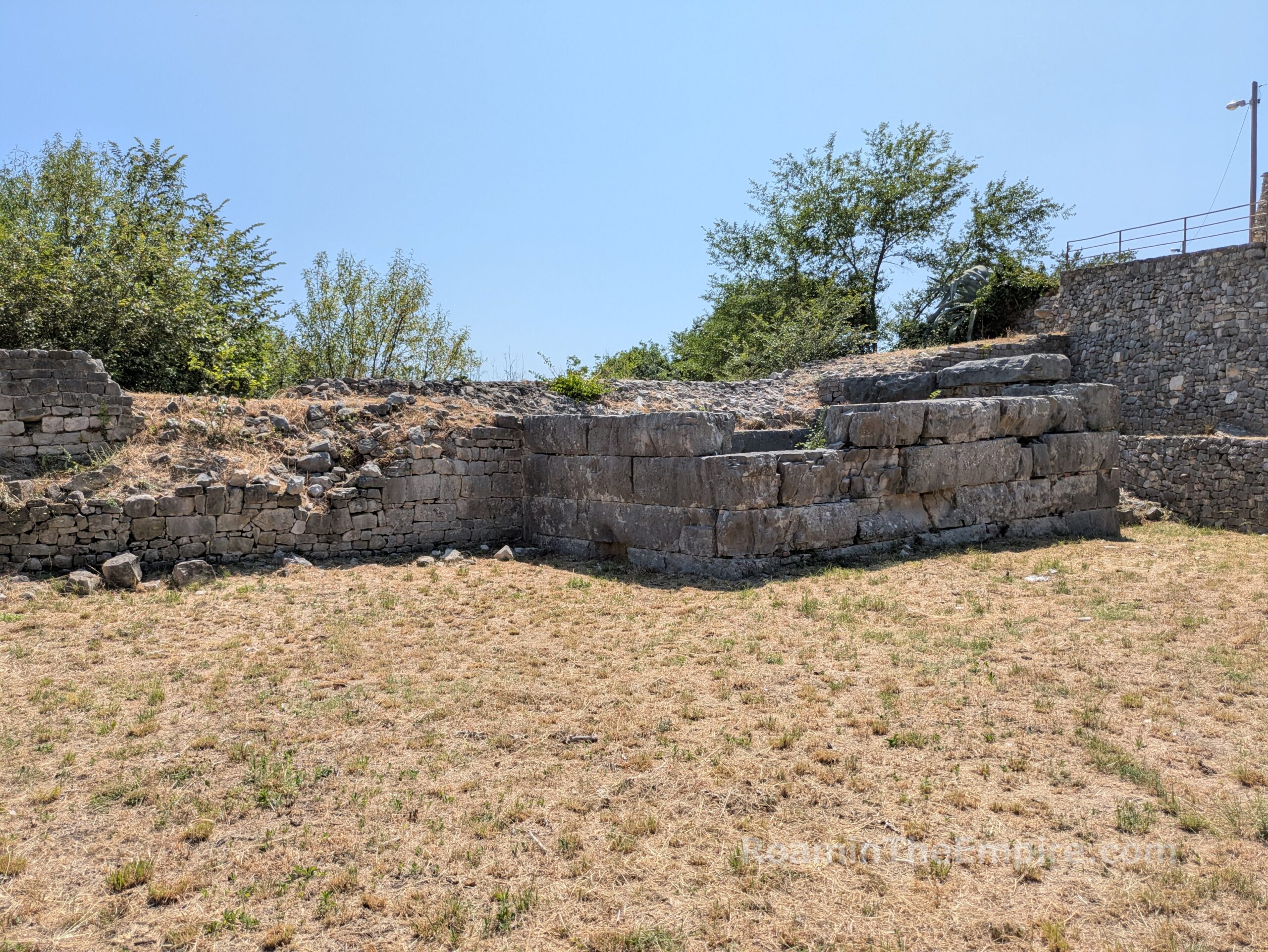
It feels sort of like someone’s yard, but the walls of Salona are effectively built into someone’s property and later buildings. So the south side (interior) of the walls are inaccessible, but there’s a small public greenspace on the north side. A couple of towers are visible that would have flanked the gate, with the easternmost of these sporting one of the later triangular additions. The western of the two towers retains its original square form. The walls are intact, but the opening of the gate itself is no longer present. The ability to see and visit the gate is probably dependent on the clearing of vegetation. I was fortunate to visit after it looked as though it had been done recent. Like most of the sites outside the archaeological park (which I suppose this one technically is), there is not much indicating its presence and there is no on-site information. There’s also a column and an architectural fragment in a greenspace on the north side of the adjacent modern intersection.

A set of stairs leads up to Put Salone just west of the western tower. At the top of the staircase are the remnants of another tower and a bit of the associated wall. Again, Put Salone runs along the course of the northern side of the eastern extension of the city walls. So walking along this street toward the archaeological park (about half a kilometer down the road), there are some intermittent remnants of the walls and towers. Technically the road goes straight into the park and offers access without going through the official entrances. I saw many locals who seemed to be exercising or walking dogs enter and pass through the park via Put Salone.
All told, in addition to the 3.5 hours doing the main archaeological area of Salona, one can expect at least another hour or so, maybe two depending on the time of day, to visit the external sites. This is mostly because traffic and parking can be a pain at some of these sites, particularly those on the east side of the city, and it can take a while to get around. While things were packed in Split, Salona was nearly a ghost town (other than a very large school group that only visited the Episcopal Center), so it is certainly an under-visited site in comparison to Diocletian’s Palace. It could probably be fit into a half a day trip from Split if timed right, and is particularly nice to get away from the crowds of Split and still enjoy a healthy dose of archaeology and history.


Sources:
Appian. Historia Romana, 10.11.
Caesar. Commentarii de Bello Civili, 3.9.
Caesar/Aulus Hirtius. De Bello Alexandrino, 43.
Cassius Dio. Historia Romana, 42.11-12.
Dzino, Danijel. “Asinius Pollio in Dalmatia: What Happened in Salona 39 BCE?” Kilo, Vol. 93, No. 1 (June 2011), pp. 158-166.
Eutropius. Breviarium Historiae Romanae, 6.4, 9.27-28.
Orosius. Historiae Adversus Paganos, 5.20.
Pliny. Historia Naturalis, 3.141.
Smith, William. Dictionary of Greek and Roman Geography. Walton & Murray, 1870.
Stillwell, Richard, William L. MacDonald, and Marian Holland. McAllister. The Princeton Encyclopedia of Classical Sites. Princeton, NJ: Princeton U Press, 1976.
Grant, Michael. A Guide to the Ancient World: A Dictionary of Classical Place Names. New York: Barnes & Noble Books, 1997.
Višić-Ljubić, Ema. Salona Colonia Martia Julia Valeria: A Guide to Archaeological Localities. Solin: Arheološki Muzej Splitu, 2023.