


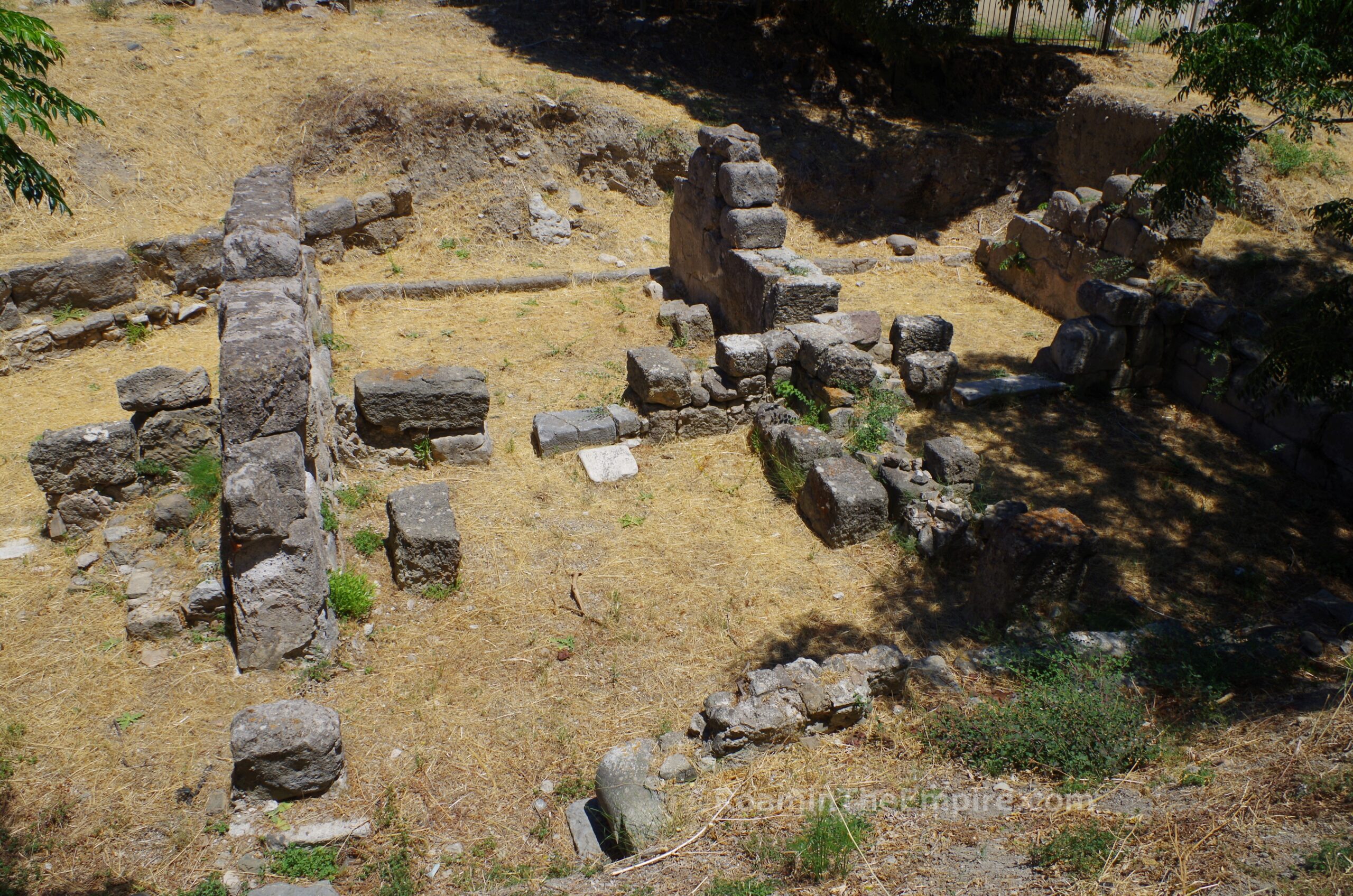
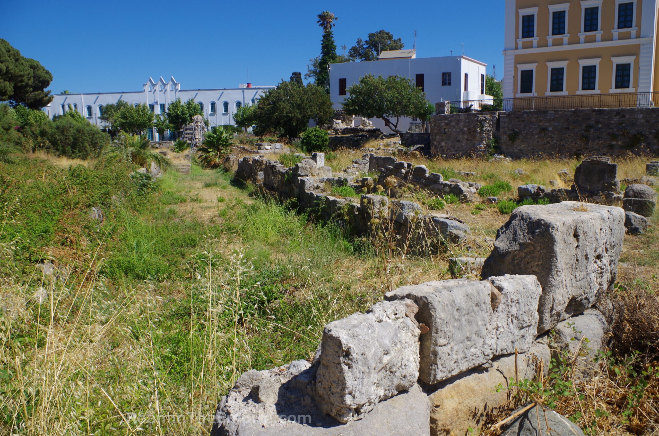
Around 30 meters west of the tholos and eastern/western stoai, along Agiou Nikolaou is the intersection with Vasileos Pavlou A. On the northwest corner of that intersection is another excavated area, the so-called House of the Bronzes. The House of the Bronzes, however, is not a domestic structure at the name suggests, but rather was part of the northern stoa in the western part of the south agora. Parts of four of the rooms from the stoa have been excavated, with the name coming from the bronze statues of Ares, Isis-Aphrodite, and Demter-Aphrodite that were found here and are now in the Archaeological Museum of Kos. An informational sign in English and Greek is located here. The area is fenced and is not directly accessible, but is fairly visible from the public areas.
A block north of the House of the Bronzes, in a park area in front of the Church of Agia Paraskevi (along Leoforos Eleftherios Venizelos) is an altar with bucrania decoration and a Greek inscription. The altar is in a little paved area right off the street. Along a path to the east are the remnants of a few walls. There are excavations noted in this area, but nothing as far as specific identification, so likely residential. The walls do look a little bit later and may be post-antique.
This rounds out the archaeological remains in the area of the south agora. It’s a short walk north on Vasileos Pavlou A (less than 200 meters) to Platia Eleftheria. On the east side of the square is the archeological area of the Ancient Agora of Kos. Like the Western Archaeological Zone and odeon, this is a controlled access but not ticketed site. And like those two, it’s advisable to double check the times. In theory, it is open in the summer (April through October) from 8:00 to 20:00 and the rest of the year from 8:30 to 15:30. It is closed on Tuesdays year round. The site has a number of entrances, but there is a convenient one on the north side off the pedestrian street Nafklirou about 70 meters east of Platia Eleftheria.
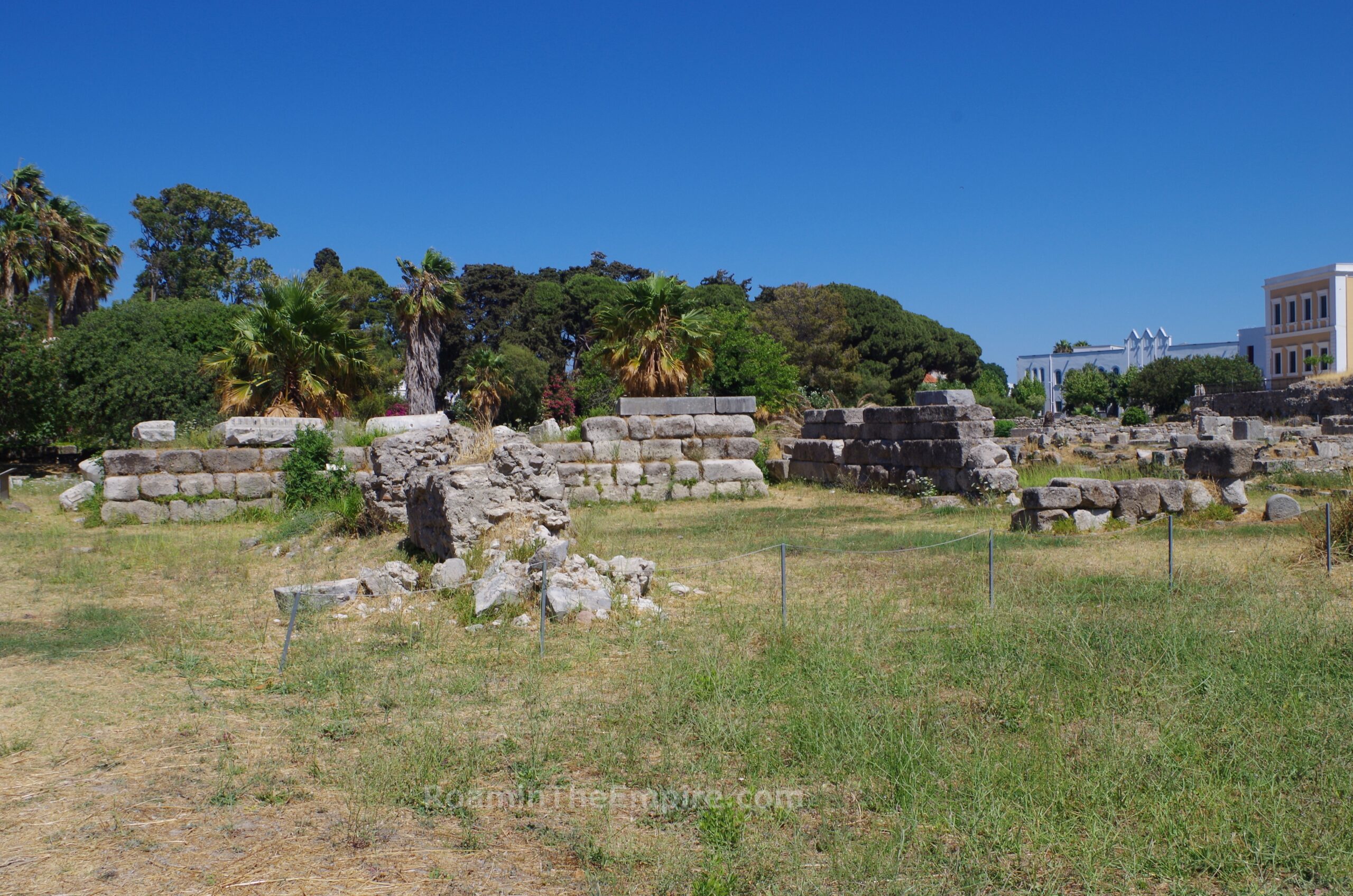
In this archaeological zone is part of the harbor neighborhood and the north agora. Upon ingress from this entrance, the area to the left (east) is the Sanctuary of Aphrodite. This sanctuary was built in the late 3rd or early 2nd century BCE, but likely replaced a cult area to the goddess dating back to the late 4th century BCE. Aside from some repairs made following earthquakes, the sanctuary kept its form through to its destruction in the 469 CE earthquake. A church of St. John the Baptist was built there by the Hospitallers in the 14th century CE, but it was removed in the 20th century CE to the east part of the agora. The sanctuary was bounded by a stoa on each side with monumental propylaea on the north side. Two identical temples with altars were constructed at center, dedicated to Aphrodite Pandemos and Aphrodite Pontia. The rear of the sanctuary would have abutted the north fortification walls (which were removed during the Roman period), meaning it was originally on the harbor side of the wall.
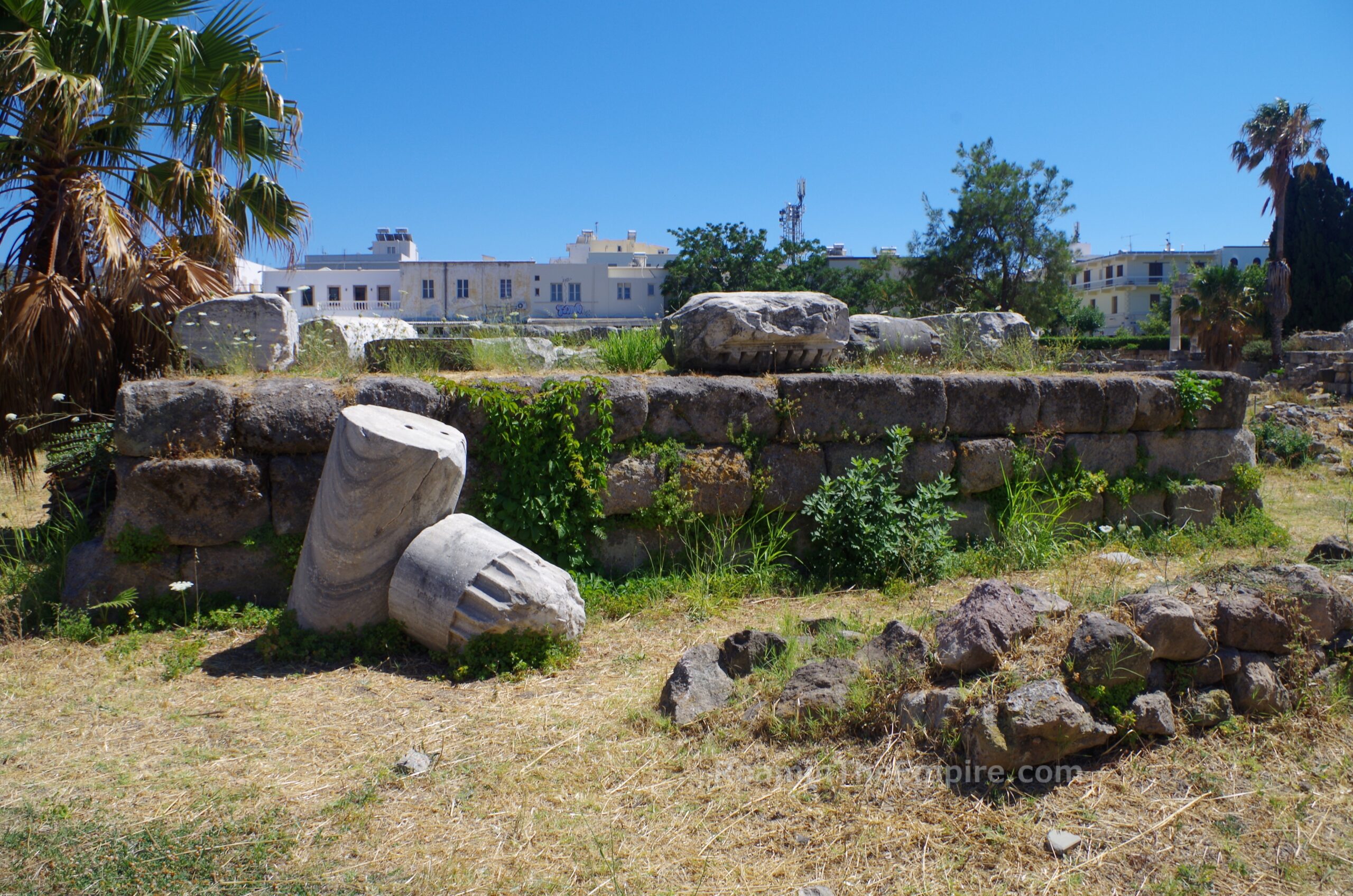
There’s a relatively large open area on the west side of the sanctuary before reaching the scant remains of the western wall. The back wall (south) of the enclosure is relatively intact being preserved up to five courses of block at one point. The western of the two temples is also relatively intact, with much of the podium remaining. The eastern of the temples, however, is largely gone, with just a few blocks marking where it stood. The eastern external wall of the sanctuary has significant remaining blocks. On the north side, not much of the enclosure wall remains, but part of one of the two entrances is discernable with a couple of column drums and the paving stones marking the feature.
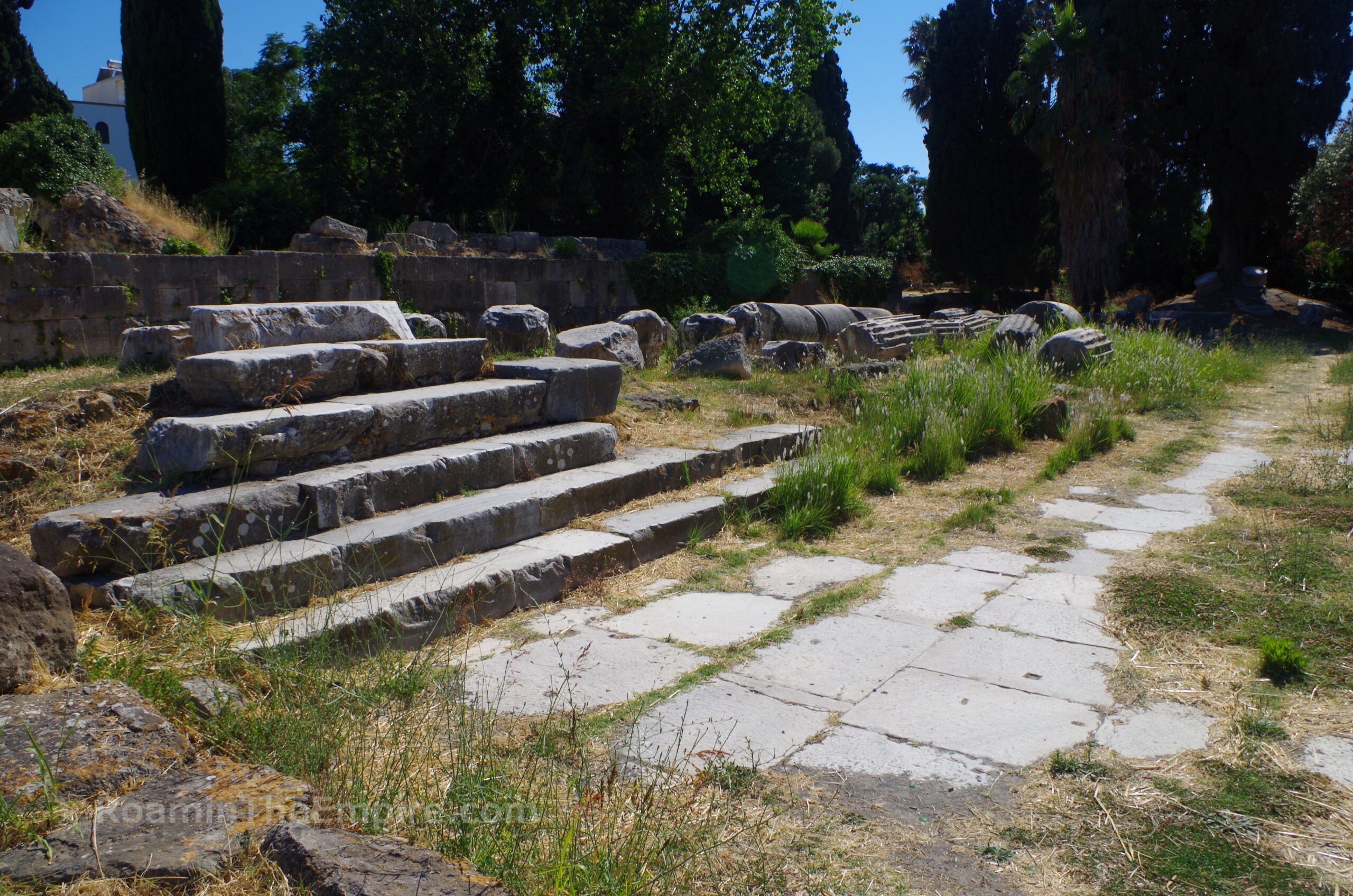
Nestled along the eastern wall of the Sanctuary of Aphrodite, and now partially engulfed by a tree is another small temple. The deity to which this temple is dedicated is unknown. The construction likely dates to shortly after the foundation of the city, in the late 4th or early 3rd century BCE. Not much of the triangular temenos is visible, but a sizable portion of the northern part of the podium as well as a few blocks of the actual cella of the temple remain.
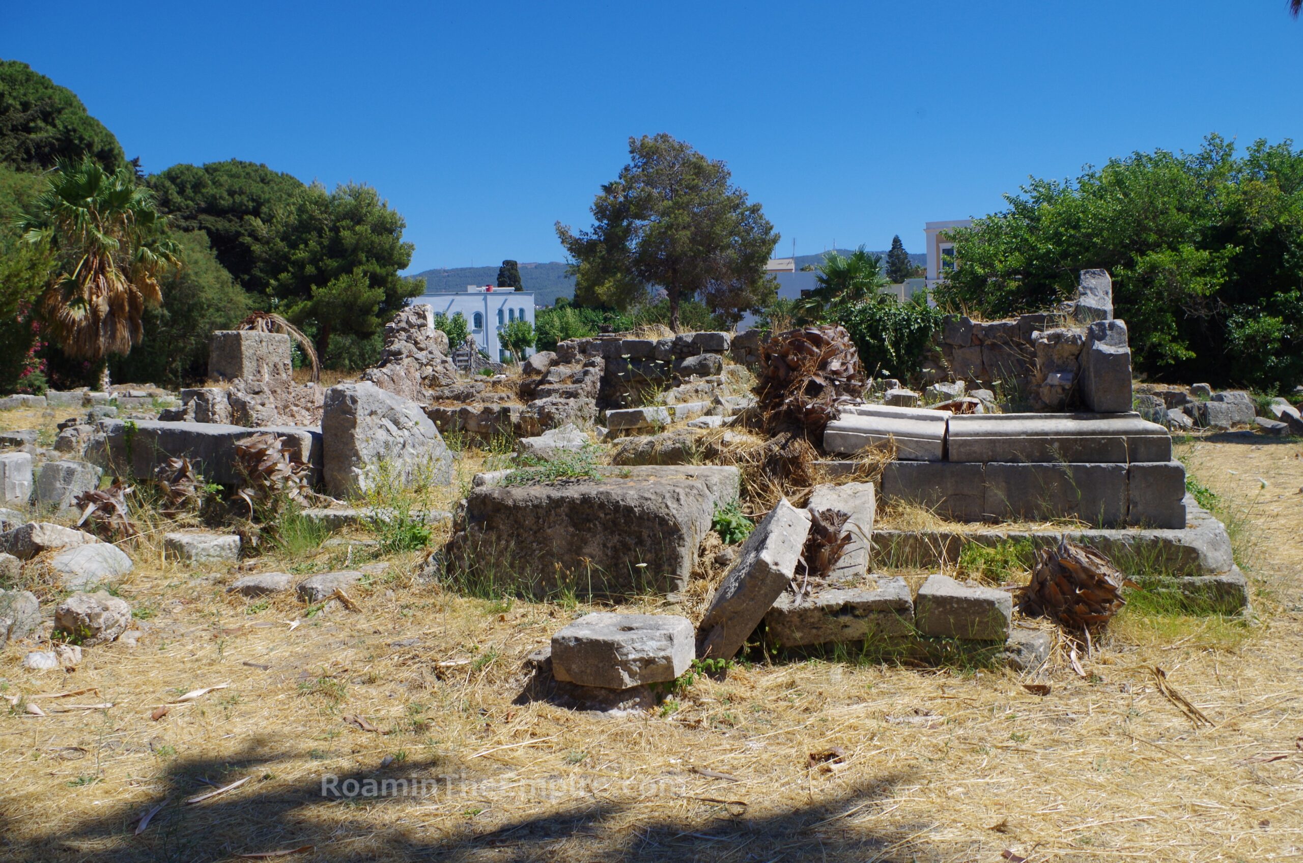
On the east side of this temple is the irregularly shaped Sanctuary of Hercules. This temple is identified as belonging to Hercules through epigraphic attestations found here as well as part of a statue with a lion skin. The sanctuary was originally constructed in the late 4th/early 3rd century BCE and doesn’t seem to have included an actual temple. A stoa was constructed along the north side of the space. In the 2nd century BCE, a temple was added at the center of the space as well as an additional stoa at the west. More rooms and stoas were added to enclose the space in the 1st and early 2nd centuries CE. The constructions here were heavily damaged in the 142 CE requiring extensive repairs and at the same time mosaic decoration was added to several rooms. The sanctuary was destroyed in the 469 CE earthquake, after which a bathing complex was built on the site and functioned here until the 7th century CE.
Despite a number of mosaics found here being displayed on the information board, they don’t seem to be in situ, aren’t in the Archaeological Museum of Kos, and aren’t even with most of the mosaics carted off by the Italians to Rhodes. The stoas surrounding the temple are in pretty bad shape and it’s hard to make out a lot of the boundaries of the sanctuary. The temple itself is in pretty similar shape to the adjacent temple of the unknown deity (minus the tree growing out of the middle of it), with the podium and a few blocks of the lower wall visible on one side.
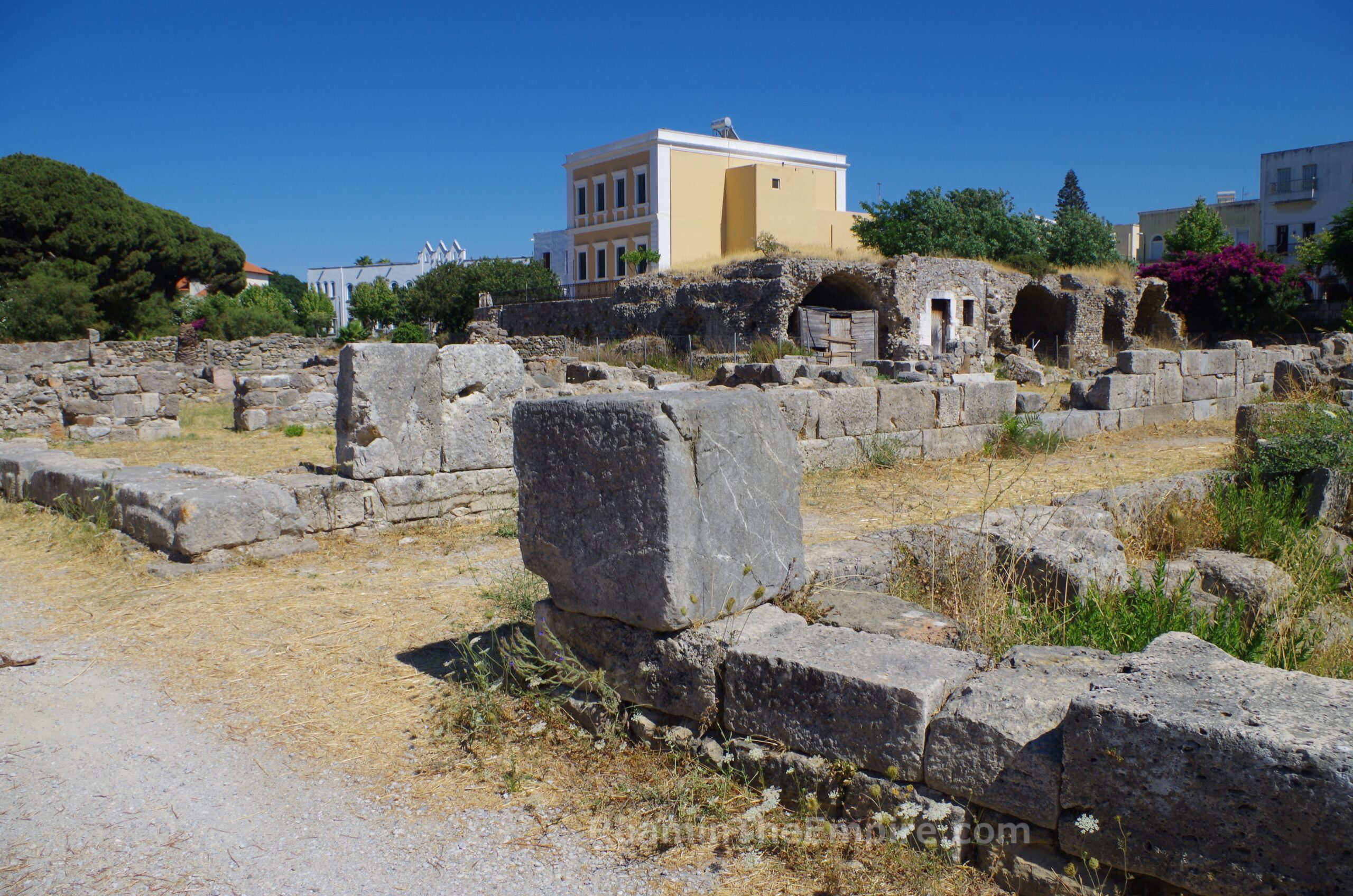
To the north of the Sanctuary of Hercules is the so-called Harbor Stoa. This is a stoa that ran along the interior of the harbor fortification wall and out along the east jetty of the harbor. It was constructed in the 3rd century CE. It suffered earthquake damage in the late 3rd century CE, requiring a second phase of construction in which it was repaired and a second level was added. Parts of the area were sort of inaccessible due to overgrowth, but the form of the stoa, particularly the western edge, is pretty clear from the southern part of the stoa.
The Harbor Stoa was destroyed in the 469 CE earthquake and a Christian basilica, the Harbor Basilica, was built at a perpendicular orientation across the northern ruins of the stoa in the late 5th or in the 6th century CE. It had the standard 3 aisled form, some of the columns are standing or have been re-erected in the western part. At the east, a doorway has been preserved. Parts of the basilica, like the Harbor Stoa, were sort of overgrown and not very accessible. A baptistry associated with the church was constructed in the northern area of the Sanctuary of Hercules, near what is now distinguishable as a stand of palm trees.
South of the sanctuaries are the remains of parts of four residential insulae. The two eastern insulae, of which only very small portions survive at the north extent. The north fortification wall of the city cuts diagonally (northwest/southeast alignment) across these two eastern insulae. On the west side of the wall are the bits of residential buildings. On the east side of the wall in this area, some constructions identified as Hellenistic storehouses are present. The wall itself was largely overgrown as were the residential areas and the storehouses in this area. Some of the structures were visible from the paths, but for the most part were not directly accessible.
The third insula from the east was probably the best kept of the residential insulae of the harbor area. At the center of it is a large later construction. A few of the areas adjacent to the path were fairly well cleared and revealed some pebble mosaics and dolia. Successive periods of occupation have been uncovered in the residential insulae dating back to the foundation of Kos through the early Christian period. The fourth insula was in the same state as the first two, largely overgrown and mostly inaccessible aide from a few rooms right along the visitor paths. Walls did rise above the growth, but it was difficult to discern many details beyond that.
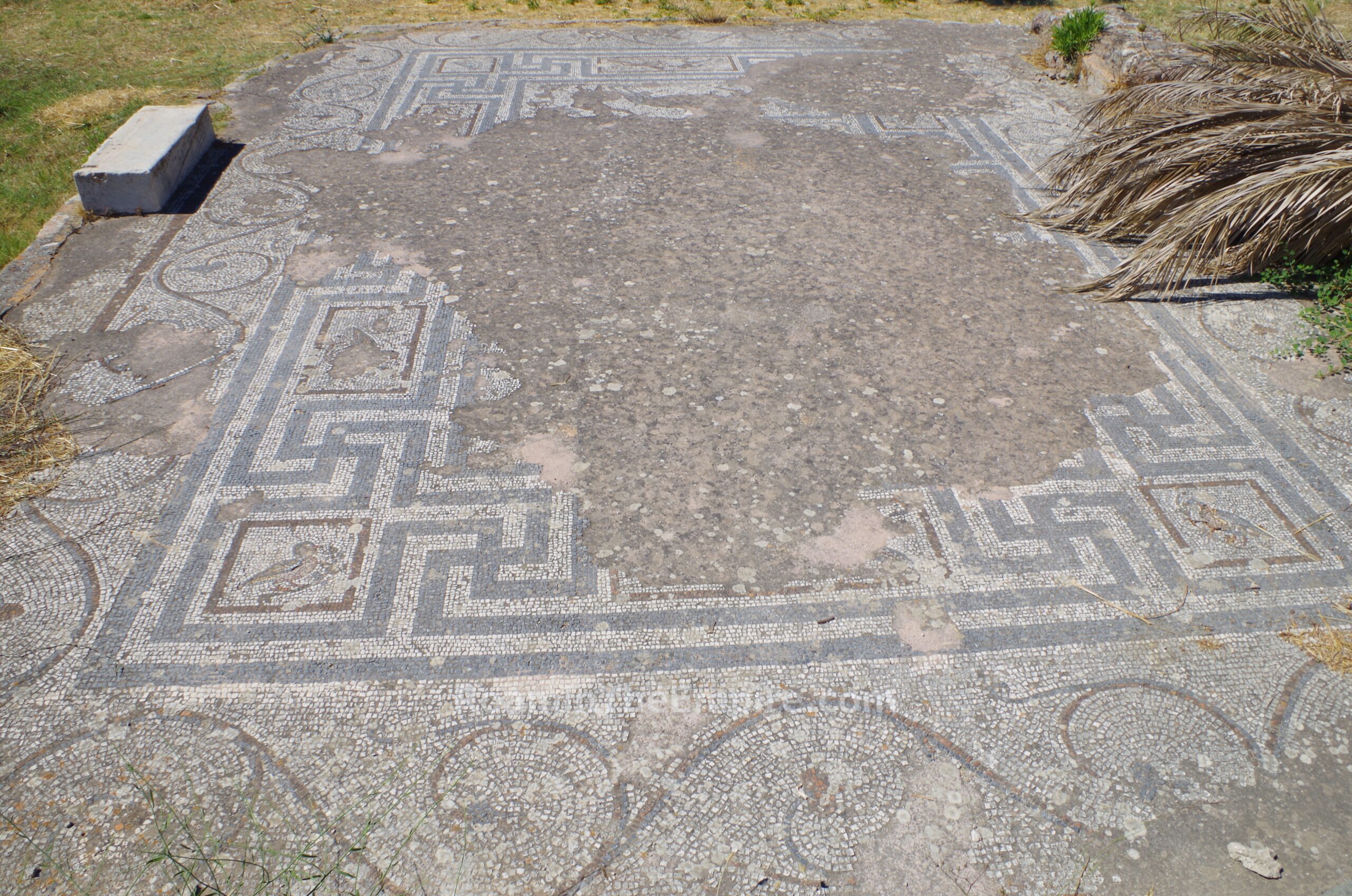
The area north of these residential insulae was originally occupied by the north fortification wall as it turned to an east-west orientation. This stretch of the wall was dismantled following the 142 CE earthquake, opening up a small space between the insulae and the Sanctuary of Aphrodite. It seems that this space was then occupied by a public building of some sort. A well-preserved but fragmentary mosaic from this building survives in situ, along with some bits of wall foundation, just to the north of the second insula from the west. Scenes of hunting and animals are among the elements that still remain.
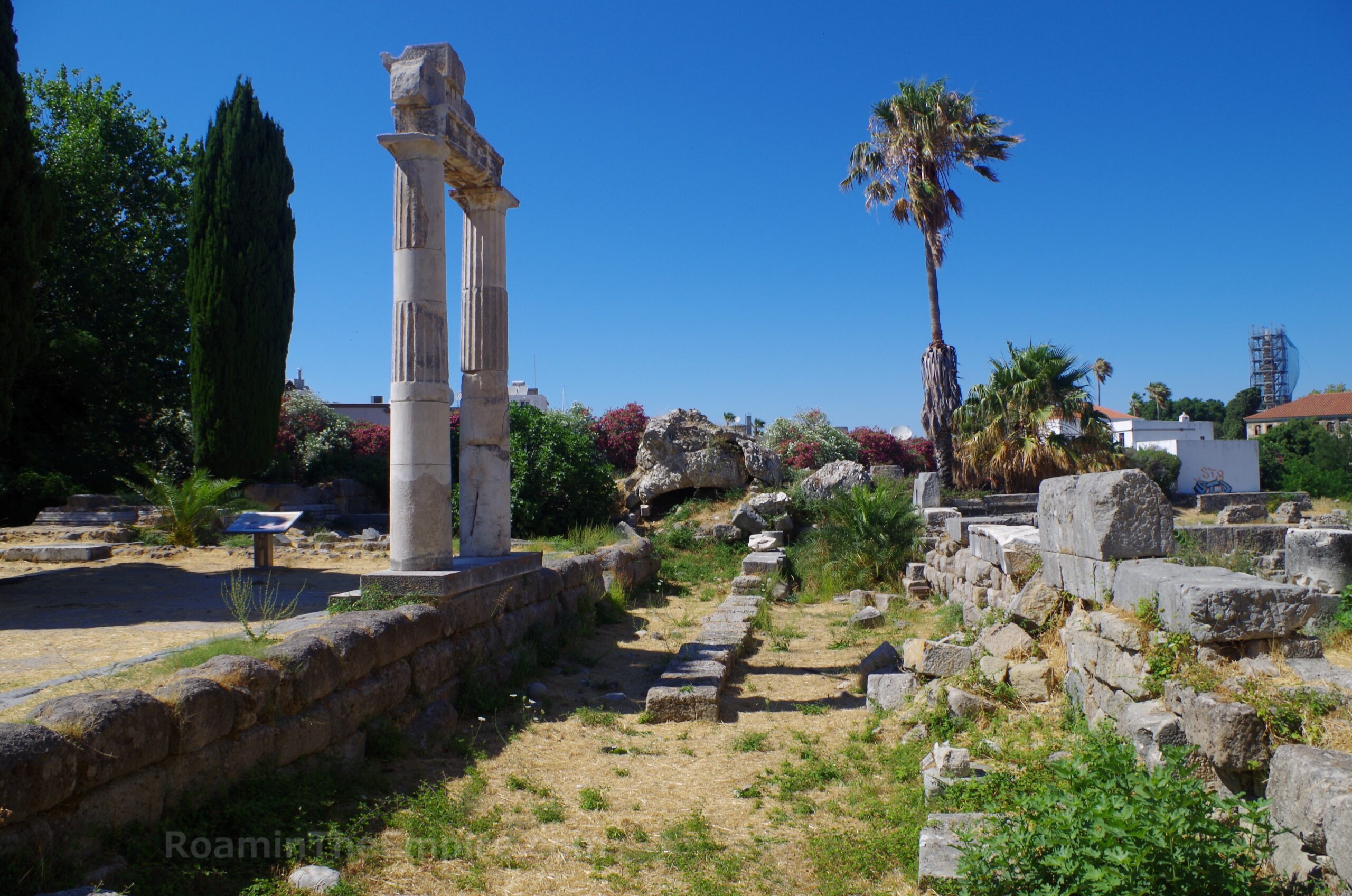
Immediately to the west of the insulae is the northern part of the connection feature between the north and south agorai. The rear wall of the northern extent of the western stoa is clearly defined with several courses of block still standing. The interior parts of this stoa are well preserved as well, offering the best glimpse of the original elements of any of the stoai in Kos. A few columns have been re-erected and reconstructed (and are surprisingly still standing despite the 2017 earthquake) as is the crepidoma that led from the stoa down into the paved area. Between the colonnade and the main section of the stoa, both dating to the 2nd century BCE, at a lower-level blocks from the foundation of the form of the stoa dating to the 4th-3rd century BCE have been excavated.
Following the 142 CE earthquake, the gateway between the north agora and the connecting feature was remodeled into a monumental propylon. The remains of this are visible adjacent to the northern extent of the western stoa. Mostly what is visible of this construction are the foundations. Some of the crepis along the south side of the monument can be seen. The form of some of the smaller portal areas is discernable. Marble revetment along the base is present inf a few places. A few large pieces of the vaulting from the entries, one with traces of stucco decoration, sit atop the foundations. On the west side of the propylon is some pavement and some column bases belonging to an exedra near where the propylon intersected with the eastern stoa, which is largely absent. Unfortunately the east side of the propylon and where the eastern stoa would have been is inhabited by a number of trees that obscure some of the remains of the monuments. I was able to find a few mason marks on some of the stones in the central area of the propylon, overlooking the agora to the north.
On the north side of the foundations of the propylon is a small section of the monumental staircase that descended from the entryway into the northern agora. Also lying along the northern foundation are numerous fragments of columns and other architectural features that decorated the propylon. In terms of the northern agora itself, the so-called fish market, not much remains other than some of the paving stones from the main floor of the agora located adjacent to the staircase down from the propylon. A relatively small area of this agora is even within the excavated area.
The agora area is the last part of the archaeological zone, and you’re essentially back where you started. This mostly rounds out the archaeological remains of Kos city as well. There’s one other thing perhaps worth visiting with ancient ties; just north of the Harbour Basilica is the Plane Tree of Hippocrates. Legend states that Hippocrates taught his pupils beneath the tree, but it has been dated as being only about 500 years old, so it could not have been the actual tree. It has been pointed out, however, that it could be from the original lineage of a tree in that spot. There is an inscribed bucrania altar among the various stone elements reused in monuments around the tree. All told, there’s a lot to see in Kos town, and it took me more than a single day (but less than two whole days) to see everything, not including the nearby Asclepieion, which will be featured in the next post in this series on Kos. It’s also worth mentioning that a theater has been identified in the south of the city (about 300 meters southwest of the Casa Romana) but it is overgrown and not accessible.


 residential insula.")
.")


Appian. Historia Romana, XII.4.23, XII.17.115-117.
Aristotle. Ton Peri Ta Zoia Historion, 5.19.
Arrian. Alexandrou Anabasis, 6.11.
Athenaeus. Deipnosophistae, 12.77, 13.71.69, 15.32, 15.38.
Demosthenes. Yper Tis Rodion Eleftherias, 27.
Diodorus Siculus. Bibliotheca Historica, 5.54.3, 11.3.8, 14.84.3, 15.76.2, 16.7.3, 16.21.1, 19.68.3, 20.27.
Evagrius Scholasticus. Ekklisiastiki Istoria, 2.14.1.
Grant, Michael. A Guide to the Ancient World: A Dictionary of Classical Place Names. New York: Barnes & Noble Books, 1997.
Herodotus, Historiai, 1.144, 7.164.
Homer. Illiad, 2.2.677.
Hyginus. De Astronomia, 2.16.
Jerome of Stridon. Chronicon.
Livadiotti, Monica. Due edifice termali a Coo città: tipologie a confronto.
LIvadiotti, Monica. “The Infrastructure of a Hellenistic Town and Its Persistence in Imperial Period: The Case of Kos.” Thiasos, No. 7.2 (2018).
Ovid. Metamorphoses, 7.357.
Parker, Robert. “The Cult of Aphrodite Pandamos and Pontia on Cos.” Kykeon: Studies in Honour of H.S. Versnel. HFJ Hortsmanshoff, HW Singor, FT Van Straten, and JHM Strubbe (eds.), Leiden: Brill, 2002.
Pausanias. Hellados Periegesis, 3.23.6, 8.43.
Pliny the Elder. Historia Naturalis, 5.134, 11.26-27, 13.5, 14.10.1, 15.18.2, 20.100.1, 23.14.1, 27.27.1, 29.4, 35.79, 35.92, 35.161, 36.20
Polybius. Historiai, 30.7, 37.
Rocco, Giorgio and Monica Livadiotti. “The Agora of Kos: The Hellenistic and Roman Phases.” The Agora in the Mediterranean from Homeric to Roman Times: International Conference Kos, 14-17 April 2011. A. Giannikouri (ed.), Athens, 2011.
Scafuro, Adele C. “Koan Good Judgemanship: Working for the Gods in IG XII.4.1 132.” Greek Epigraphy and Religion: Papers in Memory of Sara B. Aleshire from the Second North American Congress of Greek and Latin Epigraphy. Emily Mackil and Nikolaos Papazakadas (eds.), Leiden:Brill, 2016.
Sherwin-White, Susan M. Ancient Cos: An Historical Study from the Dorian Settlement to the Imperial Period. Göttingen: Vandenhoeck & Ruprecht in Göttingen, 1978.
Smith, William. Dictionary of Greek and Roman Geography. Walton & Murray, 1870.
Stillwell, Richard, William L. MacDonald, and Marian Holland. McAllister. The Princeton Encyclopedia of Classical Sites. Princeton, NJ: Princeton U Press, 1976.
Strabo. Geographica, 12.8.6, 14.1.15, 14.2.19, 15.1.3.
Tacitus. Annals, 2.75, 4.14, 12.61.
Thucydides. Historiai, 8.41-45, 8.108.