


Continued From Kos Part II
Roughly 350 meters east of the odeon, down Leoforos Grigouriou V, on the south side of the street is the Casa Romana. In the summer the site is open from 8:00 to 20:00 and is closed on Tuesdays. In the winter (November through March) it is open from 8:30 to 15:30. As with the other sites, however, it is advisable to check ahead that the hours are indeed extended in the summer season. Admission to the Casa Romana is 6 Euros.
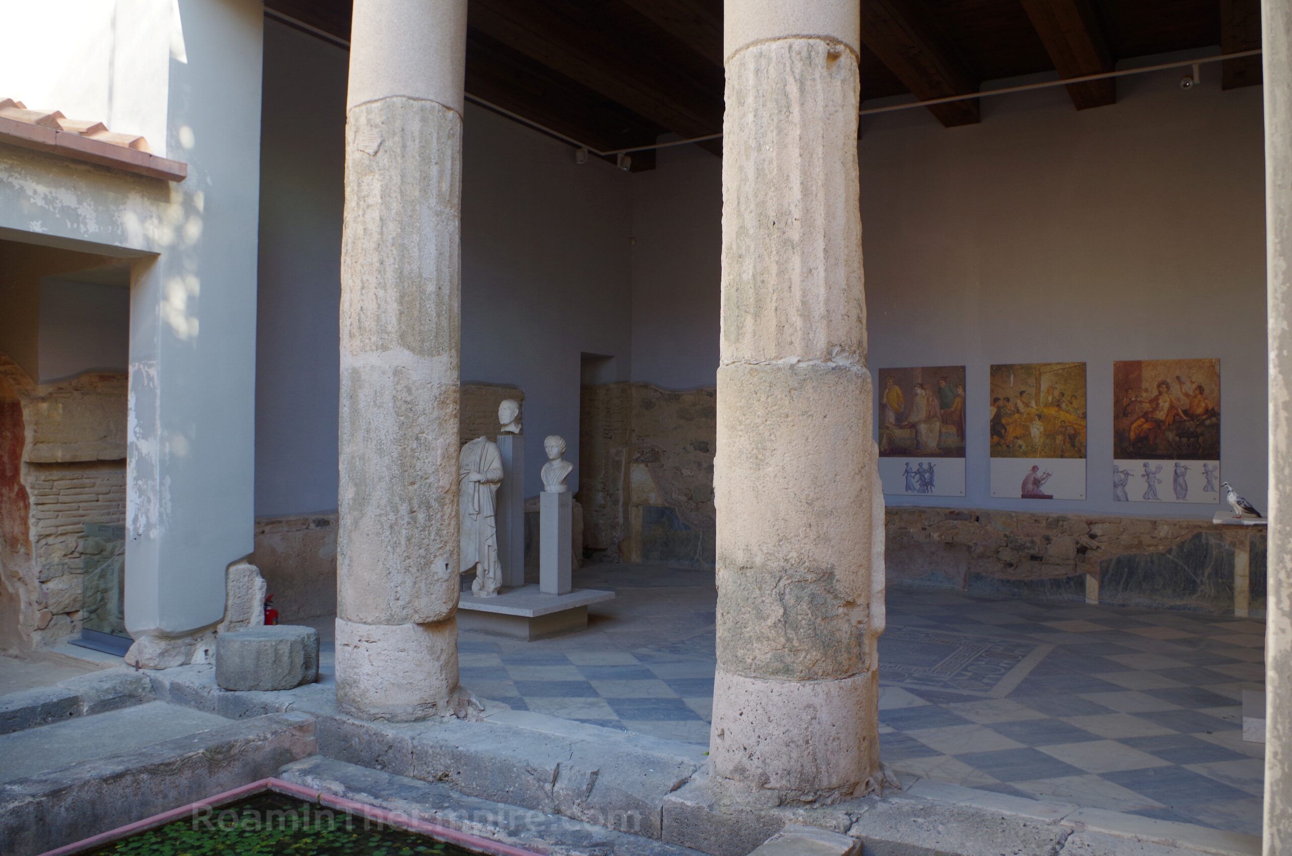
As the name would suggest, this archaeological area consists of a Roman dwelling. Sometime in the Hellenistic period, a series of three separate houses occupied the site. These were mostly destroyed in the 142 CE earthquake. In the 2nd century CE, a single house was built occupying the entire insula and overlaying nearly the entire footprint of the Hellenistic houses. This larger house had three atria that somewhat followed the location of the atria of the three Hellenistic houses that preceded it. The house was heavily renovated in the 3rd century CE and the decorative scheme updated and enhanced. The dwelling was severely damaged in the effects of an earthquake that struck off the coast of Crete in July of 365 CE, though the south part remained in use through to late antiquity.
This site is really interesting because a modern reconstruction of the residential complex has been constructed over nearly the entirety of the site. The archaeological remains have been preserved and in some places, incorporated into the reconstruction. Original marble and mosaic floors decorate some of the rooms, while fragments of intact fresco have been built around and used to reconstruct the wall decorations of some rooms. Of particular note are the basins of a fullonica at the northeast corner. The northeastern atrium has some remains of a figural mosaic depicting a hunting scene. Another room off this has a decorated floor as well, and in the room directly to the south is exposed underfloor water channeling.
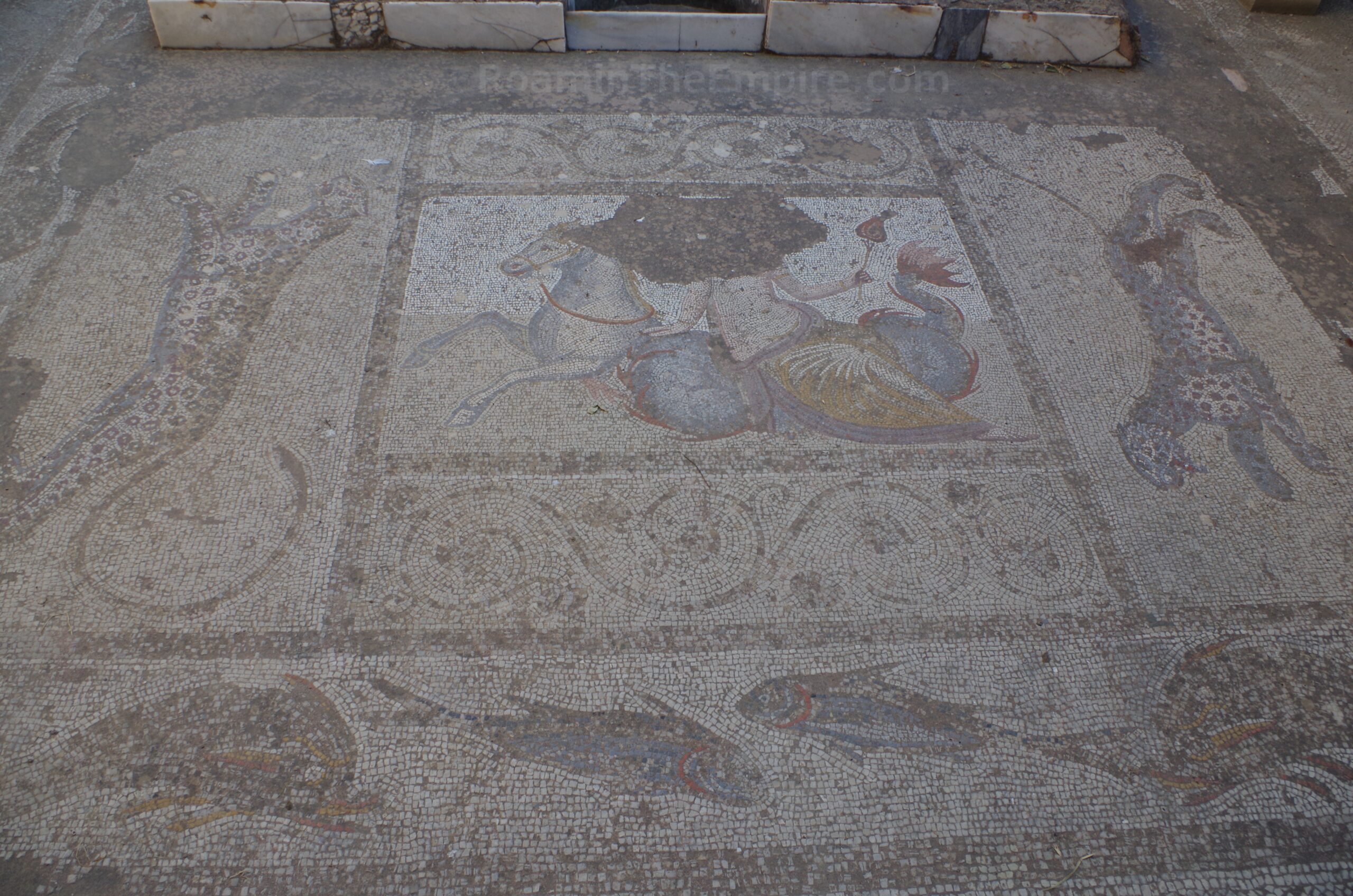
The peristyle of the northwest atrium also contains the remains of a figural mosaic; this one depicting a Nereid riding a hippocamp and flanked by leopards. The room south of that is decorated with opus sectile flooring. A couple of rooms on the east side of the large southern atrium have mosaic flooring depicting animals. A room at the northeast corner of this core has significant intact fresco decoration, including a depiction of Eros, according to the information there. A small portion of the upper level reconstruction can be visited near this atrium. Scattered throughout the villa are objects that seem to have been found in the excavations here (there’s really no notation either way). This includes reliefs, fragments of statues, and coins as well as other smaller objects. Highlights include a statuette of Venus and votive relief of Cybele.
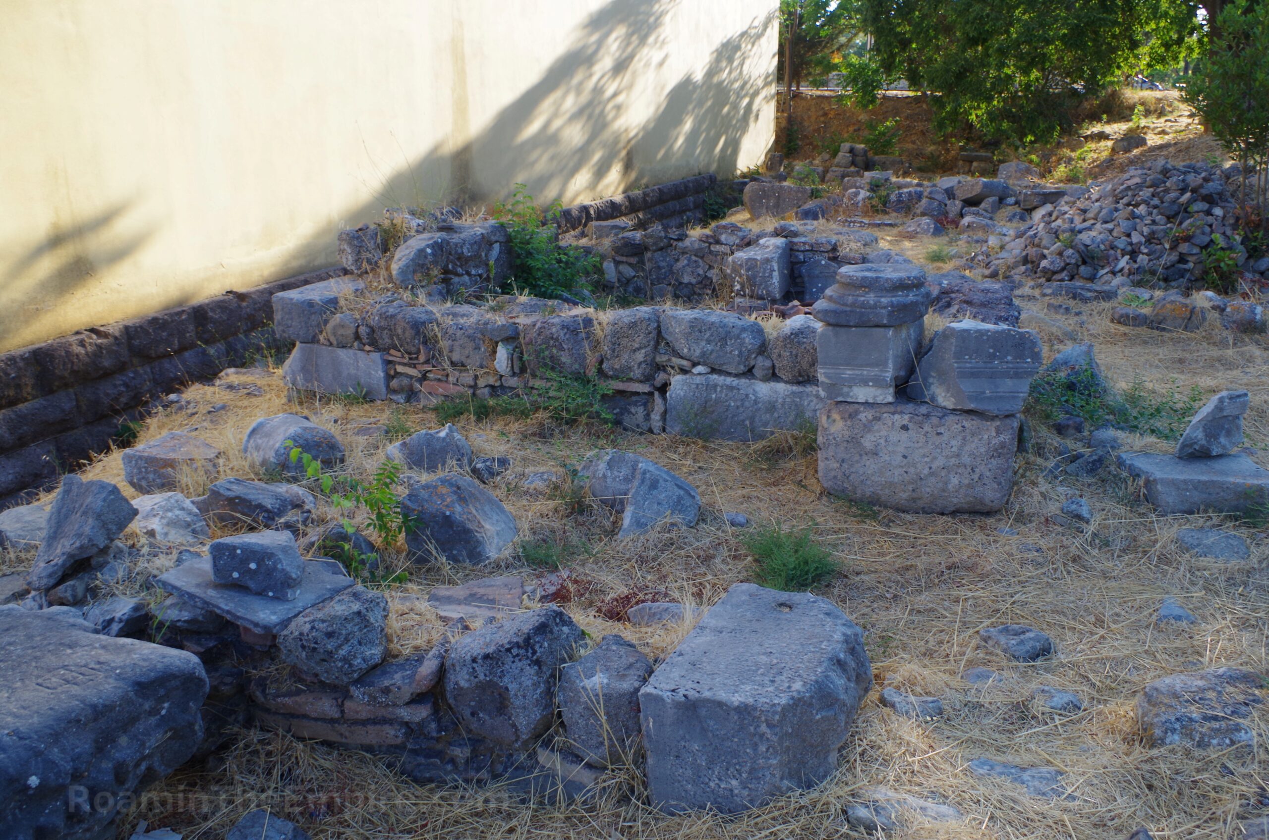
The very southern portion of the complex is not included in the reconstruction. This is the area that was occupied through late antiquity following the 365 earthquake damage. The sort of haphazard later construction style is pretty evident with the reuse of materials. There’s nothing especially of note here except for a paved floor at the southeast and an adjacent basin. The entire insula to the east of the Casa Roman is occupied by the Central Baths. Unfortunately, these are almost completely inaccessible. The imposing remnants of the western praefurnia are visible adjacent to the southern section of the Casa Romana. From the north, near the entrance to the Casa Romana, some remnants of marble revetment of a pool or niche as well as some pilae from one of the tepidaria can be seen. But otherwise, there is no access and nothing else can be seen of the Central Baths.
The Central Baths of Kos follow a pretty similar construction history with the Western Baths. They were originally constructed in the late 1st or early 2nd century CE. Following the earthquake of 142 CE, they were reconstruction and the plan somewhat altered to include a basilica thermarum and apodyterium in place of the open palaestra at the north side of the complex. The Central Baths underwent a radical renovation in the late 3rd or early 4th century CE when many of the central rooms were expanded and/or reorganized.
In antiquity, the decumanus maximus ran along the course of the present-day Leoforos Grigouriou V. The space out in front of the Casa Romana that abuts the modern road but is not part of the dwelling was occupied by a stoa that lined the decumanus maximus (or the primary east-west plateia in the Greek/Hellenistic period) in antiquity. The same is true for the insula of the Central Baths. In front of the Casa Roma, the remains of these taberna-like cells can be seen to the west of the entrance of the Casa Romana. A few inscriptions, with no context or information, are also on display in this space.
My feelings on reconstructions are pretty well documented on this website when encountering them in other archaeological areas. I often feel they are heavy handed and overshadow what was actually found at the location with a sort of vanity project of interpretation. The Casa Romana is quite possibly the best reconstruction I’ve encountered. It does an amazing job balancing the preservation and presentation of the original archaeological remains with the reconstructed parts of the house. The original archaeological parts are certainly the focus, while the reconstruction enhances and builds on the foundation both literally and conceptually. It isn’t perfect, but it’s much closer to that than most, in my opinion. There’s also ample information on site with loads of information boards in English and Greek. It took me a little more than an hour to go through Casa Romana.
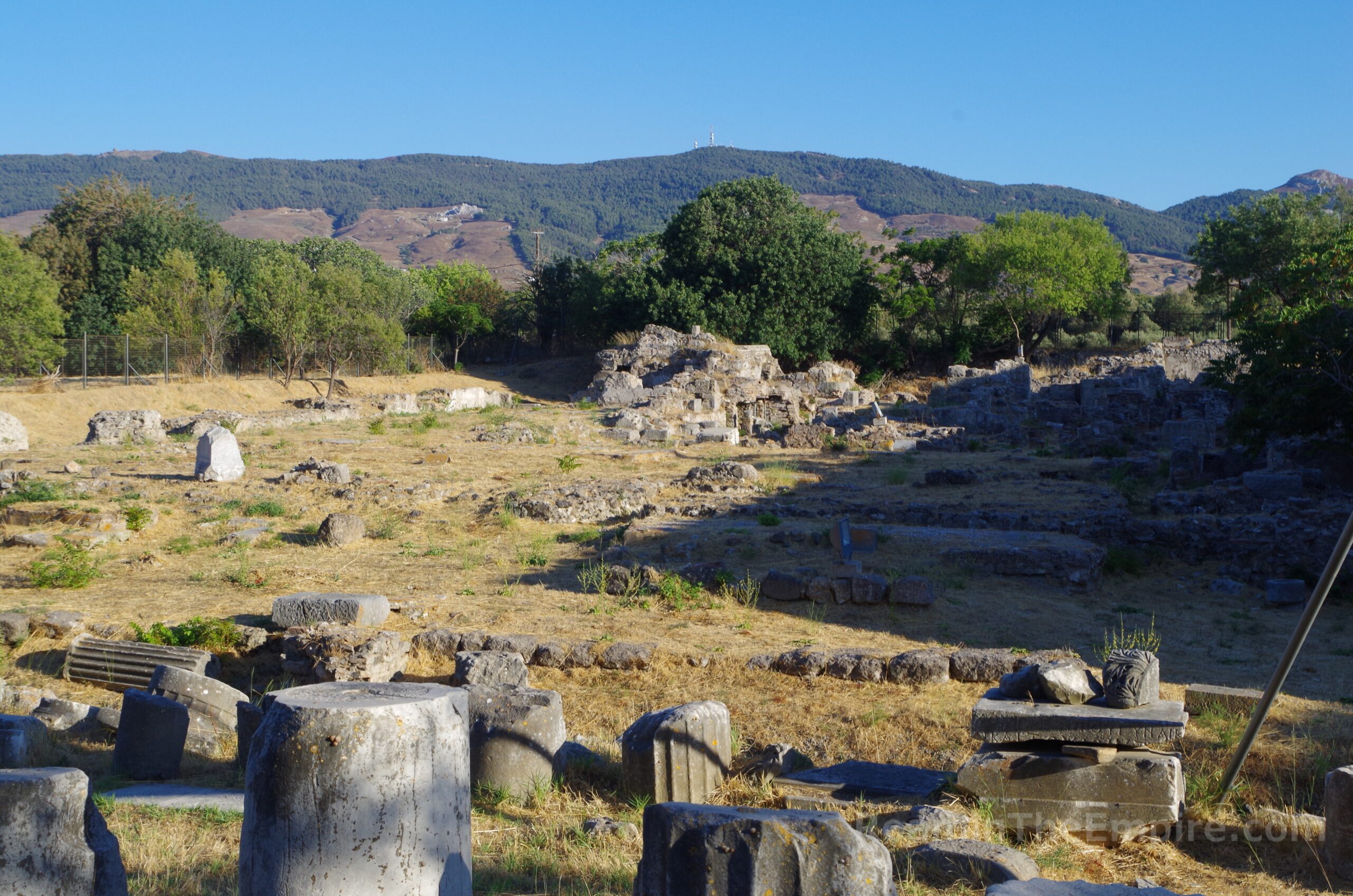
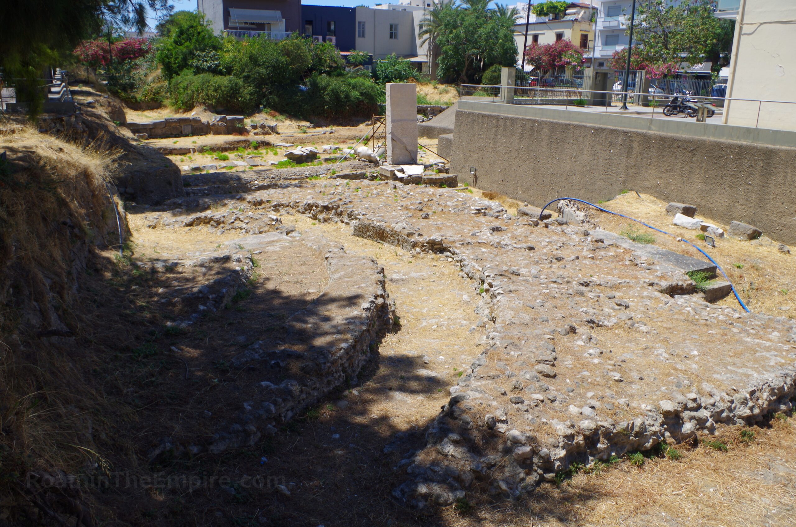
Directly across Leoforos Grigouriou V (and in antiquity the decumanus maximus) was the western part of the southern portion of the agora of Kos. Nothing is left of this western part of the agora, but a short walk to the east, a fairly big section of the southern agora can be seen. It seems that at the foundation of the city in 366 BCE, two agoras were constructed. One was up near the harbor and may have been built on the site of the agora of the previous settlement. This seems to have functioned mostly as a commercial and maritime trade center. It is sometimes called the harbor agora or the fish market, as it seems to have been referred to in an inscription. At the same time, a larger rectangular agora was set up in the south, at the intersection of the main north-south and east-west plateiai (or the cardo maximus and decumanus maximus in the Roman period). This agora seems to have been planned to serve a more religious and civic function and was significantly larger than the one in the north.
In the late 4th or early 3rd century BCE, a feature was built to connect these two agorai, initially an open space lined stoai on the east and west sides that formed a sort of L shape with the wider southern agora at the bottom and the acropolis occupying the space to the west. There were some alterations to the agorai in the 2nd century BCE. Repairs occurred following the earthquake of 6 BCE, but the form remained the same. After the 142 CE earthquake, however, the extensive damage allowed not just for repairs but for significant alterations, particularly in the north where part of the abutting fortification walls around the harbor were completely dismantled. A monumental propylon was also constructed between the north agora and the connecting feature between the agorai. The earthquakes of 469 CE and 554 CE likely destroyed significant portions of the agorai of Kos and rendered them unusable for their original functions.
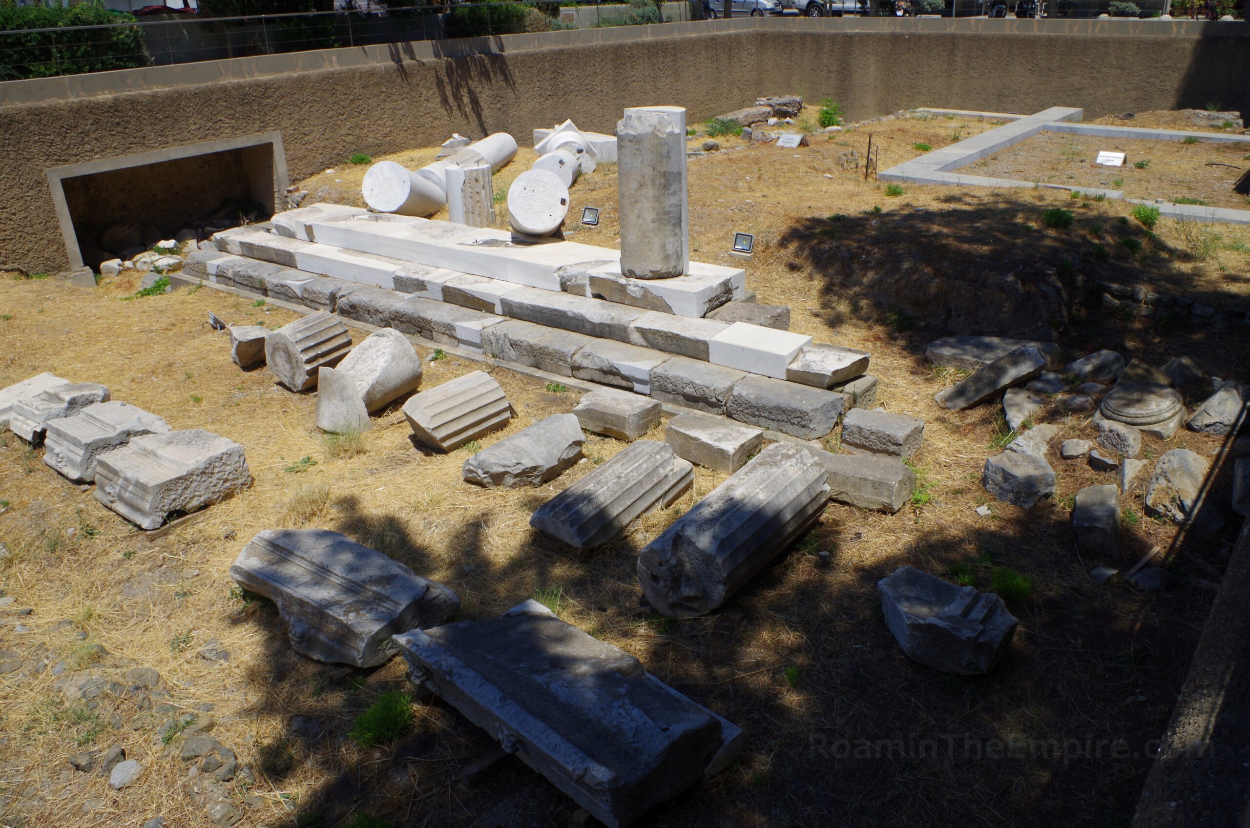
The remains of the southern forum start on the north side of Leoforos Grigouriou V at the intersection with Makrigianni. In a recessed area of the park are the remains of the so-called Altar of Dionysus. Though only the crepis remains here, it is believed that the main structure of this altar had depictions of the life of Dionysus as well as scenes of battle between his followers and the Gauls based on fragments of the reliefs that have been found, which were later reused in the Neratzia Castle and can now be found there (though it was closed when I visited, apparently heavily damaged in the 2017 earthquake). The themes of Dionysus and battles with the Gauls, as well as the proximity to the Temple of the Attalids would suggest that this altar was also associated with the Attalid Dynasty, who traced their lineage to Dionysus Kathegemon and were fighting Gauls in the early 2nd century BCE. The altar seems to date to the middle of the 2nd century CE. Again, only the base remains, but the ramp that led up from the west side of the altar into the main area of the altar where sacrifices were made is still visible. There are stairways down into the recessed area and the altar is directly accessible as part of a public park area.
Roughly 30 meters to the northeast, in the same recessed area of the park, are the remains of the Temple of the Attalids. This temple predates the altar by a few decades, likely being constructed in the early 2nd century BCE and remaining in use until it Roman imperial times, probably sometime around the earthquake of 142 CE, when the agora was drastically reconstructed. The temple seems to have been dedicated to King Eumenes II of Pergamon and was dedicated on the occasion of his victory over the Gauls in 183 BCE. A statue of the king would have been placed in the temple and he would have been venerated, probably along with Dionysus. The veneration of the king here was a reflection of particularly good relations between Kos and the Attalids. The bases of stone pedestals can be seen around the temple, used to leave offerings. There are informational signs in English and Greek with helpful pictures and diagrams for both the temple and the altar, as well as other points of interest around the south agora area.
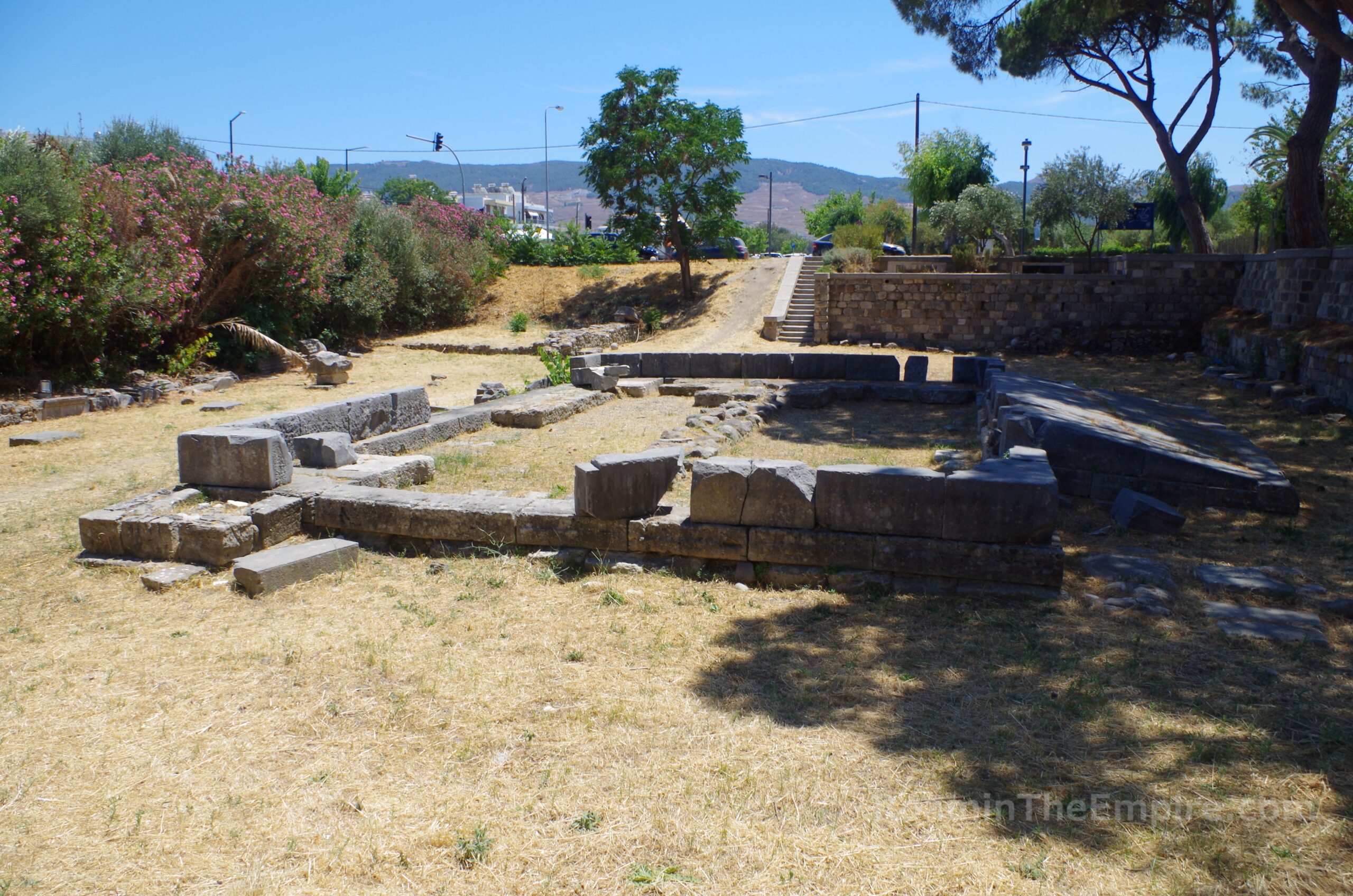
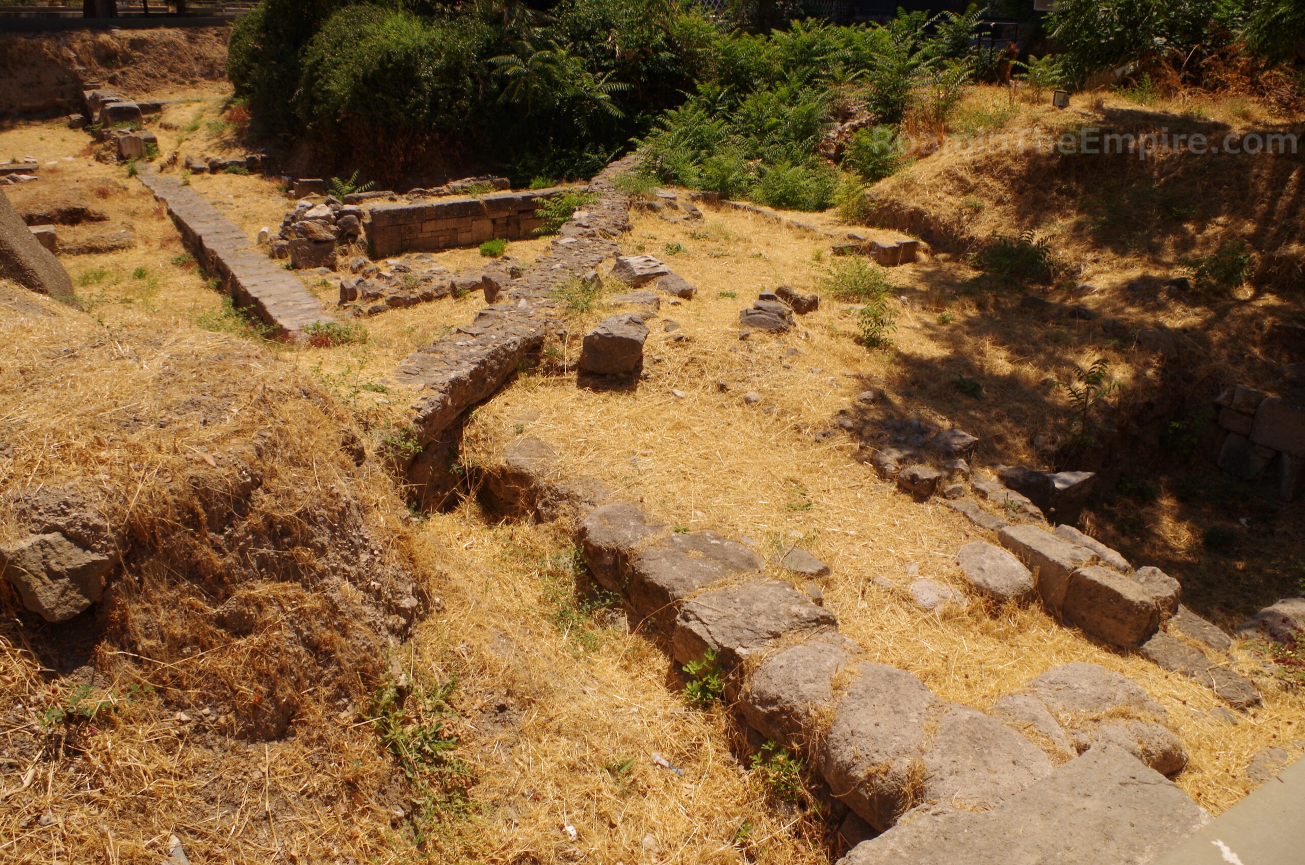
A few meters to the east at street level is a reconstruction of the eastern stoa of the agora of Kos. It seems as though only a very small portion of the stoa has been found here, seemingly just a few blocks. So, it seems this is not indicating what actually lies at the ancient level (aside from the few blocks). Rather, this looks to be just a reconstruction of what is generally considered to be the path of the eastern stoa of the agora. In that case it makes a lot more sense to have the street level reconstruction rather than to cover up the original stoa even though there are excavated areas all around it. The entranceway into the forum can be seen about midway. Roughly 30 meters northwest, or 35 meters north of the Temple of the Attalids is some more reconstruction of the circular south part of the tholos. This too doesn’t seem to indicate what is below the surface, but instead is what should be there based on other archaeological evidence.
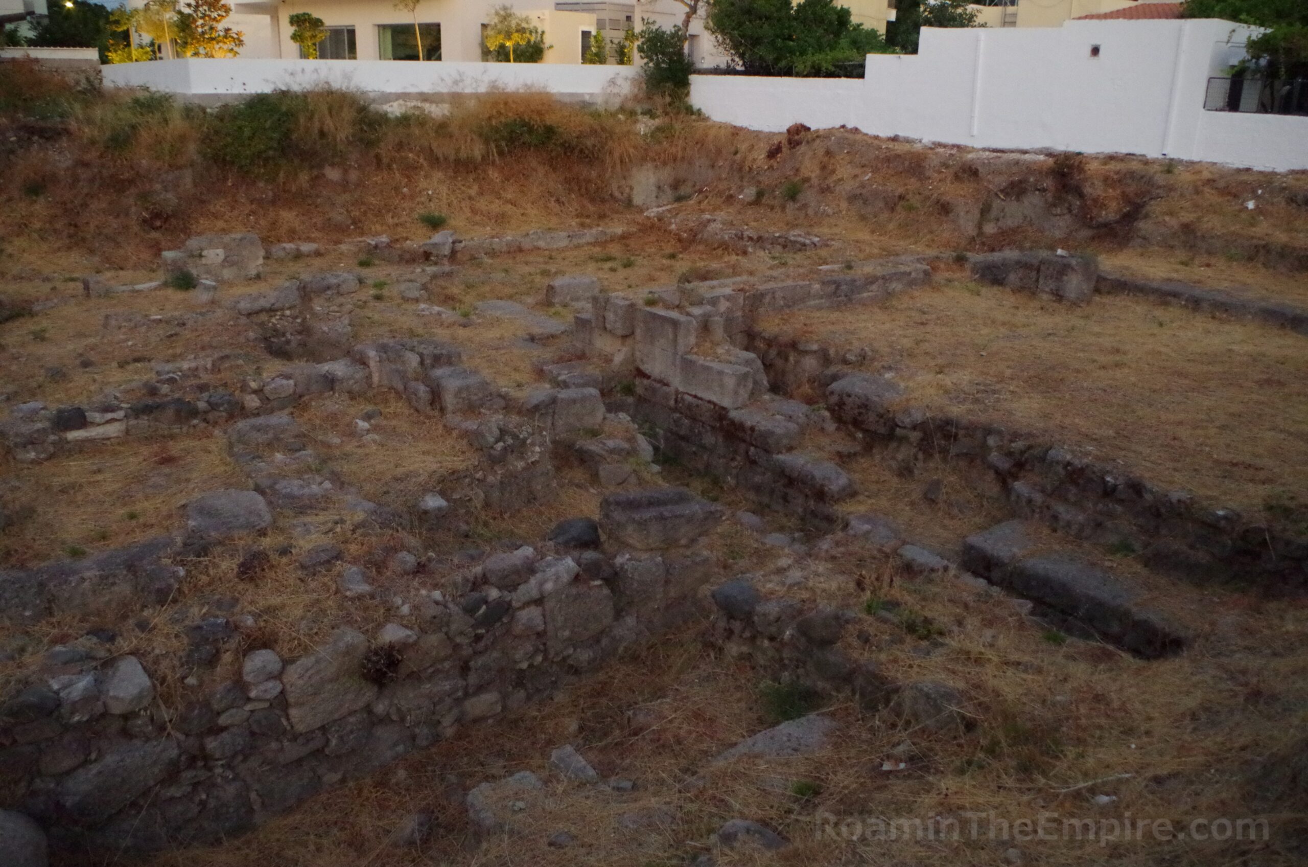
Continuing through the area of the southern agora, across the street east of the reconstructed stoa (Lórdou Výronos) is another large excavated area. This would have belonged to buildings in the insula to the east of the agora. Unfortunately there isn’t really much information available about what is here. The construction of the square buildings in the south looks to be Hellenistic, while constructions in the north appear to be a bit later. The edge of the insula, which lines up with the plateia that would have entered the forum (based on the reconstructed stoa) can pretty clearly be made out, especially when looking at satellite imagery of the area.
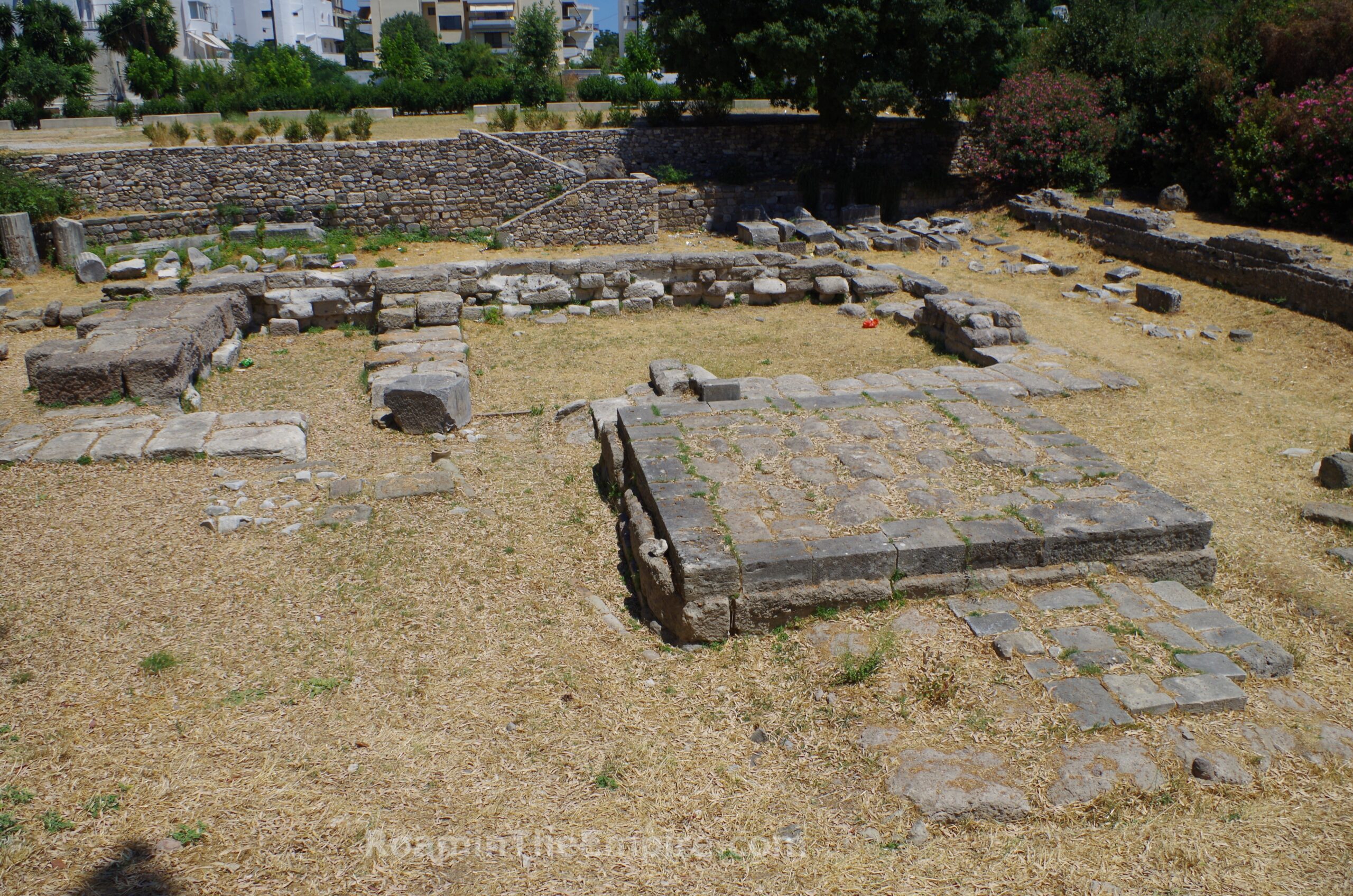
Just to the north of the tholos reconstruction, across Agiou Nikolaou, is an actual excavated area. Toward the center of this is the north half a circular structure that is the actual remaining structure of the tholos. The circular tholos on a raised platform was constructed during the time of Augustus, possibly following the 6 BCE earthquake. The exact nature of the structure has not yet been determined. Similar tholoi in the east built around the same time have been thought to be dedicated to Tyche or Fortuna. Rectangular pedestals around it seem to have supported inscribed stele, one of which survives and has been re-erected to the north of the tholos. This stela records the names of patrons who donated money for the construction of a monument in the agora, perhaps the tholos, and also dates to the time of Augustus. Following the earthquake of 142 CE, the stela was reused as a cover for a sewer that runs nearby.
To the east of the tholos is part of the partially reconstructed colonnade that fronted the eastern stoa. Some of the steps that led down into the agora remain, as do parts of the columns. At one point a couple of these columns had been reconstructed and re-erected, but they were toppled in the 2017 earthquake that hit Kos and presently remain fallen in place. A few meters further east are the mostly reconstructed remains of the cells of the east stoa, though some of the original elements remain. To the west of the tholos are the original elements of the western stoa as well as the first few meters of an alteration to this part of the agora made in the 2nd century BCE, which extended the western edge of the agora in line with the western stoa and created some kind of monumental area with the northwest corner. The western stoa is also visible from the street north of this plot. The southeast corner of this extension can be seen in an excavated area back across Agiou Nikolaou, showing where this extension turned back toward the west to close out the area. All these areas are fenced and not directly accessible.
Continued In Kos Part IV


Sources:
Appian. Historia Romana, XII.4.23, XII.17.115-117.
Aristotle. Ton Peri Ta Zoia Historion, 5.19.
Arrian. Alexandrou Anabasis, 6.11.
Athenaeus. Deipnosophistae, 12.77, 13.71.69, 15.32, 15.38.
Demosthenes. Yper Tis Rodion Eleftherias, 27.
Diodorus Siculus. Bibliotheca Historica, 5.54.3, 11.3.8, 14.84.3, 15.76.2, 16.7.3, 16.21.1, 19.68.3, 20.27.
Evagrius Scholasticus. Ekklisiastiki Istoria, 2.14.1.
Grant, Michael. A Guide to the Ancient World: A Dictionary of Classical Place Names. New York: Barnes & Noble Books, 1997.
Herodotus, Historiai, 1.144, 7.164.
Homer. Illiad, 2.2.677.
Hyginus. De Astronomia, 2.16.
Jerome of Stridon. Chronicon.
Livadiotti, Monica. Due edifice termali a Coo città: tipologie a confronto.
LIvadiotti, Monica. “The Infrastructure of a Hellenistic Town and Its Persistence in Imperial Period: The Case of Kos.” Thiasos, No. 7.2 (2018).
Ovid. Metamorphoses, 7.357.
Parker, Robert. “The Cult of Aphrodite Pandamos and Pontia on Cos.” Kykeon: Studies in Honour of H.S. Versnel. HFJ Hortsmanshoff, HW Singor, FT Van Straten, and JHM Strubbe (eds.), Leiden: Brill, 2002.
Pausanias. Hellados Periegesis, 3.23.6, 8.43.
Pliny the Elder. Historia Naturalis, 5.134, 11.26-27, 13.5, 14.10.1, 15.18.2, 20.100.1, 23.14.1, 27.27.1, 29.4, 35.79, 35.92, 35.161, 36.20
Polybius. Historiai, 30.7, 37.
Rocco, Giorgio and Monica Livadiotti. “The Agora of Kos: The Hellenistic and Roman Phases.” The Agora in the Mediterranean from Homeric to Roman Times: International Conference Kos, 14-17 April 2011. A. Giannikouri (ed.), Athens, 2011.
Scafuro, Adele C. “Koan Good Judgemanship: Working for the Gods in IG XII.4.1 132.” Greek Epigraphy and Religion: Papers in Memory of Sara B. Aleshire from the Second North American Congress of Greek and Latin Epigraphy. Emily Mackil and Nikolaos Papazakadas (eds.), Leiden:Brill, 2016.
Sherwin-White, Susan M. Ancient Cos: An Historical Study from the Dorian Settlement to the Imperial Period. Göttingen: Vandenhoeck & Ruprecht in Göttingen, 1978.
Smith, William. Dictionary of Greek and Roman Geography. Walton & Murray, 1870.
Stillwell, Richard, William L. MacDonald, and Marian Holland. McAllister. The Princeton Encyclopedia of Classical Sites. Princeton, NJ: Princeton U Press, 1976.
Strabo. Geographica, 12.8.6, 14.1.15, 14.2.19, 15.1.3.
Tacitus. Annals, 2.75, 4.14, 12.61.
Thucydides. Historiai, 8.41-45, 8.108.