


History
Located on the northeast coast of the Sardinia, Olbia is today, as it was in antiquity, the primary city on the eastern coast of the island. The city has taken on a number of names throughout history; Civita, Phausania, and Terranova Pausania, before being changed back to Olbia under Mussolini. Historically, the founding of Olbia (not to be confused with the ancient settlement on the Black Sea of the same name) is attributed to settlers from Greece; Thespians according to Pausanias. The Greeks were likely not the ones who initially founded Olbia, though, despite the name. One interpretation of the evidence is that Olbia was founded by the Phoenicians in the mid-8th century BCE. The city was then taken over by Greek settlers from Phocaea in 630 BCE (the nature of this acquisition is not clear) and given the name of Olbia. At the end of the 6th century BCE, the city was then retaken by the Carthaginians, notably after the Battle of Alalia in 540 BCE, when a Punic/Etruscan allied fleet defeated a Phocaean Greek fleet in an attempt to halt Greek expansion in Corsica and Sardinia.
Other interpretations state that the Greeks never held the territory, and that while Phoenician traders may have operated in the area, the city was not founded until much later; sometime in the late 6th or early 5th century BCE by the Carthaginians. The name ‘Olbia’ would seem to be derived from the Greek word for happiness or prosperity, which seemingly indicates some kind of Greek influence, though.
Like many of the Punic settlements on Sardinia, Olbia functioned as both a center for the collection of resources in the northeast area of Sardinia, but also as a hub of external trade. During the first Punic War, Olbia was the target of the consul Lucius Cornelius Scipio in 259 BCE. After successfully capturing Aleria on Corsica, Scipio sailed to Sardinia and launched an attack on Olbia. The Punic general Hanno was killed in defense of the city and was given a full military funeral by Scipio. Ultimately, Scipio had to abandon the city. Olbia eventually came under Roman administration after the Romans seized Sardinia following the First Punic War.
Though Sardinia didn’t see much action in the Second Punic War, Olbia featured in a small role. In 210 BCE a general Hamilcar commanded a Punic fleet that was making attacks in the hinterland of Olbia. When the praetor Publius Manlius Vulso, commander of the two Roman legions stationed to defend Sardinia, sought battle, Hamlicar fled with the fleet to conduct raids in the vicinity of Caralis. The city continued to be an economically important center through the Roman period, and the freedwoman and mistress of Nero, Claudia Acte, had a villa in the vicinity of Olbia. After the Vandal invasions in the 5th century CE, Olbia entered a period of decline, but remained a population center and retained its importance in later periods.
Getting There: As one of the primary cities on the island, Olbia is well connected among the island and to Italy and Europe. There are train and bus connections from elsewhere on the island, there are typically about half a dozen train departures from Cagliari to Olbia (3.5-4 hours, 18 Euros). Olbia also has an airport that serves multiple flights from Italy as well as flights from other destinations in Europe. A few ferry lines run service into Olbia from the Italian mainland (Genoa, Livorno, and Civitavecchia). Getting around the relevant parts of the city is pretty easy to do on foot.
San Simplicio
In the heart of Olbia is the Basilica di San Simplicio. The current church dates to the 11th and 12th centuries CE, and replaces an earlier Paleo-Christian church that dates to the late 6th or early 7th century CE. In the Punic period, this area was outside of the city walls and was the location of a necropolis, and possibly some kind of cultic area at the spot of the church. The use of the area as a necropolis continued in the Roman period and a Roman temple dedicated to Ceres was erected where the Basilica di San Simplicio stands today. What appears to be some spoliated marble is used in the construction of the exterior of the current church, on the south façade near the entrance. An inscription found notes the restoration of the temple of Ceres by the previously mentioned Claudia Acte.
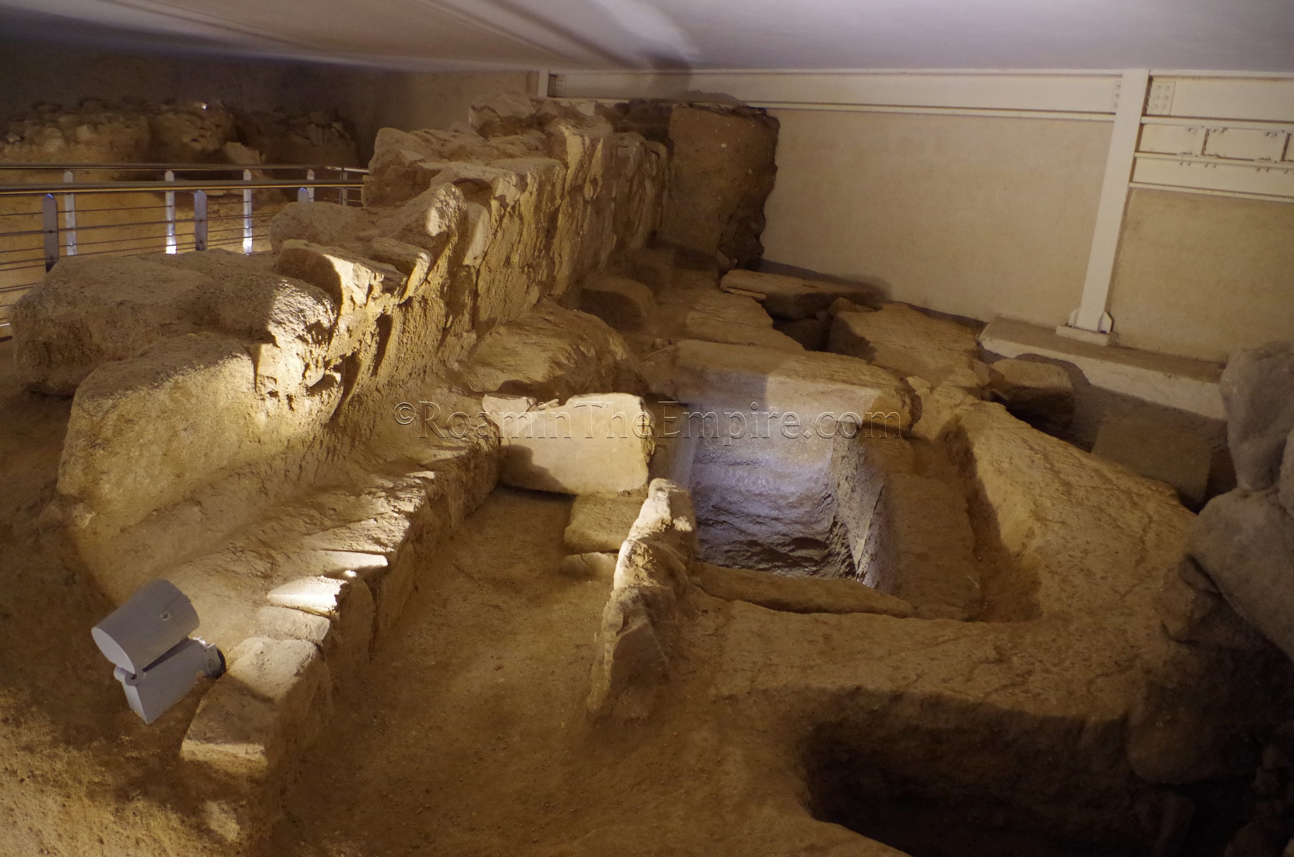
On the south end of the Piazza San Simplicio is the Necropolis San Simplicio. The entrance to the archaeological area of the necropolis is actually located in the parking garage. One can access it via a stairway/elevator on the south side of the piazza or via the parking garage entrance off Via Gabriele d’Annunzio. There are signs from the stairway that lead to the parking garage office, near the entrance, at which one can purchase the ticket and gain entrance to the archaeological area. The Necropoli San Simplicio has a weird system of openings. It is closed on Tuesday and Sunday. Mondays, Thursdays, and Saturdays it is open from 10:00 to 13:00, while Wednesday and Friday it is open from 17:00 to 20:00. Admission is 5 Euros and includes an audio guide.
Though the area was a necropolis through most of antiquity, all the graves in the Necropoli San Simplicio are from after the Roman occupation of Olbia. Most of these are from the Republican period, though a cluster of graves near the entrance, as well as a few near thewalkway toward the middle of the site, are dated to the imperial period. Two small wells are described as being Greek in origin due to the presence of Greek ceramics found in them. The two larger walls are late 1st century CE constructions related to the access ramp of the temple dedicated to Ceres. The circular stone construction between the two walls is a limekiln dated to the 11th century CE. A couple of medieval burials are also present in the immediate vicinity of the limekiln.
Some small finds from the excavations are on display in a few cases throughout the archaeological area. In addition to the audio guide, informational panels (with English translations) are posted as well. The graphical representations of the site with color coded timeframes are particularly helpful, as looking at the remains just based on text or audio description is sometimes confusing. In all, it took less than a half an hour to view the remains. The price is a little steep for what is here, but the site seems to be run by the company that owns the parking garage, so all things considered, the availability to even visit the site makes it hard to complain.
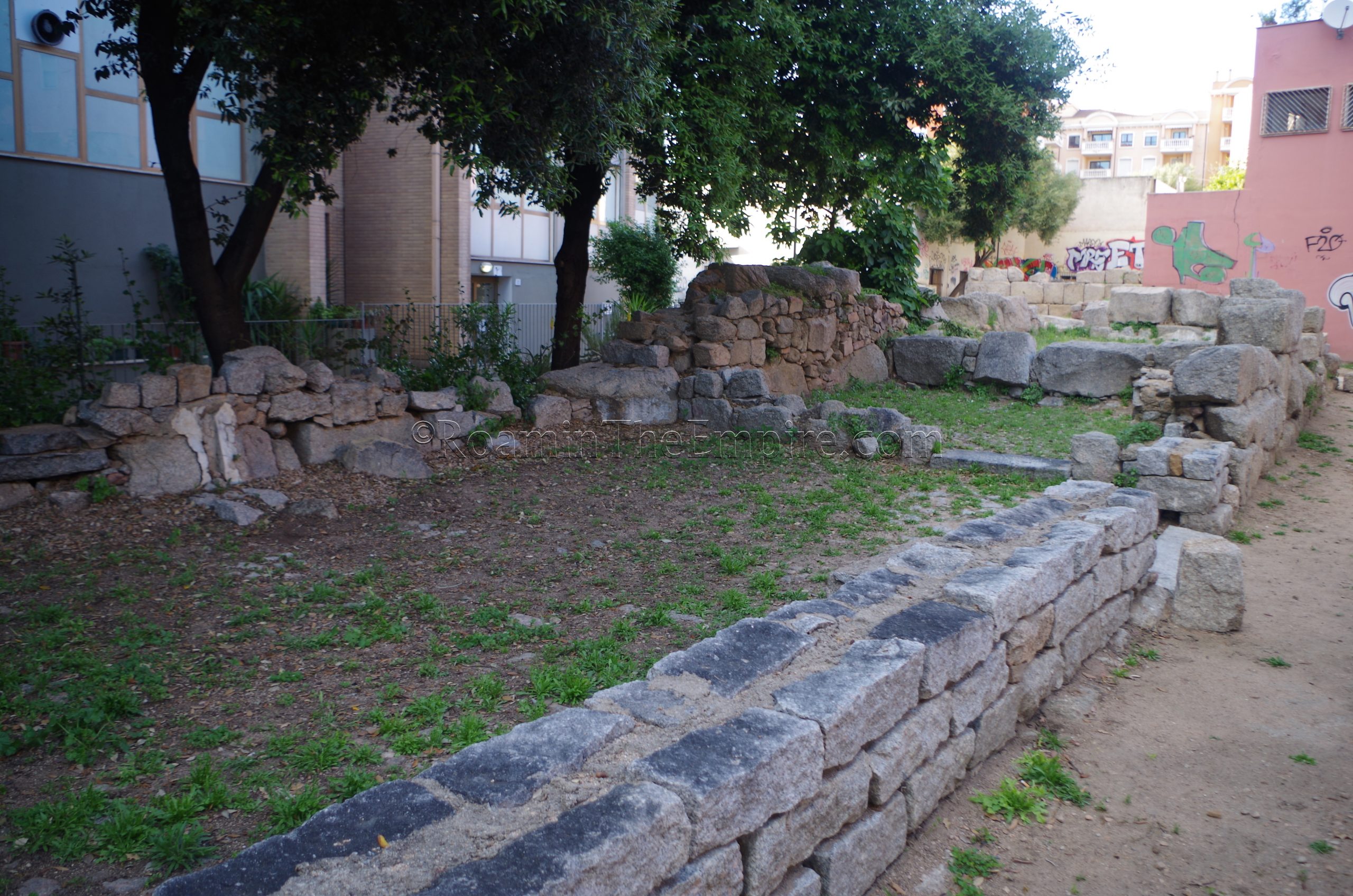
About a half a kilometer walk to the south, just north of Piazza Ennio Roych, stand the remains of a stretch of the Punic fortification walls (Le Mura Puniche). The walls are excavated for a length of 64 meters, starting in the north with a large square tower. The walls continue for a short distance to a gateway in the walls, where the modern pathway is present. The remaining stretch of walls continues south of the gateway. This section of the city walls would have been part of the western fortifications of Punic Olbia. A water storage tank with waterproof lining now filled and covered for preservation) was found in the tower. The walls are just out in the open, so they can be visited at any time. There’s a small informational sign, with a translation in several languages, at the south end of the walls.
Museo Archeologico di Olbia
Heading to the west, toward the port area about a kilometer away, is the Museo Archeologico di Olbia. Located on the small Isola Peddone among the tourist port (Via Isola Peddone, no number), the museum is closed on Mondays and Tuesdays. The rest of the week, it is open from 10:00 to 13:00 and from 17:00 to 20:00. Entrance to the museum is free.
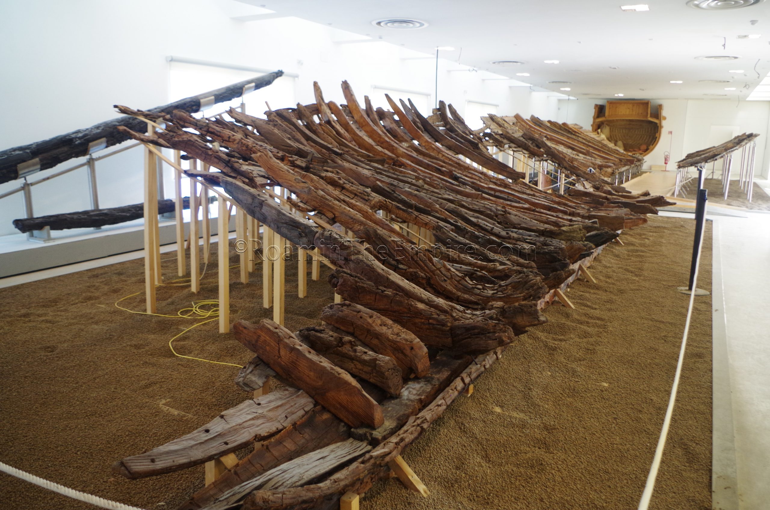
A few rooms on the ground floor of the museum display the remains of three ships found in the port of Olbia. The first two are purported to be Roman ships sunk by the Vandals about 450 CE during their conquest of the city. The third is a medieval era shipwreck. A few other fragments of the total of 11 Roman ships found in the port are also displayed. The vast majority of the collection is small terracotta objects from the Punic and Roman periods. There are a few smaller marble and metal pieces as well as a couple larger inscriptions and marble sarcophagi. One of the more interesting pieces is a terracotta head of Hercules and a full-size, color reconstruction of the statue. The terracotta dates to the middle of the 2nd century CE, but is based on a Greek bronze from the 4th century BCE.
It took me a little less than an hour to go through the museum. The collection has a few interesting pieces and the price can’t be beat. There are a few informational signs through the museum, but those, along with the artifact cards, are only in Italian.
Olbia Aqueduct
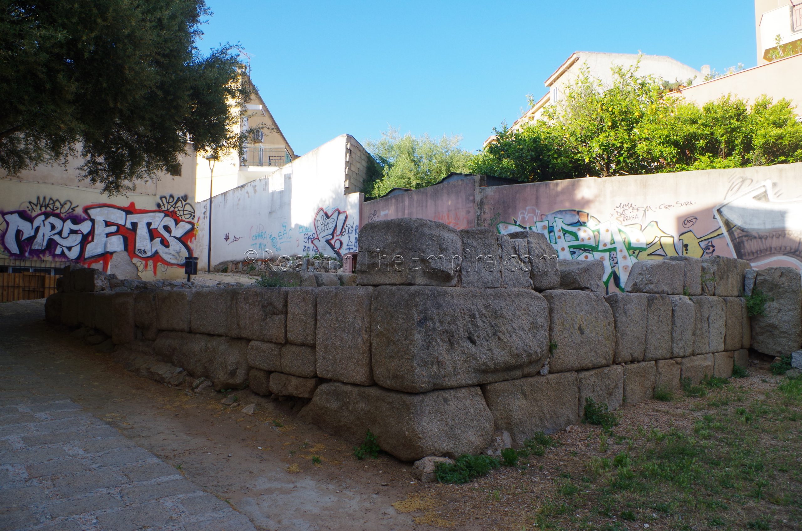
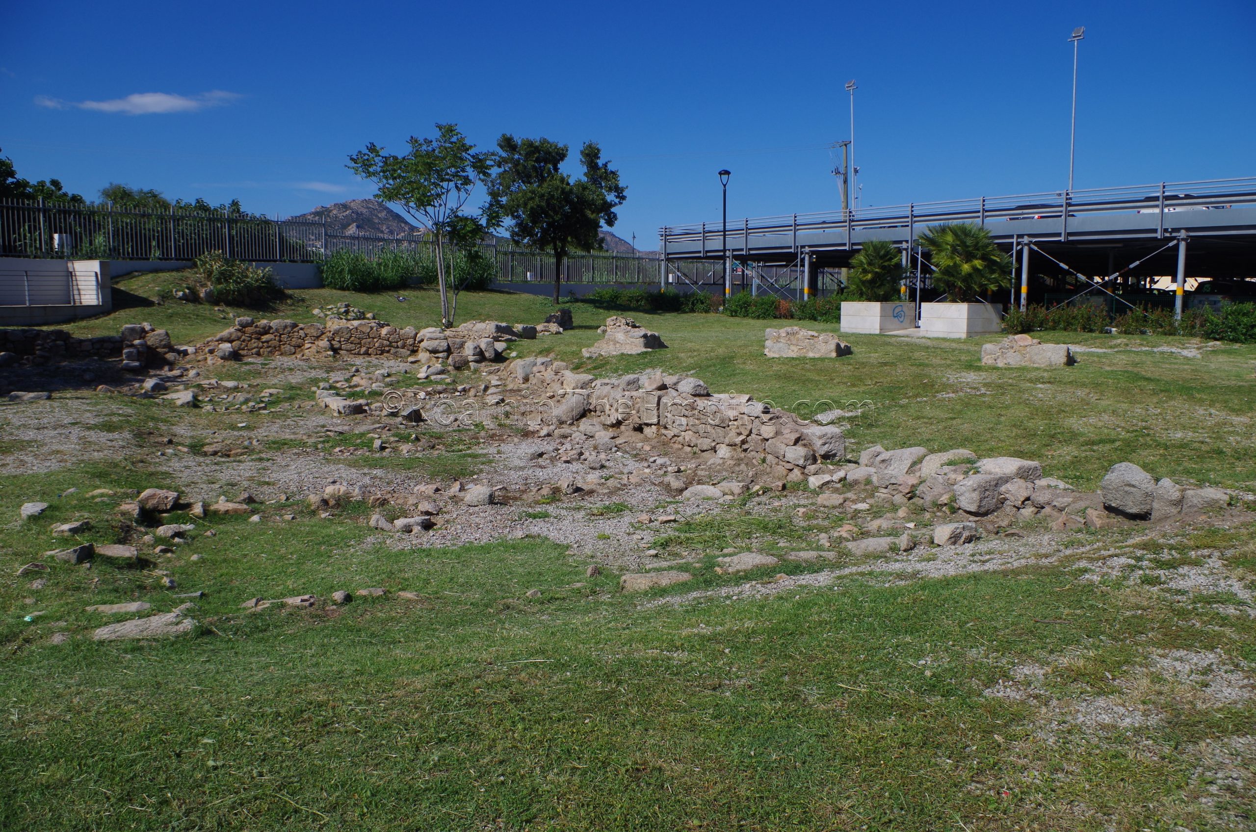
From the museum, it is a short 10 minute walk to the next stop, the Antiche Rovine Romane along Via Nanni Alessandro. Housed in an open access green space, the remains here seem to be the base of the aqueduct running into Olbia and a water cistern. The foundations of the aqueduct are the intermittent piers running in an orientation from the northwest to the southeast on the east side of the area, closest to the parking garage. The cistern is laid out at an opposing orientation on the west side of the aqueduct course. The heaviest remains of the cistern are the east and north walls, while the remains of some of the interior divisions within the cistern can also be seen. There is no information on-site.
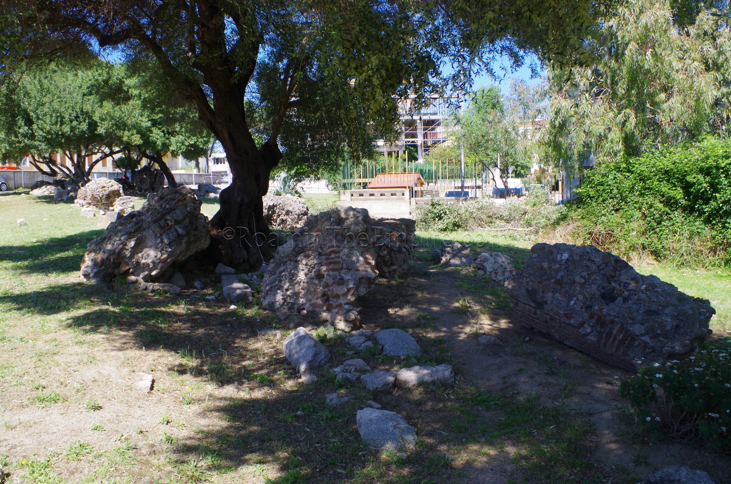
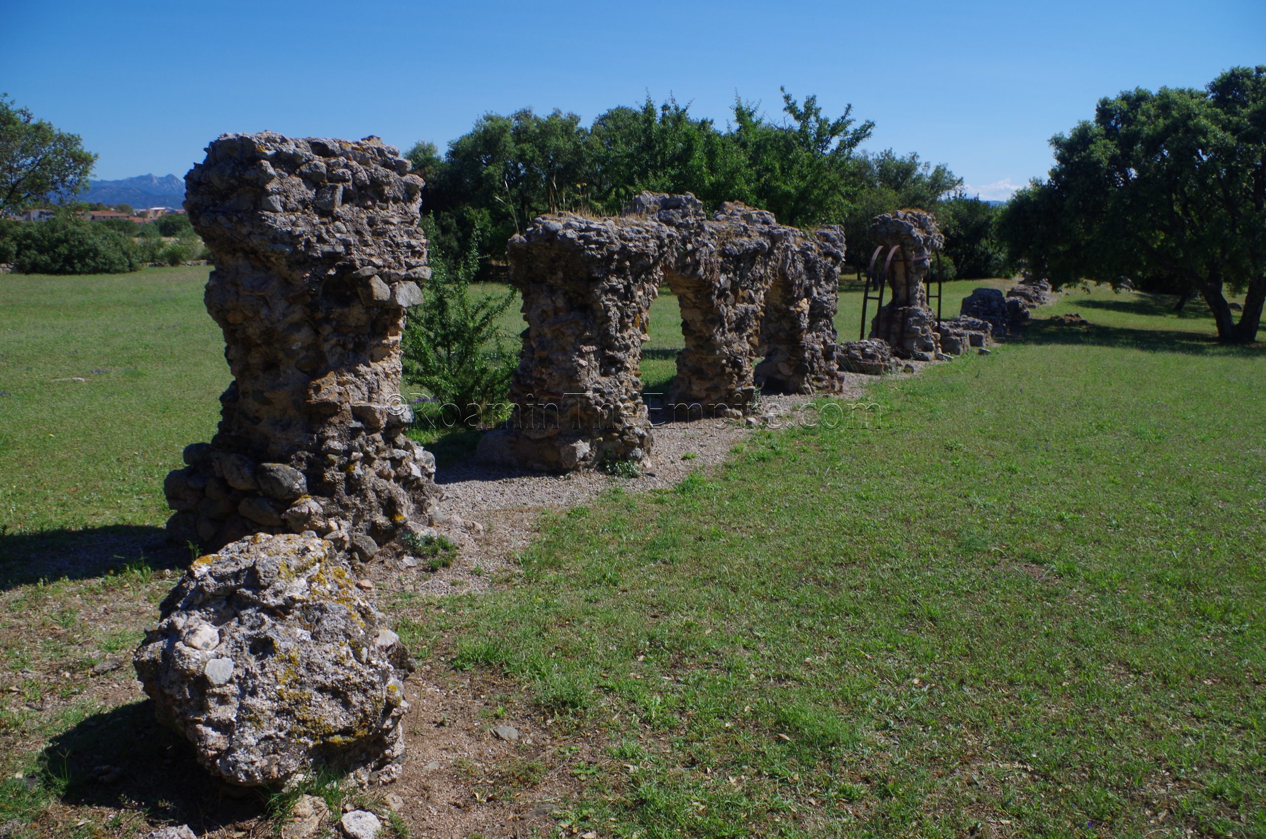
More remains of the aqueduct can be seen about 10 minutes to the north, near the intersection of Via Aldo Moro and Via Canova. The Tratto Urbano Dell’Acquedotto Romano di Olbia is a stretch of about 65 meters of the 2nd to 3rd century CE aqueduct runs in a southwest to northeast direction through a small park. Some of the remains here correspond to the foundations of the aqueduct, but much of it is collapse laying in the general orientation of the aqueduct course. Though there is a small fence surrounding the park, the gateways doesn’t seem to be able to be closed off, so there is likely 24 hour access.
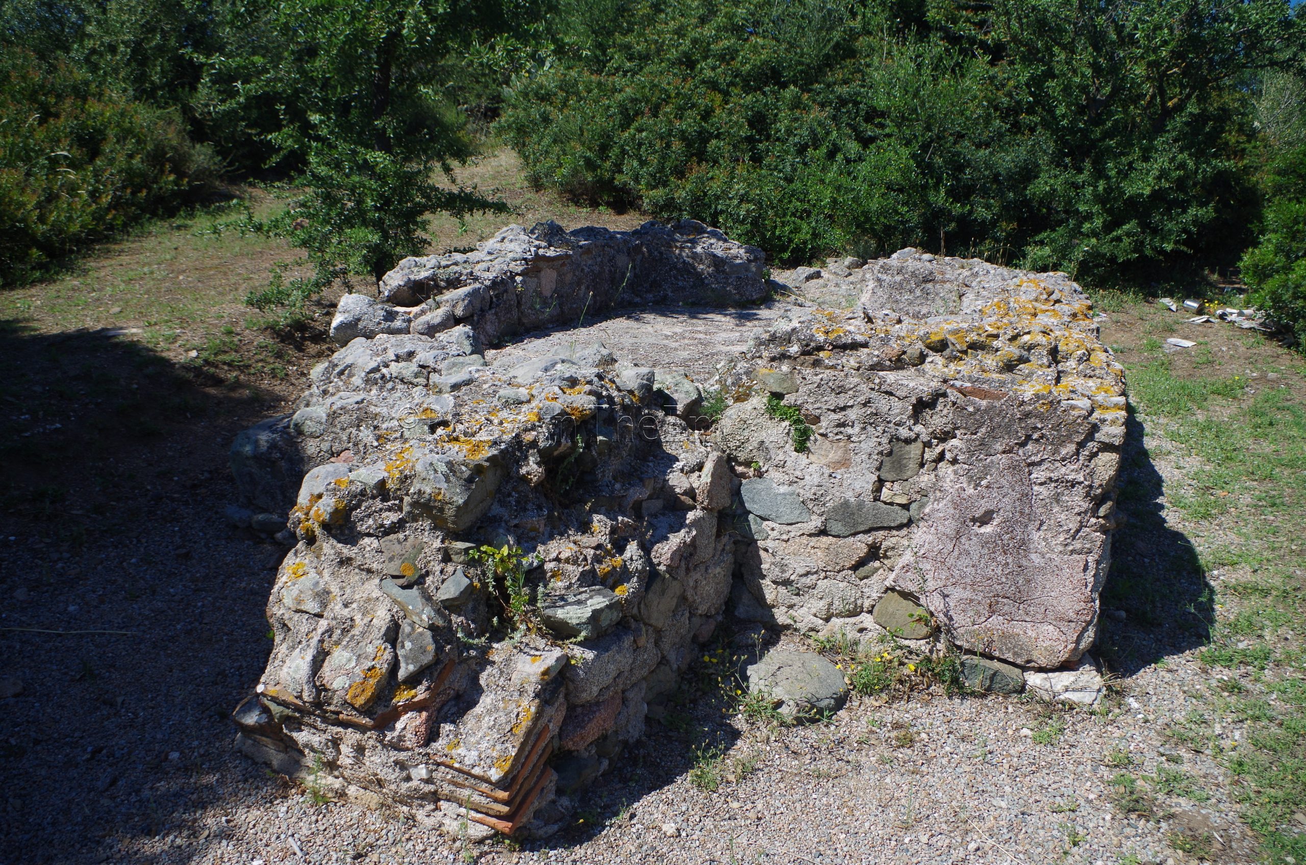
The final bits of Roman Olbia that are visible lie a bit outside the center of town, about a 15 minute walk from the previous section of aqueduct. On the east side of Via Mincio, between the road and the railway line, is another stretch of about 130 meters of the Roman aqueduct into Olbia. This part of the aqueduct is in park that, though there is a low stone wall in places and a gate at the north end, doesn’t seem to really seem to actually limit access, and can essentially be visited at any time. At the north end of this stretch of aqueduct are the remains of a settling tank. A small informational sign with translations in several languages is posted near the settling tank.
Directly across Via Mincio from the north gate of the aqueduct area is another small park that is host to a cistern. Again, there is a gate, but the wall is pretty low and I don’t know that the gate is ever really closed anyhow. The cistern does not seem to be connected to the aqueduct, and was likely water storage for some kind of residence. The entrance to the cistern is poorly blocked off, but generally there is very little in the way of precautionary measures taken to prevent access on the obviously structurally compromised cistern. There are a few places where one can see into the cistern and view some of the intact barrel vaulting of the various cells of the tank. A small sign nearby has some information about the cistern in several languages, including English.
The Punic/Roman sites of Olbia are pretty easy to see in a half a day, the whole route took me less than 4 hours total.


.")
.")
.")
.")
.")
.")
.")
.")
Sources:
Dyson, Stephen L. and Robert J. Rowland Jr. Archaeology and History in Sardinia from the Stone Age to the Middle Ages: Shepherds, Sailors, & Conquerors. Philadelphia: University of Pennsylvania Museum of Archaeology and Anthropology, 2007.
Livy. Ab Urbe Condita, 27.6.
Maximus, Valerius. Factorum ac Dictorum Memorabilium Libri IX, 5.1.2.
Pausanias. 10.17.
Stillwell, Richard, William L. MacDonald, and Marian Holland. McAllister. The Princeton Encyclopedia of Classical Sites. Princeton, NJ: Princeton U Press, 1976.
Van Dommelen, Peter. “Punic Persistence, Romanization and Local Resitance in Wester Central Sardinia.” On Colonial Grounds: A Comparative Study of Colonialism and Rural Settlement in First Millenium BC West Central Sardinia. Leiden, 1998.