


History
Located on the south bank of the Tirso River (called the Thyrsus in antiquity) are the remains of Forum Traiani in the modern town of Fordongianus. The spot of a natural hot spring, the location was likely a gathering and water cult site for the Nuragic population in the area; called the civitas Barbariae by the Romans. About 30 kilometers from the coast, there doesn’t seem to be Punic habitation at Forum Traiani, there are outposts nearby that have been associated with the so-called ‘Punic Limes’. Though the notion that the Carthaginians had a network of militarized fortifications on Sardinia akin to the Roman limes systems elsewhere in the Mediterranean is not generally accepted anymore, it does seem to represent a sort of frontier line between direct Punic control and more independent Nuragic control. In fact, it has been posited that perhaps any line of fortification was of Nuragic construction to limit the aggression of the Carthaginians, rather than vice versa.
The Romans originally called this place Aquae Hypsitanae, which is a reference to the hot springs. Epigraphic evidence (an inscription found in the baths) suggests that during the Julio-Claudian period, the site functioned as a sort of meeting place for the Barbariae to swear allegiance to Rome and the emperor. In the late 1st century CE, the location became more important for the administration and control of the area, and a number of building projects were started, particularly under the rule of Trajan, and the settlement took the name Forum Traiani. As the name would suggest, it was also designated as a market town. Sometime during the Severan dynasty, Forum Traiani was given the status of civitas.
Forum Traiani continued to function as an administration center and as one of the most important urban settlements in the interior of the island. Under the reign of Diocletian, Forum Triaini was elevated to the status of municipium. Sardinia was captured by the Vandals in the 5th century CE, seemingly with little resistance. In the 6th century CE, following the Byzantine reacquisition of the island, the name was changed from Forum Triani to Chrysopolis and it became an important military center. Fortification walls were constructed during the reign of Justinian, though there are no visible remains of them at present.
Getting There: As always, the easiest way to get anywhere in Sardinia is by personal vehicle, but, Fordongianus is actually fairly accessible. The best starting point is Oristano, which has a train station and can be reached via train from any other of the main cities in Sardinia (Alghero, Cagliari, etc.). From Oristano there is an ARST bus, line 512, which runs a route that stops in Fordongianus. Fortunately, this route seems to be plugged in to Google Maps, so a route search for public transportation between Oristano and Fordongianus shows up. The trip takes about 35-45 minutes and costs 2.5 Euro. There is also a bus that runs from Ghilarza (which also has a train station, but one which is less frequently visited than Oristano) to Fordongianus; ARST line 415, also available in Google Maps.
Amphitheater and Bridge
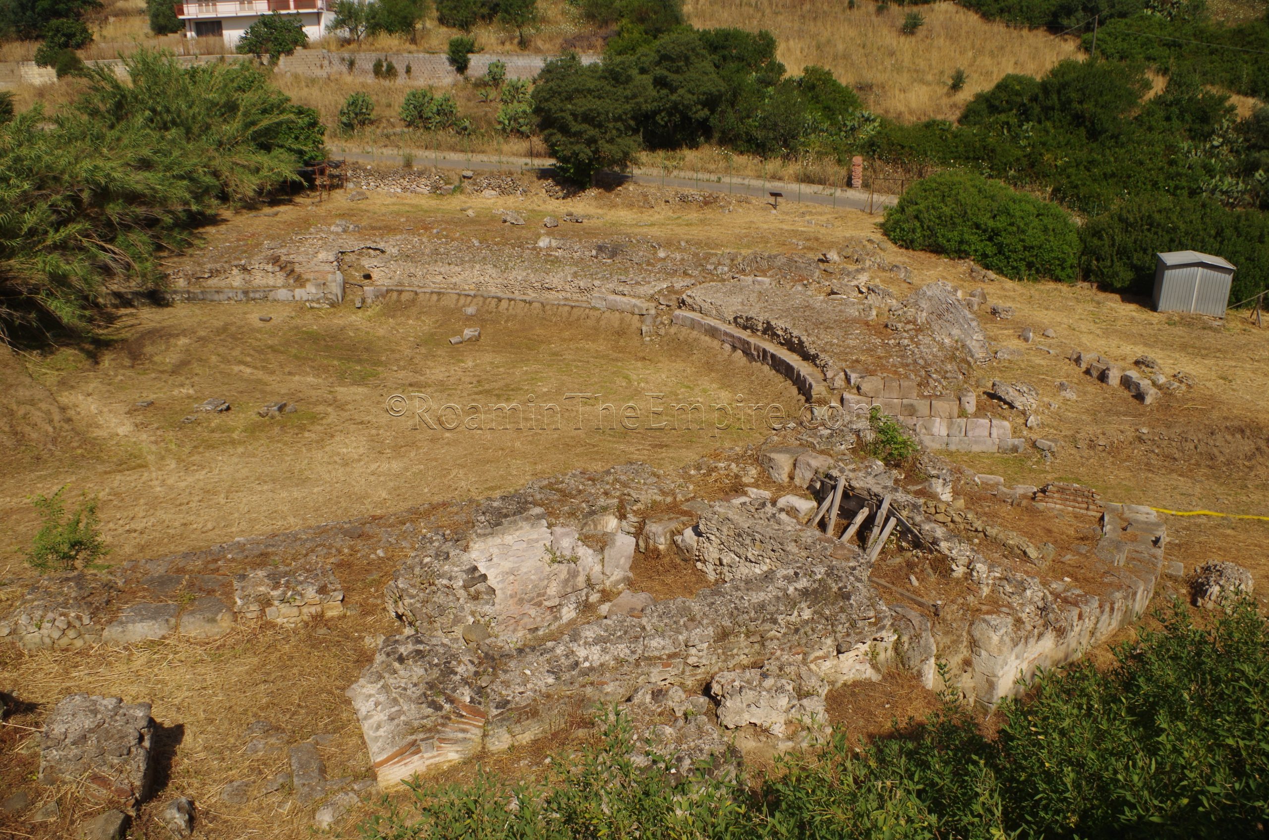
Despite the importance of the settlement, there are relatively few remains of Forum Traiani. At the edge of town on the southwest, are the remains of the amphitheater. Only about half of the amphitheater is exposed, with the other half remaining unexcavated on private land. The amphitheater is fenced off and there is no admission, but it can be viewed from the two roads that pass by it on the east and west. The road on the east side is at a higher elevation and affords the best views of the amphitheater, but the informational sign (in Italian and French) is along the road on the west. Built in the late 1st century CE, and then renovated in the 3rd century CE, the amphitheater could hold about 3,000 spectators. In size, it was second only to Caralis among the known amphitheaters on Sardinia.
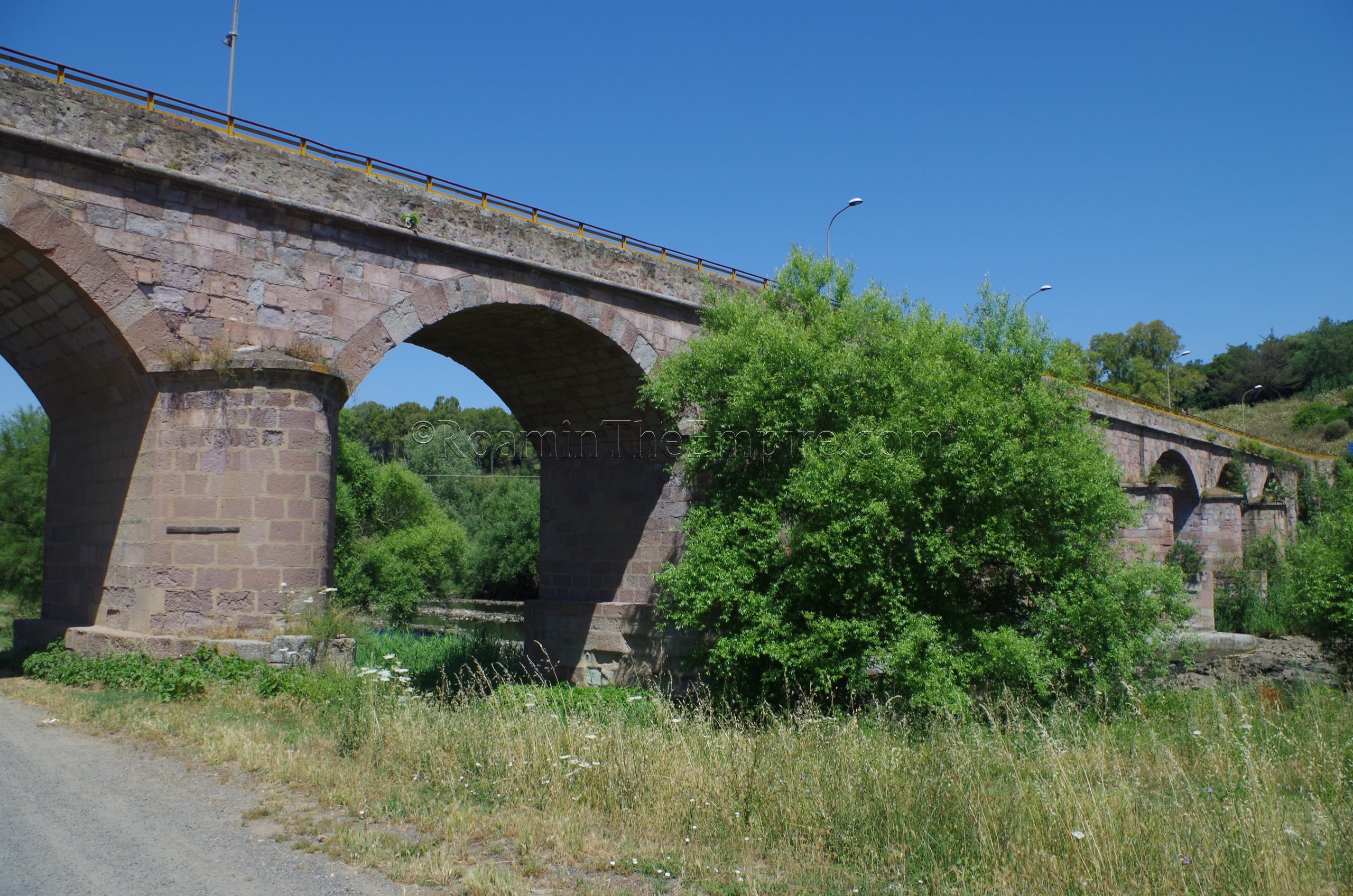
On the opposite end of town is the Roman bridge over the Tirso. Still in use today, the bridge is the sole access point in the vicinity of Fordongianus over the river, presently in the form of the SS388. The bridge was originally constructed, like many of the monuments in Forum Traiani, in the 1st or 2nd century CE. Many restorations have been given to the bridge over the years, particularly noticeable in the modern concrete at the pier bases and the modern mortar restorations between most blocks. The piers seem to be the most clearly Roman, while the other elements of the bridge are much more mixed. A plaque on the east side of the bridge notes a particularly important restoration in 1877. There best, or at least most accessible, viewing points for the bridge are from the south bank of the Tirso.
Baths
The baths are, perhaps, the centerpiece of the remains at Forum Traiani. Located along the river front, just west of the bridge (no actual address), the baths are open every day from 9:30 to 13:00 and 15:00 to 17:00. Admission to the archaeological area is 4 Euros and includes an audio guide.
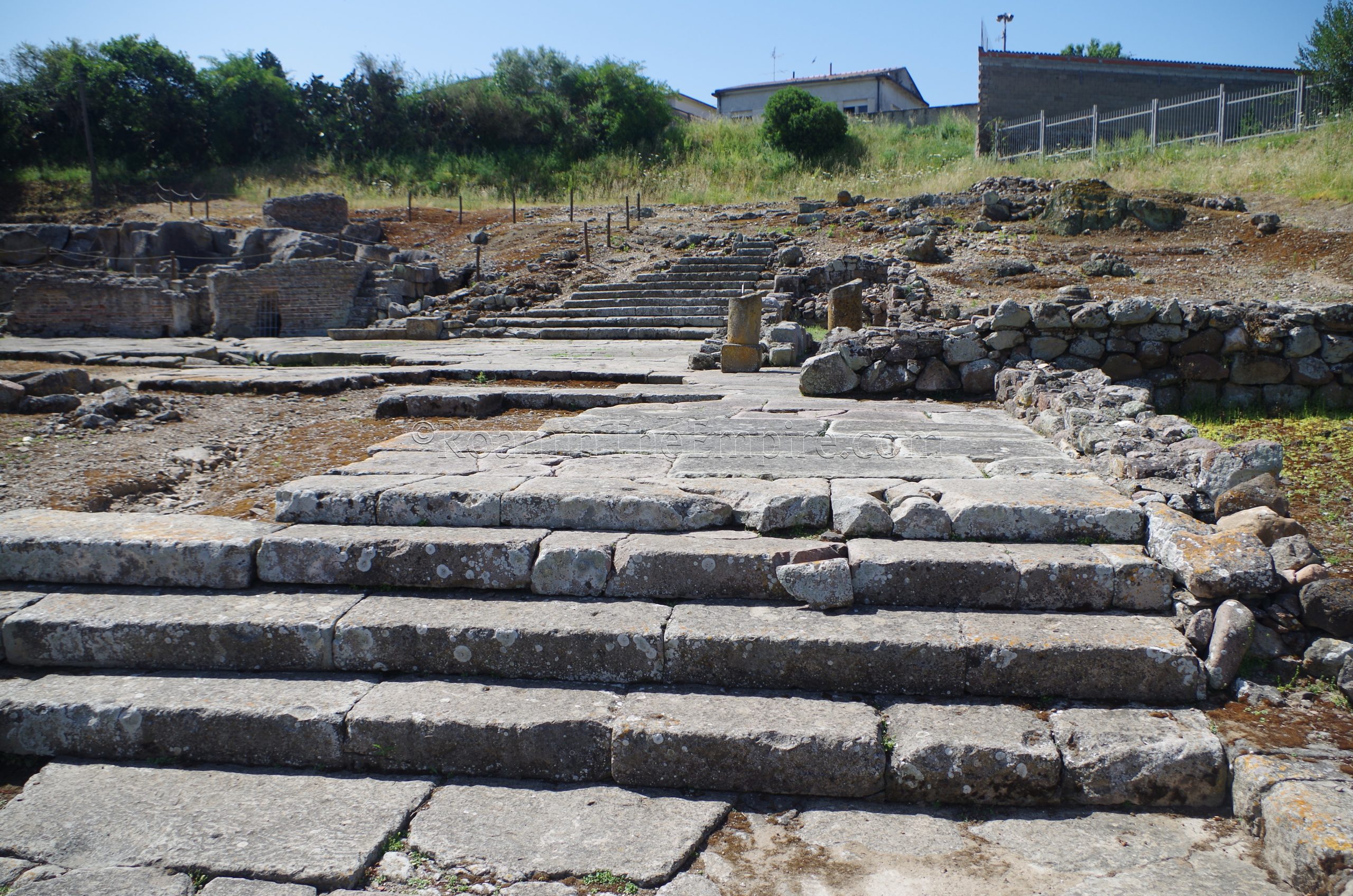
The baths are essentially divided into three sections; a 1st century CE spa complex nearest the river, a 2nd-3rd century CE bathing complex immediately south of that, and then some ancillary structures at the far south end of the archaeological area. The ancillary structures include a nymphaeum on the far east end of the site, and an aqueduct channel on the far south end of the site. The aqueduct feeds into a tank area that also utilizes a well. Much of the rest of this southern area is made up of a large paved square that is lined by tabernae, and with a paved staircase in the southwest corner. One of the tabernae at the southeast corner of the square, notable by the modern roof protecting it, has some preserved frescos on the walls.
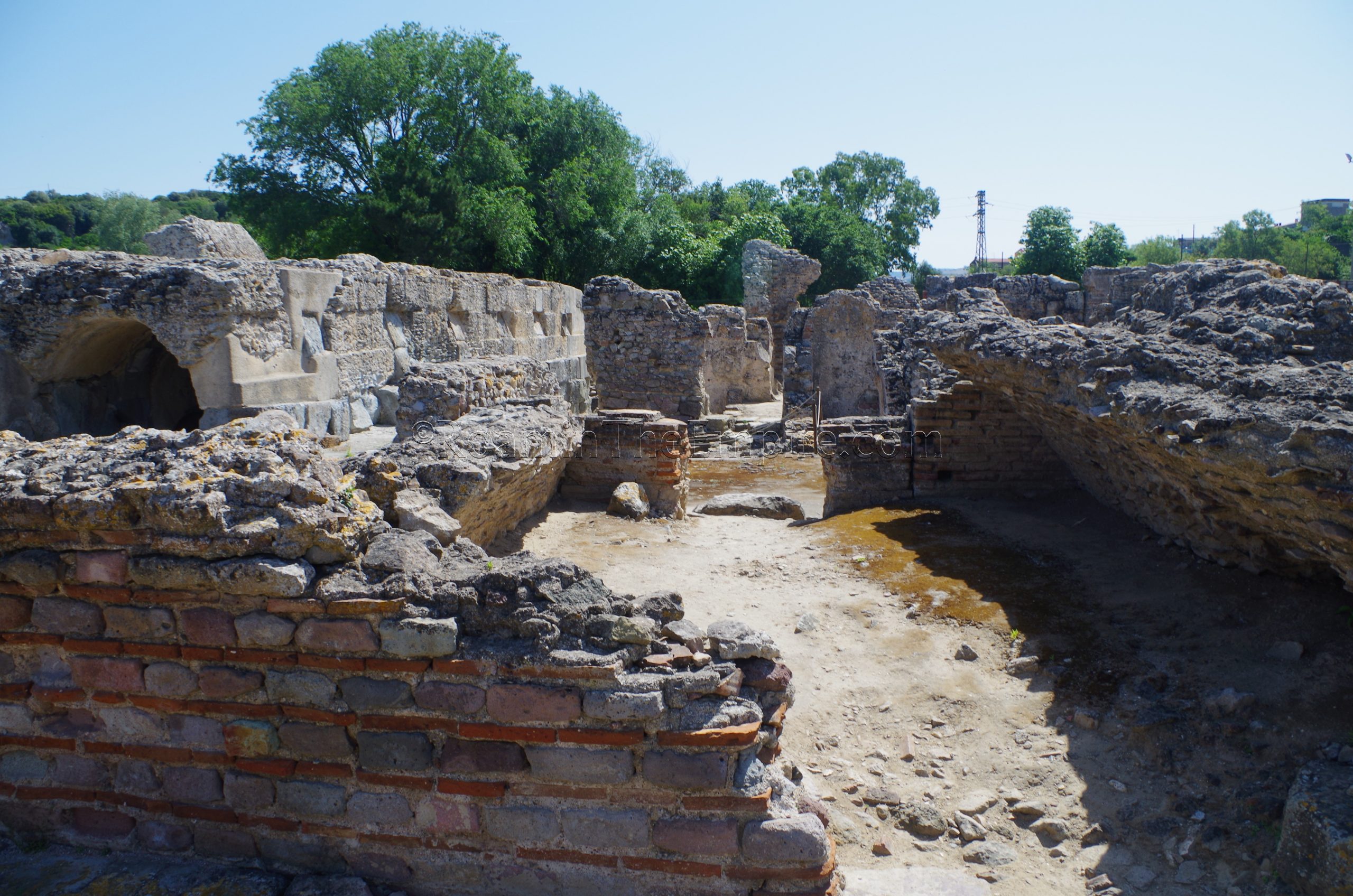
The 2nd to 3rd century bathing complex is relatively compact and has the typical bath rooms. The two rooms on the east side of the complex, including the larger room with the apsidal basin, are the frigidaria. The larger room perhaps also doubles as an apodyterium. There is a staircase leading out of the larger of the rooms to the earlier spa complex. The room immediately west of the large frigidarium is the tepidarium. The tepidarium also connects with the stairway to the spa complex. West of the tepidarium are two tandem caldaria, one of which with a basin. Then the furthest west in the complex are two prafurniae.
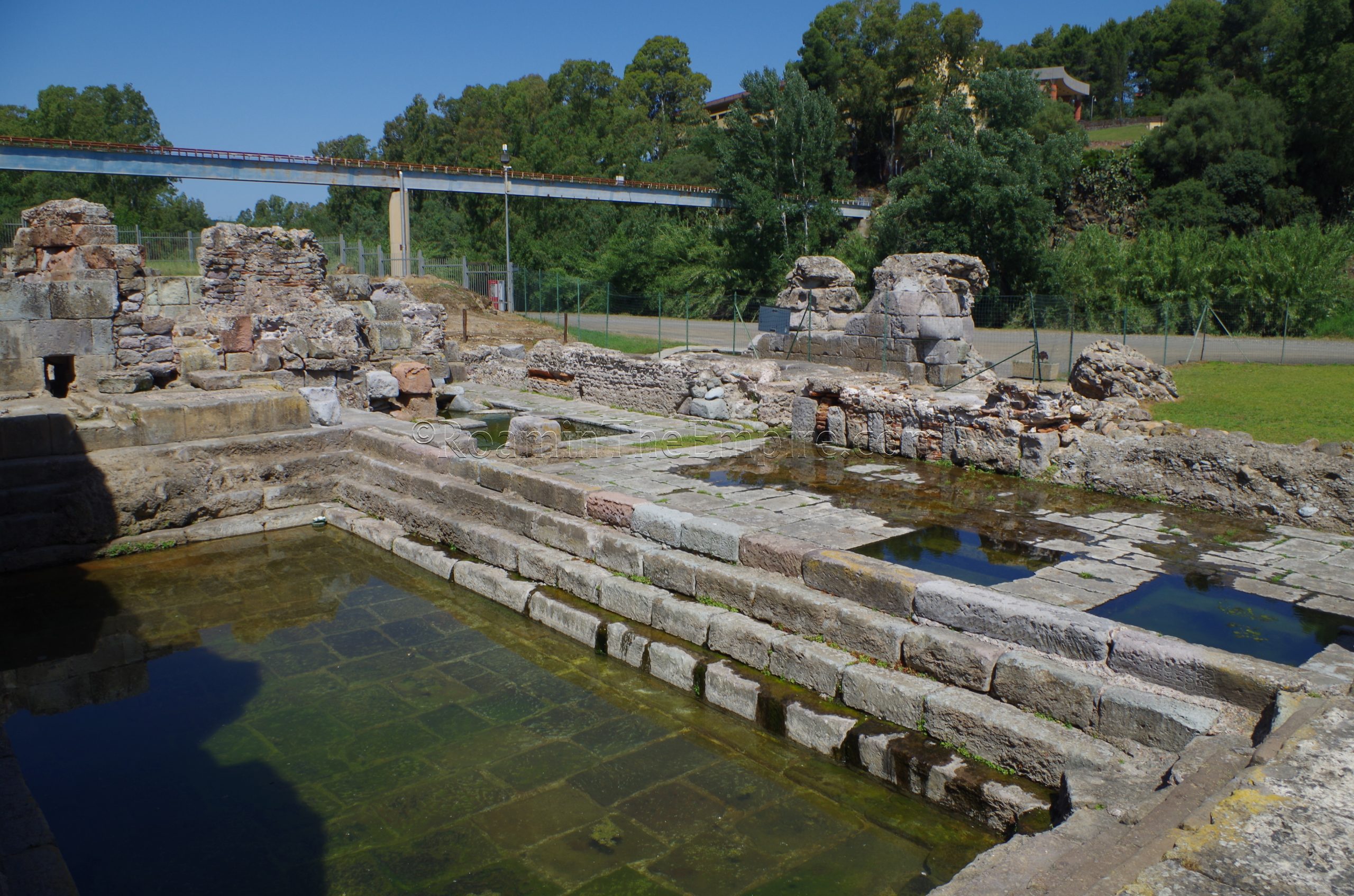
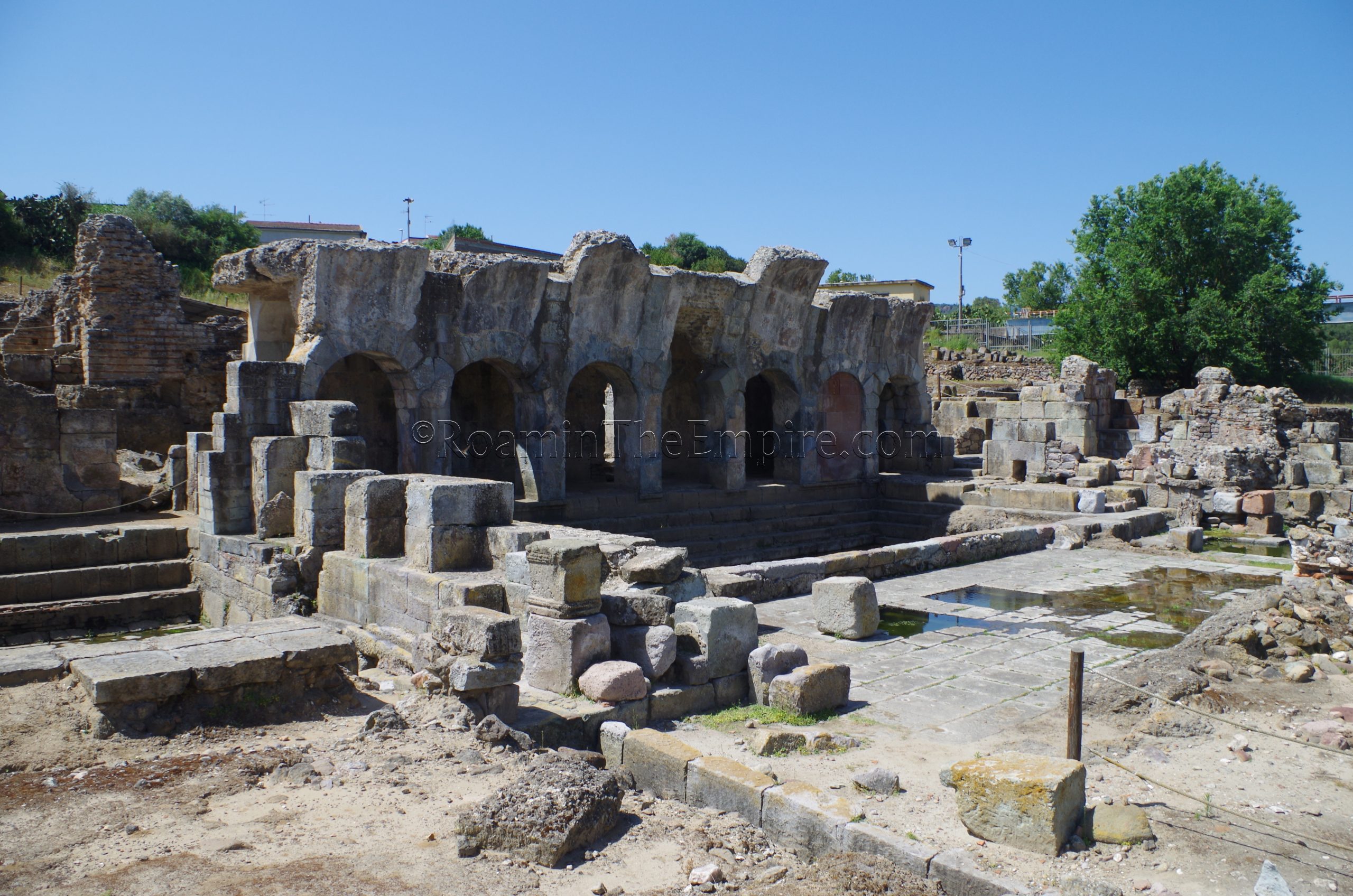
The 1st century CE spa complex is perhaps the most interesting set of remains in this archaeological area, and is really the main attraction; it’s this part of the complex that is most frequently pictured. Unlike the 2nd-3rd century CE bathing complex, or most bathing complexes for that matter, this spa complex is primarily devoted to the warm water hot springs that feed it. Rather, there are a series of tubs and pools fed by the hot spring around a large natatio, also fed by the spring. There is one basin at the east end of the complex near where the hot spring originates and where the cold water arrives from the aqueduct, which is thought to utilize both sources for a tepid water bath.
Upon entering the spa area from the bathing complex, one enters a corridor. The corridor faces onto the large natatio, into which a staircase leads from the corridor. The natatio has the form with the stepped entry on all four sides. The paving of the steps and the natatio are both survive . On the lowest level of the north set of steps into the natatio, there is a reused inscriptioin. North of the natatio are the baths and tubs, which are typically filled with water even today. Steps down into the tubs immediately to the north of the natatio can be seen. The warm temperature of the hot spring water can also be felt in these tubs, as well as in the modern pools at the extreme north of the site where the water flows out toward the Tirso.
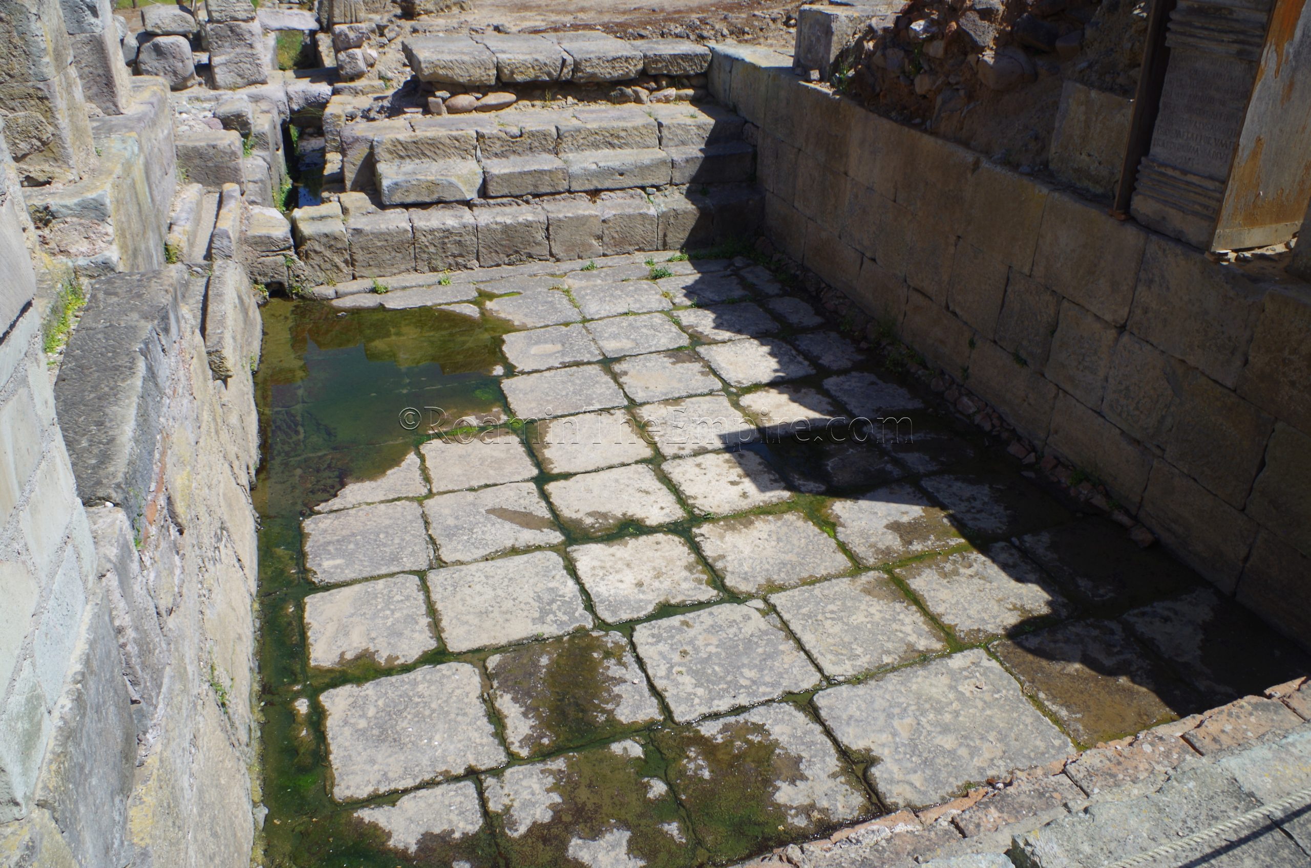
From the north part of the natatio, the start of a vaulted ceiling can be seen extending off the arcade associated with the corridor, giving the structure its unique look. To the east of the corridor and natatio, there is a large nymphaeum. The nymphaeum looks mostly like a smaller version of the natatio; paved in a similar manner. Presently it houses an inscription and a few reproductions of inscriptions. A large drainage channel leads out from the north part of the nymphaeum to the Tirso.
The baths are well worth the stop. The spa complex is a bit of a departure from the typical Roman bathing site, and the continued utilization of the hot springs as part of the presentation of the spa portion of the site is an excellent demonstration. I imagine the level of water is not constant, but the natatio had a few centimeters of water in it, and the smaller spa pools were completely full. There isn’t much on-site information posted, but an audio guide and interpretive map are provided with entrance. The baths took me a little over an hour to see, and the whole circuit of sites in Fordongianus can be seen in under two hours.
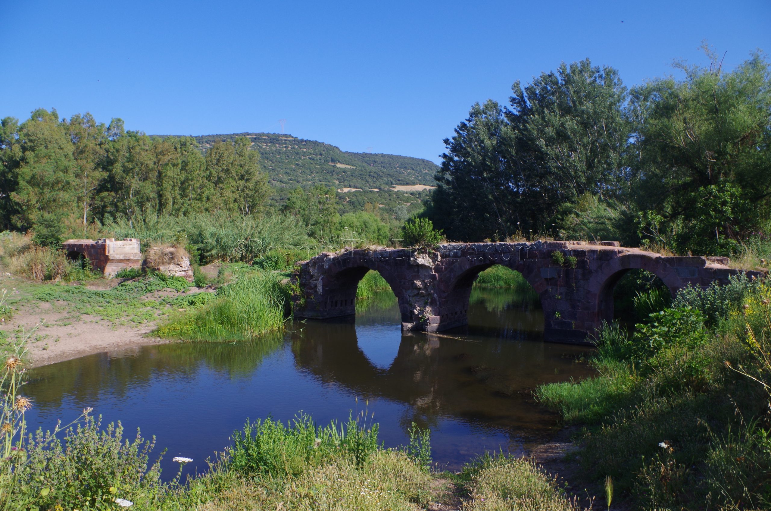
Pont’Ecciu
Not far from Fordongianus (about 15 minutes driving) to the southeast is the town of Allai and a site related to Forum Traiani. Just north of Allai, spanning the Massari River is the Pont’Ecciu (also called Su Ponti Ecciu). This 1st century CE bridge was part of the route from Forum Traiani to the interior of the island. Though it was restored during the medieval period, the bridge remained in use until the first part of the 20th century, when a new bridge was built further upstream near the modern town. The bridge is incomplete, though three extant arches extend the bridge over most of the river from the east bank. The remains of the far end of the bridge can also be seen on the west bank. Some modern conservation allows visitors to walk out on the bridge, though it doesn’t quite extend past the marshy land on the west bank, preventing the ability to walk fully to the other side of the river. The bulk of the bridge is built with red trachyte stone, a common building material in the area. There is no entrance or access limitations to the bridge. There are buses that run between Fordongianus and Allai, the details of which can be found under a public transportation route map on Google Maps.


Sources:
Dyson, Stephen L. and Robert J. Rowland Jr. “Survey and Settlement Reconstruction in West-Central Sardinia.” American Journal of Archaeology, vol. 96, no. 2, April 1992, pp. 203-224.
Dyson, Stephen L. and Robert J. Rowland Jr. Archaeology and History in Sardinia from the Stone Age to the Middle Ages: Shepherds, Sailors, & Conquerors. Philadelphia: University of Pennsylvania Museum of Archaeology and Anthropology, 2007.
Spanu, Pier Giorgio. “Procopius’ Barbarikinoi and Gregory the Great’s Barbaricini: Mauri and Sardinians in the Sixth and Seventh Centuries A.D.” Change and Resilience: The Occupation of Mediterranean Islands in Late Antiquity, edited by Miguel Ángel Cau Ontiveros and Catalina Mas Florit, Oxbow Books, 2019, pp. 51–85.
Stillwell, Richard, William L. MacDonald, and Marian Holland. McAllister. The Princeton Encyclopedia of Classical Sites. Princeton, NJ: Princeton U Press, 1976.