


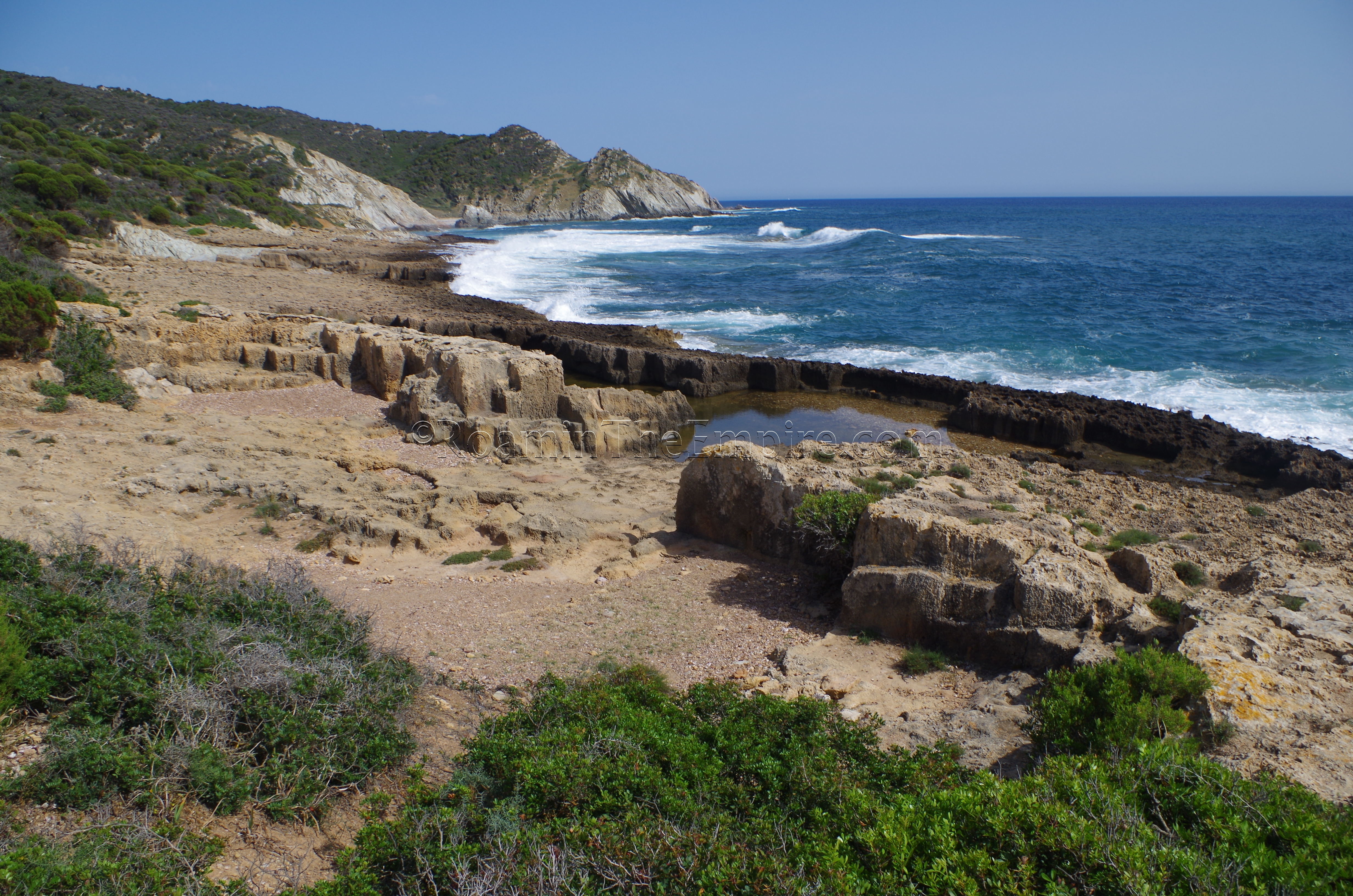
About 45 minutes to the south of Pani Loriga, at Capo Malfatano, is the Piscinnì quarry, a Punic-era quarry along the coast. This one requires a bit of hiking. There is a small parking area above the Cala Segreta beach park. There is a trail that leads down to the beach, and then up to the Torre di Pixinni, a 16th century tower that is visible from the parking area. From there, it’s a short hike east to the quarry. There’s a stretch of about 100 meters where quarrying activity can be seen, primarily in two large, waterlogged pits. The quarry is open with no obstructions, so it can be visited at any time.
From there, it’s a short drive to Chia, the modern town on the site of ancient Bithia. Bithia, like Monte Sirai, despite its costal location, seems to have been established in the 7th century BCE in order to consolidate access to resources in the area, and functioned mostly as an outpost rather than a civilian settlement for much of its early life. Not much remains visible of Bitha, though there are currently some archaeological excavations ongoing on the northern slope of the hill on which the Torre di Chia sits, and there are a few other scattered structures on the north side of the hill which may date to the Punic or Roman periods.
Bithia
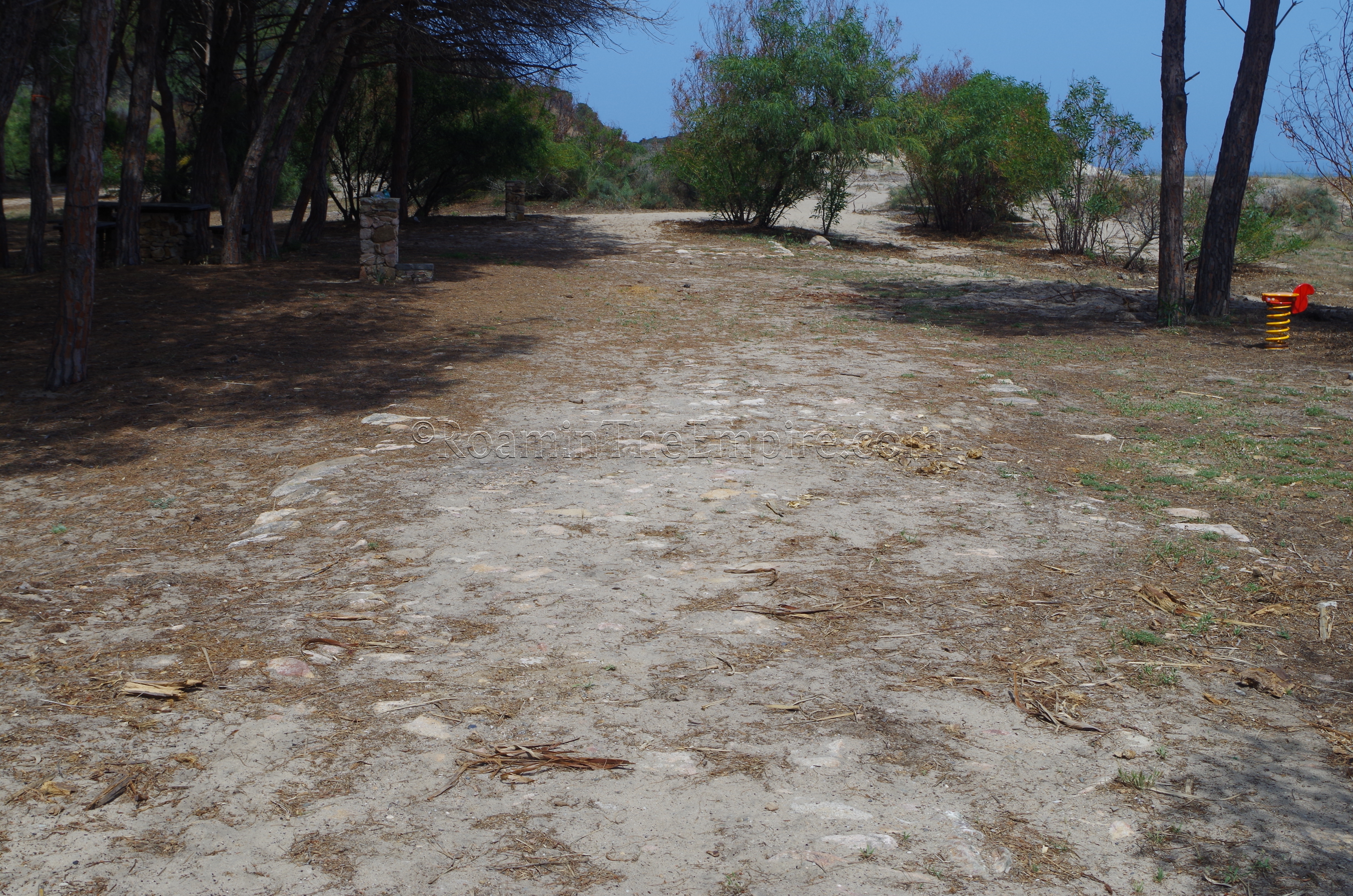
At the foot of the hill, in a picnic area adjacent to the Spiaggia Su Porto, there are what appear to be the remains of the Roman road that ran between Bithia and Nora. I haven’t been able to find much information on these remains, but they would appear to be consistent with the directionality of where the road would have been. The Strada Romana trail that runs for about 12 kilometers between Chia and Pinus Village is a popular tourist attraction. Though I didn’t hike the whole thing, primarily due to time constraints, there are apparently well preserved stretches of the Roman paving at points of the trail. I did do a little hiking at each end, and found some remnants of road structures and road terracing, though whether these improvements date to the Roman period or not is unclear.
Also visible from the Bithia end of the Roman road, is the island Isola di Cardolinu. It’s a large island that is also clearly visible from the Torre di Chia. From the Roman road trail, though, one of the Punic structures on this island can be seen. During the Punic period, the island served as the tophet for Bithia, and part of a shrine structure can be seen on the northwest part of the island. Apparently the island is accessible at some times by a sand bar that leads out to it, but when I visited, the island was completely separated by water, making it inaccessible. A sign noting that activity along the coast in that area was prohibited (including swimming, wading, and boating), which would have made the prospect of bypassing the channel even trickier.
The road on the west (Bithia) side can be accessed via a road on the north/east end of the beach that leads up the side of the mountain to the Strada Romana. There is parking at a few small parking lots near the beach; there was no charge when I parked there. On the east end of the road, there is a large open area for parking on the north side of Pinus Village. From there it is a short walk down to the beach where there is a trail leading up to the Strada Romana.
Decimum
Heading up the coast and back toward and then past Nora, there are a few things to see in the vicinity of Decimomannu (Decimum in antiquity, noting its placement 10 miles from Caralis). There is a bridge Decimomannu, on the south side of town. The bridge is fairly easy to get to, there is a small dirt area that can be parked in at the end of the road, and from there it is a short walk to the bridge. Some paving stones from the Roman road that utilized the bridge can be seen on the path leading up to the bridge. One can traverse what remains of the bridge and get up on to a berm on the west side where the bridge can be seen; undergrowth prevents access around the sides of the bridge from the eastern approach. Only a fraction of the bridge remains today, three arches of what was estimated to have been up to thirteen arches and about 160 meters long. It would have spanned the nearby Flumini Mannu and was constructed in the 1st century CE as part of the road between Caralis and Sulcis.
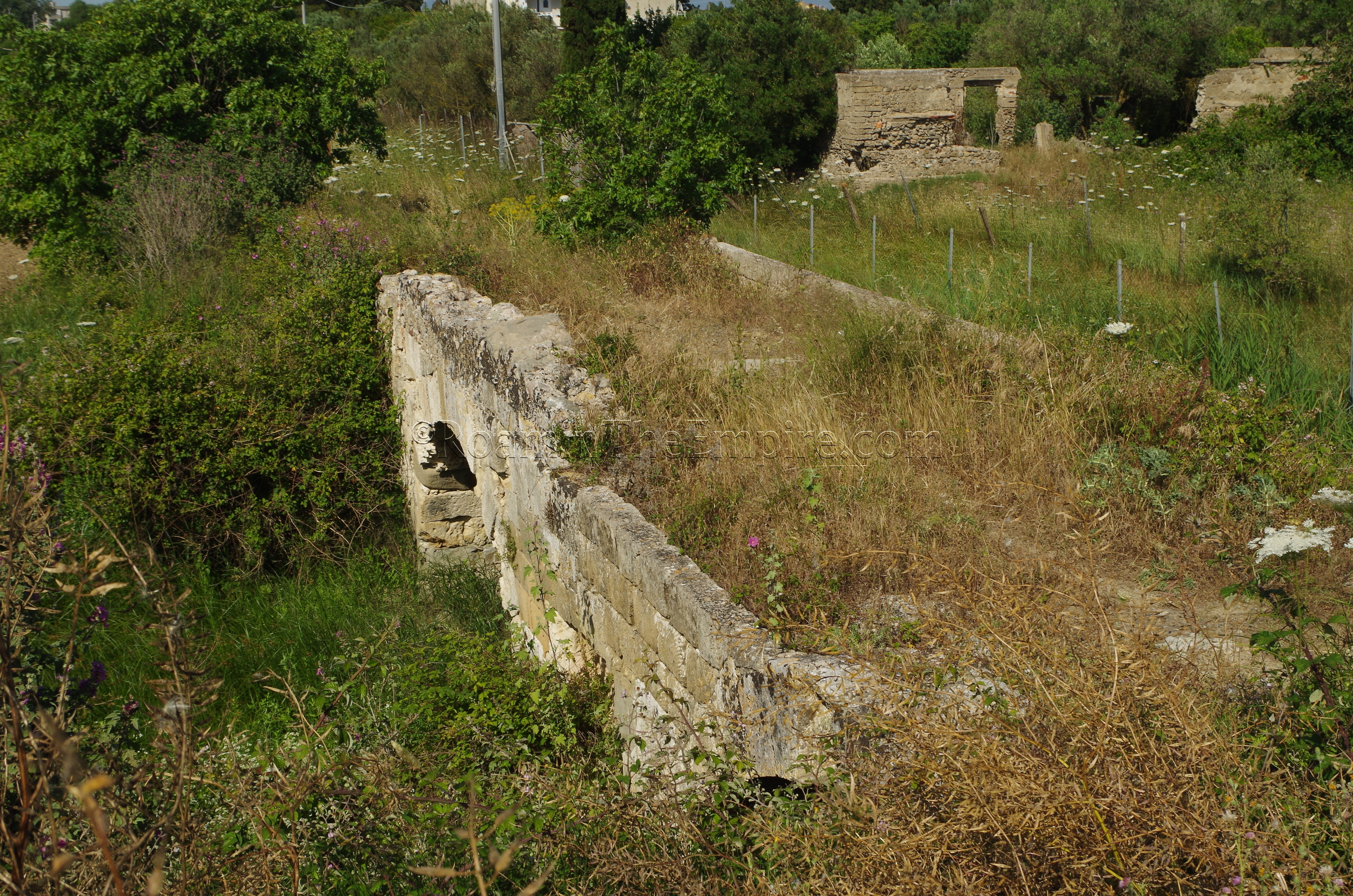
A few kilometers to the northwest is the town of Villaspeciosa. Outside of town, to the west, is the Area Archeologica di San Cromazio. The area seems to have been a bathing complex that was, in the 4th century CE, repurposed into a church, but was part of a larger settlement in the area. In the late antiquity/early Medeival period, the area was abandoned and the population moved to present day Villaspeciosa. Unfortunately it was closed when I tried to visit and I couldn’t find any sort of reliable information for the opening. Furthermore, it doesn’t seem to have regular opening hours; rather it seems to be only open on certain occasions, which is a shame, because the site has several well-preserved mosaics and there doesn’t seem to be much information about when these special openings actually are.
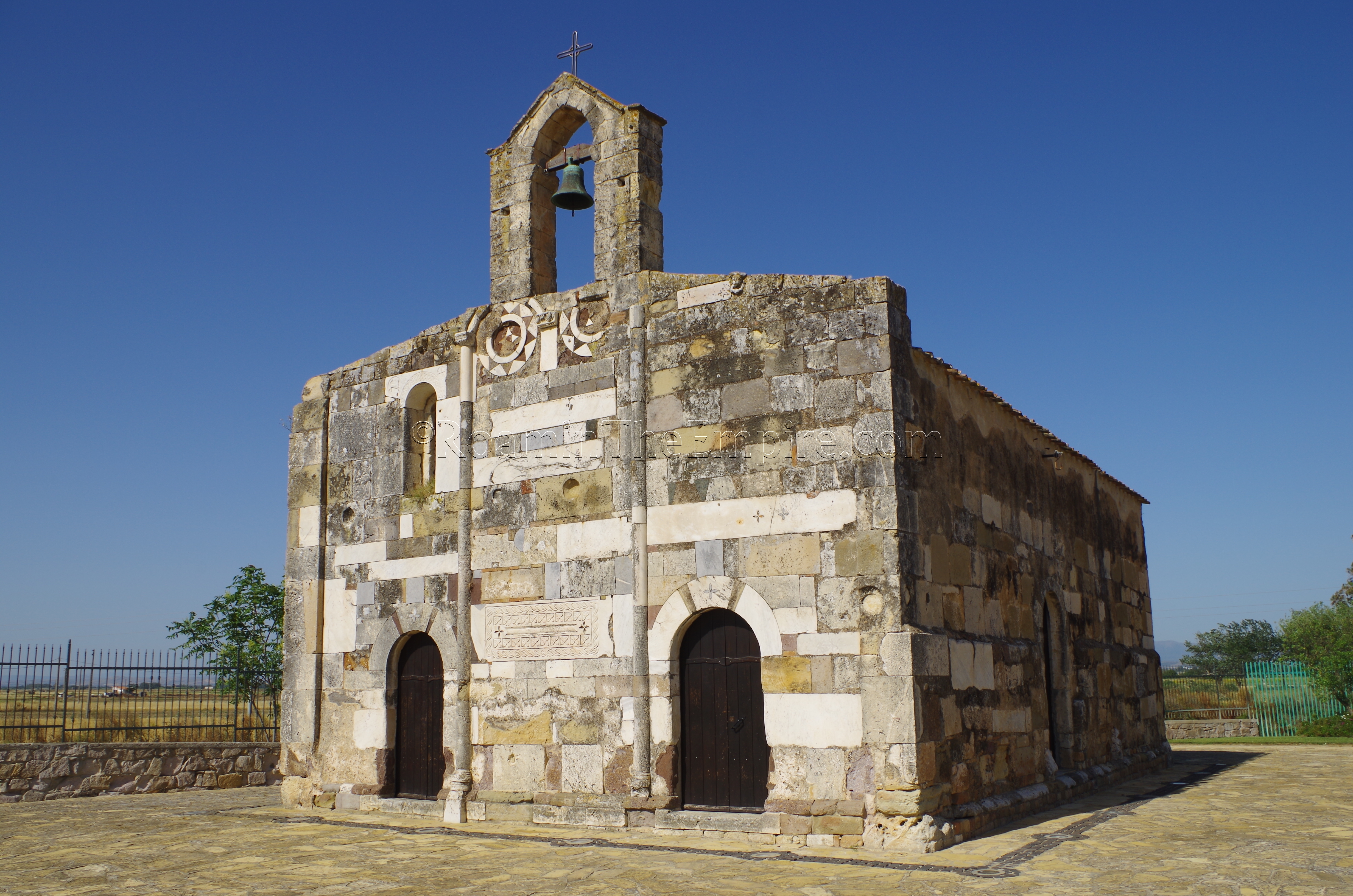
Back in the town of Villaspeciosa, on the north side, is the Chiesa di San Platano. The church, dating back to the 12th century CE is constructed almost completely of spoliated building material from the Area Archeologica di San Cromazio. There exterior walls of the church are made up primarily of masonry blocks and undecorated marble, but there are also decorated marble pieces used. The interior of the church apparently also has spoliated Roman material, but the interior is only accessible in late August during a festival for the saints Platano and Antiochus.
Is Cuccureddus
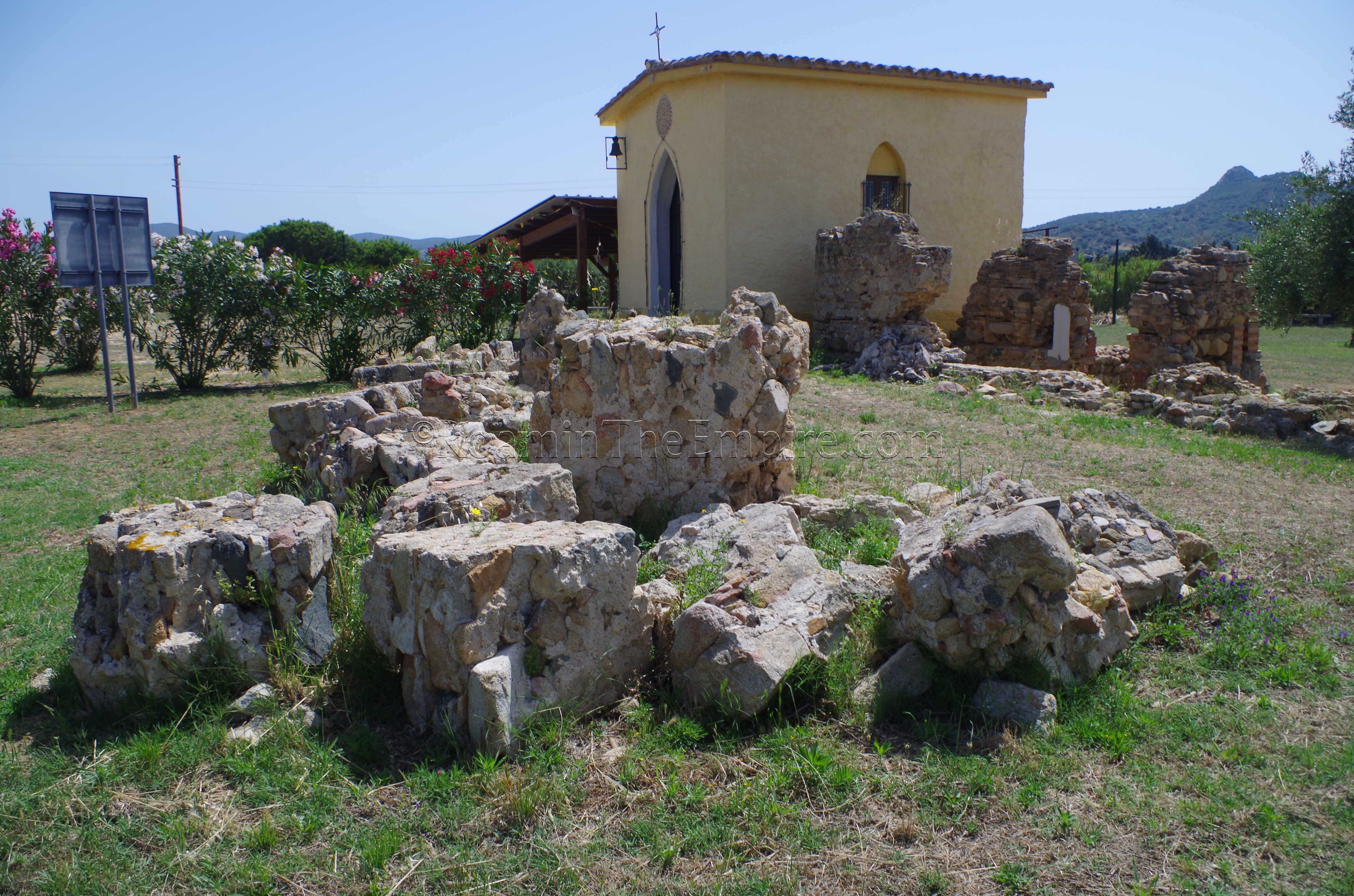
The last stops are about an hour and a half to the southeast (depending on traffic, which can be heavy with beachgoers leaving Cagliari in the summer), in the vicinity of the town of Villasimius in the extreme southeast of the island. The first two sites are near Villaggio Mandorli, a small beach town. On the grounds of the Chiesa Campestre di Santa Maria are the remains of a small Roman bathing complex, probably part of a rural villa. All that really remains of the complex which is recognizable is the caldarium and its two adjacent praefurnia, though there is another nearby wall associated with an undetermined structure. The structures here seem to have been built 2nd century CE and been in use perhaps as late as the 7th century CE.
On a hill overlooking the village to the southwest is the Insediamento Fenicio e Romano di Cuccureddus archaeological site, a Phoenician/Roman sanctuary. Getting to the site is a little difficult, and it requires a bit of travel uphill on dirt roads; though they were fairly well graded when I traveled on them. There really are no signs once one gets there, but there is a small area that allows for parking. Further, there was a fence mostly surrounding the site, but it was down in several places when I visited allowing almost unfettered access to the site. So, be aware that there could be some sort of access limitations when visiting in the future. It does appear to be an excavation that has been active at some point recently (at least the last year or so), so please be respectful of the site.
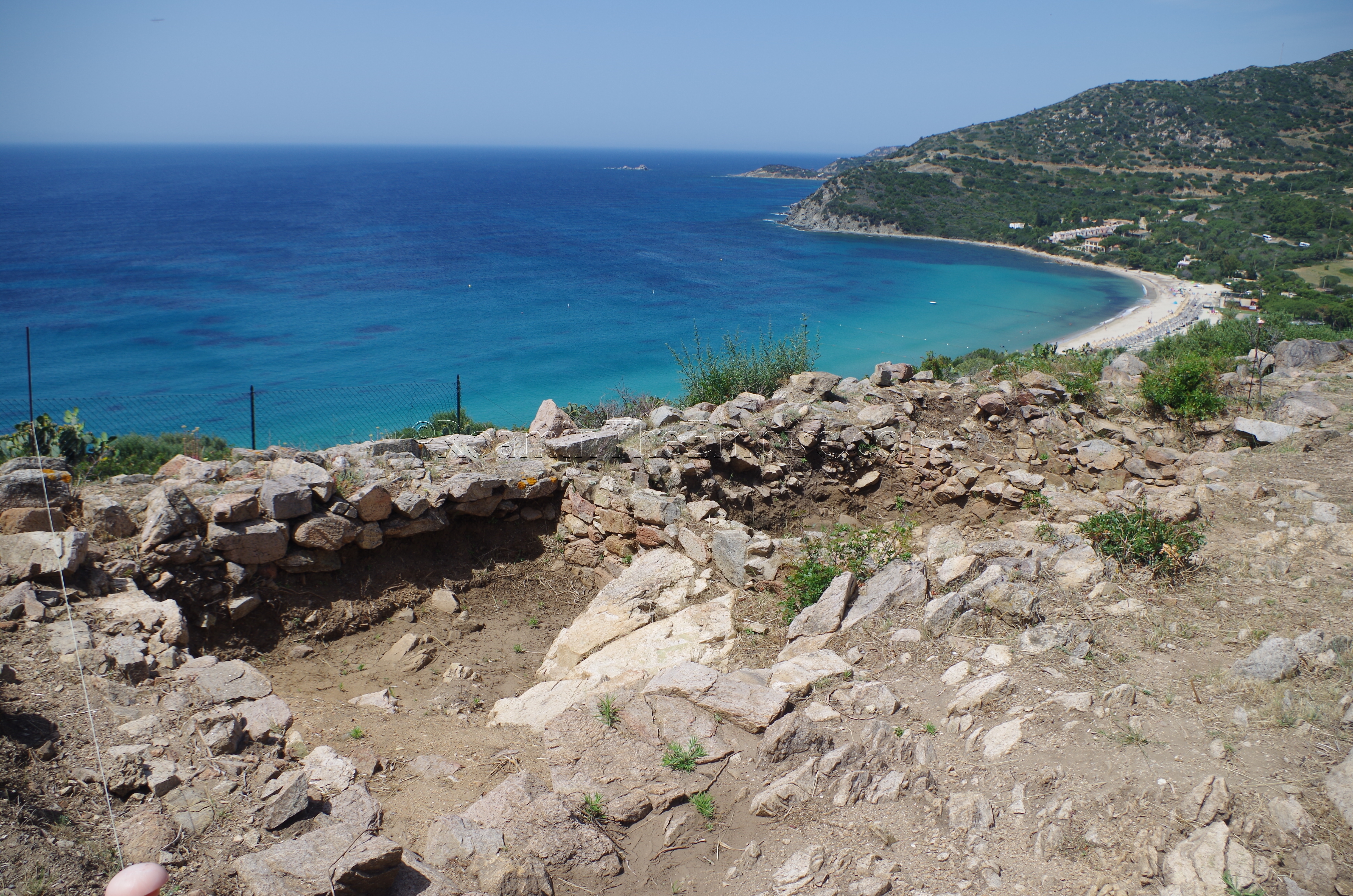
The Phoenician settlement in the area is referred to as Is Cuccureddus and is associated with the mouth of the Riu Foxi; the river that runs along the western base of the hill, and was navigable in antiquity. The settlement was established in the 8th century BCE and the sanctuary seems to have been active starting in the mid-7th century BCE. This sanctuary seems to be dedicated to Astarte and was accessed via a staircase from the settlement below. There is also evidence that Melqart-Hercules may also have been venerated at the site. In 540 BCE, the settlement was attacked by the Carthaginians, destroyed, and subsequently abandoned. The area was once again reoccupied in the Roman period and the sanctuary was re-established with worship of Juno, probably functioning until about the 4th century CE.
Some of the recent excavations were covered by tarps, but there are four room-like, cell structures on the southern part of the site that are exposed. These cells apparently date to the late Roman sanctuary and functioned as part of a terracing structure for a temple that was built at the site. The fill used in these cells contained votives from earlier periods (both Phoenician and Roman) and seems to have been a secondary deposit.
In the town of Villasimius is the Museo Archeologico. The area around Villasimius is popular in the summer for the beaches, and as such, Villasimius itself can get be quite busy during the summer, and so parking can be a bit of a premium in the center, where the museum is. The museum is open in the offseason, between September 16th and June 14th between 9:00 and 13:00 and between 16:00 and 18:00. During the summer it is open 10:00 to 13:00 and 21:00 to 24:00. Year round, the Museo Archeologico is open Tuesday through Sunday and closed on Monday. Admission is 3 Euros for the museum.
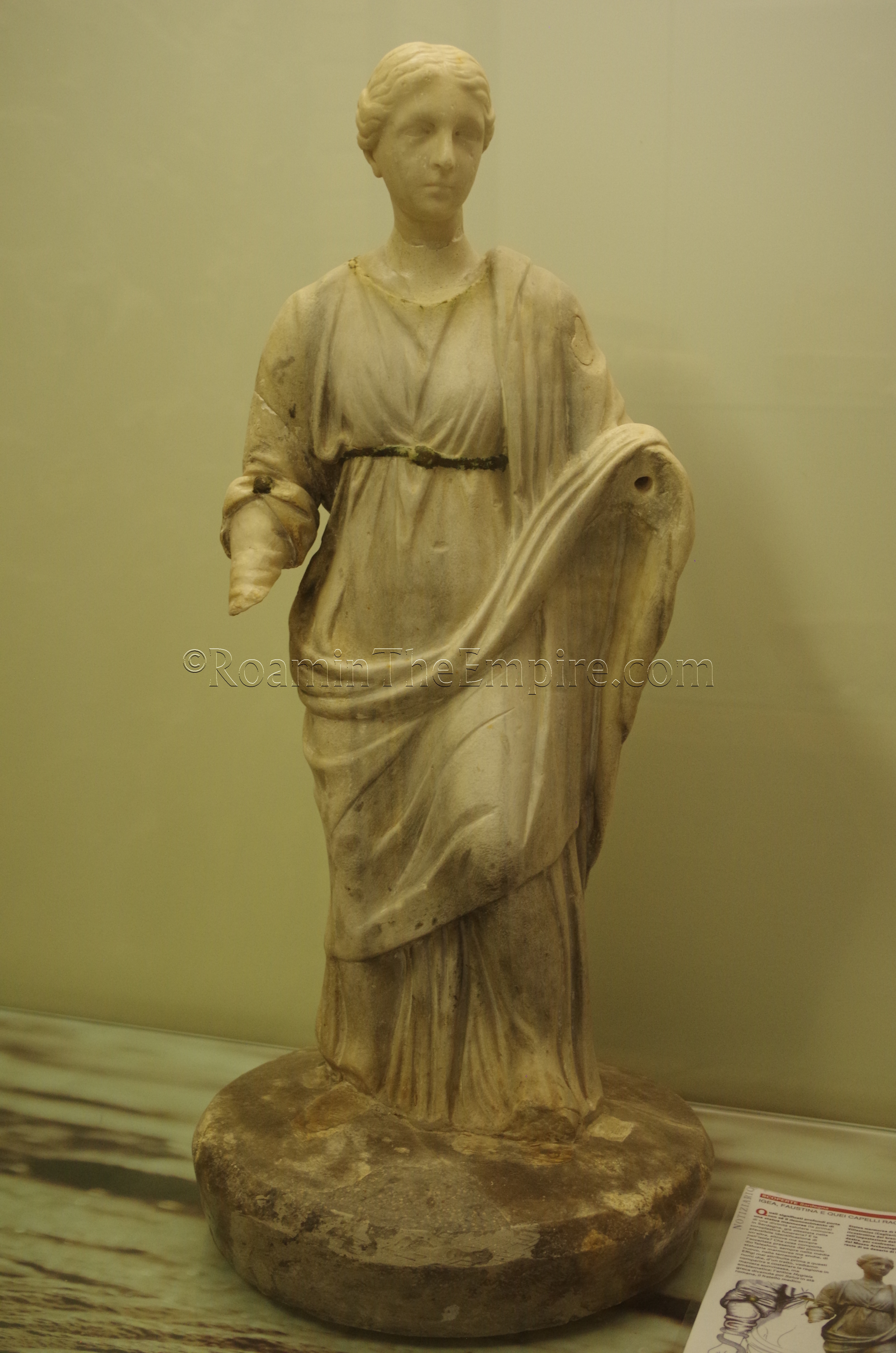
The museum itself is rather small, particularly as far as the ancient collection goes. There are not a whole lot of artifacts, and most of them are smaller ceramics. There is a larger piece of statuary, a statue of Hygeia from the area of Villasimius. The real strength of the museum is the information presented; there are lots of large informational posters, many with English translations. It took me less than a half an hour to go through the museum, though if one is fluent in Italian, it might take a bit longer because of the extra reading material in that language. There was also a video one could watch. The collection might not be especially impressive in and of itself, but it was certainly worth the stop to read about the excavations at the baths and sanctuary site.


Sources:
Auriemma, Rita and Emanuela Solinas. “Archaeological Remains as Sea Level Change Markers: A Review.” Quaternary International, no. 206, 2009, pp. 134-146.
Dyson, Stephen L. and Robert J. Rowland Jr. Archaeology and History in Sardinia from the Stone Age to the Middle Ages: Shepherds, Sailors, & Conquerors. Philadelphia: University of Pennsylvania Museum of Archaeology and Anthropology, 2007.
Hoyos, Dexter. The Carthaginians. New York: Routledge, 2010.
Miles, Richard. Carthage Must Be Destroyed. New York: Viking, 2011.