


Aside from the remains in the major urban centers of Sulcis, Nora, and Caralis in the southern part of Sardinia, there are a number of smaller sites or more isolated sets of remains, as there is throughout the island. I’ve cobbled together some of these sites in a few posts focusing on different geographic areas on the island; the next two focusing roughly on the modern Cagliari and Carbonia-Iglesias provinces. Many of these are isolated in rural areas, and as such, it is nearly impossible to visit many of them without a personal vehicle.
Temple of Antas
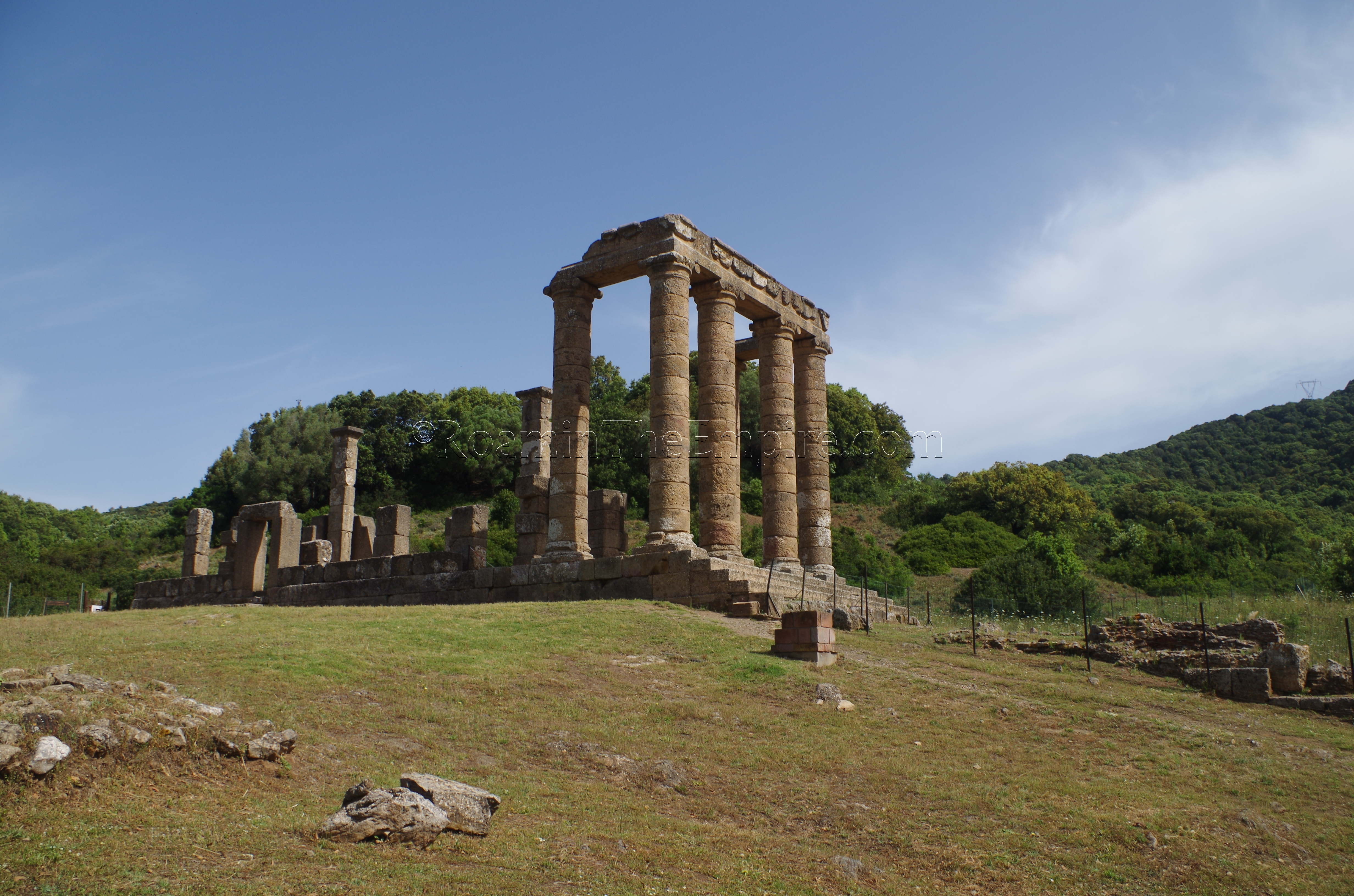
About 20 kilometers north of the city of Iglesias is the archaeological area of the Temple of Antas. One should be aware that the road from Iglesias is quite winding and due to that, the actual time it takes to get from Iglesias to the temple can exceed mapping estimates. The archaeological area is open every day, July through September, from 9:30 to 19:30. In June, the hours are 9:30 to 18:30, with the site still being open every day. In April, May, and October, the area is open every day from 9:30 to 17:30. The remainder of the year (from November to March) it is open every day except Monday from 9:30 to 16:30. Admission is 3 Euros.
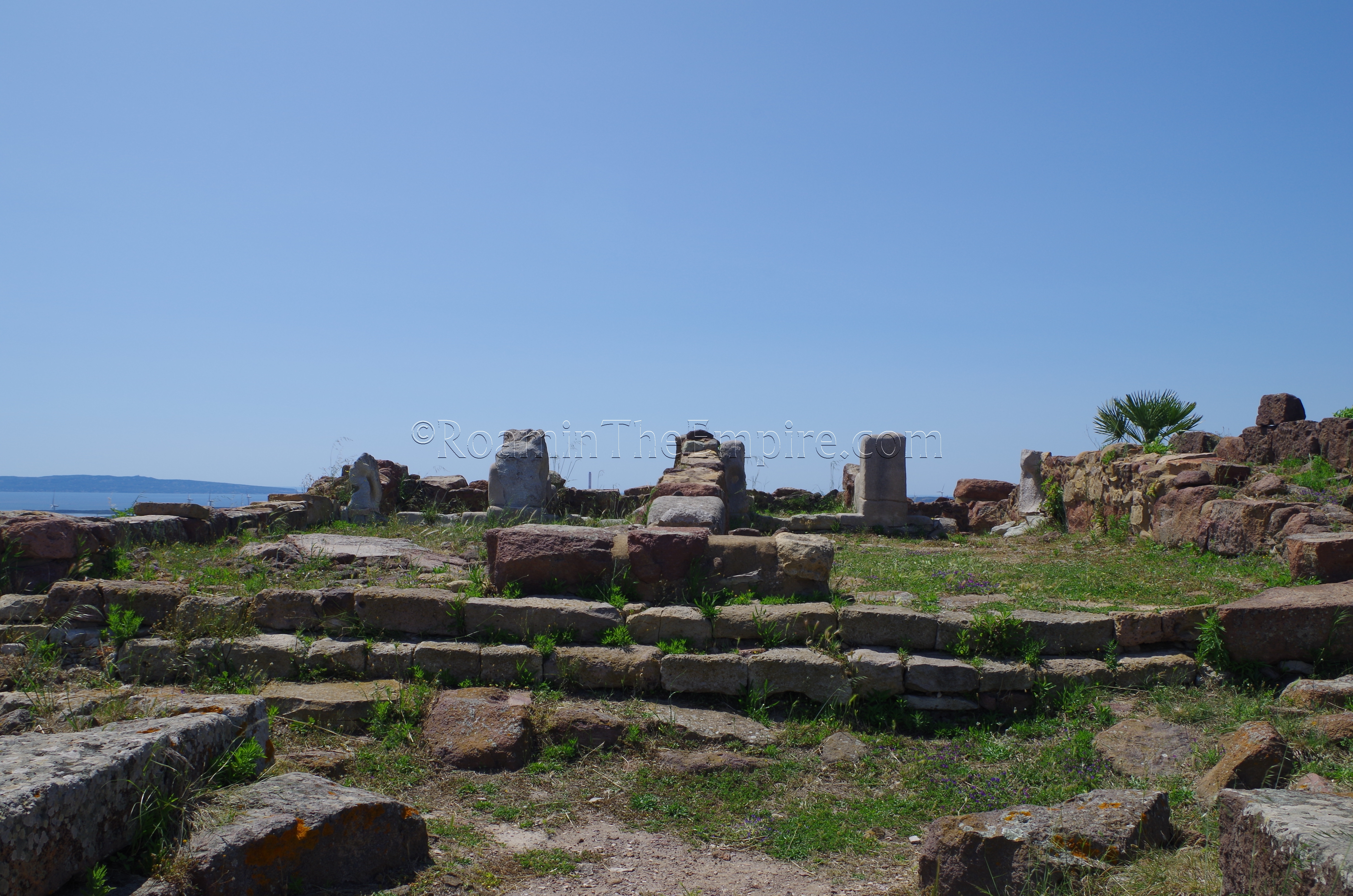
The temple that now stands dates to the Augustan period, with a restoration under Caracalla, which is noted by the partial inscription on the architrave. The site, however, dates back much further. The site was sacred to the Nuragic people and was associated with Babi (or Babai), the primary male deity of the Nuragic pantheon and protector of the island. First temple seems to have been constructed by the Carthaginians about 500 BCE, and was dedicated to Sid Addir, who the Carthaginians associated with the Nuragic god Babi as protector of the island, and may have even added the Nuragic god to the epithet as Sid Addir Babi. In the Punic pantheon, Sid was the son of Melqart (Hercules), who was then later associated with Sardus. Also a son of Hercules (under the name of Maceris), Sardus was said to have lead a group of Libyans to the island of Ichnusa to colonize it. After this, the island was renamed in his honor. By the time the Romans took control of the site, the temple was dedicated to Sardus Pater Babi.
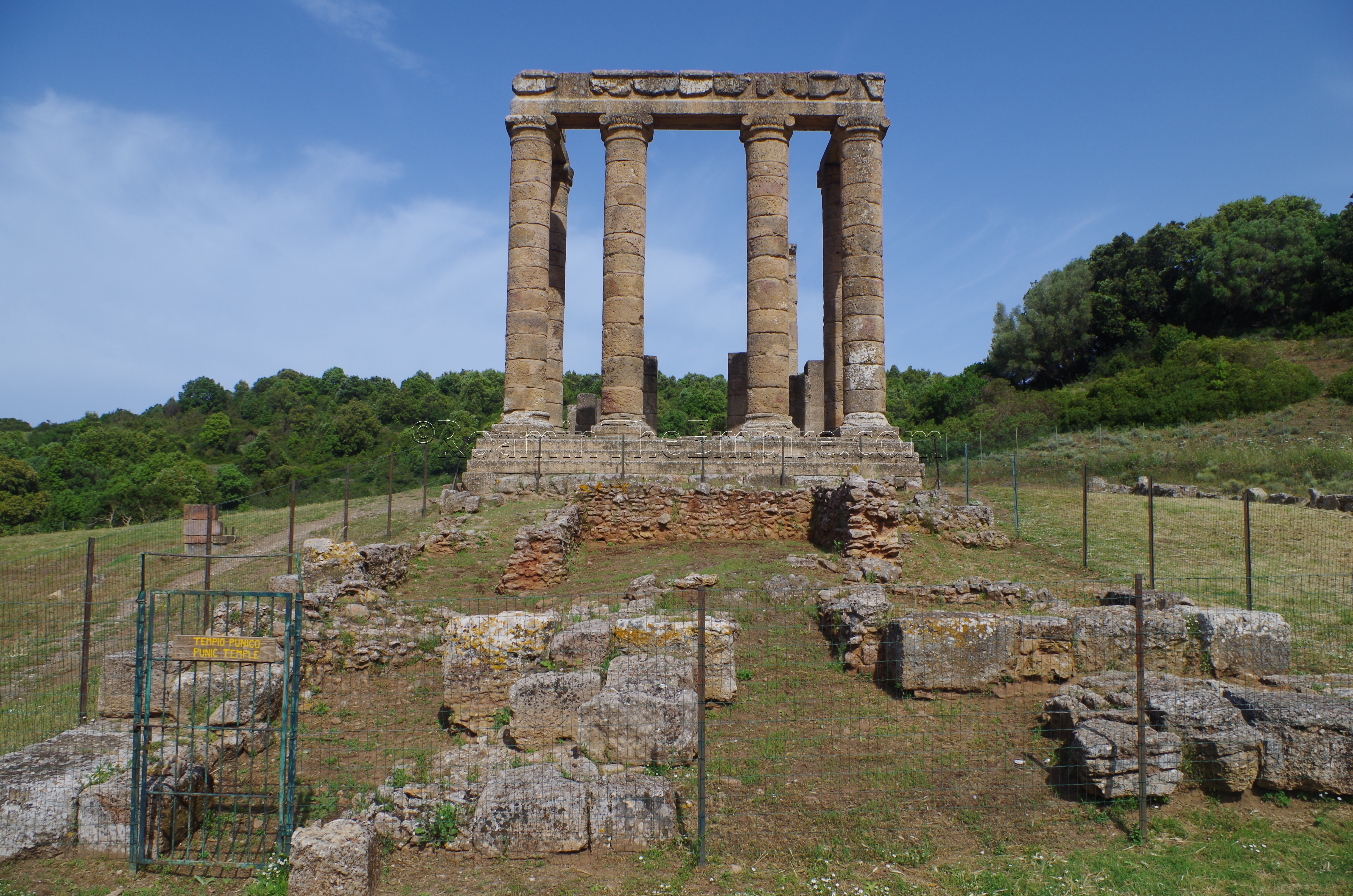
In addition to the Roman era temple standing at the site, immediately in front of it are the excavated remains of the Punic era temple, which was restored about 300 BCE. Remains of the temenos enclosure of the sacred area are visible running southwest from the front of the Punic temple for about 45 meters. Three Nuragic era pit tombs dating between the 9th and 7th centuries BCE are located to the south of the temple. One of which (Tomb 3) contained a bronze figure that is thought to depict the deity Babi. There are informational signs in Italian and English regarding both the temples and the burials.
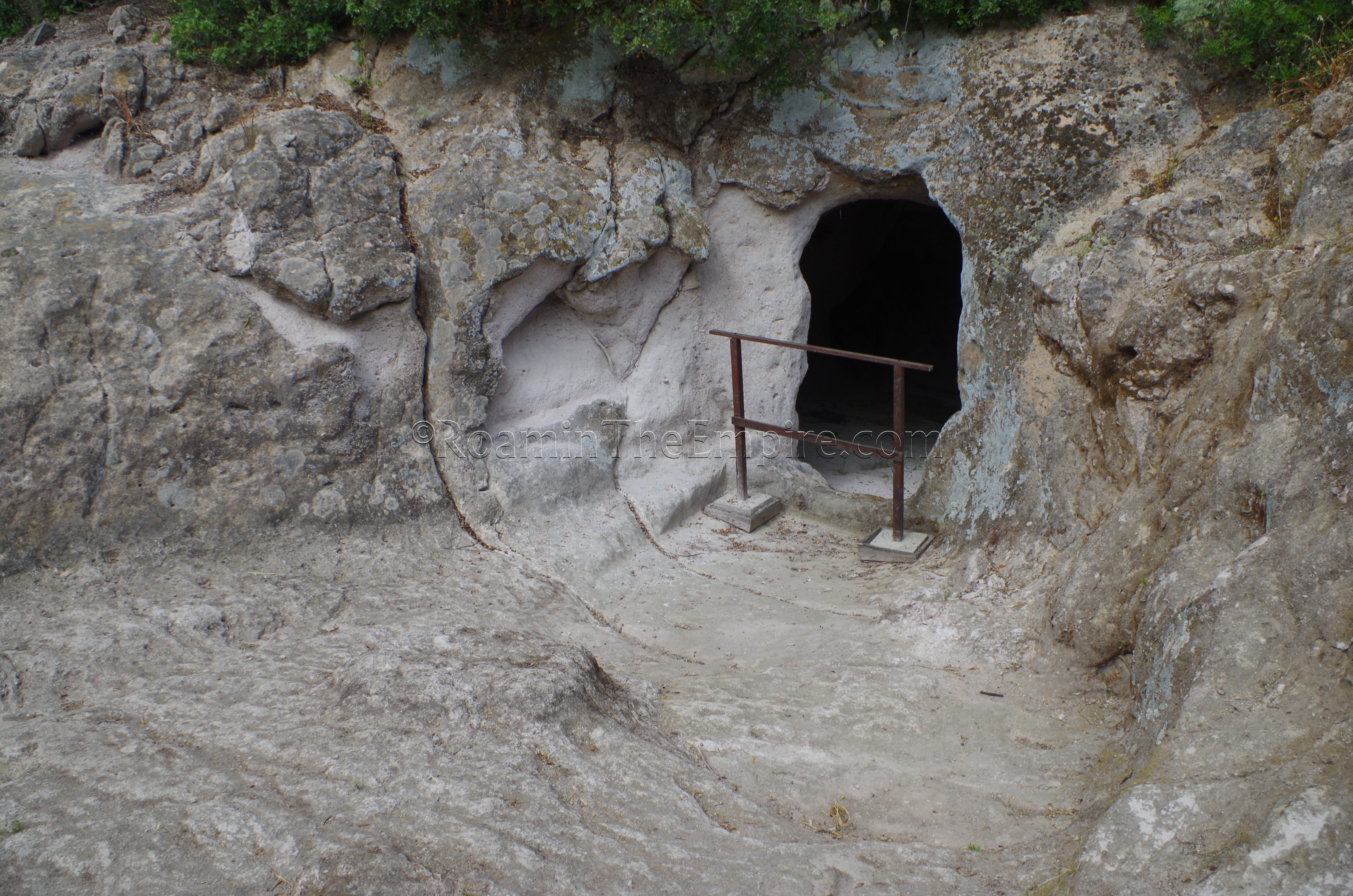
About 500 meters northeast of the temple (as the crow flies, roughly 800 meters walking on the trails), there are a couple of Roman era quarrying points that were used in construction of the temple. To access these, one must pass through the gate adjacent to the rear of the Roman temple, and take the path traveling to the northeast (or right out of the gate). There are a few hand painted signs guiding, but the trail is pretty clear. Once the trail starts heading a bit steeper uphill, there is a sign directing the visitor to the left and the site of the first quarrying area. Signs direct visitors further on and up the hill to the additional quarrying points.
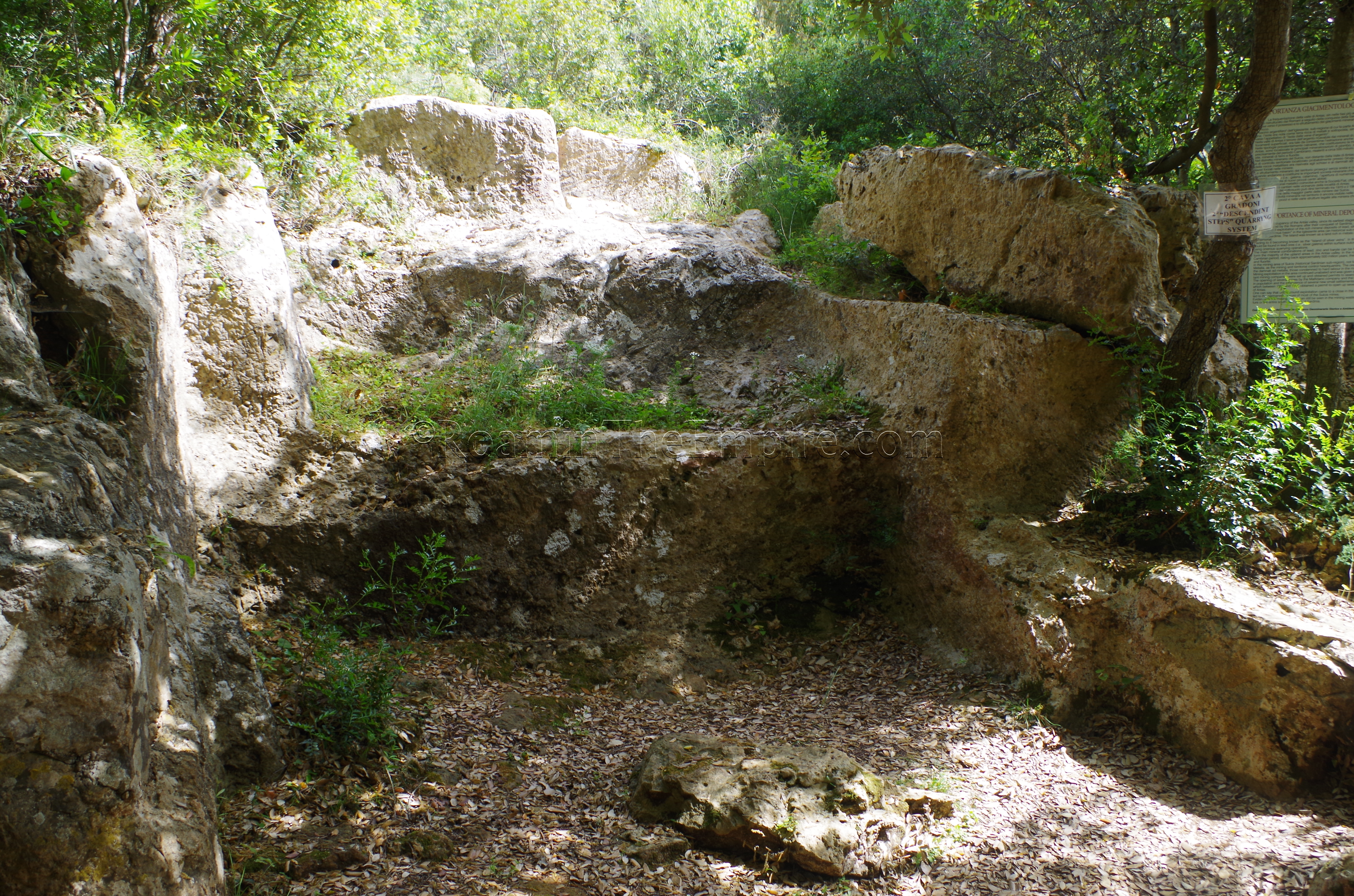
Informational signs (in English and Italian) detail the three different quarrying techniques employed at the quarries here. Unfortunately, one sign seemed to be missing, which discussed the third type of quarrying in addition to stepped and trench methods. Regarding the trench method, some blocks that were not completely quarried can be seen at a few points.
I spent a total of about an hour and a half at the site, including some walking around to other parts of the park, which included cork trees dating back hundreds of years. The remains of a Nuragic village are also visible a short hike to the northwest of the visitor’s center. Despite its rather remote location, the Temple of Antas is kind of a must-see stop on an archaeological itinerary through Sardinia.
Museo Archeologico Villa Sulcis
In the immediate vicinity of Carbonia, there are two sites worth visiting, the first being the Museo Archeologico Villa Sulcis in Carbonia. The museum doesn’t have an actual address, as it is located within the Parco Villa Sulcis, but a good place to park for the museum is at the intersection of Via della Vittoria and Via Campania. The archaeological museum is open between April and September from 10:00 to 13:00 and 15:00 to 18:30. The rest of the year it is open from 10:00 to 13:00 and from 14:00 to 16:00. Single admission to the museum is 6 Euros, but a 10 Euro combination ticket (valid for 60 days) can be purchased which also allows access to the Monte Sirai archaeological area, and the Carbonia Museum. Monte Sirai is also a 6 Euro entrance, so, even if just visiting that site, the ticket is worth it.
The Museo Archeologico Villa Sulcis is quite small. It is two stories, but really only one room on each level. Honestly, the admission price is a little steep considering the size. It does have some interesting pieces. The first floor is primarily Nuragic and pre-Nuragic, while the second floor is the Punic and Roman material. Most of the Punic objects come from nearby Monte Sirai, and the Roman objects from the immediate area. Among the more interesting artefacts are a bronze Puinc inscription of an offering from the 4th century CE, some Puinc stele, and a few Roman milestones from the Via Sulcitana between Sulcis and Caralis. In all, it only took me about 20 minutes to go through the museum. There are some English translations with the object information cards, but most of the larger informational pieces are in Italian only.
Monte Sirai
A few kilometers outside of Carbonia, perched on a hill to the northwest, is the Parco Archeologico Monte Sirai. Monte Sirai is open in April, May, June, and September from 9:00 to 19:00, every day except Monday. In July and August it is open every day from 9:00 to 20:00. The rest of the year the park is open 9:30 to 16:30 every day except Monday. Like the nearby museum, single admission is 6 Euros, but a combination with the two museums in Carbonia can be purchased for 10 Euros.
The ancient name of this settlement has been lost to history thus far, but it seems to have been an outpost of Sulcis, which is only about 14 kilometers away. There is evidence to suggest that Monte Sirai served mostly as a militarized outpost to secure the supply of agricultural goods from its foundation in the mid-8th century BCE until about the 4th century BCE. The late establishment of the tophet in the 4th century BCE (much later than other Phoenician/Punic settlements on Sardinia) could indicate that Monte Sirai transitioned from a military to civilian context at that point. At that time, the city walls were also strengthened. After the Romans took over the island, Monte Sirai continued to be inhabited for another century until about 110 BCE, when the settlement was mostly abandoned and the population of the immediate area shifted to the site of present-day Carbonia. There does seem to have been some sporadic habitation at the site in the 6th and 7th centuries CE, though.
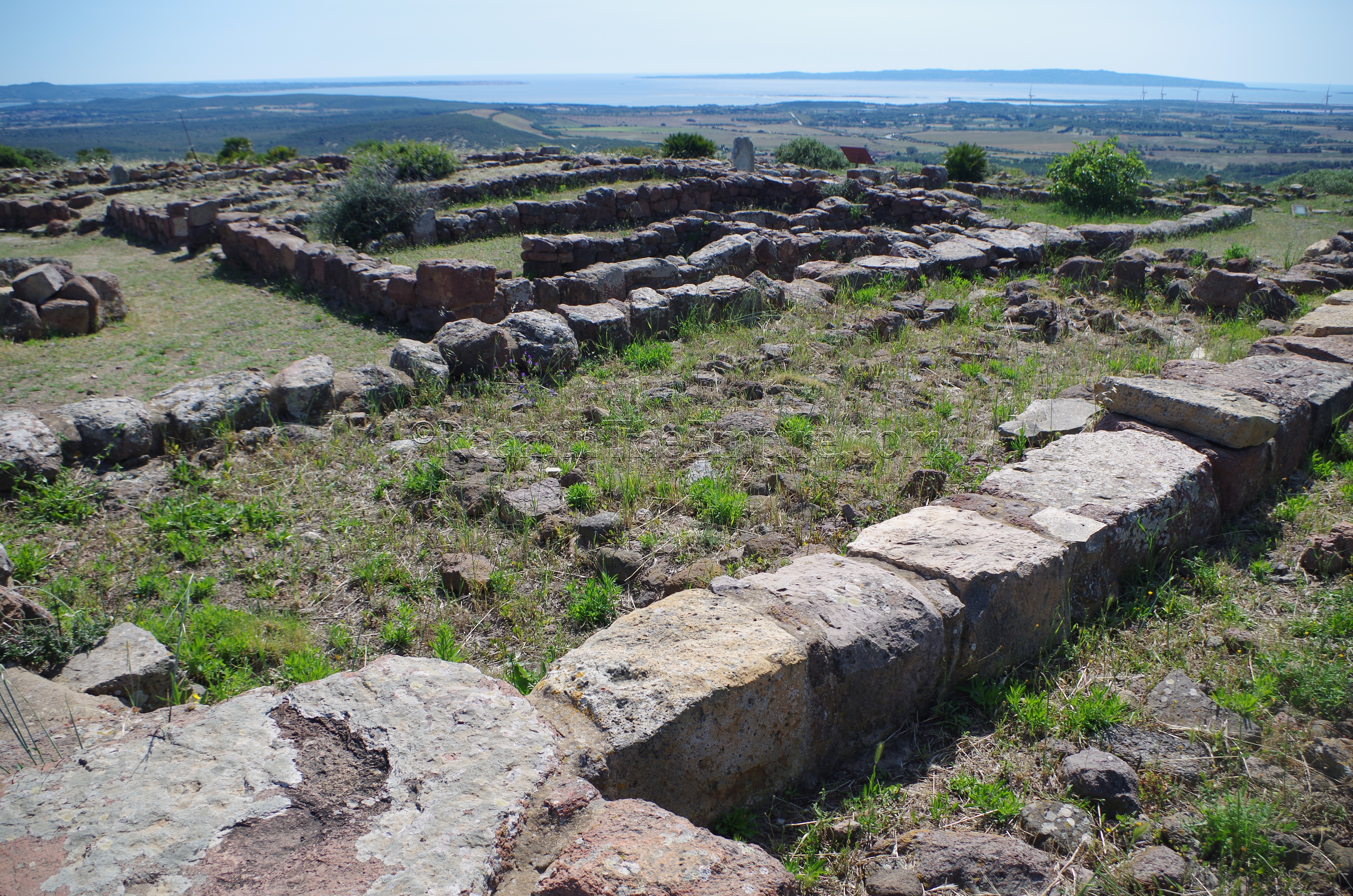
The archaeological remains of Monte Sirai are essentially broken up into three areas (in order of their recommended visit); the settlement, necropolis, and tophet. The settlement is located at the southern end of the plateau of the hill, and is mainly composed of residential buildings. Most of these are typical Punic style houses, with some being more intensely investigated (though with names and informational signs) than others. At the northern side of the settlement are some fortifications leading into the residential area, and immediately inside is the Temple of Astarte. The temple was originally constructed between the 8th and 6th centuries BCE and was built on the site of a Nuragic tower and cistern. In the later life of the temple, worship seems to have shifted from Astarte to Demeter and possibly the Egyptian deity Bes.
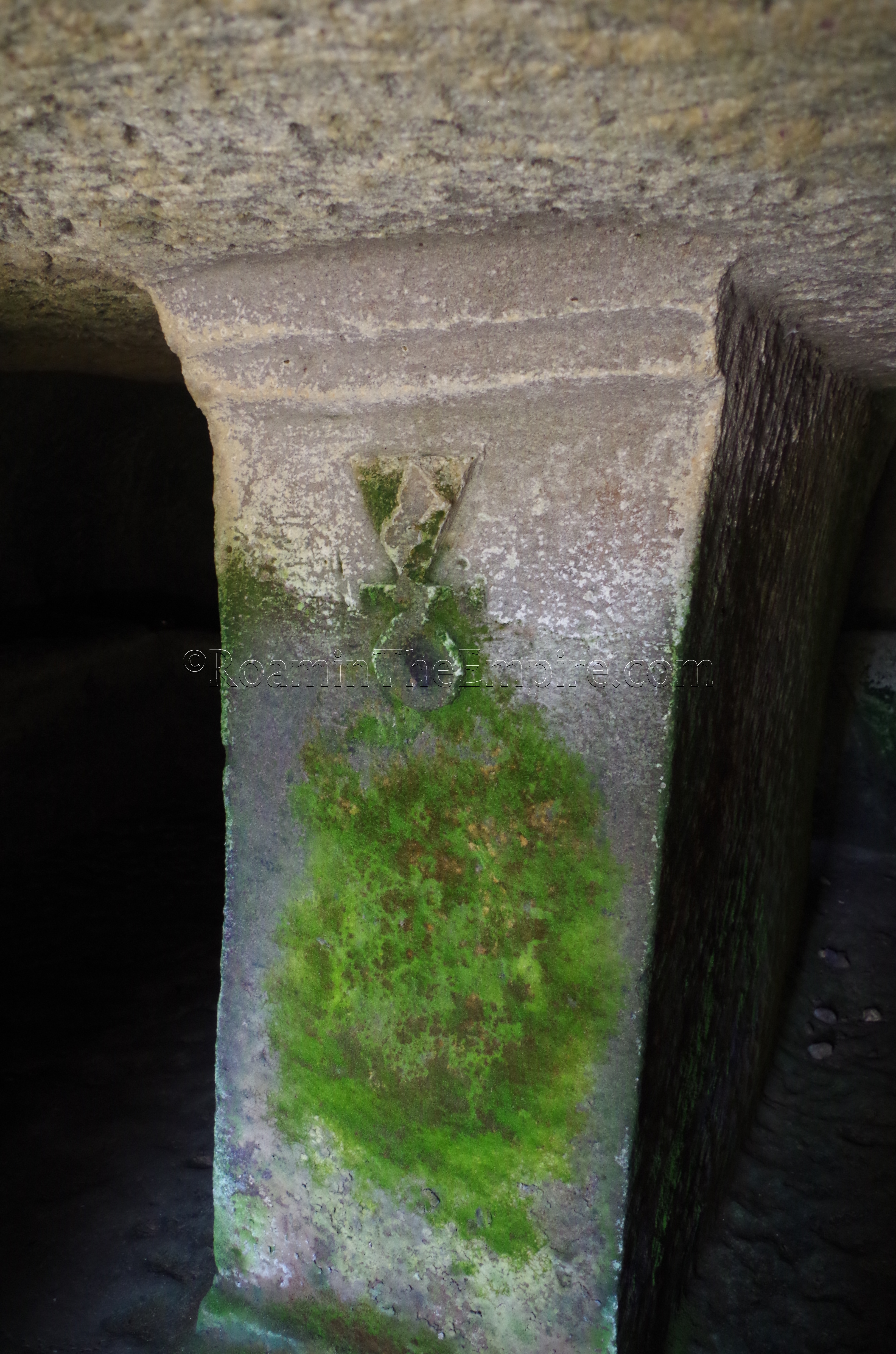
To the north of the settlement is the necropolis, which was vastly larger than what is currently on display. The necropolis provides an interesting view of the cultural change between the more or less independent Phoenician phase and the latter Carthaginian hegemony. In the early stages of the habitation of the area (8th to 6th centuries BCE), small cinerary pit burials were the predominant funerary practice, with some inhumation pit burials occurring. After the site came under the control of the Carthaginians, though, the practice seems to have shifted to more elaborate inhumation burials in the form of chamber tombs. Both types are visible in the necropolis, and a few of the chamber tombs can be entered into, including one with an upside down Tanit symbol carved onto a pillar at the entrance.
At the tophet, there is not a whole lot to see of the actual burial field, most of the burials here have been excavated and removed, though there are a few stele and pots (possibly reproductions) on site. There are some significant remains, however, of a temple. Originally a sanctuary area with an altar when the tophet originally entered into use about 320 BCE, a temple was later constructed in the mid 3rd to early 1st century BCE. Some of the monumental staircase and the foundations of some of the temple walls are preserved.
Overall, the site is well worth visiting; there are no other Punic sites on the island that are preserved to this degree without later periods of occupation. There are free guided tours from time to time, primarily in Italian, though the guides sometimes speak English and seem happy enough to attempt brief explanations if possible. I think because the site is not heavily visited, there’s a bit of flexibility to the times. It took me about an hour to visit the site and the small information center.
Pani Loriga
About half an hour to the southeast is another important Phoenician/Punic settlement, the Area Archeologica di Pani Loriga – Santadi. The archaeological site of Pani Loriga is open Friday through Saturday from 9:30 to 18:30. When I visited, however, there was not open admission, one could only visit with a guided tour, which occurred at 10:00, 11:30, 15:30, and 17:00. Admission is 5 Euros and includes an audio guide.
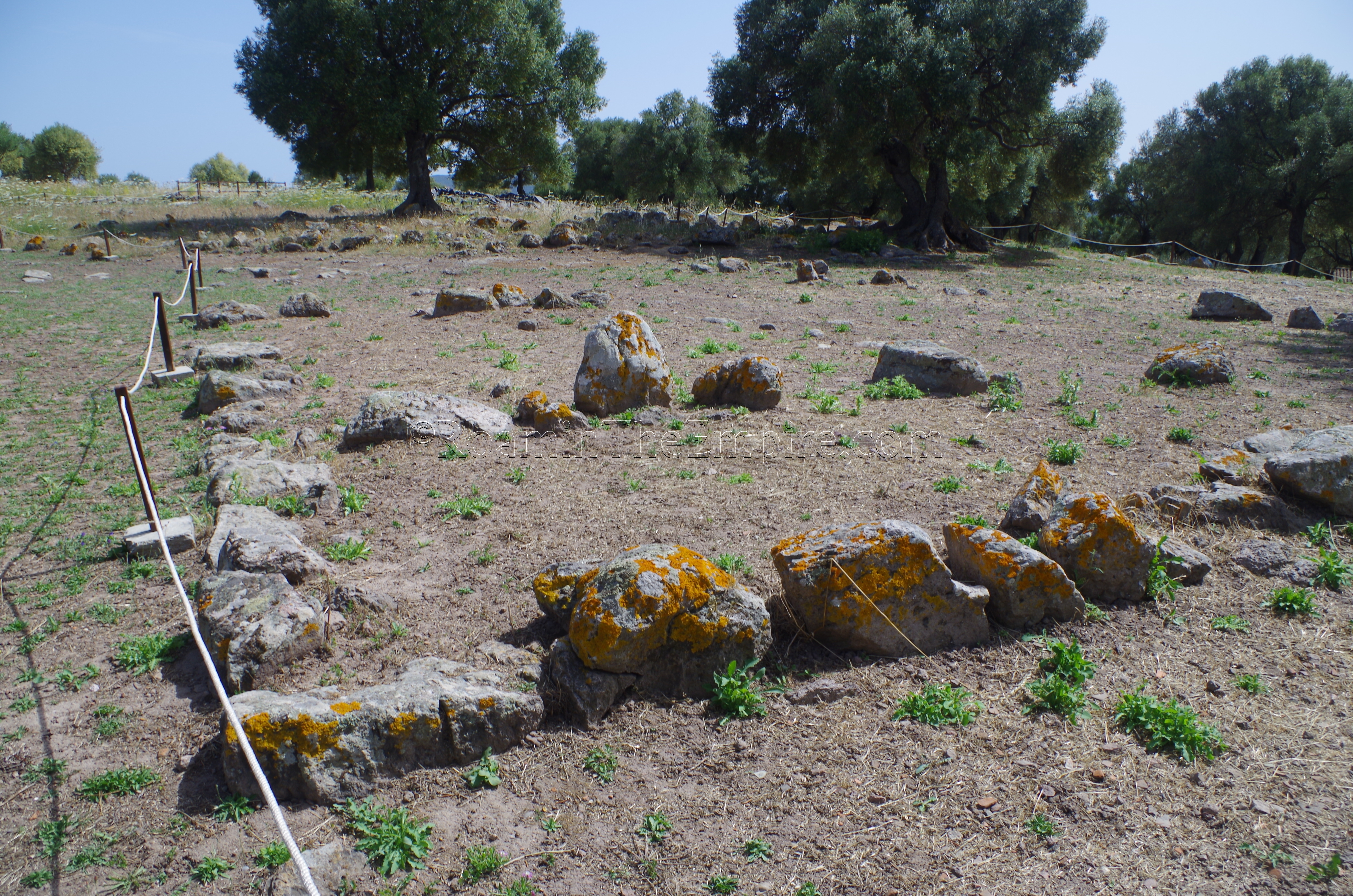
The site of Pani Loriga (modern name) was founded in the 7th century BCE, likely as a colony of Sulcis used to control the local resources. The site was inhabited in prior to the Phoenician colonization as shown by the pre-Nuragic necropolis (Domus de Janas) at the southern end of the hill apex and the Nuraghe Diana at the north. Pani Loriga continued to function through the period of Carthaginian hegemony with significant construction occurring at the site through the 3rd century BCE.
The site is accessed via the Valloncello, a valley that leads up to the site and was the access point to the settlement in antiquity. The first area that can be visited at the site is the Area B Punic living quarters. When I visited, these were mostly covered with tarps due to ongoing excavations in the last few years. One can then continue to the Area A Punic living quarters on the south end of the hill, which is at a leveled area below the final apex of the hill. This is probably the best preserved area at the site, as the delineation of the walls is pretty clearly recognizable. On the way up to this apex, there is the pre-Nuragic necropolis, which contains a few rock-cut chamber tombs known locally as a Domus de Janas, or a fairy house. At the apex of the hill is another Punic living area known as “casematte” which is extremely fragmentary. At the north end of the hill is the poorly preserved Nuraghe Diana, which doesn’t look like much more than a pile of rocks at this point.
The visit then takes visitors around the southwest side of the hill where the Phoenician and Punic necropolis are. The southern part of this area contains the Phoenician necropolis which, like Monte Sirai, is composed of the pit burials characteristic of the pre-Carthaginian burial practices. Some of these graves are visible as rock packs that were used to cover. A bit further on is the Punic necropolis, which is composed of the rock-cut chamber tombs that became predominate under Carthaginian hegemony. While none can be entered, a few can be approached close enough to see inside.
Like Monte Sirai, Pani Loriga offers a seldom afforded opportunity to see a Phoenician/Punic settlement without subsequent Roman or later periods of occupation on top of it. It takes about 45 minutes to visit and includes a rather steep climb uphill on sometimes uneven terrain. There are no informational signs on site, but the audio guide is pretty helpful, and though the guide taking me around did not speak fluent English, he was helpful in offering what information he could beyond the audio guide.


Sources:
Botto, Massimo. “The Punic Settlement of Pani Loriga in the Light of Recent Discoveries.” The Journal of Fasti Online. 2017.
Dyson, Stephen L. and Robert J. Rowland Jr. Archaeology and History in Sardinia from the Stone Age to the Middle Ages: Shepherds, Sailors, & Conquerors. Philadelphia: University of Pennsylvania Museum of Archaeology and Anthropology, 2007.
Hoyos, Dexter. The Carthaginians. New York: Routledge, 2010.
Miles, Richard. Carthage Must Be Destroyed. New York: Viking, 2011.
Pausanias. Description of Greece, 10.17.
Sallust. Historiae, 2.3.