


Most Recent Visit: June 2017.
It’s not often that I’ll delve completely off the path of the Romans and do a site that doesn’t even have a period of Roman occupation. In fact, Motya was gone for over 100 years before the Romans even came to the island in force. But, I thought I’d make an exception here for two reasons. First, as I’ve stated elsewhere on this site, I have a soft spot for the Carthaginians. My primary focus is usually the Romans, but, if there is something Carthaginian to see, I’ll try to make it a secondary priority. Second, Motya plays kind of an important, but understated, role in the history and balance of power in Sicily, particularly in the western part of the island.
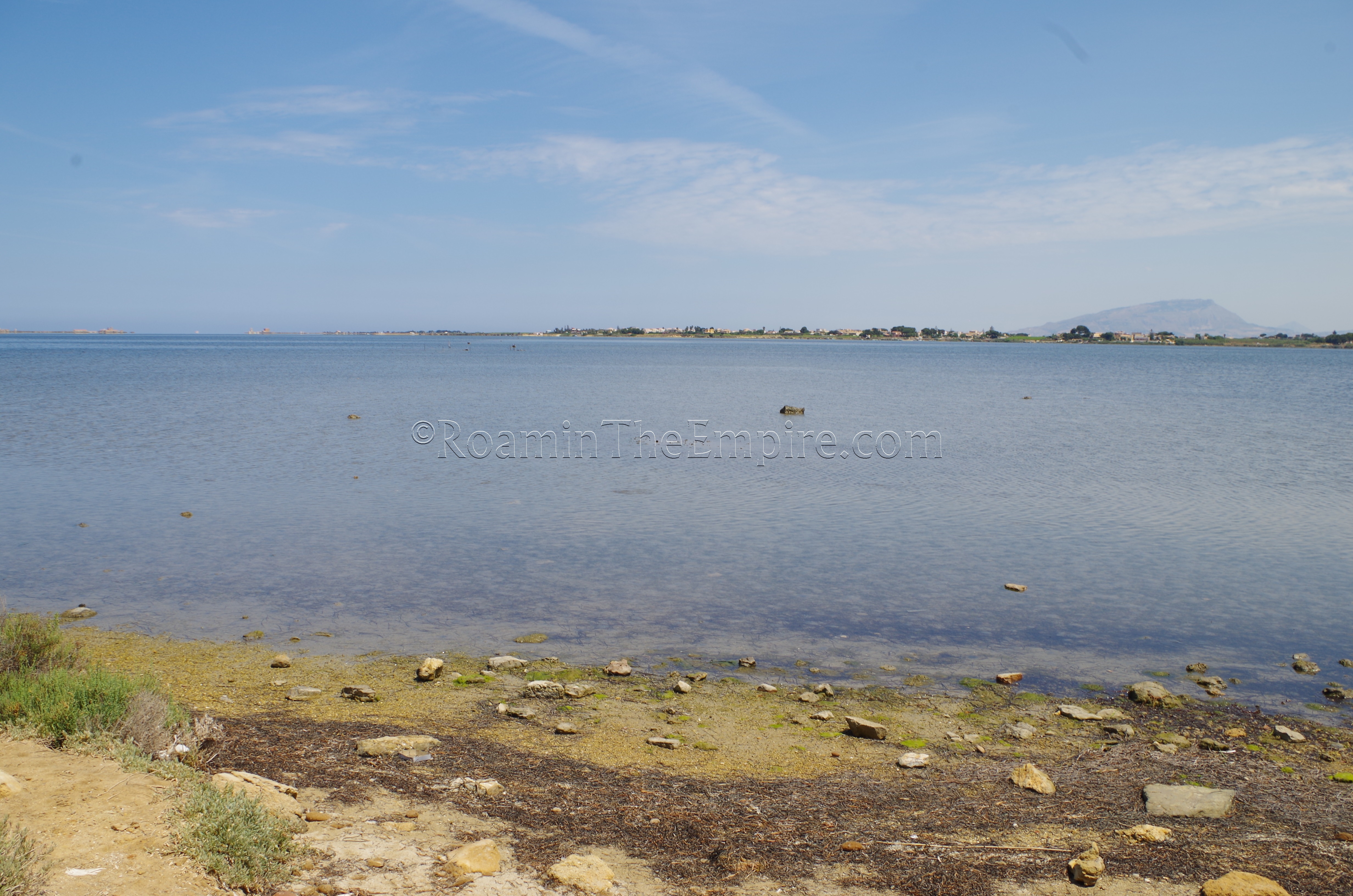
Motya lies on the island of San Panteleo in the Stagnone Lagoon to the north of present-day Marsala (Lilybaeum) and to the south of Trapani (Draepenum). It lies about a kilometer offshore, among shallows that helped defend the island. The island seems to have some form of habitation dating back to as early as the 17th to 14th centuries BCE. It may have been used as a Phoenician trading post as early as the 11th century BCE as part of the extensive Phoenician trade network throughout the Mediterranean. According to Thucydides, the Phoenicians were inhabiting Sicily along all the coastlines until the Greeks began arriving in the 8th century BCE, at which point the Phoenicians consolidated themselves in Motya, Soloeis (Soluntum), and Panormus. It is probably at this point that Motya became more of a permanent settlement, rather than a trading post, with the earliest structures being built on the south bank of the island. Of the three Phoenician settlements mentioned on Sicily, Motya was the closest in proximity to the Phoenician colony of Carthage, and probably functioned as the primary point of contact between North Africa and Sicily for the Phoenicians.
Motya probably functioned as an independent Phoenician settlement until about the 6th century BCE. About this time, growing Carthaginian influence and increasing conflict on Sicily seems to have brought Motya solidly into the Carthaginian hegemony. This also probably resulted in the building of fortifications around the island, which do not seem to have existed prior to the 6th century BCE. Though Motya didn’t feature in the conflicts militarily, the economic fortunes of the island settlement probably rose and fell with the conflicts between the Carthaginians and the other parties on the island. When the Phoenician/Carthaginian town of Himera was captured in 480 BCE, it likely brought economic hardship on the island, and when it was recaptured in 409 BCE, prosperity.
Because of its defensible position, Motya became a base of operations for the Carthaginian fleet, a stronghold of Carthaginian power on Sicily, and a prime target of Dionysius of Syracuse in 397 BCE when he sought to drive the Carthaginians from Sicily. As Dionysus marched toward Motya with a sizable force, many formerly Greek towns that were under Carthaginian control, and some non-Greek like Eryx, defected to the Greeks, in many cases killing their Carthaginian garrisons. In preparation for a possible Carthaginian siege, the long causeway that connected Motya to the mainland was destroyed. Motya, Segesta, and Entella were all besieged by Dionysius, but, since Motya was the stronghold of Carthaginian power, he focused his attention there with a force of 80,000 troops and a sizable fleet to control the lagoon.
The Carthaginians sent a fleet of about 100 triremes to try and relieve Motya, approaching the lagoon from the south. An ongoing plague at Carthage apparently prevented the sending of more reinforcements. If the Carthaginians could control the south approach to the lagoon, the Greek ships, numbering at least double the Carthaginians fleet, would essentially be trapped in the lagoon, which had no navigable exit on the north. As the Carthaginians approached, some Greek ships and land based siege weaponry engaged the Carthaginians while another force of triremes was carried over the shallows on the north and then sailed around the isthmus on the west side of the lagoon with intention of trapping the Carthaginians in the lagoon with Greeks attacking from both sides. The Carthaginians, however, disengaged and sailed back to Carthage before they could be hemmed in, leaving Motya without reinforcement and facing the forces of Dionysius alone.
With no fleet of their own, the Motyans could do little against the Greeks that now controlled the lagoon and built their own causeway to the island. According to Diodorus Siculus, the houses in Motya towered above the city walls, due to the density of the population on the small island. So, when Dionysus constructed siege towers to assault the city, the towers actually came level with the upper stories of the houses (apparently six stories high, double the height of the walls). The Motyans feared brutal reprisals at the hands of the Greek invaders, rightly so as it turned out, and so they fought doggedly against the Greeks, preventing them, for several days, from advancing much beyond the siege towers. Dionysus made a habit of calling off the attack each day at sunset and resting, resuming the attack in the morning. After several days of this, he went about the schedule as usual, and the Motyans expected the fighting to be over for the day when the attack was called off. One day, though, Dionysius instead sent a small unit after nightfall to covertly breach the city and let the rest of the army in.
By the time the people of Motya realized what had happened, the Greeks had entered the city and, again, having nothing to lose, the people of Motya fought back in the streets, forcing the Greeks into brutal house to house fighting through the city. When the Greeks finally did gain the upper hand and the battle was lost for Motya, they began indiscriminate slaughter of the inhabitants, much to the dismay of Dionysius, who ordered them to stop with no success. Fearing the total slaughter of the town, Dionysius then encouraged the remaining citizens of Motya to take refuge in their temples, knowing the Greek soldiers would not violate the sanctity of those seeking refuge in them. When the smoke cleared, those that did survive the assault were sold into slavery (except any Greeks who fought with Motya; they were crucified) and the town was sacked and destroyed.
After the return of the territory to Carthaginian control, and the end of that conflict with Syracuse, the city of Motya was never rebuilt. Instead, the survivors of Motya were resettled in the new settlement of Lilybaeum, to the south along the coast. Lilybaeum would grow to become the most important Carthaginian settlement in Sicily, and the most important settlement on the western part of the island. The island of Motya was largely abandoned after 397 BCE; there was intermittent subsequent activity on the island, but no large-scale habitation anywhere near what existed prior to 397 BCE.
Getting There: Motya’s modern Italian name is Mozia or Mothia, and is not especially close to either Trapani or Marsala. I had a rental car, so, again, I don’t have any personal experience using the public transport options. There is a bus that goes from Marsala to the Mozia embarkation point, but the schedule, travel time, and exact route apparently vary greatly based on the season and a number of other factors that can mostly be summed up as “Italian prerogative”. The bus line from Marsala that goes to Mozia is Line 4, which sometimes leaves from the Marsala train station. An updated, though not altogether clear schedule can sometimes be found here. A round trip ticket costs 4.20 Euro. The Mozia embarkation point is about midway between two train stations on the Marsala to Trapani line, but, it’s about a 6 kilometer walk from either one. As is the case with a lot of places in western Sicily, a rental car remains the most convenient option. An address that can be used for navigation purposes to get to the embarkation to Mozia is Contrada Spagnola 390, Marsala. There is a second embarkation point at 228 Contrada Spagnola, but, all the information I have presented is for the former. Once at the Mozia embarkation point, there is a boat service that leaves every half an hour or so for the island in the summer between 9:15 and 18:30. The trip takes about 5-10 minutes and costs 5 Euros roundtrip. Updated info can be found here.
The entrance is just outside the disembarkation point of the ferry. Entrance to the site and the Whitaker Museum is 9 Euros. The site is open in the winter between November 1st and March 31st, from Monday through Saturday between 9:00 and 15:30. The rest of the summer it is open from Monday through Saturday between 9:30 and 18:30. Of course, visiting the site is dependent on the ferry schedules to and from as much as it is on the actual opening hours of the site.
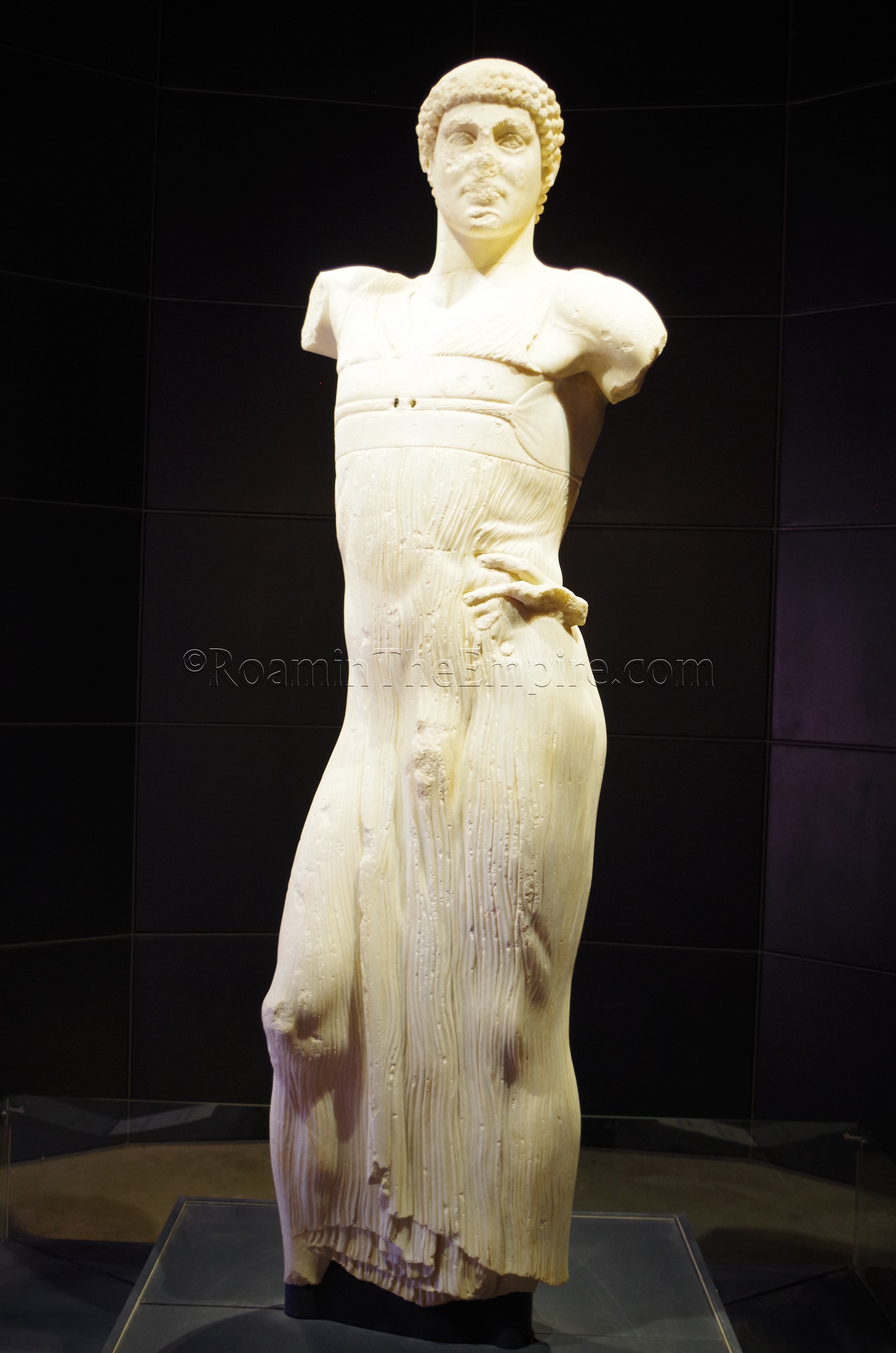
Very near the entrance is the Whitaker Museum, a private museum with artifacts recovered from the excavations on the island. In addition to many Punic artifacts, there are also objects of Greek and Egyptian origin, illustrating the wide trade network and likely the diverse origins of the citizens of Motya. There are lots of small ceramic finds such as figures, lamps, and pottery. There are some larger stone finds as well, including some decorative elements of the city walls. There is quite a large collection of decorated stele, some inscribed in Phoenician. The highlight of the collection is the Youth of Mozia, alternatively called the Charioteer of Mozia; a 2 meter tall statue of a charioteer. The statue is believed to have been carved in Selunite for a wealthy local, possibly of Greek origin. Alternatively, it may have been taken from Selunite as loot in a recent capture of the city by the Carthaginians. Some of the damage to the statue occurred in antiquity, when the statue may have been damaged either during looting after the fall of the city, or in being used as filler to try and shore up the walls of the city.
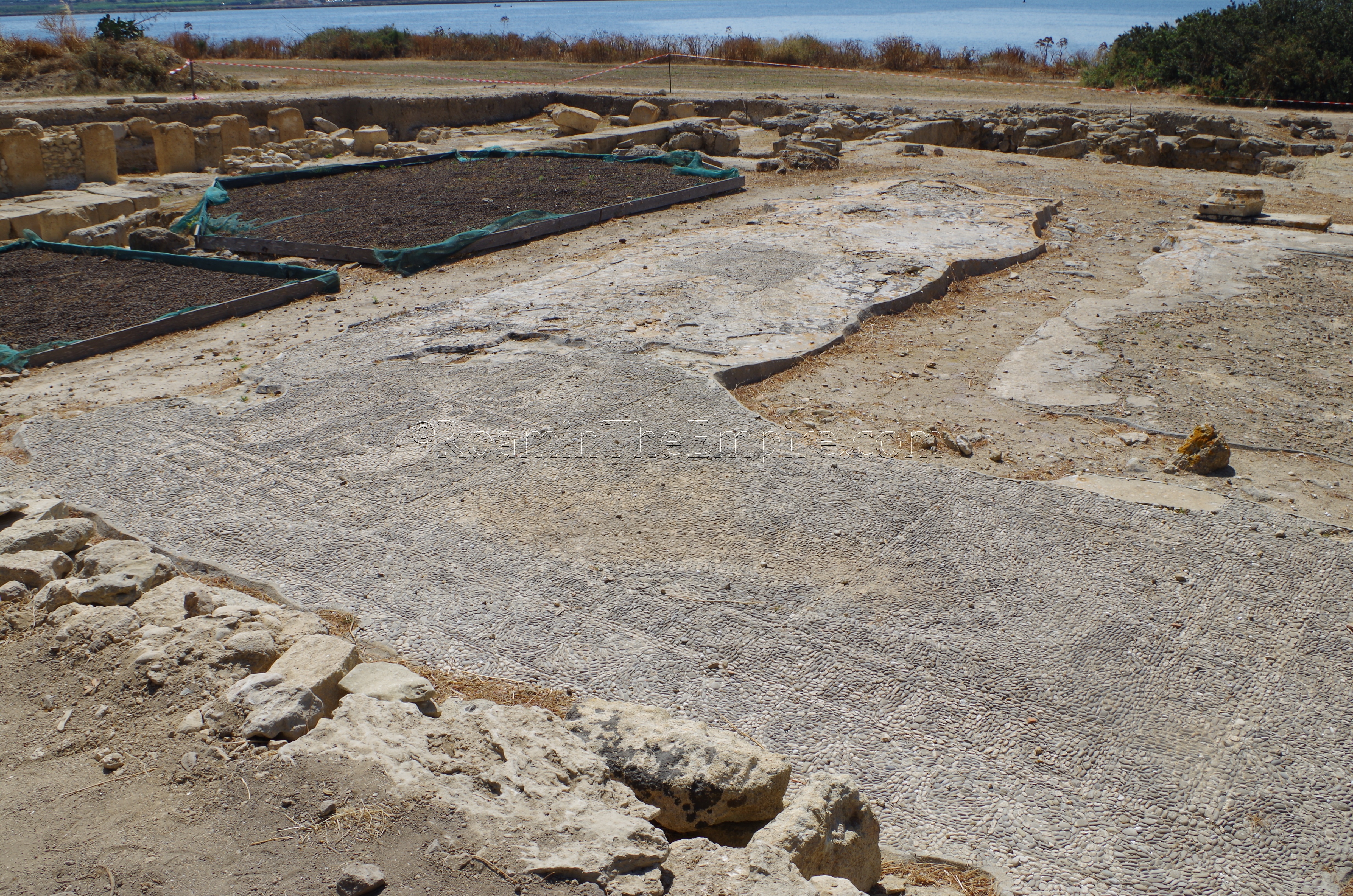
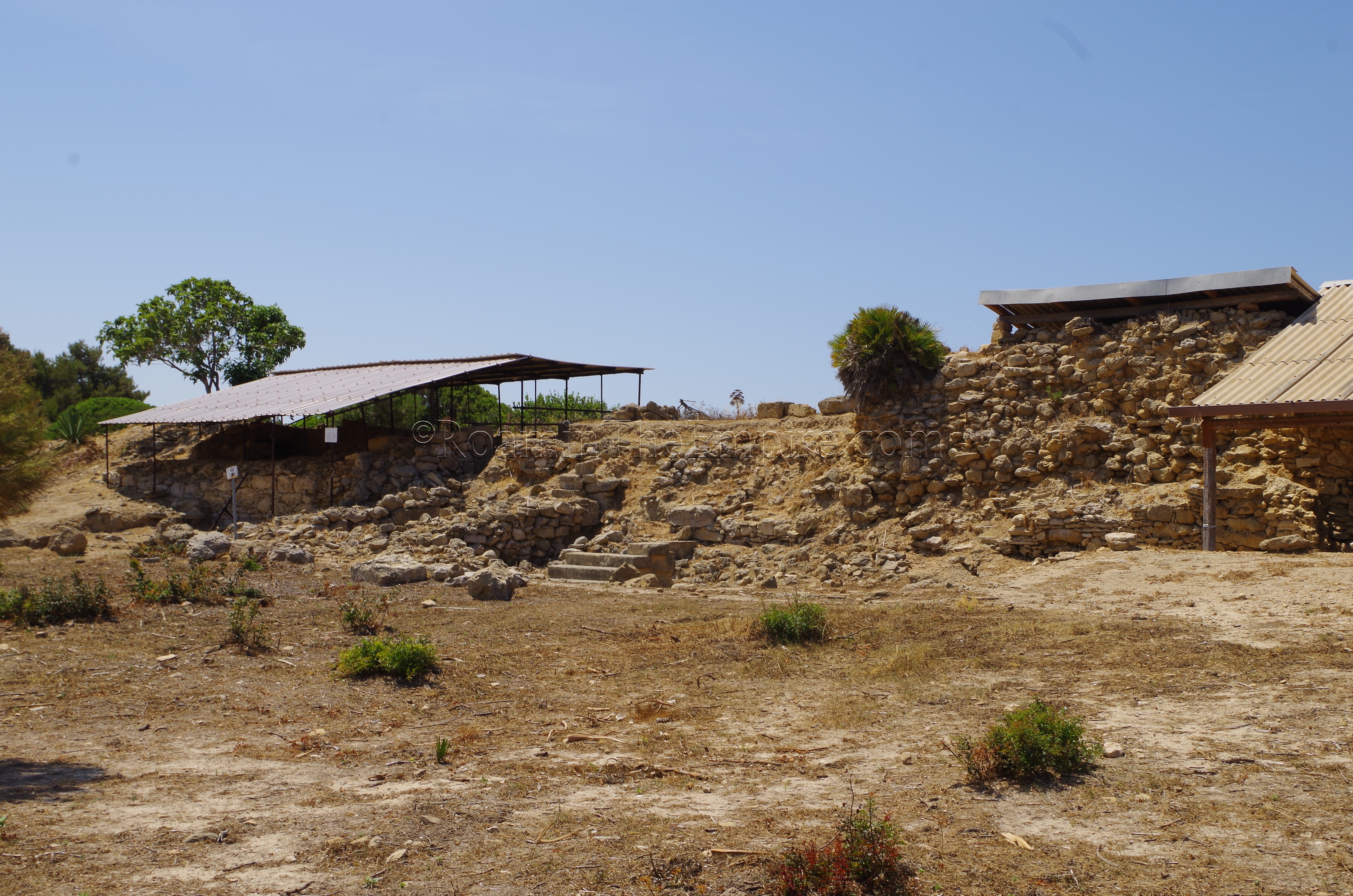
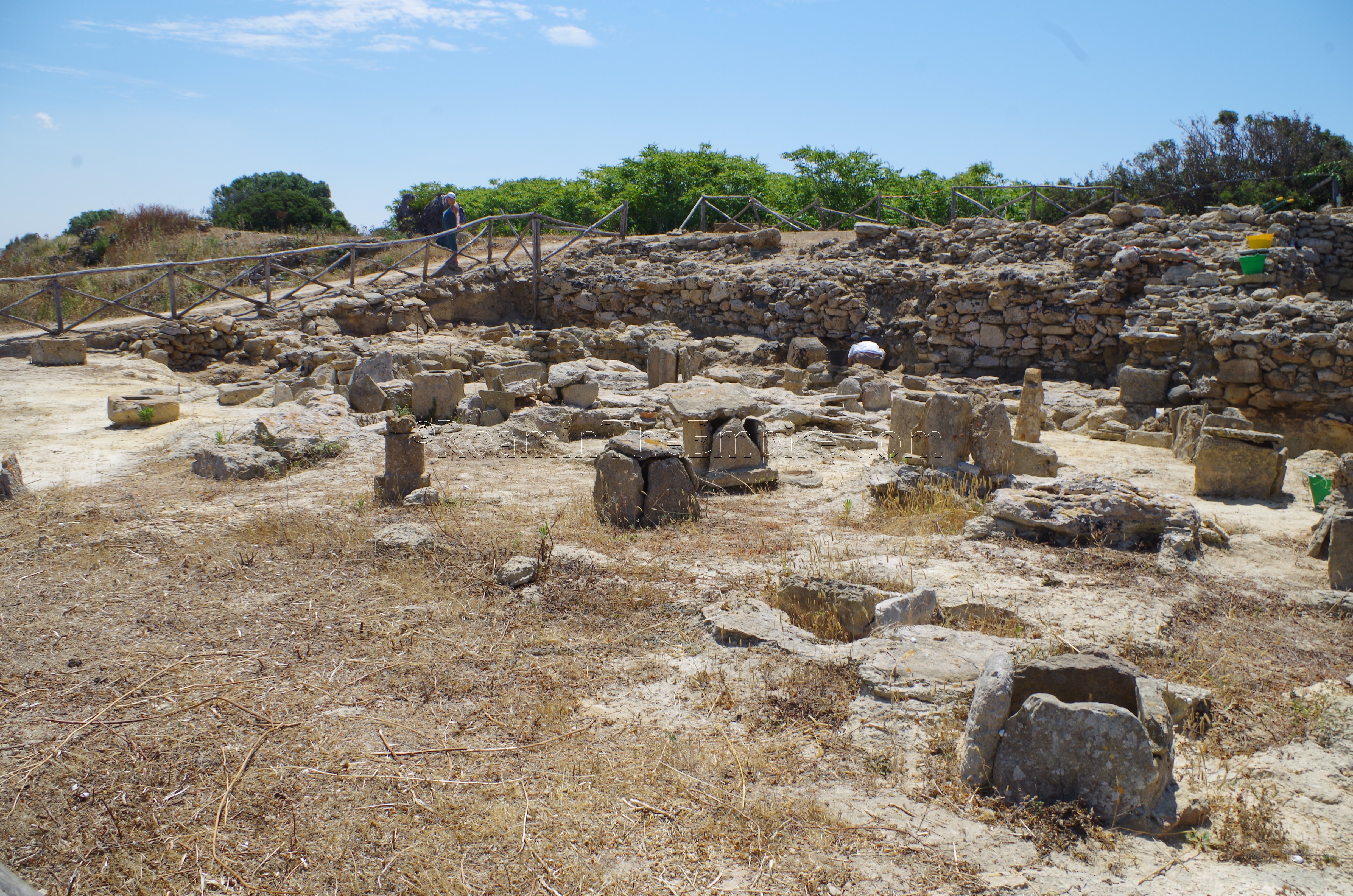
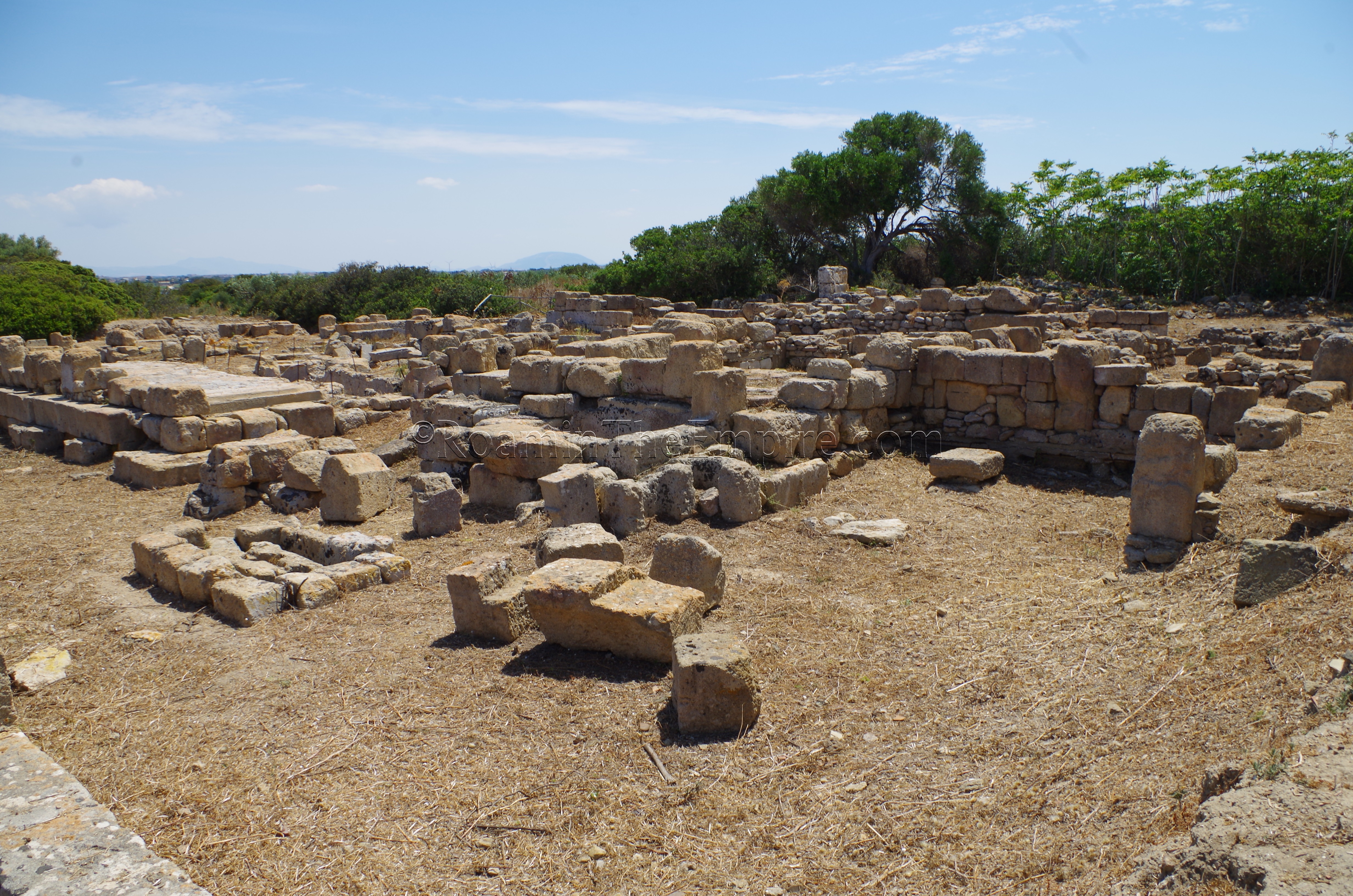
A building adjacent to the museum contains some excavations of a domestic structure. Perhaps most interesting about this particular point is that it details some of the history of the excavations and occupation layers on the island. The structure itself isn’t particularly notable, but the excavation through the Punic level of occupation into Bronze Age levels is. To the south of the museum is one of the more interesting excavations on the island, the House of the Mosaics. This domestic structure is dated, in part based on the style and technique of the mosaics, to the middle of the 3rd century BCE: after the destruction of the city. This house seems to have been constructed after Motya was left largely uninhabited, but does indicate that there was some sporadic habitation not long after the destruction. Unfortunately the house is in a state of ongoing excavation, so there are no permanent barriers up, and viewing conditions for the eponymous mosaics are not great. The mosaics are not covered either, further preventing ideal viewing conditions. The pebble construction of the mosaic also makes for less vibrant colors overall.
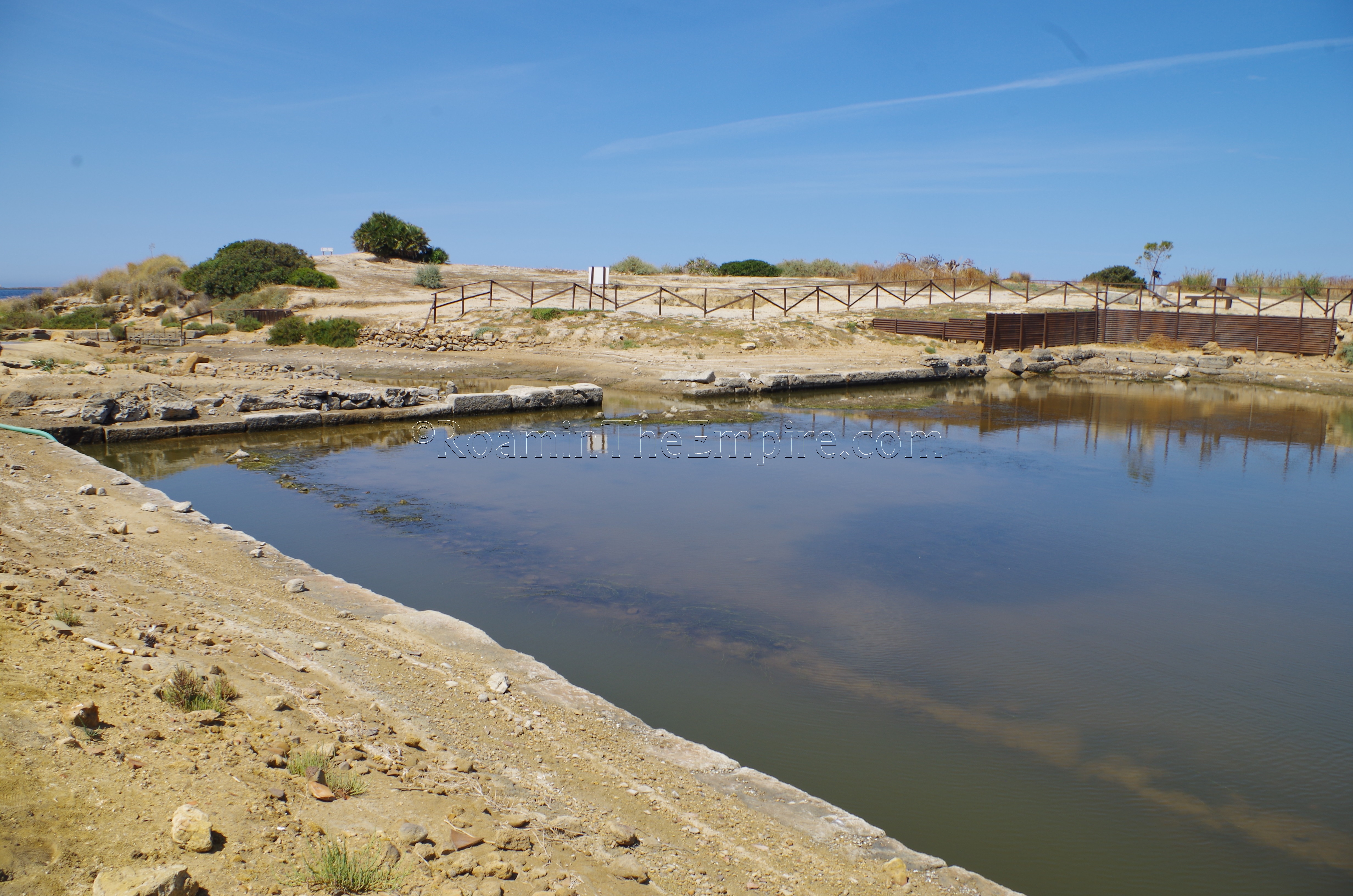
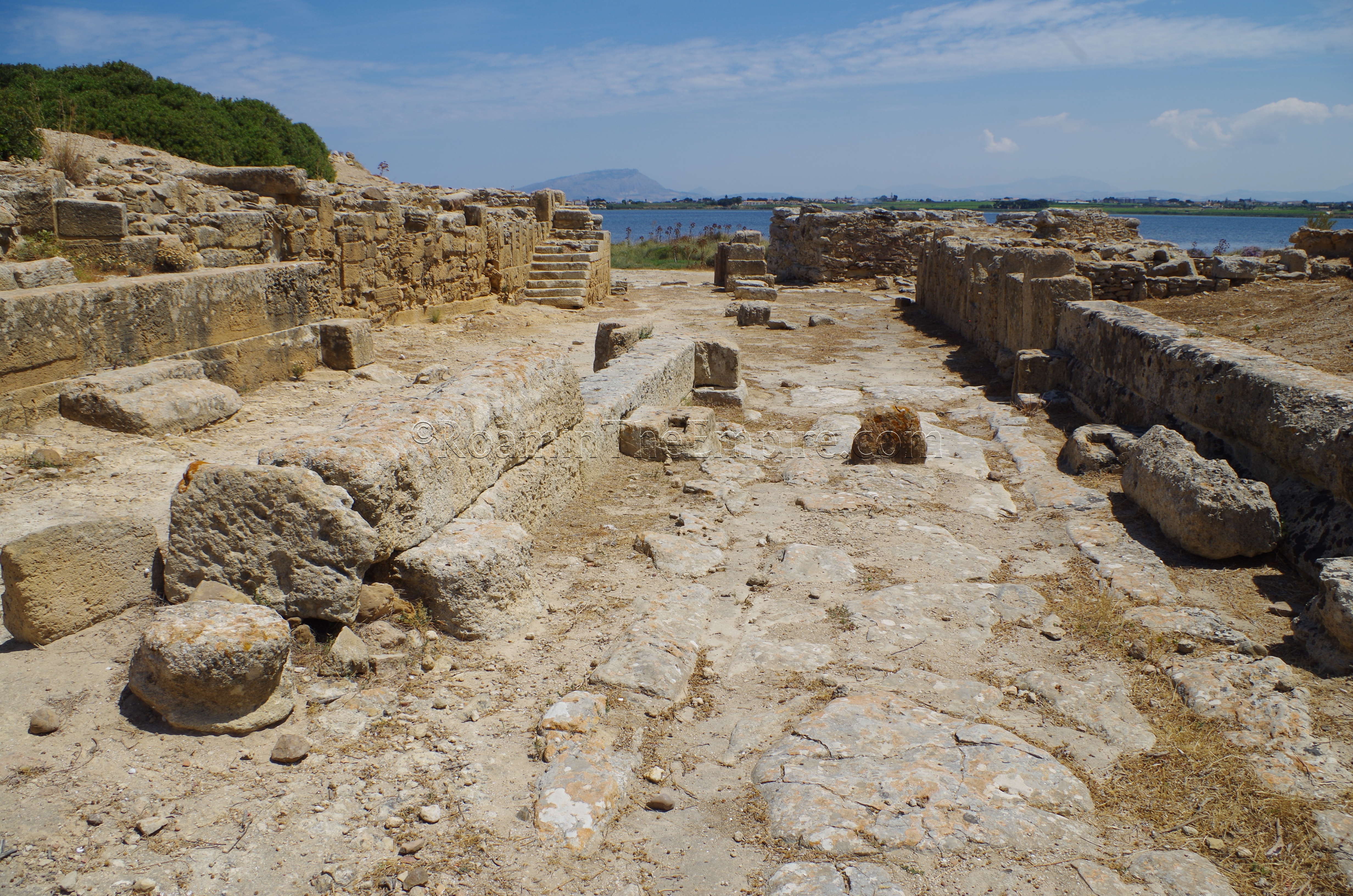
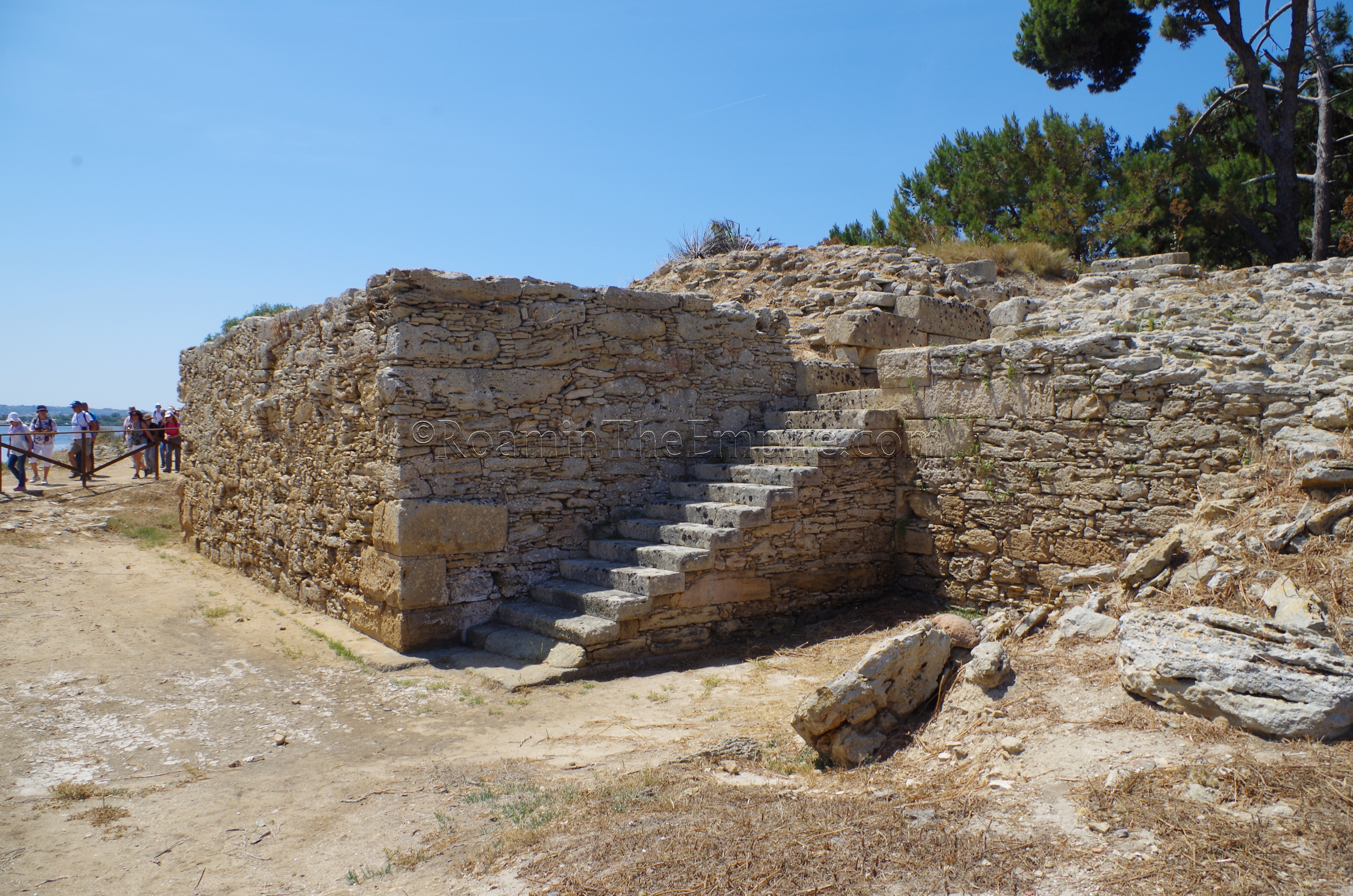
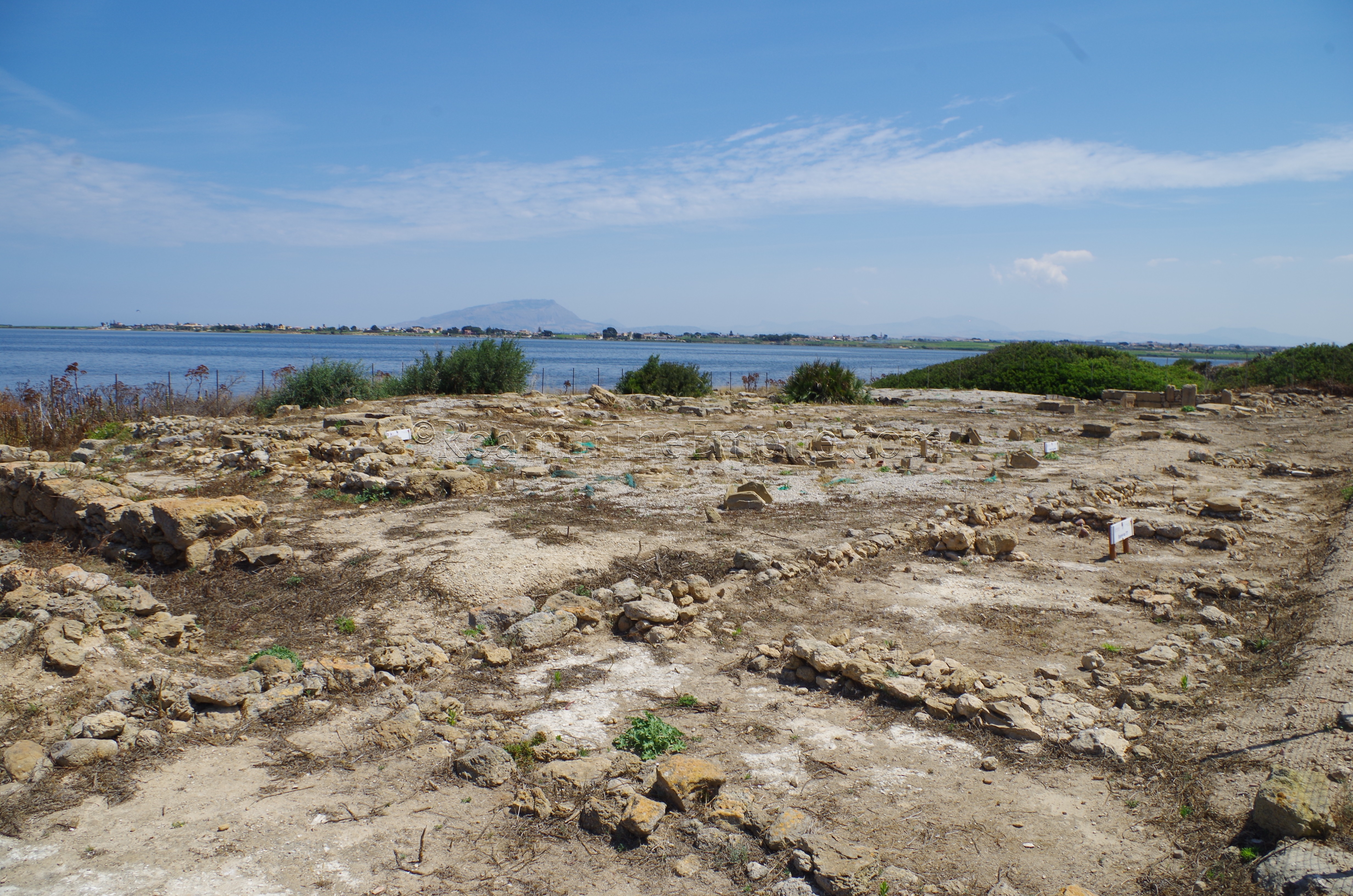
Continuing south/southwest along the shoreline from the House of the Mosaics, some remains of the walls can be seen as well as a barracks with an intact flight of stairs. The remains of the walls eventually lead around to the monumental South Gate, which leads into the sacred area, and just beyond that the entrance to the enigmatic Kothon, around which the sacred area is centered. The Kothon is a large pool with a channel leading out to the sea, which was at one point thought to be an artificial, sheltered harbor. It is now, rather, theorized to be a ritual pool for the surrounding religious precinct. The pool itself was, in antiquity, fed by underground aquifers, rather than by seawater from the channel.
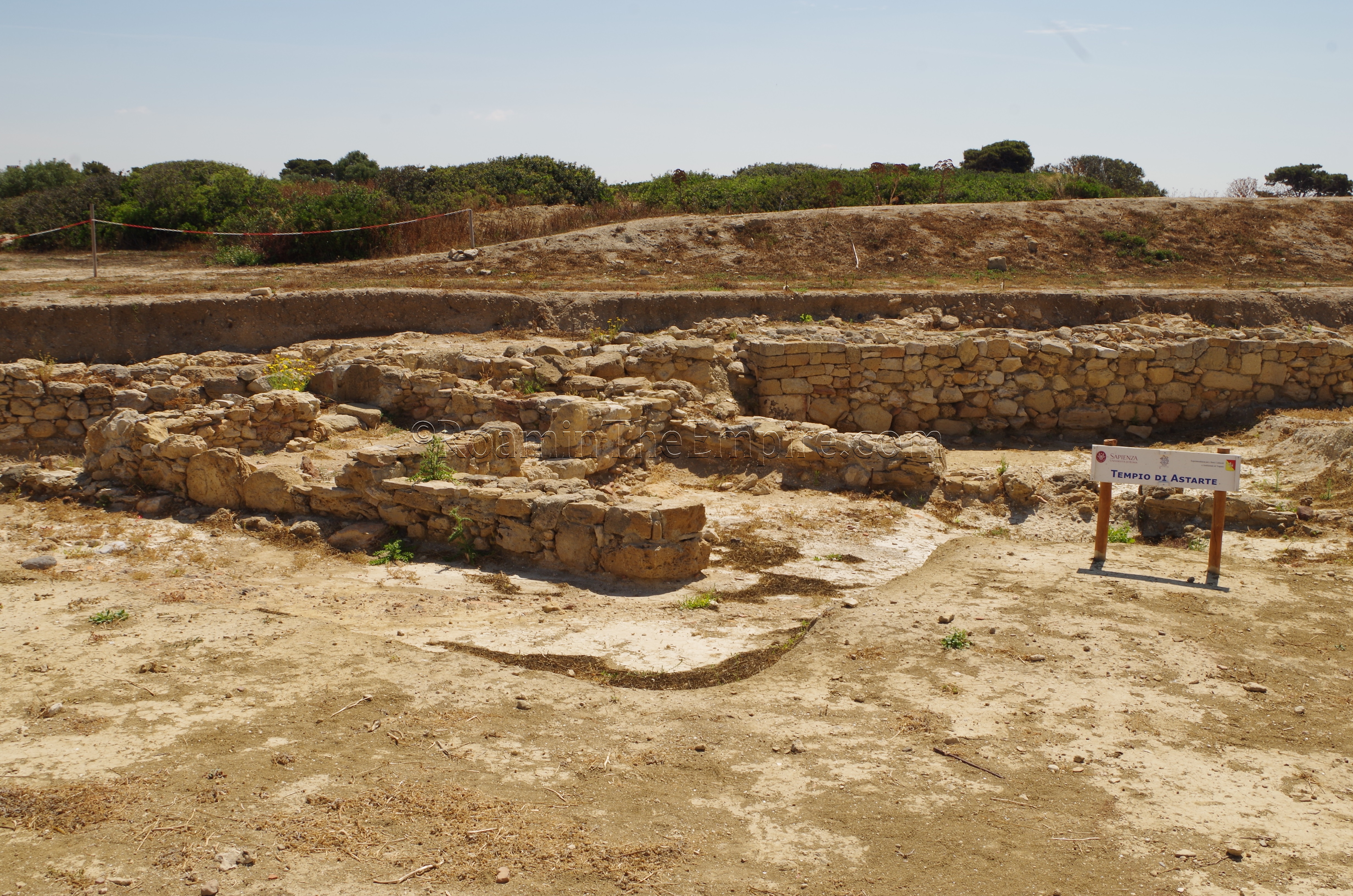
It was this area of the island that was settled first, with some phases of the structures here dating back to the 8th century BCE. A circular temnos radiates out around the Kothon. Contained within the temnos are the excavated remains of three religious buildings and a domestic structure, the latter of which probably dates to the original settlement and is positioned up against the city walls. From there, there is the Kothon Temple, a temple dedicated to Baal Addir-Poseidon, a small temple dedicated to Astarte, and a water-related sanctuary of some sort, with no definitive deity associated with it.
Most of the interior of the island is unexcavated, but there are a few houses around the museum that are uncovered, though in varying stages of visibility. A cluster of well-maintained houses are located on the path back towards the museum from the sacred area (the inland path). To the north of the museum, on the path towards the north side of the island, are the remains of another house, but it is overgrown and largely inaccessible.
In the northwest of the island, along the coast is the Tophet Sanctuary, a sanctuary associated with the urn burials of sacrificial victims; both human and animal. The Tophet, in particular, is popularly associated with the child sacrifices performed by the Carthaginians, the practice of which literary and archaeological evidence supports, though the scale is a matter of debate. Amid the sanctuary are various structures including a well and a shrine, probably to Baal Hammon, the god associated with the child sacrifice ritual. Adjacent to the Tophet is a necropolis, which is actually intersected by the construction of the 6th century BCE wall. The construction of the wall and the impact it had on the necropolis at this location probably led to the use of a necropolis on the mainland near the end of the causeway.
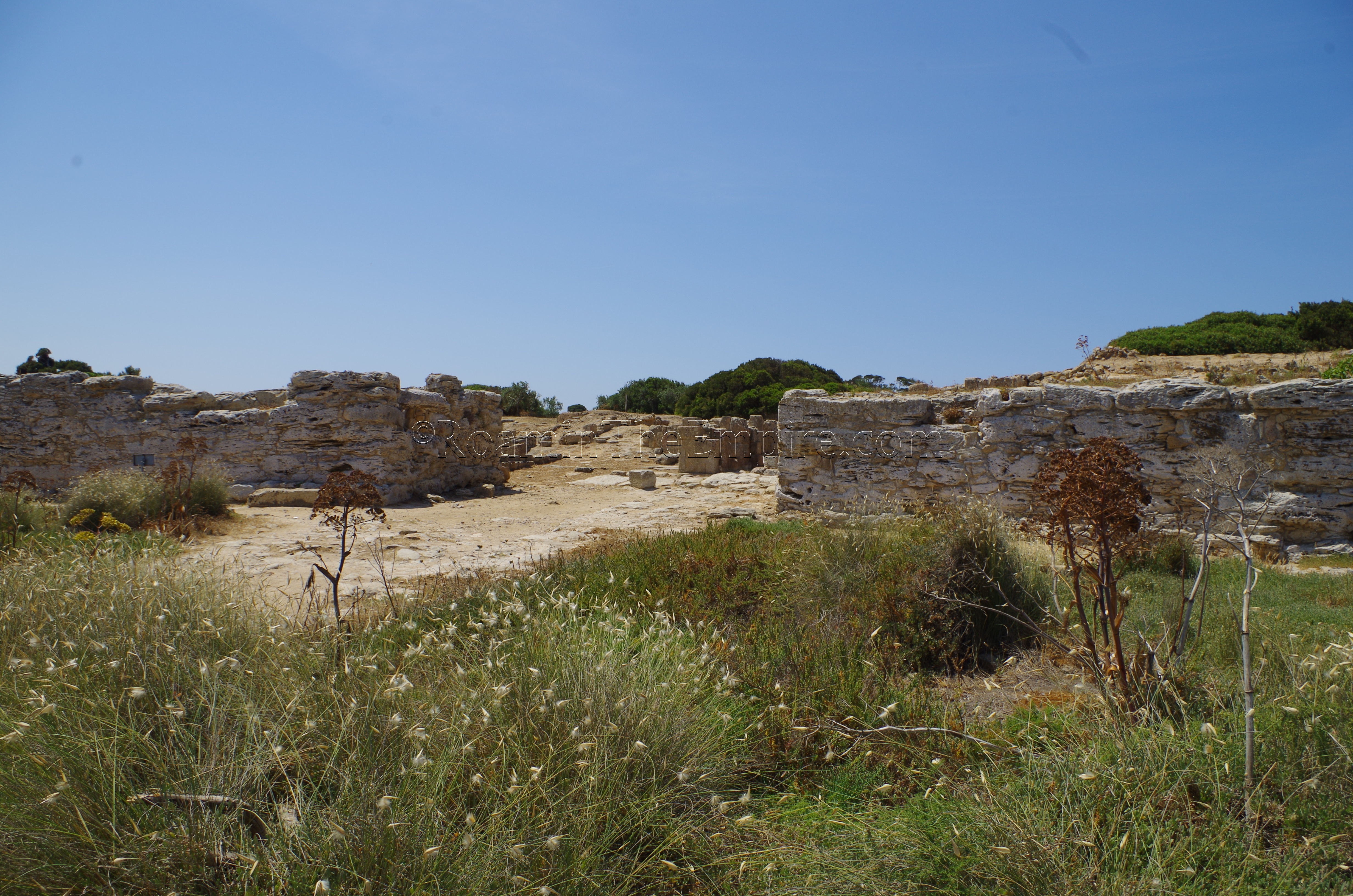
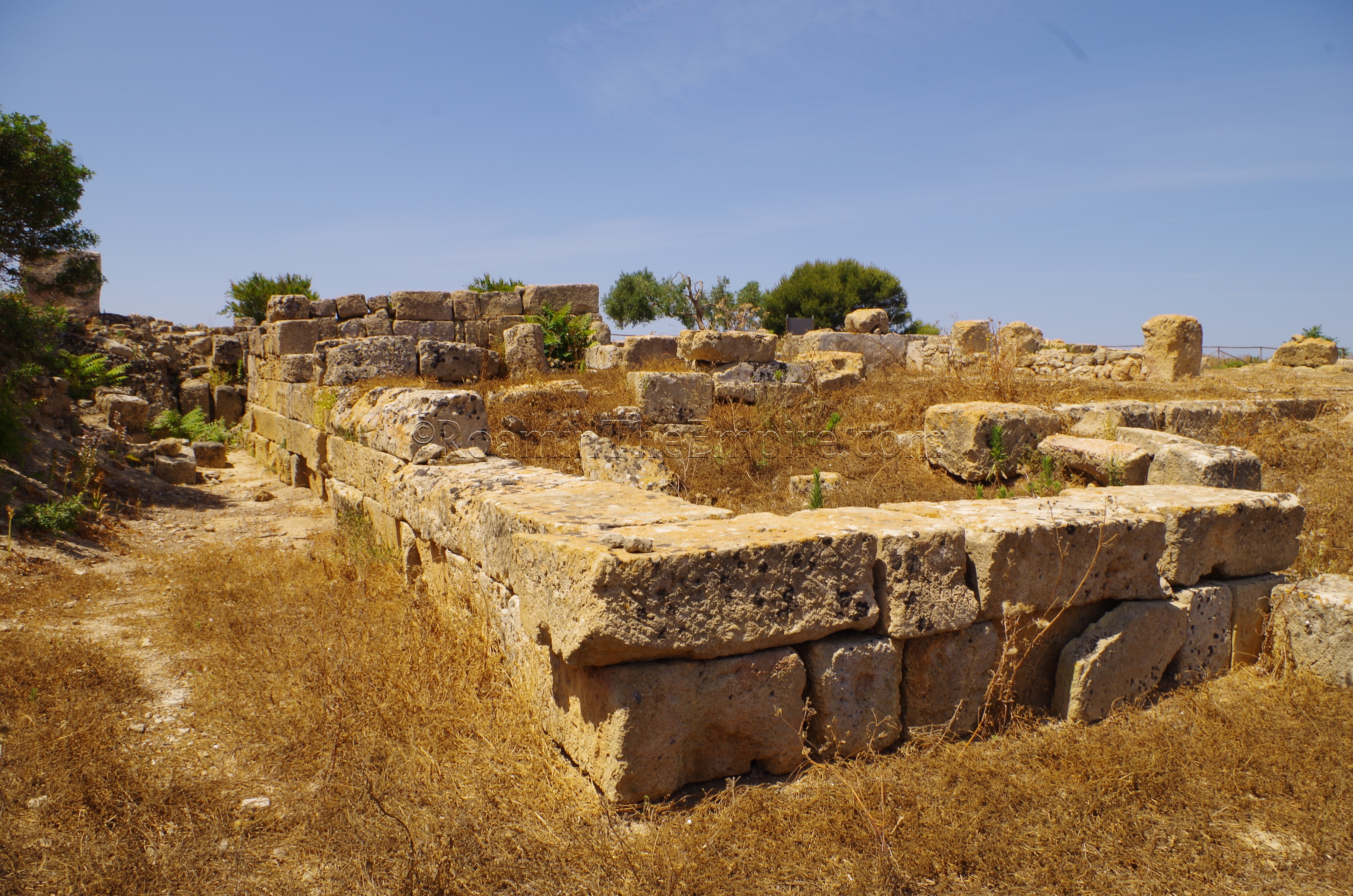
Continuing east along the north shore, eventually the North Gate is reached. It is from this point that the causeway from the island to the mainland originated. Though most of it is gone, some vestiges of it can be seen from the shore (and it is quite visible from satellite maps). Between the North Gate and the shore are a pair of shrines (largely overgrown when I visited) on either side of the road, the dedication of which are unknown. There is some possibility that their location may indicate use by non-Phoenician/Carthaginian inhabitants of the city, perhaps Greek. The North Gate is well-excavated and fairly well-preserved, including paving stones on which cart ruts can be seen, and stairways to the towers.
About a hundred meters inland from the North Gate is the Cappiddazzu Sanctuary, a large public building of uncertain use. The layout and the presence of some animal bones possibly associated with sacrifice lend credence to the theory that it was a religious structure, possibly a housing for several small sanctuaries, but there has yet to been found any conclusive evidence allowing for a definitive determination of its use. The remains of a post-destruction structure, probably a Byzantine church is present at the location as well. Extending south from the North Gate along the shore are the eastern walls of the city, which are quite extensively excavated and preserved, including the East Gate of the city.
Despite the fact that Motya is quite an ordeal to get to, particularly without a personal vehicle, it is absolutely worth the trouble. I can’t say for sure, but, I’d wager there may not be any better Punic remains in Europe, and given that most other Punic colonies, including Carthage, have significant subsequent layers of habitation, I’d wager that Motya’s remains are among the best preserved Punic remains period. Anyone with any interest in the Phoenicians and/or Carthaginians certainly shouldn’t miss this one.


Sources:
Diodorus Siculus, Bibliotheca Historica, 13.54-63, 14.47-53, 22.10.
Holloway, R. Ross. Archaeology of Ancient Sicily. Routledge, 1991.
Isserlin, B.S.J. and J. B. S. Isserlin. “The Cothon at Motya: Phoenician Harbor Works.” Archaeology, vol. 27, no. 3, July 1974, pp. 188–194.
Ruggieri, G. Aldo. “Motya and Lilybaeum.” Archaeology, vol. 10, no. 2, June 1957, pp. 131–136.
Smith, Christopher John. Sicily from Aeneas to Augustus: New Approaches in Archaeology and History. Edinburgh Univ. Press, 2007.
Stillwell, Richard, William L. MacDonald, and Marian Holland. McAllister. The Princeton Encyclopedia of Classical Sites. Princeton, NJ: Princeton U Press, 1976.
Taylor, Joan Du Plat. “Motya: A Phoenician Trading Settlement in Sicily.” Archaeology, vol. 17, no. 2, June 1964, pp. 91–100.
Thucydides, History, 6.2.
Whitaker, Joseph Isaac Spadafora. Motya: A Phoenician Colony in Sicily. G. Bell and Sons, Ltd., 1921.