Most Recent Visit: May 2021
Located near the northern extent of the Peloponnese at the entrance of the Gulf of Corinth is the city of Patrae (also Patrai or Patra). Today it is located among the modern city of Patras, a name clearly derived from the ancient name. The mythological origins of the settlement date back to a King Eumelos, who was taught agriculture by Triptolemus and founded a city called Aroe, a name derived from the word ‘plough’ in reference to Triptolemus’ gift. He then founded a second nearby city called Antheia, named after his son Antheias. Between the two he founded a third settlement Mesatis, literally deriving its name from the middle position between the two others. During the Dorian migrations, the hero Spartan hero Patreus united the settlements together (possibly along with four others) into a single entity and named it after himself; Patra. The acropolis was apparently still called Aroe, though.
During the Peloponnesian War, Patrae supported the Athenians. A naval battle was fought off the coast of the city in 429 BCE between a Spartan/Corinthian fleet and an Athenian fleet under the command of Phormio to establish control over access to the Gulf of Corinth. The Athenians were victorious and maintained naval control of the gulf. In 419 BCE, the people of Patrae were convinced by Alcibiades to construct long walls in the manner that Athens had, connecting the city with the port. Following the death of Alexander the Great, the city was controlled by Cassander, who was then driven out by the Antigonid general Aristodemus in 314 BCE.
Patrae, along with Dyme, another settlement along the coast to the southwest, was the first city to expel the Macedonians in 280 BCE. This led to Patrae playing a significant part in the re-establishment of the Achaean League to counter Macedonian power in Greece. The following year, Patrae was among the few Achaean cities that sent troops to aid the Aetolians during the Gallic invasions. Patrae is noted as being a point at which Philip V disembarked during campaigns in the Peloponnese during the Social War, at which point the Achaean League was allied with the Macedonians. The defeat of the Achaean League at the hands of the Romans in 146 BCE led to either the destruction or large scale abandonment of Patrae, though harbor seems to have still remained in use to some degree and the city does seem to have rebounded somewhat by the middle of the 1st century BCE with notable visitors such as Cicero.
During the Caesar’s Civil Wars, Cato the Younger captured Patrae in 48 BCE, but it was re-captured by Quintus Fufius Calenus shortly thereafter. Prior to the Battle of Actium, Marcus Antonius wintered at Patrae in 32/31 BCE. The city was captured by Agrippa shortly before the battle. Following the battle, the convenient location of the port for travel between Greece and Italy led to the establishment of a colony by Augustus in 14 BCE with veterans from Legio X Gemina and Legio XII Fulminata. The new name of the colony incorporated the original settlement’s name; Colonia Aroe Augusta Patrensis. Patrae was also declared a civitas libera and given control of a significant amount of the surrounding territory and smaller settlements.
The city flourished in the imperial period with Nero disembarking here for his tour of Greece and adding the honorific title of Neronia to Patrae’s official title. Pausanias notes women outnumbering men in the city by a ratio of 2 to 1 in the mid-2nd century BCE, in part owing to the superior flax grown in the region and used for garment making. Many improvements were made in the 2nd century CE, particularly under Hadrian and Antoninus Pius. An interesting note is that Apuleius’ Metamorphoses is said to be based on a work either written by a Lucius of Patrae, or features the figure as the narrator of the story. A devastating earthquake around 300 CE seems to have sent the city into a hastened state of decline from which it would not recover until the Byzantine period.
Getting There: Modern Patras is the third largest city in Greece behind Athens and Thessaloniki and is relatively well-connected to the rest of Greece. Trains leave hourly from Athens to Patras via a connection in Kiato. The total transit time depends on the train as the connecting trains in Kiato leave less frequently, and so the stopover time can be lengthier (though perhaps long enough for a side trip to Sicyon). But including this stopover time, the total journey can be between about 3 and 6 hours and costs 17 Euros for the single journey. Details of the schedule can be found here . A personal vehicle is, of course, also a good option, though I found street parking in Patras to be a bit of a challenge, even though I stayed a little bit out of the center.
The remains of the Roman city of Patrae are quite extensive, though spread out and often poorly maintained or noted aside from a few of the major monuments. And by spread out, most of them are still within about a square kilometer, with a few exceptions, but are mostly not part of any real cohesive archaeological area, but rather just excavations in lots among the modern buildings of the neighborhood.
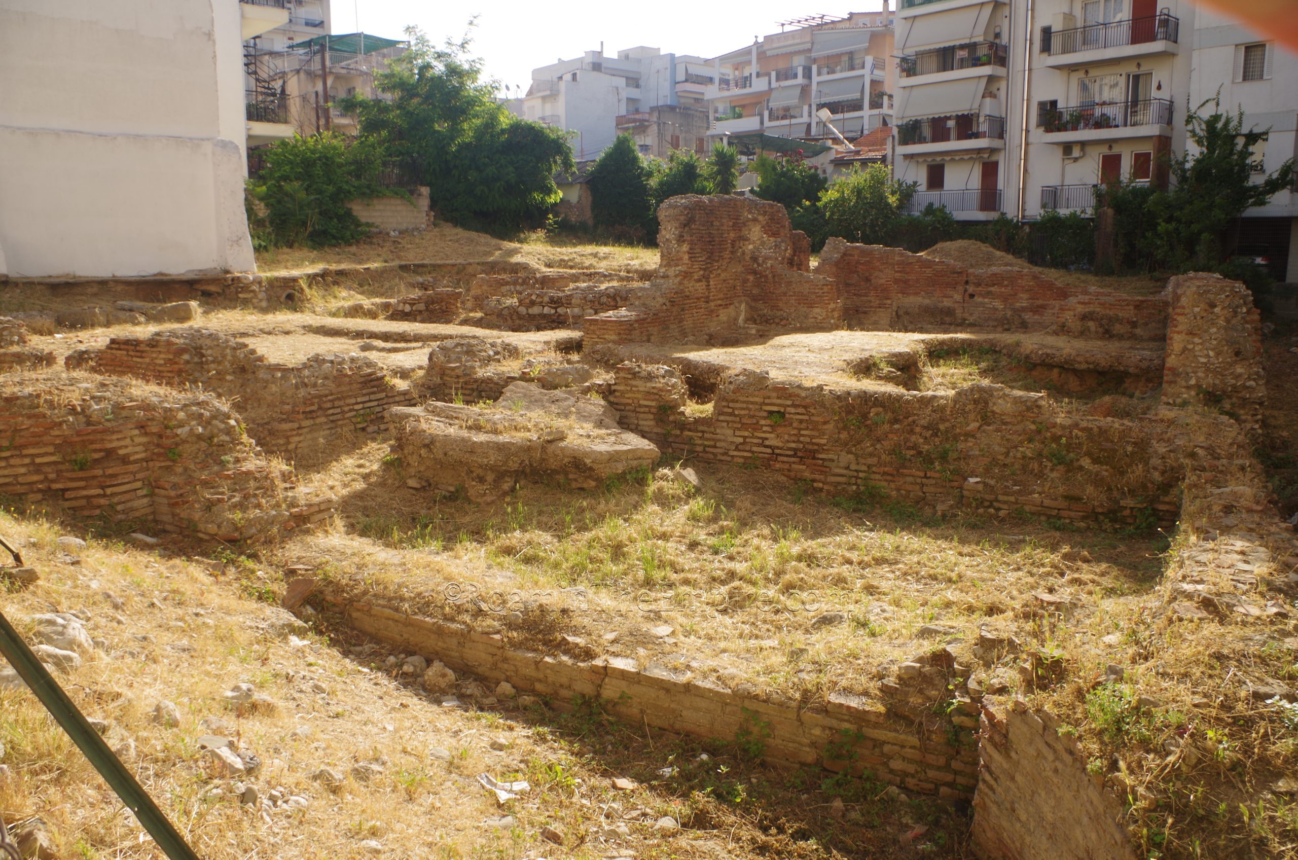
The first stop was the southernmost of the remains, a bathing complex along Vasiliou Roufou. A sign in front of the excavated lot notes that these are the remains of Roman baths, but other than that, there is no information on site. It was probably one of the better cared for of these types of sites; the brush had been cleared recently and the form of the building was easy to distinguish. Most notable was, in the southern part of the site, a large room with a raised floor that had been partially cut away. Though there didn’t seem to be any visible hypocaust system holding up the flooring, it perhaps could have been one of the heated rooms. There is no direct access to the baths, as it is fenced, so one can really just view it from the street.
A few blocks to the northwest, along lower Athanasiou Diakou are the remains of a large retaining wall dating to the Roman period. Two streets named Athanasiou Diakou actually run parallel, with one running on the upper ridge above the retaining wall to the east, and the other running at the foot of the retaining wall to the west between Sachtouri and Miaouli. The best preserved section of this is right in the middle, at the end of Tsamadou, which is also where the identifying sign is located. The wall apparently dates to the reign of Nero and was used to shore up the side of the hill here, which was located above some of the port constructions. It may also have served as part of the defensive constructions of the city.
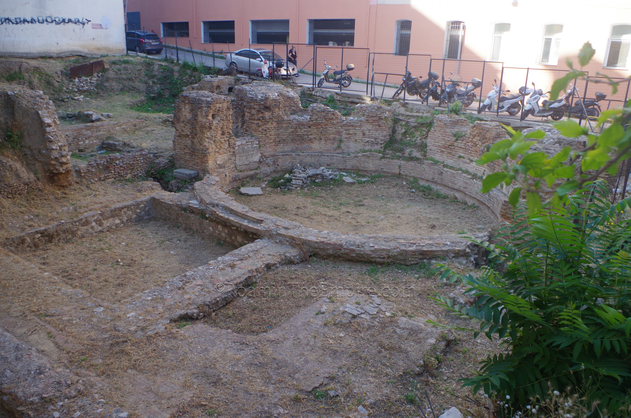
A couple minute walk from there to the north, at the intersection of Ioannou Vlachou and Kanari is a structure identified as a nymphaeum. The main feature of this set of remains is the large circular structure, which is preserved to a greater height on the west side, up against Kanari street, which reveals the presence of niches that would seem to follow the form of some nymphaea. Semicircular constructions along the rear of the higher wall are also reminiscent of tanks used to supply water to such a structure. Aside from the circular structure, there are a few rectilinear structures surrounding it, including a rather large space on the northeast side. I couldn’t find any information on dating or really anything regarding the structure. Like the baths, it is relatively well taken care in terms of having the vegetation cleared away. It is also fenced and only visible from outside along the adjacent streets.
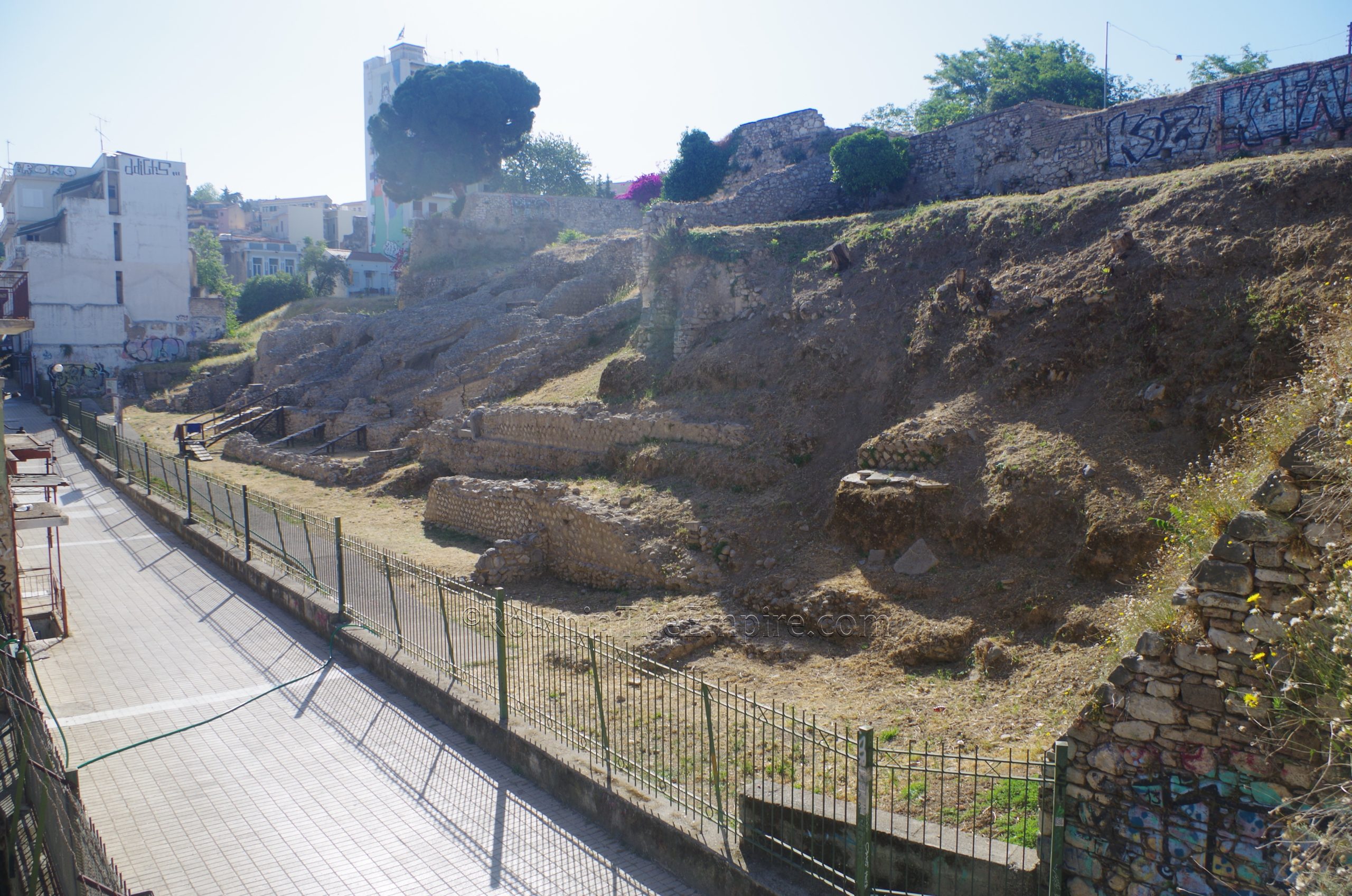
To the northeast a few blocks along Alexandrou Ipsilantou between Pantanassis and Patreos are some remains of the support structures of the cavea on the north side of the stadium. The stadium was probably built between 80 and 90 CE, during the reign of Domitian, perhaps as part of a program of construction marking the centennial of the Augustan re-foundation of the city. The structure measures 200 meters long by 90 meters wide, giving it a shape that’s almost somewhere between a circus/stadium and an amphitheater. In fact, gladiatorial contests were held there in addition to other sporting events that would typically be held in a stadium and perhaps even theatrical performances. In his description of Patrae, Pausanias does not note the presence of a stadium or amphitheater, but rather notes a theater near the odeon, which would seem to correspond roughly to this location. The area is fenced without any access, and though not completely overgrown, was not cleared quite to the level of the baths or nymphaeum.
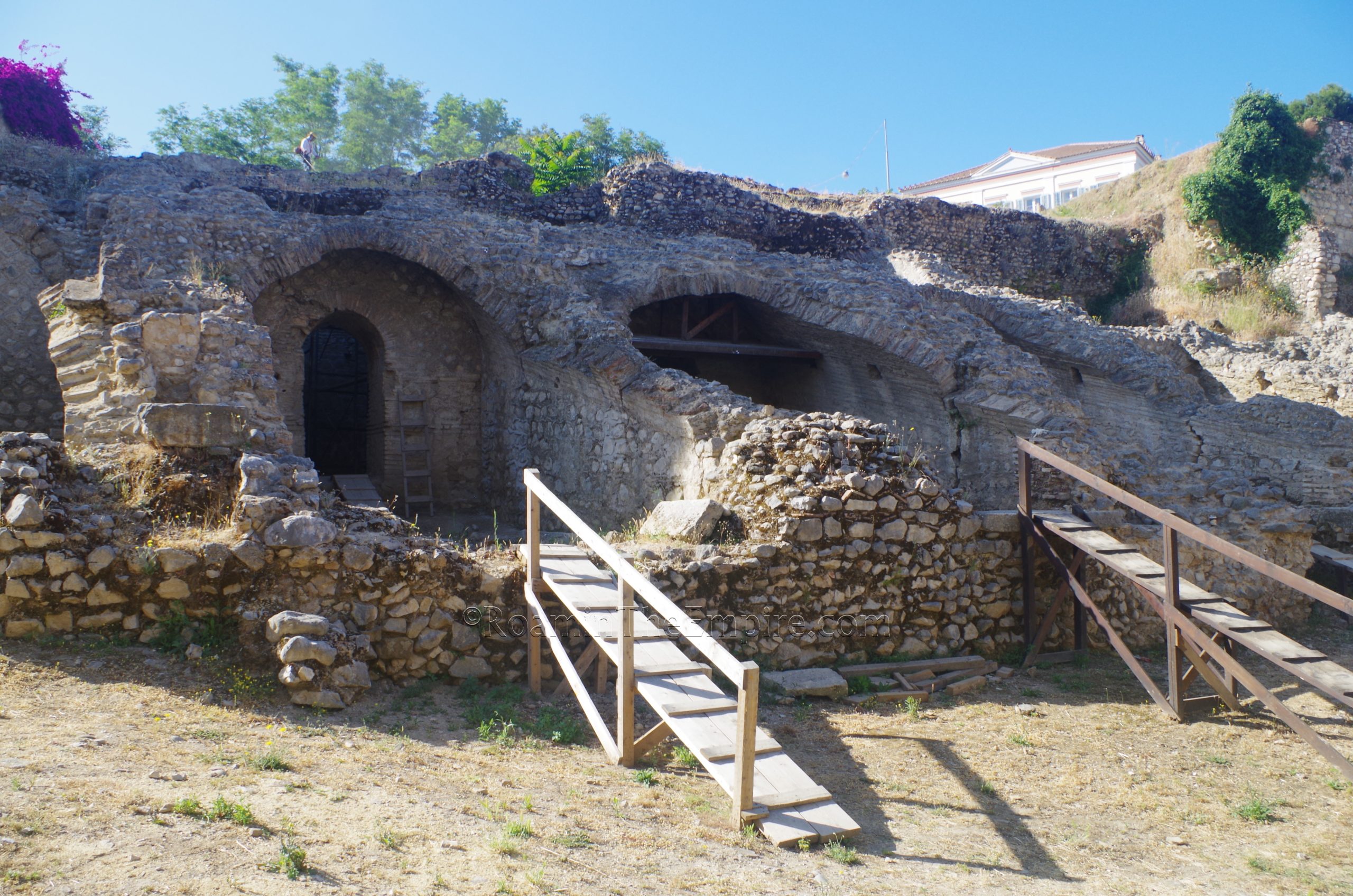
Another larger part of the south side of the stadium can be seen the next street over, along Ifestou, a pedestrian street. Some pretty significant remains of the supports of these southern cavea can be seen. This part of the stadium is built into a rise, part of the same rise the earlier retaining wall secures. A staircase at Patreos street leads up to the top of the rise giving some good views along the way. Not much is visible from atop, though. This area was also fenced off and inaccessible, but was in the process of being cleared when I visited.
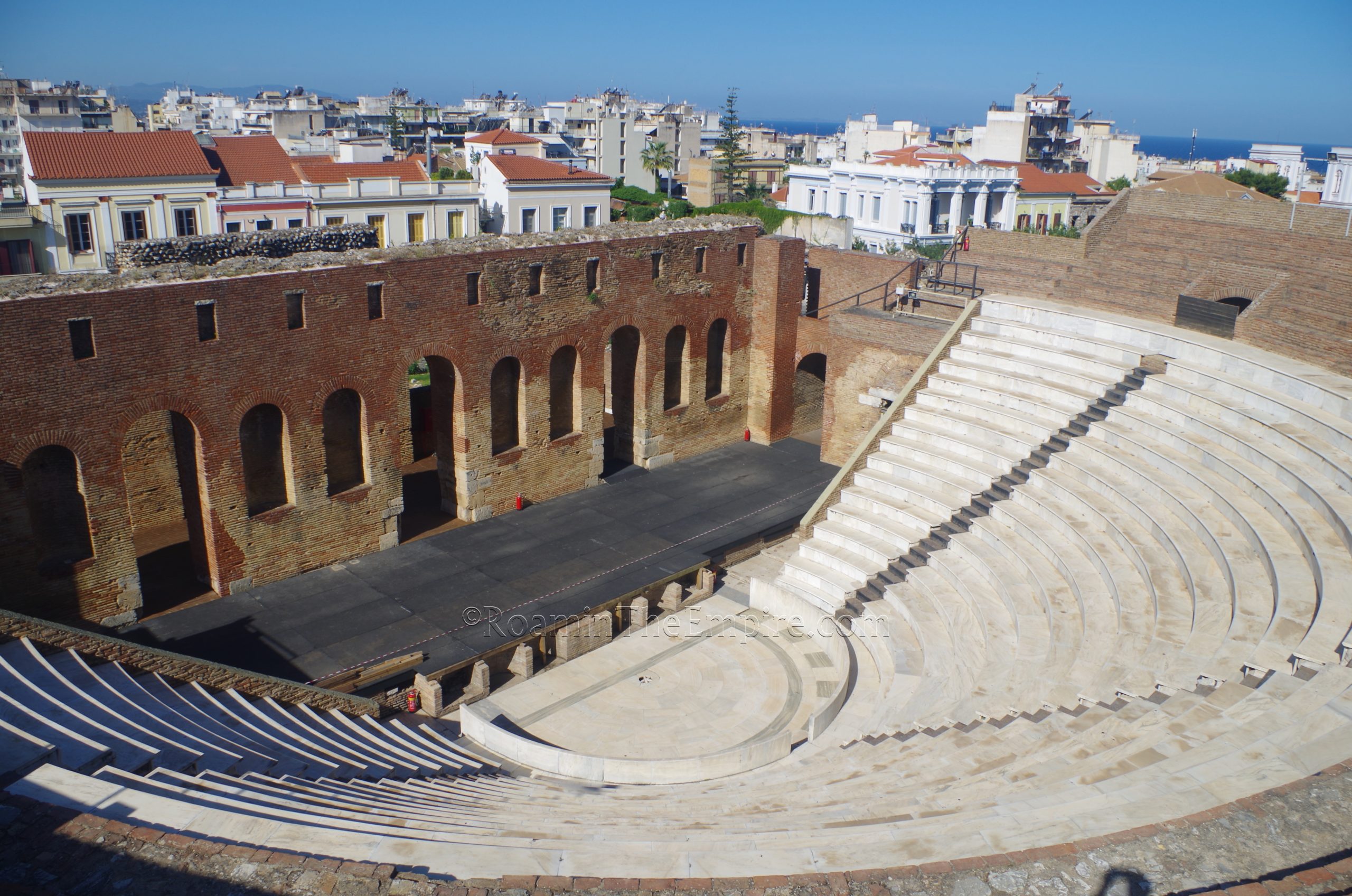
About 100 meters from the top of the staircase over the stadium remains is the odeon. Located officially at Agios Georgios Square, the Roman odeon is open Wednesday through Monday from 8:30 to 15:30. It is closed on Tuesdays. While there is controlled admission to the site, there’s no actual ticket and entrance is free.
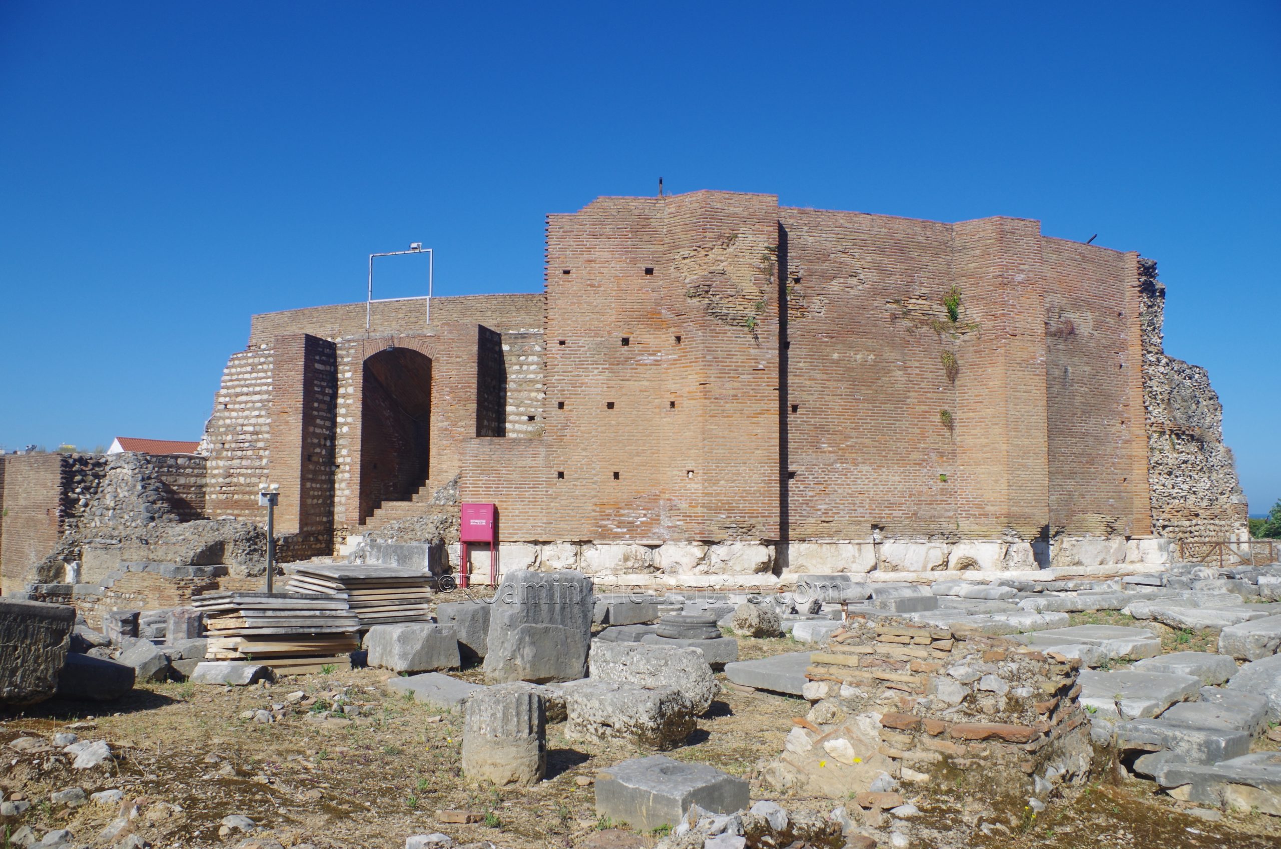
The odeon seems to have been constructed sometime before about 160 CE. It is mentioned by Pausanias, who calls it the largest and finest odeon in all of Greece behind the Odeon of Herodes Atticus in Athens. The interior seating consists of 16 rows of lower seating and 7 rows of upper seating and held an estimated 2,500 spectators. It’s theorized that there may possibly have been additional tiers of seating above the presently preserved/reconstructed 23 row. A statue of Apollo paid for with spoils from Patrae’s expedition to help the Aetolians in 279 BCE was apparently among the decoration here and that the building was dedicated to Apollo, according to Pausanias.. By the 3rd century CE the odeon seems to have been abandoned.
The odeon has been pretty heavily reconstructed. The interior seating area looks almost brand new with marble seating and brickwork. And perhaps that’s because events are held her even today and upkeep is important. Upon close examination, it’s clear what is original and what parts are reconstruction in both the brick and the marble. The newer brick is a slightly darker shade and the marble is a slightly lighter shade than the original. The interior is nearly fully open, there are a few areas that are roped off, but by and large one can walk around most areas, including up to the top of the seating.
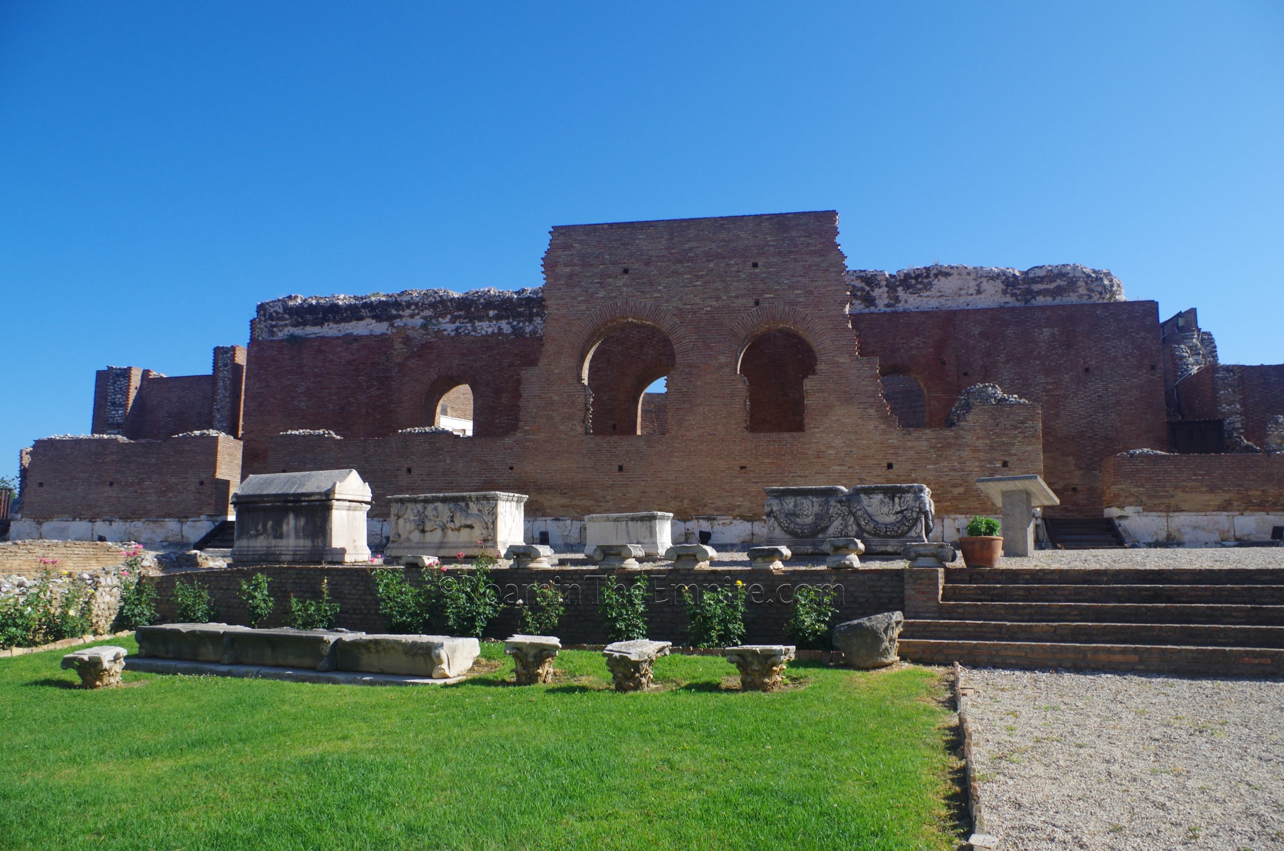
Some structures around the odeon have also been exposed, including a series of rooms on the south side, which includes one with an in-situ mosaic. Another mosaic is preserved in the northwest corner of the archaeological area of the odeon. This mosaic includes a circular area with a mosaicked inscription, of which there was no information on-site and of which I could find no additional information. There was one informational sign in Greek and English.
Kitty corner to the odeon, on the southeast corner of Sotiriadou and Paleon Patron Germanou is an excavated area that I haven’t been able to identify, as it isn’t noted on any of the information I’ve been able to find. There is a circular structure that could perhaps be a well, making use of terracotta bricks, indicating a Roman period or later. What seem to be retaining walls above this would could possibly be later, so it might be a post-Roman set of remains. The area is fenced and was fairly reasonably kept, perhaps due to its proximity to the odeon.
Continued in Patrae Part II
Sources:
Diodorus Siculus. Bibliotheca Historic, 19.66.
Grant, Michael. A Guide to the Ancient World: A Dictionary of Classical Place Names. New York: Barnes & Noble Books, 1997.
Herodotus. Historiai, 1.145.
Koumoussi, Anastasia et al. Short Perimeter Road of Patras: A Road Changing the Archaeological Map of Patras. Patras, Greece: Hellenic Ministry of Culture and Sports, Ephorate of Antiquities Achaea, 2018.
Pausanias. Hellados Periegesis, 7.18-22.
Pliny the Elder. Naturalis Historia, 4.5.
Plutarch. Alcibiades, 15.
Smith, William. Dictionary of Greek and Roman Geography. Walton & Murray, 1870.
Stillwell, Richard, William L. MacDonald, and Marian Holland. McAllister. The Princeton Encyclopedia of Classical Sites. Princeton, NJ: Princeton U Press, 1976.
Thucydides. Historiai, 5.52.


