


Most Recent Visit: May 2021
The founding of the settlement of Sicyon is attributed to the mytho-historical figure Aegialeus, who gave the city its original name, Aigialeia. At other points during the early history of Sicyon, it was apparently also called Telchinia after the mythological Telchines and Mekone, a reference to the poppies that grow prolifically on the plain on which Sicyon sits, between the Asopos and Elisson rivers, in the spring. This Mekone is also believed to be the location at which Prometheus tricks Zeus into choosing an inferior sacrifice at a meeting between mankind and the gods to decide sacrifices to the gods, ultimately resulting in the denial of fire to humans by Zeus as revenge. The name Sicyon itself seems to derive from a word meaning gourd, which also grows in great numbers in the area.
Following its founding, Sicyon was ruled by a series of twenty-four kings until it was conquered by Mycenae under the rule of Agamemnon. The city is then subsequently conquered by the Dorians from Argos, who control Sicyon until 676 BCE, when the Orthagorids seize control and establish a tyranny. The most important of the Orthagorids is Cleisthenes (grandfather of the famous Athenian of the same name), who reforms the constitution and introduces Dionysian worship to the city during his rule between 600 BCE and 560 BCE. During this time, the artistic schools for which the city would later become famous were first established. Orthagorid rule comes to an end in 556 BCE, when the city is conquered by Sparta and an oligarchy is established.
Sicyon remains under Spartan control/influence during the Persian Wars and contributes 15 triremes to the Battle of Salamis and 3,000 hoplites at the Battle of Platea, of which Sicyon is named in the fifth position on the Serpent Column at Delphi for their contribution. The city remains loyal to Sparta during the Peloponnesian War, contributing troops to the relief of Syracuse during the Athenian Expedition. Though usually friendly with nearby Corinth as well, during confrontations between Sparta and Corinth, Sicyon would always side with the Spartans. In 369 BCE, the city was captured by Thebes and Euphron of Sicyon took the opportunity to overthrow the oligarchy and establish a short-lived democracy and then tyranny before being killed by Siconian aristocrats in Thebes in 366 BCE.
It is during the 4th century BCE that Sicyon becomes a center of art in Greece, giving rise in particular to painting schools under Eupompus and sculpture schools under Lysippus. The schools produce famed painters Apelles and Pausias. Following the Battle of Charonea in 338 BCE, a Macedonian garrison was established at Sicyon. In 314 BCE, the Macedonian commander of the Sicyon garrison was murdered and his wife, Cratesipolis, ruled the city until 308 BCE, when she turned it over to Ptolemaic commanders. Sicyon was recaptured by the Macedonian general Demetrias Poliorcetes in 303 BCE, who destroyed the city on the plain (apparently near modern Kiato) and re-established it with a new name, Demetrias, on a hill to the south. The new name, however, did not endure for very long.
The next half a century alternated between tyranny and brief periods of democracy, notable for the frequently violent end of those who ruled. In 251 BCE, the city was captured by Aratus of Sicyon, who expelled the tyrants, re-established democracy, and brought Sicyon into the Achaean League to fight against the Macedonian hegemony. Aratus became an important military leader in the league. Sicyon remained a democracy until the Roman dissolution of the league following the destruction of Corinth in 146 BCE. Shortly before and after this, in 153 BCE and 141 BCE, Sicyon suffered significant destruction in a pair of earthquakes. The destruction of Corinth also brought Sicyon new regional prominence and administration over the Isthmian Games until the rebuilding of Corinth in 44 BCE. In 87 BCE, the city was sacked by Sulla during the First Mithridatic Wars, resulting in the looting of many artworks. Sicyon is also noted as being heavily in debt by the mid-1st century BCE, which combined with the restoration of Corinth and the loss of the Isthmian Games, appears to have driven the city into a state of decline. In the middle of the 2nd century CE, another earthquake devastated the city and by the time of Pausanias’ visit in the latter half of the century, the population city seems to have been significantly reduced, though not completely abandoned.
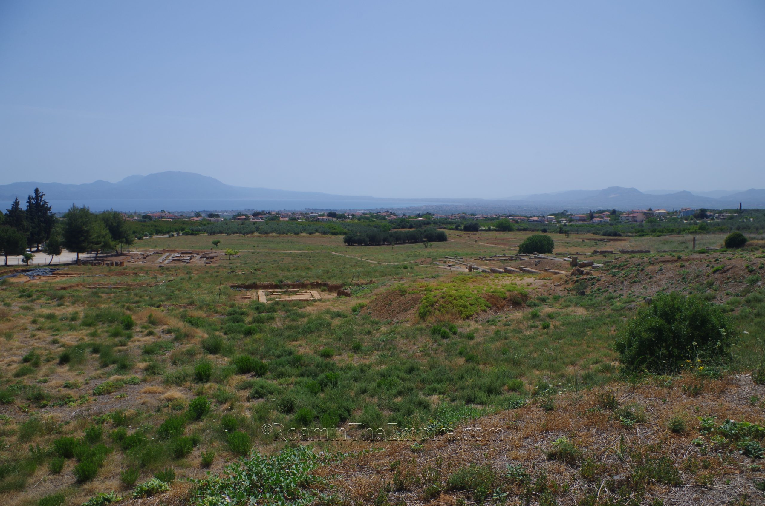
Getting There: Modern Sikyon is a rather small town, and as such, there doesn’t really seem to be any sort of easily accessible public transportation connections with the larger cities in the region, such as Corinth. I’m sure there is some connection, but it is likely geared mainly toward locals. The archaeological area is a bit outside of the modern town as well, so really the best means of exploring the remains of Sicyon is by private vehicle. The site is approximately a half an hour by car from Corinth, and as it is on the outskirts of the modern town, parking is pretty easy and ample.
The archaeological area and museum of Sicyon are located northwest of the modern town at Epar. Od. Sikionas-Nemeas 202. Both are open daily from 8:30 to 15:30, except on Tuesdays when they are closed. Admission to the archaeological area and museum is 4 Euros, and is purchased at the entrance to the museum.
The first building encountered upon entering the archaeological area is the Archaic Temple. This temple is thought to be dedicated to Artemis Limnaia, though it is also possibly the temple dedicated to Apollo, mentioned by Pausanias. A temple was first constructed here in the 6th century BCE, which then underwent a rebuilding or renovation in the 4th century BCE. A third phase of construction occurred in the late 4th century BCE, probably around the time of the rule of Demetrias Poliorcetes. The foundations of this temple are what remain visible and excavated to this day. The temple was then likely destroyed in the earthquake of the mid- 2nd century CE. In the 4th or 5th century CE, a Christian basilica was built on the site of the temple.
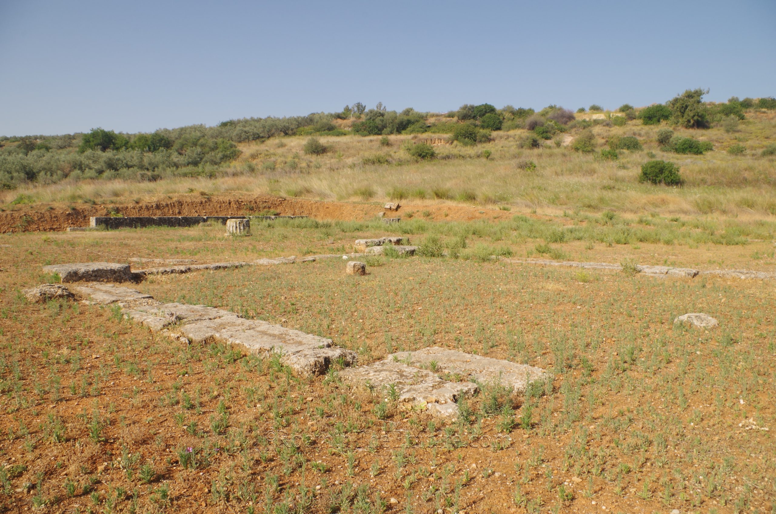
There’s a couple of excavated areas to the west of the Archaic Temple that seem to be in the process of exploration, as there were tarps covering some areas and some of the work looked rather recent. The area isn’t really on the visitor’s path, as there is no information available, but the custodian that was monitoring my visit didn’t seem to have a problem with me tromping through the low brush to get a look and some pictures of the area. The best I can figure, this might be some sort of structure associated with the palaestra/gymnasium to the south, as the reconstruction of this area on the maps seems to parallel the adjacent building, though, again, there’s no actual identification given. One structure in the southwestern part of this area looks like it might actually be another, smaller temple.
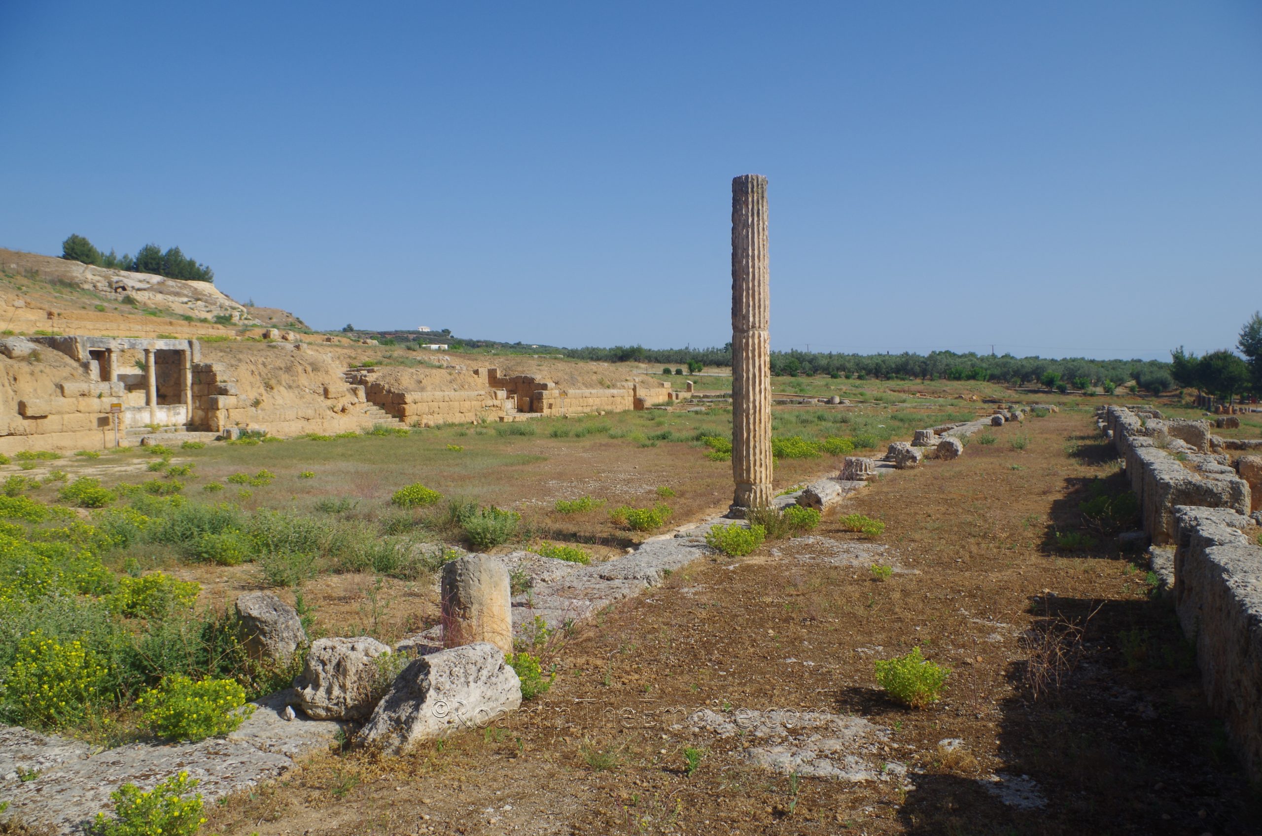
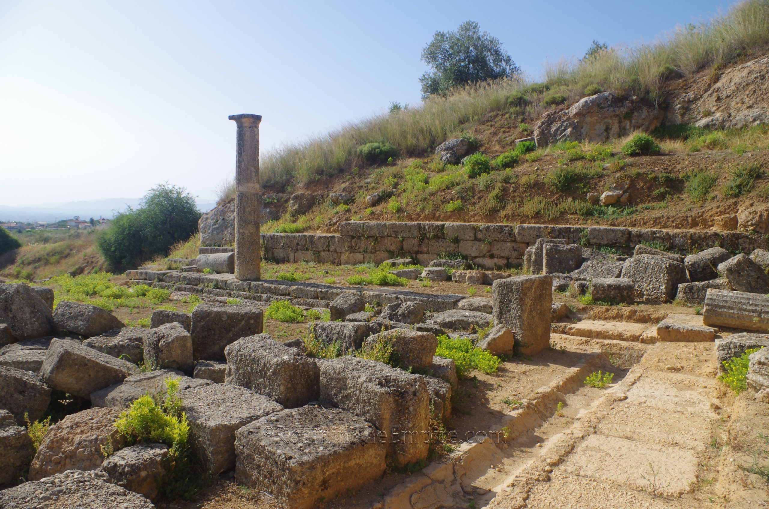
Southwest of the Archaic Temple is the palaestra/gymnasium, situated on two levels on the slope of the hill on which the Hellenistic acropolis stood. The two terraces were constructed during separate periods. The lower terrace dates to about 270 BCE and is identified as possibly being the Gymnasium of Kleinias mentioned by Pausanias. Kleinias was an archon and the father of Aratus of Sicyon. The structure consisted of a roofed building on the south, east, and northern sides with an internal colonnaded courtyard. Along the west side was a retaining wall, into which were built two fountains. Between the two fountains and at either extent of the wall were staircases leading up to the upper terrace. The original entrance to this building, which was walled up in the Roman period, was on the northwest corner.
The upper terrace was constructed sometime during the Roman period. The constructions on the upper terrace mirrored that of the lower terrace with a roofed building on the north, west, and south side and an internal colonnaded courtyard in the center, effectively creating a completely enclosed internal area between the two terraces. Along the west side, and accessible from the western part of the building, was a sanctuary to the Nymphs carved into the slope of the hill. A natural spring was located here in antiquity. Both terraces were damaged in the 2nd century CE earthquake, but seem to have been repaired in the 3rd century CE. Most of the areas of the two terraces are accessible to visitors.
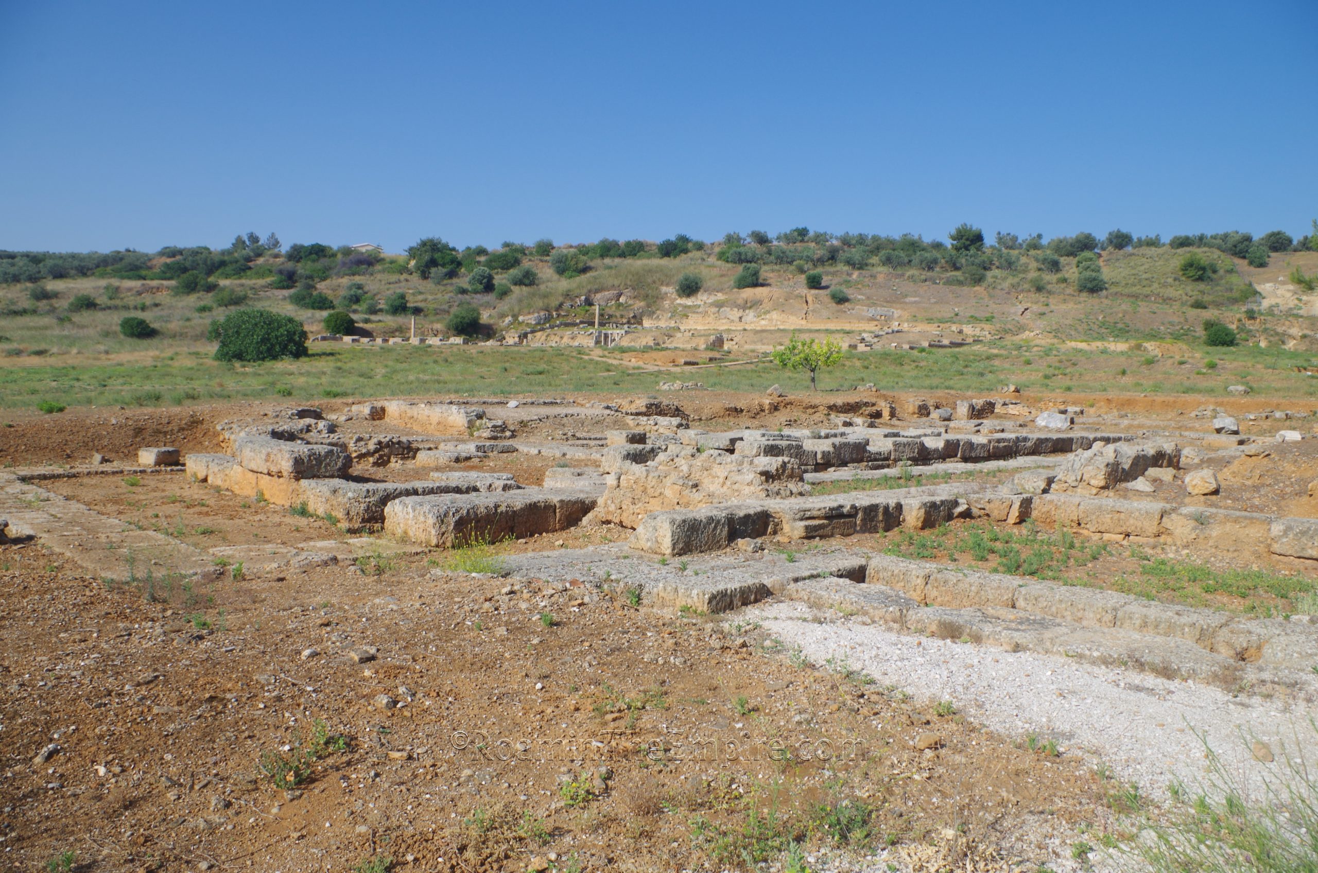
Heading east from the palaestra/gymnasium is a square building identified as the bouleterion, the meeting place for the town council. This building was originally constructed in the first half of the 3rd century BCE. The form of the building seems to have been first stone and later earthen seats (none of which remain in situ due to their material, but of which remains have been found) arranged as a small amphitheater around a central square area that is still visible. Some inscriptions dating to the Roman period have been found on the slabs that formed the base for the railings around this central area. I couldn’t make out any legible inscription on any of them, though there were markings in the stone that were perhaps the badly weathered remains of said inscriptions. During the Roman period, however, the bouleterion was converted into a bathing complex, of which two basins sunk into the ground on either side of the south axis of the central square seem to be associated with, and which can still be observed on site.
Just east of this is the so-called Long Stoa or Painted Stoa or Stoa of Lamia, after the mistress of Demetrias Poliorcetes with whom it is associated. It seems to have been constructed in the early 3rd century BCE, though some dating puts it at the 2nd century BCE. Later, the building was converted from shops into workshops and was then subsequently destroyed in the 2nd century CE earthquake that devastated much of the city. A wooden walkway guides visitors around the site, other than the excavations west of the Archaic Temple, and signs in both Greek and English give information and diagrams on each of the major buildings encountered.
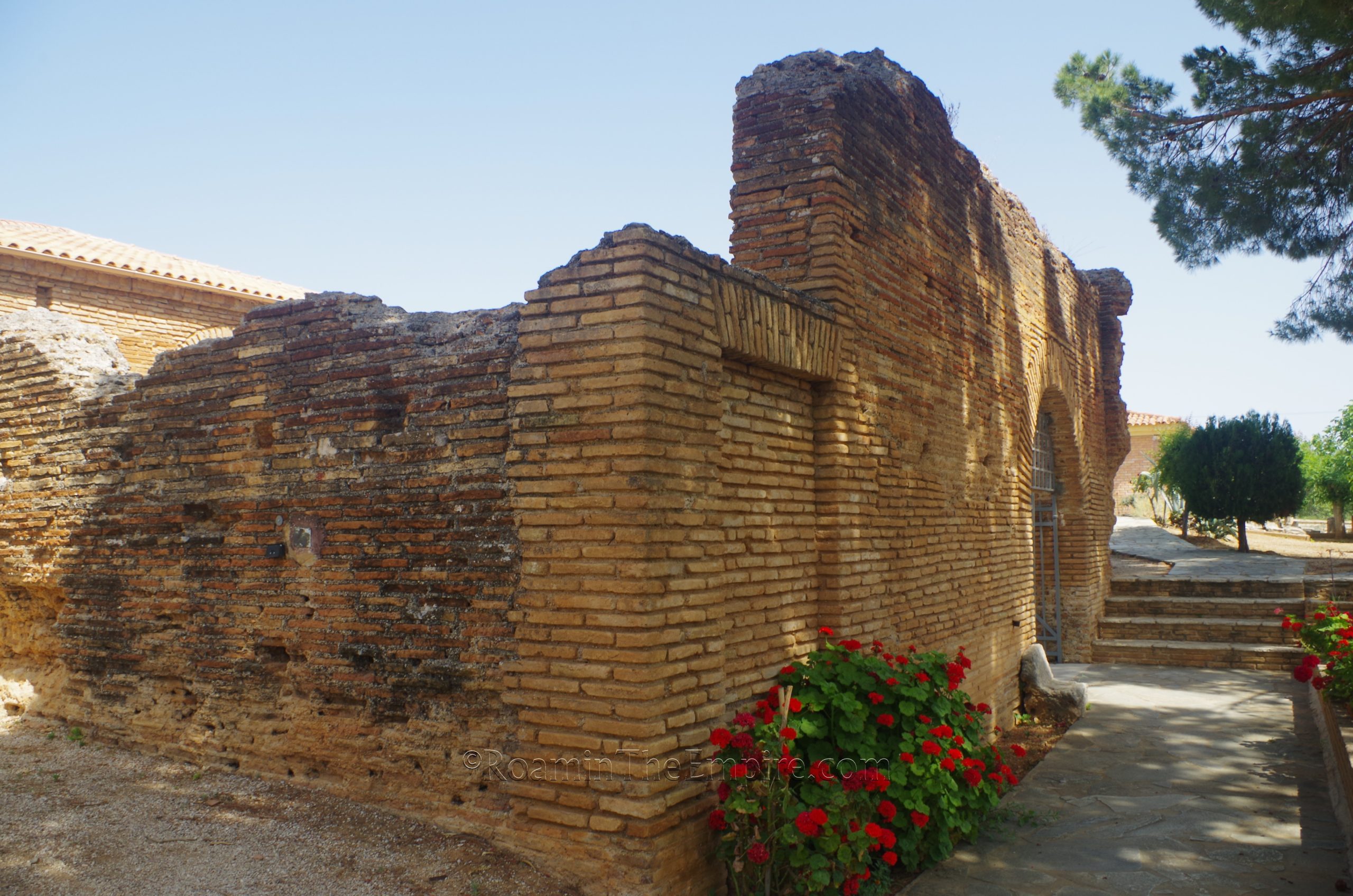
Across the street from the archaeological area is the archaeological museum, which is actually housed in the remains of a 2nd or 3rd century CE Roman bathing complex. The walls in some places were preserved to a height of 4 meters. The rooms that serve as the museum were obviously restored significantly and given roofs, but the idea is pretty interesting in and of itself. Aside from the rooms that are restored, there are other scattered remains associated with the baths around the grounds of the museum, so it’s really worth it to take a little walk around the exterior of the museum to see some of these.
The museum itself is really well presented. There are lots of informational signs in both English and Greek around the museum. I found the staff here, in particular, to be extremely helpful and accommodating. In fact, when it was obvious I was having trouble getting a picture of something due to the backlighting from a window, one of the staff offered to close some blinds (which were up high on the wall and required a special rod to close, so it was actually quite a bit of trouble) in order to eliminate some of the glare I was getting. It was overall a really great experience for a museum.
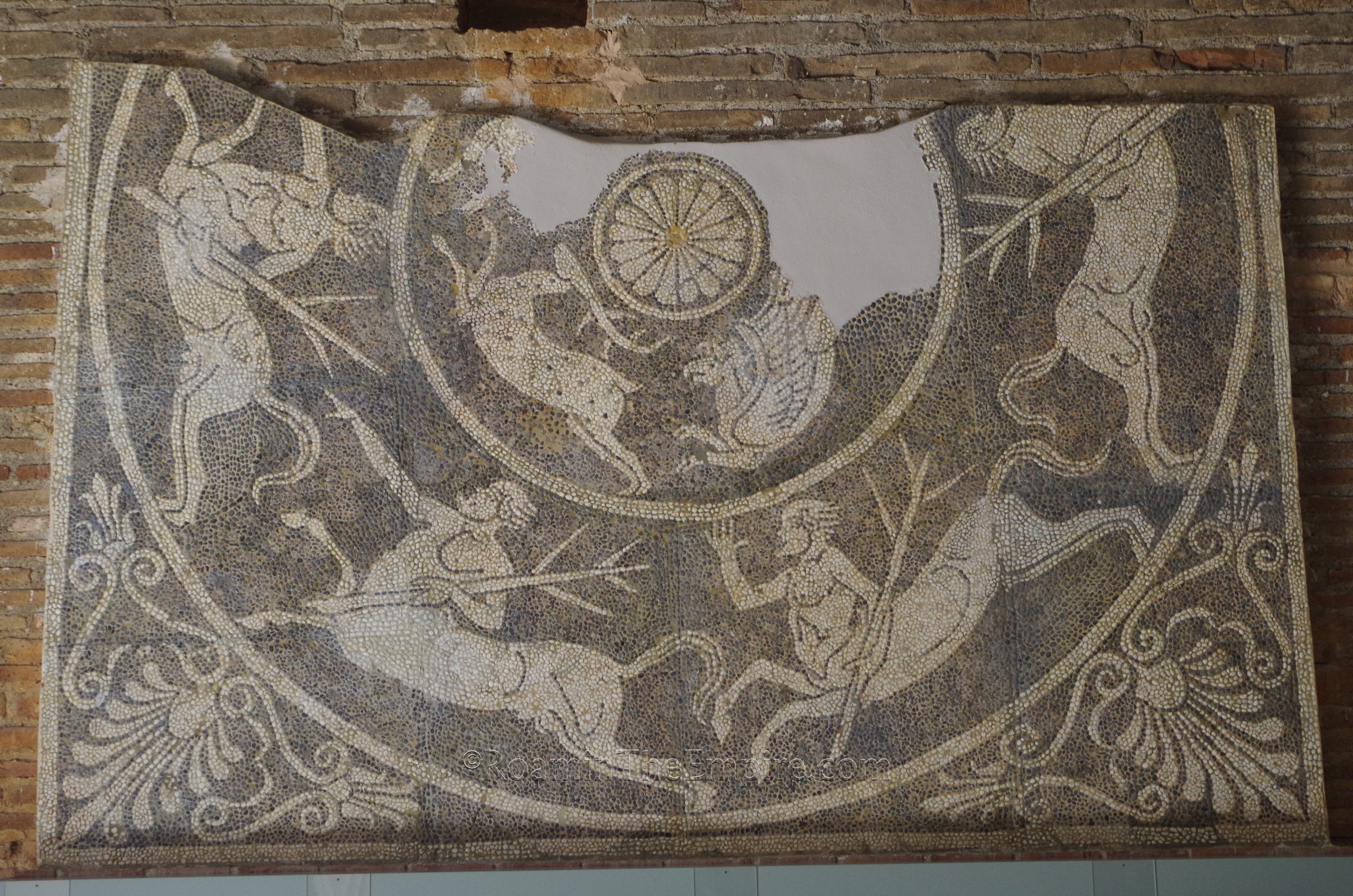
The courtyard of the museum contains a number of inscriptions and architectural fragments from the site. Some of the highlights of the museum include a very nice collection of statuary, a few mosaics, and some nice reliefs. There is a large collection of pre-Roman ceramics from the Sicyon and from the region around the city. It isn’t an exceptionally large museum, but it took me a solid hour to get through. There is a lot of interesting material here.
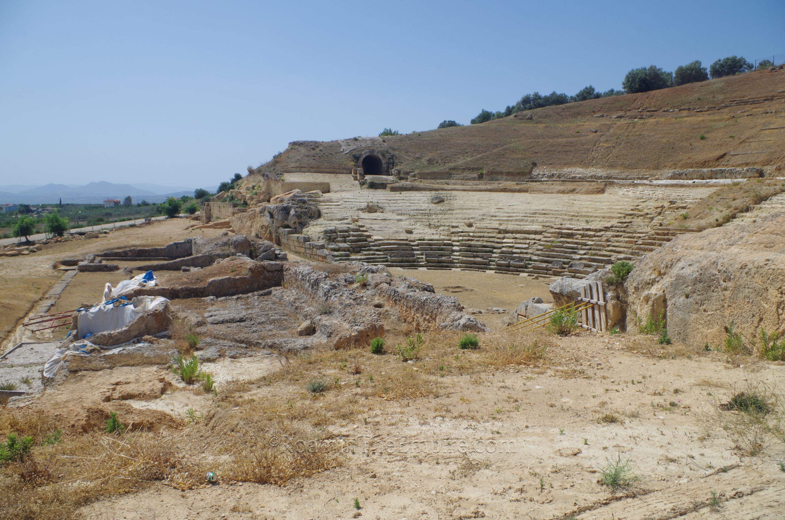
There are a couple of areas worth visiting that aren’t in the park. Just 200 meters up the road, to the west, from the museum is the theater. Unfortunately, the theater is in the midst of restoration works and isn’t accessible, but it can be seen from outside the fence pretty well. The theater was constructed into the slope of the hill in the Hellenistic period, probably before the reorganization of the city by Demetrias Poliorcetes in the late 4th century BCE. It served as the meeting place of the Achaean League in 168 BCE following the Roman defeat of the Macedonian king Perseus. Sometime during the Roman period, the theater underwent extensive restorations, including the replacement of the proscaenium with a pulpitum.
Just a few meters to the northeast of the theater are the remains of the western half of the stadium. This building was also constructed sometime in the Hellenstic period. There’s not a whole lot to see, the area is mostly overgrown, but the shape of the stadium is definitely discernible. There’s some reconstructed wooden seating in the northwest corner and some scattered remains here and there, but it’s mostly just the shape visible cut/excavated into the hill. There are some retaining walls that extend eastward to seemingly form the base platform of the east end of the stadium, as this area drops in elevation from the plane of the stadium. Originally, the stadium ran a length of about 245 meters.
Some remains of the Hellenistic fortifications of the city are apparently located in the area, but I was unable to find any of these despite a few attempts. The same for two quarries, one that is supposed to be located above the theater, and another in the modern town of Sikyon.
 Archaic Temple.
  Excavated area west of the Archaic Temple.
  Excavated area just north of the palaestra/gymnasium.
  Lower terrace of the palaestra/gymnasium.
  Palaestra/gymnasium.
  Palaestra/gymnasium.
  Staircase between the upper and lower terrace of the palaestra/gymnasium.
  Upper terrace of the palaestra/gymnasium.
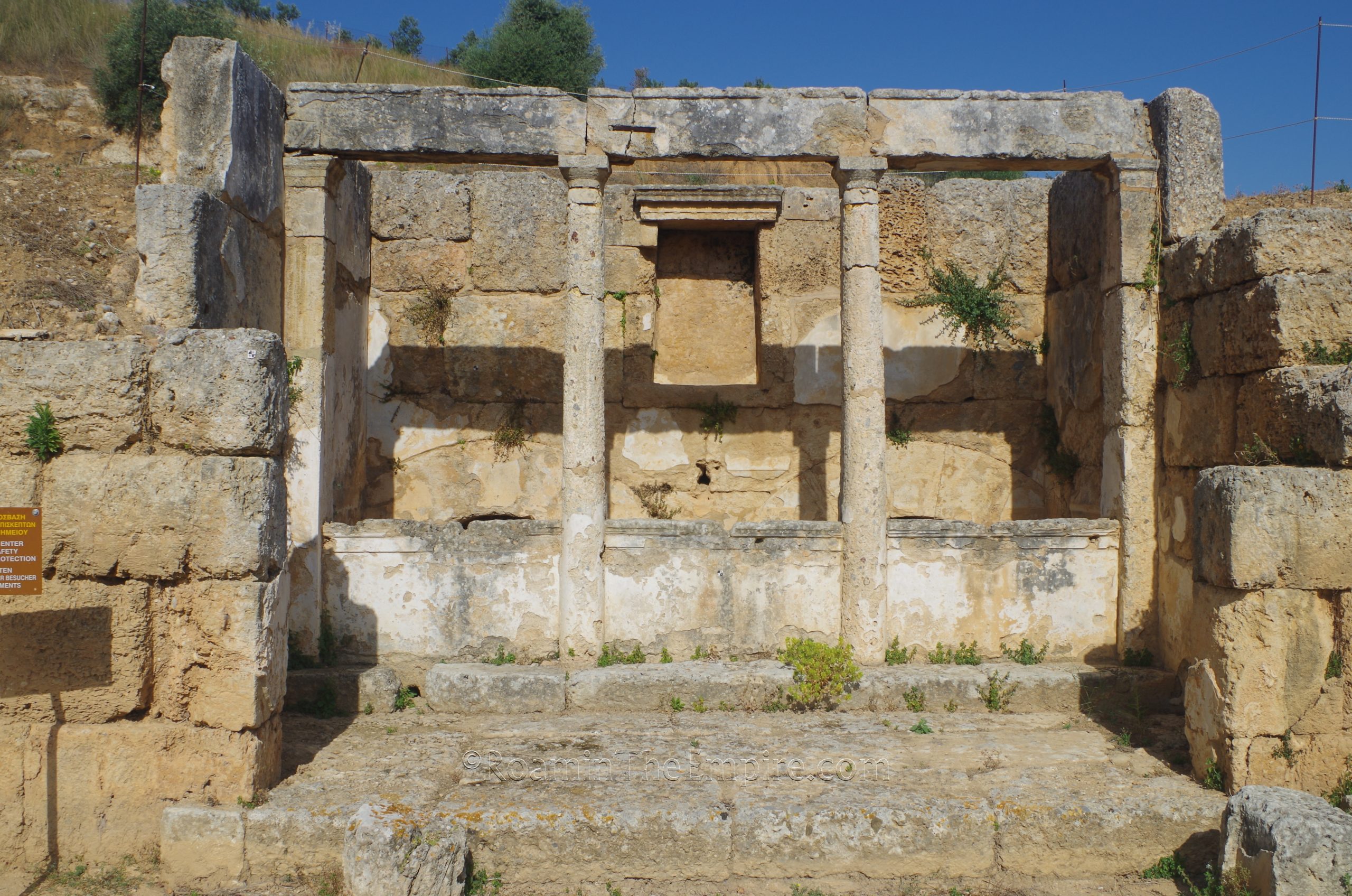
  Sanctuary of the Nymphs off the upper terrace of the palaestra/gymnasium.
  Basins in the bouleterion.
  Long Stoa.
  Long Stoa.
  Remains of the Roman baths on the grounds of the museum.
  Courtyard of the museum in a room of the Roman baths.
  Statue of Hekate from Room II of the Roman baths. Dated to the 1st or 2nd century CE. Archaeological museum.
  Statue of Artemis Kynegetis from Room II of the Roman baths. Dated to the 2nd century CE. Archaeological museum.
  Stadium.
  Retaining wall in the eastern area of the stadium.
Sources:
Diodorus Siculus. Bibliotheca Historica, 15.69-70, 18.11, 19.67. 20.102-103.
Grant, Michael. A Guide to the Ancient World: A Dictionary of Classical Place Names. New York: Barnes & Noble Books, 1997.
Herodotus. Historiai, 5.67-5.69, 6.126, 8.43, 9.28.
Hesiod. Theogony, 510-616.
Pausanias. Hellados Periegesis, 2.5.5-2.11.8, 2.6.5, 2.8.1-3, 4.11.1.
Pliny the Elder. Naturalis Historia, 35.16.
Plutarch. Aratus.
Polybius. Historiai, 5.27, 17.16.
Smith, William. Dictionary of Greek and Roman Geography. Walton & Murray, 1870.
Stillwell, Richard, William L. MacDonald, and Marian Holland. McAllister. The Princeton Encyclopedia of Classical Sites. Princeton, NJ: Princeton U Press, 1976.
Thucydides. Historiai, 1.111-114, 2.9, 5.82.
Xenephon. Hellenica, 4.2.14, 7.3.1-12.