


There are a number of sites in the immediate vicinity of Tharros that are worth seeing. Two of these are in the tiny village of San Salvatore di Sinis, about 10 minutes north of Tharros. The village sits at the junction of the SP7 and SP6, the two roads one would take to get to Tharros from the north or east, respectively, and anyone visiting Tharros would need to pass right by the village to get there. From the outside, the village is pretty unassuming, but it houses a true gem in the hypogeum of the Chiesa di San Salvatore.
The Chiesa di San Salvatore is located at the center of the village, which is largely closed to traffic. There is a small parking lot near the restaurant at the northern entrance to the town (off the SP7), and from there it is a short walk to the church. The church itself, like the village, is pretty modest both inside and out. In fact, it barely even looks like a church from the outside. The hours for the church are irregular and apparently dependent on the availability of volunteers to keep the church open and accessible. I stopped there on a Monday morning in early June and it was open. There is no set admission fee for the church or hypogeum, though a donation to the church is encouraged.
Once in the church, the stairs down to the hypogeum are located right inside the entrance. The underground chamber below the church was constructed during the Roman period, but the use of the area dates back further than that. A spring located beneath the church probably hosted the site of a Nuragic sacred well perhaps dating back as the far as the 4th millennium BCE. After the arrival of the Phoenicians, the spring was dedicated to Sid, and in particular the healing aspect of the god. When the Romans arrived, the healing aspect remained and the spring was associated with Aesclepius. It was at this point that the hypogeum seems to have been built, first functioning as a cistern, but by the 3rd or 4th century CE, as a ritual space. By the 6th century CE, the space had become associated with Christian worship. The present church was constructed in the 17th century CE.
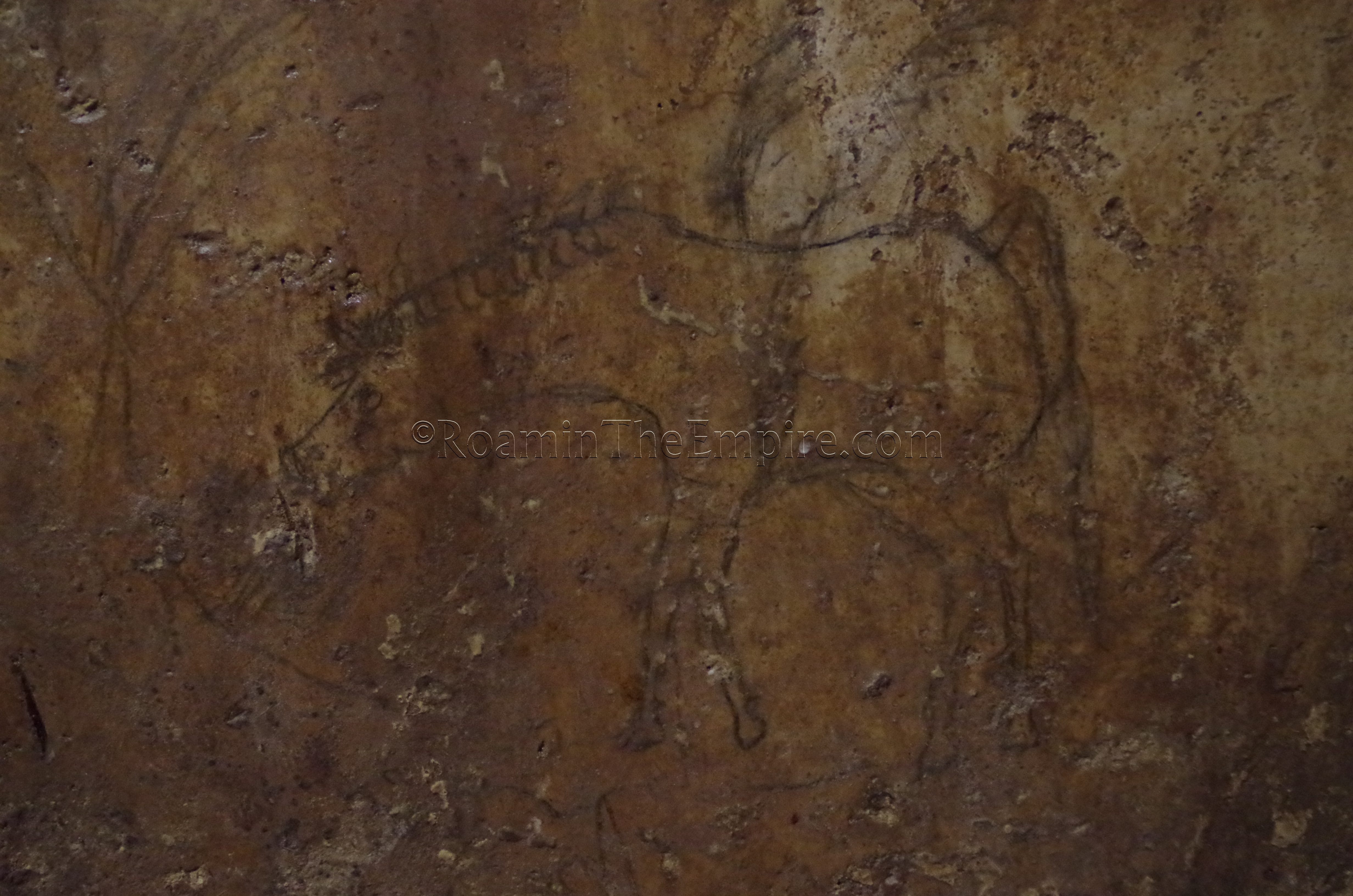
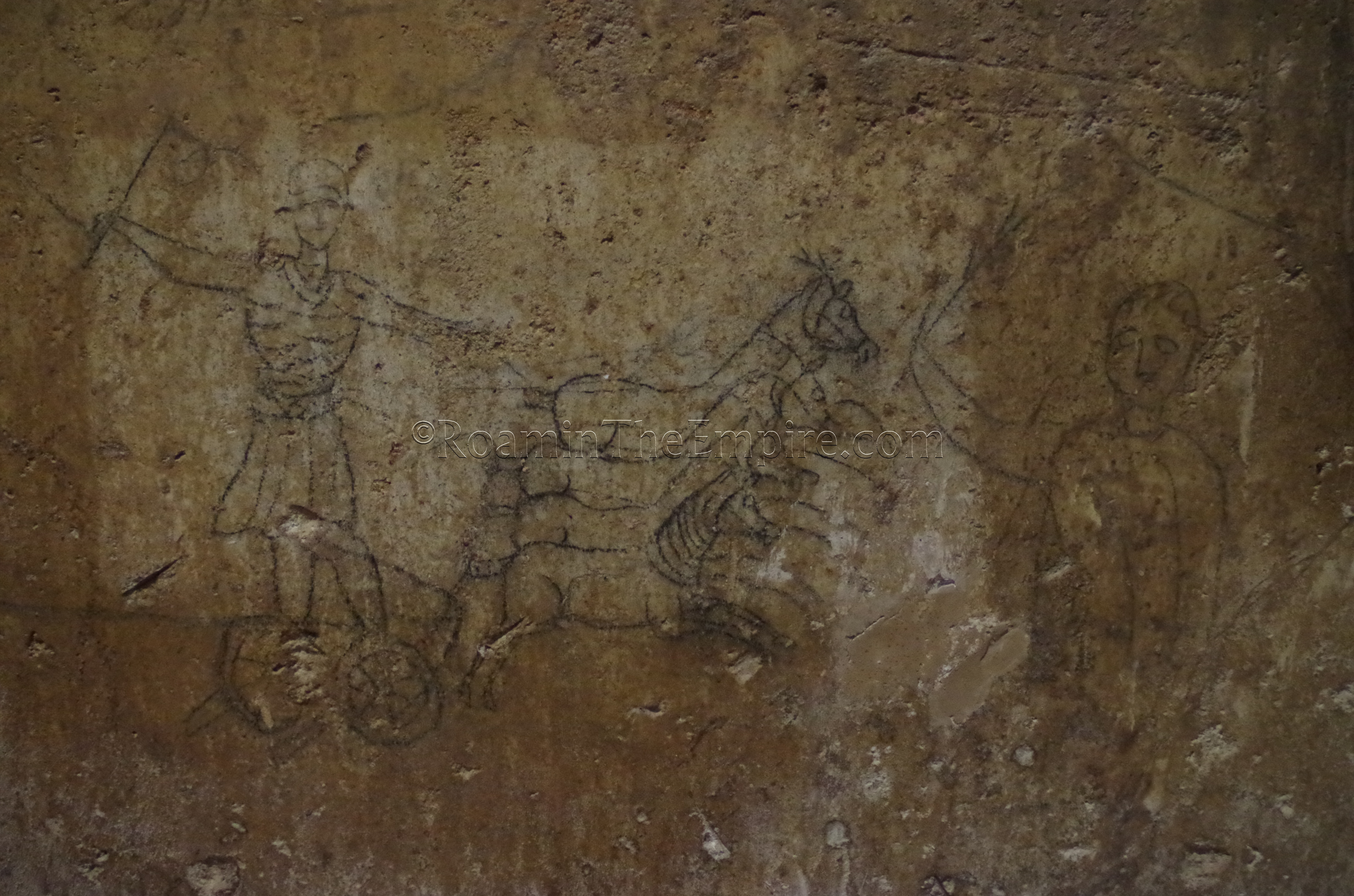
The most interesting aspect of the hypogeum are the inscription and figural paintings on the walls. The underground chamber is essentially divided into five rooms, with four rooms (two on either side) of the main corridor, and an apsidal room opposite the entrance. The main corridor has a well that leads to the spring, as does the apsidal room, which also contains a sacred stone probably in use since the Nuragic period. Most of the paintings are in the four flanking rooms off the corridor. The dates vary, but many of the pictures seem to date to the time period of the Roman ritual space and depict themes in both Pagan and Christian religion. Some of the figures represented are Hercules battling the Neman Lion, Pegasus, gladiators, a quadriga, ships, and pagan deities.
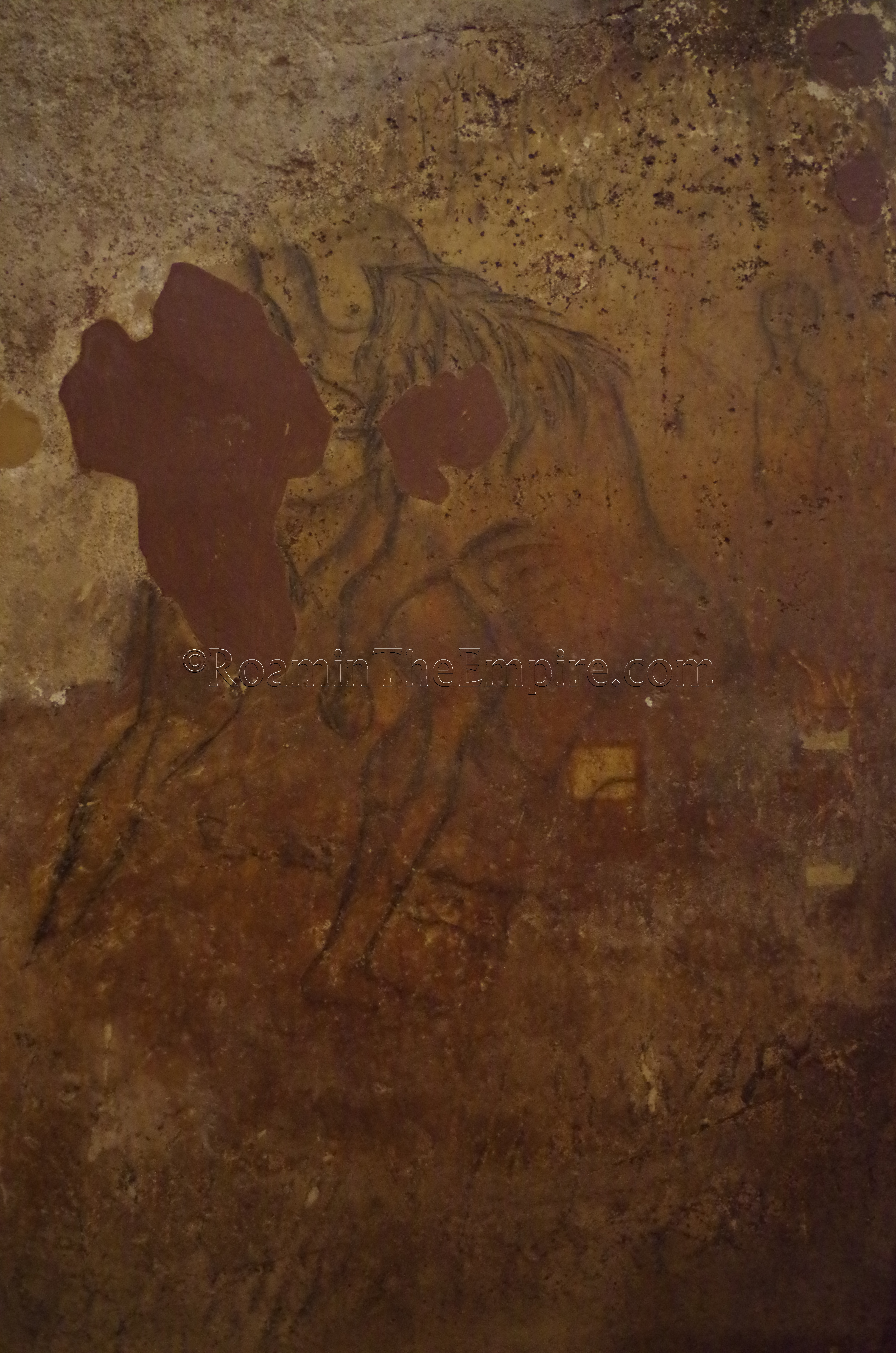
One of the most famous paintings is that of Venus, and Venus and Mars together. It is thought that Venus may have been particularly important to the cultic activities at the site in the later Roman period, perhaps in her association with water. The painting of Hercules is also interesting in the context of the history of the site. The Punic god Melqart, by the 6th century BCE was often increasingly associated with the Greek Heracles as a means of justifying Punic colonialism with the mythological heritage of Heracles’ travels. In the Punic pantheon, Melqart’s son is Sid, the god to which it is believed the Punic era iteration of the sanctuary was dedicated.
It’s hard to oversell this site. It’s small, and even though I went through it in a pretty detailed manner, it only took me about 25 minutes. For most visitors, it’s probably less than 10 minutes. But the level of preservation/restoration on some of the paintings is pretty fantastic. The quality ranges from what appears to be hastily scribbled graffiti to intricate pictures that likely took a significant level of effort. In either case, there aren’t many places where a collection of ad hoc imagery such as this is available to the public.
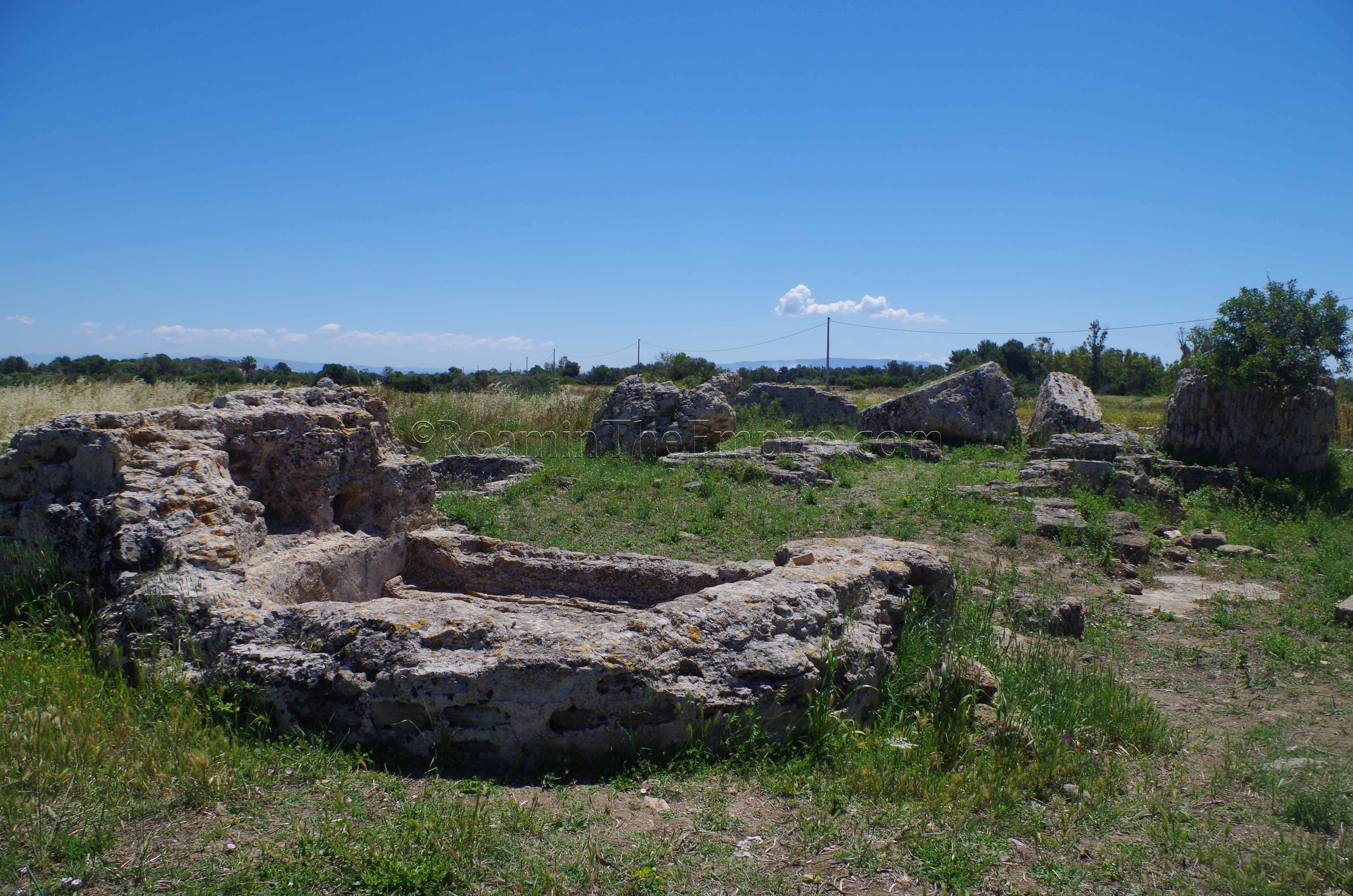
A few minutes’ walk from the church, to the southeast and just on the outskirts of the village, are the remains of a bathing complex. There is open access to these remains, so there are no hours or admission. The bathing complex has acquired colloquial name of Dom’e Cubas, home of the barrels, which was likely a reference to barrel vaulting from the baths that was once visible. The baths seem to have had two phases of construction; the first half of the 3rd century CE and the first half of the 4th century CE. The most identifiable feature of the baths is the frigidarium flanked by two small water pools, the remains closest to the village. The circular tepidarium is also visible, which then leads into the first of two caldaria. Part of the circular laconicum is also discernable at the east end of the complex. There is an informational sign on site with a diagram of the baths and an English translation.
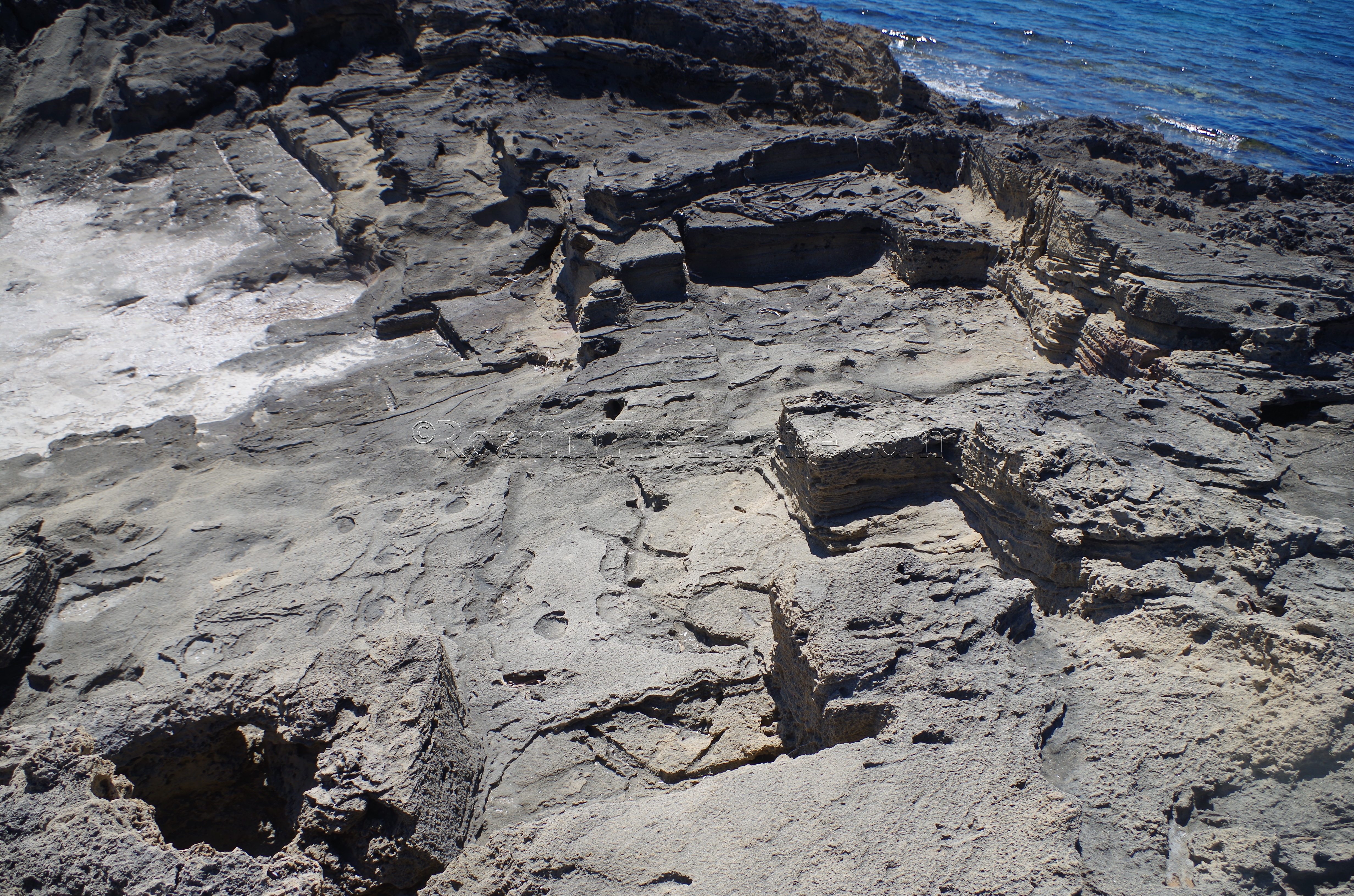
About 7 kilometers away on the west coast of the peninsula is Punta Is Arutas, at the south end of the Spiaggia di Is Arutas, which sports a Roman era quarry. The beach is quite popular during the summer, so parking can certainly be an issue, but there is a fairly large free parking lot for the beach off the SP59. If it’s full, the dirt road south out of the parking lot leads to some additional parking space that wasn’t nearly as in-demand as the parking lot spaces. From the parking lot, it’s only a maximum of about a 10 minute walk to the quarries.
The quarries actually stretch over a pretty considerable space of about 500 linear meters, though not continuously and only about half of that is accessible. From the tip of Punta Is Arutas, quarrying is identifiable on the southwestern shoreline of the point. The orthogonal cuts in the rocky coastline are pretty recognizable for about 80 meters from the tip of the point. When reaching the ending point of the obvious quarrying along the shoreline, one can head directly inland (to the northeast) and about 50 meters from the coast reach another area of quarrying. When I visited, it was quite overgrown, but there is still a very clear pit quarry stretching for over 100 meters. Aside from this large singular quarry, there are various small points of quarrying activity in some of the rocky outcroppings to the north of the large quarry.
Heading back to the east and off the peninsula is the Museo Civico Giovanni Marongiu in Cabras. Located on Via Tharros (no street number, but at roughly 155), the museum is open Tuesday through Sunday in the summer, from 9:00 to 13:00 and 16:00 to 20:00. The rest of the year it is open every day from 10:00 to 18:00. The hours are apparently adjusted throughout the year, so it may be best to check the schedule on the webpage. Single entrance to the museum is 6.50 Euro, though combination tickets can be purchased that include the Tharros archaeological site (10 Euros) or the Tharros archaeological site and Torre Costiera di San Giovanni (12 Euro).
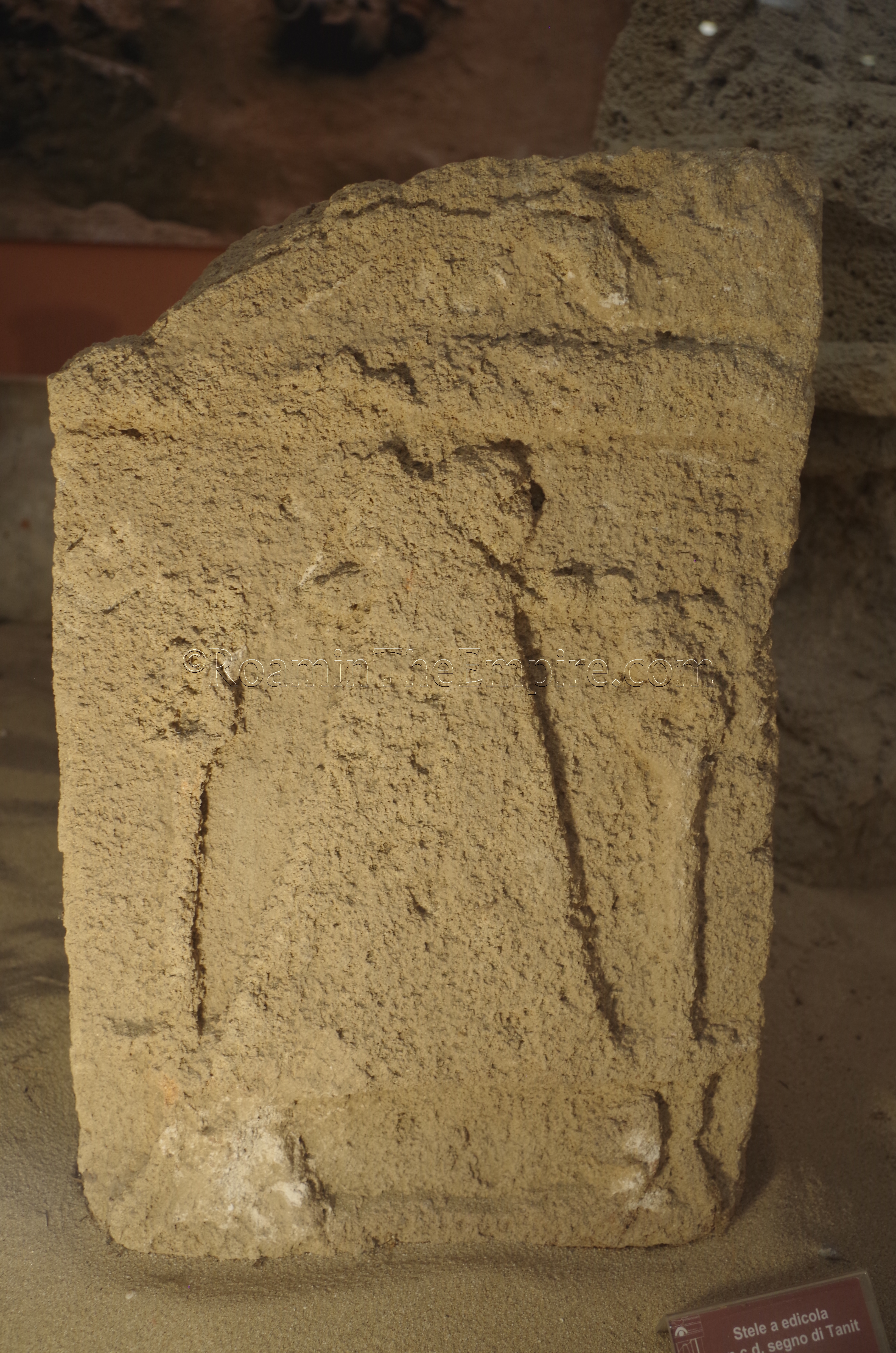
Despite being billed as the museum associated with Tharros, I thought the collection was surprisingly light on objects from the site. A significant portion of the collection was Nuragic objects, many from the nearby island site of Cuccuru Is Arrius. For Tharros, the collection included a number of stele from the Punic tophet and a few small finds from the Phoenician/Punic period. There were also several Roman sculpture heads, some small finds, and a small assemblage of stamped lead ingots. Outside, on the museum grounds (in the southern part of the courtyard), stand the remains of a Roman tomb dated to the end of the 1st or early 2nd century CE.
In all, it took me about 30 minutes to go through the museum. I hesitate to say the museum was not worth the stop, because the collection was worth seeing and the tophet stele were particularly interesting, but, considering the archaeological museum in Cagliari is 7 Euros, the price point on this museum seems a bit high. This can be mitigated a little by the combination ticket; 3 Euros, or maybe 4 Euros at the outside, seems like a more reasonable price point for the museum. There are lots of informational signs in the museum, but only a few are not strictly in Italian.
A short 15 minute drive down the road, there is another archaeological museum in Oristano; the Museo Archeologico e Storico Artistico ‘Antiquarium Arborense’. I found navigating and parking in Oristano particularly frustrating. There is parking at the museum, located off Piazza Giovanni Corrias, but I ended up parking on the outskirts of the city center and walking, since I couldn’t get to the museum via car because my navigation program kept trying to send me the wrong way down one-way streets. The Antiquarium Arborense is open Monday through Friday from 9:00 to 20:00 and on Saturdays and Sundays from 9:00 to 14:00 and 15:00 to 20:00. Admission is 5 Euros for the museum, though there are various combination tickets one can purchase that allow for access to other museums in the area.
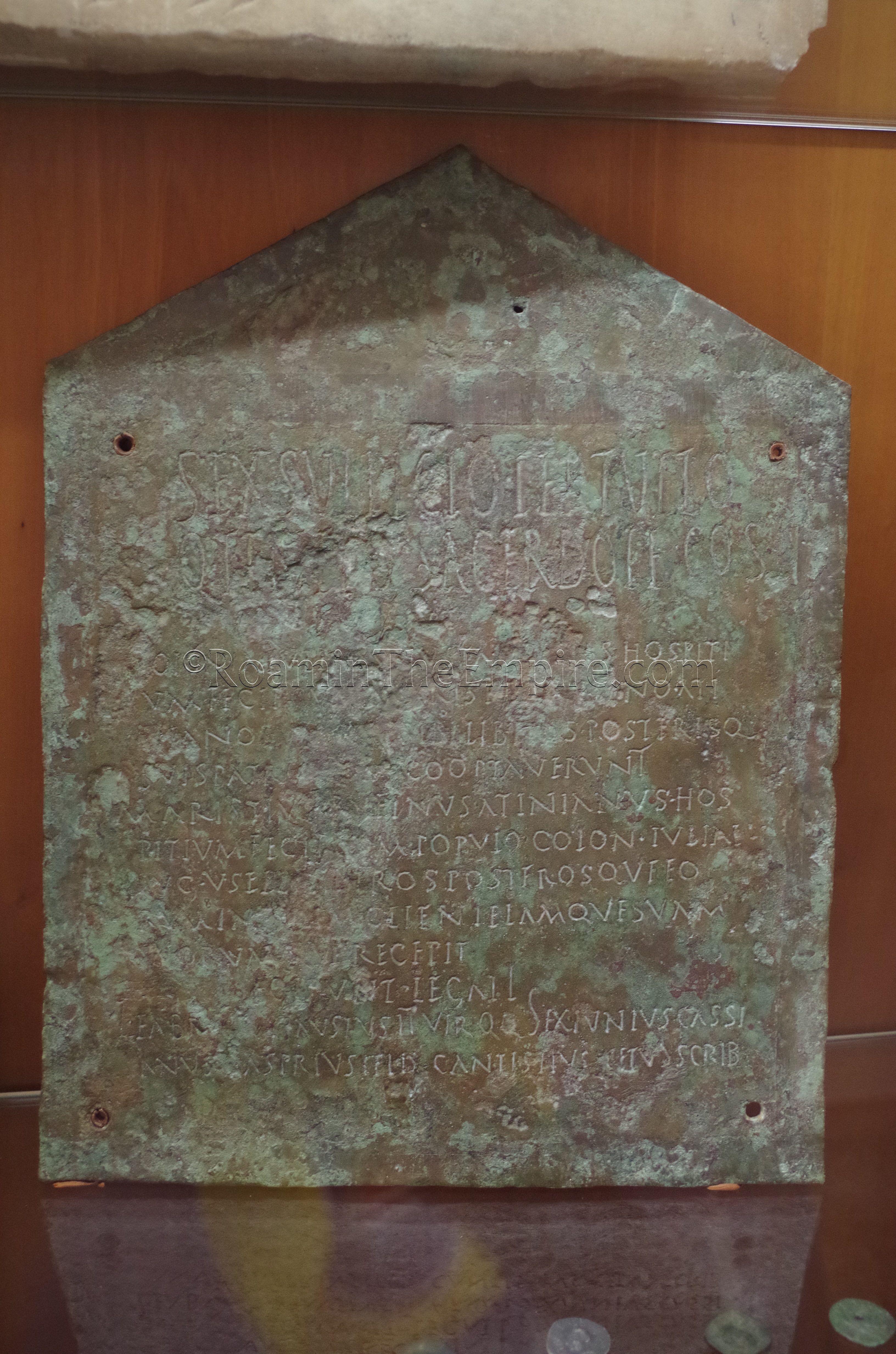
The collection here was a bit larger than that in the museum in Cabras, though it also was more expansive as a generalized historical museum covering the entire history of the area, rather than just antiquity. There was a bizarre temporary exhibition on fake Sardinian-Punic idols, which initially was unclear that they were indeed fake. The archaeological portion of the collection includes Nuragic, Phoenician/Punic, and Roman objects from both the immediate area and the wider region. When it comes to Roman artifacts, I’d say the collection from Tharros here was better than that of the museum in Cabras. While the museum contained a lot of small ceramic and stone finds, it also had a number of larger sculptural fragments, some large inscriptions, and large funerary pieces such as stele and sarcophagus fragments.
The Antiquarium Arborense took a little under an hour to get through. Most of the information in the museum is in Italian with English translations. The price, like Cabras, is a bit steep for what it is, in my opinion, but I think it is comparatively a better value. The layout definitely feels more like an antiquarium than a museum, though, so the name of the museum is particularly apt.
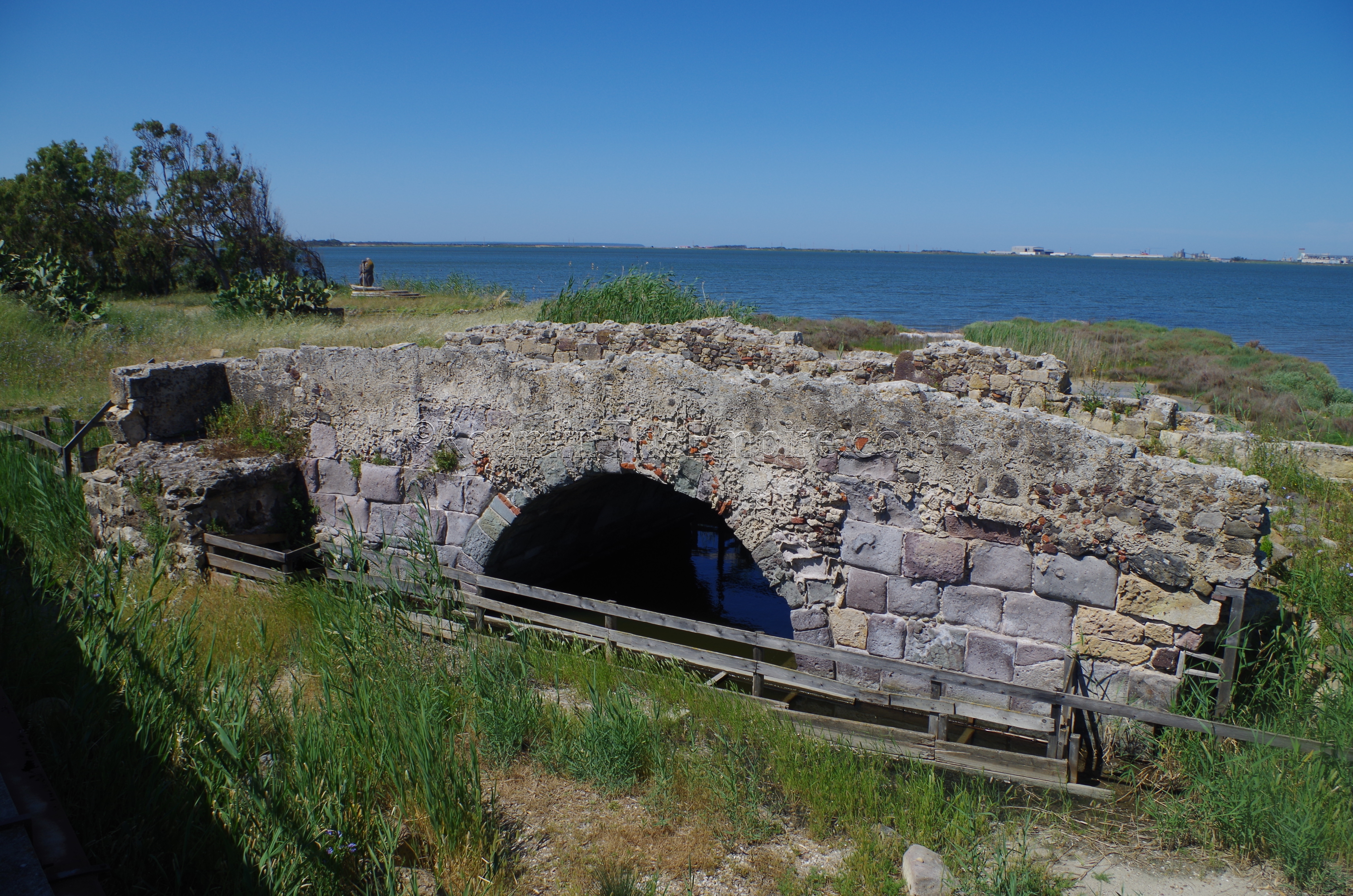
The final stop on this route is just 10 minutes to the south, outside the town of Santa Giusta. To the south of Santa Giusta, just over the Rio Palmas are the remains of a Roman bridge. There is a small dirt area to pull off right after passing over the modern bridge. Access to the bridge is not restricted, so there are no hours or fees associated with visiting. The land is marshy, though, so the exercise of caution is recommended. The bridge was constructed in the 2nd century CE as part of the main north-south road on the island between Turris Libysonis and Caralis that was built during the reign of Trajan. The bridge is in the area of the Phoenician/Roman town of Othoco, of which some remains have been found in Santa Giusta, but is mostly believed to be submerged in the lagoon. About 20 meters of the single arch remain, but it is believed to have originally ran about 30 meters long.


Sources:
Donati, Angela and Raimondo Zucca. L’ipogeo di San Salvatore. Sassari, Italy: Carlo Delfino Editore, 1992.
Dyson, Stephen L. and Robert J. Rowland Jr. Archaeology and History in Sardinia from the Stone Age to the Middle Ages: Shepherds, Sailors, & Conquerors. Philadelphia: University of Pennsylvania Museum of Archaeology and Anthropology, 2007.
Hoyos, Dexter. The Carthaginians. New York: Routledge, 2010.
Miles, Richard. Carthage Must Be Destroyed. New York: Viking, 2011.
Piroddi, Luca, G. Ranieri, M. Cogoni, A. Trogu, and F. Loddo. “Time and Spectral Multiresolution Remote Sensing for the Study of Ancient Wall Drawings at San Salvatore Hypogeum, Italy.” Near Surface Geoscience Conference, 2016.
Quinn, Josephine Crawley (ed.) and Micholas C. Vella (ed.). The Punic Mediterranean: Identities and Identification from Phoenician Settlement to Roman Rule. Cambrdige: Cambridge University Press, 2014.