


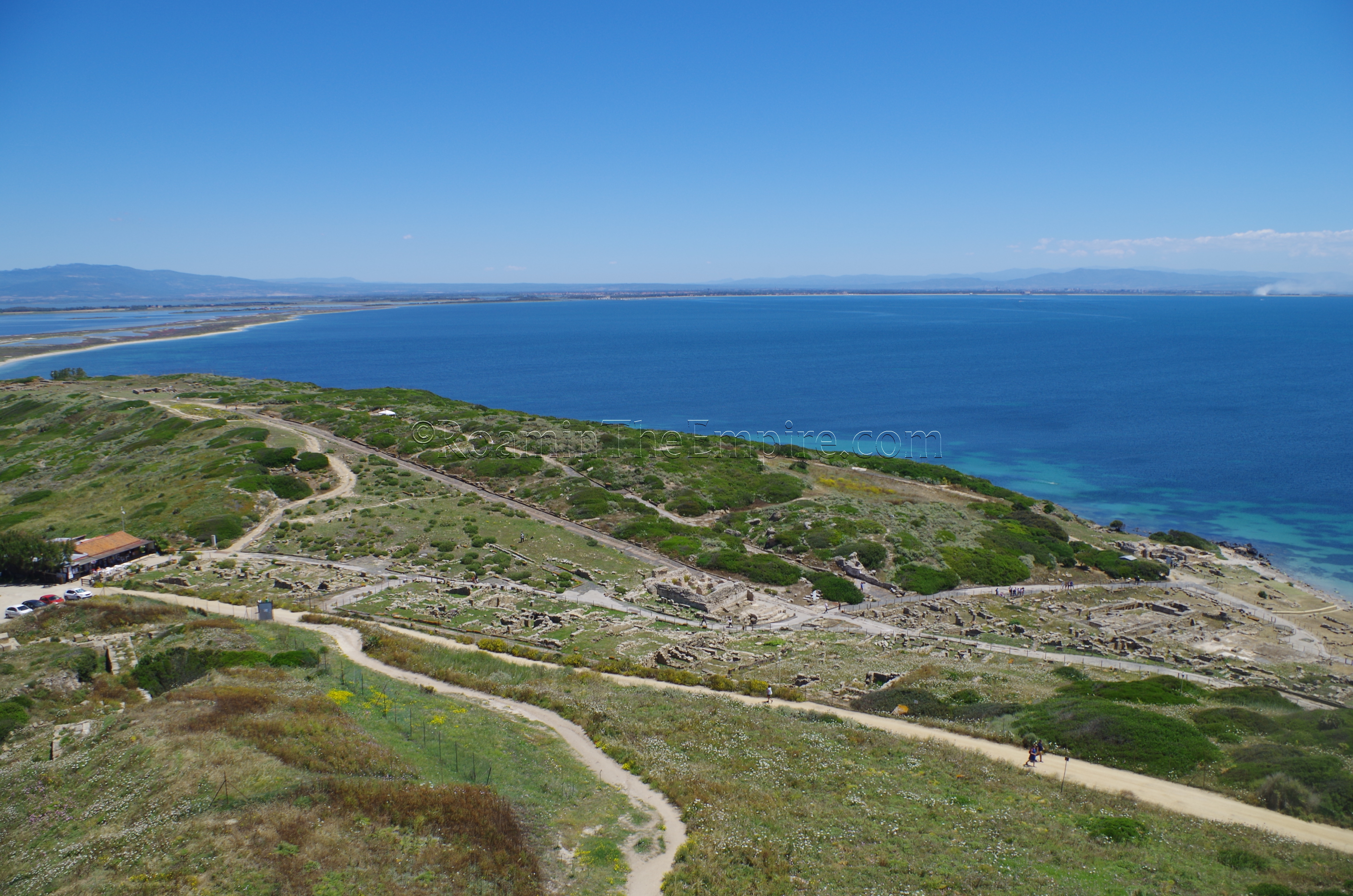
Like the settlement of Nora, Tharros was established by Phoenician colonists on a narrow promontory to allow for the construction of two harbors, and ensuring the ability for ships to come and go regardless of the wind conditions. Founded in the 8th century BCE by colonists from Tyre, in the same wave as those that settled at Nora and Sulcis, Tharros became an important station on the trade route from Massalia to the eastern Mediterranean. After it fell under Carthaginian hegemony, it would fill the same role in the trade route between Massalia and Carthage. A Nuragic settlement, Su Muru Mannu, preceded the Phoenician settlement on the hill to the north of the main Phoenician settlement. Evidence suggests that the Phoenicians may have had a significant profile at Su Muru Mannu in the years prior to the founding of Tharros. The remains of the Nuragic settlement were spoliated and used to construct fortifications for the Phoenician settlement.
Despite being one of the more important settlements on Sardinia, Tharros doesn’t feature much in the historical record of the island, and is only mentioned in passing by the ancient sources. As the city passed first under the hegemony of the Carthaginians and then into the hands of the Romans, it continued to thrive as an important trade center and point of embarkation for resources in central western Sardinia. The Carthaginians, in particular, heavily developed the agricultural capacity of the hinterland of Tharros. The city retained many of its Punic characteristics through the first few centuries of Roman rule, and it wasn’t until the imperial period that the city was urbanized in a more Roman manner. Tharros continued through the Vandal invasions of Sardinia and the collapse of Roman rule before finally being abandoned completely in the 11th century CE.
Getting There: Once again, the easiest option to visit Tharros is a private vehicle. There is plenty of free parking on-site. In the absence of that, however, there is a bus from the ARST station (Via Cagliari 185) in Oristano, the closest city with a train station. The bus station is just a 15 minute walk from the train station, from which one can travel from Cagliari or Alghero. ARST line 430 runs between Oristano and San Giovanni di Sinis a few times a day and takes about 40 minutes. The schedule can be found here.
The Area Archeologica di Tharros is located on the SP6 just south of the town of San Giovanni di Sinis. The archaeological park has a somewhat complicated set of rolling opening hours; it opens at 9:00 year round, but closes between 17:00 and 20:00 depending on the time of year. The exact schedule can be found here. It is also open every day from April through October, but is closed on Mondays the rest of the year. Entrance to Tharros is 6.50 Euro, but a combination ticket with the Museo Civico Giovanni Marongiu in nearby Cabras is 10 Euros (single admission to the museum is also 6.50 Euro) or with the museum and the nearby Torre Costiera di San Giovanni (which offers great views of the site and surroundings) for 12 Euro.
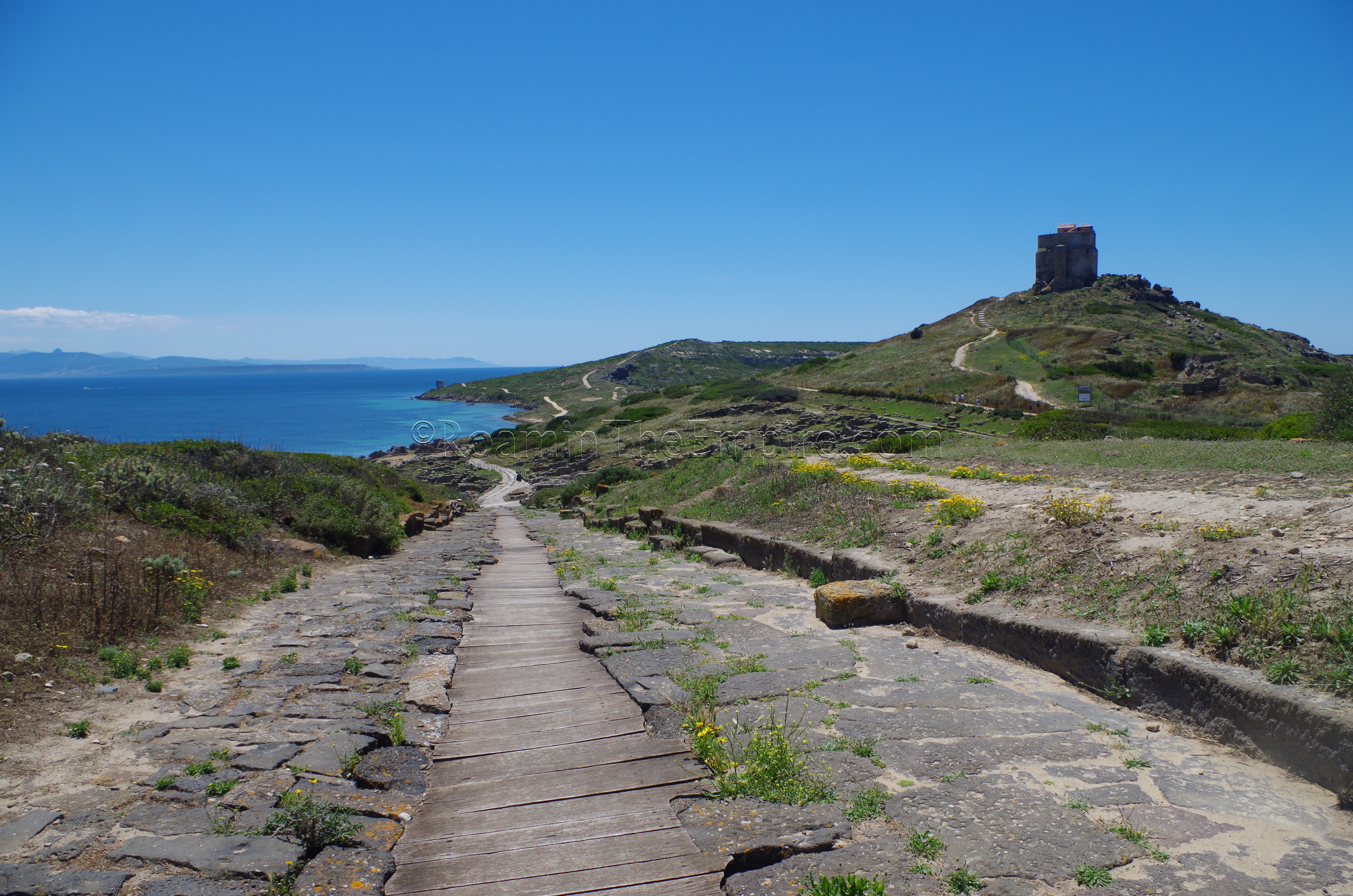
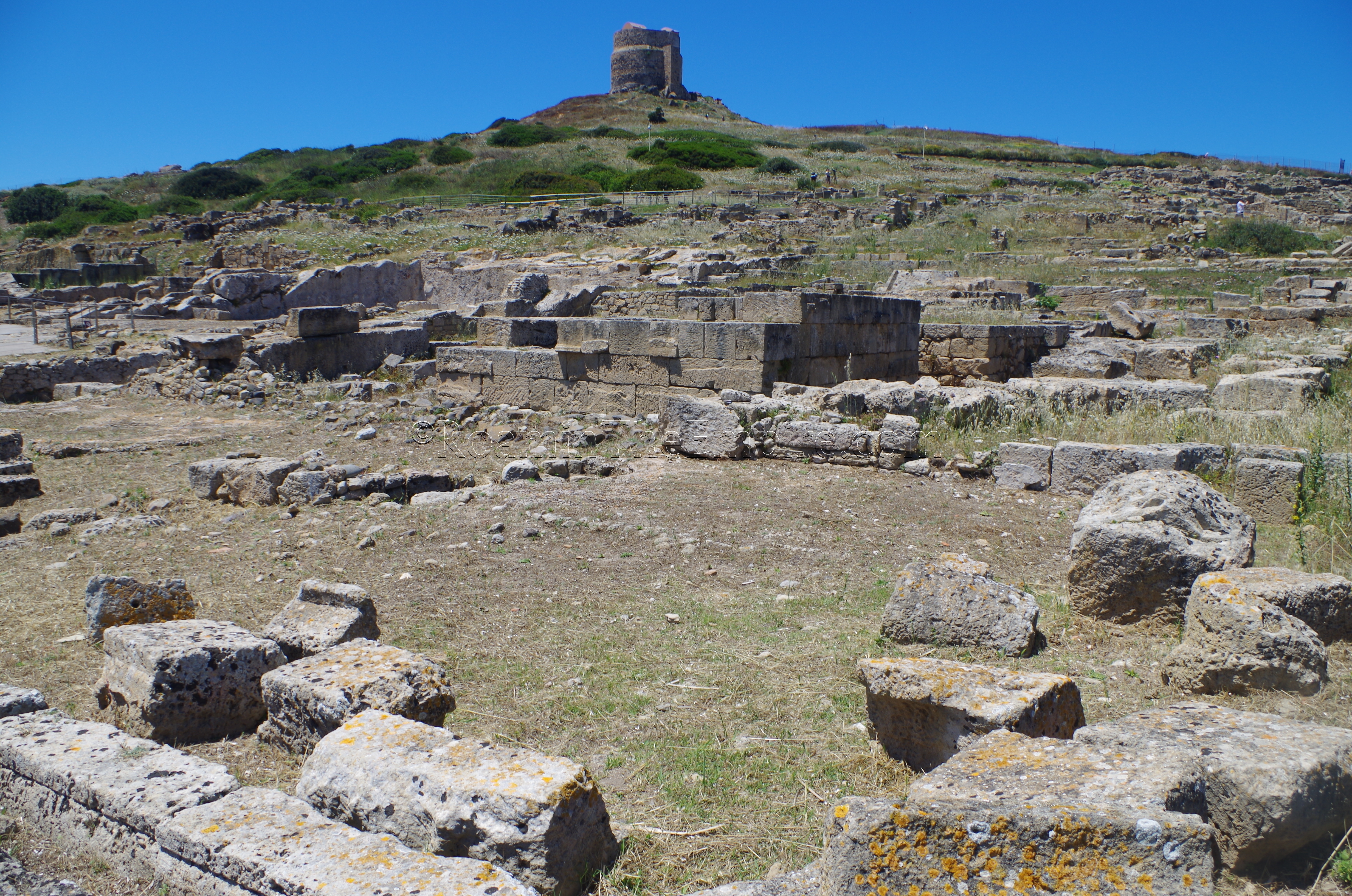
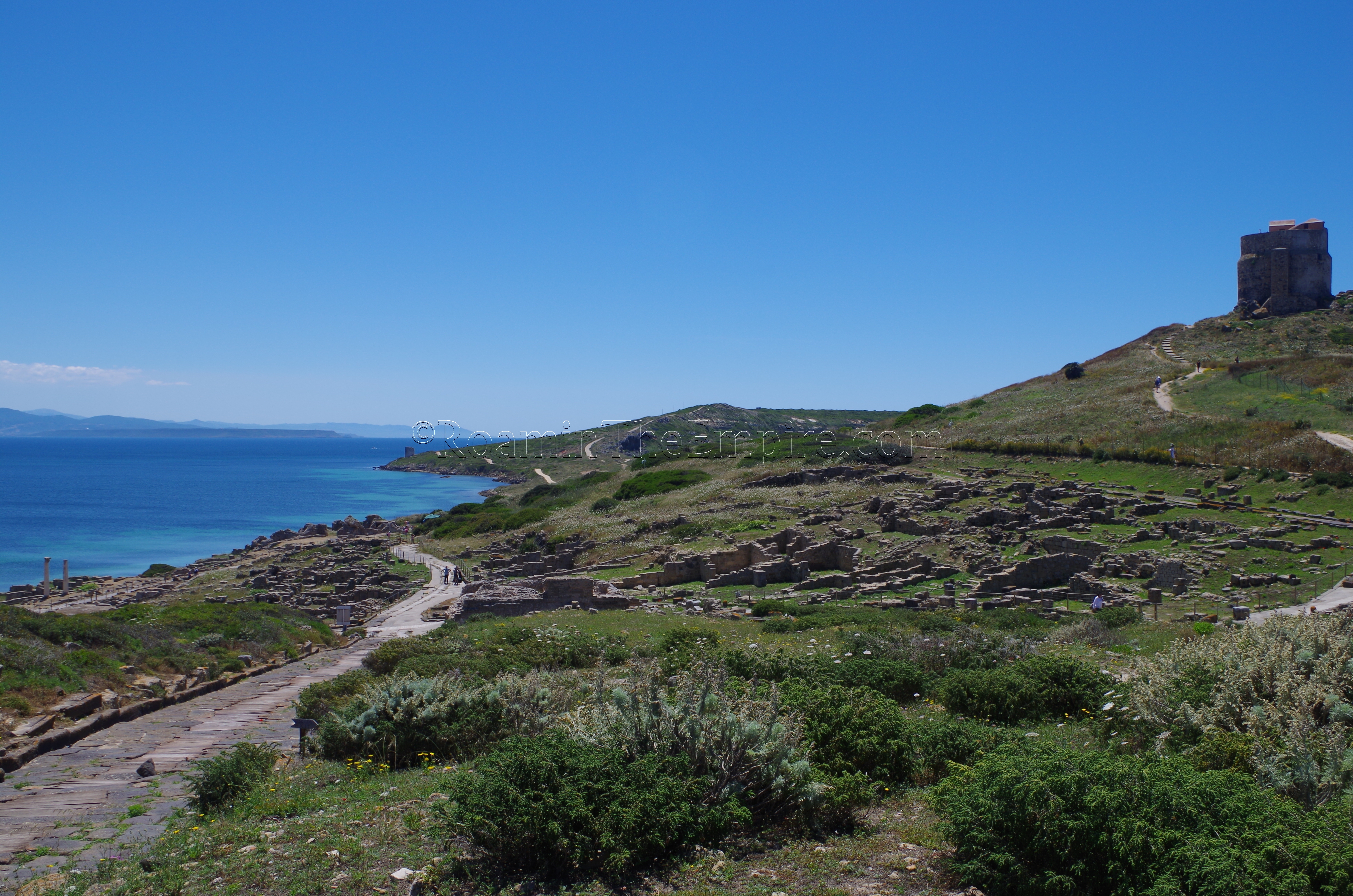
Like Nora, the visitor is prevented from walking among the remains in most areas and is limited to viewing from a few designated paths through the site; the Roman era roads in most cases. When entering and heading to the south (right), the structures to the right (west) side of the road are part of one of the residential districts of Tharros, sloping up the eastern side of the San Giovanni Hill toward the tower. Despite the houses being constructed during the Roman period of occupation, most of the houses are constructed in Punic style.
The left side is largely unexcavated until reaching the intersection, at which point there is a large structure; the castellum aquae. The castellum aquae was the ending point of what was probably a very short aqueduct that only ran about 500 meters from a well north of the settlement. A segment of the aqueduct channel can be seen running at ground level to the west of the castellum aquae.
Continuing south on the road, both sides of the road are flanked by residential buildings. At the end of that road are two non-residential buildings. To the west of the road, on the slope of the San Giovanni Hill, is a building designated Temple K. Unfortunately, because of its distance up the hill from the road, it is actually better viewed from outside the park than in. The core of the temple dates to the 2nd century BCE, though the portico seems to have been added in the imperial period. The Punic style altar, some Punic architectural elements, and reuse of a couple Punic inscriptions in the temple construction suggests that there was likely an earlier Punic sanctuary on this site that is partially reflected in the Roman building.
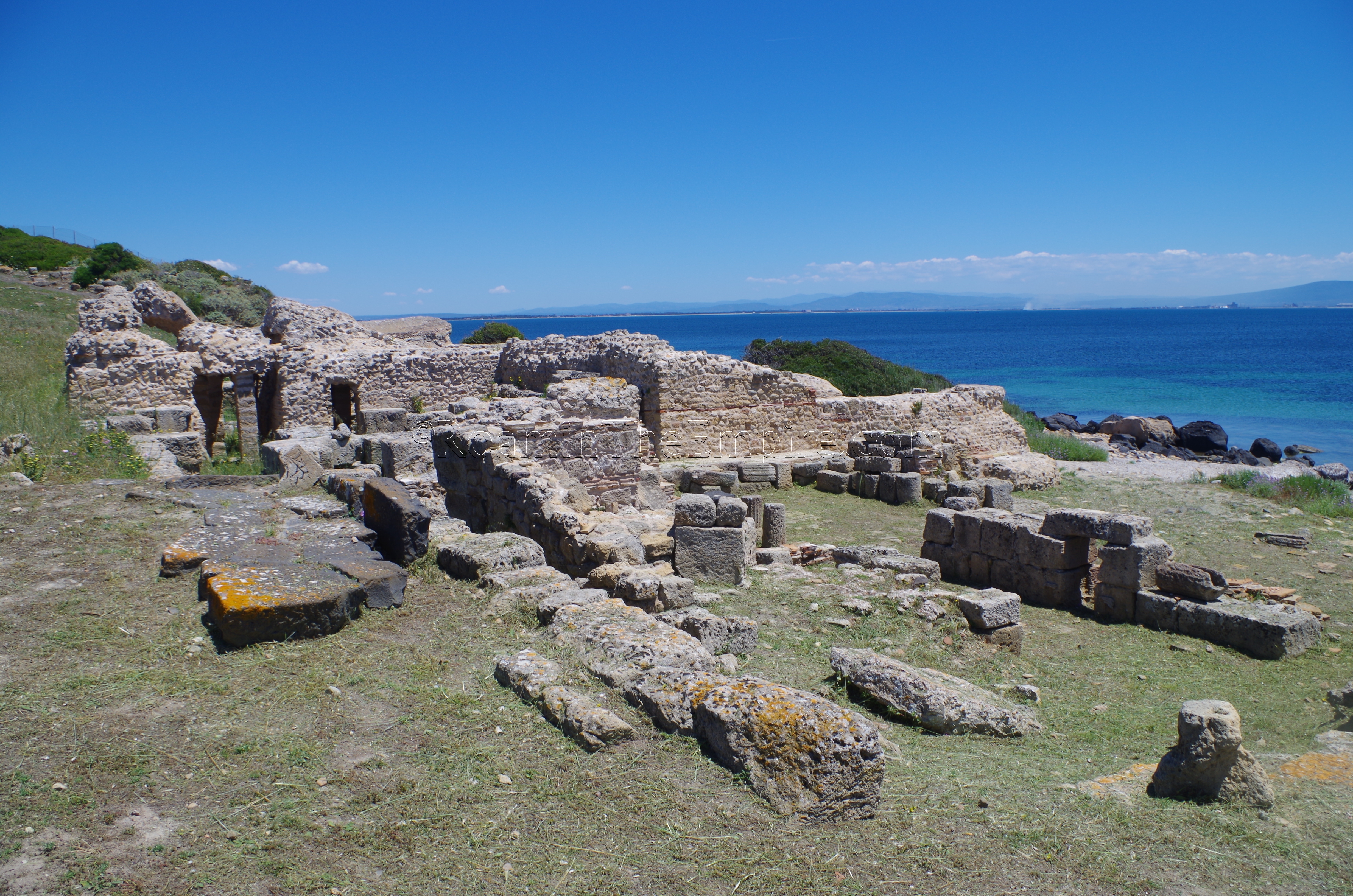
To the east of the road are the 2nd century CE Terme no. 2, or ‘Baths of the Old Convent’. While it’s large and the walls are pretty robustly preserved, there isn’t much that can be seen aside from the exterior or the main bathing rooms and some ancillary rooms. The name comes from the supposition that the building was used as a monastic space in the Byzantine period.
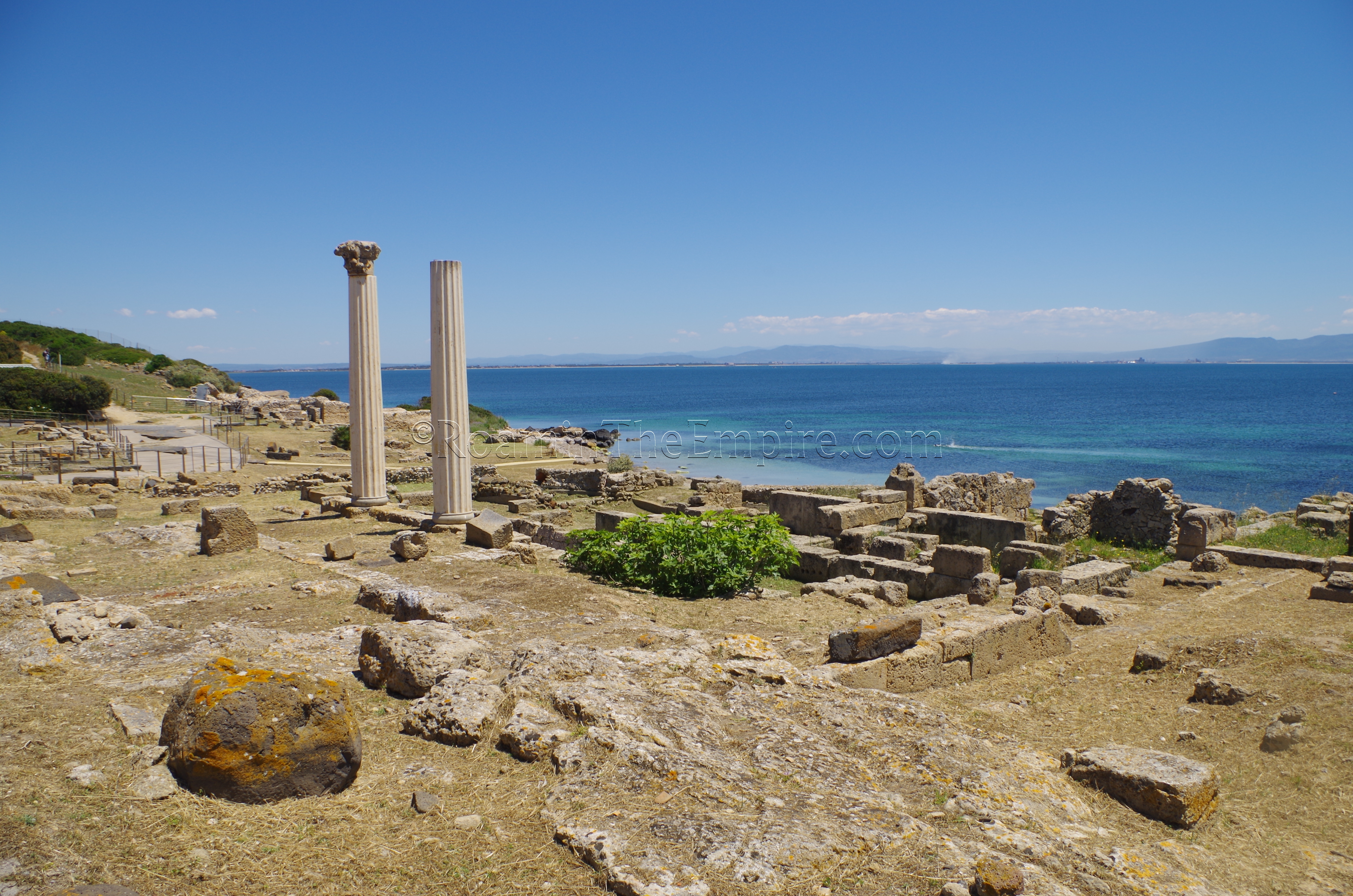
Turning around and heading back down a road to the northeast are a series of religious buildings on either side of the road. On the east side of the road is the so-called ‘Tetrastyle Temple,’ distinguished by its two standing Corinthian columns. This temple is thought to have been the temple dedicated to the Capitoline Triad, and likely dates to the 1st century BCE.
Opposite this temple on the west side is the so-called ‘Semetic Temple’. The Semetic Temple has an interesting layout in that the space is essentially carved out of the rock, which is used in conjunction with some rather robust freestanding walls to create an enclosure. These enclosing walls would have been faced in painted plaster. Despite most of the surviving structures of the temple dating to the 3rd century CE, the style is reminiscent of some Punic temples in North Africa, which is where the temple’s name is derived. A well within the temple area was also full of intact Punic vessels. Like Temple K, the use of this area as a religious space probably dates back to the Punic and/or Phoenician periods of occupation with subsequent temples reflecting previous buildings in the space.
North of the Semetic Temple is the “Temple with Doric Columns” as it is known. As with many of the other temples at Tharros, this one too seems to have been preceded by a Punic area of worship. The first incarnation of this sanctuary dates back to the founding of the Phoenician colony, and was little more than a rocky outcropping decorated with offering niches. In the 4th or 3rd century BCE, a temple composed primarily of sandstone blocks was built upon the rocky outcropping. Finally, after the Roman occupation, the Punic temple was destroyed and a Roman style temple was built, with the podium being constructed, in part, with blocks from the Punic temple. Sandstone blocks with carved Doric columns and Aeolian-Cypriot capitals are, in particular, remnants of the Punic temple. The deity to which any of the phases of temples were dedicated to is unknown.
That road continues a little farther northeast past the temples to another bathing complex, the Terme no. 1. Like the Terme no. 2, these baths seem to be pretty well preserved in terms of existing wall height, but are similarly inaccessible. None of the main bathing rooms can really be seen from the visitor’s vantage point, though the arch in the southern part of the complex apparently belongs to one of the praefurnia. The Terme no. 1 were constructed in the 2nd century CE, but at least parts of the baths seem to have been converted into a church in the late antique and early medieval periods. Heading back to the west, toward the castellum acquae, there is a third bathing complex, the aptly named Terme no. 3, across the cardo maximus from the castellum acquae, but not much more than a single exterior wall is visible from these.
This completes a loop of the main settlement of Tharros, and one can head up the cardo maximus to the Su Muru Mannu area. There is not much excavated on either side of the cardo maximus when heading up the hill, though a significant amount of paving is intact with wood paneling covering the sewer down the center. Just past where the pavement ends, on the right (east) side is the Temple of Demeter. The temple is very fragmentary with just a few sections of remains still standing. These remains date to the Roman period, but there was a temple at this location, also likely to Demeter, in the late Punic period.
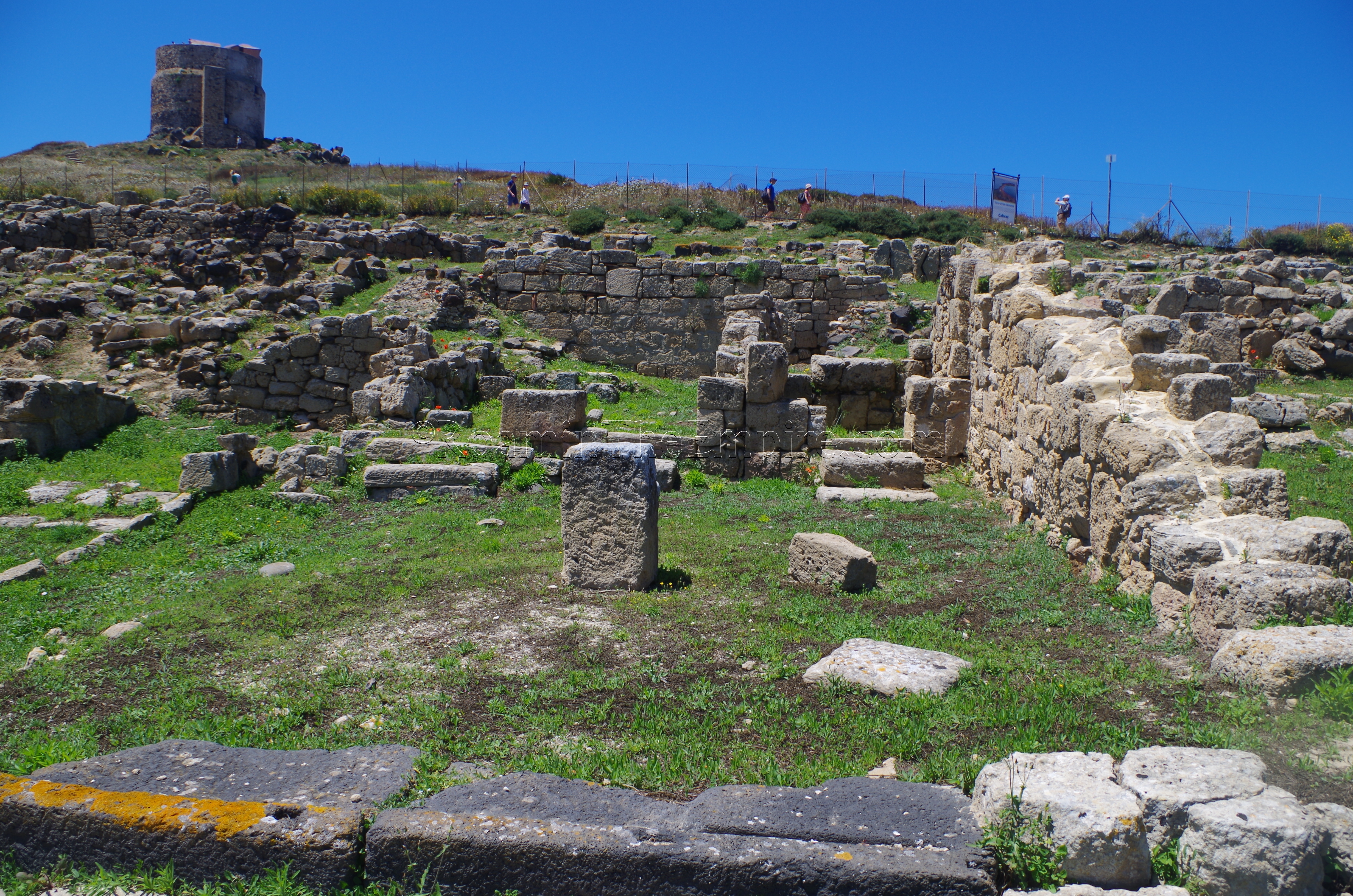
Past the Temple of Demeter are the remains of the Su Muru Mannu Nuragic settlement. The western part of the hilltop was apparently workshops while the eastern part are residential buildings. During the Phoenician/Punic period, the area served as a tophet from the 7th century BCE until the arrival of the Romans. There are no visible remains of the tophet. On the north side of the hill are large ashlar blocks that form the northern extent of fortifications for the settlement. The sandstone blocks seem to date to the Punic age fortifications from the 6th or 5th century BCE, while the basalt are probably Roman dating to the 2nd century BCE. The fortifications are difficult to see, as the area below them had restricted access when I was there. The fortifications essentially fell out of use in the 1st century BCE, and sometime after that the area just beyond them was used as a necropolis. The remains of some sarcophagi lids are visible. It has been suggested that the hill was the location of a mostly wooden amphitheater during the Roman period, based on some fragmentary remains of a large circular stone course in the center of the hill (not really discernible from the ground, but visible in satellite maps). Whether or not this was true is a matter of some discussion, and it’s not really presented as being such by the official site information.
There are a number of signs posted throughout the site (though not at every major monument) with translations in several languages (English, French, Spanish, German). The main site really only takes about an hour to go through, so it’s not a huge commitment of time, and is one of the best archaeological sites on the island.
There are a few things right near the site, but outside of the archaeological area that can be seen. On the walk up to the site from the parking lot, right across the road from the small outbuilding that houses the toilets, are the remains of the aqueduct which ran from the castellum aquae north to a well. Some of the channel is dislodged chunks of masonry, but there is a stretch that is relatively intact.
Across the road from the archaeological site, to the west, about 30 meters to the south of the archaeological site entrance, are the remains of some of the Punic fortifications. They can be difficult to see from ground level if the area is overgrown, as it was when I visited. Going up in the Torre Costiera di San Giovanni affords a pretty good view of the fortifications, though.
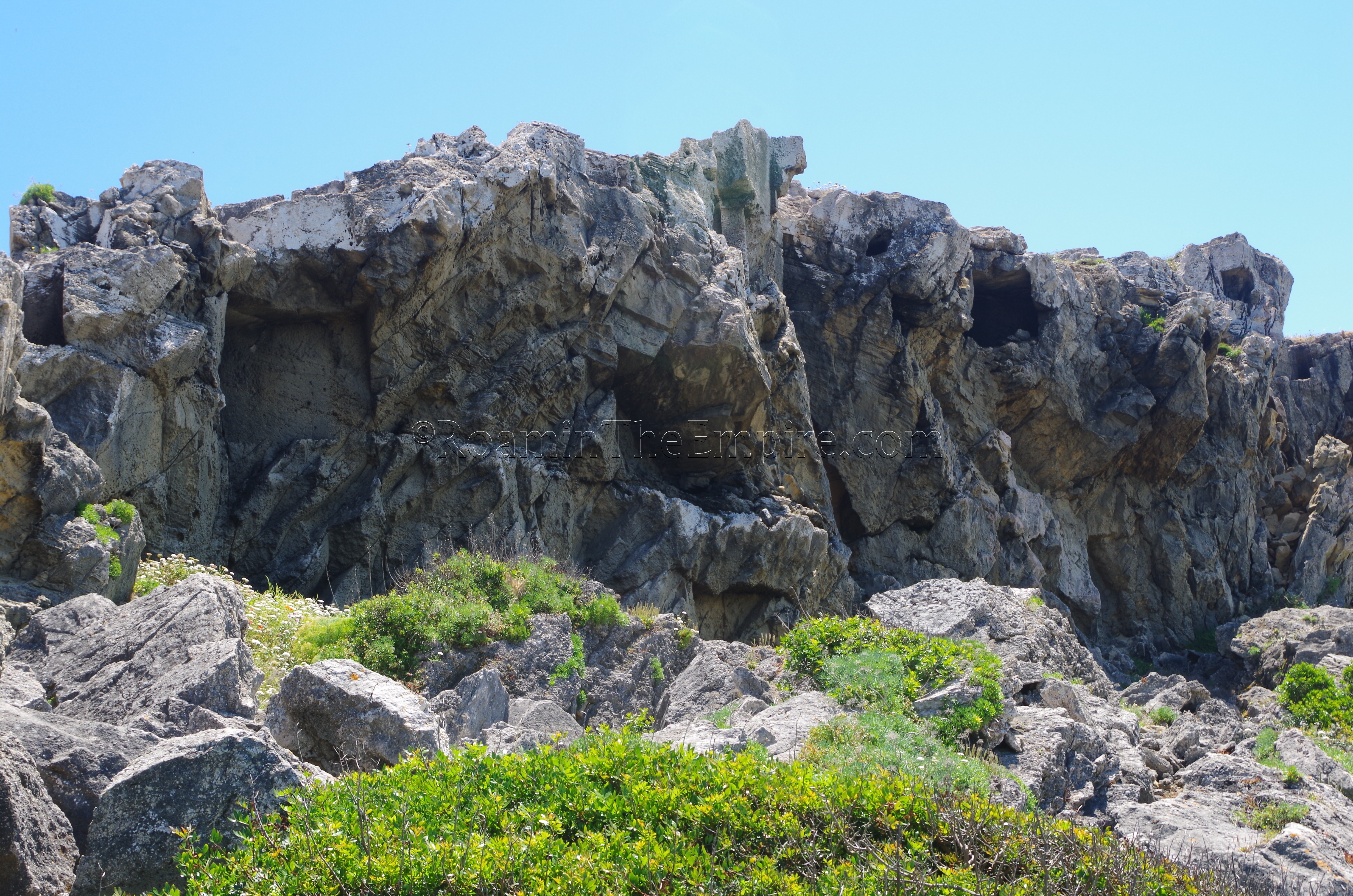
Following the SP6, which is just a dirt road once clearing the entrance to the site, south about 850 meters, roughly to the point on the road that is at the south end of the Spiaggia di Capo San Marco are the remains of the Punic necropolis (the Southern Necropolis). There are a few chamber tombs on either side of the road as it climbs up the rise, but the really interesting part is between the rocky outcropping and the water on the west side of the road. There is a path that leads down toward the water, and from there, some of the chamber tombs can be seen in the cliffs above. This is due to some of the rock breaking off since antiquity. There are a few large fragments of rock below the cliffs with the remains of tombs bore into them. These tombs
There is a small portion of the Punic Northern Necropolis visible off Via Sirio in the northern part of San Giovanni di Sinis. There is no access, but a number of chamber burials have been excavated.


Sources:
Andersen, Helle Damgaard. Urbanization in the Mediterranean in the 9th to 6th Centuries BC. Copenhagen: Museum Tusculanum Press, 1997.
Dyson, Stephen L. and Robert J. Rowland Jr. Archaeology and History in Sardinia from the Stone Age to the Middle Ages: Shepherds, Sailors, & Conquerors. Philadelphia: University of Pennsylvania Museum of Archaeology and Anthropology, 2007.
Hoyos, Dexter. The Carthaginians. New York: Routledge, 2010.
Miles, Richard. Carthage Must Be Destroyed. New York: Viking, 2011.
Stillwell, Richard, William L. MacDonald, and Marian Holland. McAllister. The Princeton Encyclopedia of Classical Sites. Princeton, NJ: Princeton U Press, 1976.