


Quick Info:
Address:
Alcazaba
Plaza del Rastro, s/n
06800 Mérida
Hours:
Everyday (April-September) 9:30-21:00
Everyday (October-March) 9:30-18:30
Admission: 6 Euros (15 Euros combination ticket)
Continued From Augusta Emerita Part II
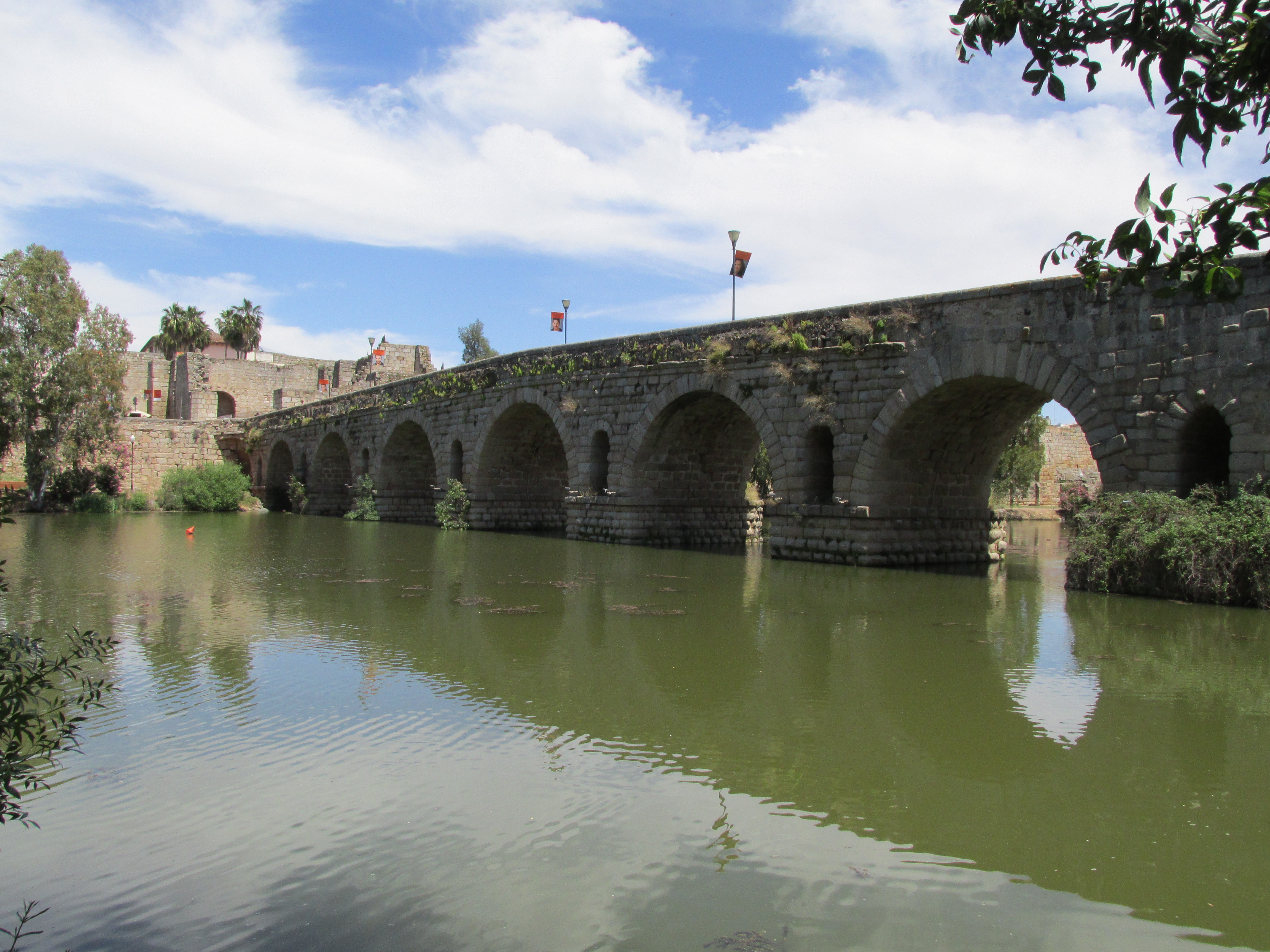
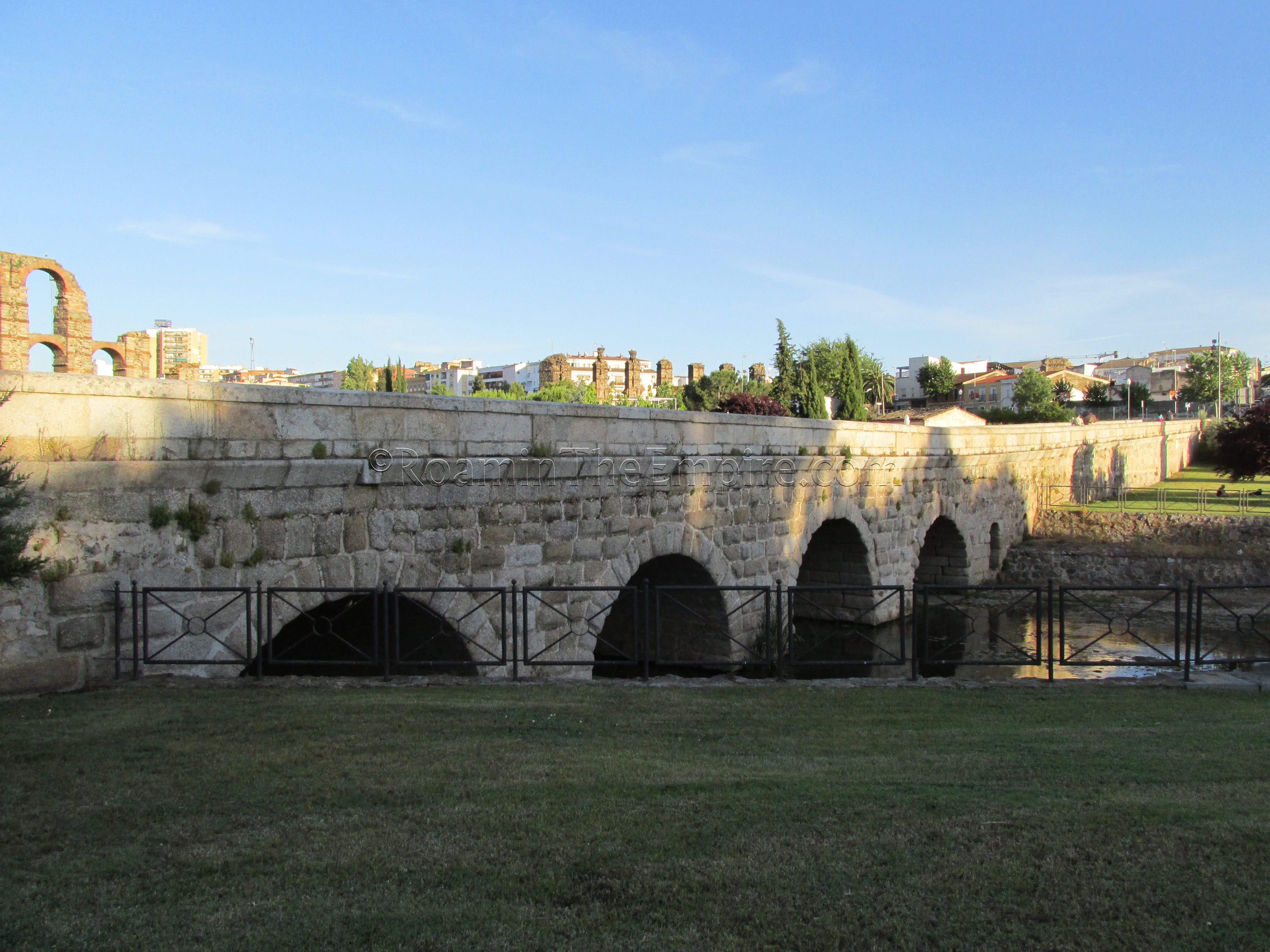
The Roman bridge over the Guadiana River (called the Flumen Anas during the Roman period) is the longest extant Roman bridge in the world at 792 meters in length. It was built in the 1st century BCE around the time of the founding of the colony. Some sources put this bridge as the oldest existing Roman monument in the city. The main road between Hispania and Augusta Emerita, a branch of the Via Augusta, crossed the Fluman Anas via this bridge and became the decumanus maximus as it entered the city.
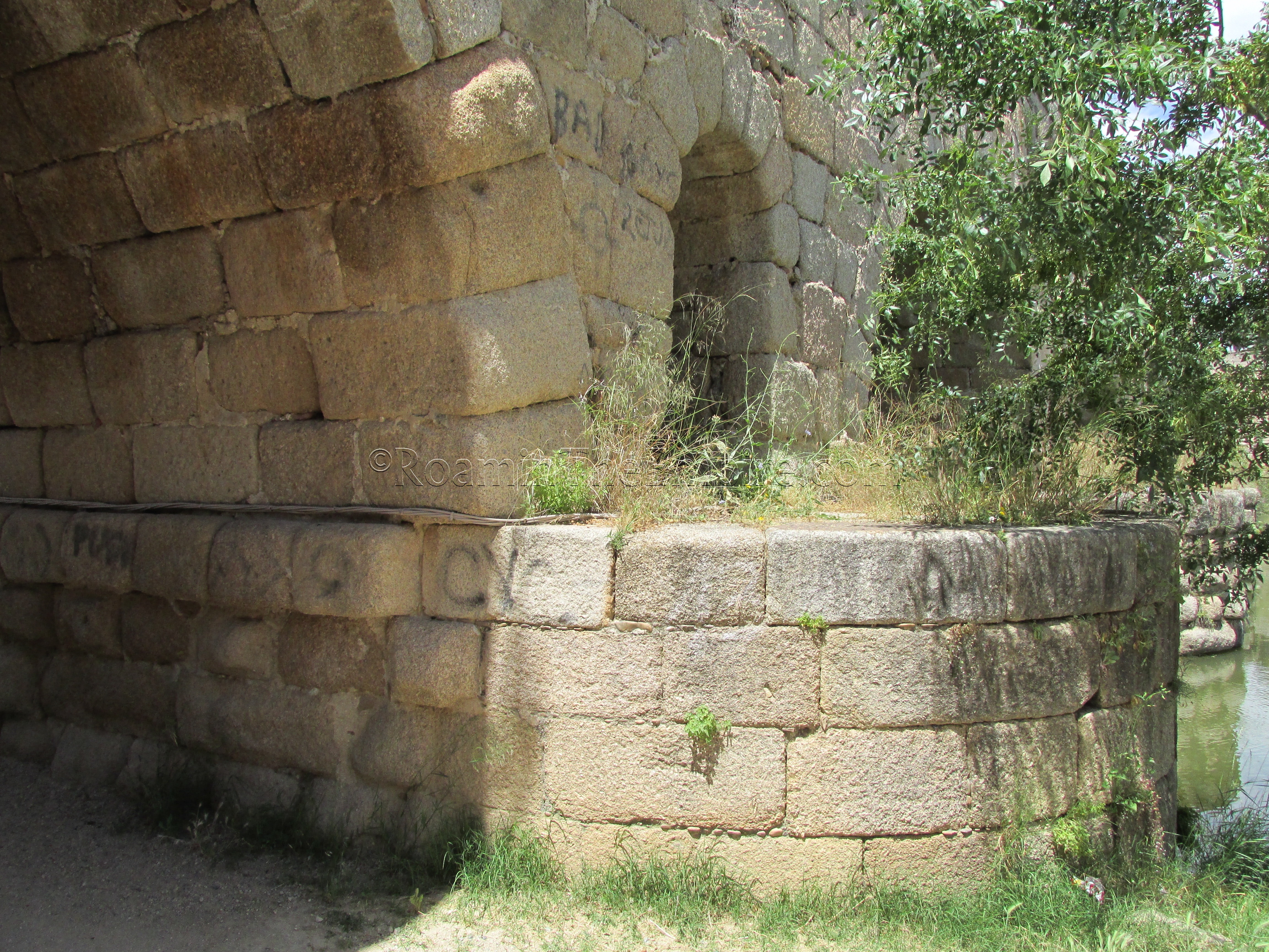
Originally the bridge did not extend the full span across the river that is able to be seen today. The force of the river was apparently of great concern to the engineers of the bridge, likely acting directly under Marcus Agrippa, and so a number of measures were taken to relieve the pressure that would be exerted on the bridge by the current. One of the biggest of these measures was the creation of a raised cutwater on the island to break and divert the force of the river. So, when first built, the bridge actually consisted of two sections; one that crossed the canal from the city to the raised cutwater on the island and then another separate section that crossed from the island over the main branch of the river to the opposite bank.
Flooding that overwhelmed the cutwater created by the island in the 17th century necessitated the connection of the two spans, and created a single unified bridge. Extensions were made to the bridge on at least three occasions during the Roman period. On the island were wharves, shops, and warehouses; none of which remain today. Only one small portion of the cutwater still survives on the east side of the easternmost ramp off the bridge.
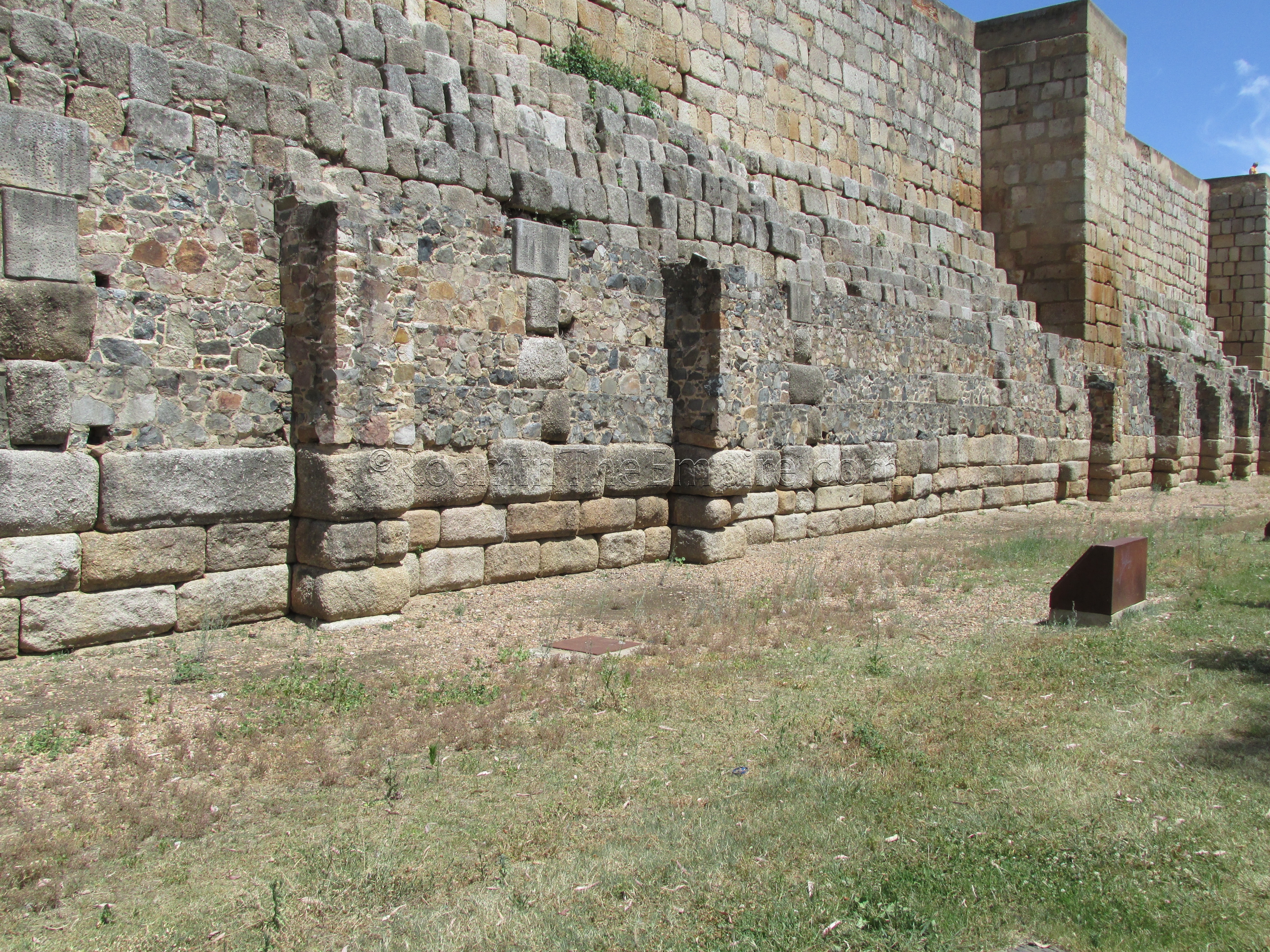
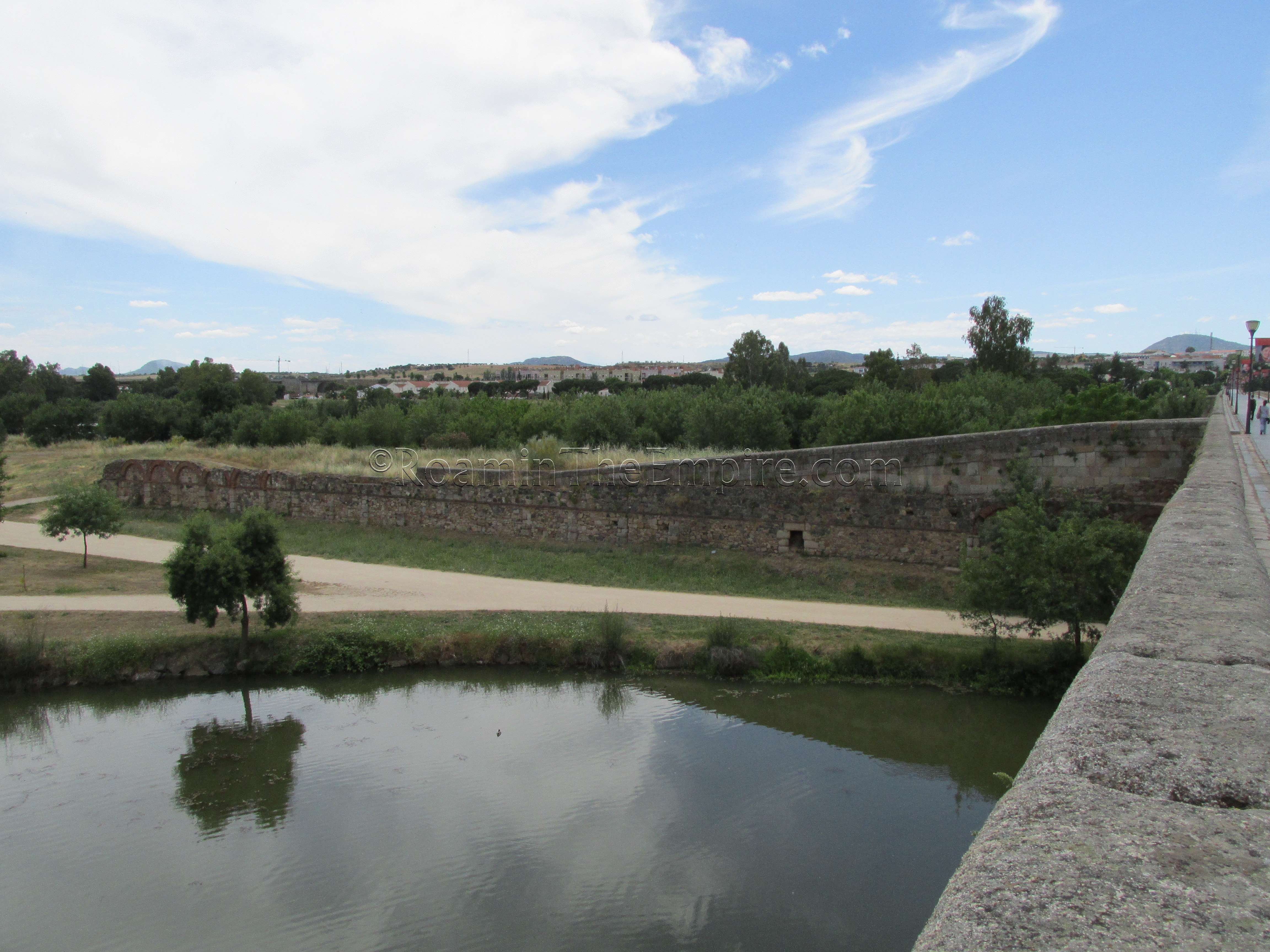
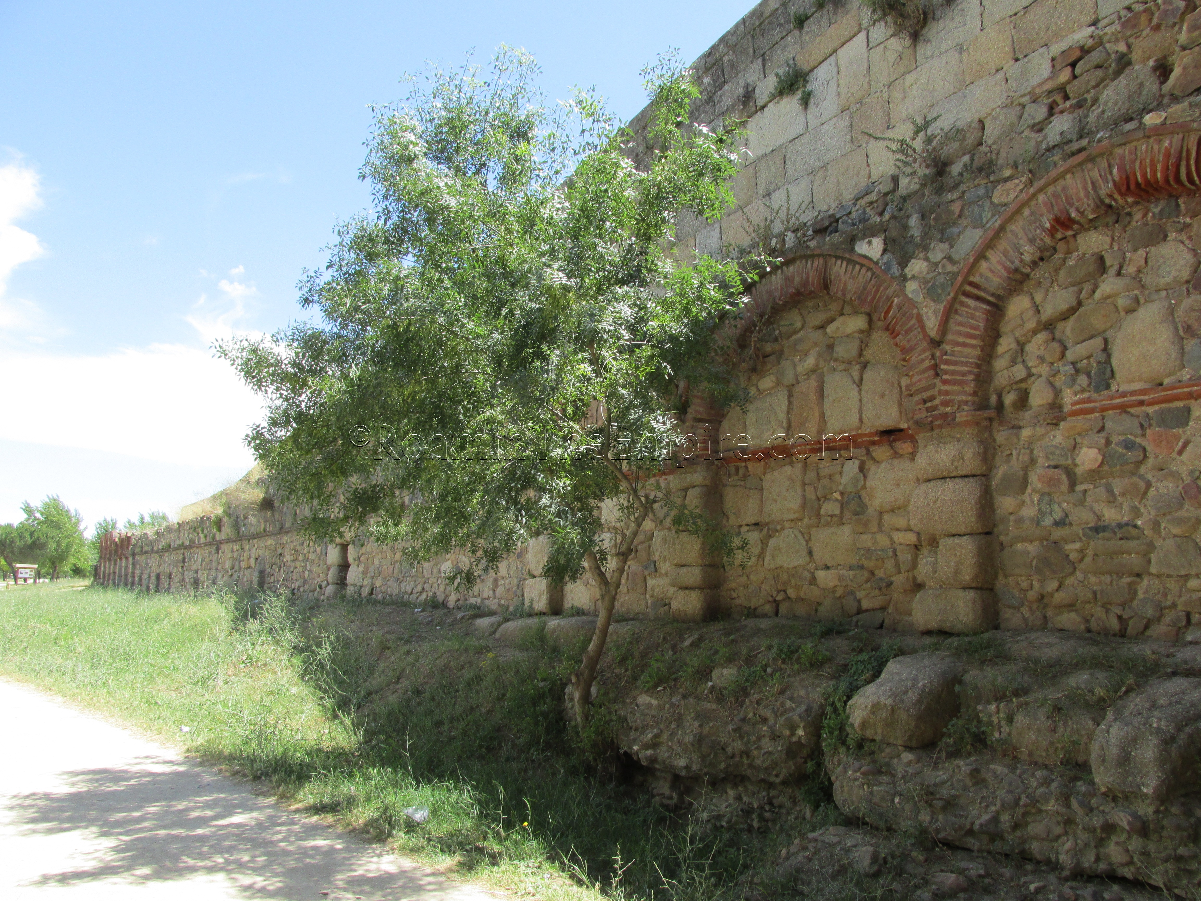
The creation of the cutwater also required the construction of a dam-like retaining wall along the east bank of the river, presumably to help fight against erosion and which may have also served as wharves. A section of the river-side of the wall is currently above water-level and is visible as the bottom layer of the Alcazaba walls, south of the bridge. A small section of the interior portion of this wall is visible within the Alcazaba. Part of the interior side of this dam/retaining wall is also able to be seen within the walls of the Alcazaba when descending into the cistern.
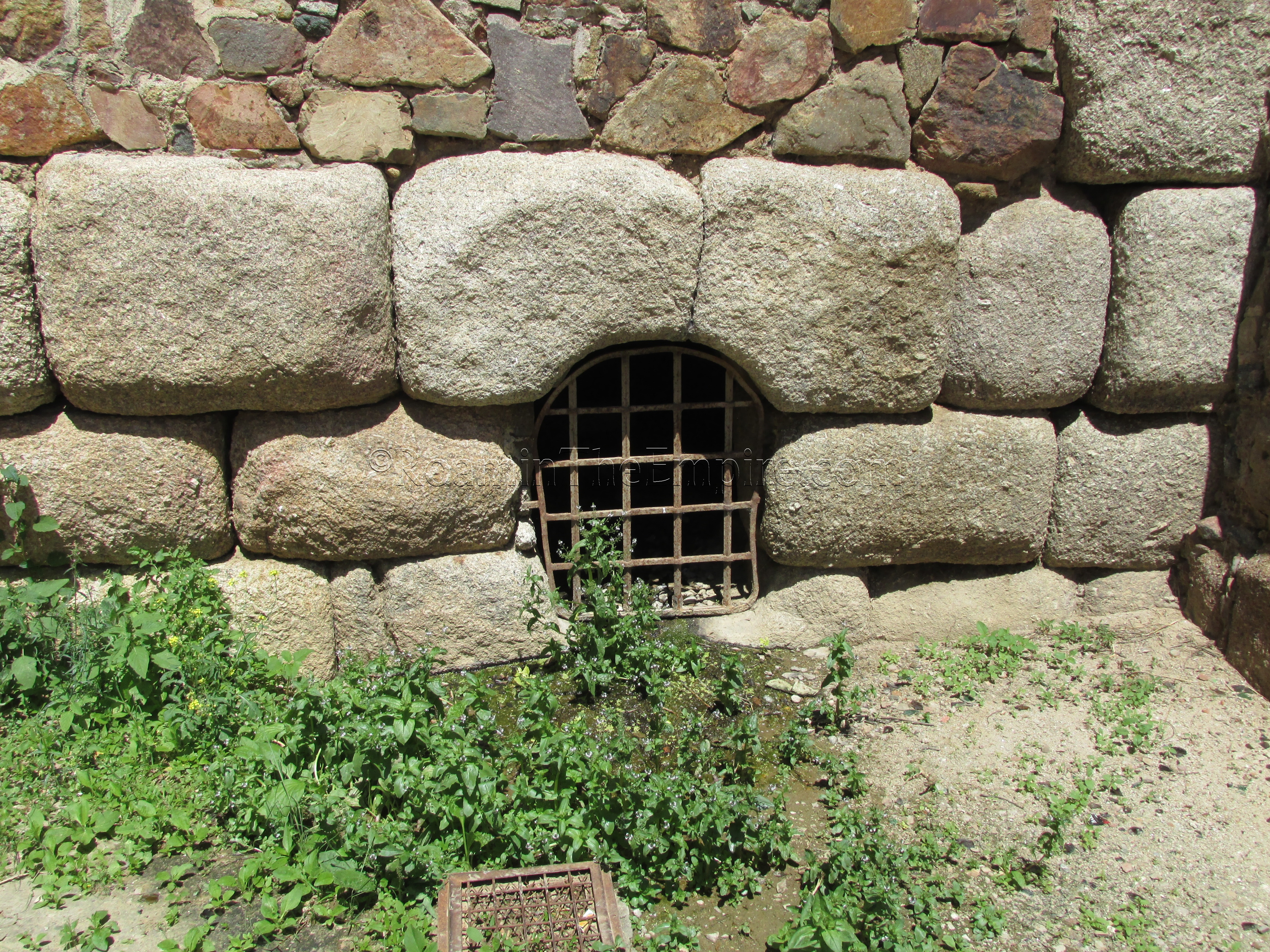
Within the retaining wall, near to where the bridge meets the shore, there is also an opening that has been identified as the cloaca maxima of Augusta Emerita, where the sewer line running under the decumanus maximus emptied into the river. The retaining wall is visible for about 350 meters along the banks of the river, and eventually past the point at which the Alcazaba walls are built on top.
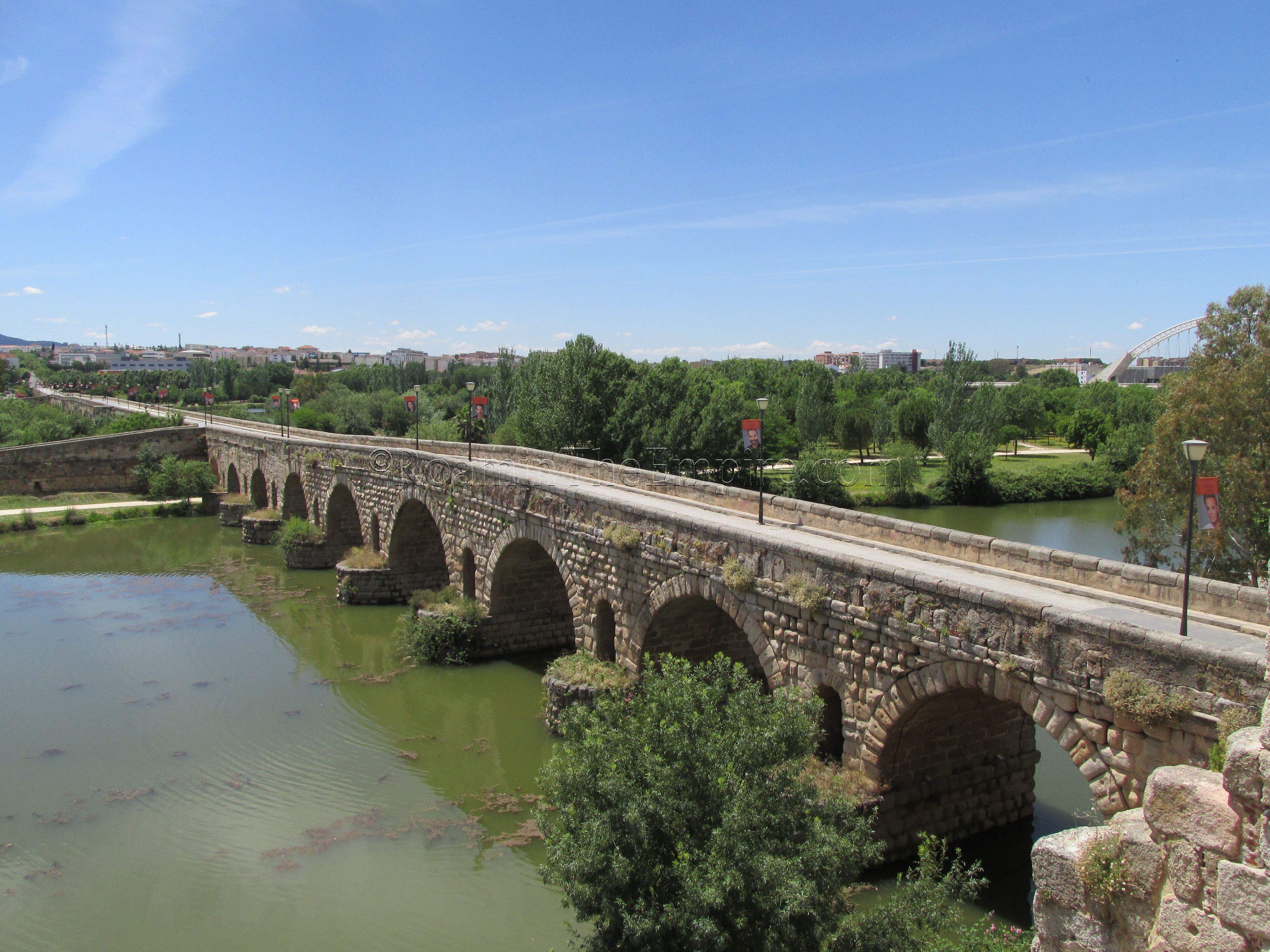
Another way the Roman engineers sought to lessen the impact of the water on the bridge was to create rounded cutwaters on the piers of the bridge on the upstream side, along channels above some of the cutwaters to allow the flow of water through. Later additions to the bridge used more angular cutwaters and did not include the windows, making it largely possible to identify the original Roman portions of the bridge. Including both original Roman sections and later additions, the bridge is now composed of a total of 60 arches. The two ramps off the bridge are also both apparently of 17th century construction.
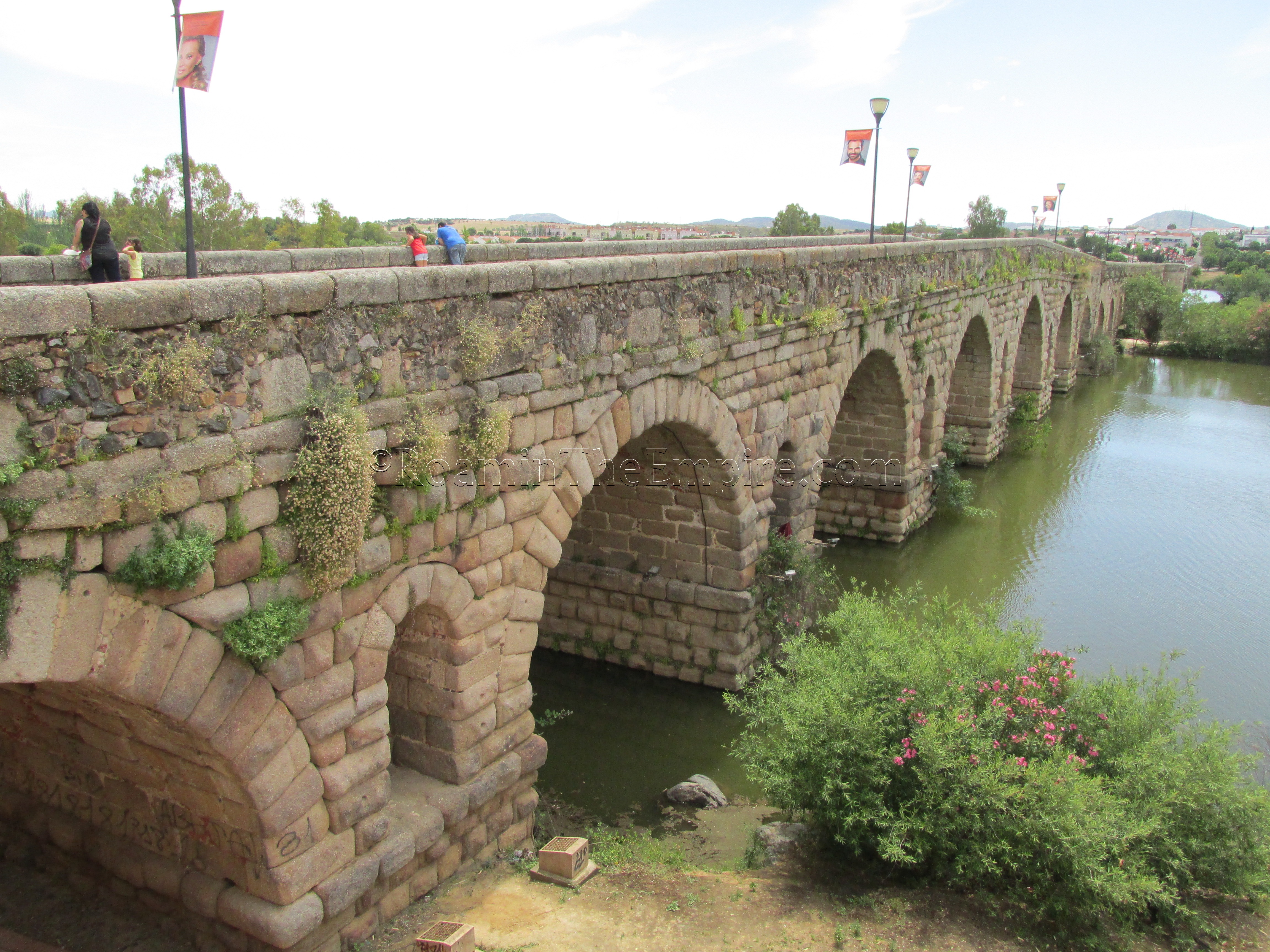
Up until the early 1990’s, the bridge was open to traffic, but with the building of the Puente de Lusitania about 400 meters upstream, it was then closed down and is now a pedestrian only bridge. In addition to the 17th century flood that destroyed the cutwater, floods in 1860 and 1877 further damaged the bridge, requiring repairs, as did the destruction of several arches in 1812 to slow the French advance into Andalusia during the siege of Badajoz.
The second of the two remaining bridges is located on the north side of the city, crossing over the Albarregas River. This bridge led out of the city from the cardo maximus, and was the start of the so-called ‘Silver Way’; a road between Augusta Emerita and Asturica Augusta (modern-day Astorga) by which silver mined in the north of the Iberian peninsula was brought down to Augusta Emerita for transport elsewhere. Like the Guadiana bridge, the Albarregas bridge was built in the 1st century BCE, close to the date of the founding of the city.
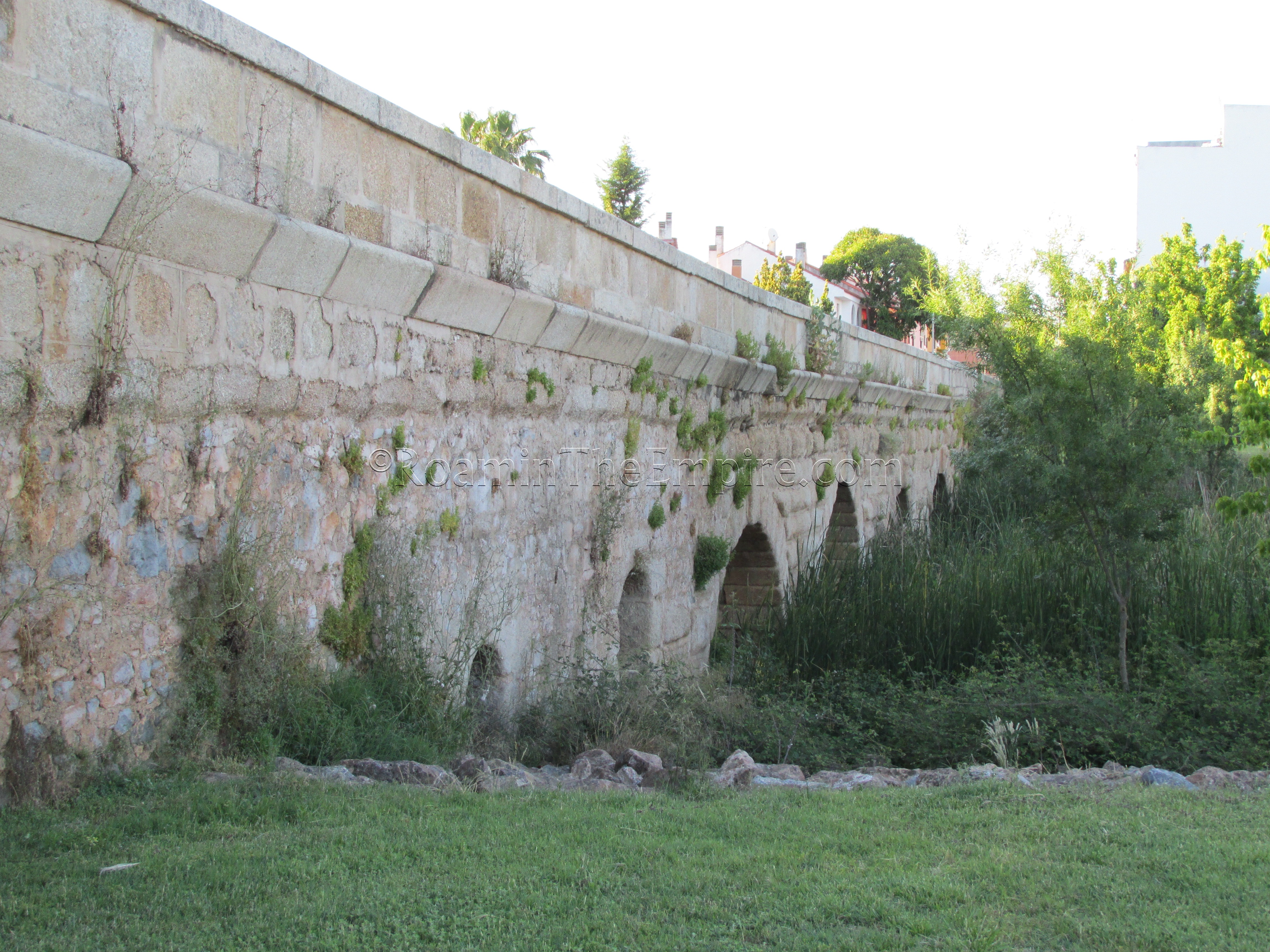
The bridge runs about 145 meters long and is composed of 4 arches. While the Albarregas River is normally not a very strong flow, occasional surges required the building of two overflow channels just to the north of the arches. This bridge is also only open to pedestrians.
A third, single arch bridge that carried a sewer line over a small stream apparently exists between the railway tracks and the river to the northwest of the city, about 600 meters to the east of the A-5/E-90 bridge over the Guadiana. The World Hertiage Site guide created by the city mentions its existence and that there are some scant traces of it remaining, but the location of both the stream and the bridge are not named in any capacity. While I cannot verify the location, as I did not personally visit it, this is apparently where it is, about 2 kilometers northwest of the Roman bridge over the Guadiana River.
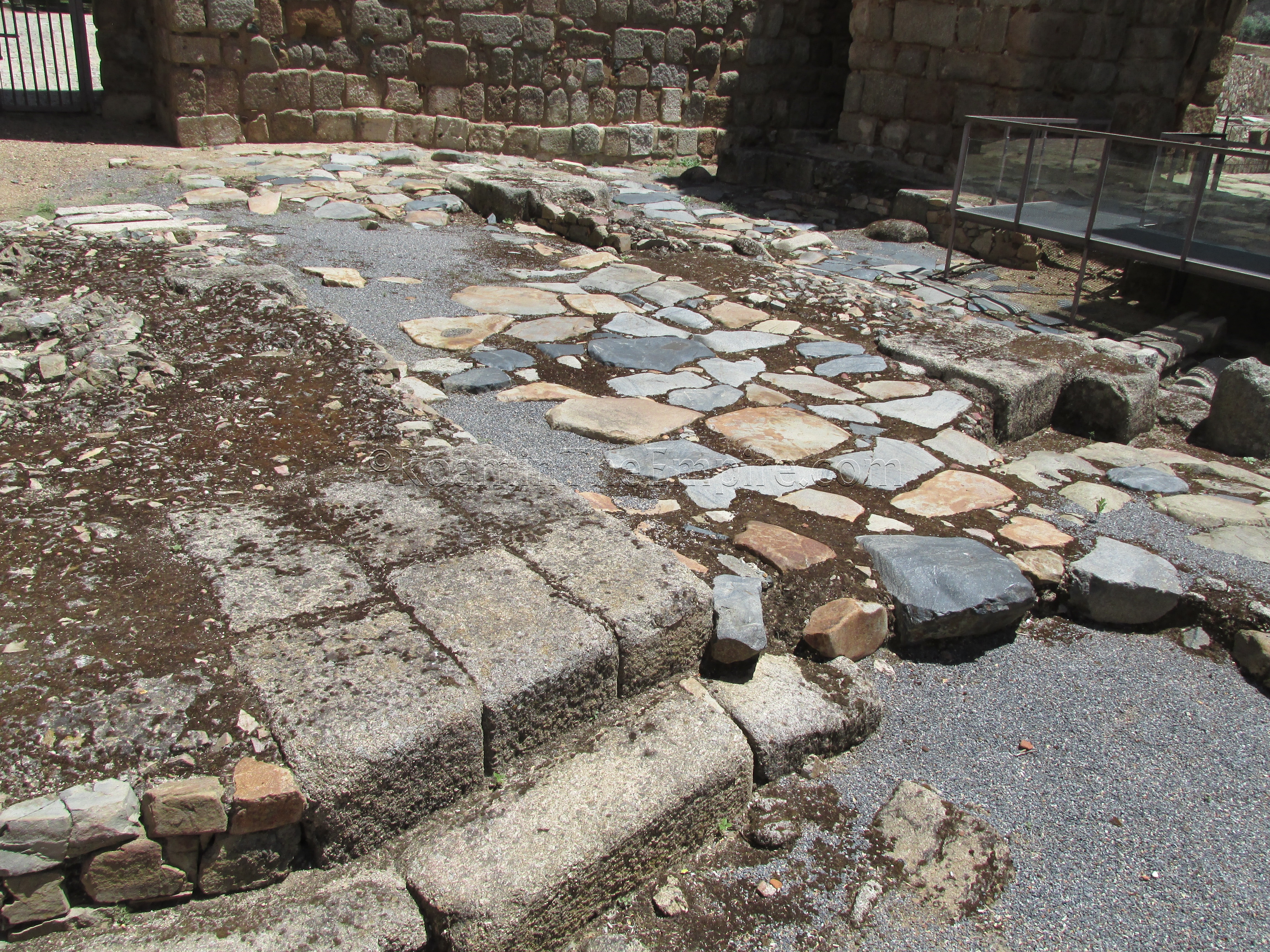
The route of the decumanus maximus starts at the Guadiana bridge, and just a few meters from the east bank end of the bridge, in the Alcazaba, are the remains of the city’s main gate. Though only the very foundations remain, it seems as though this was the monumental double gate featured on the coinage of Augusta Emerita. The section of the decumanus maximus that runs through the gate is also visible. The Alcazaba was completed in 835 CE while the city was under Moorish rule, and the area that the Roman gate occupied continued to be used as the fortified entrance between the city and the bridge.
To visit the gate, admission to the Alcazaba is required, and there are other remains within the walls of the Alcazaba as well. The Alcazaba is open every day from 9:00-21:00 from April to September, and from 9:30-18:30 the rest of the year. Admission is 6 Euros for just the Alcazaba, or a 15 Euro combination ticket can be purchased that allows entrance to all the major sites in the city (circus, amphitheater/theater, Santa Eulalia crypt, Casa del Mitreo, Los Columbarios, and Zona Arqueológica de Morería).
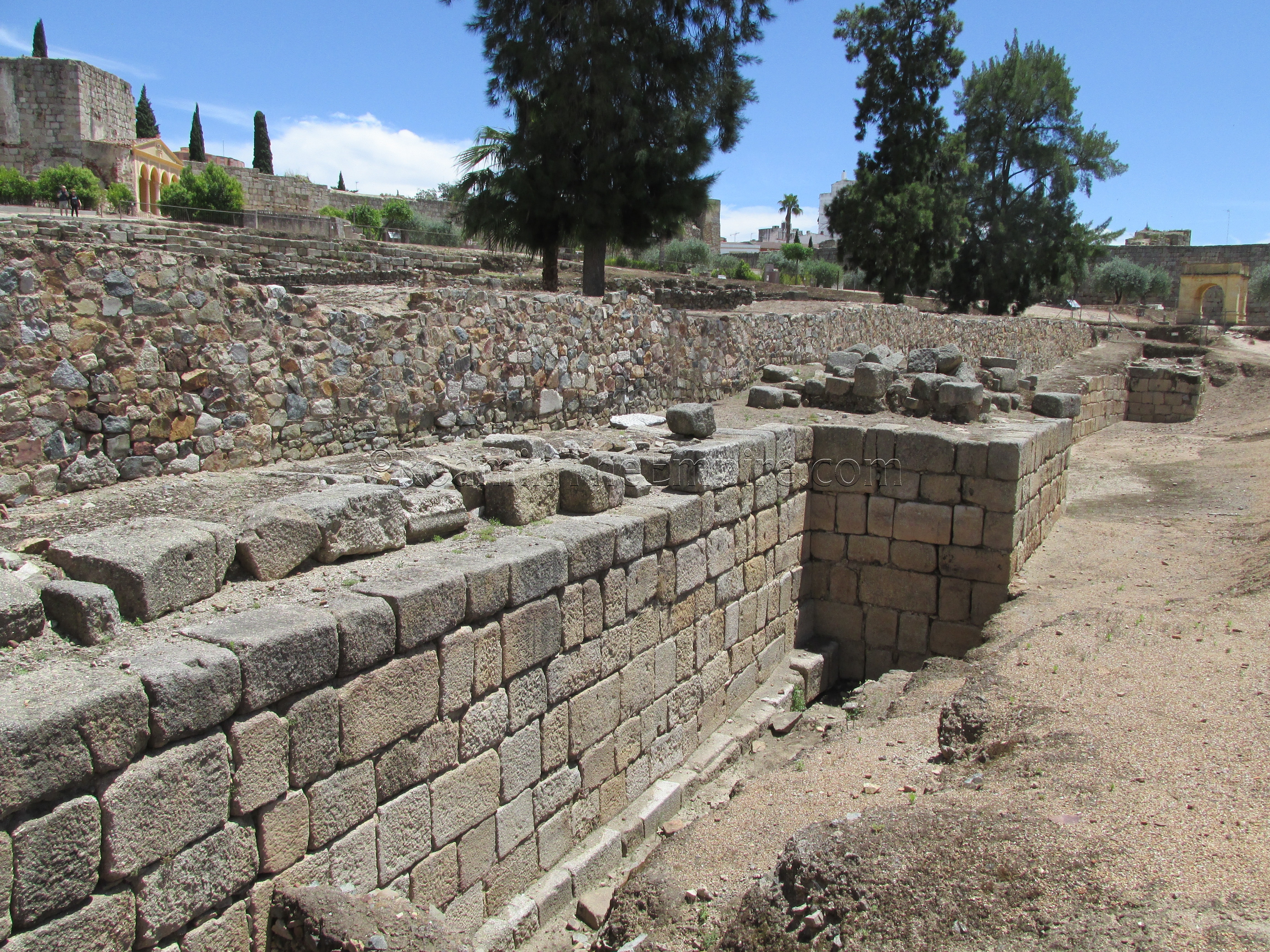
In addition to the gate and the previously mentioned section of the river wall that are accessible inside the Alcazaba, there is also a portion of the Roman-era wall, some extra-mural structures, and a portion of a residential neighborhood excavated. Continuing into the Alcazaba from the gate area, there is a section of about 70 meters of the Roman fortifications, with two towers, running on the left side of the entrance.
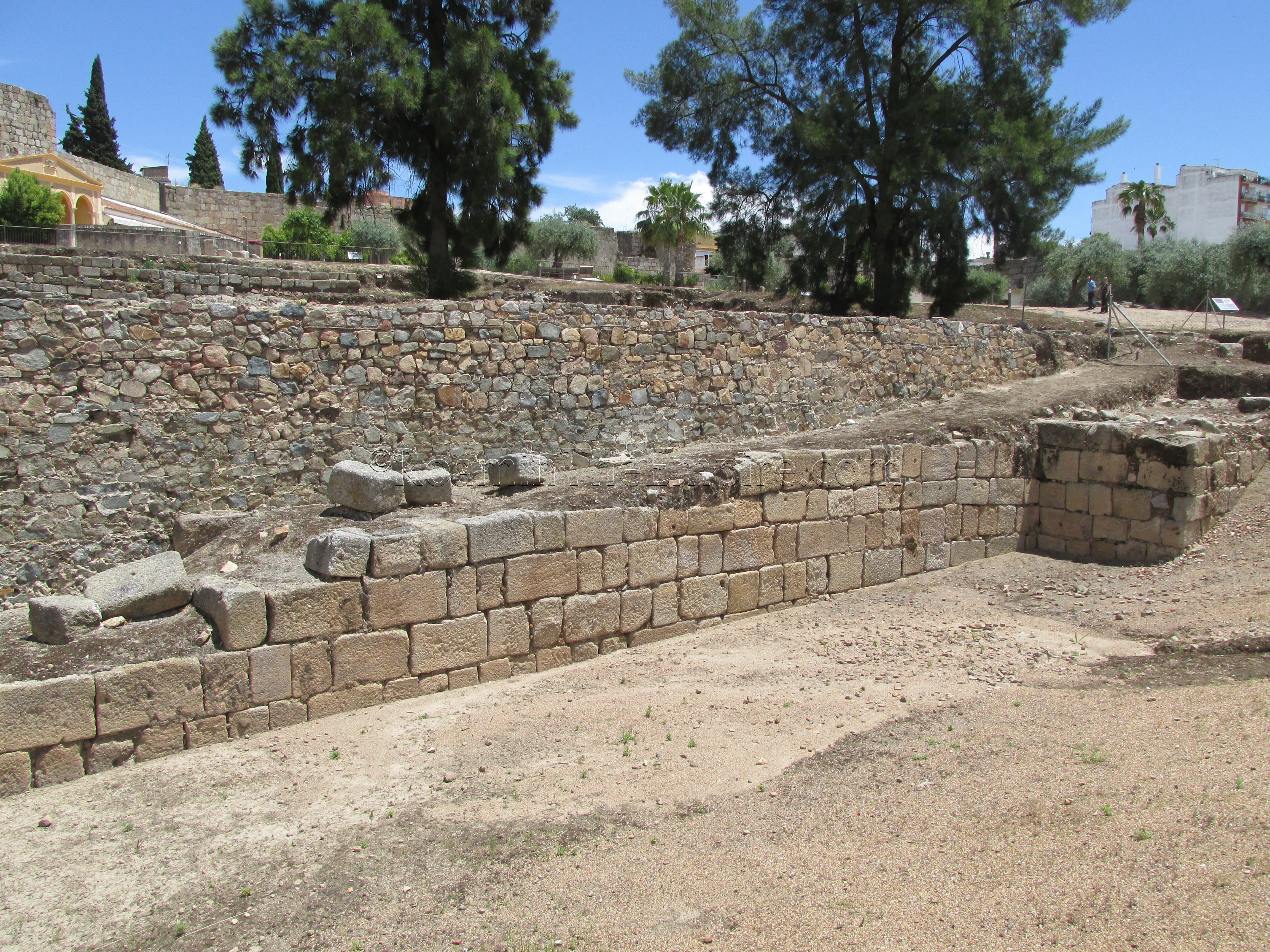
There seems to be two phases of construction visible in this wall; the 4th century CE improvements to the wall which are composed of the ashlar blocks running on the outermost course of the wall, and the 1st century CE phase which is made up of the higher interior portion of the wall made of semi-regular stone. This earlier phase most certainly dated to around the foundation of the city. The 9th century walls of the Alcazaba also seem to be made up of spoliated ashlar blocks from the later Roman fortifications.
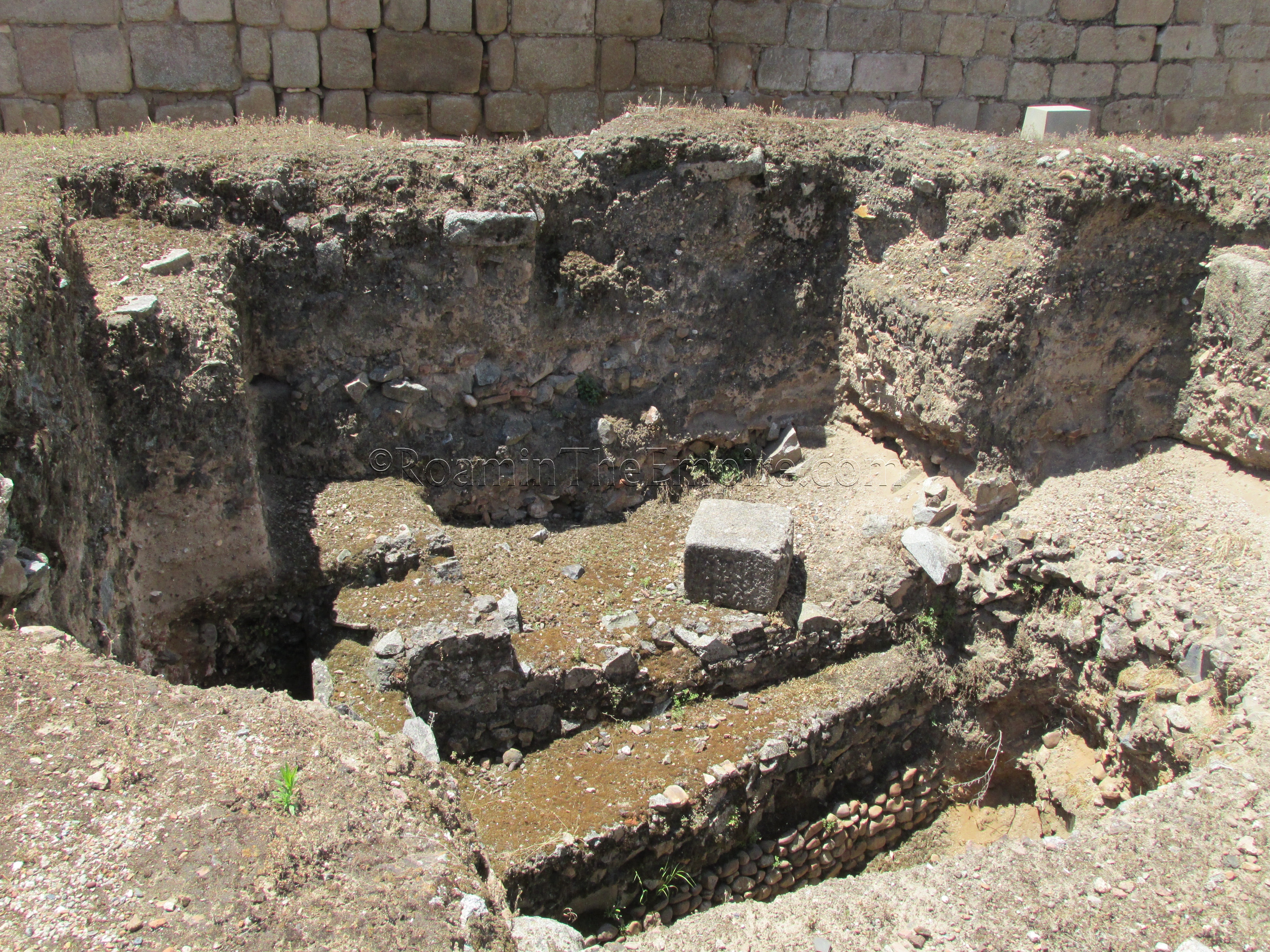
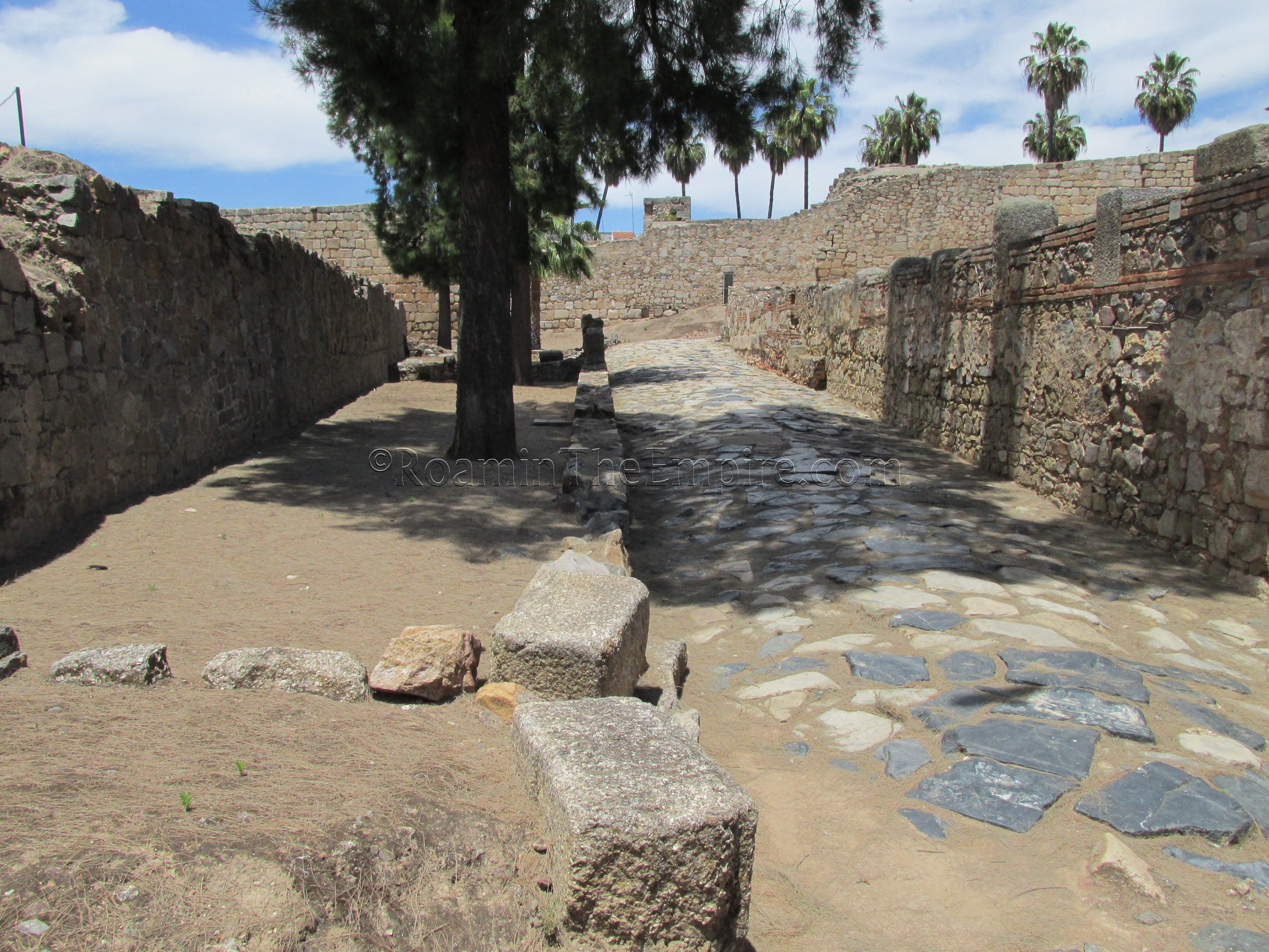
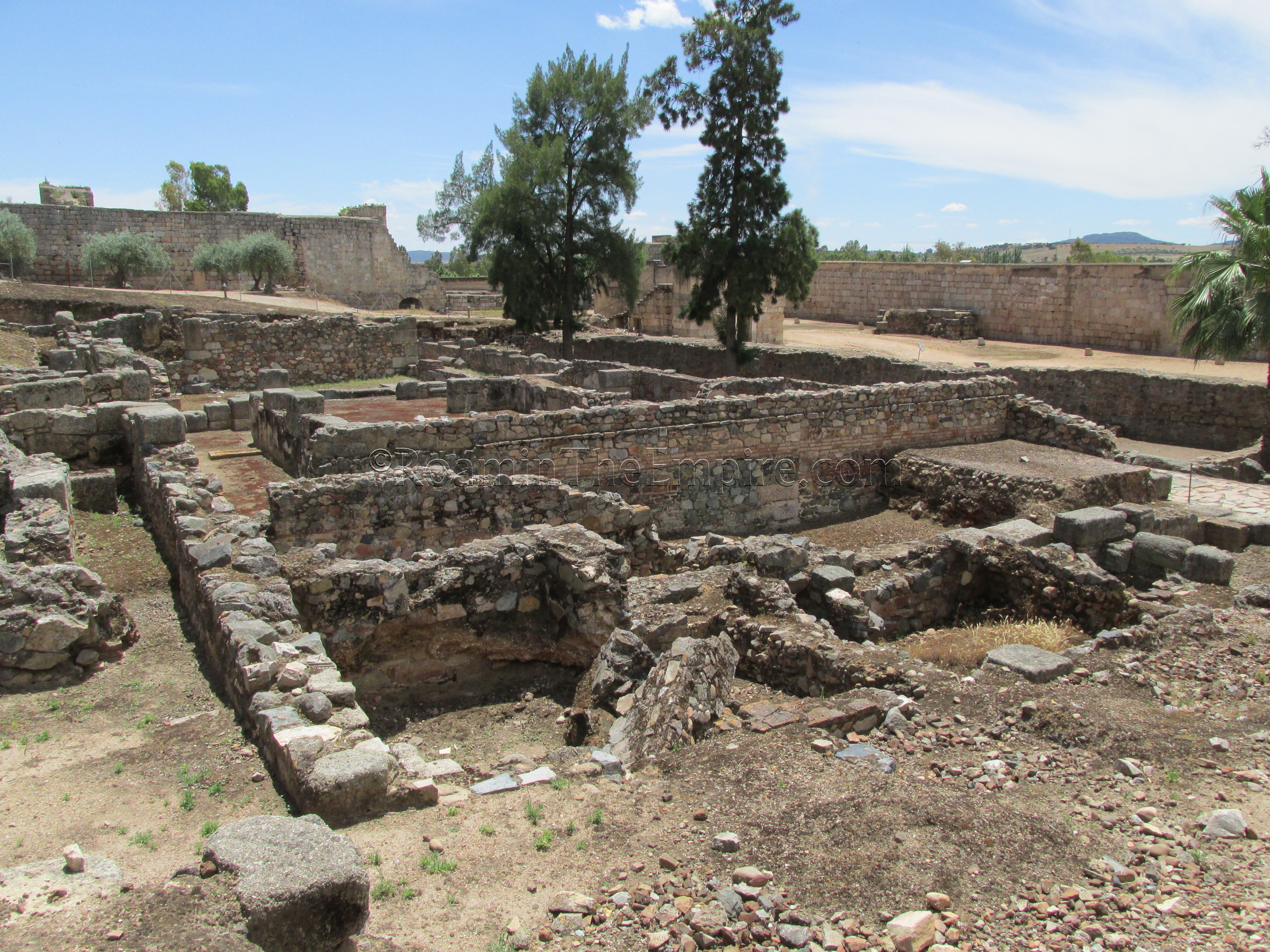
To the right, which would have been outside the Roman walls, are a few domestic structures that date to the Roman period. Behind (east of) the Roman wall, a few streets and a section of a domestic structures can be seen. The decumanus running parallel to the wall dates to the foundation period of the city, while the perpendicular cardo seems to be of a later construction.
Between the decumanus and the wall are some structures that are identified as tabernae. Bounded by the two roads is a portion of a domestic structure. Since the walls at street level are rather high, seeing the residential building is best done from the rise to east of these excavations. A peristyle, tablinum, some corridors, and a portion of a bathing complex are among the rooms that can be seen.
The route of the decumanus maximus is actually marked through the center of town. The stretch of Calle Sta Eulalia between Plaza de España and Puerta de la Villa is marked with a large dash-like pattern indicating the approximate route of the decumanus maximus. The street layout of Augusta Emerita is apparently well documented due to the findings of the Roman sewer lines that were running under the Roman era roads, and so the paths of many of the streets have been able to be determined.
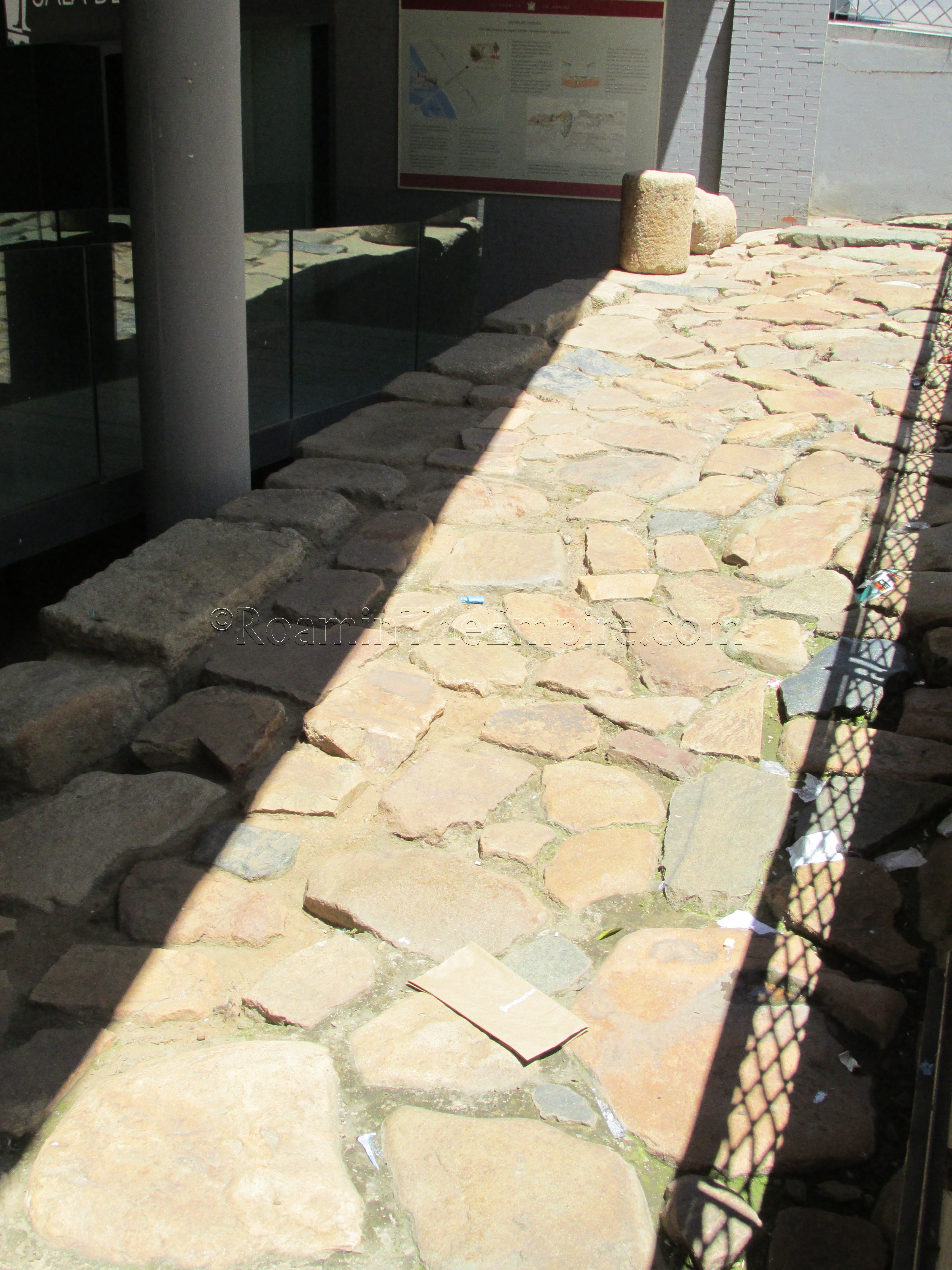
The ending point of this stretch of Calle Sta Eulalia, Puerta de la Villa, was the location of another of the city’s gates, which gives the square and monument its name. On the northwest corner of Calle Sta Eulalia and the Puerta de la Villa is the Sala Decumanus. In front of the Sala Decumanus, below the street level, is a preserved stretch of the decumanus maximus. Within the Sala Decumanus there are apparently the remains of some shops and a domestic structure along the decumanus maximus, but the building remained closed the entire time I was in town (and seemed to be a gathering spot for vagrants in the catwalk above). Admission to the exhibit in the Sala Decumanus, if anyone manages to catch it while it is open, is free.
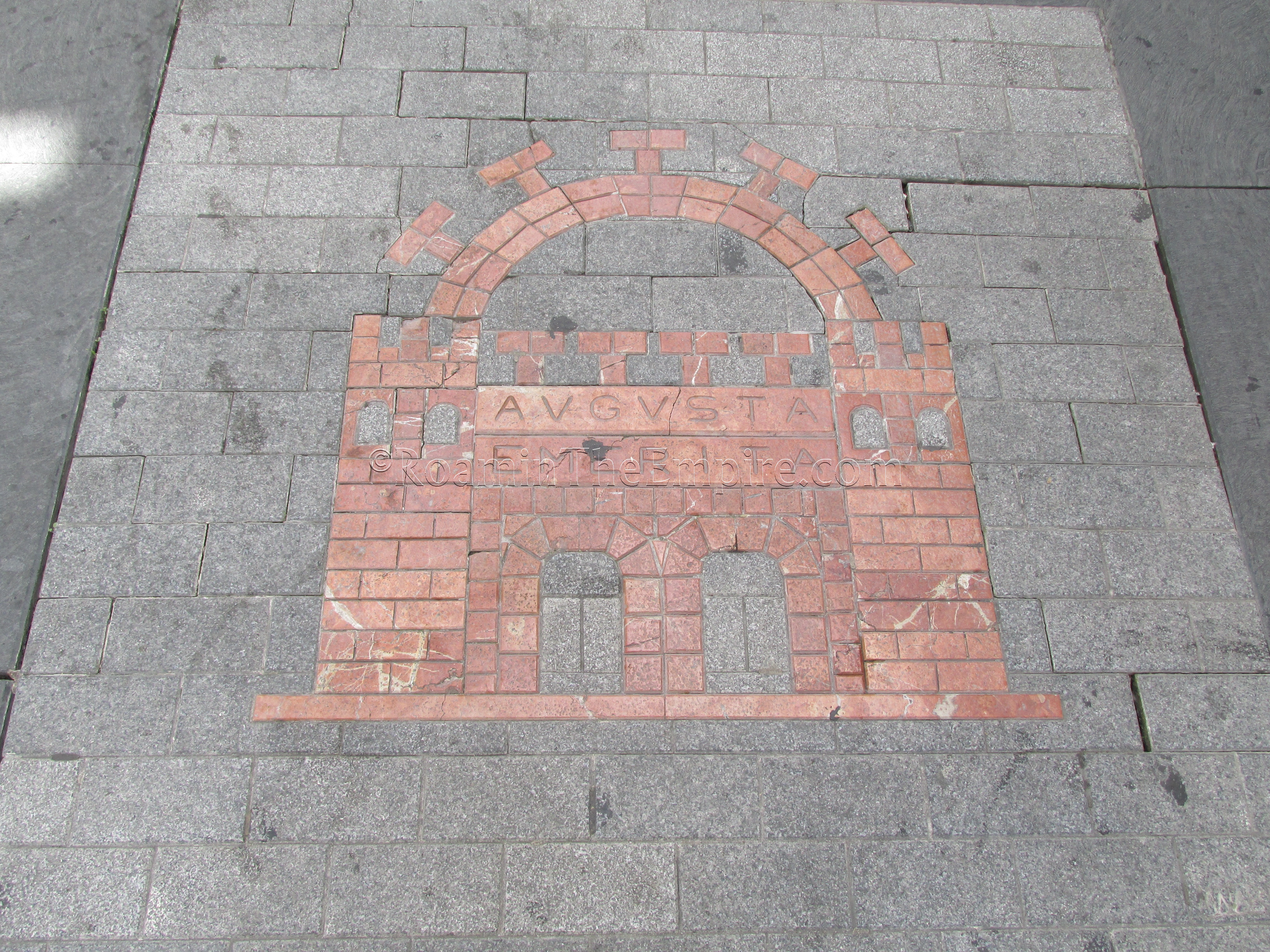
At the intersection of Calle Sta Eulalia and Calle Juan Pablo Forner/Calle Alonso Zamora Vicente is a large medallion of the coat of arms of Mérida; the familiar double gate that was featured on coinage minted in Augusta Emerita. That intersection is the approximate location of the intersection of the decumanus maximus and the cardo maximus. The same markings that denote the route of the decumanus maximus along Calle Sta Eulalia can be seen running southeast on Calle Alonso Zamora Vicente (only until the next cross street, Calle Romero Leal) and northwest on Calle Juan Pablo Forner to mark the route of the cardo maximus.
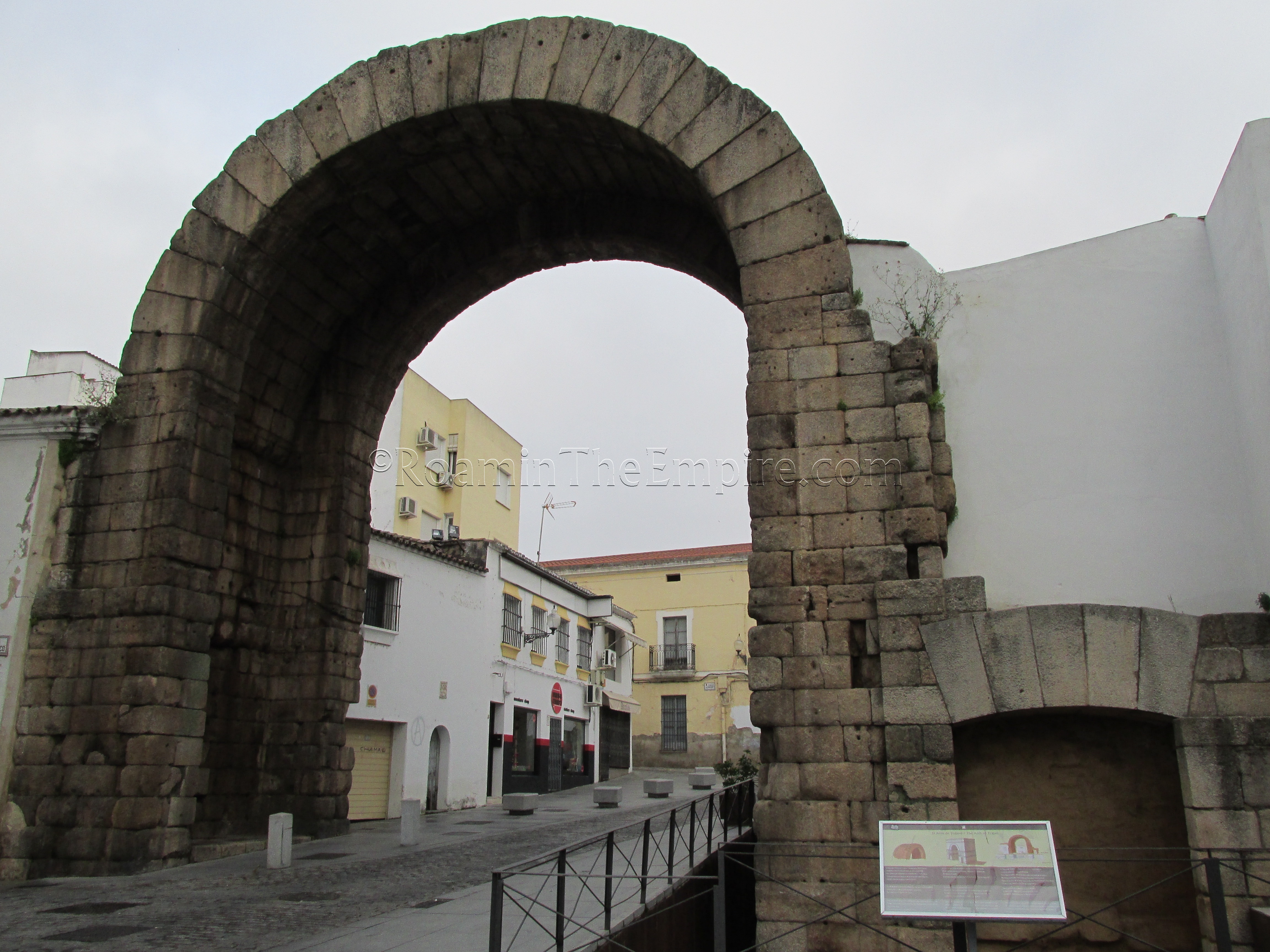
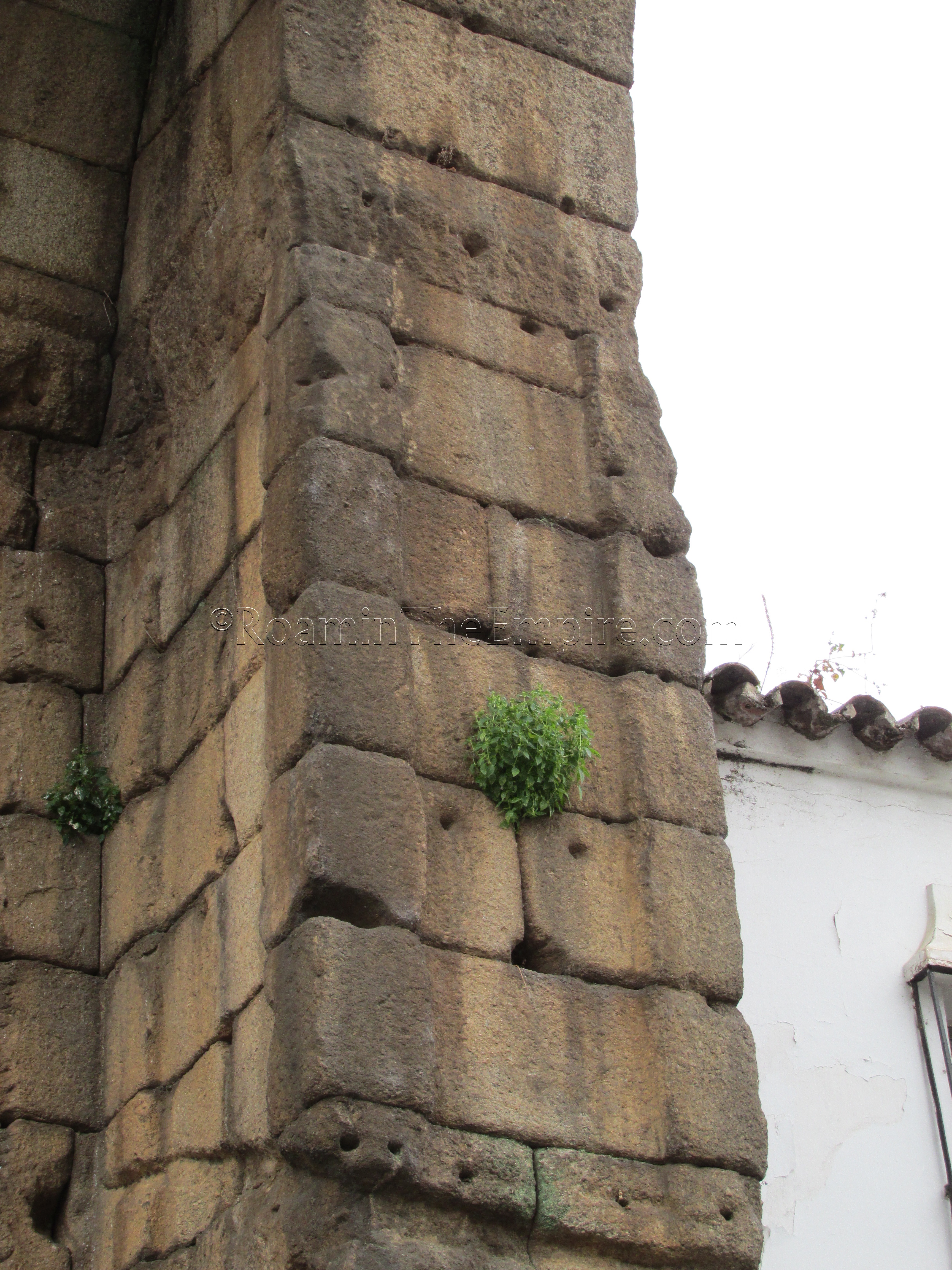
The markings on Calle Juan Pablo Forner also only run until the next cross street, Calle F Valverde Lillo, but at the point, the street that continues on in that direction, Calle Trajano, can be followed a short distance to the so-called Arco de Trajano. This arch actually has nothing to do with Trajan, but was rather an Augustan-era city gate (or perhaps as late as Tiberius) through which the cardo maximus exited to the north. Later, when the city walls were expanded in the early 2nd century CE, perhaps under Trajan or Hadrian, this no longer functioned as a city gate, but then served as the monumental entry to a precinct dedicated to the Imperial Cult.
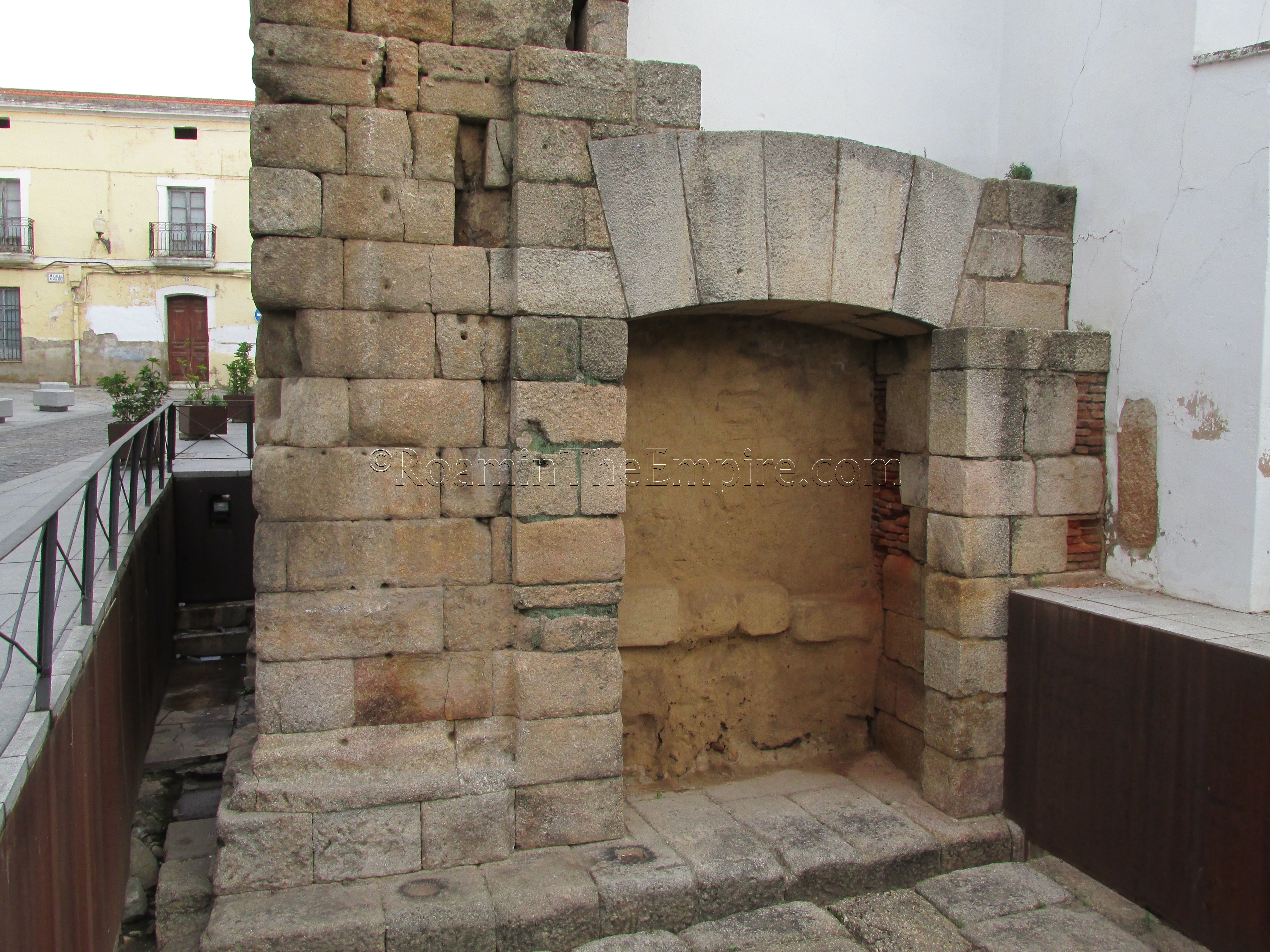
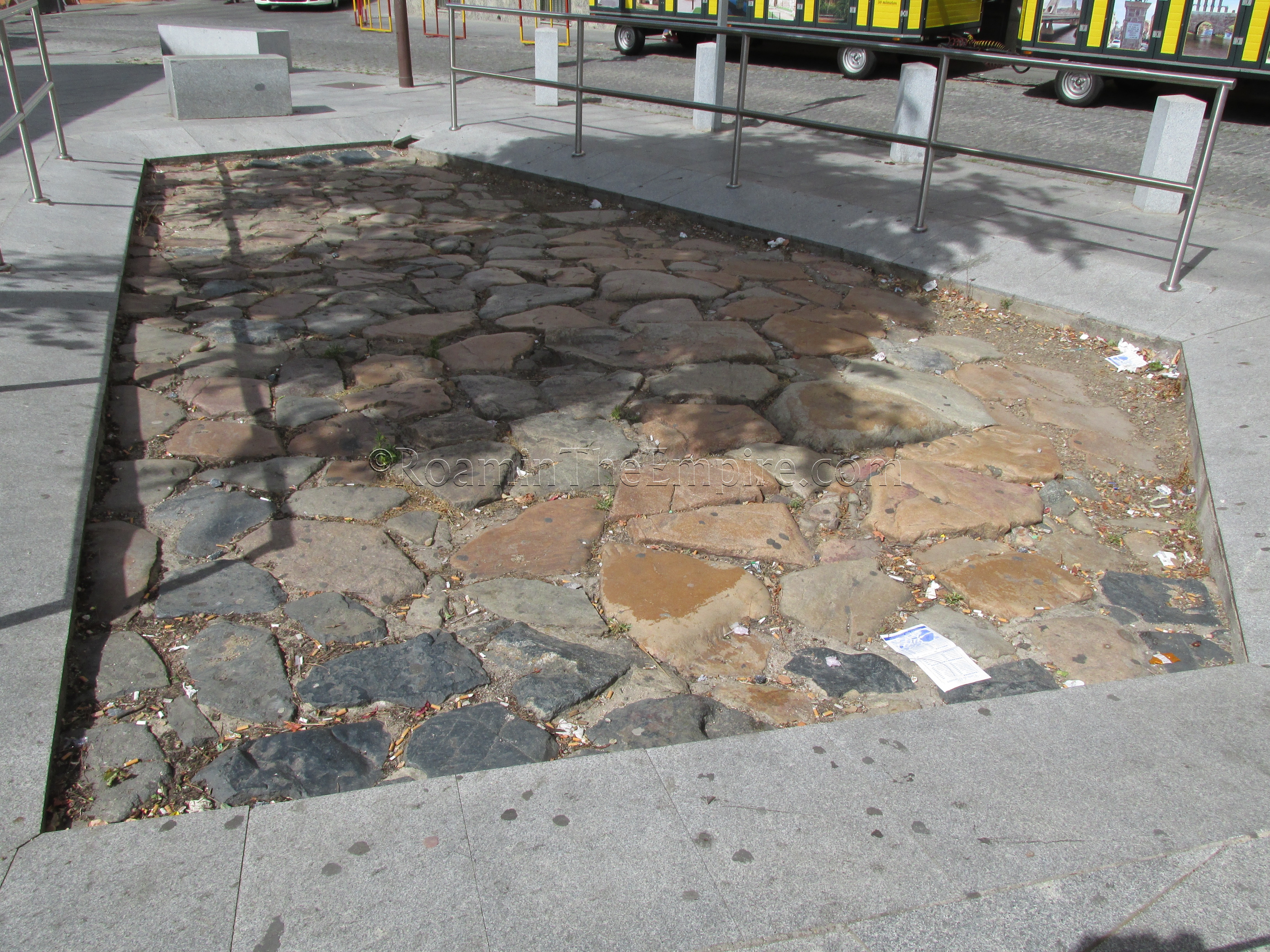
The arch is currently at about 14 meters above ground level, but a meter or so of arch exists below the current ground level, and is exposed at the pedestrian gate on the east side of the arch. Paving from around the arch is also preserved in this area. The arch would have originally been faced in marble, and the attachment holes for these marble panels can still be seen all over the arch.
There is also a restaurant adjacent to the arch on the east side called A de Arco, in which a portion of the arch can be seen. My first pass by the arch was early in the morning, before the restaurant was open, and when I went by later it looked a little out of my budget while I was there, so I decided not to go in, but in hindsight it seems like a fairly reasonably priced place. A drink or small plate would probably be a sufficient purchase to get in and see the part of the arch inside.
Another section of a secondary decumanus is located along Calle José R Mélida, west of the entrance plaza for the amphitheater and theater site.
Continued In Augusta Emerita Part IV


")


