


Continued From Augusta Emerita Part I
The lifeblood of a Roman city, it’s not much of a surprise that Augusta Emerita relied on three separate aqueducts to thrive. The first of these three aqueducts constructed was, what is today often referred to as, the Cornalvo Aqueduct, but was probably called the Aqua Augusta in antiquity. A large bronze inscription noting an ‘Aqua Augusta’ was found, and this likely refers to the Cornalvo Aqueduct, though this is not completely secure identification. Given that name’s association with Augustus, this aqueduct was probably constructed during the reign of Augustus, perhaps close to the foundation of the city. The modern name comes from the source of the aqueduct, the Cornalvo Reservoir, located about 15 kilometers northeast of Augusta Emerita.
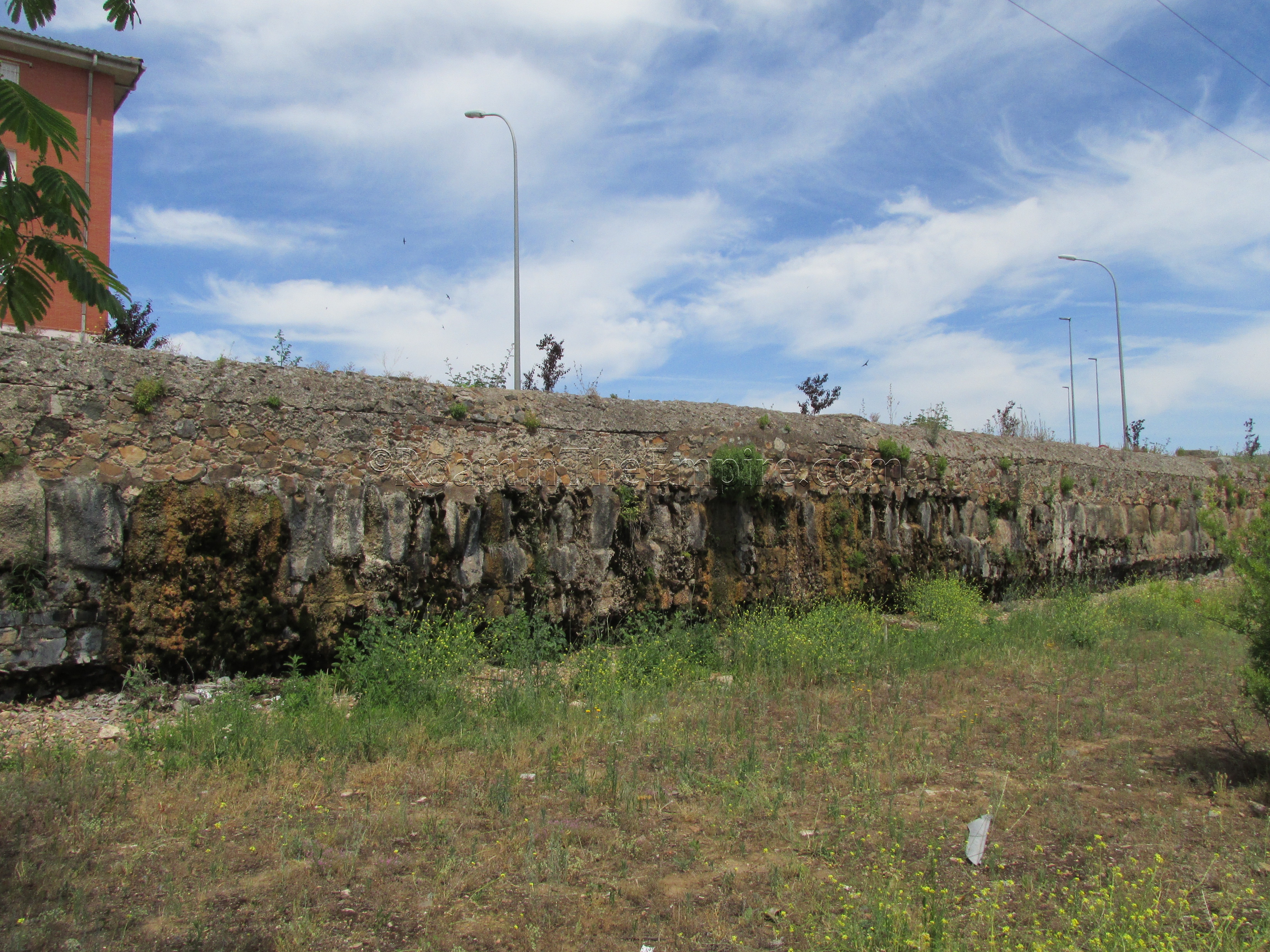
The Cornalvo Reservoir itself is of Roman construction. An earthen dam measuring about 194 meters long, 20 meters high, and 8 meters wide seems to have been originally constructed by the Romans on the Albarregas River (which runs along the northern side of Augusta Emerita further downstream) to create the reservoir. The reservoir was not the original source of the aqueduct, though, as the dam seems to be a later construction, perhaps as late as the end of the 1st century or beginning of the 2nd century CE. The un-dammed Albarregas River and its feeders were the source of the aqueduct up to that point.
The dam still remains and can theoretically be visited, but, it is essentially in the middle of nowhere. With that being said, I was not able to find any sort of public transport out to the dam, and one would probably need a personal vehicle or to pay for a taxi. I did not have the former and was not willing to pay for the latter, particularly as the dam has later improvements and there is some speculation and differing opinion on which remaining parts, if any, are actually Roman. Because of that, I was not able to actually visit the Cornalvo Dam, though it might be a worthwhile trip for someone with transportation and a few hours of spare time.
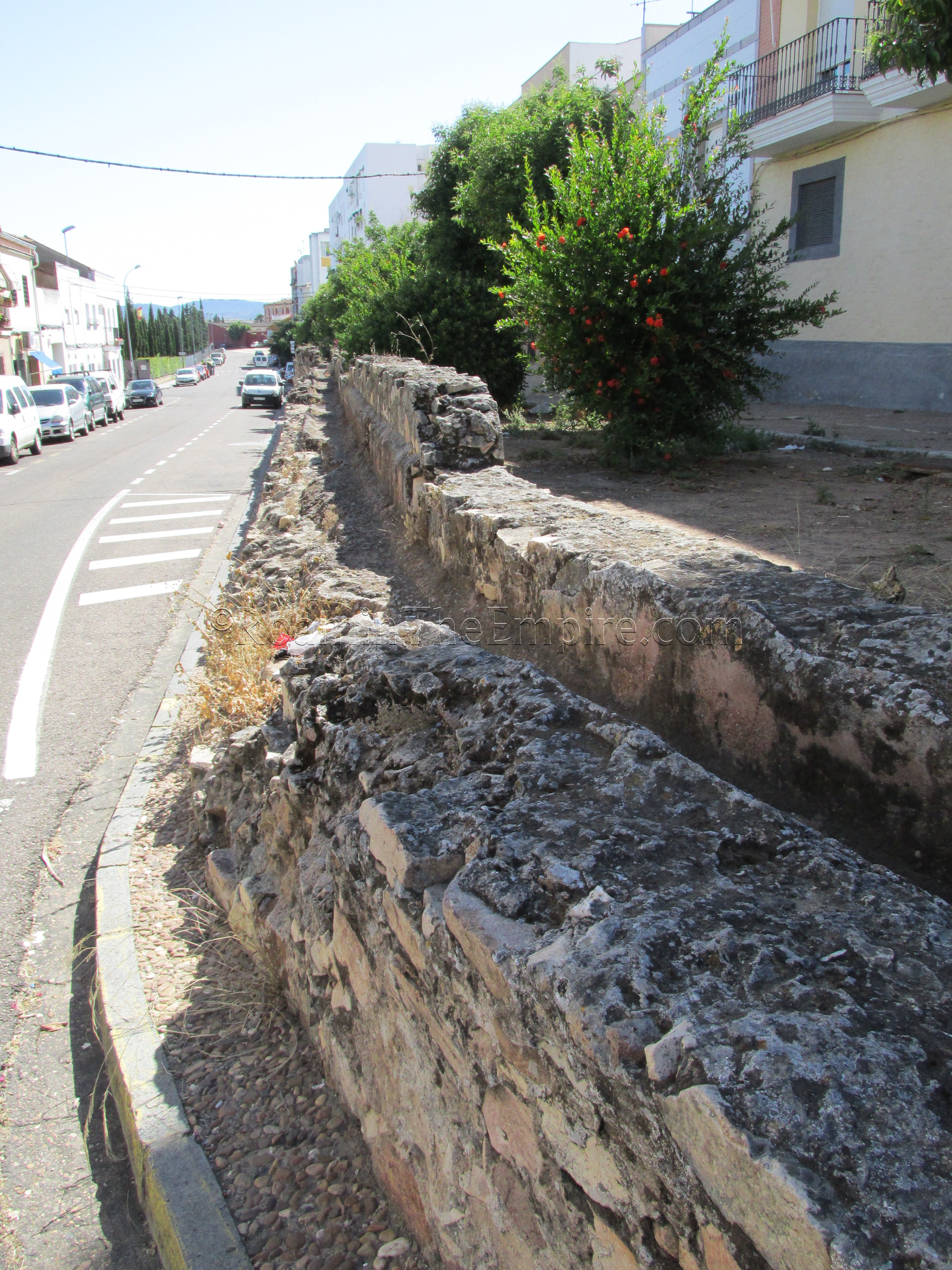
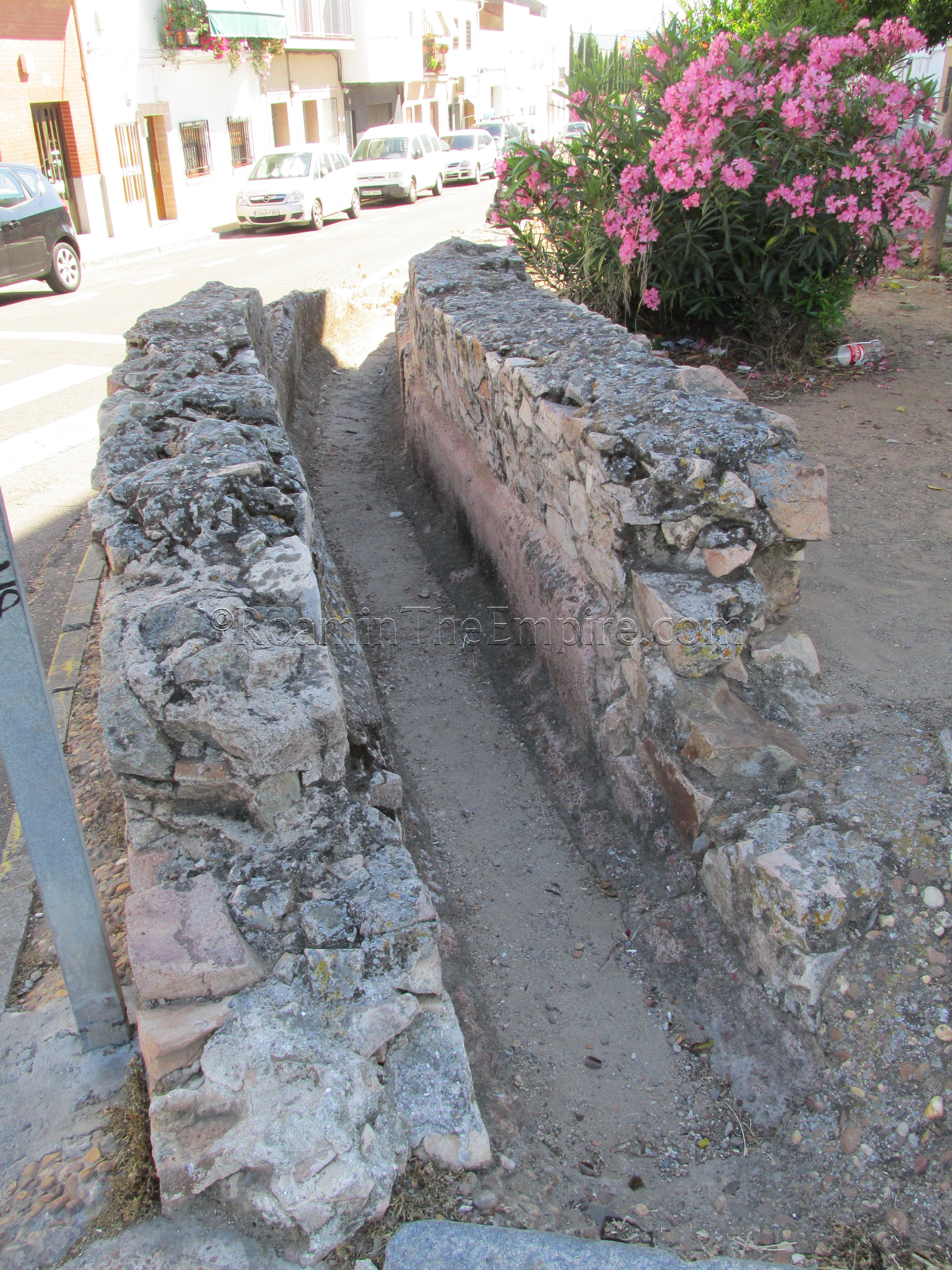
Unlike the other two aqueducts that feed Augusta Emerita, the Aqua Augusta had no towering, arched bridges. It travels a distance of about 17 kilometers between the reservoir and where it enters the town, largely through an underground channel. Consequently, there’s not very much in the way of remains of the Aqua Augusta to see. There is one stretch of about 83 meters of aqueduct remaining, though, running along the west/north side of Calle Via Ensanche. Starting at the street’s intersection with Calle de la Guardia Civil, it runs roughly to the intersection with Calle Antonio Machado, the opposite corner of which is the location of the Los Columbarios tombs. This section of the aqueduct would have still been running outside of the city walls.
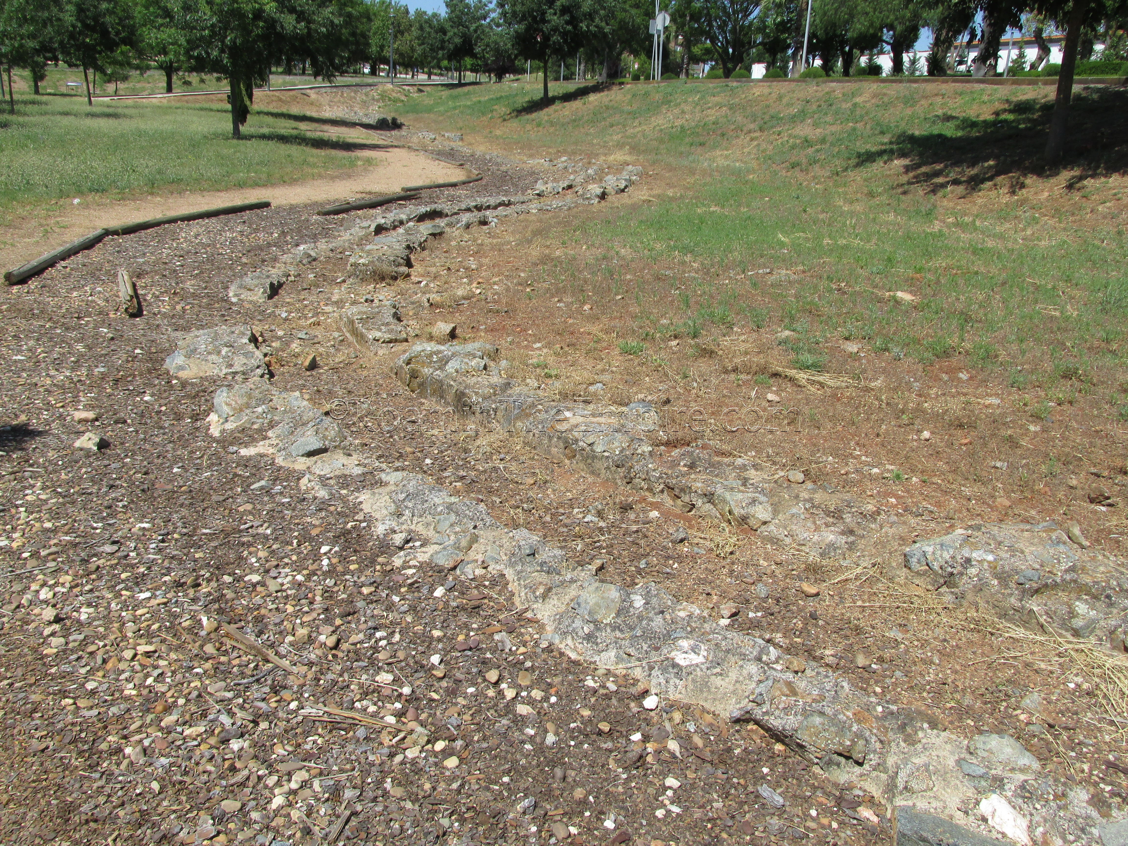
The second aqueduct that was built for Augusta Emerita seems to be the Las Tomas Aqueduct. Unlike the Aqua Augusta, the ancient name of this aqueduct does not seem to survive in any from. It was likely built in the late 1st century CE, around the same time as the Cornalvo Dam. The Las Tomas Aqueduct originates north of the city in the Las Tomas Valley, and runs about 4 kilometers to the city, primarily underground.
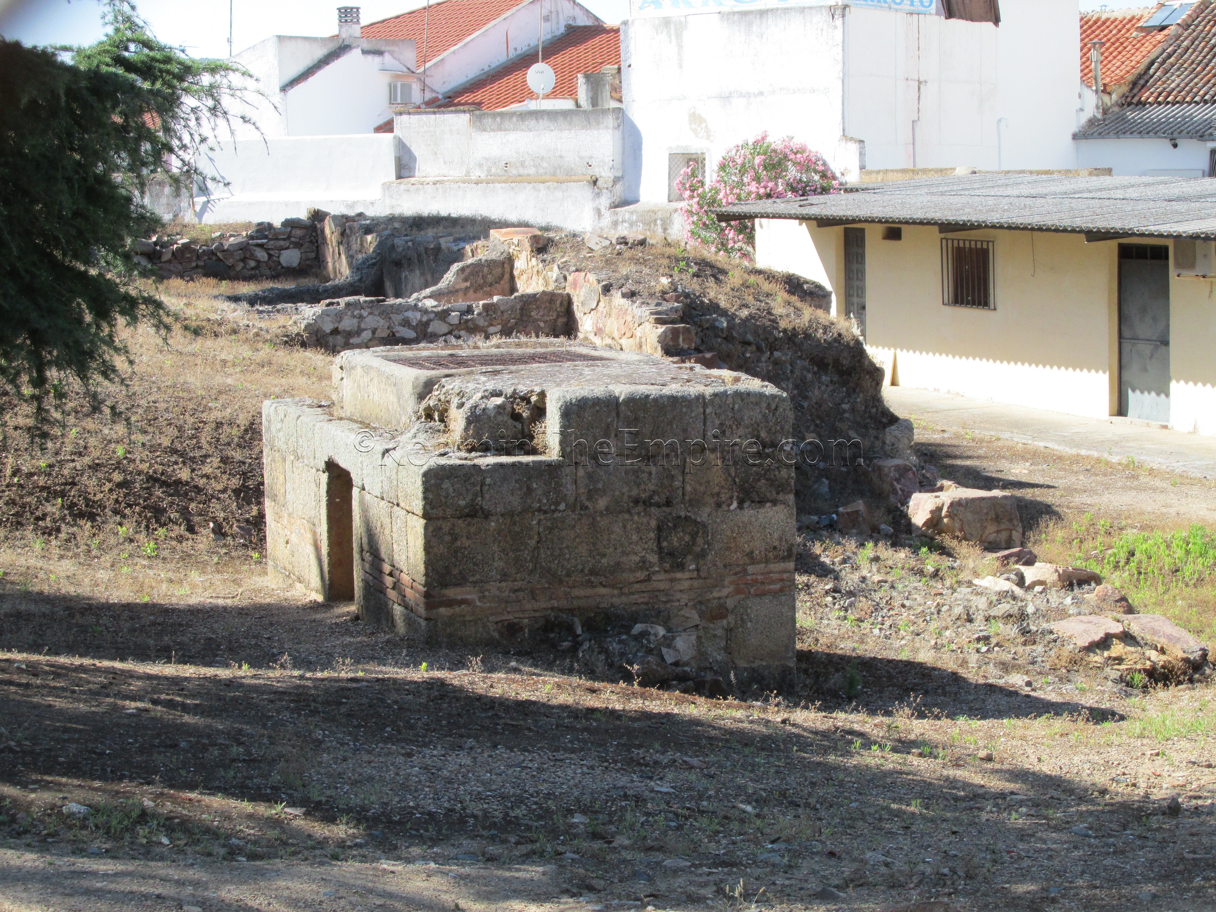
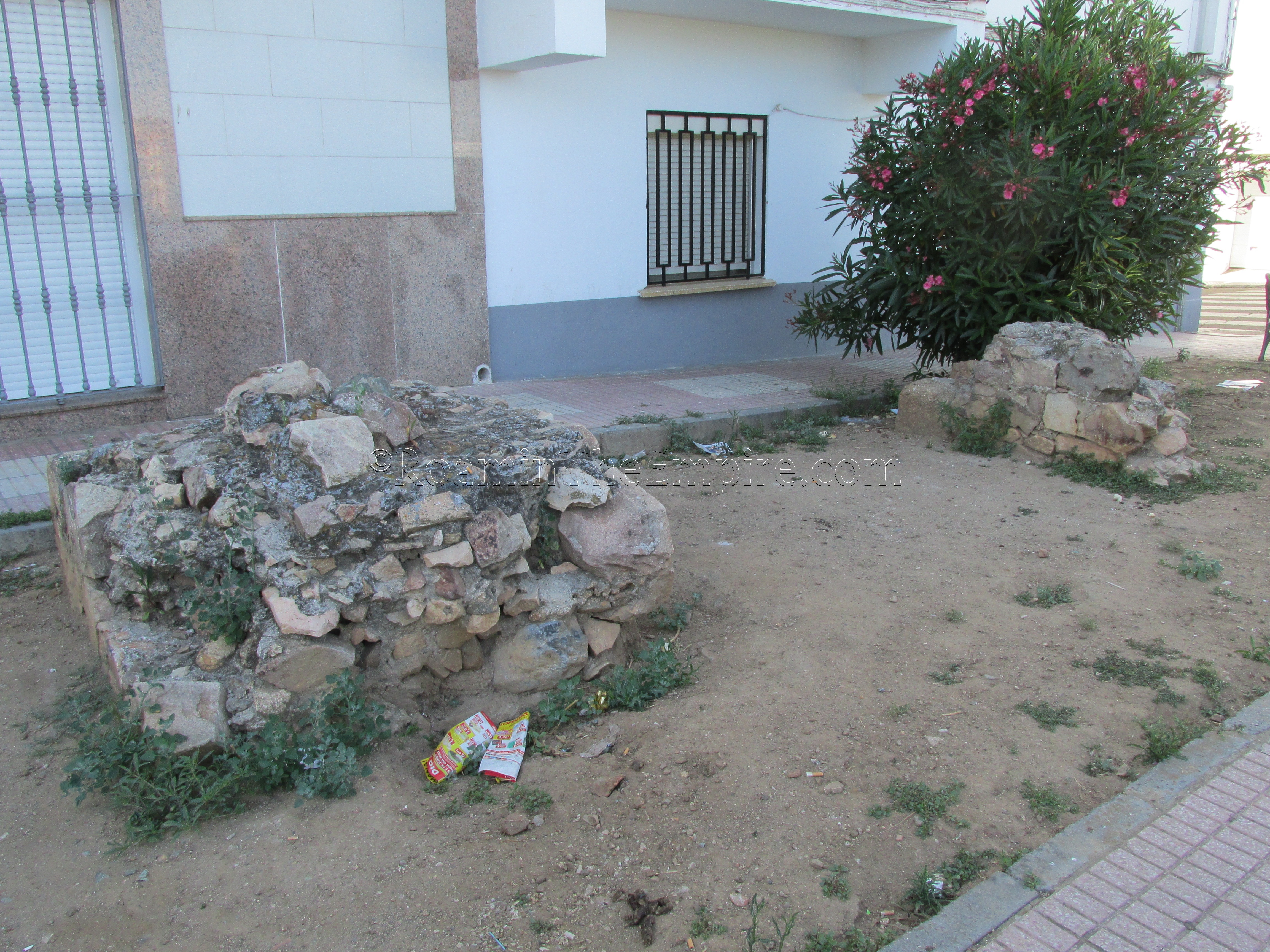
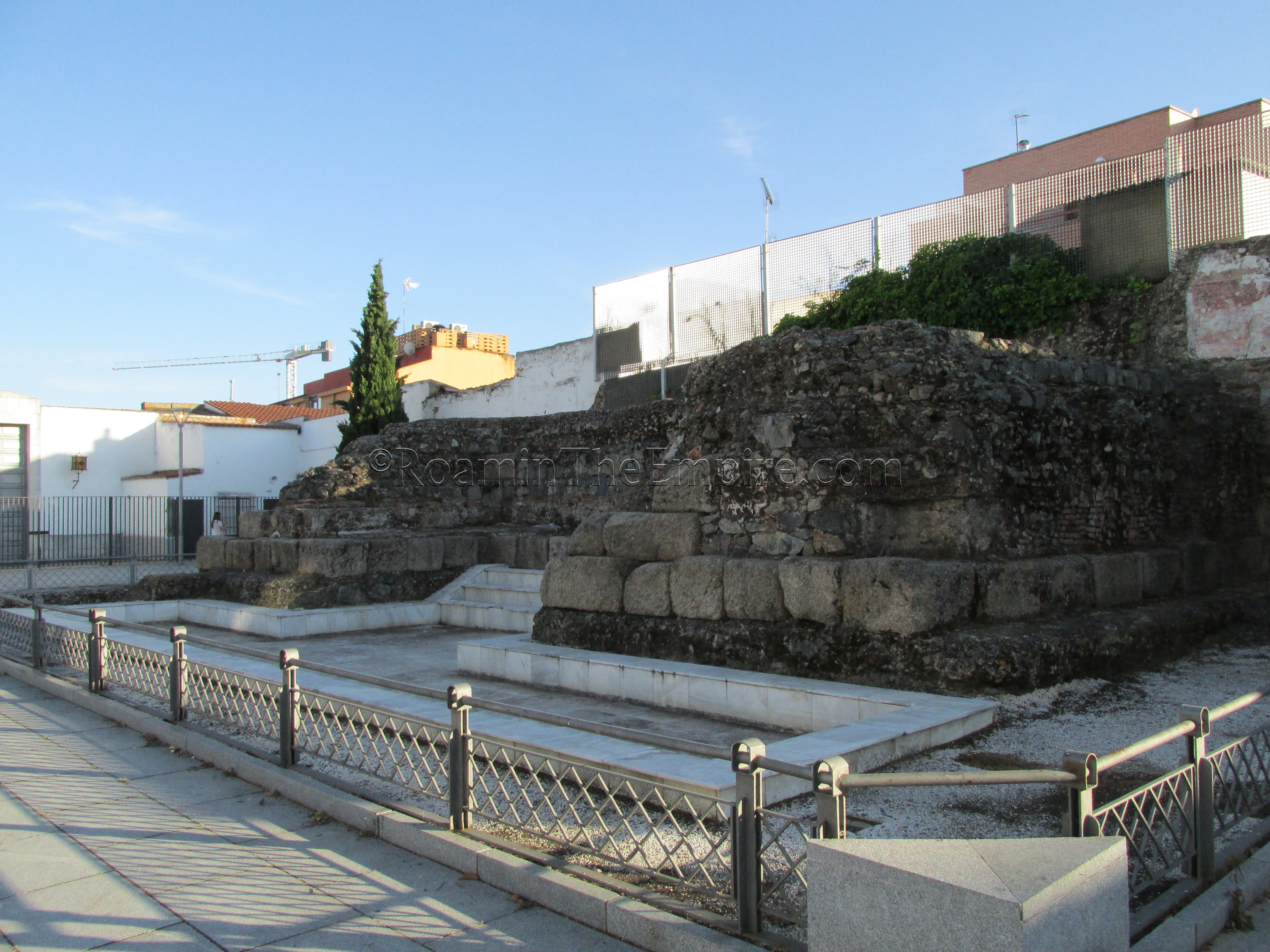
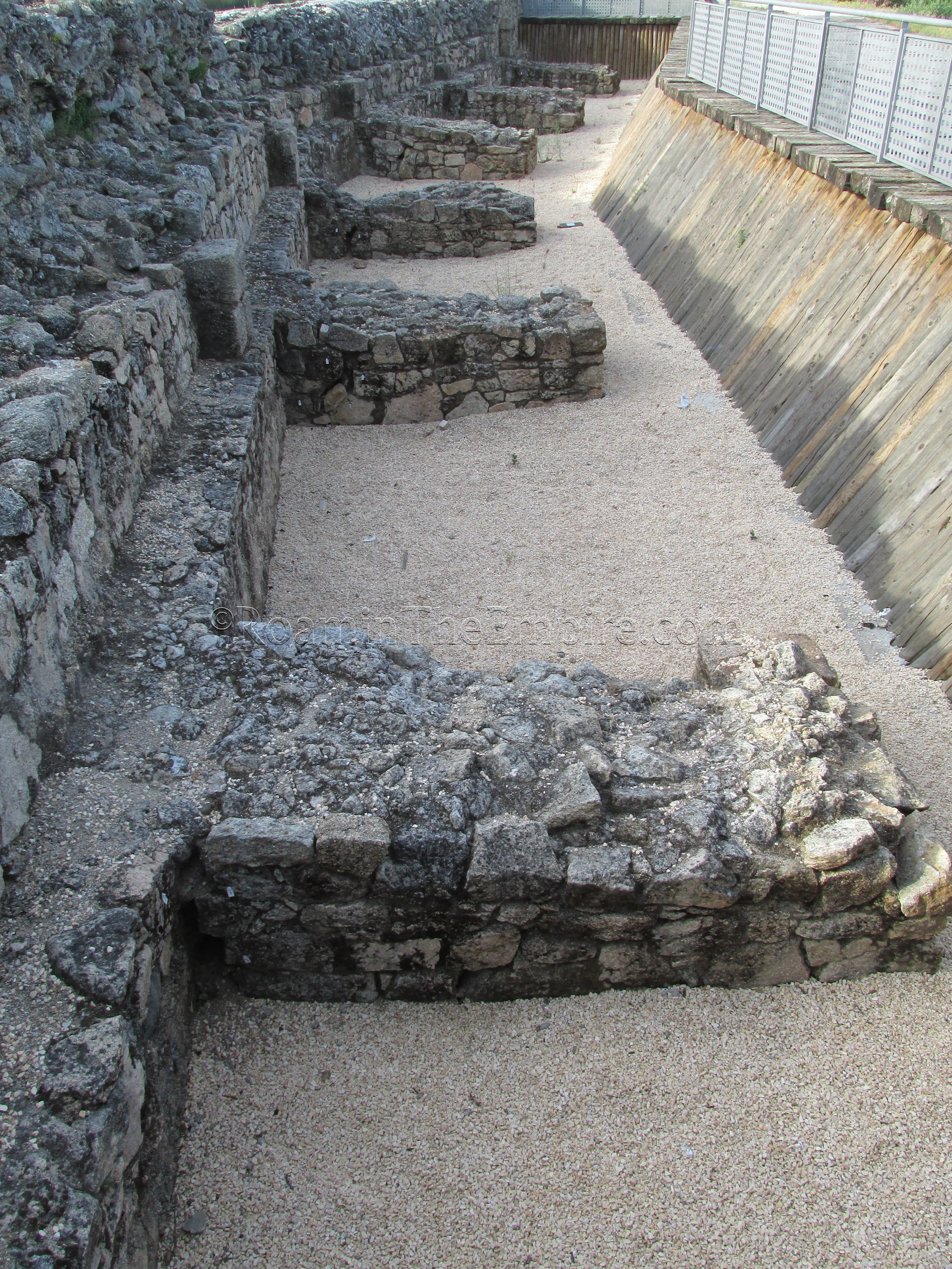
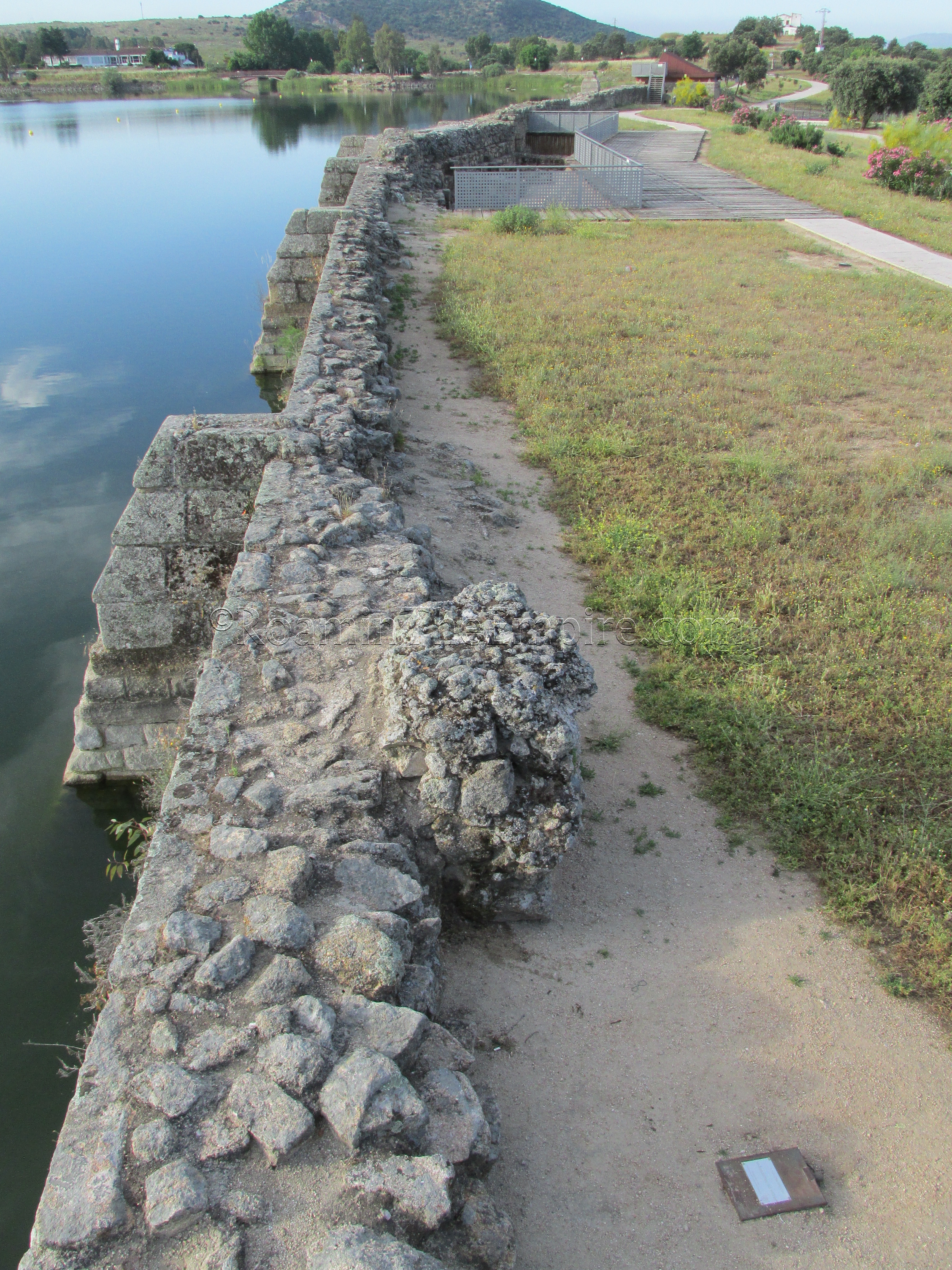
Though the origin point of the aqueduct is not completely clear, the terminus of it is. On the grounds of the Amphitheater House archaeological site is the definitive ending of this aqueduct, the castellum aquae. These grounds were unfortunately closed while I was visiting, but the final section of the aqueduct and the castellum aquae are both visible through the fences from outside the site. On Calle José R Mélida, the pedestrian passage running along the north side of the amphitheater and south side of the Amphitheater House, there is a stretch of unobstructed chain link between near where the entrance to the Amphitheater House is located (just to the east of the restaurant and the plaza for entrance to the amphitheater and theater). Here, one can see the castellum aquae, which just looks like a rectangular stone structure with some brickwork, as well as the last part of the aqueduct channel.
Another part of this section of the aqueduct can be seen on the north side of the Amphitheater House site, on the south side of Calle Pontezuelas at the mid-point between Calle Cabo Verde and Calle Diego María Crehuet. The course of the aqueduct can clearly be seen running into the Amphitheater House site, and can be followed a little ways through a courtyard (and followed a little further, though less clearly, at a courtyard further south, just east of the intersection of Calle Diego María Crehuet and Calle Mariano José de Larra). This may, however, be a later reconstruction of the aqueduct, as there were significant reconstructions to it in the 6th and 16th centuries CE.
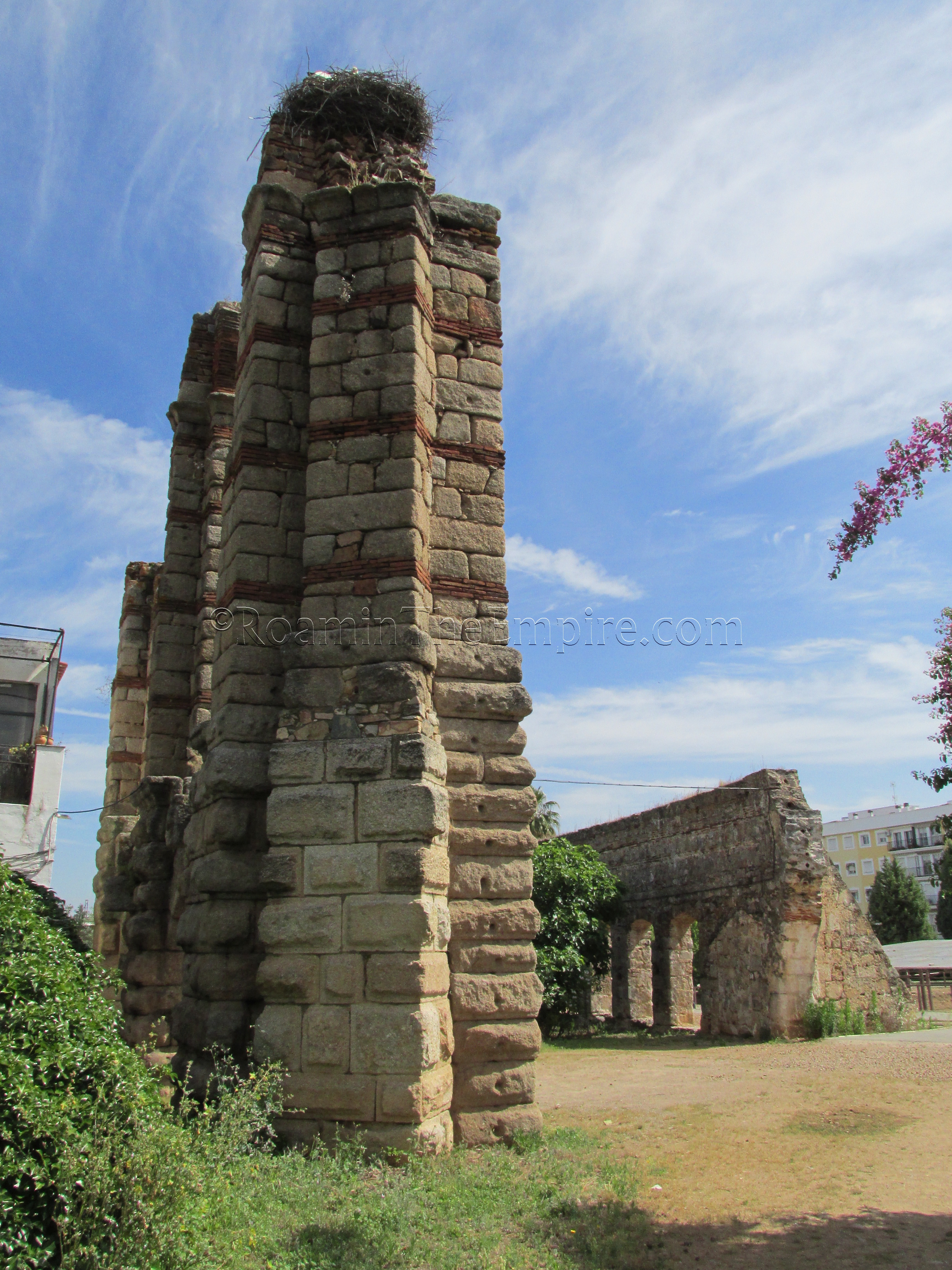
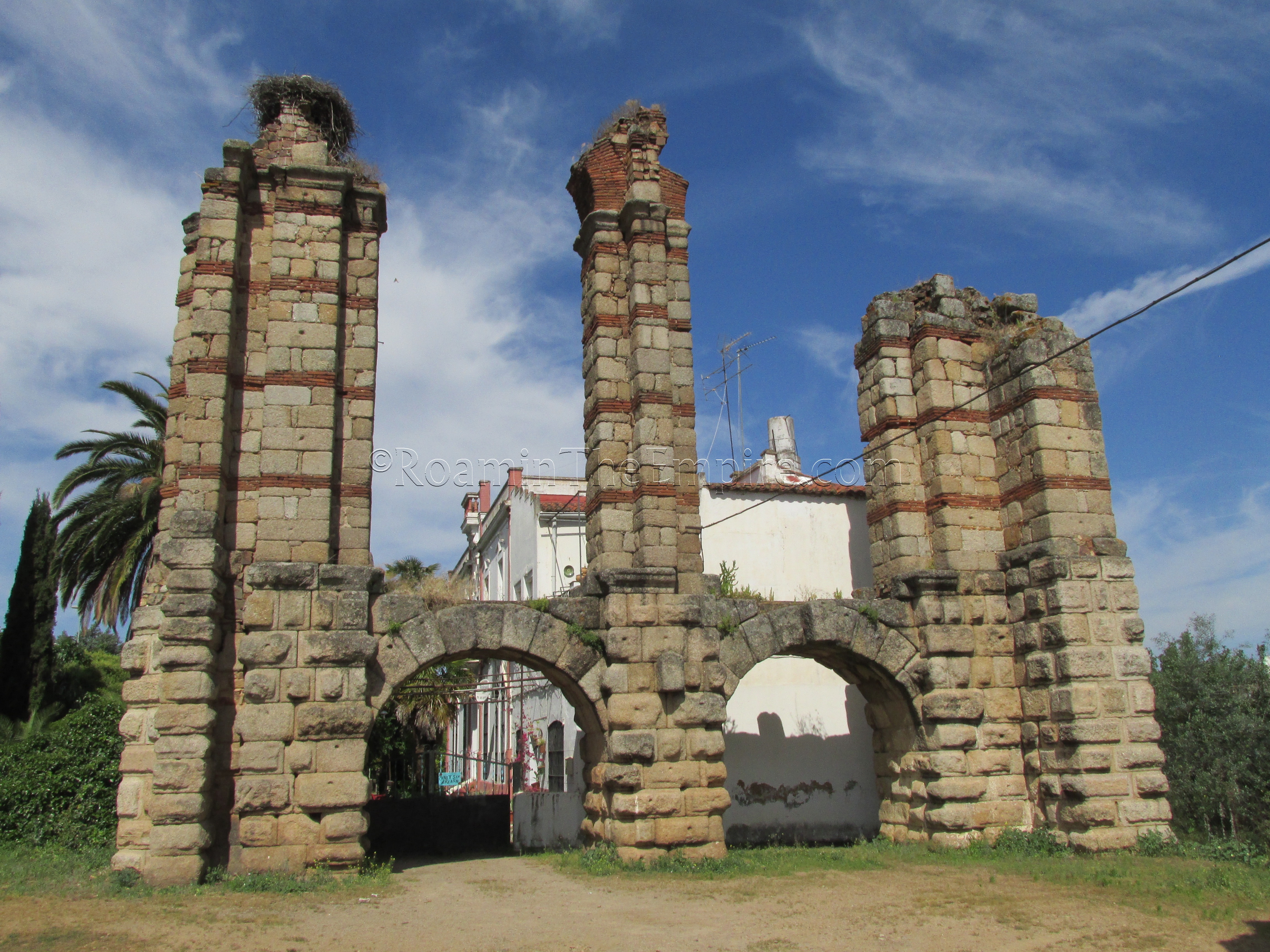
One section of the aqueduct that definitely isn’t a later construction are three piers that stand just west of the northwest corner of the circus, just across Av. de Juan Carlos I. These three piers are all that remains of the roughly 1600 meter aqueduct bridge that allowed the aqueduct to cross the Albarregas River. Immediately adjacent to those three pillars, which have distinctive red brick courses running horizontally, is a much more complete 16th century CE reconstruction of the aqueduct bridge using materials from the original bridge over the Albarregas River. This more modern portion, which was a significant source of water for the city up into the 20th century, is the San Lázaro-Rabo de Buey Aqueduct.
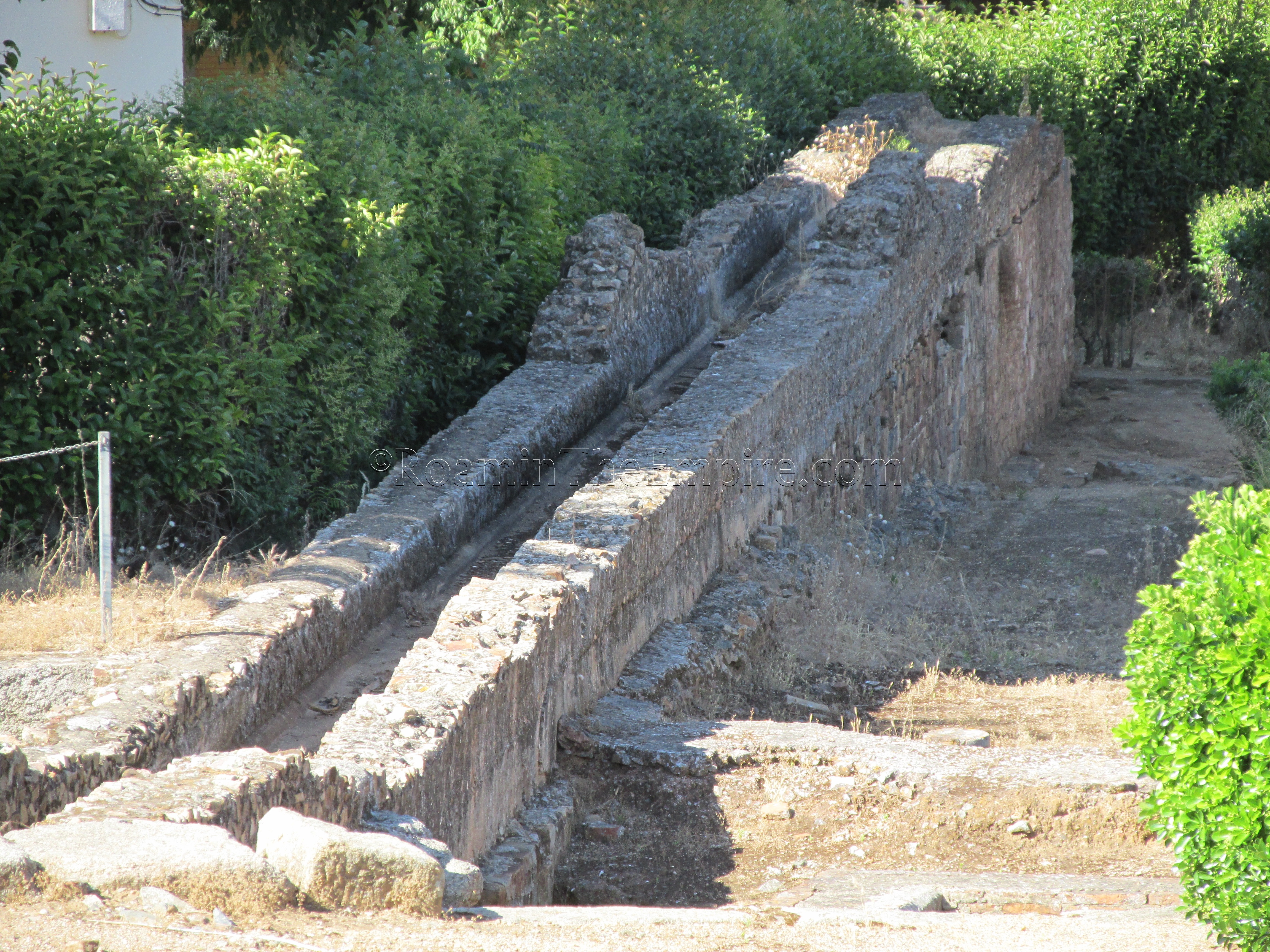
The San Lázaro-Rabo de Buey Aqueduct, while much later in actual construction, follows the general course of the original aqueduct, and illustrates generally how long the original pillared section of the aqueduct would have needed to be to bridge the Albarregas River. At the northern end of the bridge, which can be followed via footpath, the arched sections give way to a still elevated aqueduct course. Sections of the actual channel are laid out along the east side of the aqueduct course, and these fragments are of Roman construction. The elevated channel can be followed for another kilometer from where the arched section ends, and appears to be of the same construction as the 16th century work, though the actual interior channel is apparently from the Roman aqueduct.
Though I didn’t follow it any farther than where the elevated section ends at the N-630, the course of the aqueduct can be traced further, as another slightly elevated section picks up on the north side of the N-630 and can be followed for some distance. The path of the aqueduct is pretty easy to pick up on satellite photos for at least another half a kilometer north of the N-630, possibly a little longer, though it eventually veers away from the road that is running roughly parallel to it (Calle Torrente de Godina) and continues on what looks to be private land.
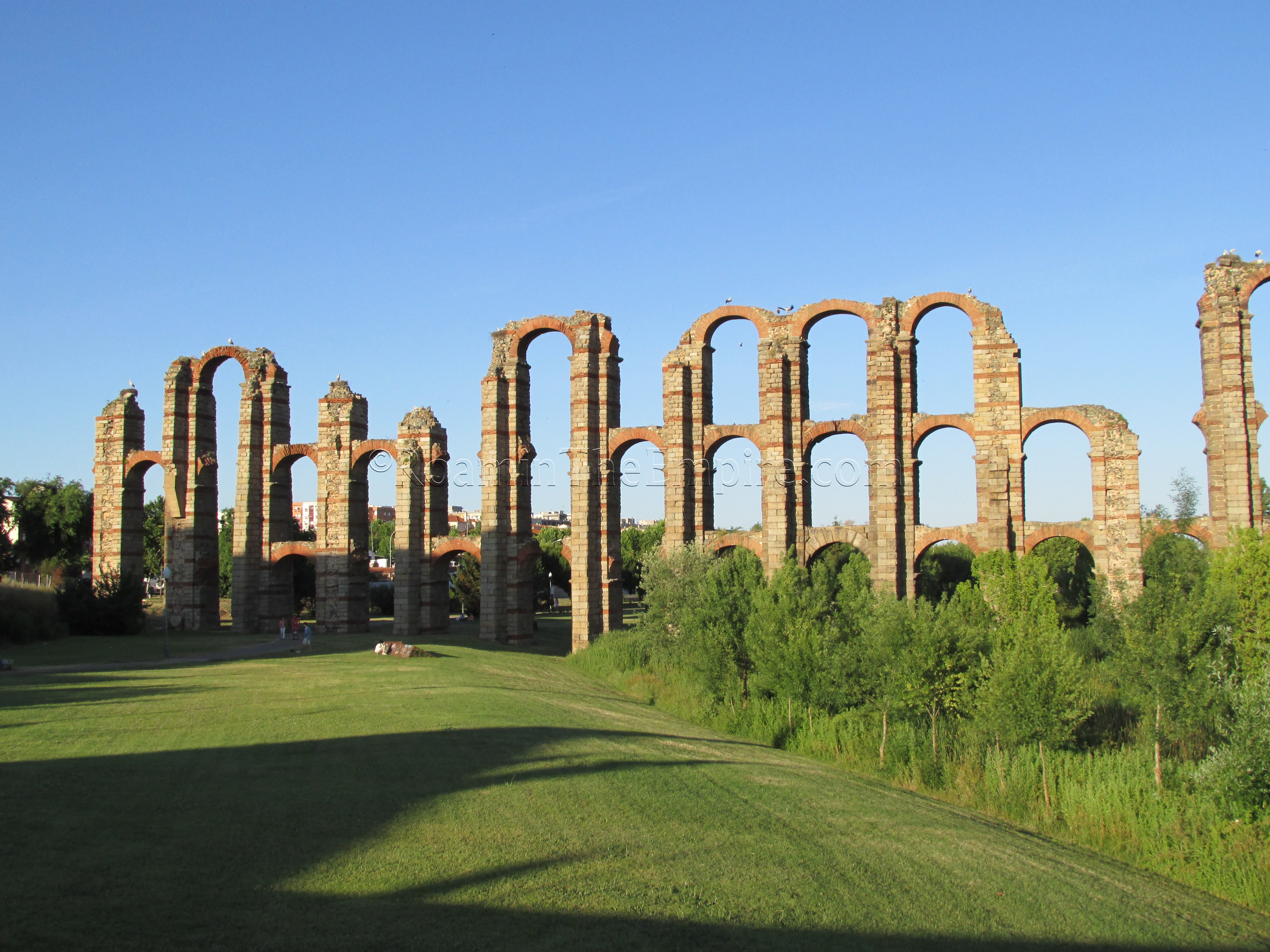
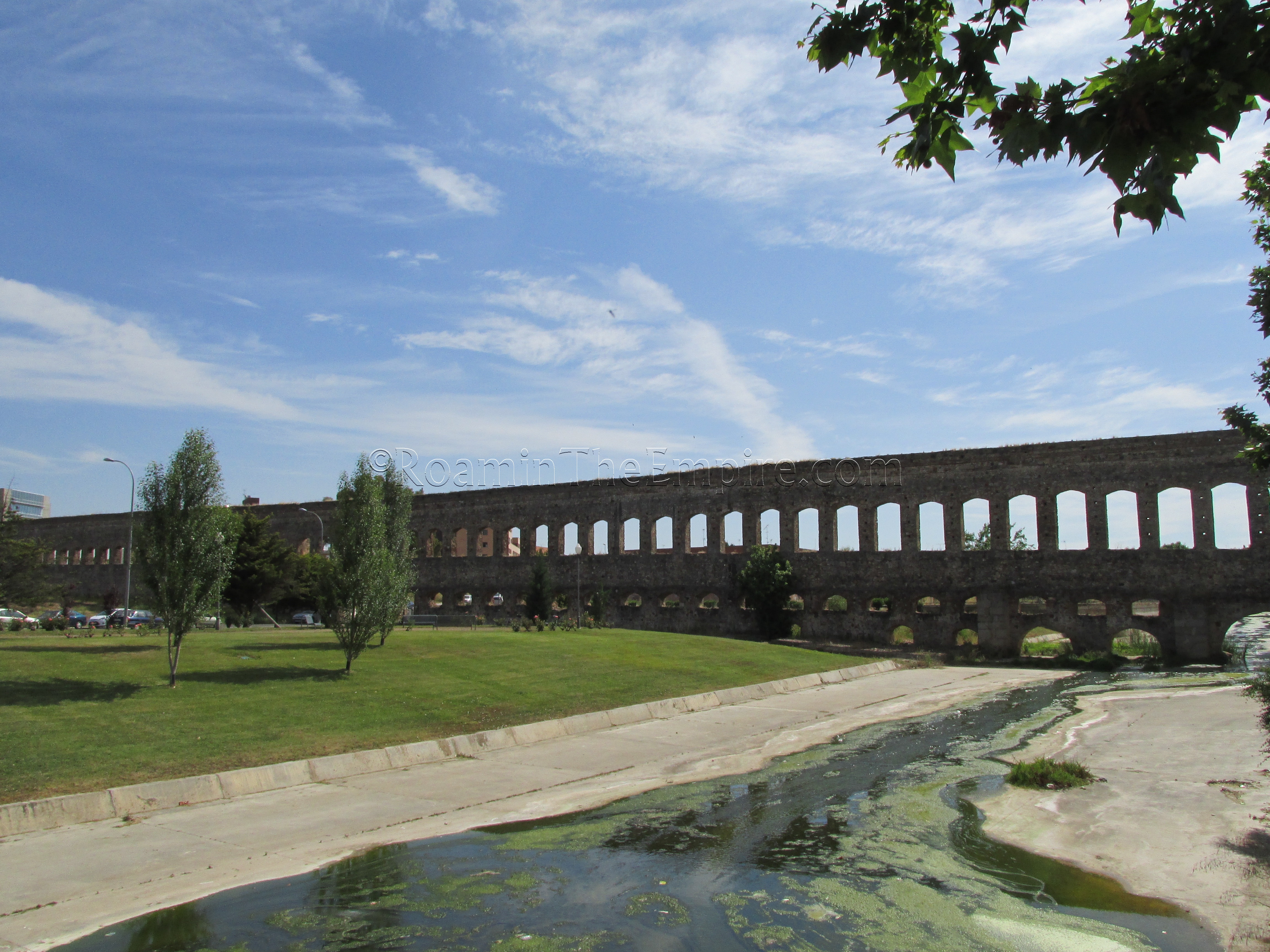
The final aqueduct constructed was the Proserpina Aqueduct (also referred to as the Los Milagro Aqueduct), which was built at the end of the 1st or beginning of the 2nd century CE. The name of Proserpina comes from the source of the aqueduct, the Proserpina Reservoir, which is so named because of an inscription to Proserpina found at the site of the reservoir, not because it was a name given in antiquity. One of the nice things about this aqueduct, aside from its spectacular arched sections, is that both the source and ending of the aqueduct are easy to visit. The aqueduct runs for about 10 kilometers between the Proserpina Reservoir and the northern section of the ancient city.
On the Calvario Hill, just south of the intersection of Calle Calvario, Calle Concordia, and Calle Augusto, is a monumental fountain and the castellum aquae, the ending point, of the Proserpina Aqueduct. According to the placard nearby, the castellum aquae was discovered in 1971, when an 18th century chapel built on the site was torn down.
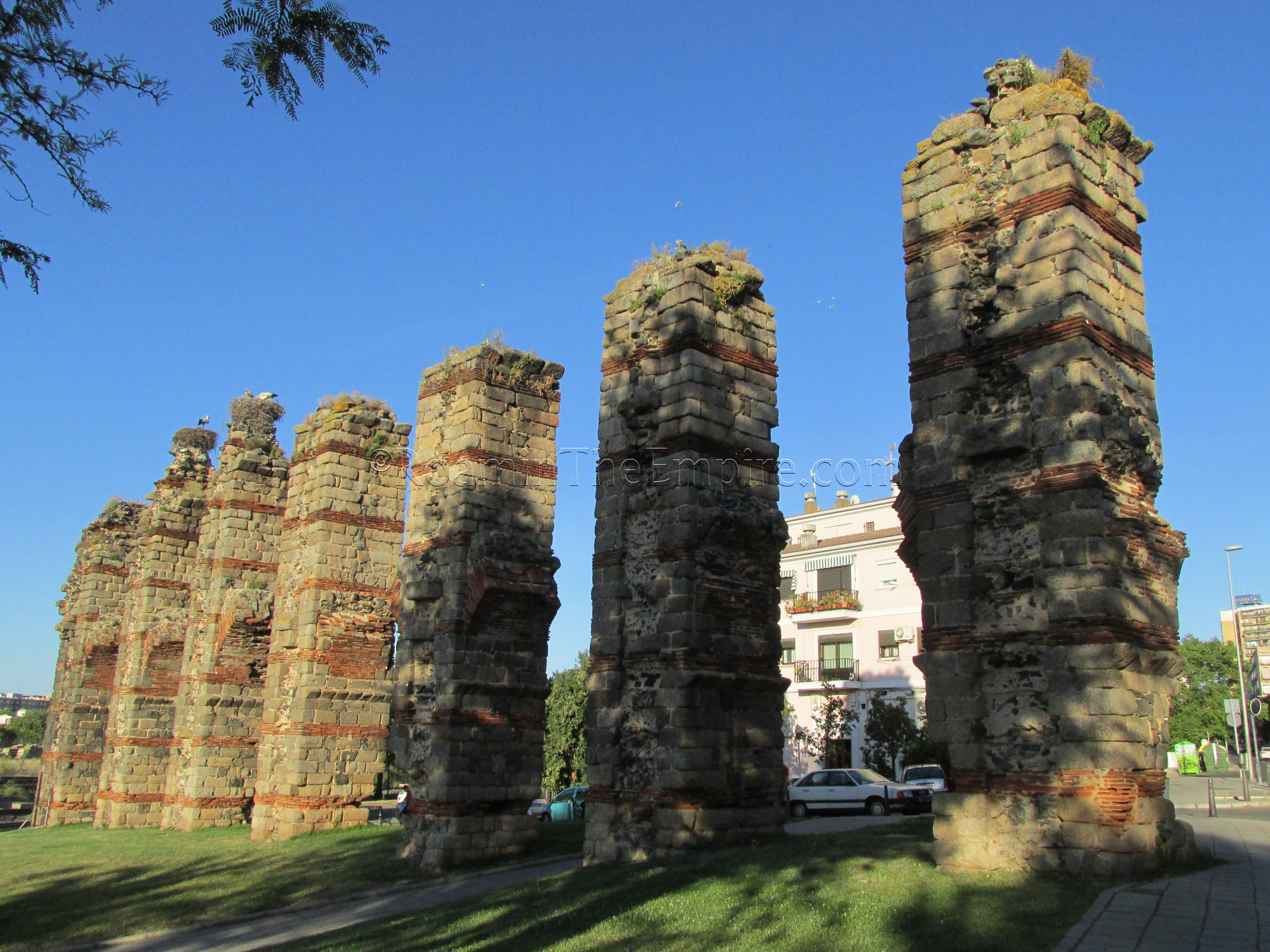
About 75 meters to the northeast of the castellum aquae is the southernmost remaining pier of the aqueduct, just behind the buildings on the north side of Calle Concordia. This pillar is not visible from Calle Concordia, though, and can only be seen from the north on Calle Marquesa de Pinares. Seven additional consecutive pillars are lined up on the north side of Calle Marquesa de Pinares, to the east of Calle Calvario. From this point, the southernmost pillar can be seen looking south. The northernmost of the seven pillars just to the north of Calle Marquesa de Pinares is noticeably more robust than the other six due to it being the turning point where the aqueduct changes from a southward trajectory to a southwestern trajectory.
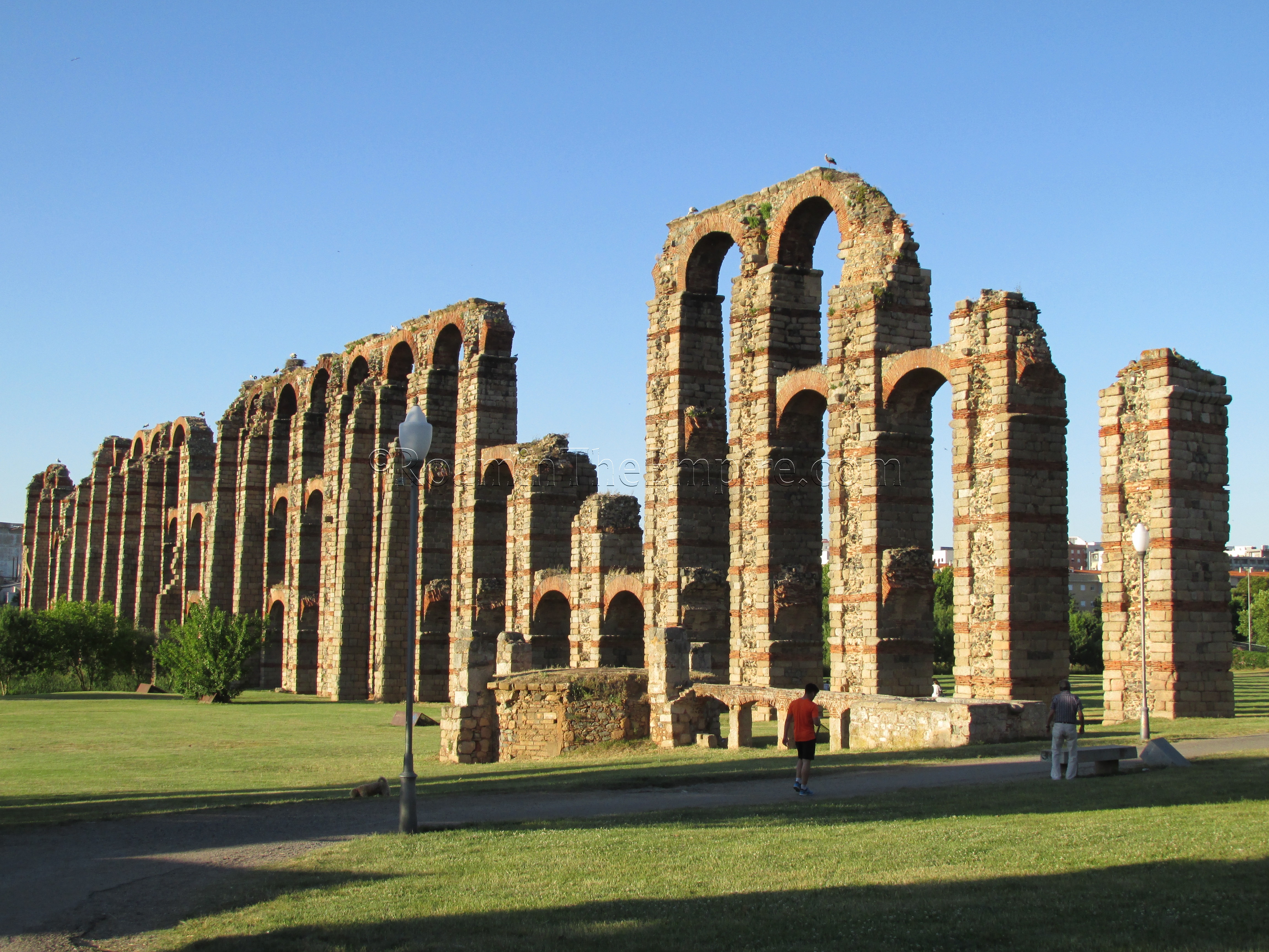
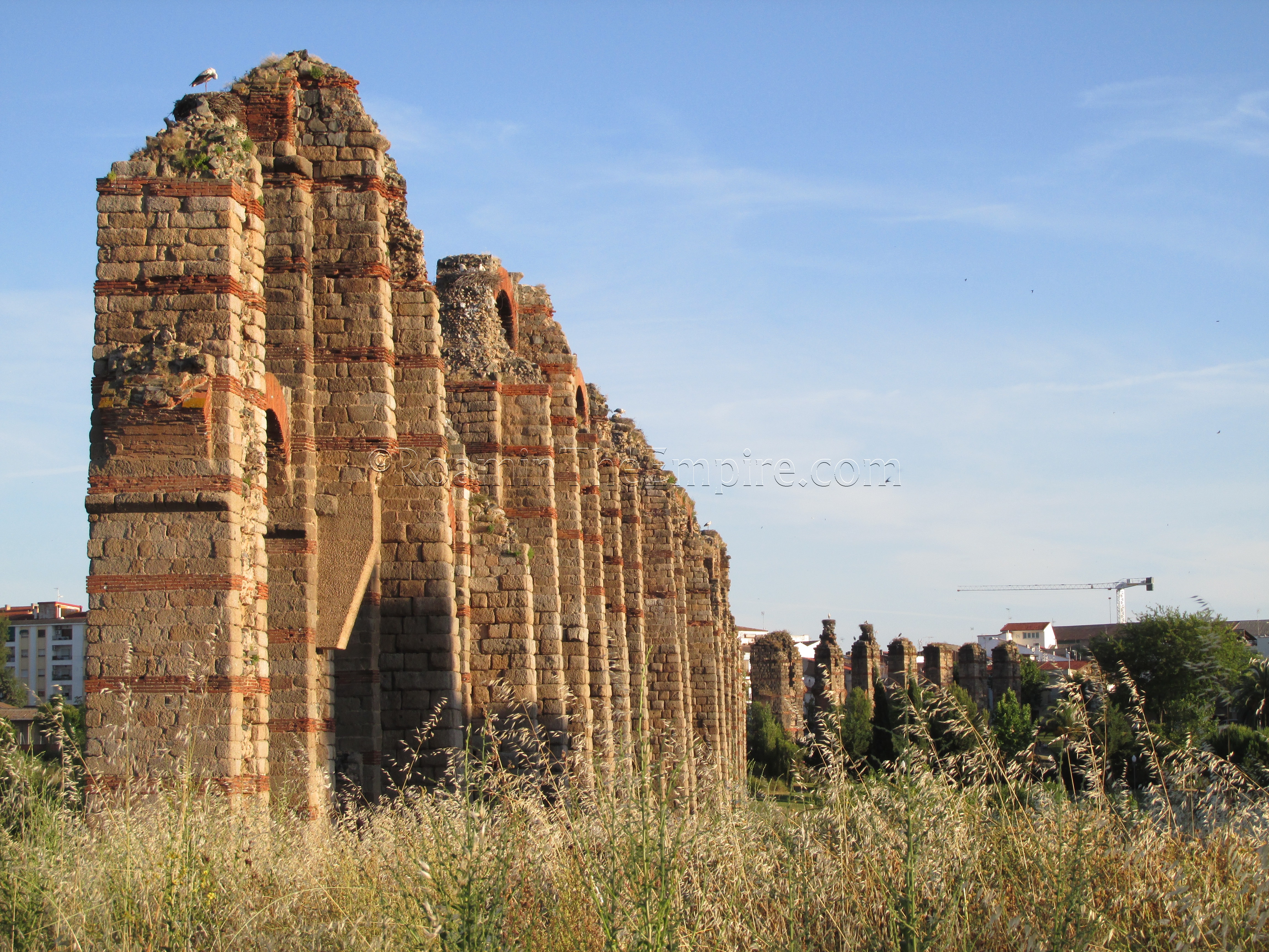
There is about an 80 meter gap between the seven piers standing to the north of Calle Marquesa de Pinares and the main preserved section of the aqueduct bridge that spanned the Albarregas River valley. The section of the aqueduct bridge consists of 26 piers over a span of about 190 meters, with the maximum height being about 25 meters. Like the Las Tomas Aqueduct, the Proserpina Aqueduct is constructed of ashlar blocks with distinctive horizontal courses of red brick. At the pinnacle of the aqueduct, where it actually crosses the Albarregas River, there are up to three sets of arches supporting the channel.
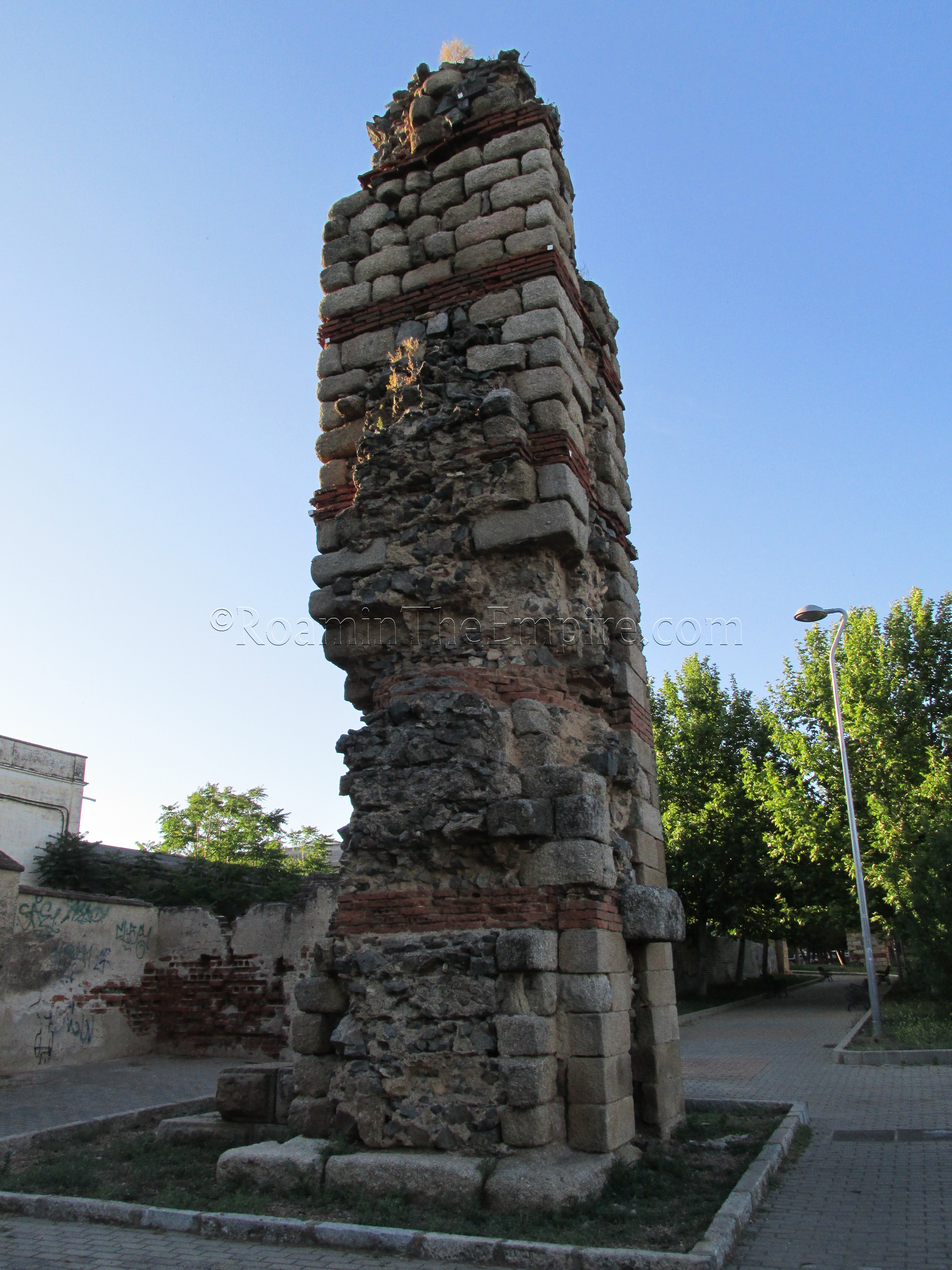
Running parallel to the aqueduct, on the west side, is a Roman-era bridge that can be used to cross the Albarregas River to continue following the aqueduct on the north side of the river. Where the valley bridge ends, there is again a gap, this time of about 130 meters between the next pier. This one can be found by following the alignment of the previous section across the road to the north (Av. de los Milagros) and down a footpath that runs along a greenbelt. It is here that a single pillar is located. Continuing on down the greenbelt about 80 meters are the final two standing piers from the aqueduct.
As the greenbelt and street continue uphill, the greenbelt ends in a small playground while the roads on either side end in a dirt lot. Just a few meters from the end of the road on the west side of the playground/greenbelt are the remains of what looks like a crumbled aqueduct pier. A few meters on from that are the beginnings of a stretch of raised channel that continues on for about 16 meters before coming to the remains of a filtration basin that would have trapped impurities in the water before it continued on into the city. The channel continues north from the filtration basin losing elevation before reaching approximately ground level.
The aqueduct then disappears again for about 37 meters, but a rough path follows the course of the aqueduct to where the channel picks up again at relatively ground level. The course can be followed clearly from here until just before it reaches a roundabout.
If one crosses roughly diagonally across the roundabout to a park, and continues north, the channel picks up again heading north through the park (after about 40 meters) running roughly parallel to the road on the east side of this park (Av. Via de la Plata). The channel is then easy to follow again as it runs along the edge of the park before making almost a horseshoe turn back south, but then heads off to west, ending as it goes to cross the street on the west side of the park (Calle la Legua).
It is technically possible to follow the channel west of the road, but shortly thereafter it runs on to what appears to be private land that was, during my visit, fenced off. There are apparently more vestiges of the aqueduct between that point and the Proserpina Reservoir, some of which appear to be visible via satellite imagery, but visiting them would probably require independent transportation and more time than I had available to me.
It is possible to visit the Proserpina Reservoir via a bus that runs from the small bus station on the south side of Paseo Roma, just across from the eastern end of the Zona Arqueológica de Morería, and about 100 meters west of the north side of the Puente Romano and the Alcazaba. The line is circular, so the bus departs and arrives at that same station on the south side of the road. The line that runs to the Proserpina Reservoir is Línea 13 (L13) – Paseo de Roma-Proserpina, which only runs between June 1st and August 31st. The cost of the ticket each way is 1.10 Euro and can be purchased on the bus. The trip takes about 25 minutes or so depending on traffic and such and seems to take a roundabout way out to the reservoir. The stop that puts you closest to the dam is at nearly the end of the line, and though the stops are not very clearly marked (they all have names, but the stops are not announced or marked), if you notify the driver that your destination is the “presa”, they should drop you off on the north side of the dam. If all else fails, the dam is on the westernmost side of the reservoir, and is easily identifiable. Because bus schedules seem to change relatively frequently, it is best to check this site for the details of the bus schedule. Returning should theoretically be possible from the same spot, but I actually walked along the reservoir to the Museo Del Agua (more on that later), which is the end of the bus circuit, and caught it from there.
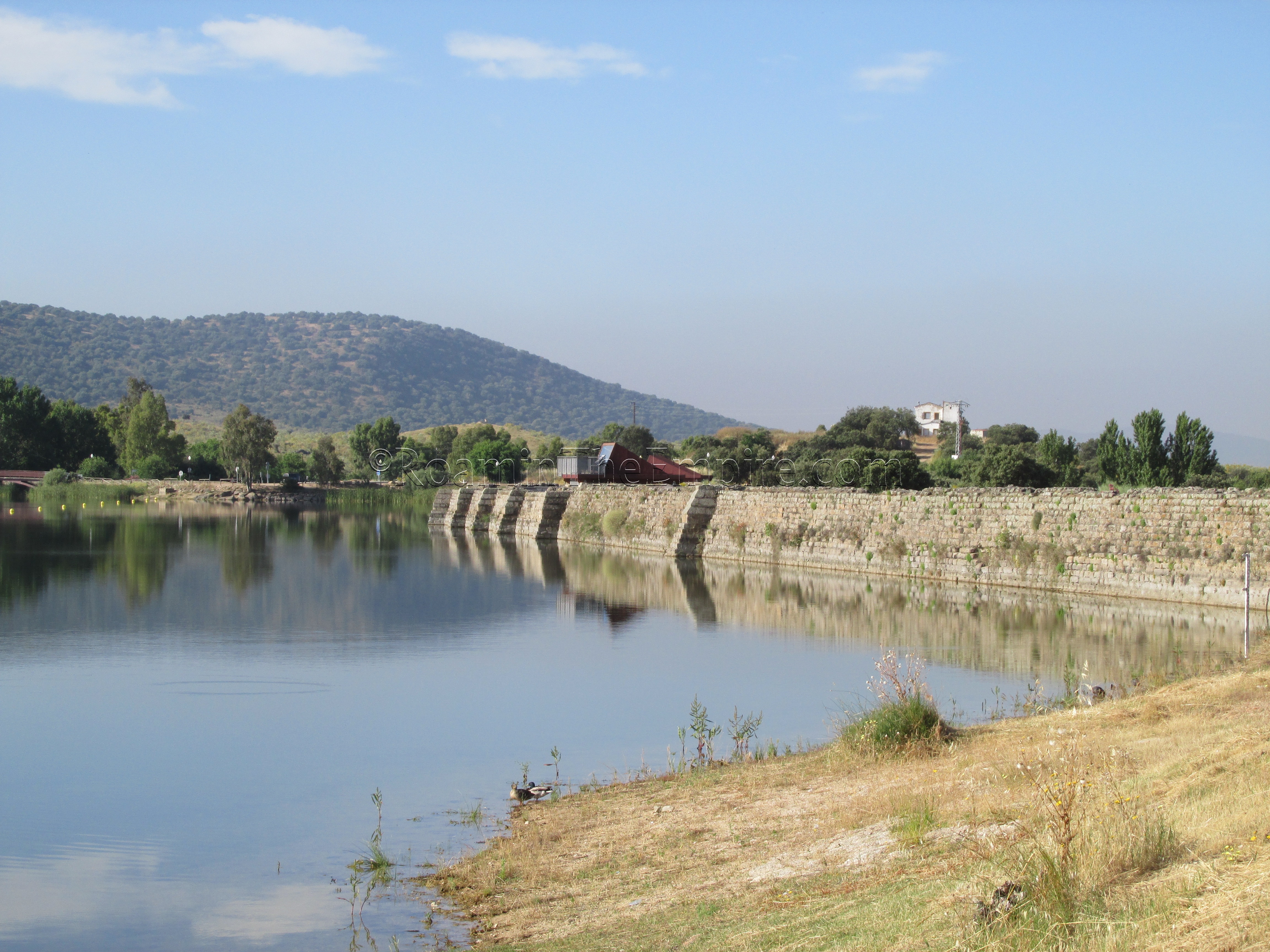
Most of what is visible of the dam is not actually of Roman construction, but are rather 17th century renovations and improvements; the Roman construction is actually the core of the dam, which is largely sandwiched between these later layers. There are points along the top of the dam, however, where excavations have revealed the Roman core. Like the rest of the Proserpina Aqueduct system, the dam was constructed at the end of the 1st or beginning of the 2nd century CE. The dam is 427 meters in length and about 21 meters high at its greatest height. The Proserpina Reservoir that is created has a capacity of about 5 million cubic meters. The maximum water output of the dam through the aqueduct seems to have been about 150 liters per second. On the downstream side (the west side of the dam) there are some constructions related to the outflow of water from the dam, but, much of it seems to be on private property and only viewable from the dam, and the exact context of the structures are not immediately clear. The dam and reservoir are both still in use as water management for the area.
Further north along the west side of the reservoir is the Museo Del Agua. The museum was opened about 10 years ago to what seems like very much local fanfare, but from what I can tell, may not have ever really been open to the public; at least that is what the impression seems to be in articles that followed in the years after the opening. Considering the amount of money that was probably put into this new museum, the fact that it did not last very long seemed to be a sore point. It was supposed to be an interpretive center for water use in the area, with a particular emphasis on the reservoir usage during the Roman period. Online resources were very unclear about the status of the museum, though I got the distinct impression that it was not open. When I got to the location of the museum, just out of curiosity, it was indeed closed, and didn’t look as though it had been open in a number of years. There do not seem to be any plans to re-open the museum in the near future, either. The trip back to Mérida is much shorter and takes more in the range of 10-15 minutes.
Continued in Augusta Emerita Part III


