


Most Recent Visit: July 2023
The Roman city of Brundisium (modern Brindisi), located on the Adriatic coast of Calabria (modern Apulia) seems to have begun life as a settlement of the Messapi; though legends have the city being founded by the mythic king Diomedes of Thrace. The Messapi are thought to have originated in the Balkans before migrating to Italy, and the Thracian heritage of Diomedes may play a part in the rise of this myth. Other traditions have Greek settlers from Knossos or Taras (Roman Tarentum, modern Taranto) founding the Greek colony of Brentesion here. The name of the Greek colony seems to derive from the Messapian name Brention, which derives from the Messapian word biendos, stag’s head, which likely refers to the pronged nature of the harbor at Brundisium. The founder of Taras, Phalanthus, is said to have sought refuge in the city after he was expelled from Taras. Prior to Roman conquest in 267 BCE, not much is known about Brundisium, other than it is noted as having signed a treaty with Thurii (Roman Thurium) around 440 BCE.
Roman conquest of the city in 267-66 BCE likely had to do with the excellent harbor and commanding position on the coast that would allow the Romans to control naval access to the Adriatic. It would also offer an advantageous position for the departure of military campaigns in the east; nearly every Roman campaign in the east after the acquisition of the city left Italy from Brundisium. Just a few years later in 264 BCE, the Via Appia had been extended to Brundisium, becoming the terminus of the road. During the First Punic War on August 5, 244 BCE, a Latin colony and fortress was established to bolster the Roman ability to control the Adriatic in response to Carthaginian raids. Sometime around 220 BCE, the poet Pacuvius was born in Brundisium. During the Second Punic War, Hannibal attempted to take the city in 212 BCE, as it would have been a vital port for Carthaginian reinforcements and supplies, but it remained loyal to the Romans. It is further noted by Livy as being commended by the Senate a few years later as one of eighteen colonies that continued to provide invaluable aid in the war.
As Roman actions in the east increased after the Second Punic War, necessitating the frequent departure of Roman armies through Brundisium, the city grew in importance and prospered. Following the Social War in 88 BCE, Brundisium, like many other colonies received municipium and the citizens were enrolled as part of the Maecia tribe. The city would play a role in a number of the civil conflicts that plagued Rome in the 1st century BCE. Not only a departure point to the east, it was also an arrival point, as Sulla landed there in 83 BCE as he marched to Rome. During the Caesarean Civil War, Pompey the Great had control of Brudisium and sought to evacuate his forces from Italy to Illyricum in 50-49 BCE. Despite being able to sail some forces across the Adriatic, Caesar besieged the remaining forces in the city. Though he had no navy to enforce a naval blockade, Caesar did attempt to trap Pompey’s ships by blocking up the choke point of the harbor. Pompey was able to wait out the terrestrial siege and escape with the rest of his forces when his navy returned to Brundisium, though.
Following Caesar’s assassination, Octavian took the mantle of Caesar while in Brundisium to draw from the large funds that Caesar had amassed there for his planned campaign against Parthia. As tensions flared between Octavian and Marcus Antonius, Brundisium came under siege by the latter in 40 BCE. Octavian attempted to break the siege militarily, but was unsuccessful. An agreement was eventually reached, resulting in the Treaty of Brundisium, which essentially carved Roman territory up into spheres of influence between the members of the Second Triumvirate. The poet Vergil died in the city in 19 BCE after falling ill while traveling from Greece back to Italy. Brundisium continued to prosper and play an important role as a trade and military port through the imperial period. It is noted as being the place that the poisoner Martina, part of the plot to kill Germanicus, met her own end in Brundisium, being poisoned herself. It was apparently known for its oysters, wine, bees, fruit, and wool according to Pliny the Elder and Strabo. The Via Traiana was constructed about 109 CE from Beneventum to Brindisium, effectively replacing the Via Appia. In the 6th century CE, the city began a decline in importance, being somewhat supplanted by Hydruntum (modern Otranto) farther south along the coast.
Getting There: Brindisi is a relatively significant city; there is a nearby regional airport for Puglia, Aeroporto del Salento, on the north side of the city with flights from around Italy and Europe. The city is also connected to the rail network; direct trains from Rome leave a few times a day and take between 5 and 5 and a half hours and average about 40 Euros. I arrived by car and there is free parking at the tip of the southern branch of the harbor. By train and from this parking lot, everything is pretty much within walking distance.
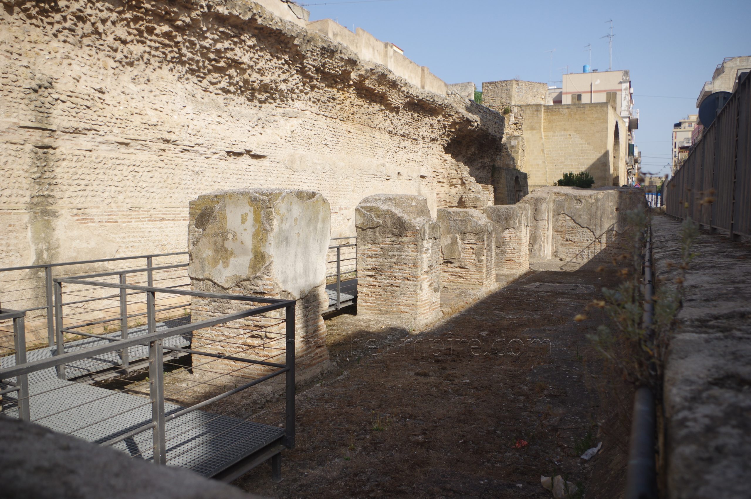
A good starting point closest to both the train station and the free parking lot is the so-called Vasche Limarie. Located at Via Cristoforo Colombo 51, the Vasche Limarie are a series of three reservoirs and settling tanks, functioning as the castellum aquae, which were constructed in the 1st century CE. This was part of an aqueduct system with a source about 12 kilometers to the west of Brundisium. Some parts of the tanks are visible from the street, but there is an entrance on the north side. The entrance is gated, so presumably the tanks can be closed, but there were no signs posted about any hours for the tanks. The reservoir stretches for about 60 meters, with the southern portion of preserving some of the internal support pillars.
At the north side of the Vasche Limarie, Via Carmine (later becoming Via Ferrante Fornari) heads to the east/northeast. About 500 meters on it intersects with Via Santi, and about 115 meters north on Via Santi is the entrance to the Area Archeologica di San Pietro degli Schiavoni in the basement area of the Teatro Verdi. The archaeological area is open Monday through Friday from 8:30 to 16:30 and on Saturday and Sunday from 10:00 to 13:00 and 16:00 to 19:00. Admission is free and it seems to essentially be open access during these hours, as there wasn’t anyone around working there that I could see.
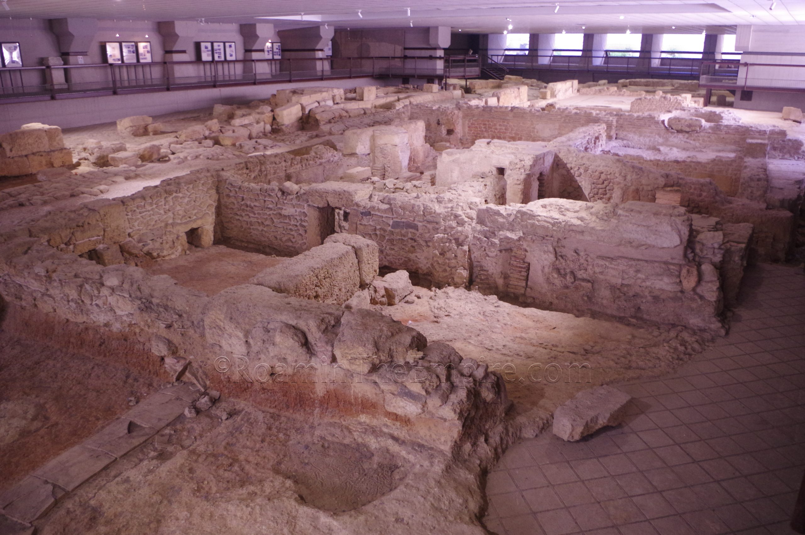
The archaeological area features the remains of a few buildings flanking a Roman road. When entering from the east (there is also an entrance at the south), the first building is a residence dating to the late 1st century BCE ore early 1st century CE. The large, white mosaicked room that features prominently in this area is identified as having been the triclinium of the house. Some painted plaster is also visible in this part of the building. To the north of this area are some remains of a building that is dated to late antiquity and possibly included an early Christian religious space. Continuing along in a counterclockwise direction, is the north end of the cardo that ruins through the archaeological site.
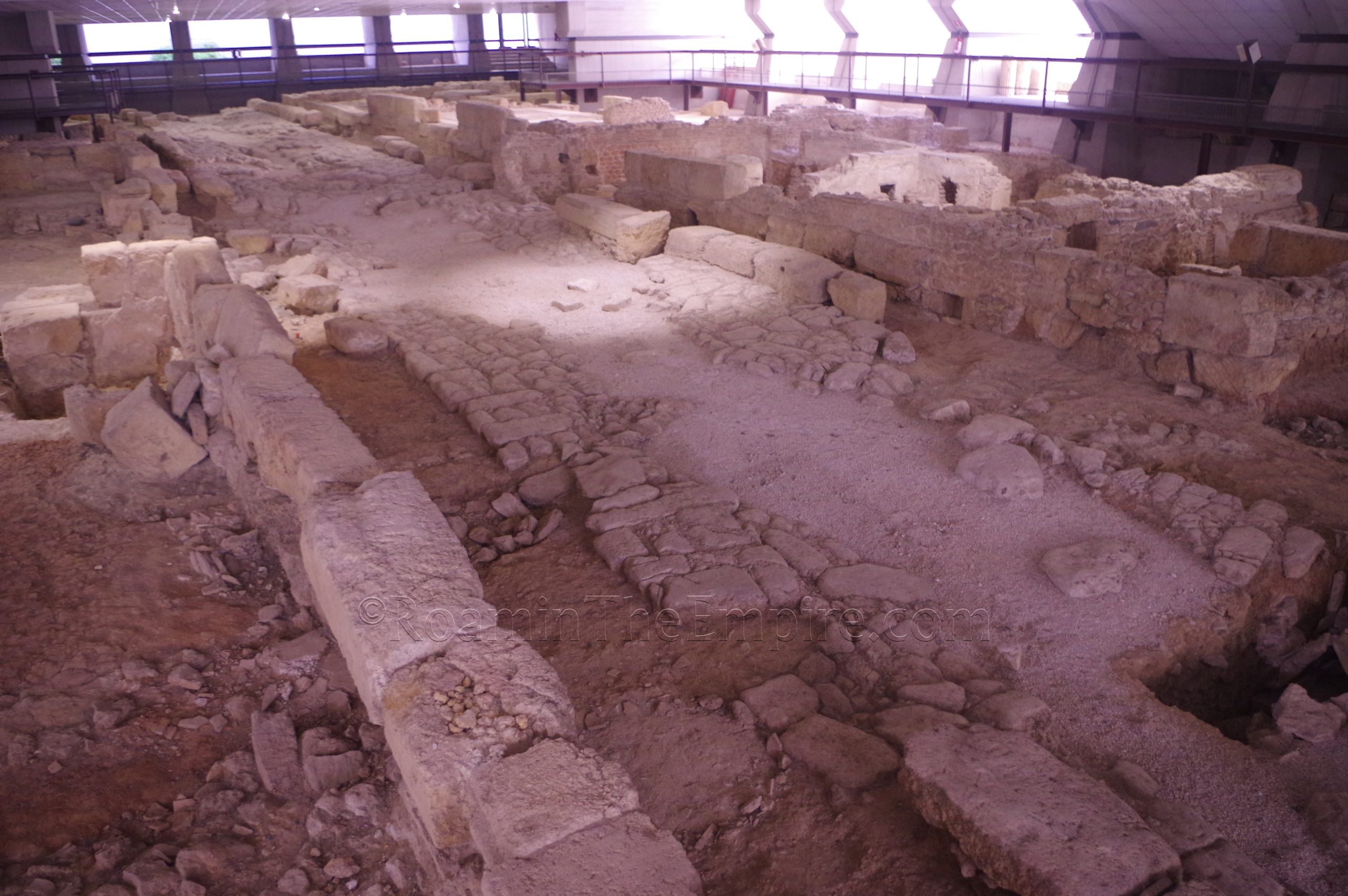
There are only some scattered remains of walls on the west side of the cardo, with only a possible latrine being identified among these. Some of the remains also date to the medieval period. This side also has a section from the aqueduct that was found elsewhere in the city and on display here. Part of a mosaic is visible as well. A number of informational panels are located along the visitor path along the west wall, but most of the information is in Italian. The last area of interest is back on the southern portion of the east side of the cardo, where a bathing complex is located. At the north end of the bathing complex, a room with an apsidal pool is identified as the frigidarium. To the west of this room is another with some visible remains of the hypocaust system, the caldarium. South of the caldarium is the tepidarium, and to the west, adjacent to the cardo, is the praefurnium of the complex. The bathing complex was constructed in the 1st century BCE and functioned until the 4th century CE.
It’s not a particularly big archaeological area, I made my way through it in about 20 minutes. There is a lot of information on-site, but most of it is in Italian. There are a few English and German translations scattered around the informational panels for the individual areas. A few inscriptions are on display here, but there’s no information presented for any of them.
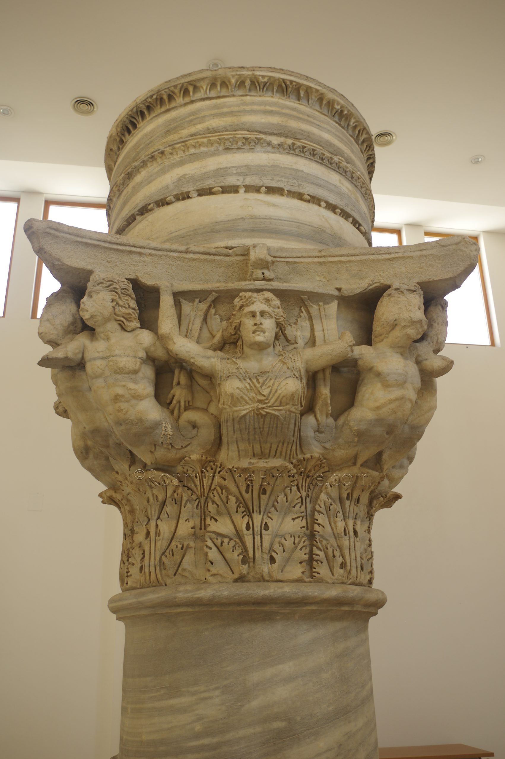
Just across the Piazza Sottile de Falco (which contains some later medieval remains) to the east is the Palazzo Granafei-Nervenga. This building is open every day from 8:00 to 20:30 and is free. Within this building is the Sala della Colonna, a room which contains one of the column capitals from the two columns that marked the end of the Via Appia near the harbor. The capital dates to the 2nd or 3rd century CE and is decorated with images of telamons and Jupiter, Neptune, Minerva, and Juno. Some remains of a Roman domus dating to the 1st-2nd century CE was also found on the grounds of the palace during renovations in 2000-2001 and is on display in a few of the adjacent rooms. Part of the domus with some nice mosaic checkerboard remaining was located in an inaccessible courtyard (but visible through the window). Two other rooms have accessible remains of the domus as well as medieval burials. There’s some information on both the columns and domus on site, but almost all of it is in Italian.
On the south side of the palace, along Via Casimiro Giambattista are the open air Scavi Romani di via Casimiro. The area is fenced and there is no direct access, but these are visible from public areas at any time. There isn’t a whole lot to see here, so it is a quick stop. At the lowest level is some very scant remains of a 2nd to 1st century BCE mosaic belonging to a public building of that period. Some slightly more substantial remains, including a few partial columns, walls, and flooring from the early 2nd century CE overlay these at a higher level.
About a 5 minute walk north of here is the Museo Archeologico Francesco Ribezzo located at Piazza Duomo 6. The museum is open daily from 9:00 to 20:00 and admission is free. The first part of the museum is a lot of pottery and other terracotta and small finds objects, coming primarily from pre-Roman necropoli in the immediate area as well as the wider region, though there are some that date into the Roman period as well. There are some interesting pieces here, but again, a lot of it is much of what one would find in most other museums in the region. This section then leads into the basement lapidarium which contains dozens of Roman inscriptions (mostly funerary) and a few statues. Unfortunately, almost none of the objects in the lapidarium have any sort of information associated with them; it’s mostly just a collection of inscriptions hung on the wall with little regard for anything more than spatial constraints.
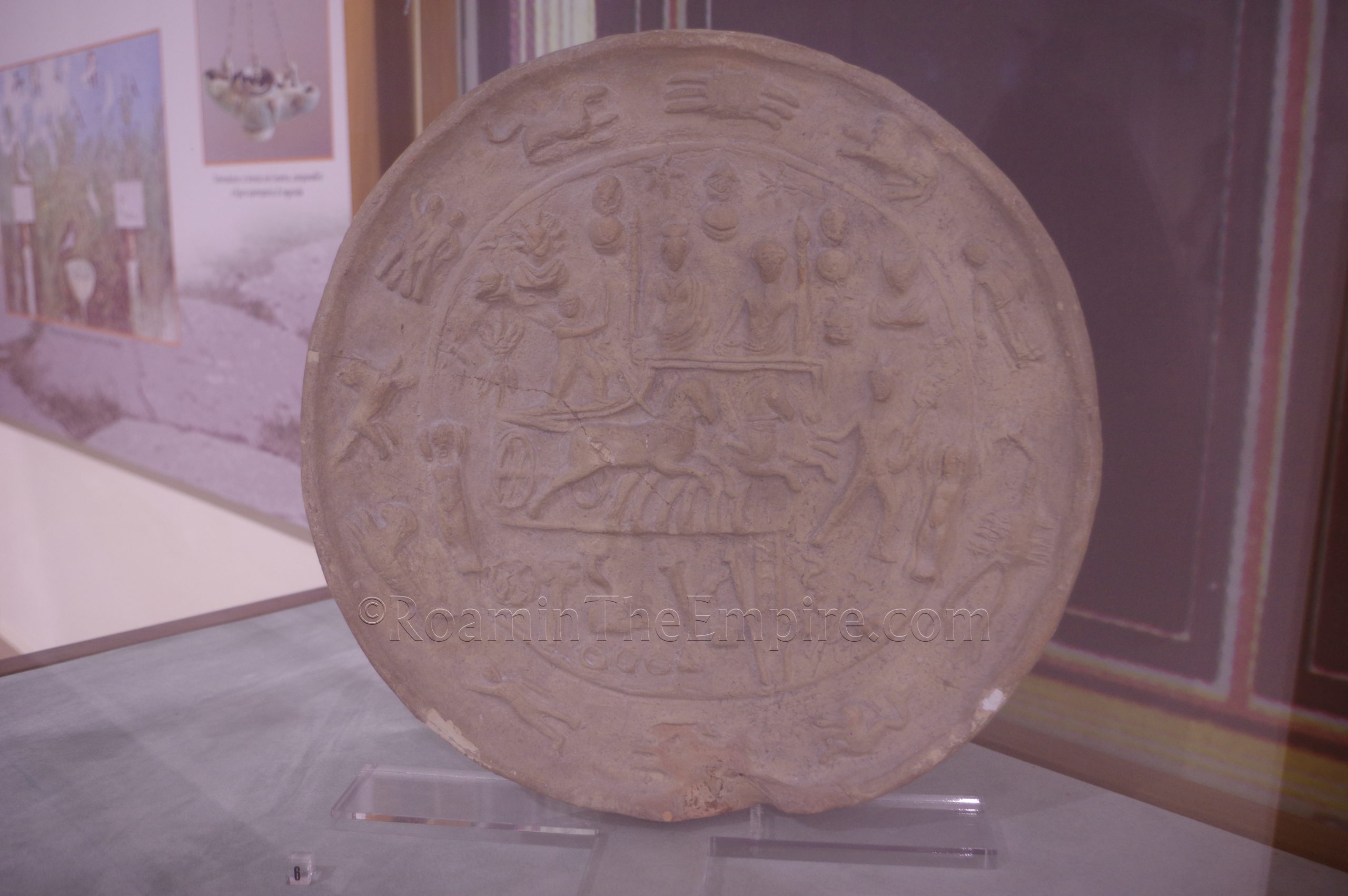
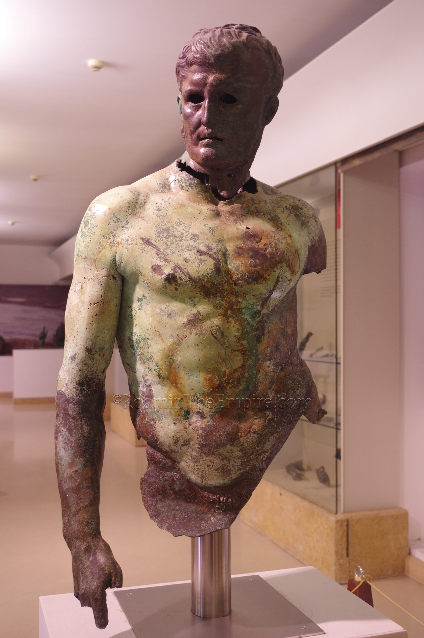
The rest of the museum focuses more on the transition from the pre-Roman to Roman period in the area. There’s a very interesting assemblage of Messapian inscriptions (and some Greek) dating to the period immediately before and after Roman conquest. Other interesting objects are some statuary and inscriptions and a large mosaic from a house in Brundisium. Toward the end of the visiting route (the museum is laid out in a way in which there is a singular course) is a collection of partial and fragmentary bronze statues found in the sea around Brindisi. There’s also an exterior courtyard between the entrance and exit with some statuary and inscriptions.
The archaeological museum in Brindisi is quite large, especially given it is a free museum. There is lots of information in the museum, in both Italian and English. The English translations, however, are only a fraction of the explanations in Italian. An information board will have dozens of lines of Italian text for instance, but only a couple lines in English summing up the most very basic points. Most of the actual object descriptions were only in Italian. It took a little over two hours for me to get through the museum.
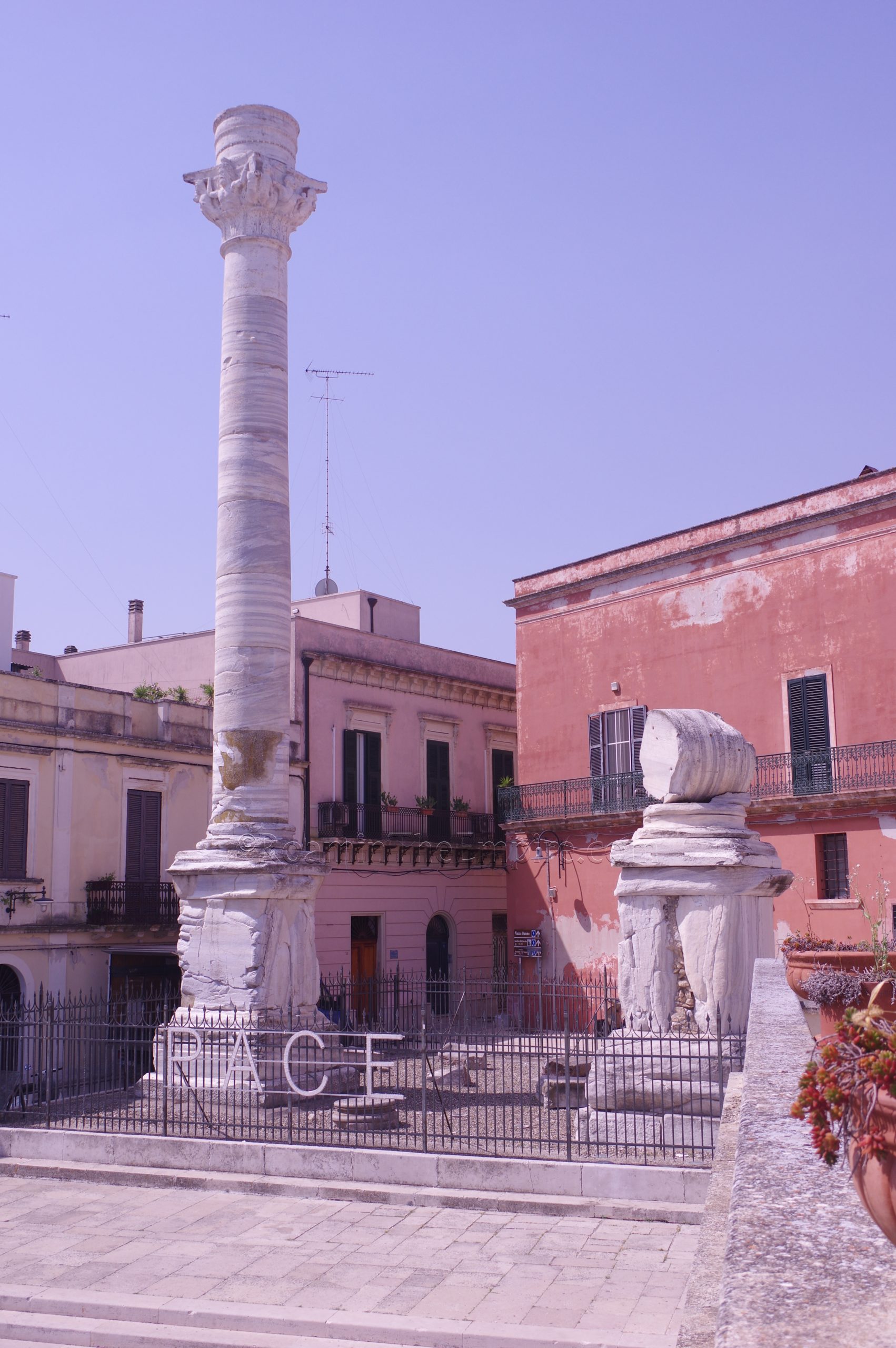
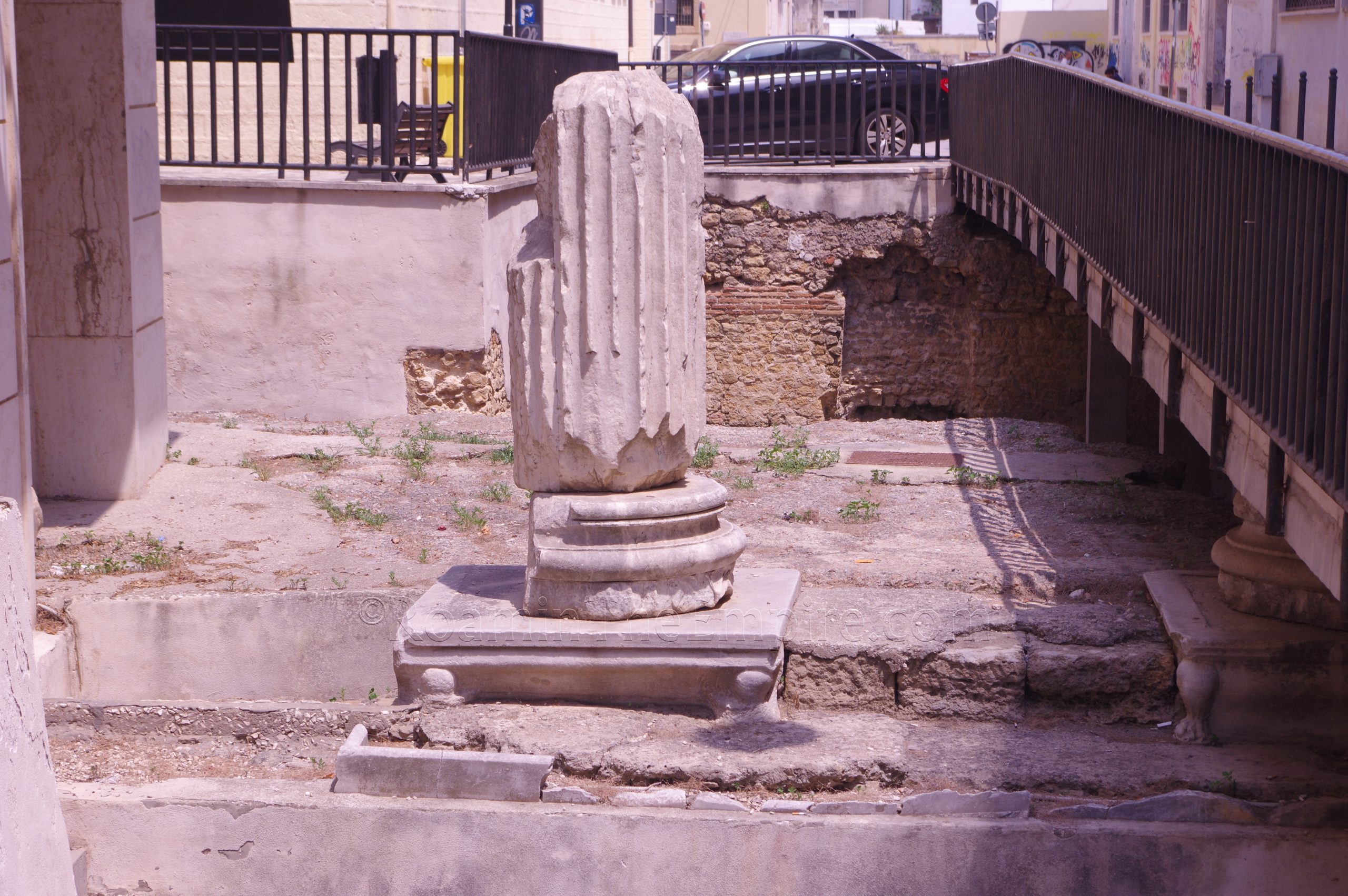
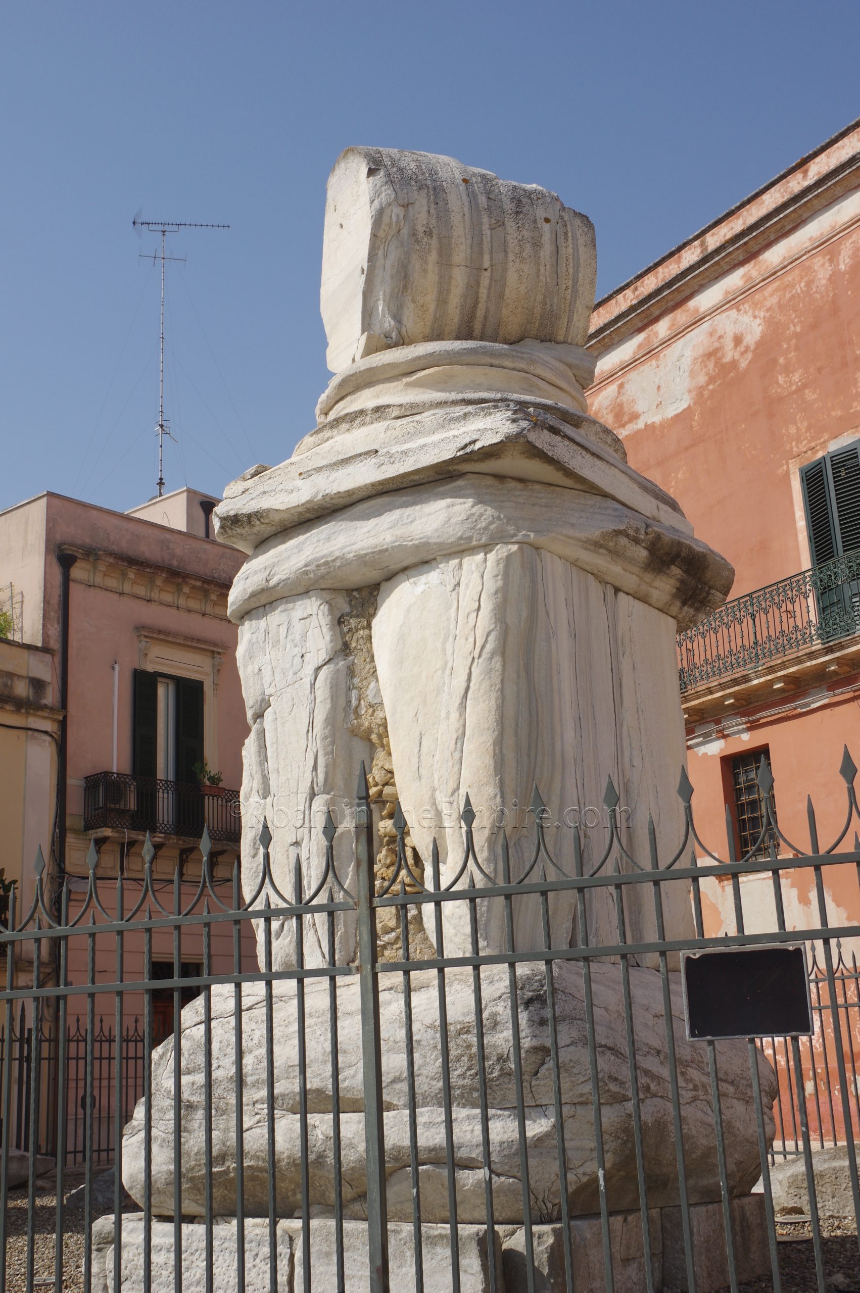
The final two stops for Brundisium are located a short walk east down the adjacent Via Colonne. Located at the top of a staircase that descends down to the harbor are the remains of the famous columns that marked the terminus of the Via Appia. Only one of the columns remains, the other was transferred to Lecce in the 17th century after toppling in an earthquake in the 16th century. The base of this column still remains. The remaining column is topped by a replica of the original capital, now kept in the previously mentioned Palazzo Granafei-Nervenga. The remaining column seems to have been erected in the 2nd or 3rd century CE, but have earlier construction phases in the bases that date to the late 1st century BCE. Adjacent to the columns on the south is the so-called Casa di Virgilio, which is now no longer visible and overlaid entirely by a new construction. This was reputedly a house where Vergil stayed before his death, but there is nothing to suggest any truth to this, and the remains that once stood there likely dated to a later period.
At the base of the staircase on the north, at Viale Regina Margherita 11, is the Palazzina del Belvedere-Collezione Archeologica S. Faldetta. This collection is open daily from 10:00 to 13:00 and 17:00 to 20:00 except for Wednesdays, when it is closed. Admission is free. This museum contains a few small floors of mainly pottery and a few other terracotta objects. They objects are assembled by type and don’t really have any provenance or descriptions beyond the dating and production origin through which they are organized. Scenes on pottery are not identified or explained except for a few examples. It is mostly Greek with some locally produced pottery. There are general descriptions in both English and Italian, though again the specific object descriptions are in Italian only. I honestly only took about 15 minutes here. If you’ve seen the pottery types before, there’s not much to get out of it with the lack of any other kind of contextual information. The top floor of the museum does have a nice viewing area for the columns, though.
All told, I spent about 5 and a half hours total in Brindisi seeing everything. It’s pretty easy to fit into a day trip from Taranto or Bari, as I did. The archaeological remains are worthwhile and are relatively well taken care of and presented, and the museum is really quite good. Also worth mentioning is a modern bronze copy of the Augustus Primaporta standing in Piazza del Popolo, not far from the ancient sites and museums.


Sources:
Appian. Bellum Civile, 1.9.84, 2.6.38-40, 2.7.48-49, 2.8.52-54, 3.7.43, 5.2.12, 5.3.26-29, 5.6.50-59, 5.7.60-66.
Appian. Historia Romana, 11.7.43.
Caesar, Julius. Commentarii de Bellum Civile, 3.1-87.
Cassius Dio. Historia Romana, 41, 45.13.1, 45.38.3, 48.27-30, 50.11.5.
Grant, Michael. A Guide to the Ancient World: A Dictionary of Classical Place Names. New York: Barnes & Noble Books, 1997.
Justin. Liber Historiarum Philippicarum, 3.4, 12.2
Livy. Ab Urbe Condita, 19, 24.10-13, 35.24, 37.4.
Lucan. Pharsalia, 2.680.
Pliny the Elder. Historia Naturalis, 2.106.2, 9.79.1, 17.35.8, 33.45.1.
Plutarch. Pompey, 27.1-2, 62.2-63.2, 65.2.
Polybius. Historiai, 2.11.6.
Smith, William. Dictionary of Greek and Roman Geography. Walton & Murray, 1870.
Stillwell, Richard, William L. MacDonald, and Marian Holland. McAllister. The Princeton Encyclopedia of Classical Sites. Princeton, NJ: Princeton U Press, 1976.
Strabo. Geographica, 5.3.6, 6.3.5-10.
Tacitus. Annals, 1.10, 3.7.
Varro. De Re Rustica, 2.6.5, 3.5.8.