


Continued From Augusta Rauricorum Part III
After rounding out the sites of the main town of Augusta Rauricorum, there are a few sites related to the fort, Castrum Rauracense, just a short walk to the north (technically in the next municipality, Kaiseraugst), as well as a few outlying sites related to the town. Directly across the street to the north from the commercial building site is a private road, but just a few meters west of that is Mühlegasse, a road that heads north. About 350 meters north on Mühlegasse, which continues on under the train tracks after a short distance, is the area of Castrum Rauracense. Amusingly, the first house on the right, after going under the train tracks, is decorated with ancient column reproductions as well as classically inspired statues and replicas of famous classical statues.
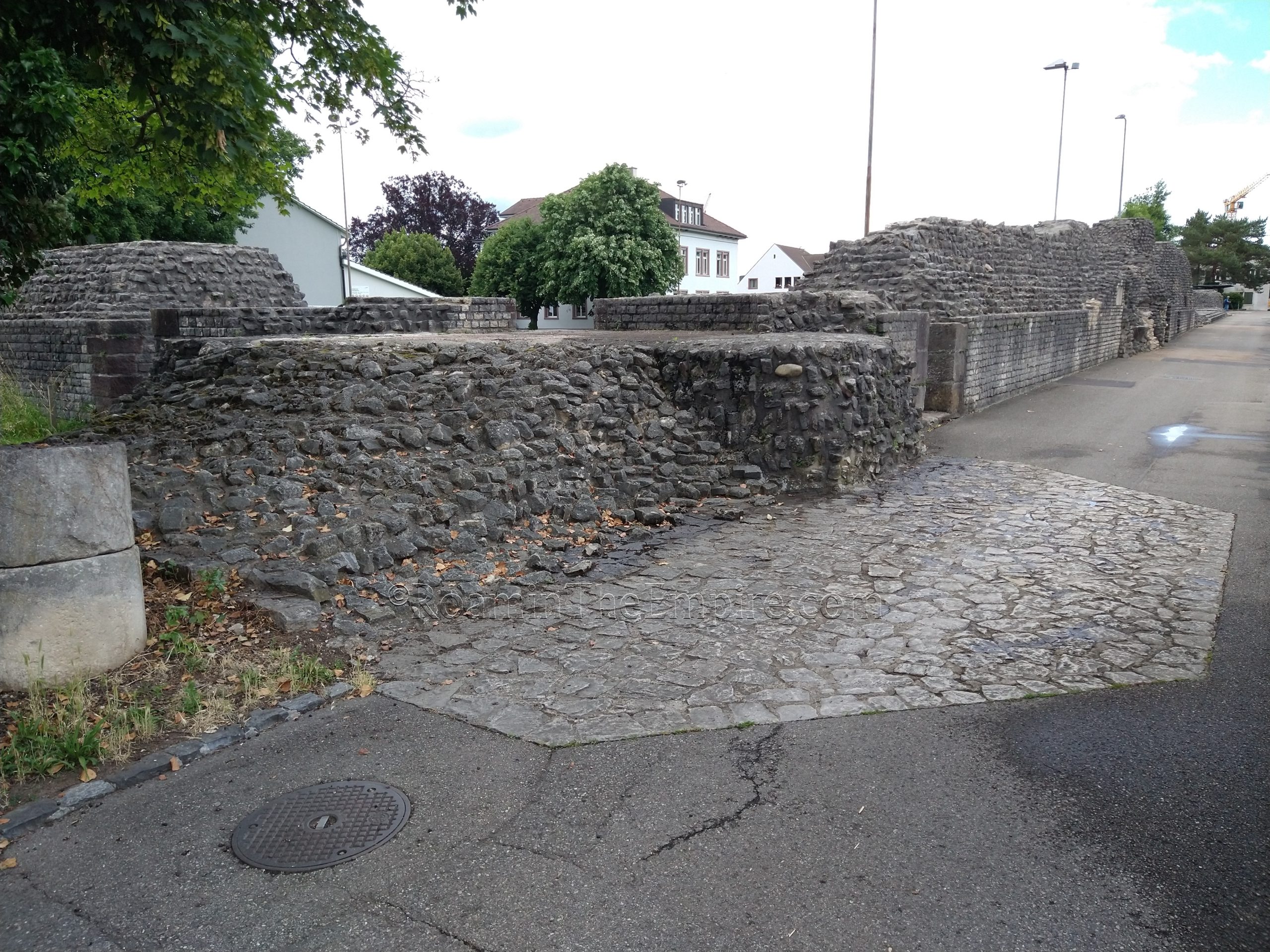
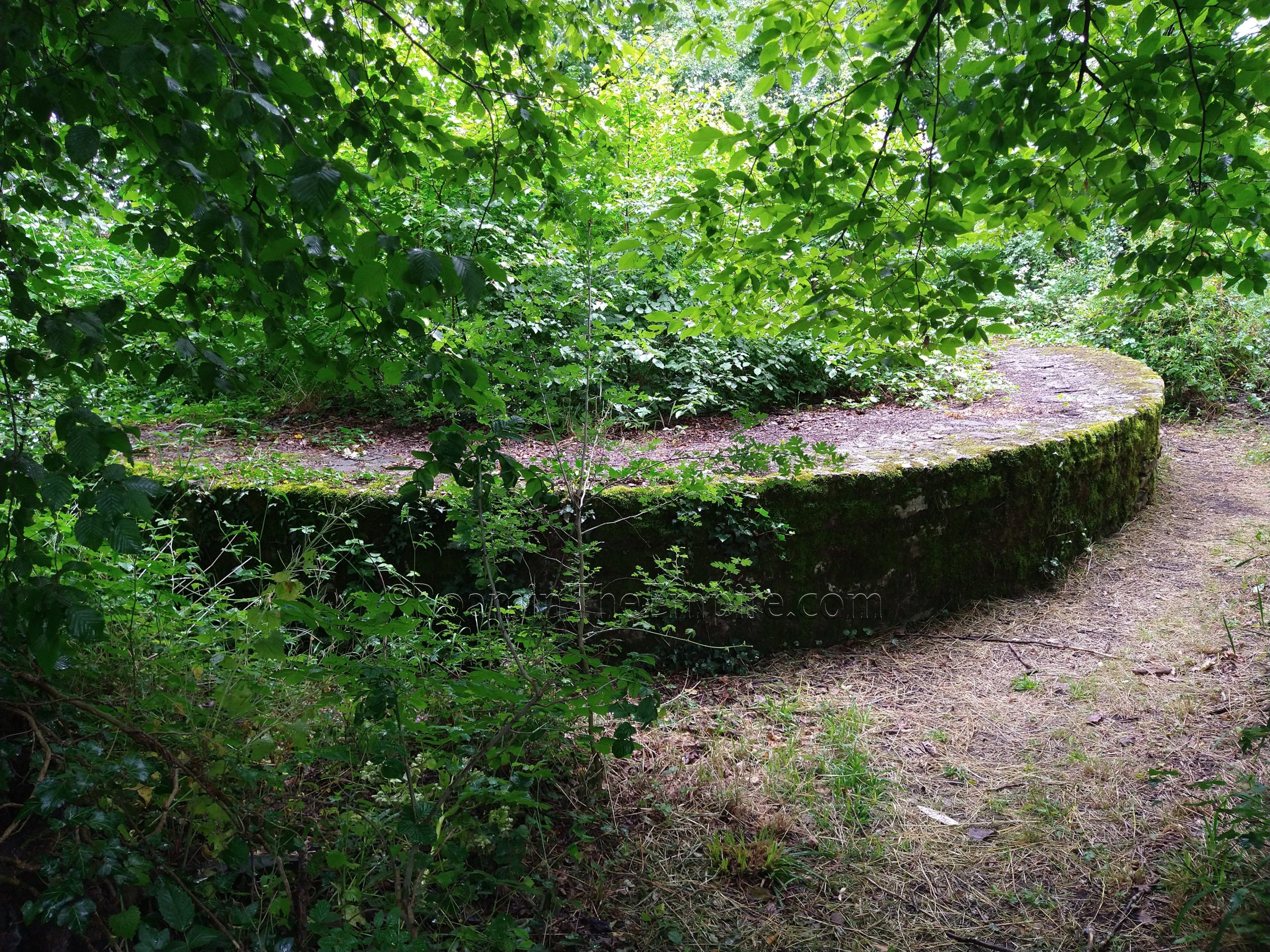
At the intersection of Mühlegasse (which turns into Dorfstrasse at the intersection) and Heidemurweg, on the northeast corner, is the southwestern corner of the fortifications of Castrum Rauracense, which is also the largest portion of the walls preserved from the fortress. They continue mostly unbroken eastward down Heidemurweg for about 100 meters, and up Dorfstrasse to the north for about 57 meters before they are broken by the road curving to the east. The area enclosed in the corner of these walls is a sport field with public access, so the interior of the walls can be seen as well. These belong to the roughly 850 meter circuit of walls constructed around 300 CE for the fortified camp, which at the time seemed to house troops of Legio I Martia, according to stamped tiles found here. Some remnants of towers are visible along this stretch of the walls, but there are also markings in the pavement showing where the towers would have been in some instances. There are a few signs in English, French, and German about the walls located around this corner.
On the street where Dorfstrasse intersects with the walls, there is the outline in the pavement of what would have been the western gate of the castrum. Unlike the city walls of the eastern gate of Augusta Rauricorum, this was a fully developed, fortified gate flanked by two towers. There is a sign in English, French, and German explaining the structure of the gate and interpreting the markings on the pavement. There is also a small, low stretch of walls continuing north from Dorfstrasse along Fuchsloch. It is worth noting that the remains of an amphitheater were found a short distance down this road, just outside of the walls along the water. This occurred during a rebuilding of the boathouse in the last few years, but by the time I had visited, the excavation had been covered over and the boathouse rebuilt.
About 55 meters east of the walls on Dorfstrasse is a parking lot on the north side of the street. At the north end of the parking lot is one of the entrances to the Rheinthermen, the Rhine Baths. There is a sign near the entrance stating that the opening hours for women are sunrise to 7:00 and men 8:00 to sunset, with an entrance fee of 1 As for men, ½ an As for women, and free for children. Of course, this is a joke regarding a theorized entrance and fee scheme for a bathing complex in antiquity. The baths are free to enter, and there is no one there watching over things, but the actual hours it is open seem to follow the rest of the sites of Augusta Rauricorum; 10:00 to 17:00.
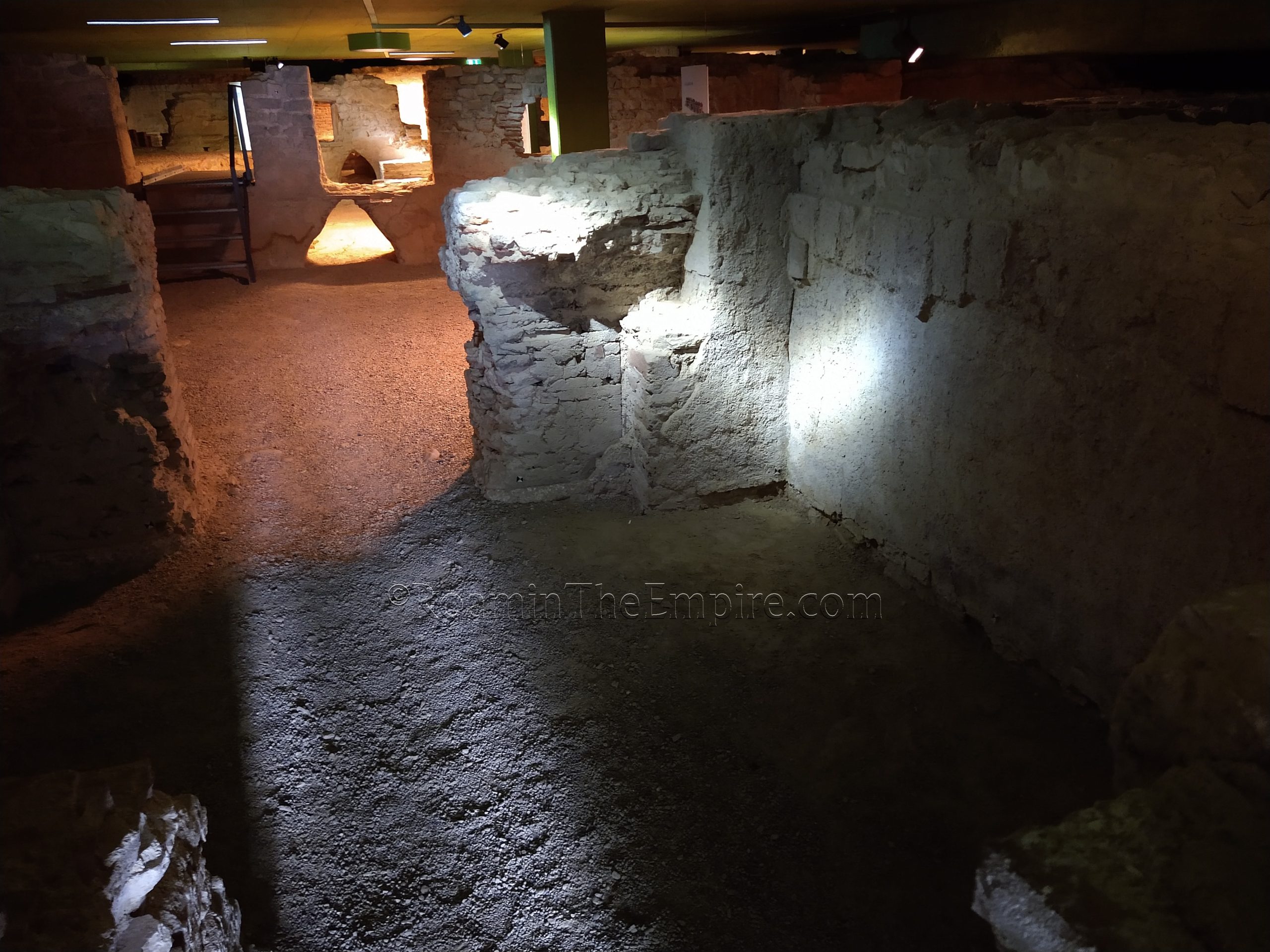
These baths actually predate the construction of the fort, having been built about 260 CE. When the fort is built, the baths are incorporated into the interior of the castrum. This bathing complex seems to have still been in use in the 4th century CE. Though it is a reasonably sizable chunk of baths excavated, it is only a small part of the complex. The entrance from this side descends into the frigidarium. Heading north toward the river, through the bathing complex, one walks through a series of two tepidaria and into the final room on display, a caldarium with a pair of hot baths. A little bit of the original hypocaust system can be see embedded in the wall of the caldarium, as well as some reconstructed foundations of pilae in the tepidaria. Some underfloor channel passages running through the walls (now above the present ground level, which would have been the foundation for the hypocaust system) is another highlight of what can be seen here, including the presence of triangular shaped channel cuts that belonged to an earlier iteration of the baths. There are a number of signs in English, French, and German describing the remains; especially helpful is a map laying out the plan of the baths.
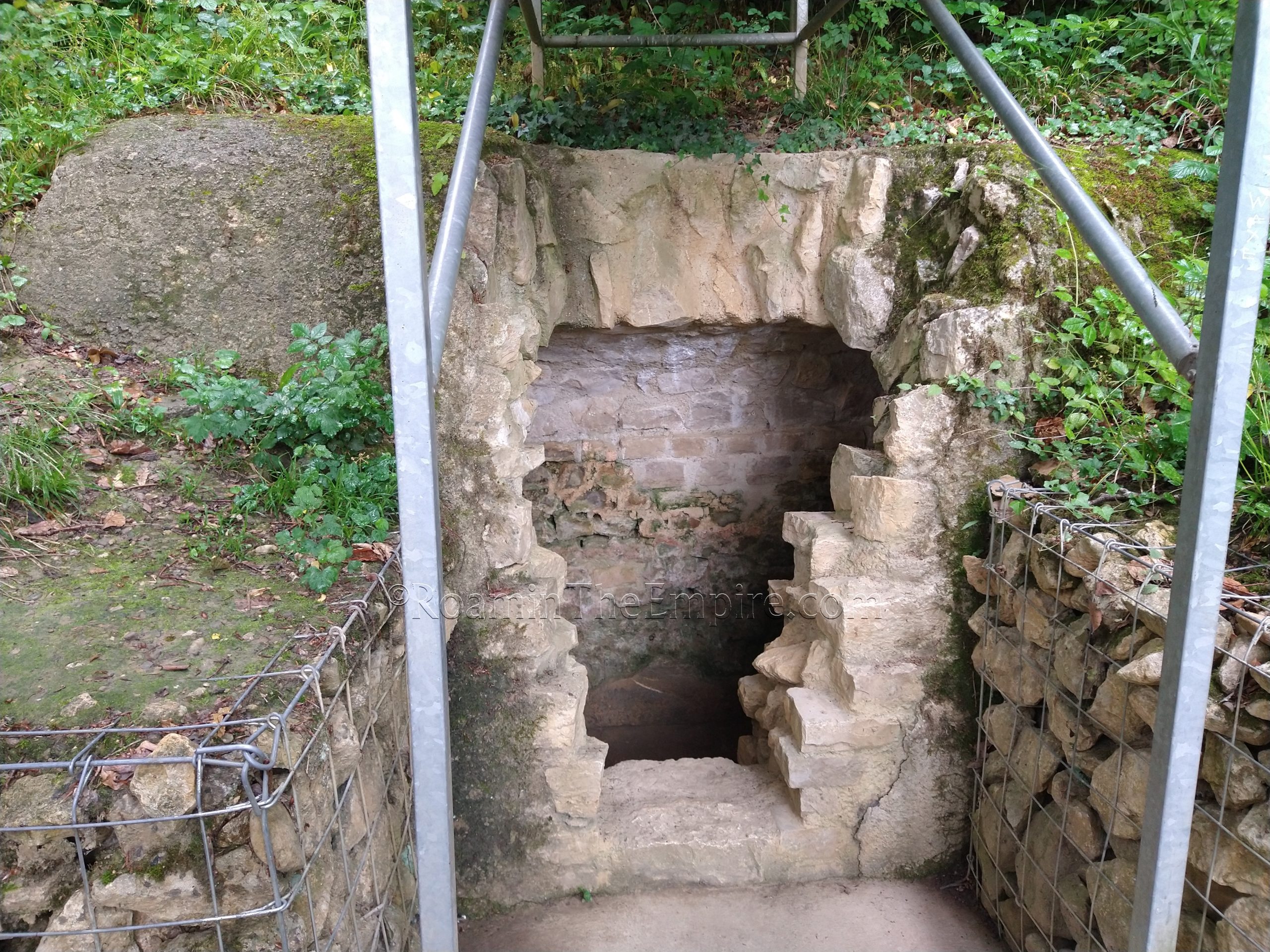
The far end of the baths exits out to a path that runs along the banks of the river, the Rhineweg. Taking this path eastward, about 75 meters on or so is a sign that marks the spot where the southern part of a bridge spanning the river that was built during the reign of Valentinian I. Unfortunately there are no remains of the bridge on this side of the river, though there are some remains on the opposite side, a site that will be visited later in the post. A little farther on from that, about 50 meters to the east, are the remains of a channel that drained water into the river. Not much remains outside, but the stone channel can be seen extending a little way into the wall that was built around it; apparently original fortifications from the castrum.
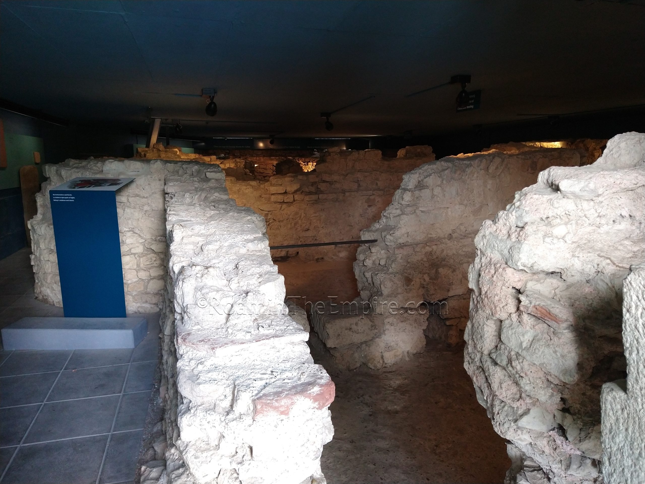
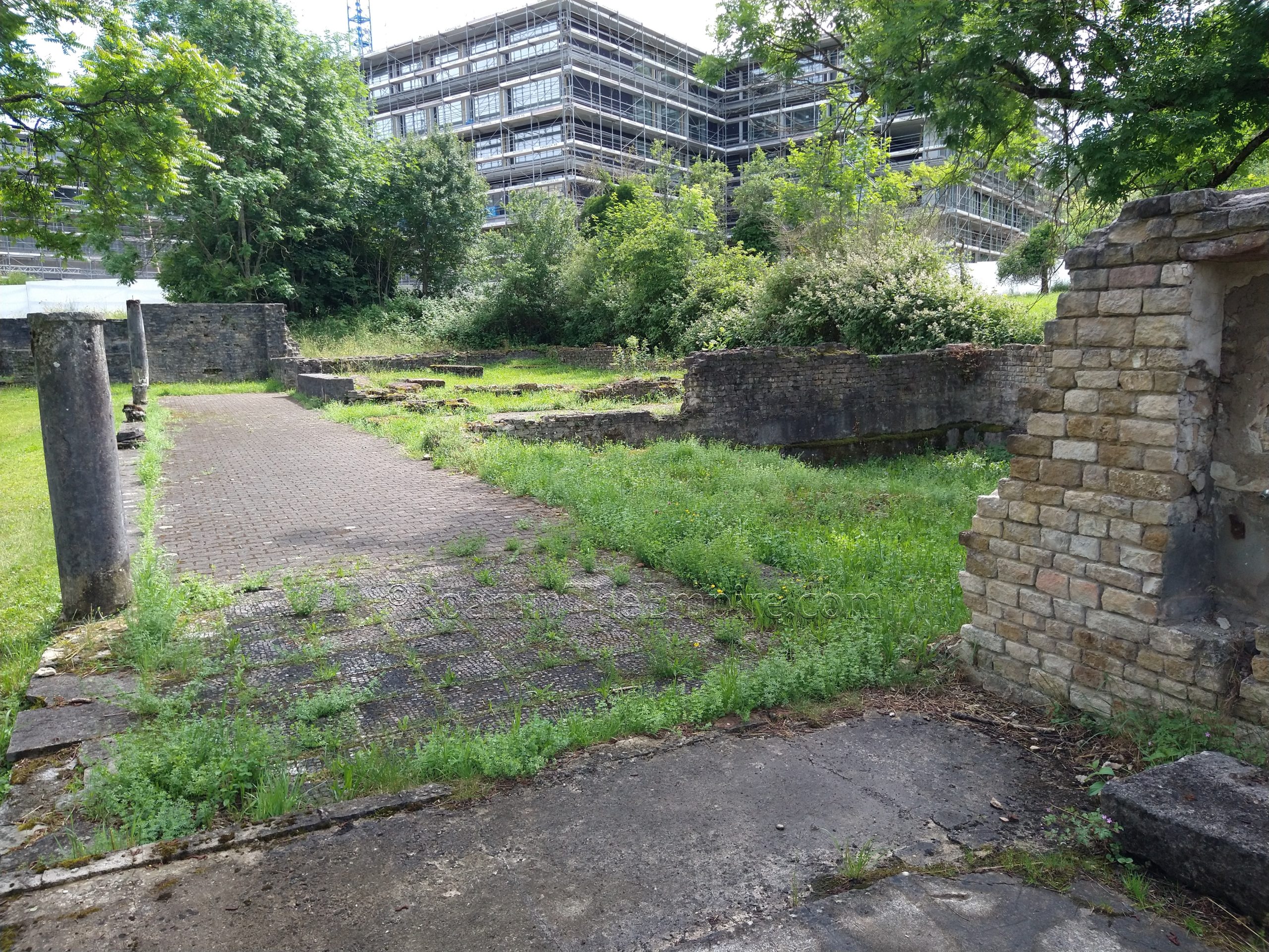
Just past this channel is the entrance to the Frühe Kirche und Bischofsresidenz, the early church and bishop’s residence. Like the nearby baths, there is no ticketed entrance or anyone really watching over things, but it is open and accessible between 10:00 and 17:00 daily. What remains here is mostly a small bathing complex that was built between 360 CE and 400 CE that was part of the residence of the bishop, attached to an early church. The sightlines for this aren’t great, but the hypocaust system can be seen in one of the rooms. There are also some artifacts from the 4th century CE found in the excavations as well as some objects dating to the 6th-7th century CE found in burials in the vicinity. Today these excavations are below the St. Gallus church.
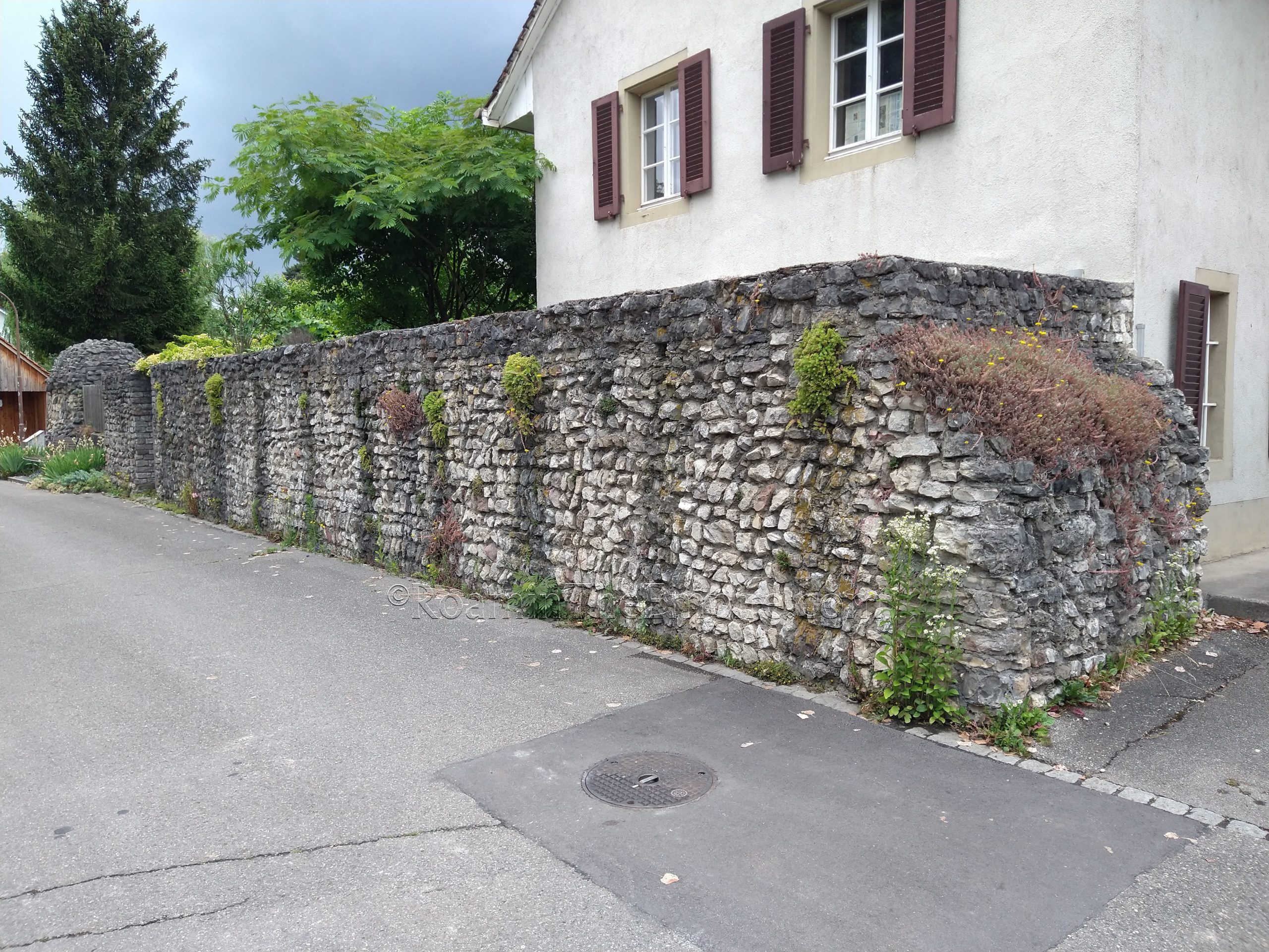
Heading back out to the Rhineweg, a short walk farther to the east intersects with a path to head to the south, which eventually meets up with Allmendgasse. Following that for about a block to the south intersects back with Heidemurweg, the street from the intersection with the large section of wall. If one heads back to the west along Heidenmurweg, there are a few more small sections of the southern wall of the castrum that can be seen intermittently along this street. At the intersection of Heidemurweg and Kastellstrasse, there are the outlines of the south gate of the fort in the paving stones of the street and sidew
The last slate of sites associated with Augusta Rauricorum are a bit out of the way. Some are borderline walking distance, but are much easier to reach by vehicle. The first of those is the bridgehead on the opposite bank of the Rhine. Unfortunately, there are no modern bridges within Augst/Kaiseraugst and the closest one is upriver (east) a few kilometers near Augarten. Crossing over the Rhine, the journey actually takes you into another country, Germany, but there are no border crossing restrictions or checks, and one must then head back to the west on highway 34. About 2.6 kilometers down the 34 is a turn off toward the river and a small area to park about 175 meters down the road. A trail then leads into a forested area where one can see semicircular, rounded constructions that made up the exterior of the northern towers of the fortlet at the bridgehead. It looks as though everything south of that has eroded away with the banks of the river. A sign in German near the beginning of the trail contextualizes what is here.
There is a mostly overgrown mansio not far from here down the 34. It required a lengthy drive down a questionable dirt road after significant amounts of recent rain, so I didn’t go in for a closer look. I did see it from the main road (up an embankment) adjacent, so it is definitely there. It is probably a little more accessible at times of year when the area is not as overgrown.
From there, it is back across the bridge to Switzerland, and a short trip to the town just to the east of Augst; Pratteln. In the parking lot of a Lidl supermarket in the western end of the town, located at Muttenzerstrasse 94, are some very scant remains uncovered during the construction of the Lidl. Quite an extensive building was uncovered here, seemingly a hospitia, but only two very small fragments remain exposed in the northwest corner of the parking lot under a little covered area; a paving stone and well. Even worse, there is an explanatory sign (only in German) on site, but it is quite faded and some key details are mostly unreadable. This can be visited at any time without restrictions.
The next few sites are associated with the aqueduct that fed Augusta Rauricorum. The exact source of the aqueduct has not yet been identified, but it ran at least 7 kilometers to the south, as the remains of the aqueduct have been identified at least up to that point. It ran roughly along the course of the Rhine tributary, the Ergolz, for much of the identified length. The aqueduct seems to have been constructed in the mid to late 1st century CE and probably operated until the late 3rd or early 4th century CE.
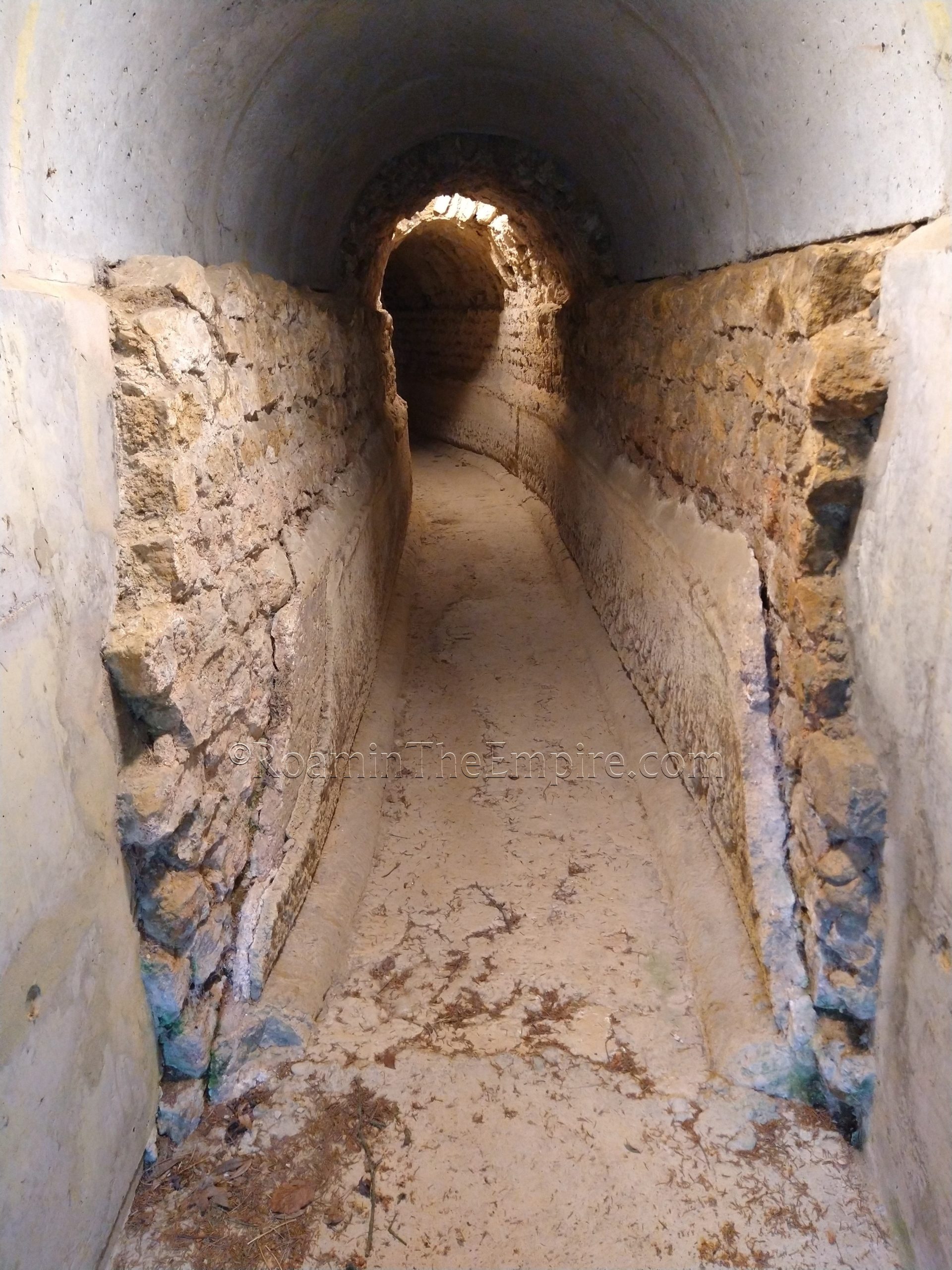
The first section of aqueduct visible is probably technically within walking distance of the rest of Augusta Rauricorum; about a 1.6 kilometer walk to the south from Parkplatz 2. There is a paved road most of the way to this part of the aqueduct, and a parking area a short walk from the actual aqueduct, just before the paved road (Augsterfeld) turns to a dirt road, should one visit it by vehicle. Walking down the dirt road a few minutes, there is a sign that indicates the presence of the aqueduct, accessible via another short trail that leads off the road to the right (south/southwest). Here there is a small part of the aqueduct exposed and the interior channel accessible. One can enter the channel and walk through it for a short distance to the northwest until reaching another break in the channel. There are no lights in the channel, and though it is short, a light might not be the worst idea. The exterior of the channel is mostly covered for this length, so the only thing to really see is the interior of the channel. There are a couple signs here in German explaining the aqueduct as a whole.
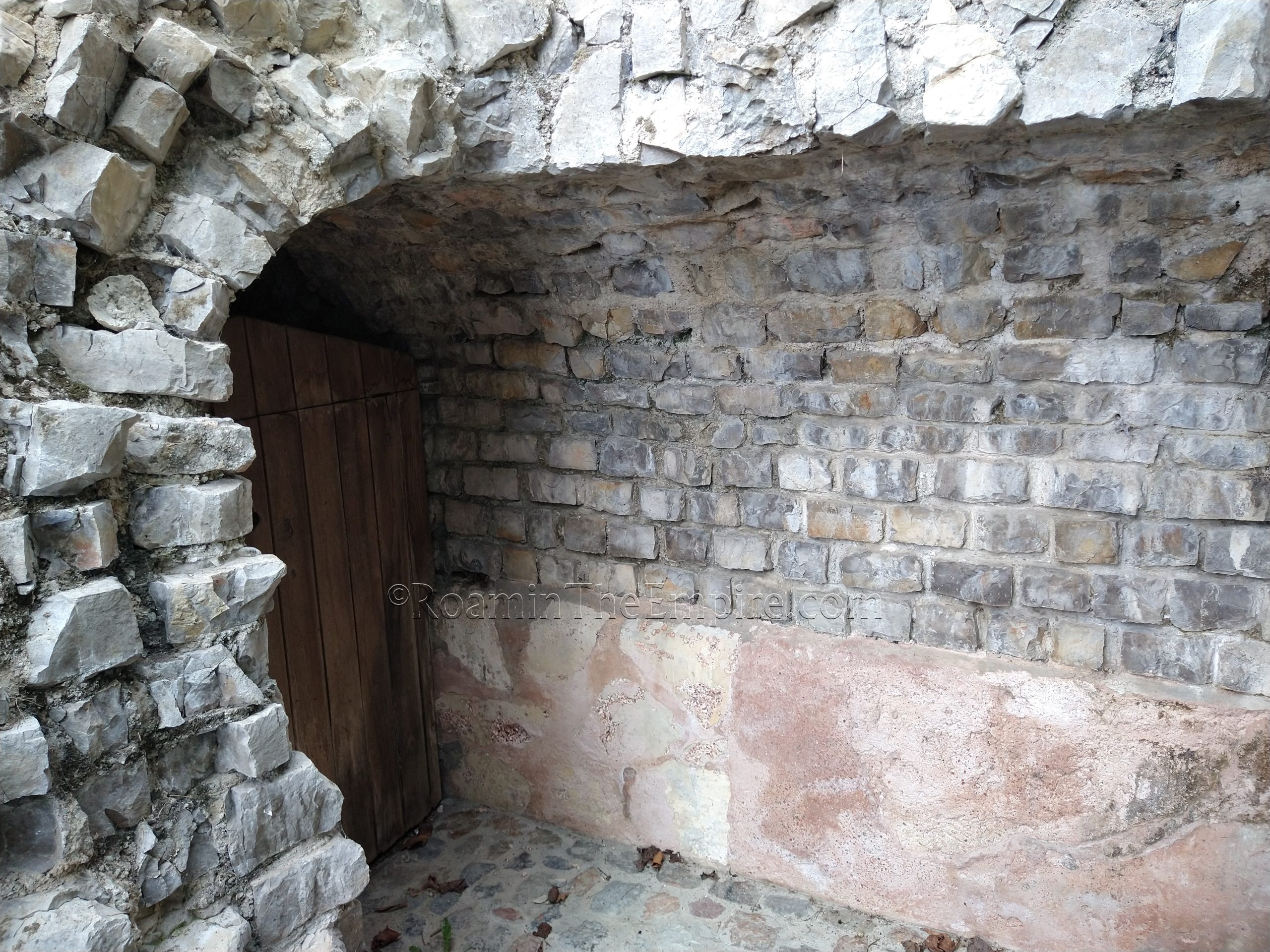
There are two more bits of the aqueduct that can be seen a short driver farther south in the town Leistal. The first is located at Weideli 10/4, in the northern part of the town on the east side of the river. Here there is a span of the aqueduct broken by the road, with an exposed, lower section of the aqueduct channel above the road on the south side, and an intact channel entering into the hillside on the north side of the street. The intact channel has a gate restricting access into the channel, which extends for several meters before curving. There is a button to turn on a light, which can be used to get a better view of the channel. A sign also indicates that a key to the channel can be acquired at the nearby residence at Burghaldenweg 19 or at the archaeological commission office in the center of town at Amtshausgasse 7. I had no luck with the residence, as no one answered (it was early afternoon on a Tuesday), and the archaeological office appeared to be closed. So I was not able to get access to the channel, but, it is still worth seeing regardless.
The next portion of the aqueduct is located about a kilometer and a half away, a short drive to the southeast. This section is located among an apartment complex, with the path accessible from across the street of Heidenlochstrasse 28 or next to Arisdörferstrasse 26. This part of the aqueduct is a small exposed section with a break in it, like the first one, but direct access to the channel is blocked by a locked gate, and the interior of the channel is further obscured by a wooden door. Once again, the key to the gate is supposedly kept down the street at Heidenlochstrasse 36, but I was not able to get any answer at the house. There is no street parking allowed along here, but there is a small parking lot about 130 meters southeast down Heidenlochstrasse.
That rounds out the remains of the aqueduct, but there is one last thing worth seeing just a few minutes away on the other side of Leistal. Located at roughly Bienentalstrasse 4 are the remains of a villa, the Römische Villa Munzach. Once again, there is no street parking allowed here, but there is a parking lot with a half an hour of free parking just to the east. The remains of the villa are open access. This villa was built in the 1st half of the 1st century CE. It suffered significant damage during the Alemanni invasion of the middle of the 3rd century CE, but it was repaired (though not to its original state) somewhat and continued to function until the 4th century CE, with sporadic habitation likely even into the 5th and early 6th centuries CE.
The villa is larger than what is excavated here, and a sign on site (in German) shows some of the other parts of the villa and adjacent structures that have been found but are no longer visible. What does remain is a long corridor that would have ran around an interior portico with a reconstructed mosaic design decorating it. Off to the south of the corridor is a large hall and two small rooms that are identified as being a small private bath area. An arch in the wall under which heated air would have traveled can be seen. The corridor then continues to the north and the west end of the complex includes rooms identified as a kitchen (at the corner) and some cubicula. There are a couple of signs explaining what is here, but they are only in German.
The remains of Augusta Rauricorum and the few sites in the vicinity are definitely something that can be done in a day. It took me a total of about 5 hours to see everything in the main area of Augusta Rauricorum, though I was admittedly doing some backtracking because I started out early to see some of the open sites first and wanted to time hitting certain things at certain times. Castrum Rauracense was maybe another hour, including walking times to and from, and then another couple hours to see the outlying sites.


Sources:
Ammianus Marcellinus. Rerum Gestarum, 14.10, 20.10.13, 22.8.44.
Caesar, Julius. Commentarii de Bello Gallico, 1.29, 1.5, 6.25.
Grant, Michael. A Guide to the Ancient World: A Dictionary of Classical Place Names. New York: Barnes & Noble Books, 1997.
Hufschmid, Thomas. Theatres and Amphitheatres in Augusta Raurica, Augst, Switzerland. Roman Amphitheatres and Spectacula: a 21st-Cemberury Perspective. Papers from an international conference held at Chester, 16th-18th February, 2007. Oxford: Archaeopress, 2009.
Pfäffli, Barbara. A Short Guide to Augusta Raurica. Augusta Raurica, 2010.
Pliny the Elder. Historiae Naturalis, 4.24.4, 4.31.2.
Smith, William. Dictionary of Greek and Roman Geography. Walton & Murray, 1870.
Stillwell, Richard, William L. MacDonald, and Marian Holland. McAllister. The Princeton Encyclopedia of Classical Sites. Princeton, NJ: Princeton U Press, 1976.