


Most Recent Visit: May 2021.
Situated just to the north of the Sinus Ambracius (the modern Ambracian Gulf), the body of water that bears the name of this city, is the Greek settlement of Ambracia. Mythologically, the city was founded by Ambrax, son of Thesprotus, who was the eponymous founder of the Thesprotians and himself the son of the Arcadian king Lycaon. Ambracia was, of course, derived from the name of Ambrax. An alternative tradition links the founding to Ambracia, the daughter of Augeas, the king of Elis and owner of the Augean stables of which Heracles was required to clean out as one of his famed labors. Historically, the Corinthians established a colony at Ambracia around 635 BCE led by Gorgus, who was either the son or brother of the first tyrant of Corinth, Cypselus. Gorgus’ son Periander was deposed after he succeeded his father as tyrant of Ambracia.
Following this, Ambracia flourished and is noted as providing seven ships in the war against Xerxes in 480 BCE and twenty ships during the Corinthian war against Corcyra in 432 BCE. That same year the Ambraciots took Amphilochian Argos and expelled the inhabitants, but aided by the Athenians, the city was retaken and the new Ambracian inhabitants were sold into slavery. By the outbreak of the Peloponnesian War the next year, in which the Ambraciots supported the Spartans, the city was a formidable regional power. Conflict continued between Ambracia and Argos through the early years of the Peloponnesian War, with several attempts made by Ambracia to recapture the city. In 426 BCE, as part of a larger plan to subjugate Arcanania, the Ambraciots were handed a pair of utter defeats at the hands of Demosthenes, including the Battle of Olpe, that ended up wiping out nearly the entire manpower pool of Ambracia. Ambracia itself was spared ruin and subjugation as the Athenians were prevented from marching on Ambracia by the Arcananians, who feared Athenian influence gaining a foothold in the region. Ambracia’s defeat prevented the city from any further actions and the war and actually required Corinthian troops to protect the city, as they had none of their own.
Ambracia was, unsurprisingly, a member of the Corinthian League in 395 BCE. During the conquests of Philip II of Macedon, the city was unsuccessfully besieged in 342 BCE, but was later conquered by him in 338 BCE. When Alexander the Great succeeded Philip II, the Ambraciots expelled their Macedonian garrison, but it was later reoccupied during Alexander’s campaigns. During the reign of Pyrrhus of Epirus, he made Ambracia his capital city and built a fortified palace here, calling it the Pyrrheum. In the conflict between Macedonia and the Aetolian League, Ambracia joined on the side of the Aetolian League around 230 BCE. At first an ally of the Romans against the Macedonians, the Aetolian League soon found itself at odds with the Romans and sided with Antiochus III against the Romans in the early 2nd century BCE.
In 189 BCE, Ambracia was besieged by the Roman consul Marcus Fulvius Nobilior. The siege is described by Polybius as being fiercely fought, with the Ambraciots countering numerous Roman attempts to assault the city. One notable effort was the Ambraciots using smoke pumped into the siege tunnels being dug by the Romans to undermine the walls, preventing them from utilizing the tactic. Eventually the surrender of the city was negotiated, but when the gates were opened to the Romans, Ambracia was thoroughly looted. The Romans declared Ambracia a free city and allowed it some degree of autonomy, but the defeat marked a period of sharp decline that culminated in the depopulation of the city to populate the newly-founded Nicopolis in 29 BCE. There was still habitation on the site through the Roman period, but never again in antiquity at a level approaching the significance it held at various points in the past.
Getting There: Like many places in Greece, there is no train service to Arta, which given that it is pretty far down the list for population centers in Greece, isn’t incredibly surprising. There is regional bus service from Ioannina a few times a day at a cost of 7.10 Euro each way. The trip lasts about 75 minutes and exact times and prices can be found here. Other than bus service, personal vehicles are also an option. Parking isn’t terribly difficult and pretty much everything ancient that can be seen is within a pretty tight radius, while the museum is a little bit of an outlier (about 15 minutes from the closest remains), it does have ample parking.
The remains of Ambracia can roughly be portioned out into a northern core and a southern core. The first site worth visiting is in the northwest part of the modern city, on the north side of the Periferiaki Artas (E951), the main artery that runs around the western, northern, and eastern sides of Arta. In a fenced off and inaccessible area significantly below the level of the road, but viewable from the sidewalk, is what has been identified as part of the fortifications of ancient Ambracia along with some vestiges of a road that ran along parallel to the wall. About 4.5 kilometers of fortification wall encompassed the ancient city and the fragments of wall visible today seem to date to about the 4th century BCE. There are no signs or indications of the presence of this wall on-site.
About a 5 to seven minute walk to the south, on the west side of the T-intersection of Tsakalof and Arachthou streets, are some largely overgrown and seemingly neglected remains. Once again, there are no informational signs indicating what is here, or even that there is anything of note here. The area is recessed below street level and fenced among private buildings, so there is no direct access. Of some of the ancient blocks that are visible, there does seem to be a pattern that looks suspiciously like road paving. But it’s hard to make out anything here.
Roughly 50 meters east down Tskalof, on the south side of the road, is the location of the large theater of Ambracia. There are, indeed, what appear to be a few ancient blocks laying around in an enclosed open area, but nothing that really looks like an identifiable element of a theater.
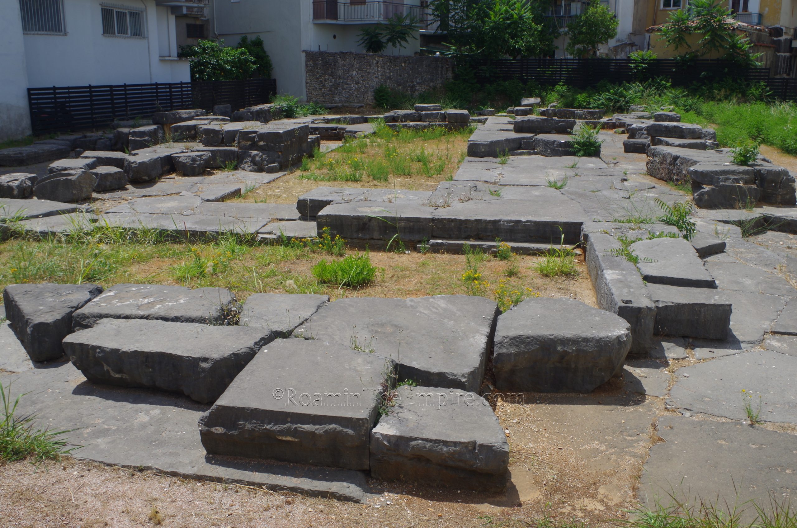
Another walk of just a few minutes to the southeast along Pirrou street are the remains of the euthenteria of the Temple of Apollo. This temple was likely to have been the most important sanctuary in the city and was dedicated specifically to Apollo Pythios Soter. It initially seems to have been constructed circa about 500 BCE, with significant restorations/renovations between 450 and 425 BCE. There is no access to the area of the temple remains, it is in a fenced in area that does not seem to ever be opened to the public.
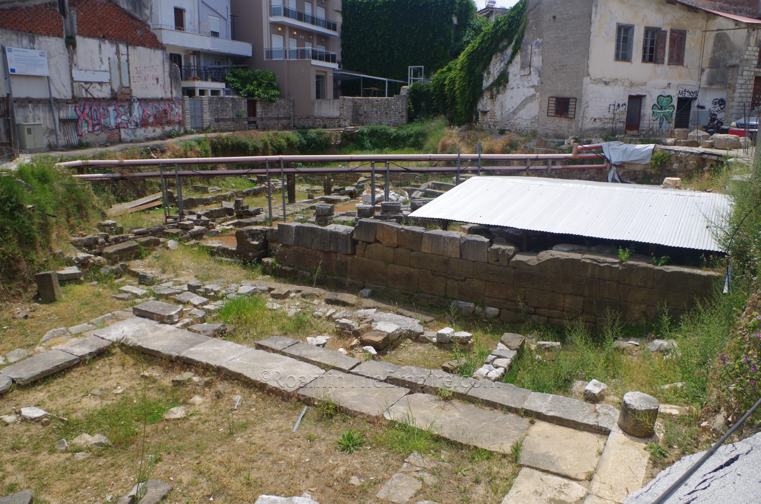
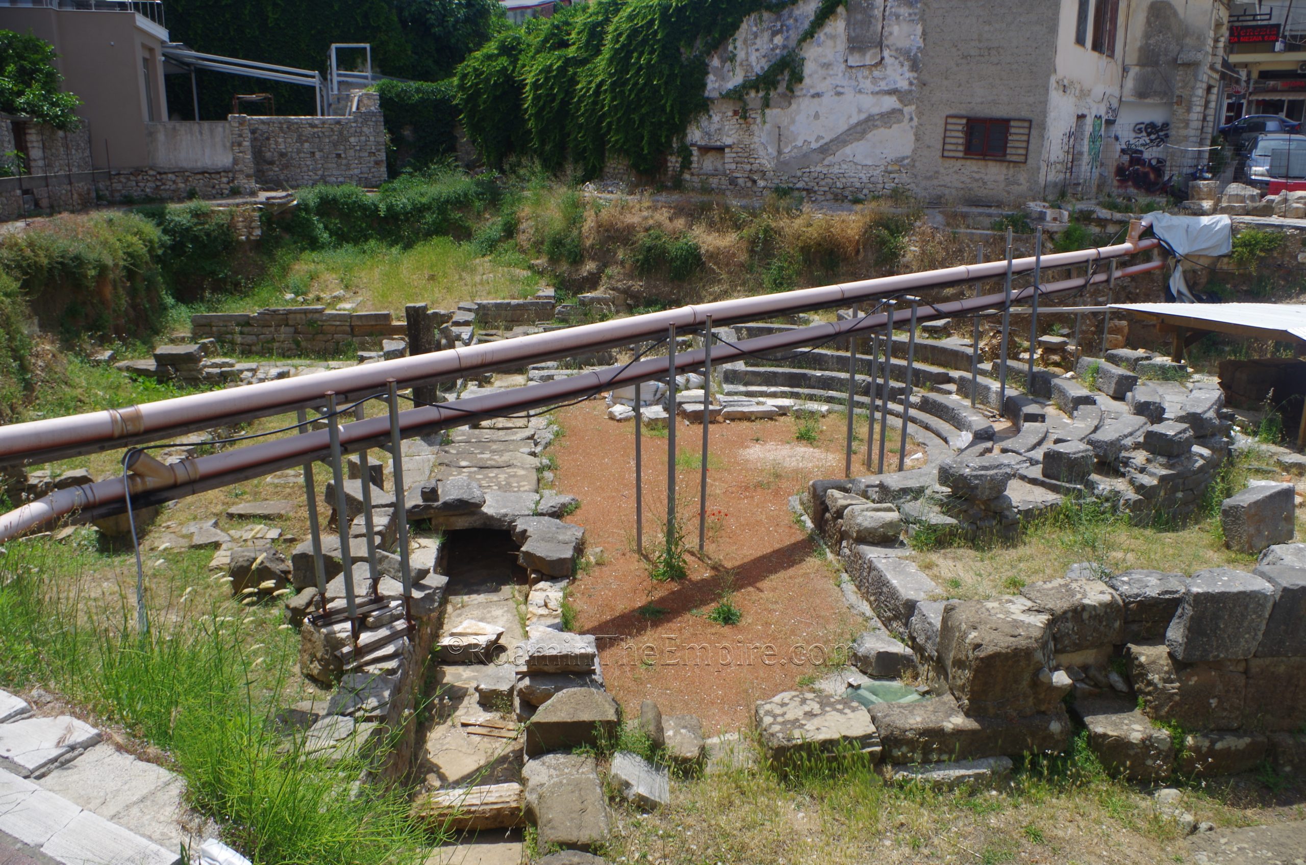
Essentially just across the street, though access is a little bit to the north on Agiou Konstantinou, is the so-called small theater. Unlike the large theater, there are actually significant visible remains of this theater, though there is, like most archaeological areas in the city, no direct access or entrance to the area. The actual form of the koilon of the theater can be seen here among the visible excavated remains. The theater itself was constructed in the late 4th century BCE or early 3rd century BCE on top of a previously constructed bathing complex, rather than the more typical construction of such a building on a natural slope. It is noted by Dionysius of Halicarnassus as being sacred to Aphrodite and Aeneas. The theater seems to have fallen out of use in the 2nd century BCE. There are some recent adjacent excavations at a higher level that appear to be of a significantly later period.
The final set of remains in the northern part of the city are a small section of the ancient wall standing at the intersection of Kosta Kristalli and Agiou Markou. There are significant patches dating to later use, but the majority of the blocks in this section were used in the ancient circuit of fortifications.
Heading to the southern part of the city, there are a few points from the ancient city along a roughly 250 meter stretch of Kommenou street starting at about Drakou. About 40 meters down Drakou toward the southwest from Kommenou, on the north side of the street, are some more remains of the exterior face of the fortification wall in a recessed green space. There is no direct access, but it is fairly visible from Drakou.
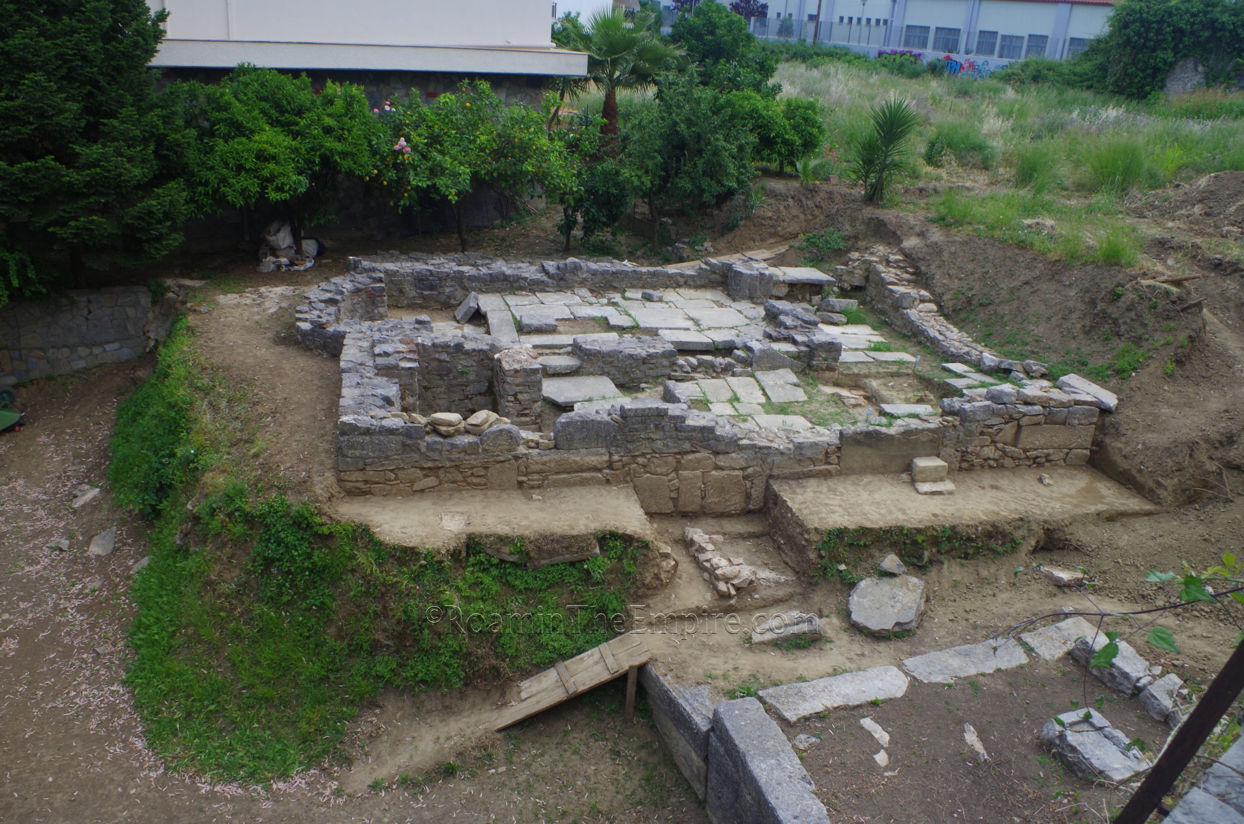
Another 75 meters down Kommenou (to the southeast) is an area on the west side of the street identified as the Polyandrion monument. The structure itself was a monument that was, according to an archaic Corinthian inscription found here, dedicated to the dead Ambraciots killed in a naval battle with the Corcyraeans at the mouth of the Archeron River at the end of the 7th century BCE. The structure itself seems to date to either the late 7th or early 6th century BCE, not long after the supposed foundation of the city. The monument sat outside the city walls, a small portion of which are preserved in the portion of the site abutting Kommenou. Once again, there is no access or opening, though this site does have a gate and stairway that would seem to indicate it may have once been accessible or is occasionally opened up.
Just on the other side (south side) of the building that borders the Polyandrion to the south is a small excavated area that appears to be part of the sacred road and Western Necropolis, of which a much larger portion is excavated about 100 meters farther south on Kommenou.
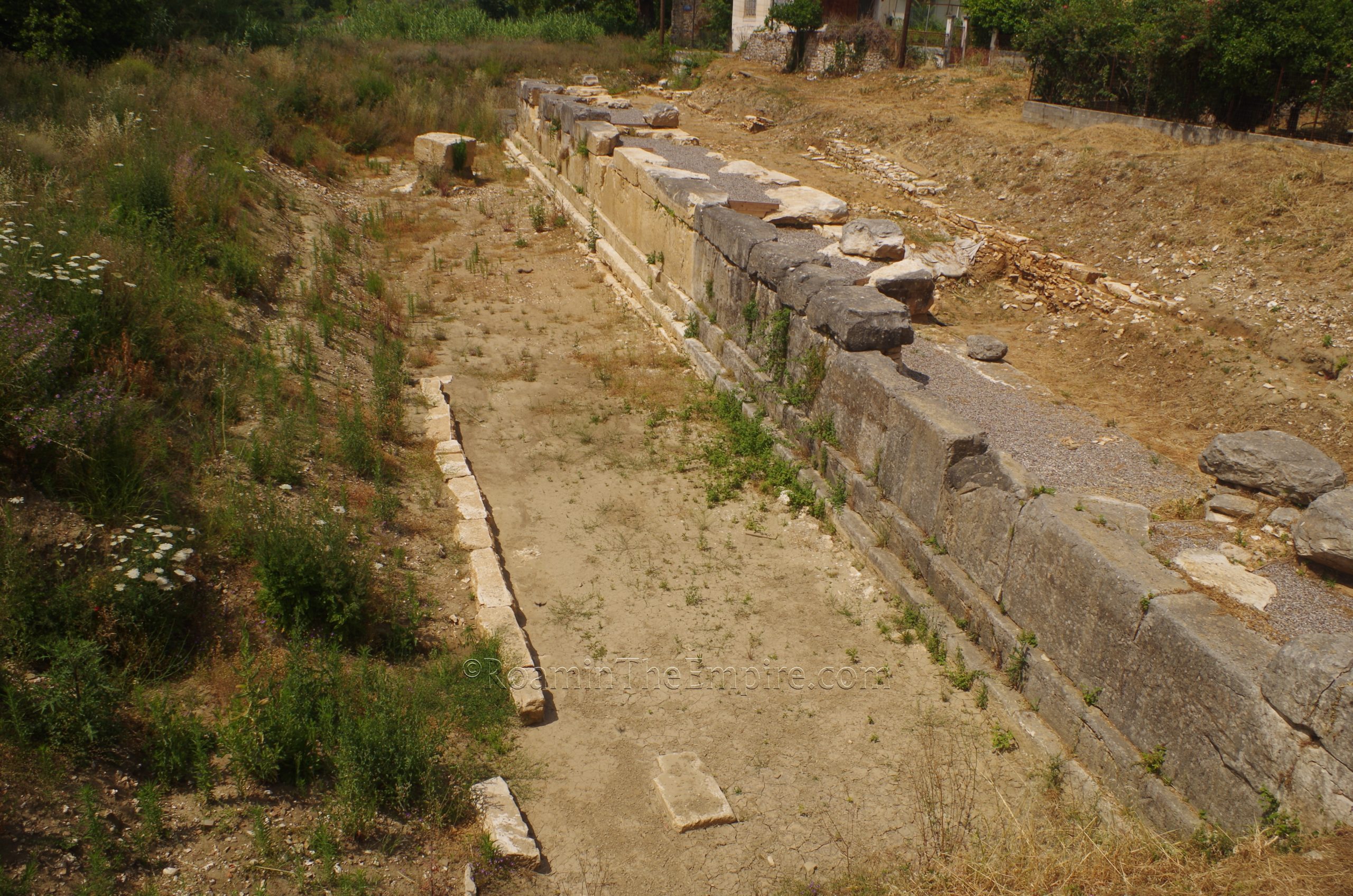
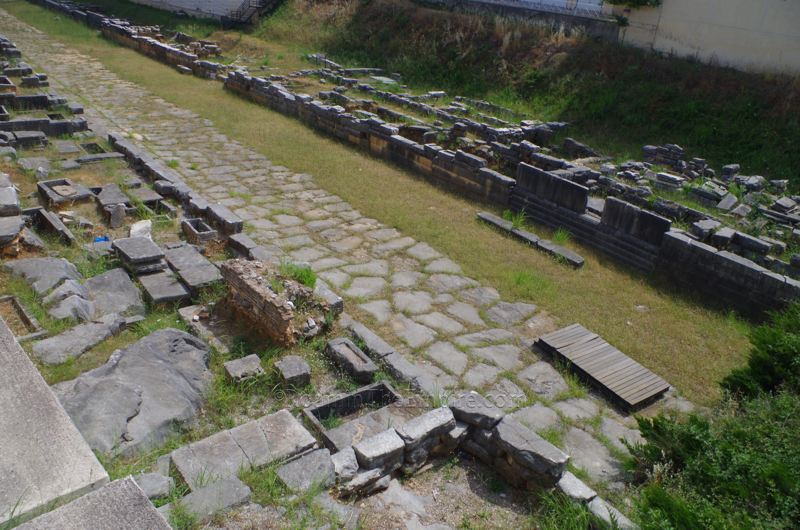
The Western Necropolis, located at Evaggelea Chelmi 15, is the largest and most well maintained of the ancient monuments of Ambracia. There is some fairly recently (within the last 10 years) built infrastructure to make this an entranced site, and officially it seems to be open between 8:00 and 14:00 Monday through Saturday, but by all accounts, the site is currently never actually open or accessible. Fortunately, because it is well below present-day street level, much of the site is quite visible from public areas. This site mostly consists of the paved sacred road flanked by various fragmentary funerary monuments and enclosures. The cemetery has apparently functioned since the foundation of the city, with burials occurring until about the 2nd century BCE.
The final stop is about a kilometer away from the Western Necropolis, at the southernmost part of the town; the Archaeological Museum Arta. The museum doesn’t really have an address, but it is marked on the map and is about 250 meters southeast along the riverfront road from the Arta Regional Bridge. The museum is open Wednesday through Monday from 8:30 to 15:30 in the summer, and until 14:00 in the winter. It is closed on Tuesday. Admission is 4 Euros.
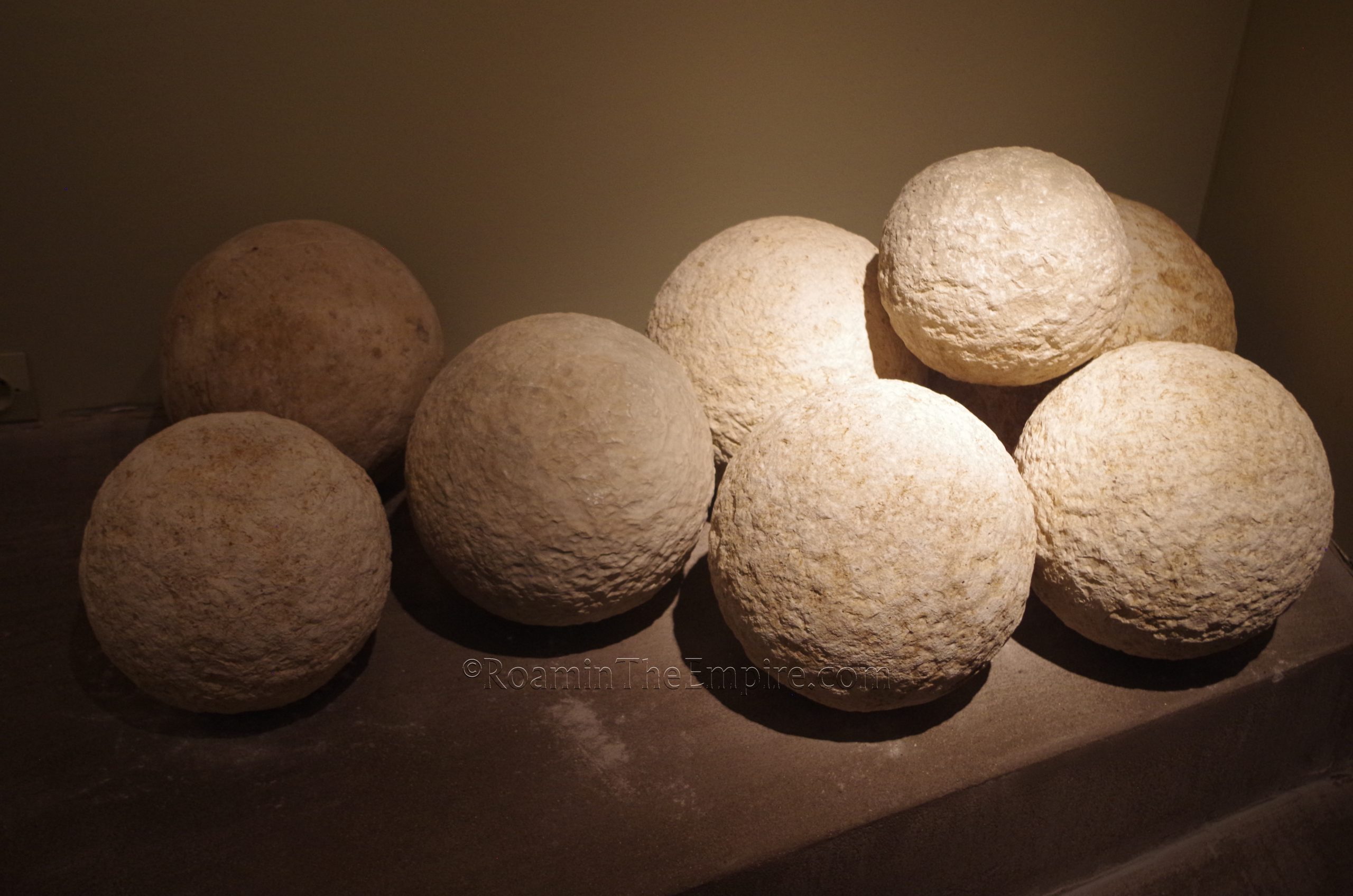
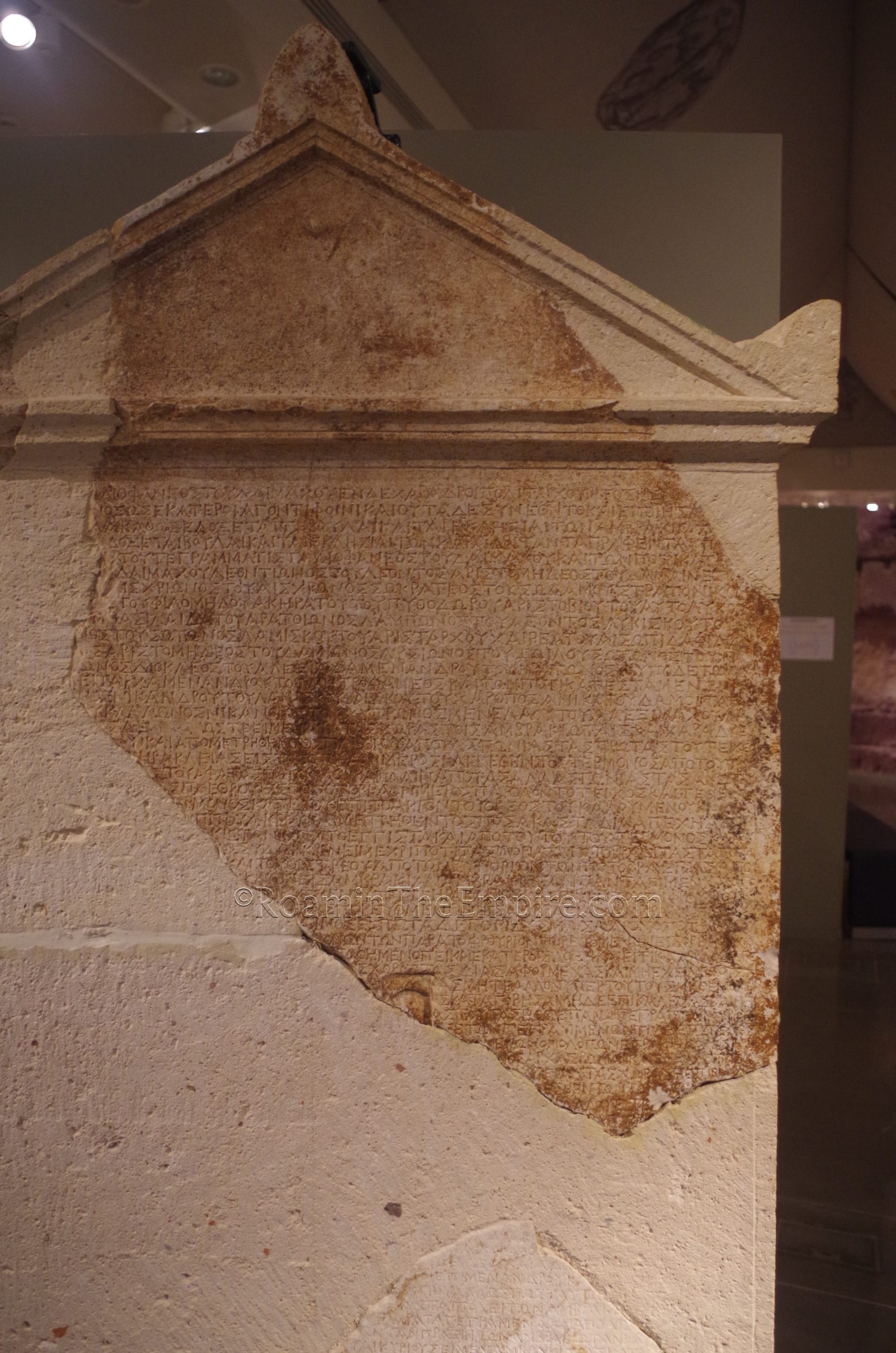
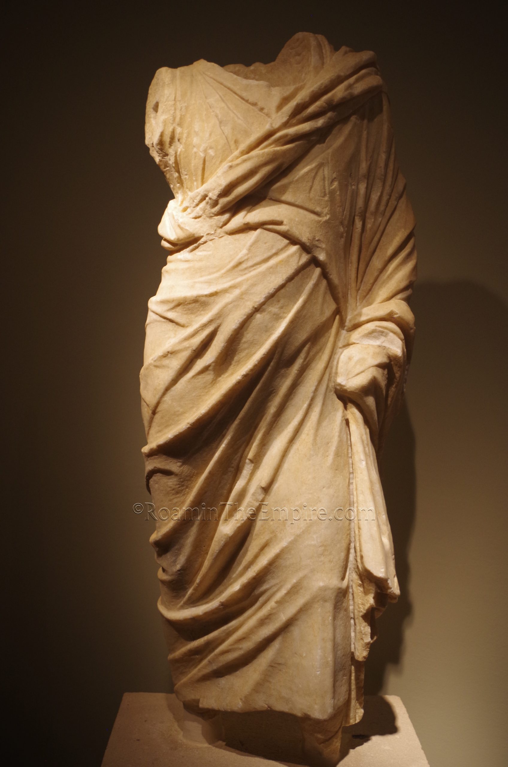
As one might expect, the majority of the museum’s collection consists of artifacts dating to the era prior to Roman hegemony in this part of Greece. There are a number of objects dating to the 2nd century BCE, which would have, despite Ambracia’s declaration as a free city, been a time of greatly increased Roman influence. There are a few pieces that are decidedly tied to the Roman period, though, including a statue of a philosopher and some Roman projectiles that seem to have been employed against Ambracia during the 189 BCE siege. Also related is a treaty between Ambracia and Charadros dated to the Roman period of hegemony, which describes the situation in which Ambracia is technically self-governing but under Roman control. The stele also identifies the Temple of Apollo as being definitively identified as Apollo Pythios Soter.
It’s not an incredibly large museum, it took me about an hour to get through. It’s a pretty typical array of objects; lots of terracotta votives and statuettes, ceramics, some inscriptions, other miscellaneous artifacts. A decent numismatic collection is on display as well. There are also a number of informational signs on the archaeological remains and general information about Ambracia, which like many of the artifact descriptions, are posted in both Greek and English.
The whole of ancient Ambracia, including the museum, can be done in a few hours. It took me three hours total to see everything, driving between the three areas. If one were to just park and walk it all, maybe add a little more time. It makes for a very good afternoon or morning day trip from Ioannina or Nicopolis.


Sources:
Cassius Dio. Historia Romana, 19.21.1.
Cicero. In Pisonem, 37, 40.
Diodorus Siculus. Bibliotheca Historica, 17.3-4, 12.60.4-6.
Dionysius of Halicarnassus. Roman Antiquities, 1.50.4, 1.51.1.
Grant, Michael. A Guide to the Ancient World: A Dictionary of Classical Place Names. New York: Barnes & Noble Books, 1997.
Herodotus. Historiai, 8.45-47, 9.28.
Livy. Ab Urbe Condita, 32.15, 38.3-5, 38-39.
Lucan. Pharsalia, 5.740.
Pausanias. Hellados Periegesis , 5.23.3.
Pliny the Elder. Historiae Naturalis, 4.1.4, 18.73.2, 35.36.2.
Polybius. Historiai, 21.30.9-12.
Smith, William. Dictionary of Greek and Roman Geography. Walton & Murray, 1870.
Thucydides. Historia, 1.27-29, 1.46.