


Most Recent Visit: May 2022
The site of Divodurum Mediomatricorum seems to have first been inhabited in the Late Bronze Age, specifically a hill at the confluence of the Mosella (modern Moselle) and its tributary, the modern Seille. Seemingly in the modern Hauts-de-Sainte-Croix area of Metz. The Late Bronze Age settlement was burned down in the 6th century BCE, and the subsequent settlement was, eventually, the chief settlement of the Mediomatrici and was called Divodurum, place of the gods. The Mediomatrici name seems to derive from the Gallic roots of medio and matres, middle and mother respectively; between the mothers. This has given rise to various interpretations which run from a physical description of a place (their territory being between two important ‘mother’ rivers, the Matrona (Marne) and Matra) to a more metaphorical religious meaning possibly relating to mother god worship.
The Mediomatrici are mentioned by Julius Caesar as having contributed soldiers to the relief army that attempted to break the Roman siege at Alesia. Divodurum may have then subsequently suffered at the hands of Caesar, but sometime around 52 BCE would have been effectively brought under Roman hegemony. Under the Romans, the settlement was called Divodurum Mediomatricorum, incorporating the indigenous name and the name of the population group which was still living in the region and for which still would have remained their primary settlement. During the reign of Tiberius, the city seems to have suffered a fire which did significant damage, but it was rebuilt following this. The construction of roads between Lugdunum (Lyon) and Augusta Treverorum (Trier) and between Durocorturum (Reims) and Argentoratum (Strasbourg) which intersected at Divodurum Mediomatricorum brought some degree of importance to the city.
The city would again seem to have suffered some level of destruction in the civil war following the death of Nero. An incident is related in Tacitus in which an army of Vitellius approaches Divodurum Mediomatricorum in 69 CE, and despite being welcomed by the Mediomatrici, the Roman troops are somehow spooked and begin attacking the civilians, killing about 4,000 before they are brought under control. The city was restored following this, seemingly in a more typically Roman manner with the construction of features like the forum and baths sometime around 80 CE. Divodurum seems to suffer yet another destruction of unknown cause at the end of the 1st century CE, and it is yet again rebuilt, with many significant public works being constructed during the reign of Trajan.
The city continues to prosper until 357 CE, when it was sacked during an invasion of the Alamanni. Shortly after the Alamanni attack, it is noted that following the Roman victory against the Alamanni at the Battle of Argentoratum in 357 CE, Julian has the prisoners and spoils from the battle taken to Divodurum. The destruction due to the Alamanni attack on the city results in the walls of Divodurum Mediomatricorum being significantly strengthened and the city becoming a type of fortified settlement. Around a century later, in 451 CE, the city is again sacked, this time by Attila the Hun. The city is again rebuilt, taking the more familiar form it would have in the medieval period, when the Mediomatricorum part of the name would evolve to Mettis under the Franks, and eventually give rise to the modern name of Metz.
Getting There: Metz is a fairly significant city in the region, and as such it’s pretty well connected to other population centers via train and bus. The closest significant airport with international flights is probably up in Luxembourg City, which is not connected directly by train to Metz, but there are a few daily buses between the two cities. Once in Metz, most of the core sites are within walking distance aside from the aqueduct remains, which require a short train ride and a bit of walking to get to from central Metz without personal transportation.
Because of the relatively continuous occupation since antiquity, and perhaps in part due to the many destructions of the city during antiquity (particularly that of 451 CE), the remains of Divodurum Mediomatricorum are pretty few and far between within the city. Starting in the southwestern part of the center of Metz is the Basilique Saint-Pierre-aux-Nonnains, located at 1 Rue de la Citadelle, just to the south of the Jardin de l’esplanade de Metz. The church is supposedly open either on Saturdays and Sundays from 14:00 to 18:00 or every day from 14:00 to 18:00 according to various tourism resources for Metz. But I didn’t see any indication regarding opening times. It seems as though it is open occasionally, but the most interesting parts are easy to see from outside.
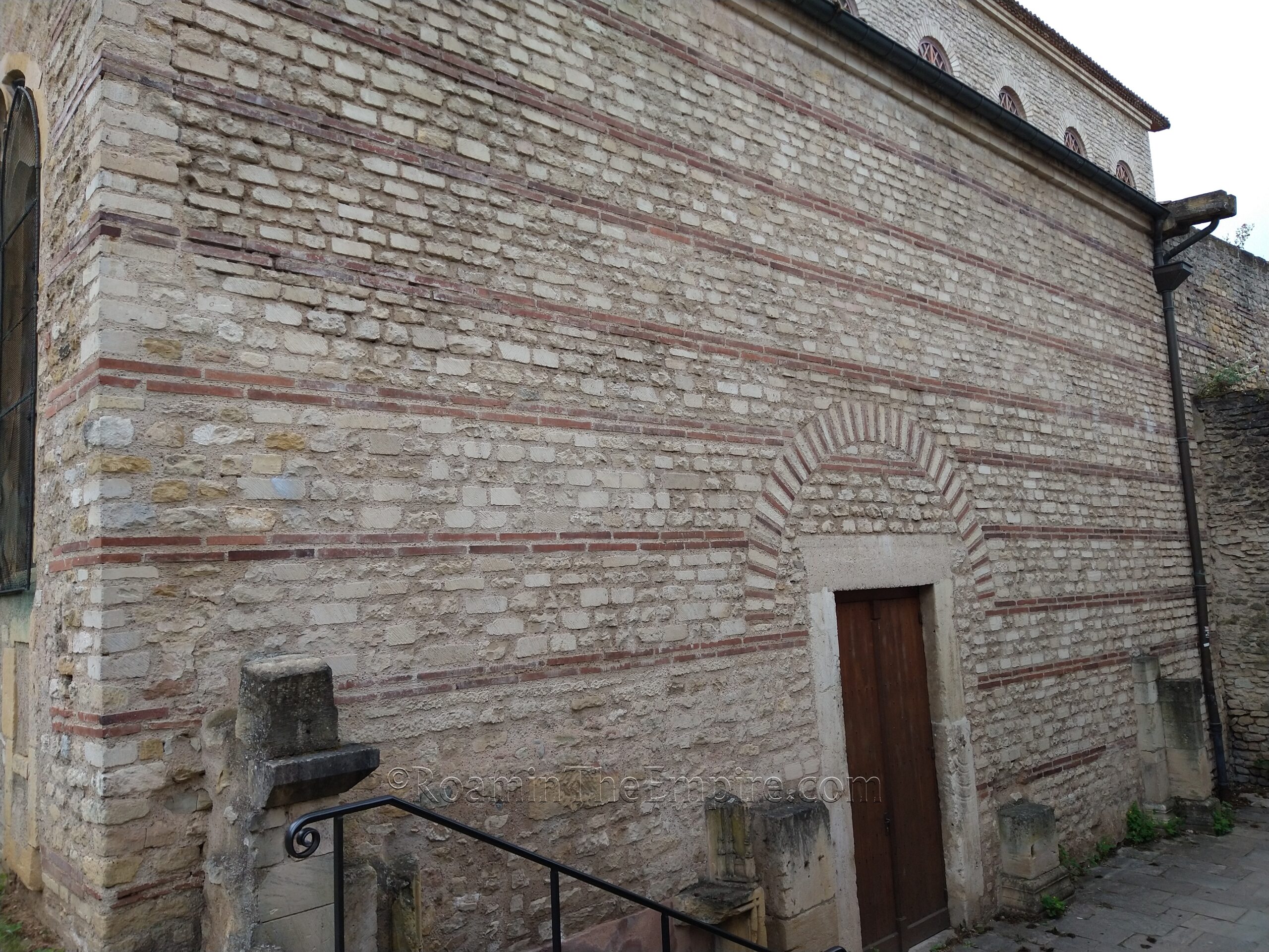
The church was constructed in the 5th century CE, making use of an existing Roman structure of some sort (alternatively suggested as a palaestra/gymnasium or civic basilica) dating to the 4th century CE. The exterior walls of the church still have remnants from this building visible (apparently much less so on the interior, which has been overhauled many times in the intervening years). On the eastern façade, the remains of what would have been a large arch can be seen in the corner. The northern façade has a fairly intact wall with the distinctive late Roman opus vittatum pattern. On the western façade, the wall of the actual church is later materials, but the Roman walls can be seen enclosing a little courtyard in front of the church. Unfortunately the southern face of the church is not really visible, as it is enclosed by a private area with restricted access.
A few minutes’ walk away, at the intersection on the northeast corner of the Place de la République de Metz is, not an ancient monument, but something worth seeing in the context of the Roman presence in the region. Located here is the reconstruction of a Jupiter column that was found in the nearby town of Merten. The original remains upon which this reconstruction are based can be seen in the Musée de La Cour d’Or de Metz.
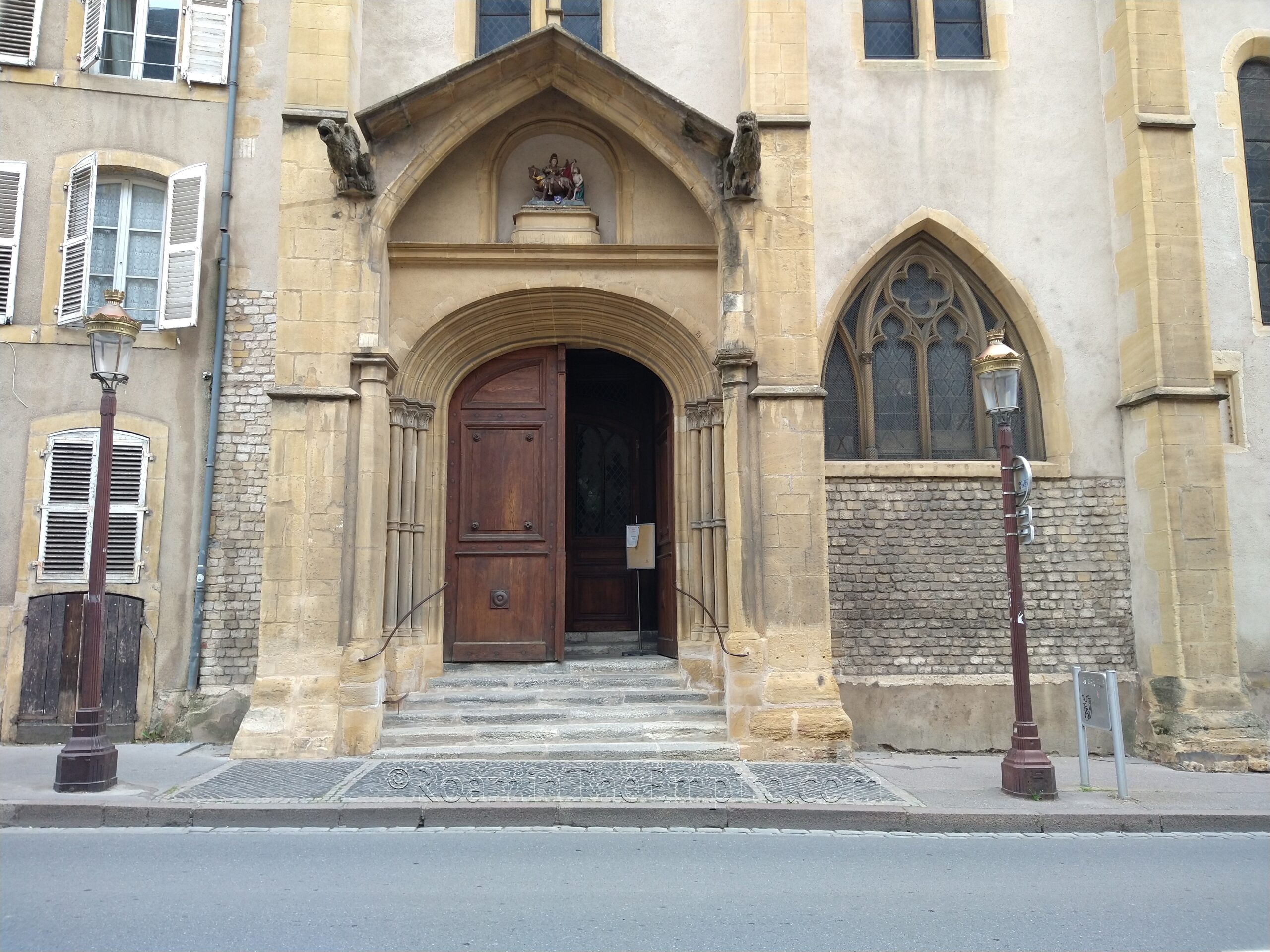
About 250 meters southeast along Rue du Coetlosquet (which turns into Place Saint-Martin) is the Église Saint-Martin de Metz. At the entrance that faces onto Place Saint-Martin (southwest side of the church) there are brick facings on either side of the door. On the left is a tall, thin facing of brick, while on the right is a shorter but much wider section. These bricks were once part of a 3rd century building, possibly a sanctuary or religious structure of some sort. The church itself dates to the 12th century CE. The Roman walls are not visible from inside the church.
A few blocks to the northeast of the Église Saint-Martin de Metz is Place Saint-Louis. It’s difficult to see, but above a few buildings on the western side, in the southern half of the plaza, are the remains of a tower from the city walls of Divodurum Mediomatricorum incorporated into the roofing of the buildings. These are best viewed from the eastern side of Place Saint-Louis, but even then, it’s a very distant and incomplete view of the Roman structure.
The final stop in Metz proper is the city’s archaeology and art museum, the Musée de La Cour d’Or de Metz. It is located in the north part of the old town, not far from the cathedral, at 2 Rue du Haut Poirier. The museum is open from 10:00 to 12:45 and 14:00 to 17:00 every day except Tuesday, when it is closed. Admission is free.
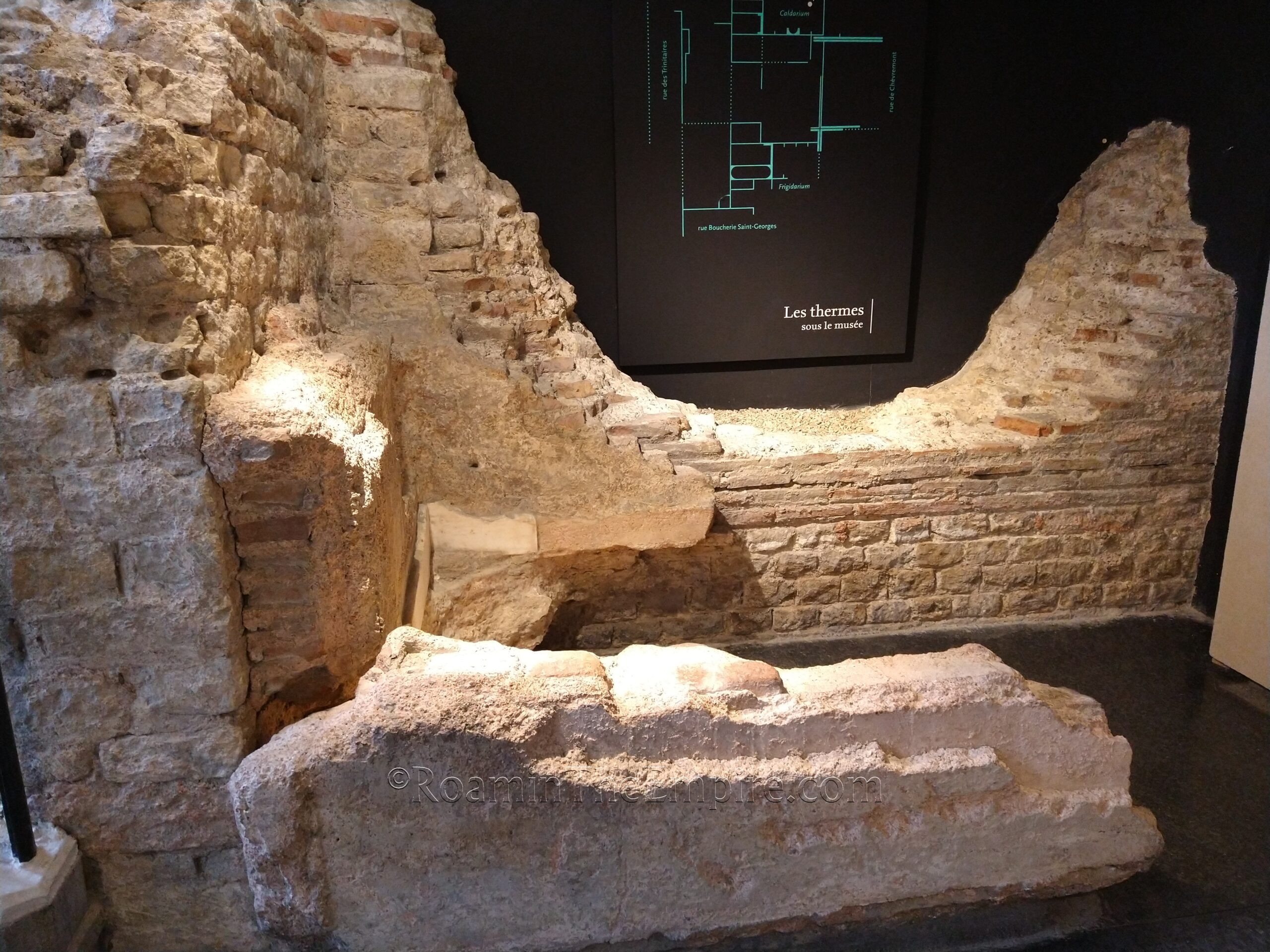
The first interesting thing about the museum is that a 2nd century CE Roman bathing complex has been partially excavated in the lower levels of the museum, uncovered during renovations in the 1930’s. One of the first areas on the path through the museum is through the caldarium area. Part of the frigidarium, including the cold water basin, is the other significant portion of the baths that is preserved. These remains are incorporated into the museum, with a portion of the Gallo-Roman collection displayed among the remains. Some of the auxiliary areas also seem to be present, with one of the water channels also being visible.
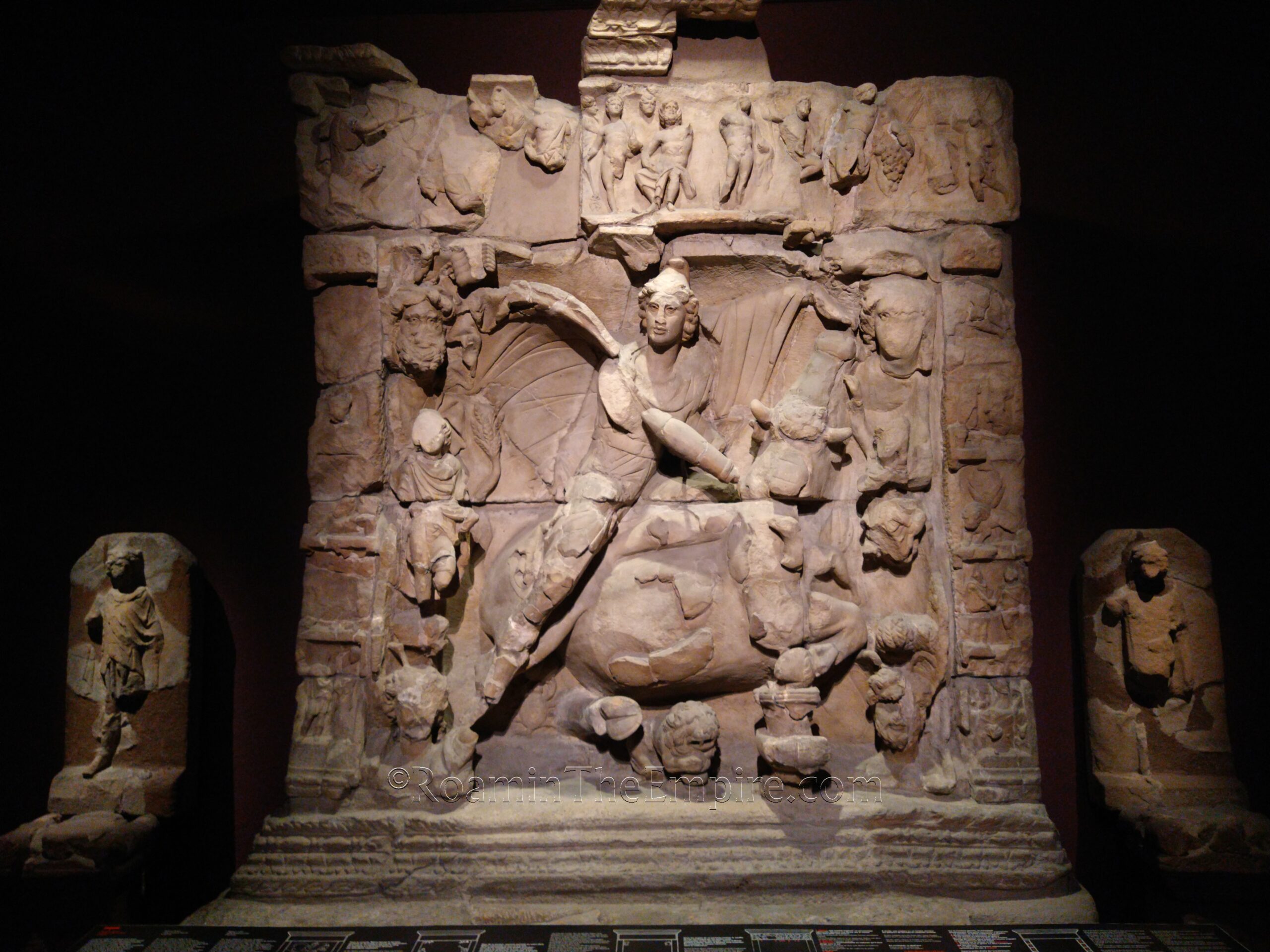
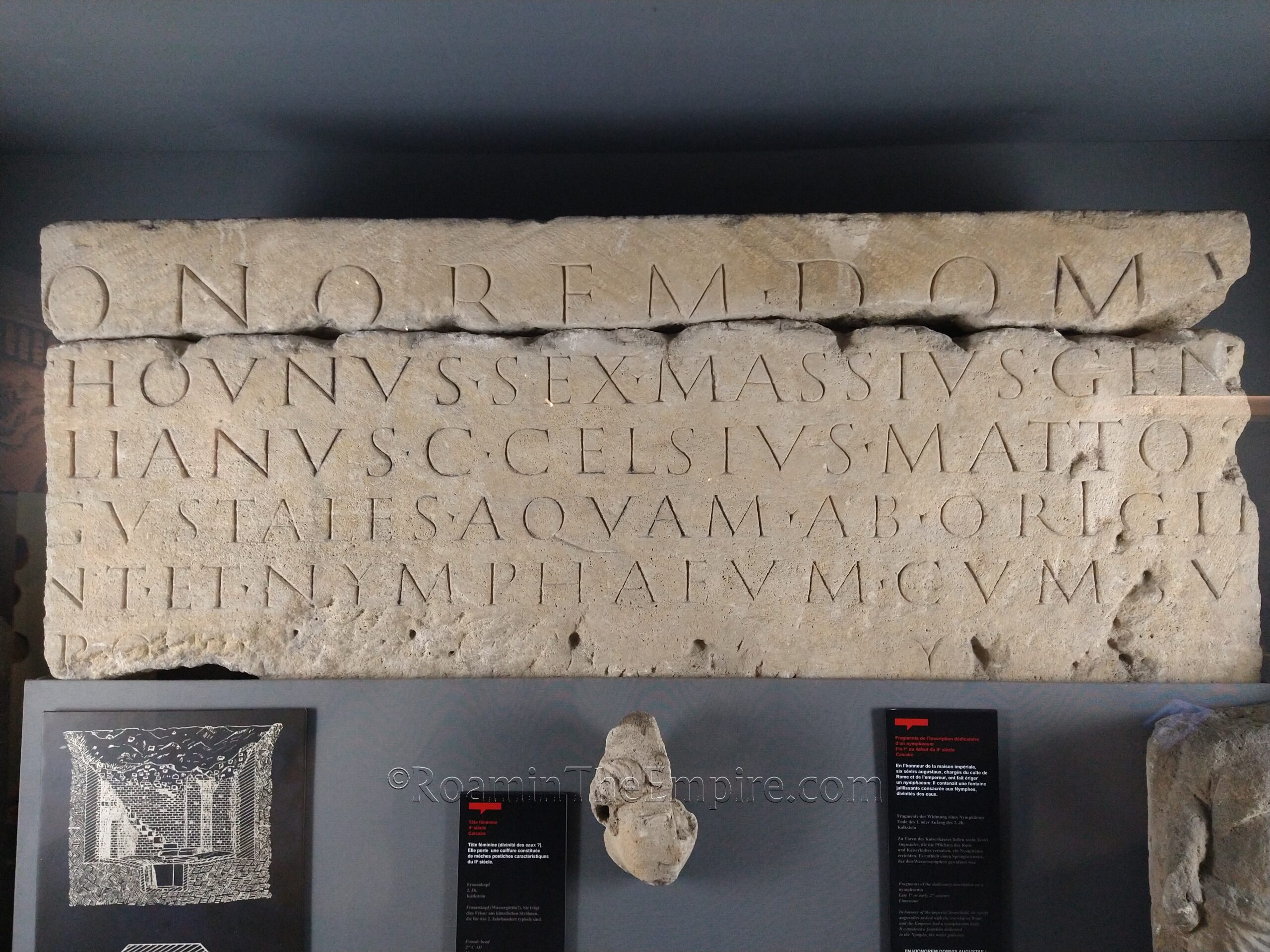
The Gallo-Roman artifact collection in this museum is absolutely fantastic, easily one of the best I saw of the course of that summer. It’s quite large and essentially has a little bit of everything; and a lot of many things. There’s some larger statuary, mosaics, wall paintings, lots of reliefs and inscriptions. There’s a pretty good small finds collection, plenty of pottery. One of the highlights for me was a very large Mithraic tauroctony with the scenes of Mithras’ life on the borders. It was apparently pretty fragmentary, but was put back together nicely. There are a few fragmentary Jupiter columns in addition to the previously mentioned example that is reconstructed in the city center. The museum is organized roughly thematically for the ancient collection.
I spent the whole first half of the opening hours in the Gallo-Roman collection, so a solid 2 and a half hours. I then came back after the midday break to finish off the rest of the museum collection, which was another hour or so. Being free, it’s hard to oversell how good this museum is. I paid 5-10 Euros for museums that weren’t even a quarter as good as the Musée de La Cour d’Or de Metz. Most signs in the museum were in both French and English. If I had one knock against the museum, it’s that the visitor path was sometimes rather confusing and labyrinthian and feels like you are missing rooms due to the way it is organized.
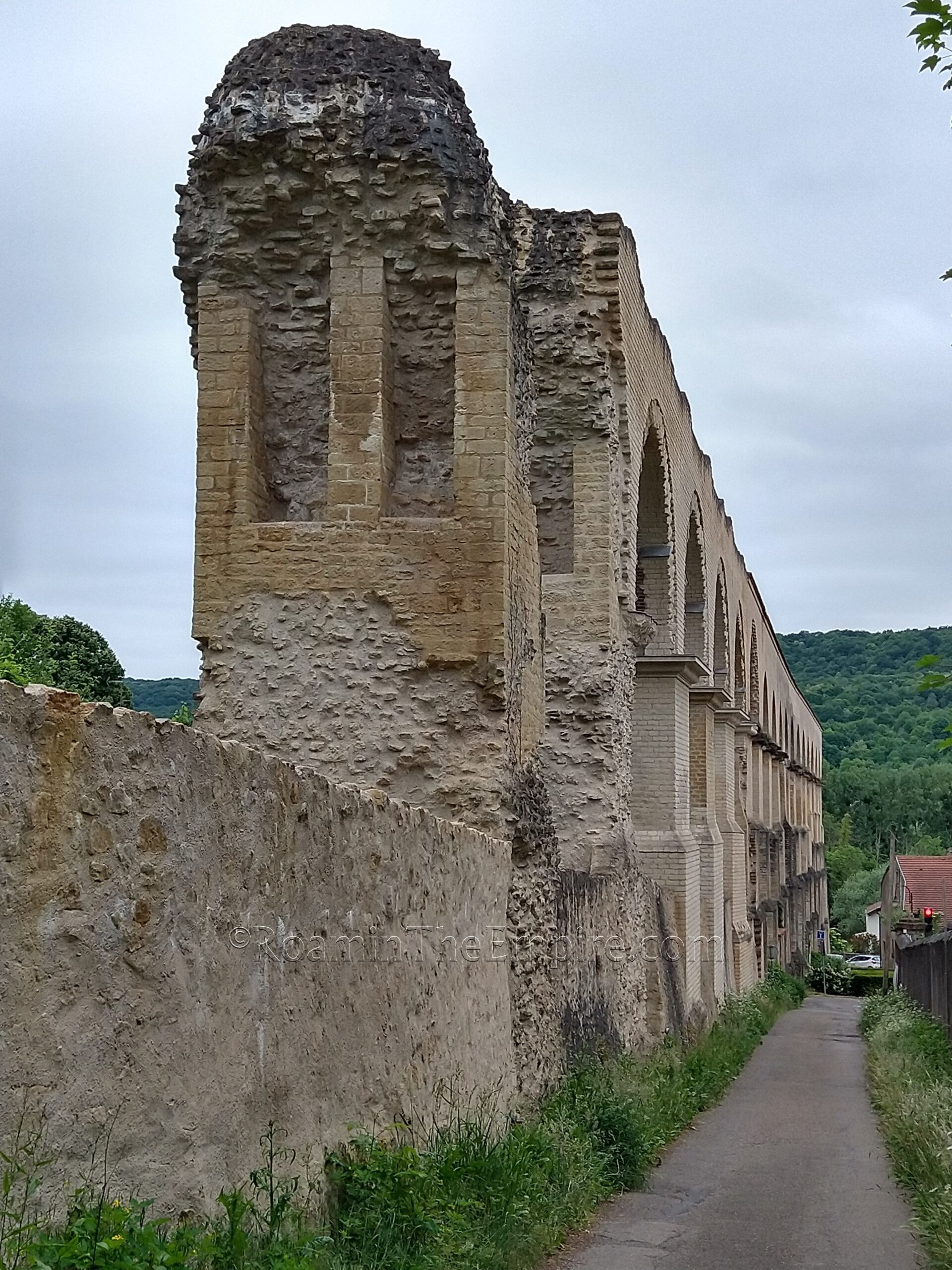
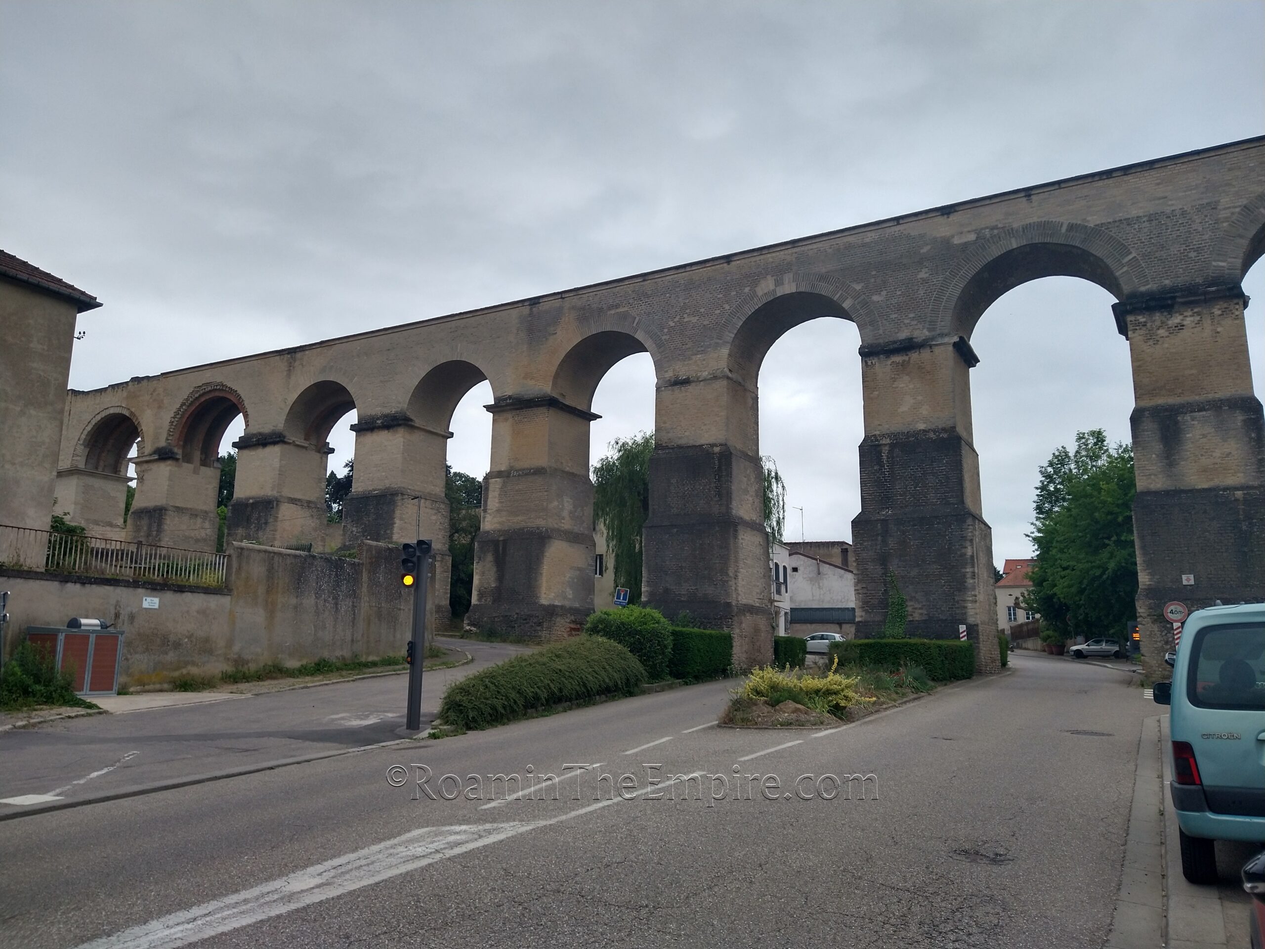
The final bits of ancient remains relevant to Divodurum Mediomatricorum are a bit outside of Metz proper; the remains of the city’s aqueduct. The aqueduct that supplied the Roman settlement was constructed in the early 2nd century CE and ran about 22 kilometers from the Bouillon Spring (modern name) near the present-day town of Gorze to the southwest. Most of the aqueduct runs underground, but, about halfway between the source and Divodurum, the course of the aqueduct has to cross the Mosella. This required the construction of an 1100 meter long aqueduct bridge over the Mosella and its valley. While the entire bridge does not remain, sections either side of the river valley do.
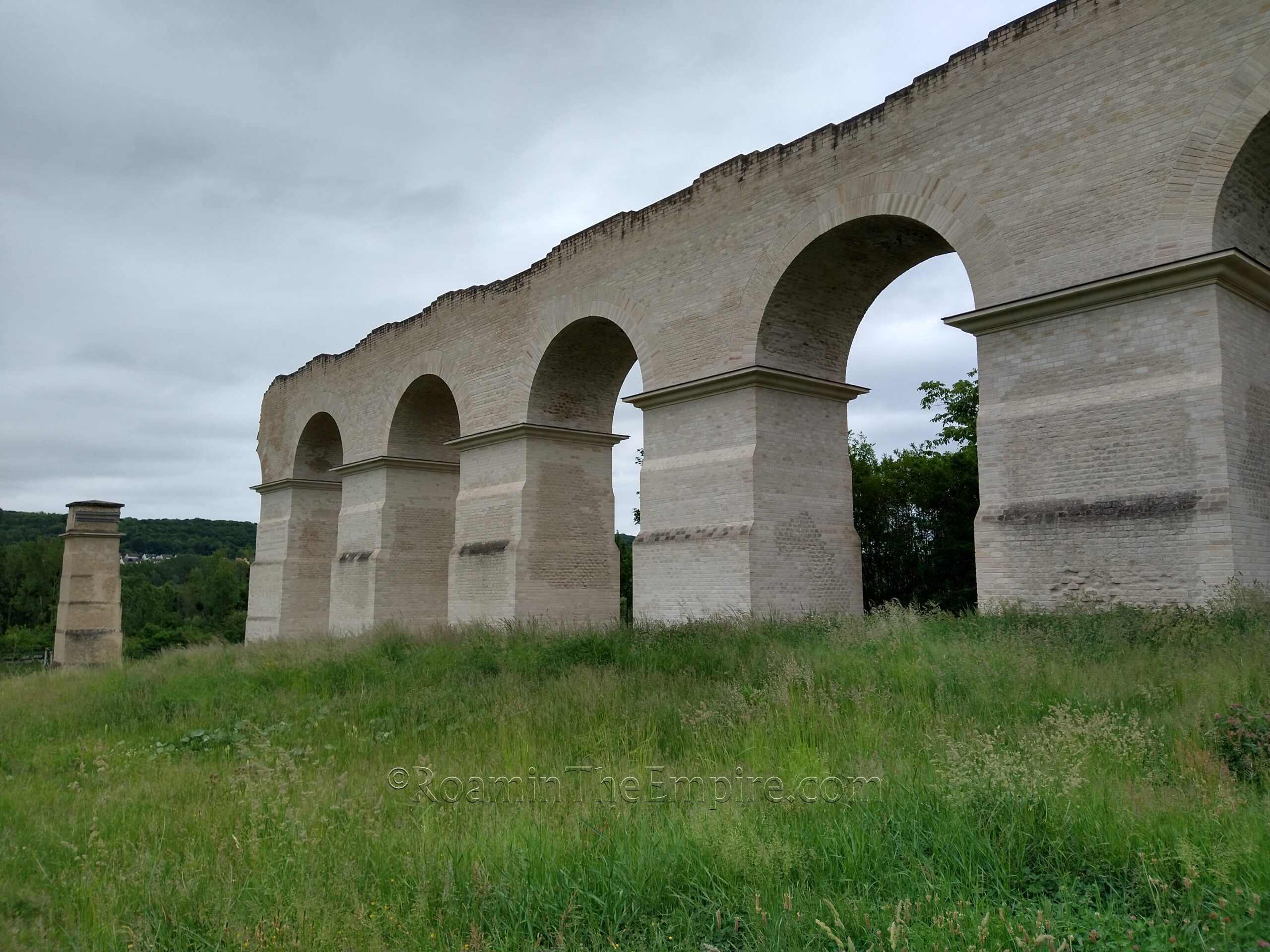
On the east side of the river, the remains of the aqueduct are in the town of Jouy-aux-Arches. The latter part of the town’s name, a reference to the arches of the aqueduct bridge here. The section remaining stretches about 160 meters over a series of 16 arches that gently slope upward into the slope of the valley. The aqueduct is preserved to a height of about 23.5 meters. While there have been later interventions to preserve the aqueduct, something reflected in the state of parts of it, one can still see some of the original brickwork lower on the pillars.
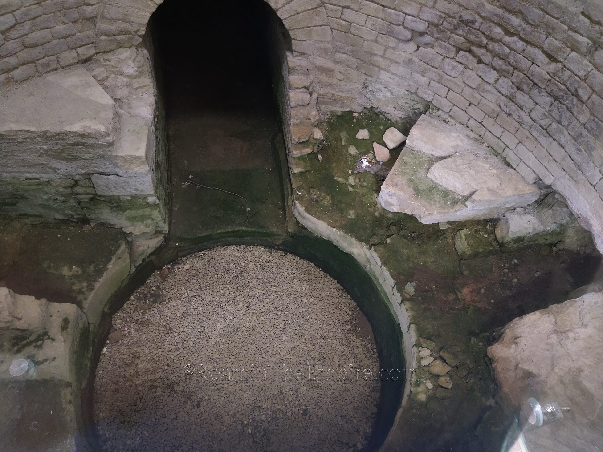
There’s a path that follows the course of the aqueduct to the east, up the slope of the river valley. The path continues past the last arch of the aqueduct, and about 90 meters on there is a path to the right (south) that leads to a basin where the flow of the water was slowed and stemmed. An unusual feature of this aqueduct bridge was that it was not one, but two canals running side by side. These canals were each thinner than the rest of the aqueduct channel, but were taller. The gradient of the bridge was also about 50% steeper (1.5m/km rather than 1m/km), theorized to be a feature to prevent freezing of the water by creating a faster flow. The basin on the east side was to help slow this quicker flow back down and to re-converge the two channels into a single channel as the aqueduct course made a 90 degree turn and headed back underground and to Divodurum Mediomatricorum.
Another channel entering the basin from the north fed local spring water into the aqueduct channel. The basin is covered by a structure, but there are clear panes to view the structure of the basin. It’s pretty easy to see in person, but the ambient light reflection off the panels makes for poor pictures. The double canal of the aqueduct can be seen at the south end. There are a few informational signs in English, French, and German along the course of the aqueduct and at the basin.
A few blocks to the north of the aqueduct, on Rue de la Vielle Tour, there are some remains of a circular structure that has been sometimes identified as a Roman mausoleum. It is in a small lot that is fenced in, and it’s hard to see any real clear hallmarks of Roman construction due to degradation. There are no informational signs around it.
Across the river, the western part of the aqueduct bridge is located near Ars-sur-Moselle. There are a couple parking spots up the road that runs parallel to the aqueduct about 75 meters to the north. This section is not quite as well preserved/conserved as the eastern part. A single pillar is located near the road along the banks of the river, while a bit farther west up the bank are 7 more arches preserved in two sections.
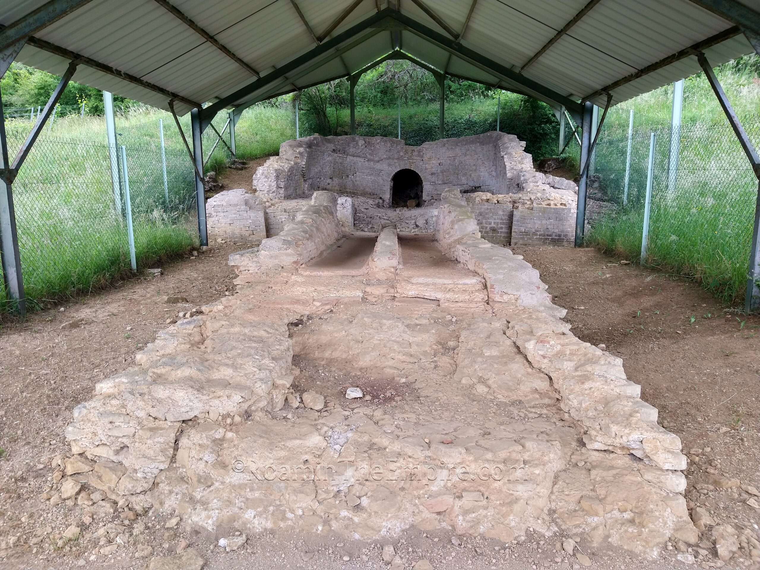
About 60 meters west of the end of the bridge is another basin, this one much more visible from the aqueduct. This basin served primarily as a settling tank, but also diverged the single channel into a double channel for the aqueduct bridge and helped slow down the flow as it hit the sluice and the aqueduct bridge. An overflow channel is present leading off to the north. This basin is also covered, but not enclosed, so it’s a lot easier to see the structure, since it is just surrounded by a fence. The channels coming off the basin and the aqueduct bridge are slightly off course, apparently due to a landslide moving the position of the basin at some point. A couple of informational signs in English, French, and German are present at both points.
The final bit of the aqueduct that can be seen is about 7 kilometers to the southwest, where a section of the underground channel has been exposed. There is a small parking area adjacent to the aqueduct channel, which is located on the east side of the road, just south of the parking area. Presumably exposed during the construction of the road, the channel pops up in two close stretches. Coming from the north, there is a sign that notes the presence of the aqueduct, but it’s actually deceptively far from the actual aqueduct. There’s no sign from the south, and no other information on site.


Sources:
Caesar, Julius. Commentarii de Bello Gallico, 4.10, 7.75.
Pliny the Elder. Historiae Naturalis, 4.31.
Ptolemy. Geographia, 2.9.7.
Stillwell, Richard, William L. MacDonald, and Marian Holland. McAllister. The Princeton Encyclopedia of Classical Sites. Princeton, NJ: Princeton U Press, 1976.
Strabo. Geographika, 4.3.4.
Tacitus. Historiae, 1.63, 4.70-72.
Witt, David E. Creolization and Agency in Divodurum Mediomatricorum. Chronika, Vol. 3, April 2013, pp. 90-98.