


Most Recent Visit: May 2021
It’s not often that I’ll feature a site that has, essentially, almost no period of Roman occupation. This is, after all, what the blog is primarily focused on. But, I certainly don’t limit my visitations to solely Roman sites. Occasionally I’ll visit a site that isn’t Roman, but is still fascinating and fantastic and worth devoting a little space on this site to. This is the case with Cassope (or Kassope).
The Cassopaean people seem to have been derived as a branch of the Thesprotian people, having become a distinct population group sometime around the end of the 5th century BCE. They dwelt primarily in the area between the Acheron (retaining its ancient name today), the Aphas (modern Louros River) and the Sinus Ambracius (modern Gulf of Ambracia). The synoikismos of a number of Cassopaean villages in the area in the first half of the 4th century BCE resulted in the founding of Cassope, which became the chief settlement of the Cassopaeans. The city is mentioned, in passing, in Diodorus Siculus’ description of the Macedonian king Cassander’s campaign against Alcetas II of Epirus around 312 BCE.
A wide Mediterranean trade network helped propel Cassope to the zenith of its prosperity in the late 3rd and early 2nd century BCE. Many of the larger public buildings were constructed during this period, with the city having a population perhaps as high as 10,000 inhabitants. Around this time, between 234 and 168 BCE, the city was enrolled as a member of the Epirote League. The alliance of the Epirote League during the Third Macedonian War lead to the Roman dismantling of the league and the subsequent destruction of 70 Epirote cities at the hands of Lucius Aemelius Paullus Macedonicus as punishment in 168-167 BCE. At the same time, 150,000 Epirotes were sold into slavery. Cassope was apparently among these cities, though archaeological evidence suggests that damage to the city at this time was not especially severe or widespread. Being a branch of the Thesprotians, who were supportive of Rome, may have spared Cassope from the most severe direct retribution.
Following this episode, the city continued to be inhabited and once again, though early on there is evidence to suggest the city struggled, perhaps if not due to direct destruction, from the instability produced by the widespread destruction of other cities. Cassope eventually prospered in the century afterward, though. With Octavian’s victory at the nearby Battle of Actium in September of 31 BCE and the founding of the city of Nicopolis shortly thereafter, the inhabitants of Cassope were relocated, along with those of many other surrounding cities, to help populate Nicopolis, and the site of Cassope was effectively abandoned.
Getting There: The Archaeological Site of Cassope is located on the slopes of Mount Zalongo near the village of Kamarina, about a 20-25 minute drive north of Nicopolis. As far as I can tell, there doesn’t seem to be any sort of regular bus service, though it is relatively close to the popular Holy Monastery of Agios Demitrios and the Dance of Zalongo monument. A car is probably the easiest and most efficient way to get to the archaeological area, though. There’s a small parking area near the entrance of the site, which is marked by signs.
The archaeological area is open during the summer (April through October) from 8:30 to 15:30 daily, except for Tuesdays, when it is closed. The rest of the year, the archaeological site is closed. The admission fee is 3 Euros.
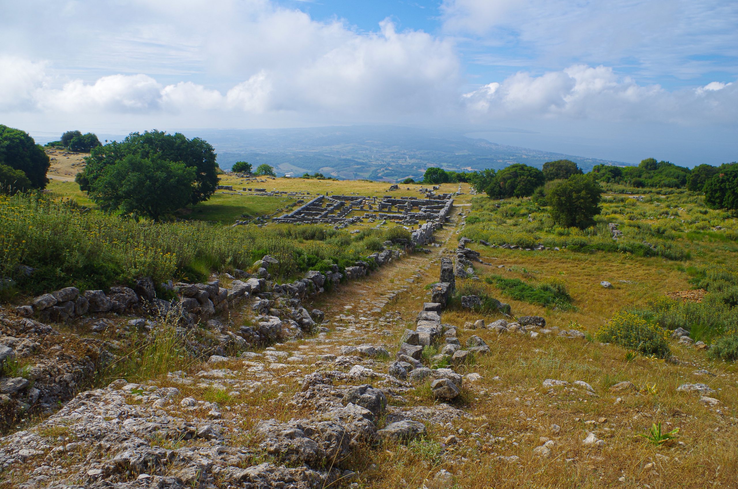
Cassope is entered through the east gate area, though nothing really substantial or noteworthy remains of this gate. Just inside this is the entrance kiosk. Heading westward into the site, there are the remains of a number of smaller residential structures, which make up the vast majority of what remains of the site. Cassope was laid out according to a Hippodamian grid plan, so this path runs the course of one of Cassope’s streets, and as such, runs the entire east-west axis of the city.
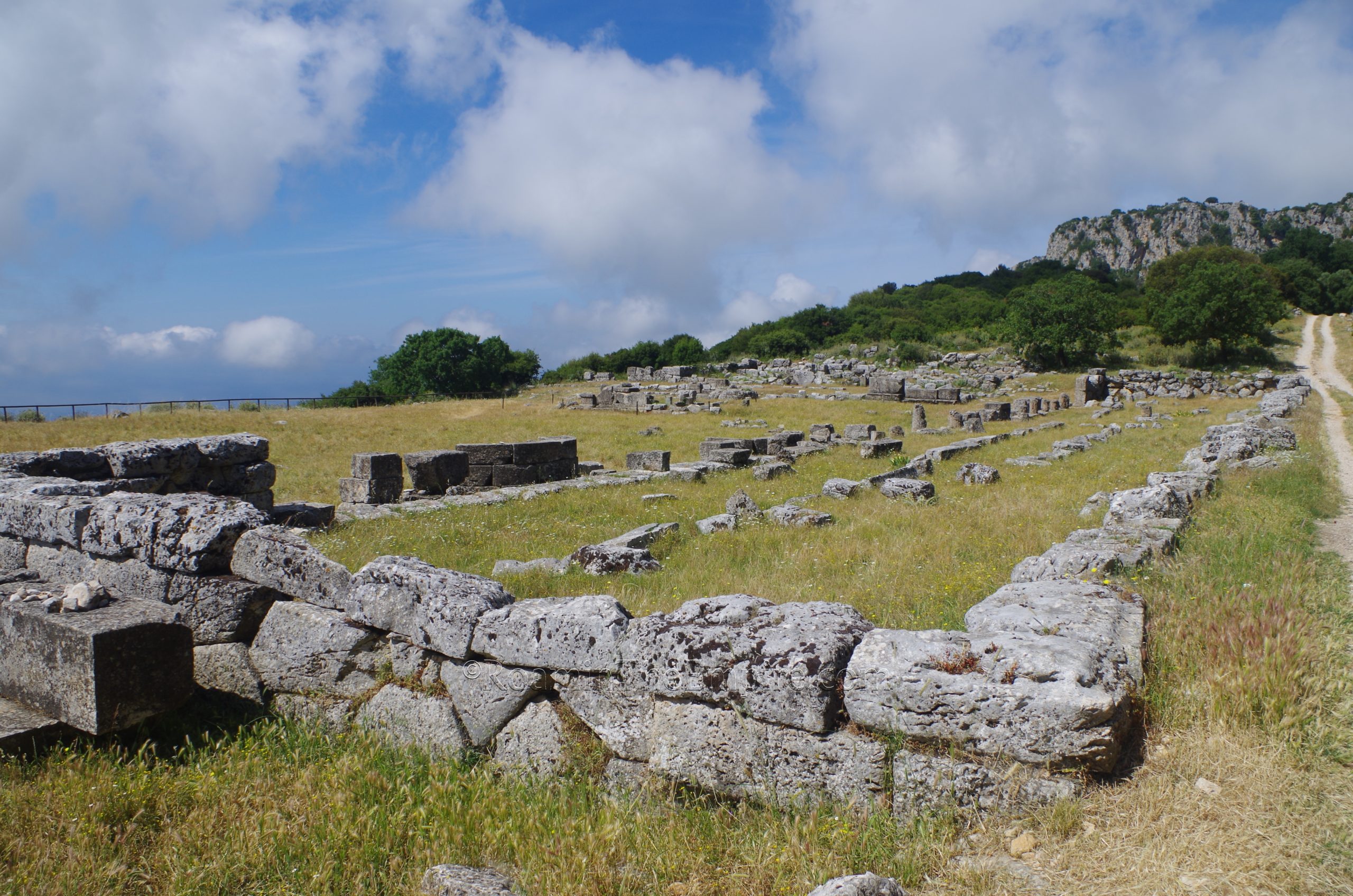
About 130 meters into the site, the path leads along the north side of the agora of Cassope. This north side of the agora is formed by the aptly named North Stoa. The North Stoa was constructed in the second half of the 3rd century BCE, seemingly one of the first buildings to be constructed as part of the restructuring and rebuilding of the agora in the late 3rd and early 2nd centuries BCE. The North Stoa replaced a similar, but smaller, structure dating back to an indeterminate period. Twenty-seven semi-circular exedra bases decorated the southern and eastern sides of the stoa, some remains of which can be seen along the southern façade, including one with the distinctive curvature still visible.
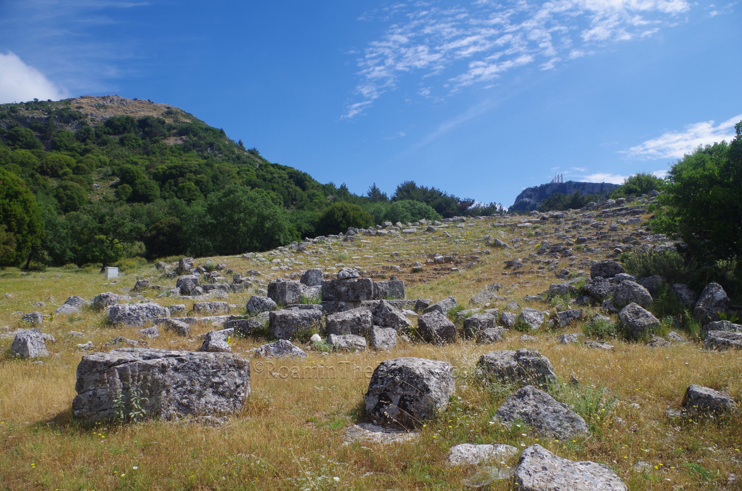
Comprising the eastern side of the agora is the Odeion-Bouleuterion. This structure was built at the end of the 3rd century BCE, making use of a hill at the location to support the slope of the seating needed. It consisted of 21 rows of seating dividing into four section which held an estimated 2,000 spectators. The seating is very fragmentary, and from some angles just looks like a scatter of large rocks on the hill. This may have been partly because though the vegetation was not overgrown, it was just tall enough to hide some of the details of the structure. And though the seating does still retain its form, the scene/proscenion area is mostly a number of stones collected in the general location of where these features would be.
The south side of the agora is bounded by a cliff, which looks out over the Sinus Ambracius. From what I can gather, this seems to have been a cliff in antiquity, rather than a loss of the southern part of the agora due to erosion. The west side of the agora is enclosed by a series of three distinct, but interconnected structures. The eastern most of these is a temnos area, which essentially mirrors the layout and form of the middle structure, the West Stoa. The temnos, however, was just an open, but delineated paved space, while the stoa was an actual building. The West Stoa was constructed in the early 2nd century BCE, and overlays the route of a previously existing north-south road, which can still be seen running along the axis of the stoa just a few meters beyond the stoa’s northern extent.
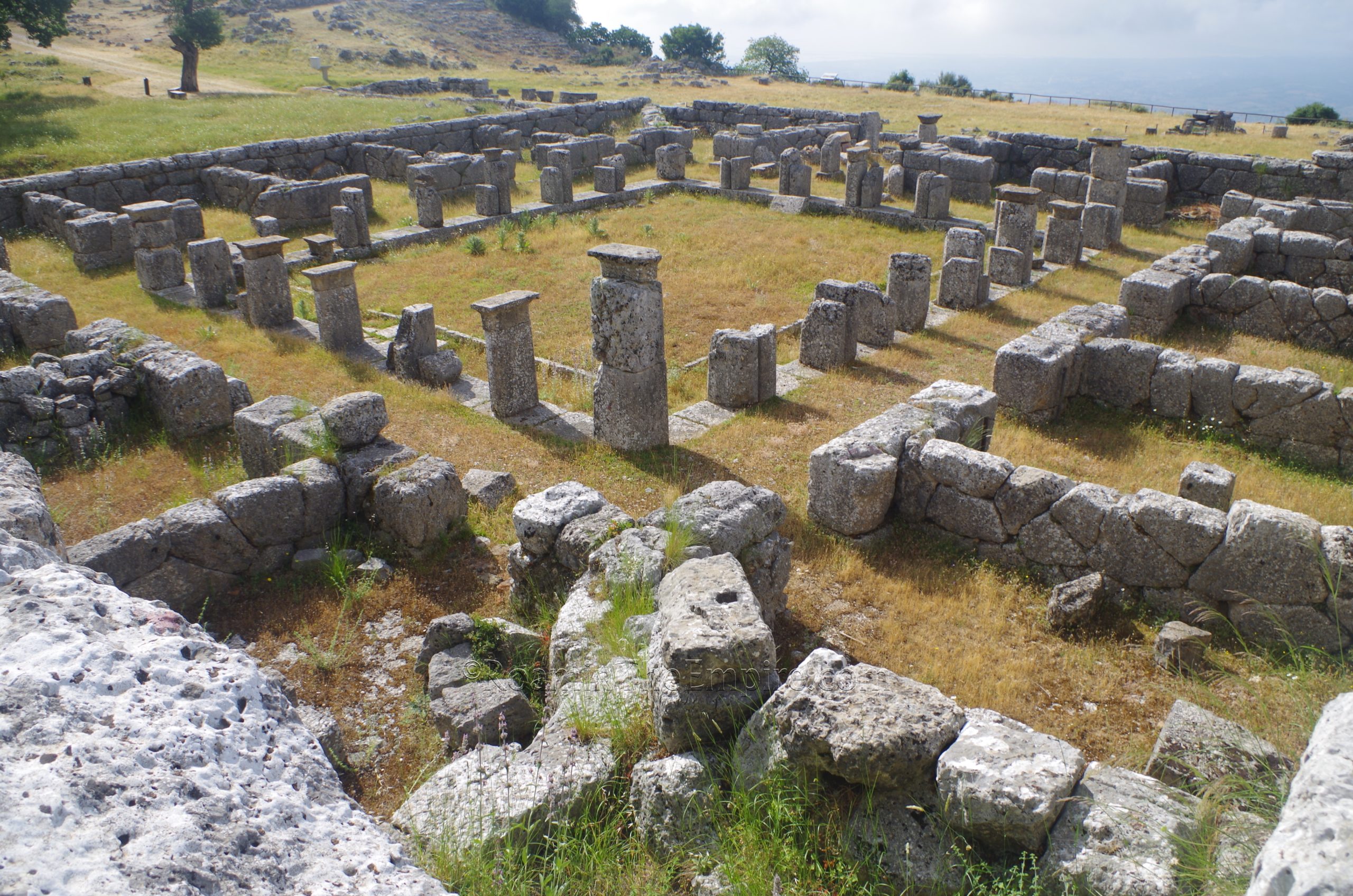
West of the West Stoa is the Prytaneion, essentially the administrative seat of Cassope. The building is connected to the West Stoa and takes the form of a number of rooms arranged around a central peristyle courtyard that was accessible from the stoa. This space was used for the hosting of symposia and official guests as well as serving as the location of the communal hearth of Cassope. The most distinctive features of the Prytaneion are the courtyard and an adjacent semi-circular room.

In front of the temnos, facing out onto the open space of the agora are a number of pedestal bases for statues. A few meters beyond that, farther into the open area of the agora, are the remains of a series of three altars. The largest, and northernmost, of the three still retains a faint inscription on its eastern face; ΔΙΟΣ ΣΩΤΗΡΟΣ, Dios Sotiros or Zeus the Savior. The inscription has been dated to the 4th to 3rd century BCE, indicating the altar likely predated the renovation of the agora buildings. I could only make out a few letters, though the first two epsilons are cut fairly deep and are the most visible.
The street running north from where the West Stoa overlays it, is probably the best preserved stretch of road on the entire site. Just across from the agora, on the eastern side of this well-preserved road is a large building identified as the Katagogion. This is perhaps one of the best preserved/conserved structures at Cassope. The form is essentially 17 rooms and an entryway placed around a central courtyard. Some fragments of the blocks have been replaced around the central space of the courtyard, allowing for the sense of the portico that would have surrounded this space. The remains of the building presently visible date to the end of the 3rd century BCE. It seems to have suffered some damage in the 1st century BCE and was then rebuilt. The Katagogion was constructed upon an earlier building dating to around the foundation of the city in the 4th century BCE.
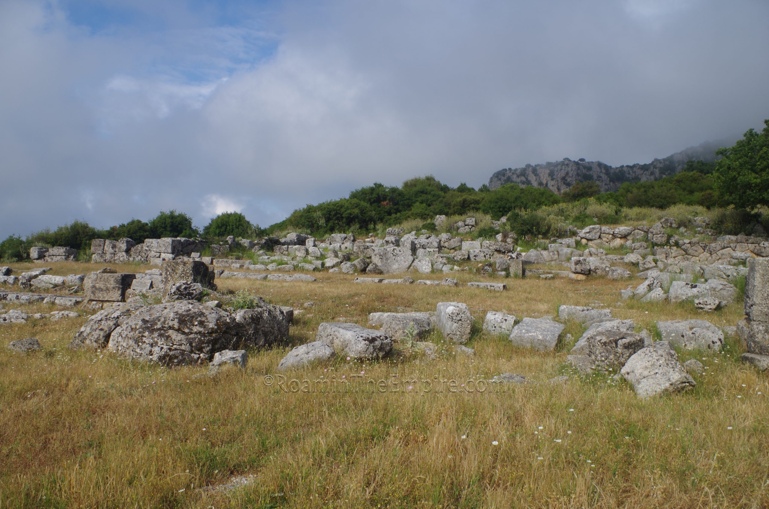
From the Katagogion, the next major landmark is the theater, which is north on the well-preserved road to the end of the excavation, and then west to the theater. Pretty much everything else west and south of those roads is residential areas in varying states of exposure. It’s certainly an interesting area to walk around and see, but there isn’t much worth mentioning in particular. Most seem to date to the 3rd century BCE and follow relatively uniform constructions, with some variation in later 2nd century BCE houses that expanded somewhat haphazardly following the decline experienced by the city immediately after the Roman actions in 167 BCE.
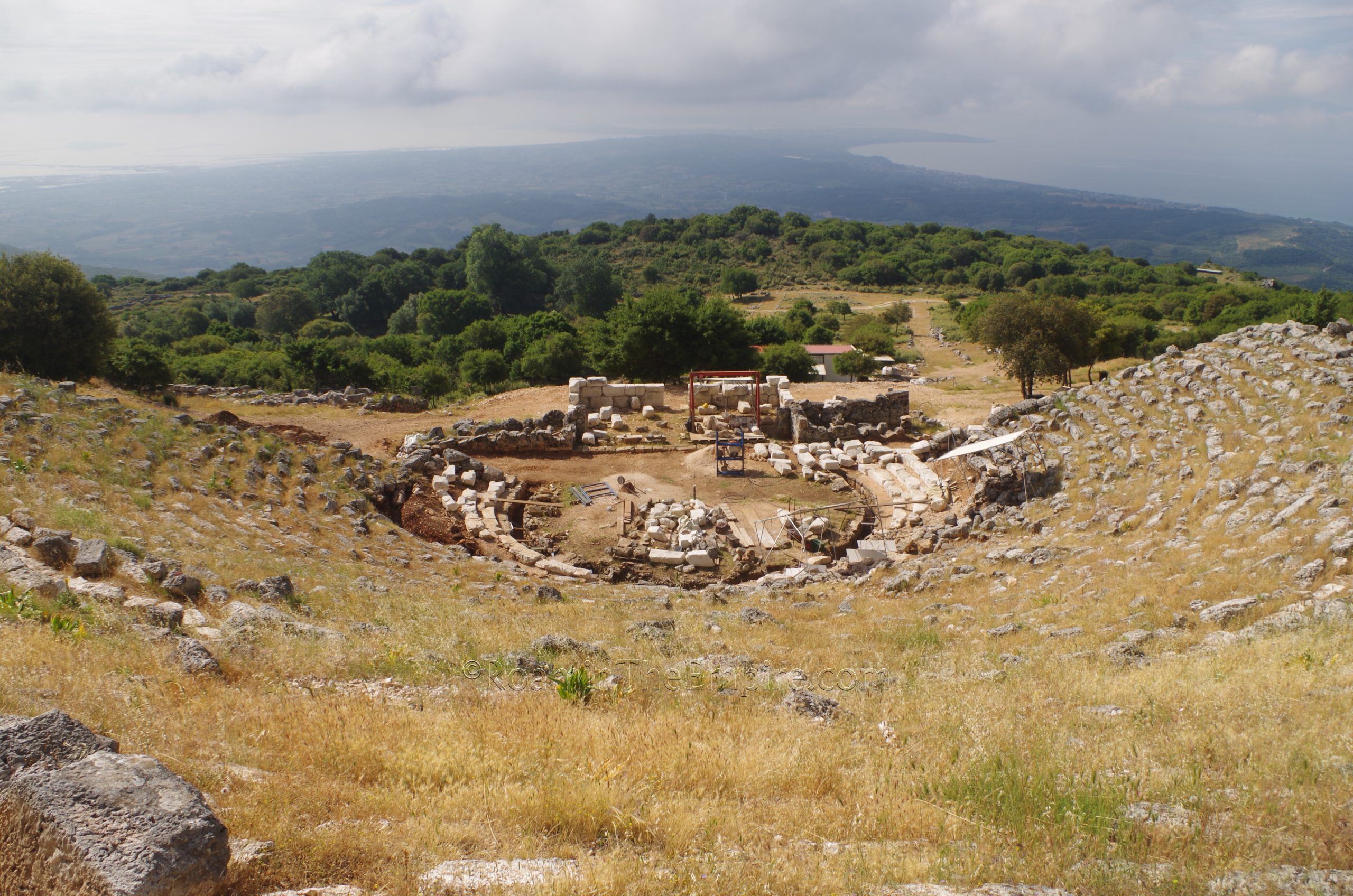
The theater, currently in the midst of a restoration project that was apparently supposed to be completed in 2020, but is still very much ongoing from what I can tell, seems to have been constructed at the same time as many of the other monuments, in the late 3rd century BCE. The theater consists of an upper and lower seating area of 12 and 24 rows of seating respectively. This gave the theater a capacity of between about 5,000 and 6,000 spectators. Though it makes use of the slope of the hill to support the seating, large retaining walls bookend either side of the seating area, as well as along the top of the theater above the last row of seats. Excavations in the last couple years have revealed the orchestra area in clearer detail. Some elements of the scene/proscenion structures have also been rebuilt recently, though I couldn’t quite pin down if they were recently excavated ancient blocks that don’t have the weathering of most of those comprising the theater, heavily restored blocks that were previously scattered, or modern blocks.
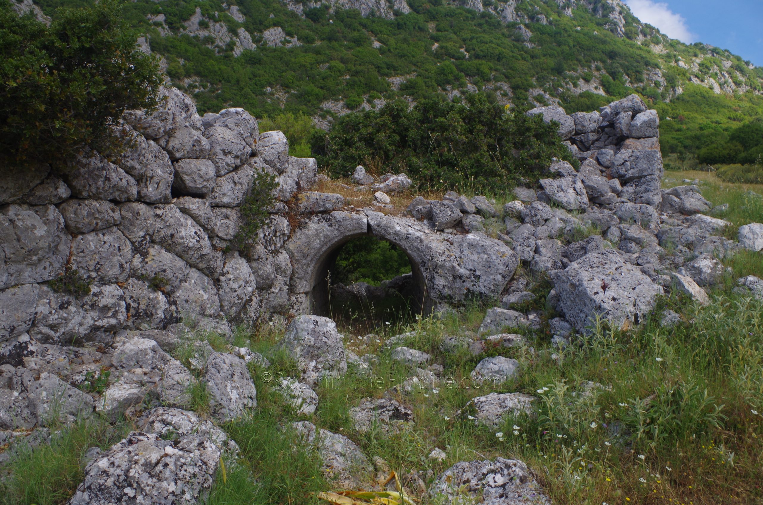
From the theater, head back south down to the southernmost road (the same road that passed by the agora farther to the east), and then take that westward to reach the western circuit of the city walls. This leads directly to the West Gate, though it can be hard to distinguish the form of the gate due to the loose stones that fill in the actual entrance. But the walls below the vaulting can be seen. About 100 meters south along the walls is a small arched auxiliary entrance. It actually faces to the south, so it’s easy to miss when walking from the north.
The last monument within the walls is a little further south, on an outcropping at the southwestern extreme of the city. Located here is the grave monument, a Macedonian style tomb (apparently the only one to have been found in Epirus) that is probably a product of favorable relationship between the Macedonian rulers and Cassope at times. When I visited, the brush had been cleared to a reasonable level up to about the grave monument, but not actually around it. There’s not a whole lot to see above ground, but there is a stairway that leads down to the subterranean chamber, which is unfortunately gated. But, one can still take a peek inside to the antechamber, which has a good amount of preserved plaster on the walls. It is theorized that this may have been a heroön for Cassope’s founder, as it seems to date to around 370 BCE.
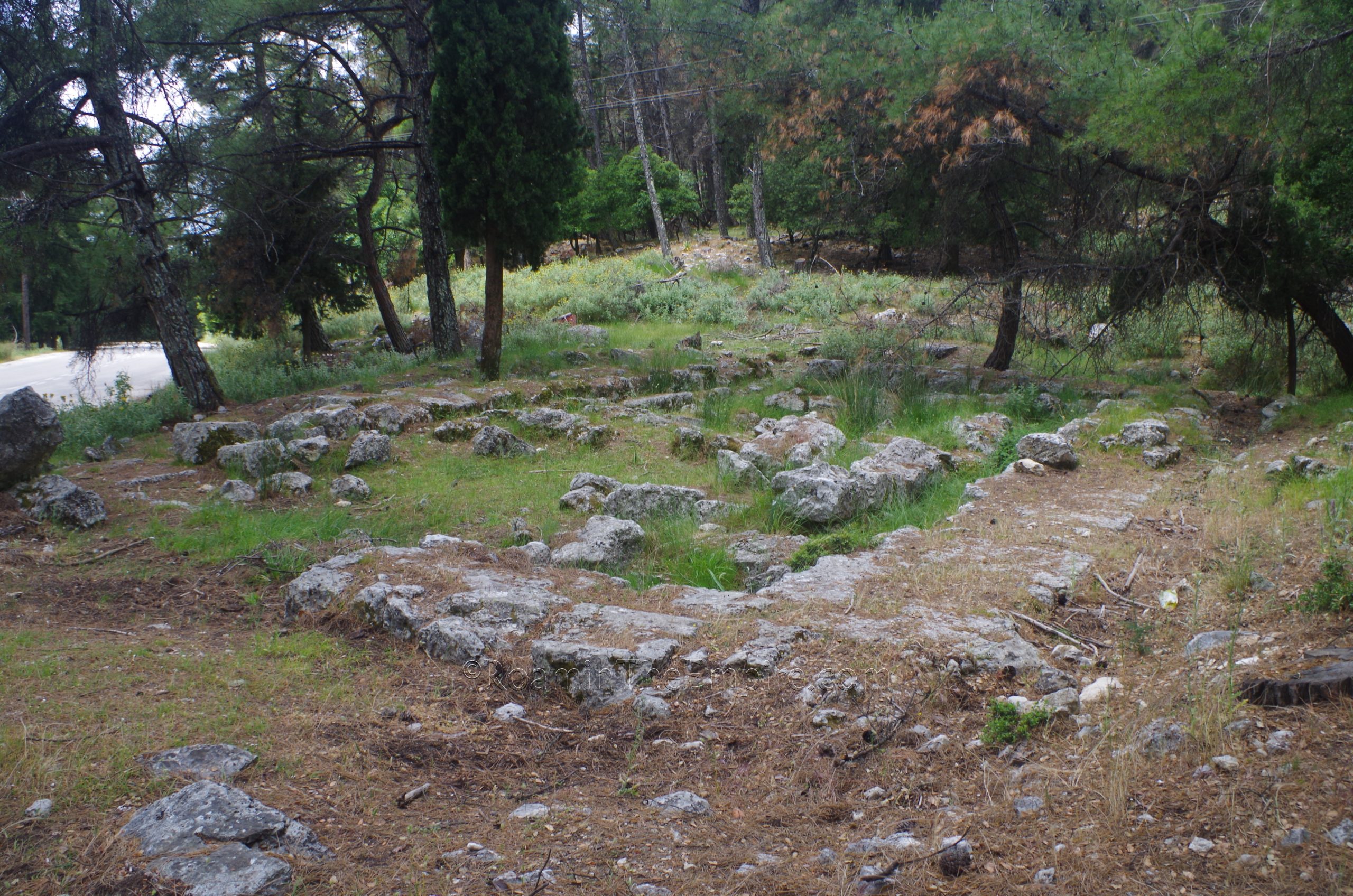
Some fragments of the northwest citadel sit atop the peak to the northwest, part of an outer circuit of walls that ran along the ridge to the west, but those aren’t easily accessible. There is one extramural temple that is pretty easily accessible. Going back out to the road that led to Cassope and continuing up the road another 200 meters or so, one comes to an intersection with the road that leads to the Holy Monastery of Agios Demitrios. Directly across from that road (to the west) are the remains of a temple dedicated to Aphrodite. It is visible from the road, but is easy to miss as there are no signs or other indications that it is there. The foundations and form of the temple are fairly apparent, though. Aphrodite was the patron goddess of Cassope, and votive finds in excavations here have led to the identification of the temple as belonging to her. It may predate the actual foundation of Cassope.
Cassope is an absolutely fantastic site. It is not heavily trafficked compared to many other sites; I had the entire site to myself when I visited (though it was early in the season and just after Greece had reopened to foreign visitors), and it offers amazing views of the surrounding countryside in addition to the great archaeology. Most monuments (except for the theater and the Temple of Aphrodite) had informational signs in Greek and English with helpful illustrations and diagrams. There were a number of general information signs as well. The staff there was friendly and happy to have a visitor as well. I spent about 2 hours wandering around the site, but it could probably be done in an hour or so if one were more concise about hitting the main points. Cassope is definitely worth the extra time to take in the views and enjoy the experience, though.
 between the west gate and agora.")


 and West Stoa.")


 north of the Katagogion.")


Sources:
Diodorus Siculus. Bibliotheca Historica, 19.88.
Gravini, Konstantina. “Archaeological Evidence from Cassope. The Local Workshops of Mouldmade Bowls.” Foundation and Destruction, Nikopolis and Northwestern Greece: The Archaeological Evidence for the City Destructions, the Foundation of Nikopolis and the Synoecism. Athens: Danish Institute at Athens, 2001.
Karatzeni, Vivi. “Epirus in the Roman Era.” Foundation and Destruction, Nikopolis and Northwestern Greece: The Archaeological Evidence for the City Destructions, the Foundation of Nikopolis and the Synoecism. Athens: Danish Institute at Athens, 2001.
Livy. Ab Urbe Condita, 45.34.6.
Polybius. Historiai, 30.15.
Schwandner, Ernst-Ludwig. “Kassope, the City in Whose Territory Nikopolis Was Founded.” Foundation and Destruction, Nikopolis and Northwestern Greece: The Archaeological Evidence for the City Destructions, the Foundation of Nikopolis and the Synoecism. Athens: Danish Institute at Athens, 2001.
Smith, William. Dictionary of Greek and Roman Geography. Walton & Murray, 1870.
Stillwell, Richard, William L. MacDonald, and Marian Holland. McAllister. The Princeton Encyclopedia of Classical Sites. Princeton, NJ: Princeton U Press, 1976.
Strabo. Geographika, 7.7.3.