


Located on a plateau atop the Monti Lepini (Volscian Mountains), an anti-Apennine mountain range overlooking the Agro Pontino (Pomptinus Ager in antiquity; the land of the Pontine Marshes), sits the ancient settlement of Norba. The settlement’s commanding presence over the Pomptinus Ager made it a particularly important location in the control of the area. The settlement may have existed as early as the 8th or 7th century BCE. By about 499 BCE, Norba may have been included among the cities of the Latin League. There seems to be a little bit of uncertainty in the sources of Norba’s status prior to about 492 BCE, though. In 493 BCE, the Foedus Cassianum was signed, allying Rome and the Latin League, and the following year in 492 BCE, a Roman colony was sent to Norba. This colony, along with others sent to Latin cities, may have been an attempt to strengthen the alliance and, in particular, increase the security of settlements on the fringes of the Roman/Latin territory against other groups such as the Volsci. Indeed, the Volsci seem to have occupied the area of Norba for much of the 5th century BCE, and likely were in control of the city itself.
After the sack of Rome and defections of Latin cities to the Volsci in 390 BCE, there is increased fighting in the Pomptinus Ager, though Norba is not specifically mentioned. Norba is mentioned as being subject to attacks by the Privernates in 342-341 BCE during another period of Roman and Latin alliance. Following the conclusion of the Latin War in 338 BCE, another colony was sent to Norba, and the town again seems to have been the victim of attacks by the Privernates in 327 BCE. During the Second Punic war, Norba is noted as having been loyal to Rome throughout Hannibal’s presence in Italy and was the location where some of the Carthaginian hostages were held following the conclusion of the war. The slaves of Norba were involved in a servile uprising centered at nearby Setia in 198 BCE, but the slaves of Norba failed to take the city.
Norba is the site of an important episode in Sulla’s Second Civil War. In this conflict, Norba supported Gaius Marius the Younger against Sulla, and in 82 BCE, even after the suicide of Gaius Marius the Younger, Norba refused to submit to Sulla. The city was finally betrayed to Sulla’s general Aemilius Lepidus, but the people and garrison of Norba killed themselves and burned down the city before it could be taken. According to Appian, the destruction was so great, that there was nothing left to be looted. Indeed, the city does not seem to have been rebuilt or reoccupied following the destruction of 82 BCE. Strabo makes no mention of the city at all, and while Pliny the Elder notes the existence of the Norbani people, he too declares the city extinct. The lack of archaeological evidence from the imperial age seems to confirm this.
Getting There: Ancient Norba is located just outside the modern town of Norma. There is not train service to the town, perhaps due to its location in a mountainous area 500 meters above sea level. There is a bus that runs from the nearby Latina Scalo train station to Norma fairly regularly, typically taking about 20-25 minutes (but sometimes as short as 15 minutes or as long as 40 minutes) to get there. Information can be found at the Cotral website. Tickets currently cost 1.30 Euro each way. Driving is also a very good option for Norba and there is a large parking area just outside the archaeological site.
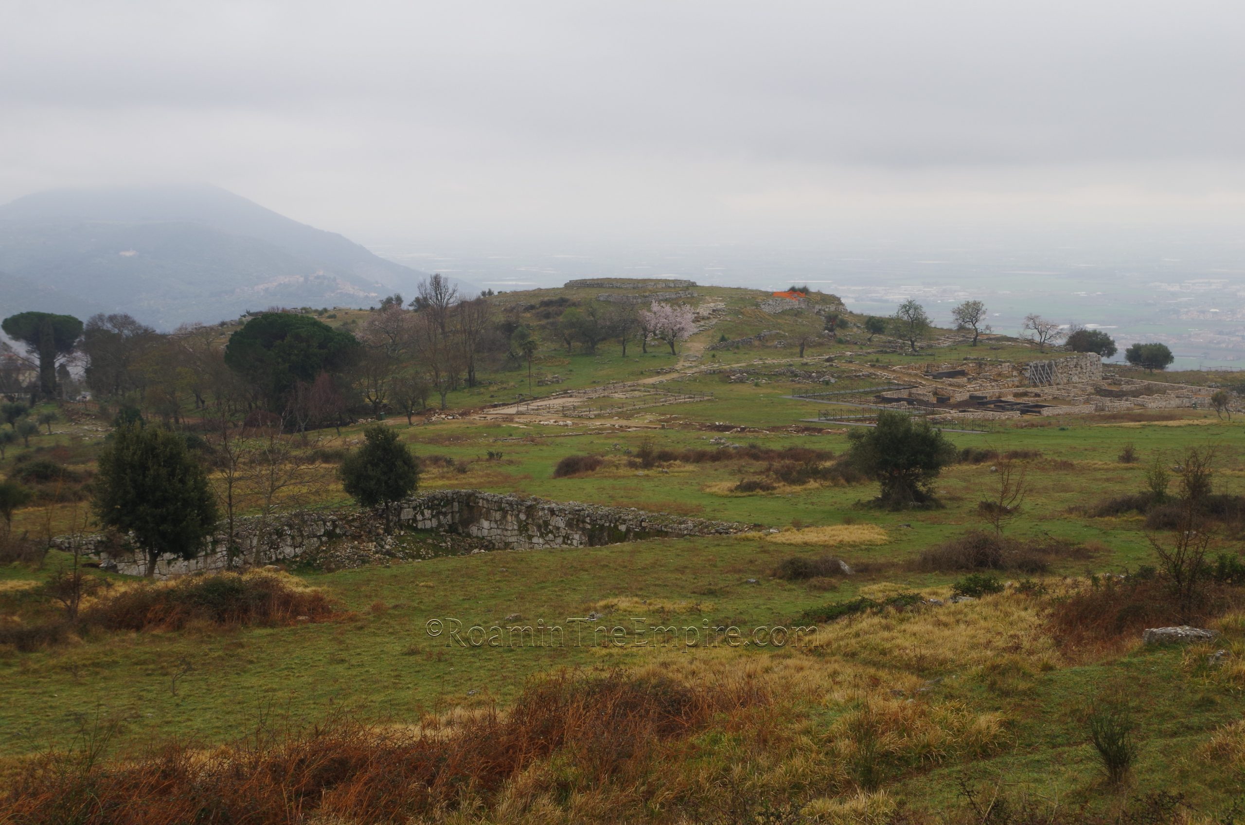
Parco Archeologico dell’Antica Città di Norba is located on a rise just to the northwest of the modern town of Norma. The archaeological remains of Norba are encompassed entirely within the archaeological area, which spans about 38 hectares. There do not seem to be any hours of regular operation for the archaeological site; it seems to just be open without any limitation of access, and as such there is no fee associated with visiting. There is a small visitor’s center near the parking area, but it was unoccupied when I visited (perhaps because it was a Monday and/or offseason).

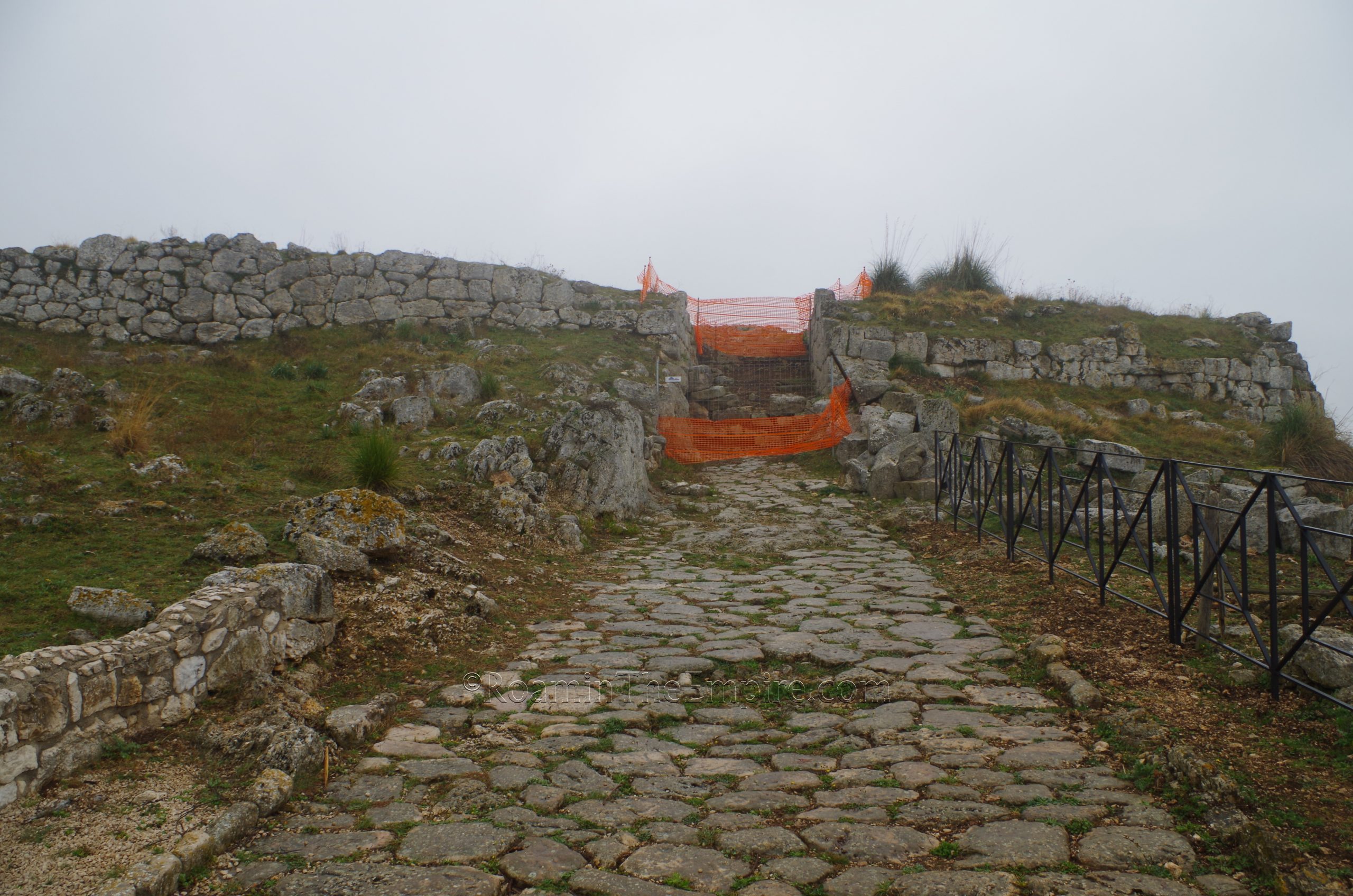
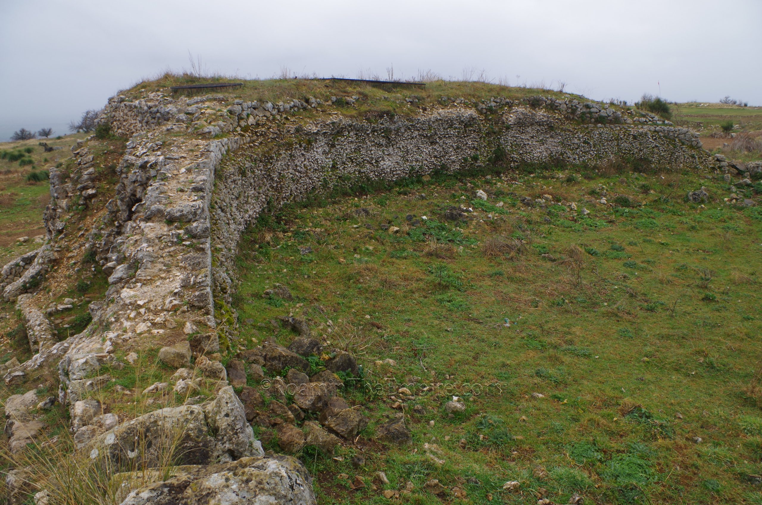
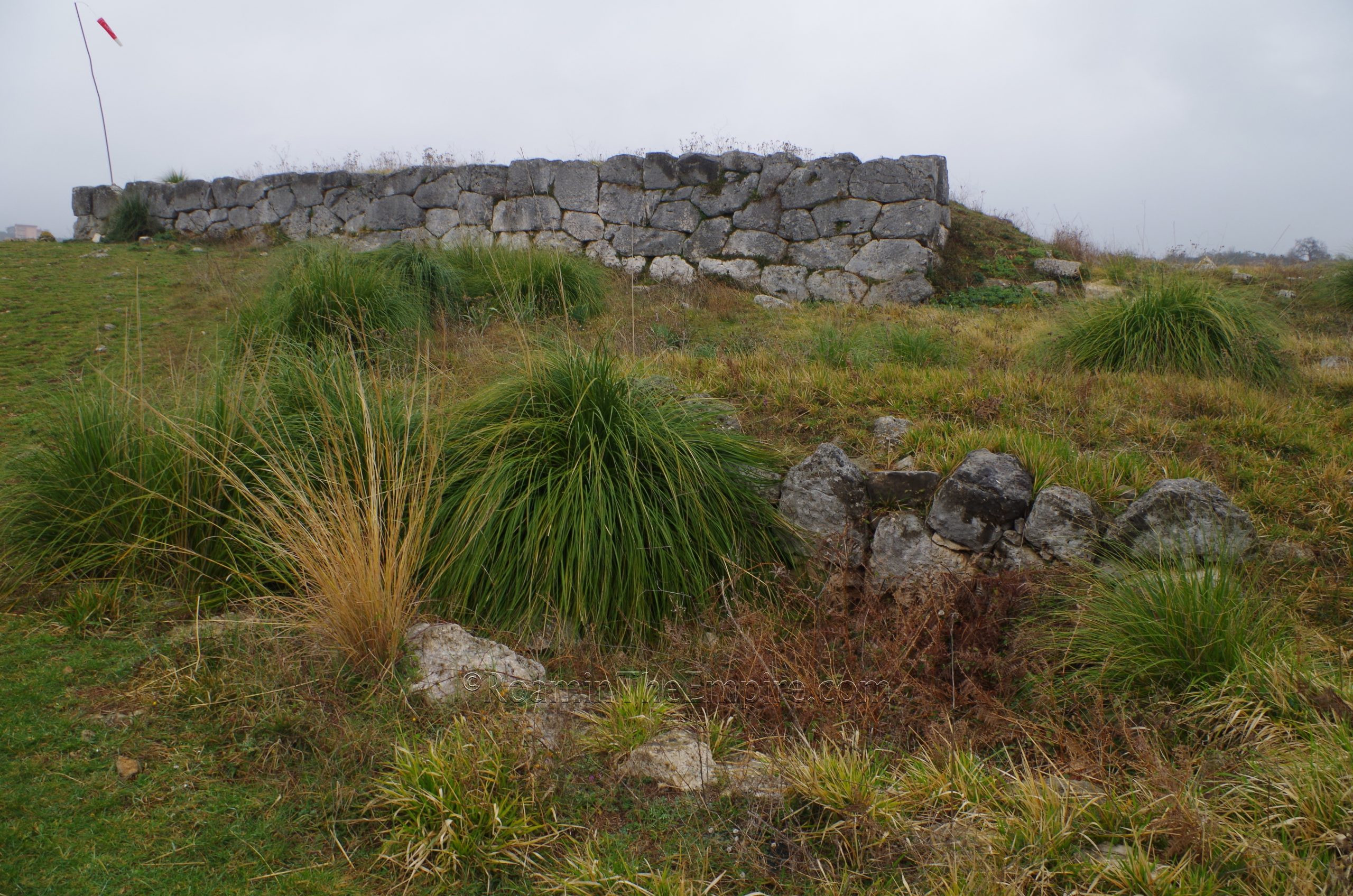
The Cyclopean walls that surround Norba are visible from the road that switchbacks up the mountain on the approach to the city from the south. Entrance to the site is through the south gate in these walls, the so-called Porta Maggiore, a modern name. But a good section of the walls is visible at this point. Right inside the Porta Maggiore, a section of road is excavated with some corresponding structures flanking the road. The path along which this road was excavated continues on toward the main area of excavations, or a small path to the south leads up to the small acropolis.
Atop this small rise, which is platformed and supported on three sides by retaining walls are the remains of two Roman temples. These are designated as the small temple (tempio minore) on the north side of the acropolis and the large temple (tempio maggiore) on the south side. All that remains of the small temple is the base, while the large temple’s platform is preserved. A small rain-fed cistern is visible on the north side of the large temple. The small temple seems to have been converted into a church in the medieval period and a number of associated burials were found surrounding it. The deities to which the temples are dedicated is unknown.
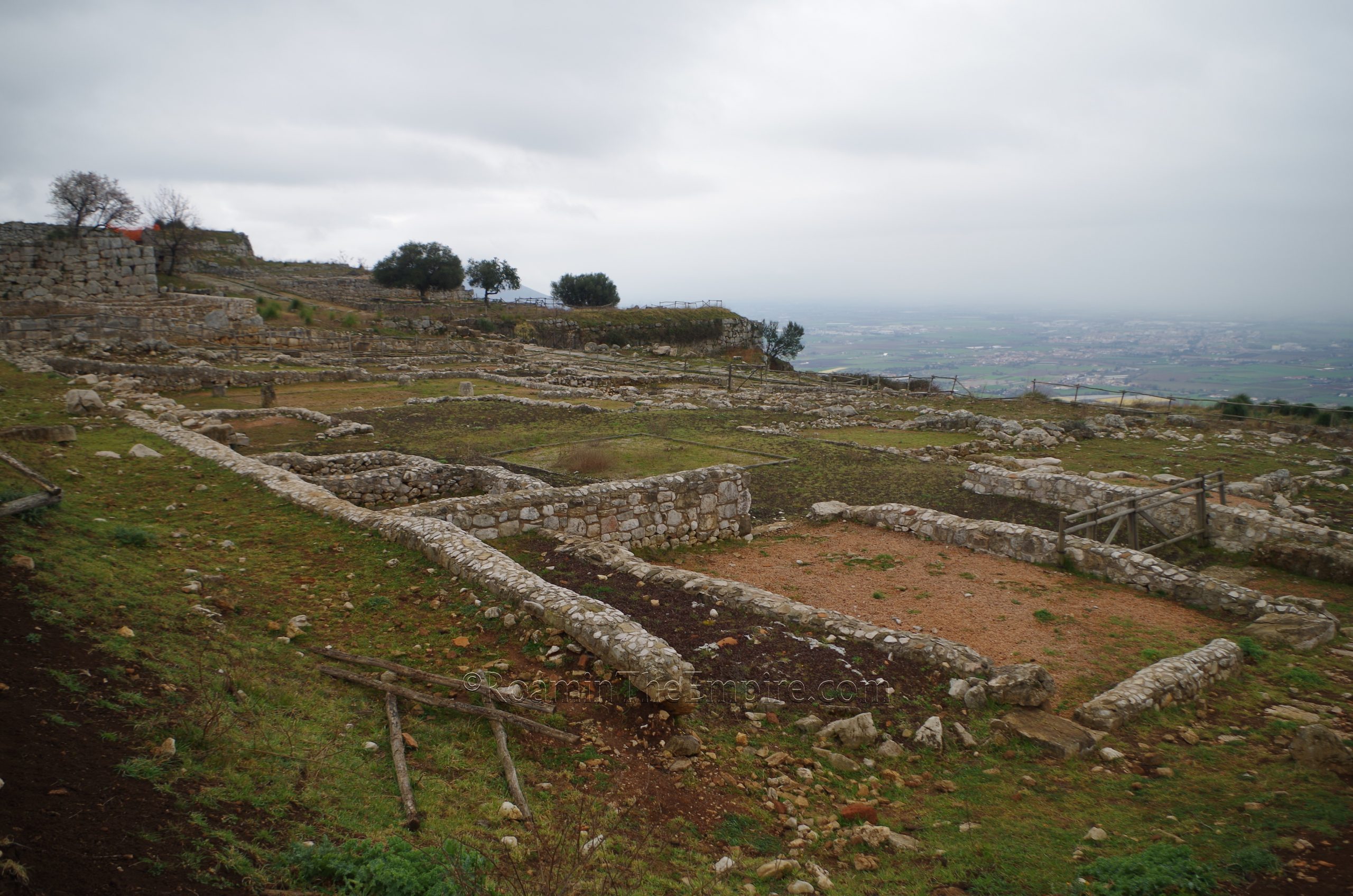
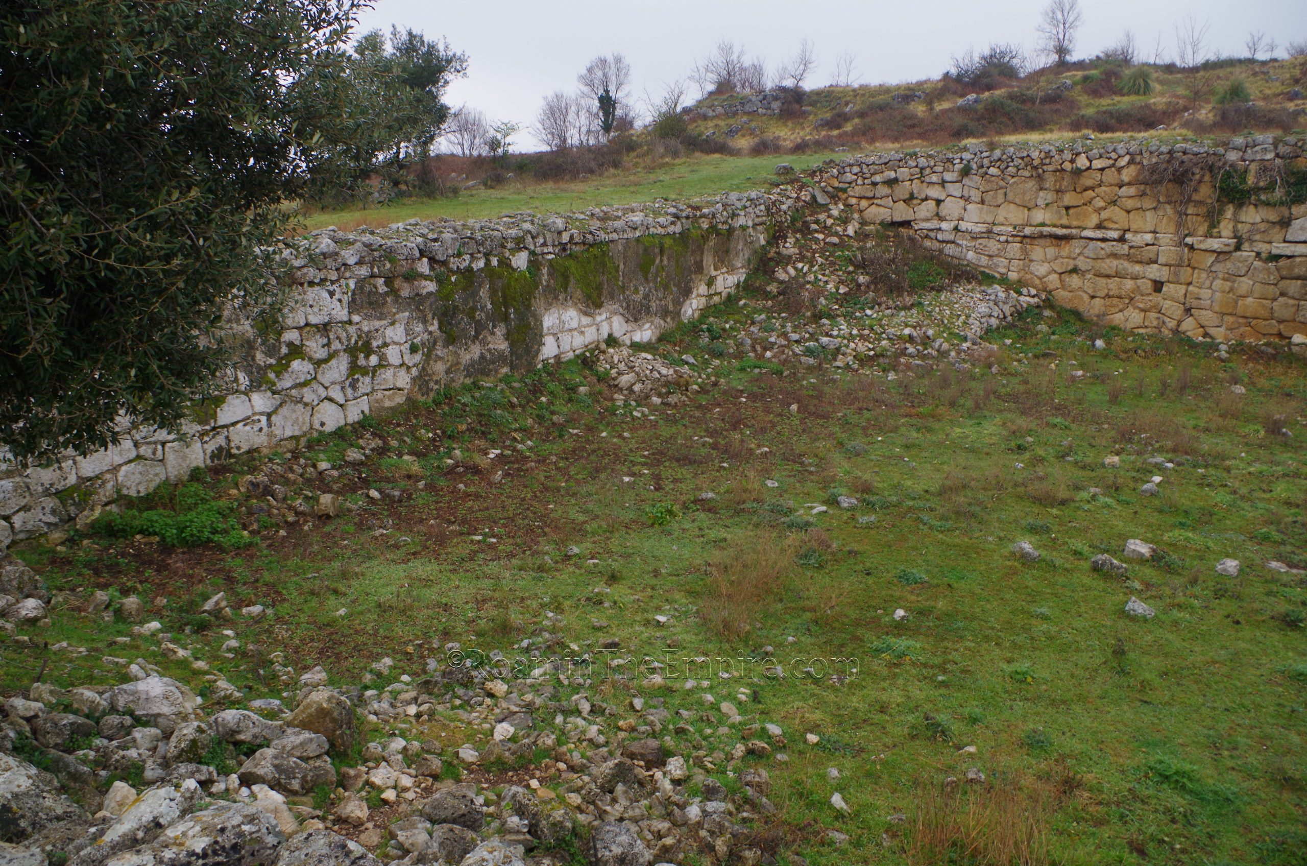
A monumental entry to the small acropolis on the west side leads down into the primary areas of Norba that are excavated. Just outside of the small acropolis, on the south side of the road leading down, are two private dwellings; Domus I, the Domus del Caduceo (Domus of the Caduceus) and farther along Domus II the Domus dei Semi Combusti (Domus of the Burnt Seeds). The two are pretty distinguishable as the Domus del Caduceo is on a raised platform about a meter above the floor level of the Domus dei Semi Combusti. The Domus del Cauceo seems to date to about the 2nd century BCE. A large limestone impluvium is visible in the middle of the atrium. At the rear of the domus (south), there is a stairwell that leads down to a couple of rooms that are not on the platform that most of the residence is built on.
Little remains of the Domus dei Semi Combusti save for the very foundations of the walls as the home is thought to have been heavily spoliated for building material in the modern town. It too sits on a pretty significant terrace as well. Another one of the city gates is located adjacent to this residence, the Porta Ninfina, again, a modern name. To actually access the area, though, there is a road a little further west that leads down to the gate; though the path that way was pretty heavily overgrown so I didn’t visit. From this point you can see how significant the terrace that the Domus dei Semi Combusti sits on is as well.
There are a number of other buildings excavated in the insula just to the north of these two residences. There is a building with what looks to be pretty robust monumental walls just across from the Domus dei Semi Combusti, but in reality this is another retaining wall that is terracing an area above it. There’s not really much remaining on top of that and there’s no readily available information on what this area was.
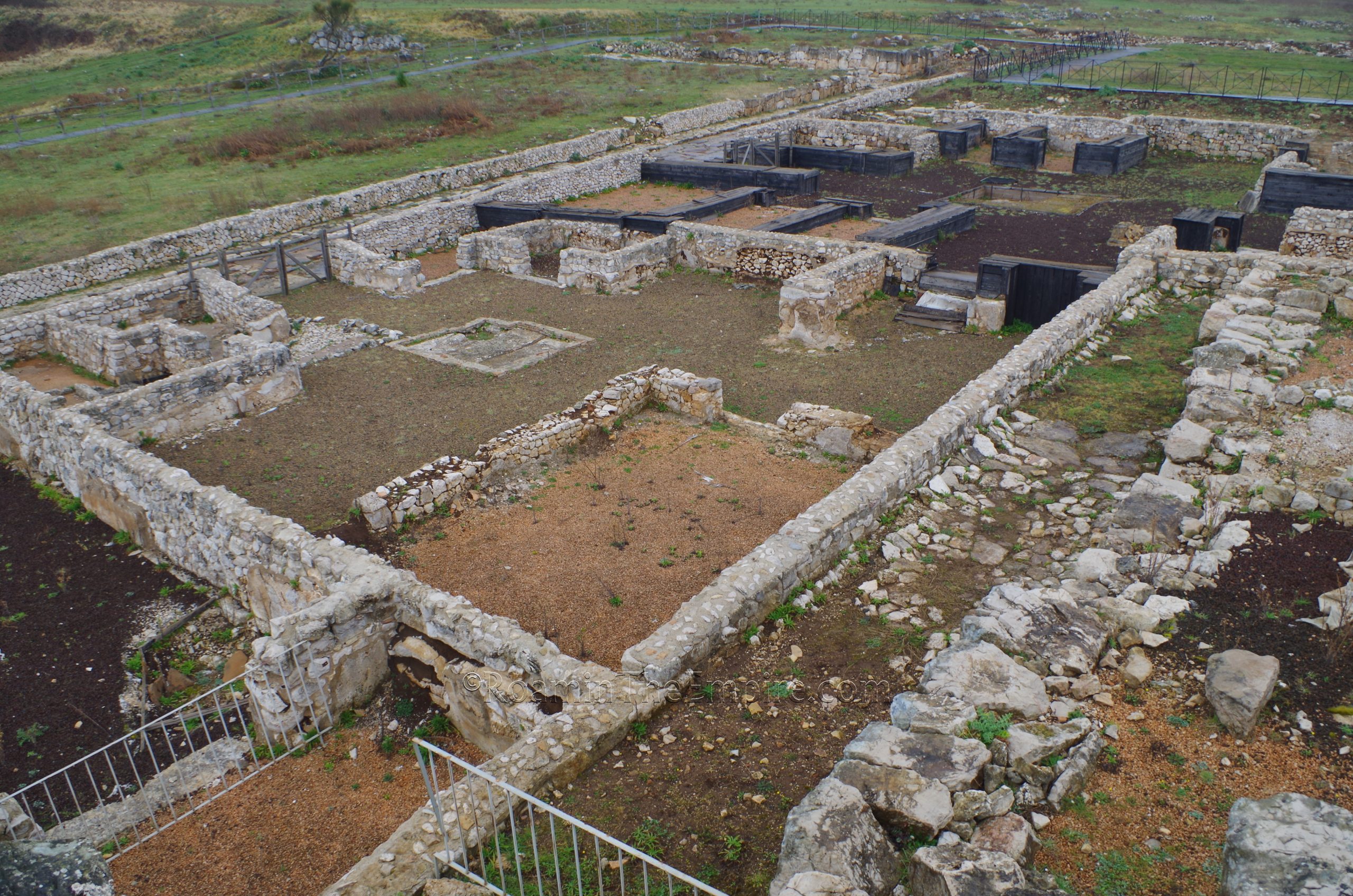
On the west side of the insula are three residences (from south to north): Domus IV, Casa del Grande Impluvio (Domus of the Grand Impluvium), Domus V, Casa delle Arule (Domus of the Altar), and Domus VI, Casa del Delfini (Domus of the Dolphins). None of these are really accessible, they’re all fenced off to prevent any access to the interior of the homes, though the titular impluvium can be seen in the first. At the northeast side of the insula is Domus XII. This house faces onto a pretty well preserved stretch of decumanus that includes a colonnade. A few fragments of columns are scattered across the road, while the column bases along the road. An intersecting cardo that shoots off to the north also preserves one of the stone ‘crosswalks’ that are commonplace at Pompeii.
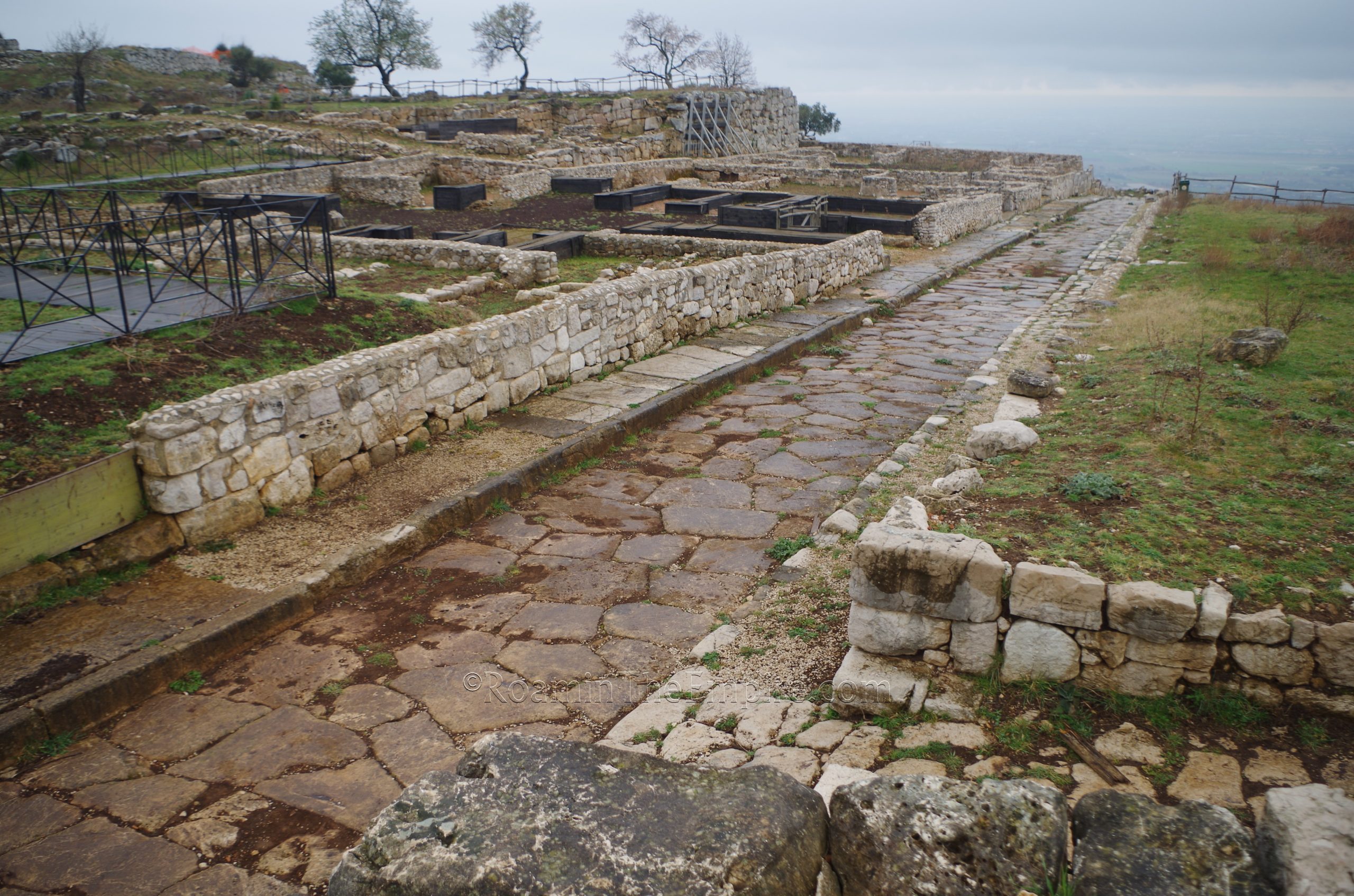
Heading back to the south side of the insula, there is another well preserved decumanus that runs along the south (from the small acropolis) of the insula and to the west. Just adjacent and to the west is another excavated house; Domus X, Domus delle Colonne. Like this other ones, this is mostly inaccessible, but is quite large in size, taking up a significantly larger footprint than any of the other excavated houses. The house gets its name from a courtyard on the northeast side that was decorated by four columns, fragments of which remain in the places of the original columns.
The well preserved road can be followed about 150 meters west to the remains of a bathing complex. This structure dates to the end of the 2nd, beginning of the 1st century BCE, so perhaps not long before the city’s destruction. It’s difficult to make out the individual rooms of the baths; I couldn’t see a whole lot to discern one area from another. What is at the core of the remains of the bathing complex is a large oval basin that was seemingly used as water storage for usage in the baths. Some tunnels around the base of the oval structure seem to be service areas and don’t have direct access to the basin. The preserved vault on the south side of the basin apparently belongs to the frigidarium.
Just to the north of the bathing complex was the forum, which, not much can be seen, but the retaining walls that helped to level out the topography of the forum are pretty visible adjacent to the north side of the oval basin of the baths. They can be seen on other sides too. Like the path to the Porta Ninifa, though, this area was pretty heavily overgrown when I visited, making it difficult to see much or do a whole lot of investigating in the forum area.
Just past the baths, continuing along the decumanus from the acropolis, there is another road that juts off to the south. This road can be followed to the area of the sanctuary of Juno Lucina, the aspect of Juno associated with child birth. Just the base of the temple remains, but a few inscriptions and a bronze tablet attribute the site to this goddess. The temple seems to have been constructed at the end of the 4th century or beginning of the 3rd century BCE, though there is evidence to suggest that there was religious activity in the area dating back to at least the 5th century BCE. Some remains of the portico that enclosed the sanctuary can be found, and to the south of the temple is a terrace supported by a pretty significant retaining wall.
Back to the north, near the Domus XII, there is a little path that leads off to the north and to a large rectangular structure (roughly 30m x 25m) that is identified as being a cistern. A bit further on from that up the rise to the northwest of the cistern is the large acropolis. The remains here are pretty fragmentary and it’s a bit off the typical tourist path, so it is not very well maintained. But, there was a temple and a portico dedicated to Diana here. The temple, of which just some scant remains of the base are present, is pretty heavily overgrown, but the remains of the portico can be a bit easier to spot to the west of it. The portico is also pretty easily visible from satellite maps.
Overall, it’s an excellent site and kind of a hidden gem; I only happened upon the fact that there was a site here. The robust fortification walls visible in some areas are particularly interesting. Perhaps my one criticism is that there is hardly any information on site, which can make it difficult to contextualize the remains. There are a couple signs, but, they don’t really tell a whole lot beyond the location of some of the major points and some basic information about the city. Still really well worth the visit, particularly with a little crash course beforehand.
There is also an archaeological museum located in town, the Museo Civico Archelogico ‘Padre A.G. Saggi’. Unfortunately, it was closed when I visited. The museum is closed on Sundays and Mondays, though reservations can be made for guided visits on Sundays. The rest of the week it is open from 9:00 to 14:00 and 15:00 to 18:00. Admission is 2.50 Euro.


Sources:
Antica Norba website.
Appian. Bellum Civile, 1.94.
Cornell, T.J. The Beginnings of Rome: Italy and Rome from the Bronze Age to the Punic Wars (c. 1000-264 BC). Routledge, 1995.
Dionysius of Halicarnassus. Antiquitates Romanae, 5.61.3, 7.13.5.
Livy. Ab Urbe Condita, 2.34, 7.42, 8.1, 27.10, 32.2, 32.26.
Pliny the Elder. Historiae Naturalis, 3.5.
Smith, William. Dictionary of Greek and Roman Geography. Walton & Murray, 1870.