


History
Located near the present day town of Gallargues-le-Montueux is the Gallo-Roman settlement of Ambrussum. The site was occupied as far back as the second millennium BCE, but the Gallic oppidium seems to have been constructed about 300 BCE. Like nearby Nemausus, the oppidum at Ambrussum was in the territory of the Volcae Arecomici. Shortly after the area came under Roman control in 120 BCE the Via Domitia was constructed. The Via Domitia passed right at the foot of the oppidum and also marked the halfway point on the road between Nemausus (Nîmes) and Sextantio (Castelnau-le-Lez). As such, a mansio was constructed along the Via Domitia at the foot of the oppidum. Following the creation of the way-station, the oppidum at Ambrussum also began to reflect a more Roman character, though some Gallic features, the ramparts in particular, remained an integral part of the settlement.
Ambrussum remained a modest settlement over the next century, and new construction at the oppidum was occurring as late as 50 CE. By the end of the 1st century CE, however, the settlement on the hill seems to be have completely abandoned. The mansio and a small settlement at the foot of the hill remained active after that, though. Beginning in the 2nd century CE, the lower settlement also began to decline and the mansio was abandoned by about 400 CE. Shortly after that, all occupation at Ambrussum seems to have ceased. Ambrussum appears on the Itinerarium Antonini Augusti, Itinerarium Burdigalense, and the Tabula Peutingeriana.
Getting There: Ambrussum is not especially easy to get to, even with a car. The signage to the site from nearby Villetelle is inconsistent, and at times, quite subtle. It helps immensely to know exactly where you are going before you get there, rather than trying to get yourself close and rely on the signs. The best bet for transportation from afield is to arrive at the train station in Lunel. From there, there is bus service from the Lunel train station to Villetelle via bus line 5; an 11 minute journey that costs 1.60 Euro each way. The schedule can be found here. From the Mairie de Villetelle stop, it’s about a 2.3 kilometer, 30 minute walk to the Ambrussum site; a relatively straight shot with just a little bit of deviation to pass under the E80 highway.
Ambrussum
The Ambrussum archaeological site is open daily except for Mondays and it is closed the entire month of January. From October to March (except January) it is open only in the afternoons, from 14:00 to 17:30. In June and September it is open from 10:00 to 12:30 and 14:00 to 17:30. In July and August the site is open from 10:00 to 12:30 and 14:30 to 19:00. Admission to the site is free of charge, though guided visits in French can be purchased for 5 Euros.
There is a small museum/information center on site. There are some artifacts, but it’s not a very extensive collection and aside from a mile stone, it’s mostly small finds from the local area. It’s absolutely worth seeing, but, it doesn’t take much more than about 5-10 minutes to get there, it’s really just a few cases. The custodian of the museum was also very excited to show me a 360 degree video presentation for the site, which was in French with English subtitles, which took about 10 minutes to watch.
Just past the museum, to the east of the road that leads up to the oppidum, are the remains of the mansio. The remains here date from about 30 BCE and are actually quite extensively excavated. Unfortunately, though, when I visited, the gate allowing for a closer visit (a fence prevented open access from the road) was locked. I’m not sure if it would have made that much of a difference, however, as this area was quite overgrown and would have been difficult to traverse or to see much of what was visible. Some of the higher walls of the buildings were visible above the growth from the road, though. The state of access and presentation of the roadhouse is a little disappointing, as this is honestly one of the most interesting aspects of Ambrussum, given that there’s not many excavated mansiones that can be visited.
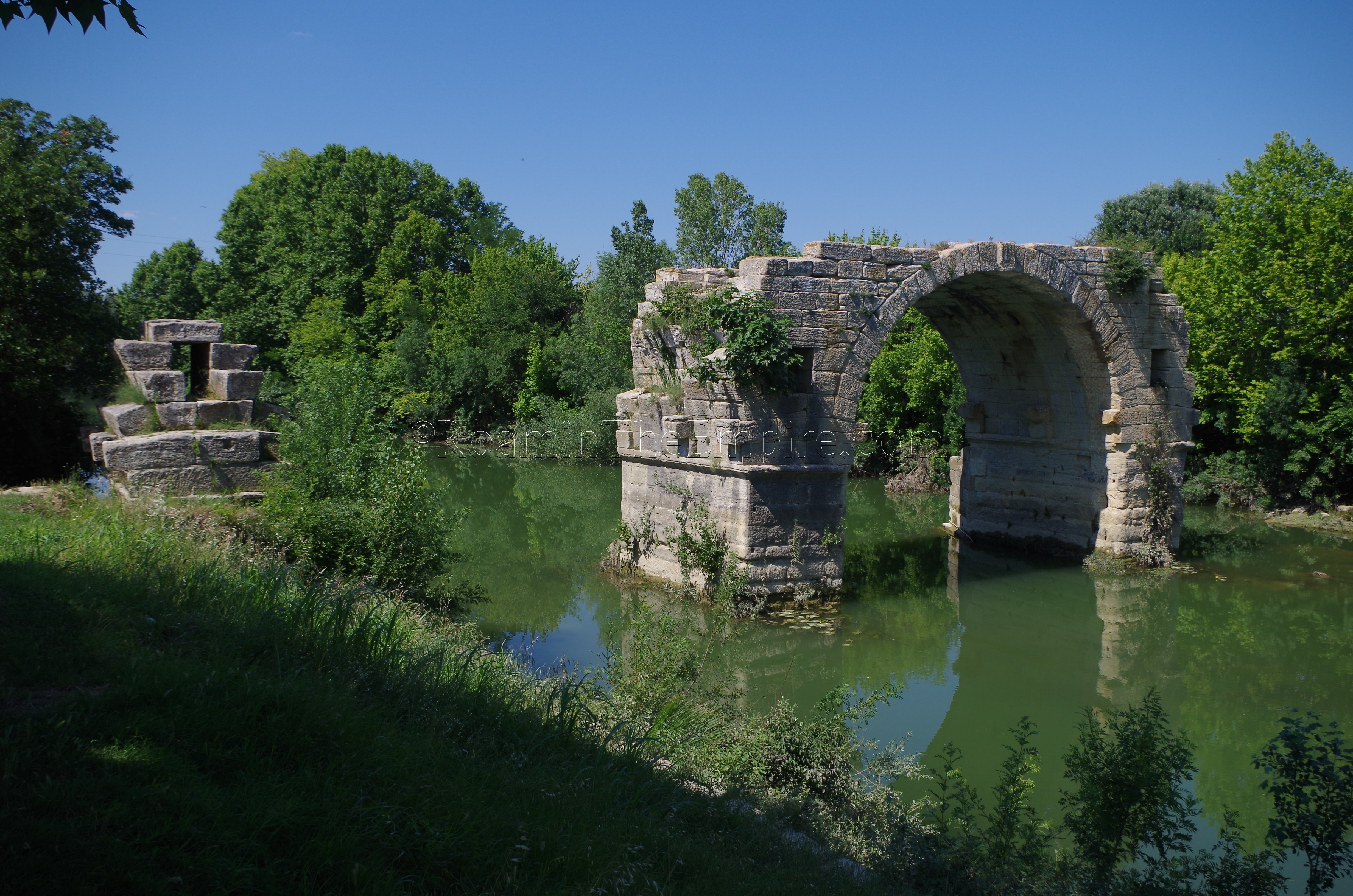
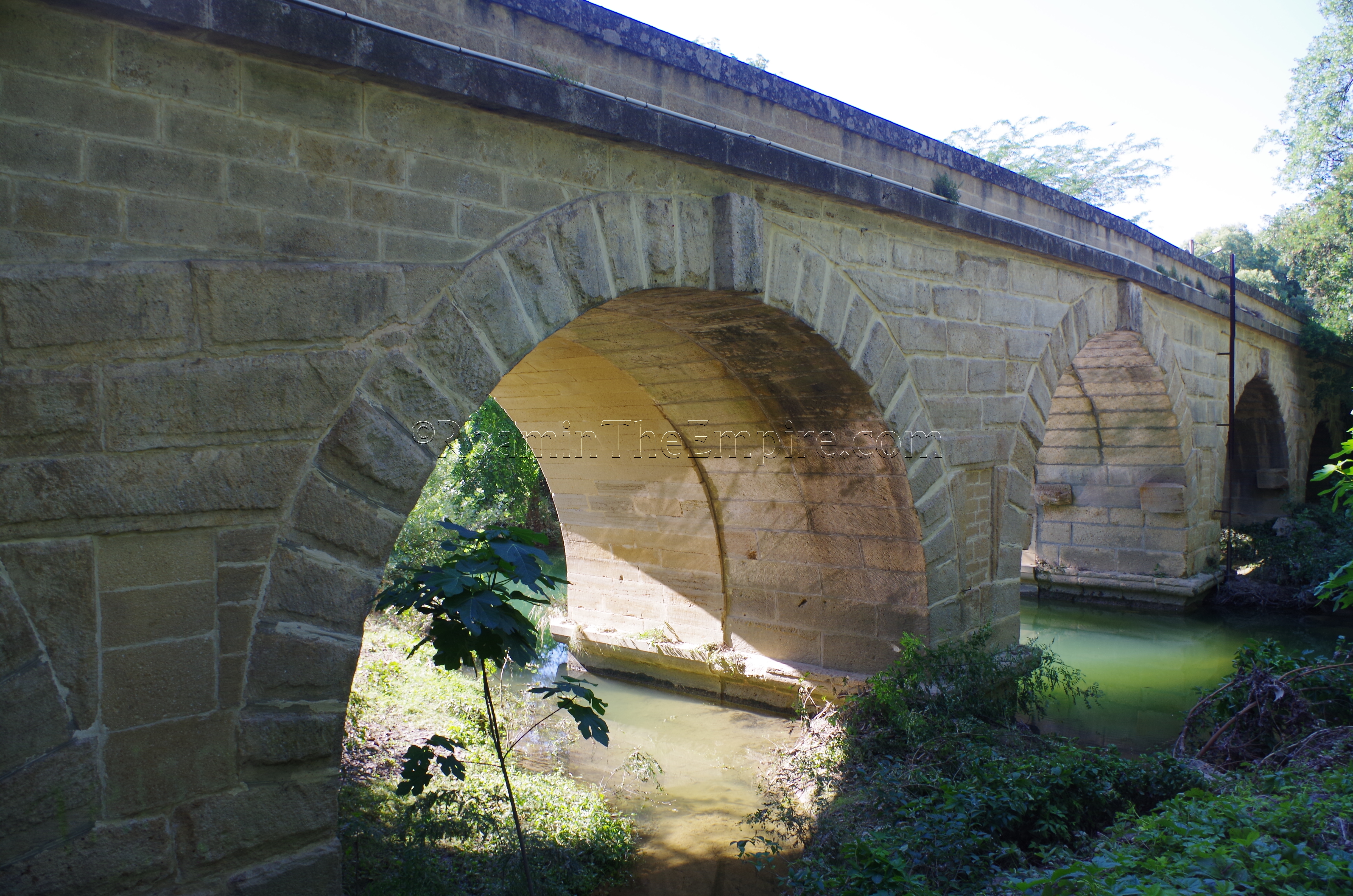
Up past the mansio is perhaps the most recognizable aspect of the site; the Pont Ambroix. The bridge, which carried the Via Domitia over the Vidourle River, was probably built around the same time as the mansio; roughly 30 BCE. Only one full arch and remnants of a few others remain, but originally the bridge spanned 175 meters and had 9 to 11 arches. The Pont Ambroix functioned well past antiquity and into the medieval period until about the 14th century when it was partially destroyed. Flooding over the last few hundred years has significantly damaged the bridge. A 17th century sketch shows four intact arches and fragments of a few others, while a 19th century painting by Gustave Courbet shows two. In both cases, the reduction in arches was due to flooding on the Vidourle.
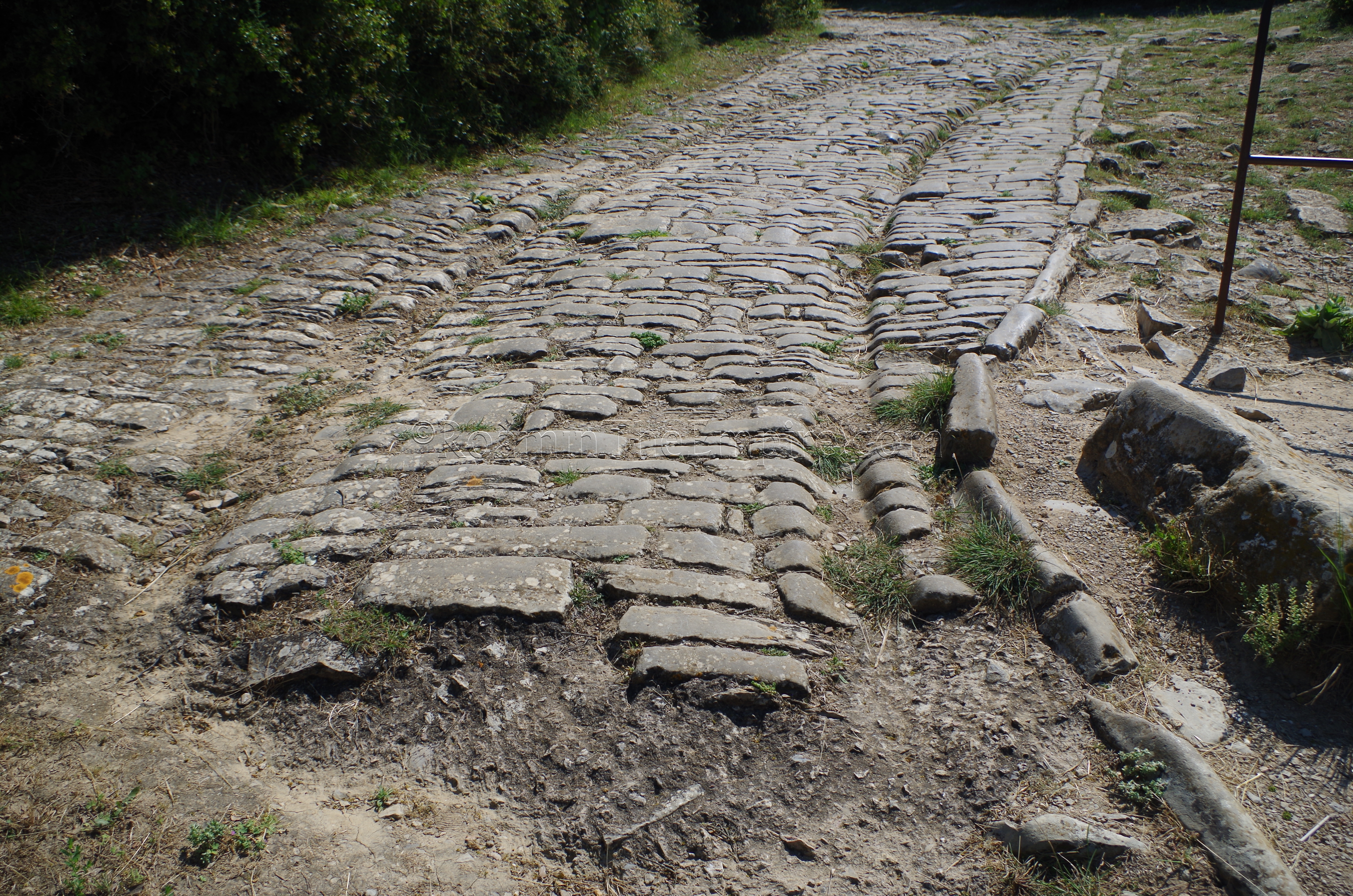
Heading up the hill to the oppidum, one encounters some well-preserved paved road, which stretches for quite a distance; essentially from the area of the east gate (no longer extant) to the south gate, branching at one point with a preserved stretch also running to the west. This road, one of the best preserved in southern France, seems to have been constructed about 100 BCE. Before exiting at the south gate, the road leads up to one of the most important monuments of the Gallic oppidum; the so-called portico palace. This building, constructed prior to the 1st century BCE, and possibly prior to Roman occupation, was probably the central public building of the Gallic settlement. A little past this was the south gate of the settlement.
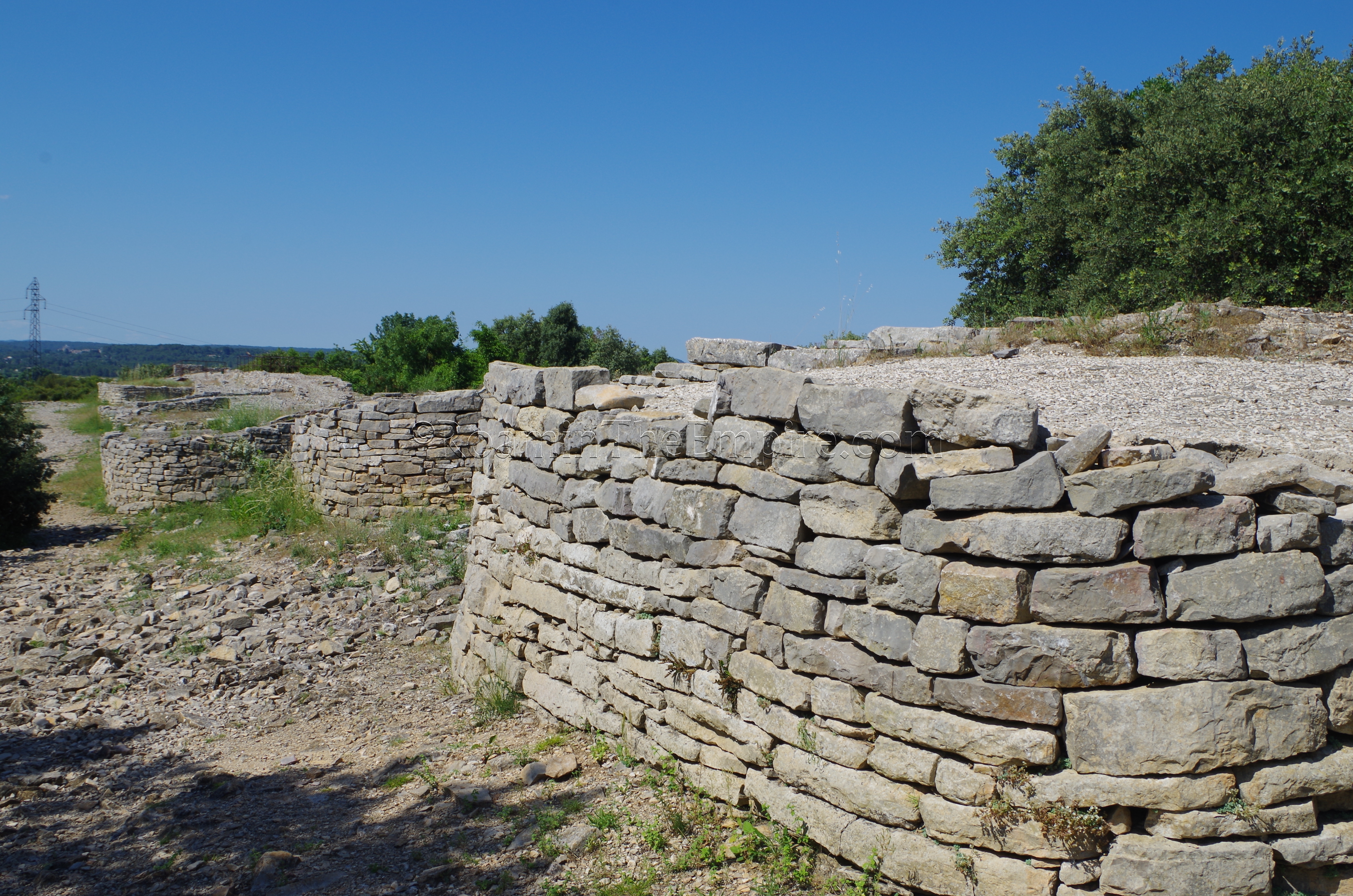
From the south gate, one can begin tracing the ramparts of the oppidum running toward the west. At first they are rather fragmentary, marked mostly by large piles of uniform rock interspersed with small intact fragments. The fortifications were apparently heavily spoliated in the 19th century for construction material to build a nearby church. As the walls continue to the west, they eventually hook up toward the north, and it is here that the form of the ramparts takes a more recognizable form with towers clearly recognizable due to preservation and reconstruction. Originally square towers, the current form of the rounded towers seems to have occurred in the 2nd century BCE. The complete circuit of the walls would have covered about 1 kilometer around the settlement and rose to a height of about 7.5 meters. About 635 meters of the wall and 24 towers remain at present.
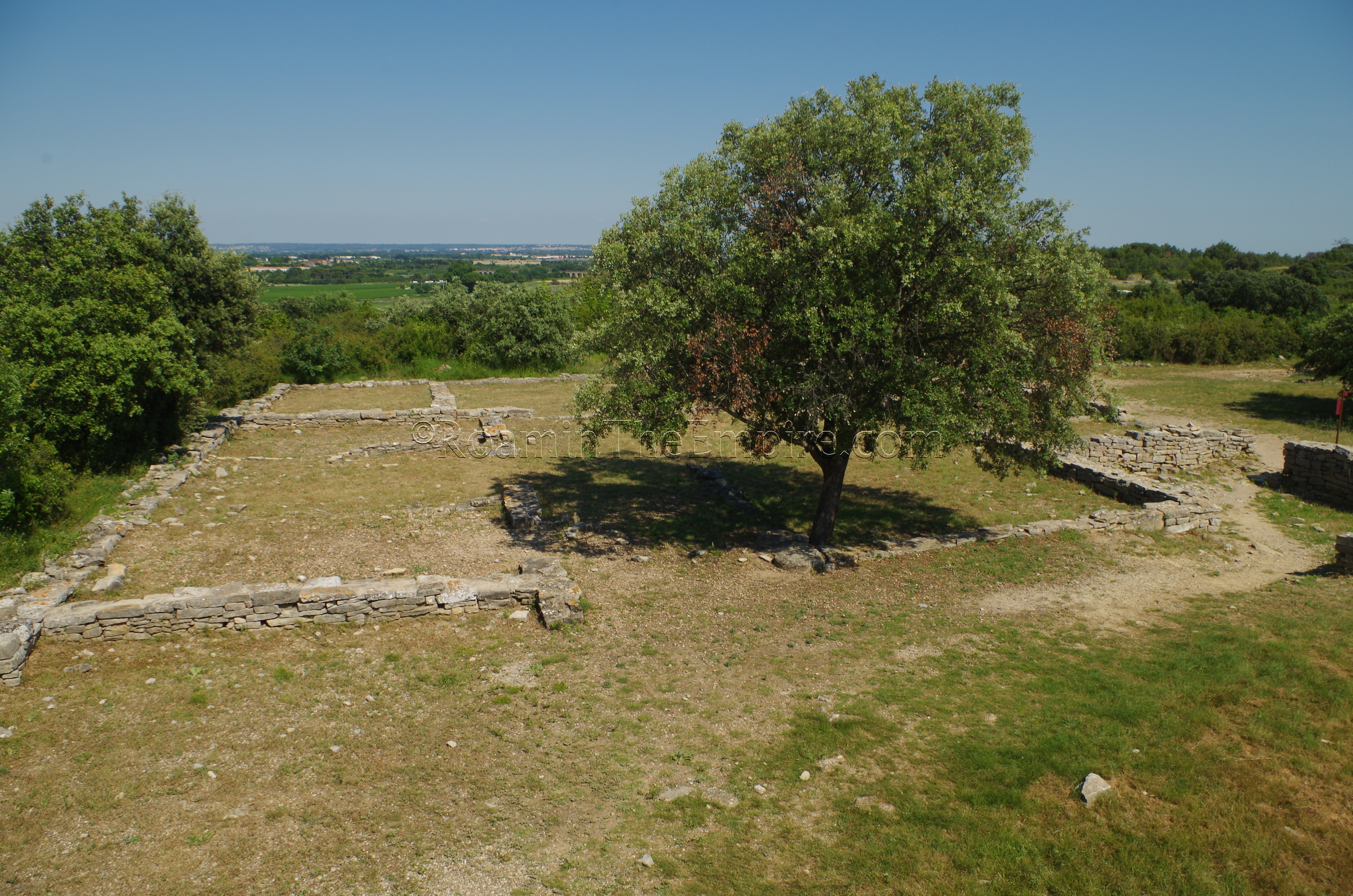
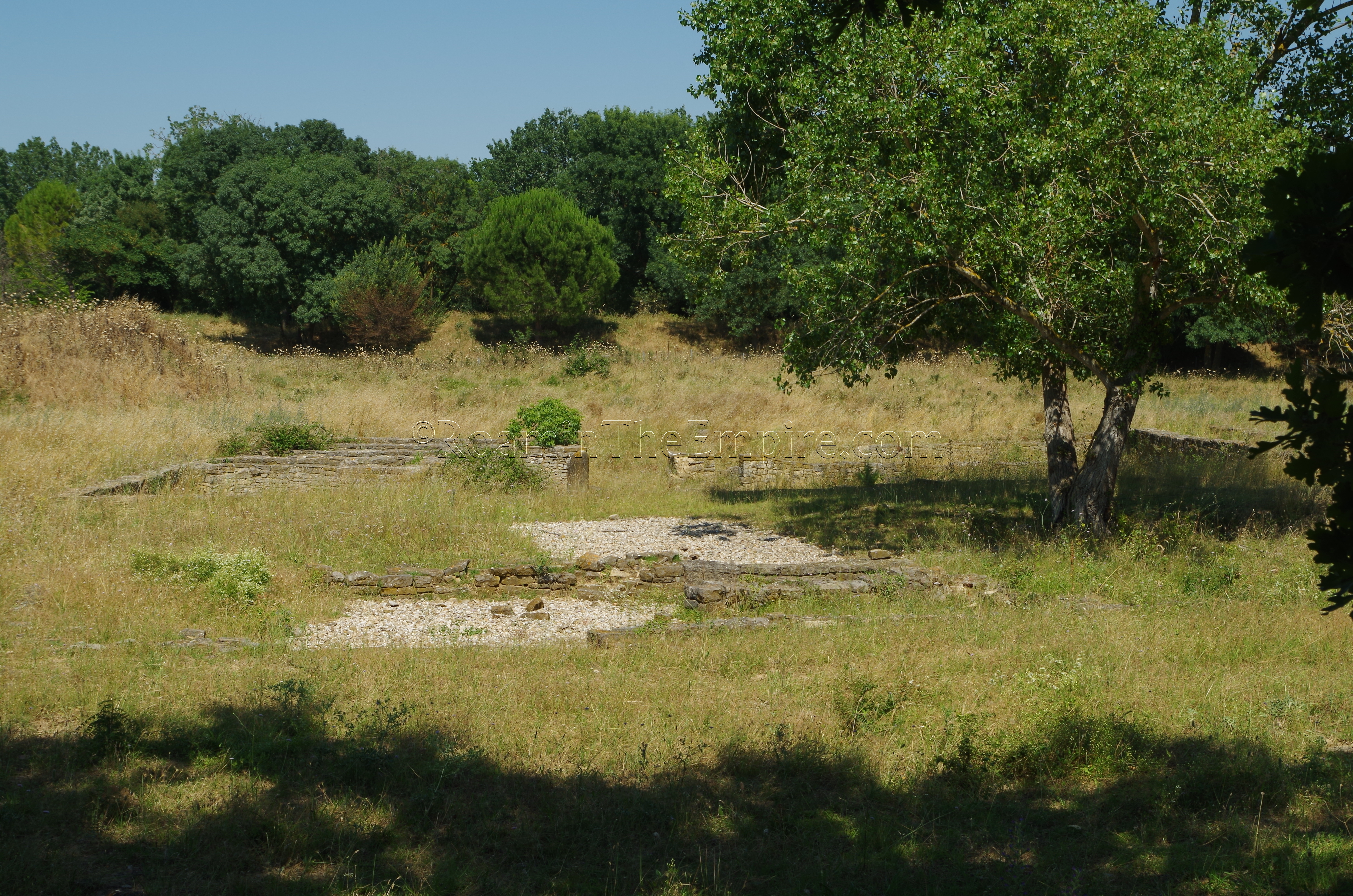
At the southwest corner of the ramparts are the remains of a residential building. The rather large dwelling (about 400 square meters) was constructed around 50 CE and were only occupied for about 50 years before being abandoned around 100 CE. A few more large residential buildings are also excavated up near the northwest corner of the ramparts as well.
Though a relatively small site and a bit out of the way, Ambrussum is well worth the stop. The Pont Ambroix is picturesque and the paved road running through the settlement is, again, one of the better stretches of paved Roman road in the whole of Southern France. The more intact part of the ramparts is quite impressive as well. At just a little over an hour to visit the site and museum, it’s not a huge investment of time either. Both the museum and the site have informational signs in both French and English.
Area Bridges
There are a few other Roman bridges in the vicinity of Ambrussum that are worth visiting if in the area as well. About 12 kilometers and 15 minutes away, on the north side of the town of Boisseron is Roman bridge spanning La Bénovie. The five arched bridge probably dates to the beginning of the 1st century CE, though some sources put it earlier. It currently carries the D610 highway over the river, so there are plenty of modern renovations and reinforcements on the bridge. The core elements of the bridge are recognizably Roman, though. Not much is visible from the road, but there is an area to go down and view the bridge from the side on the east side of the bridge.
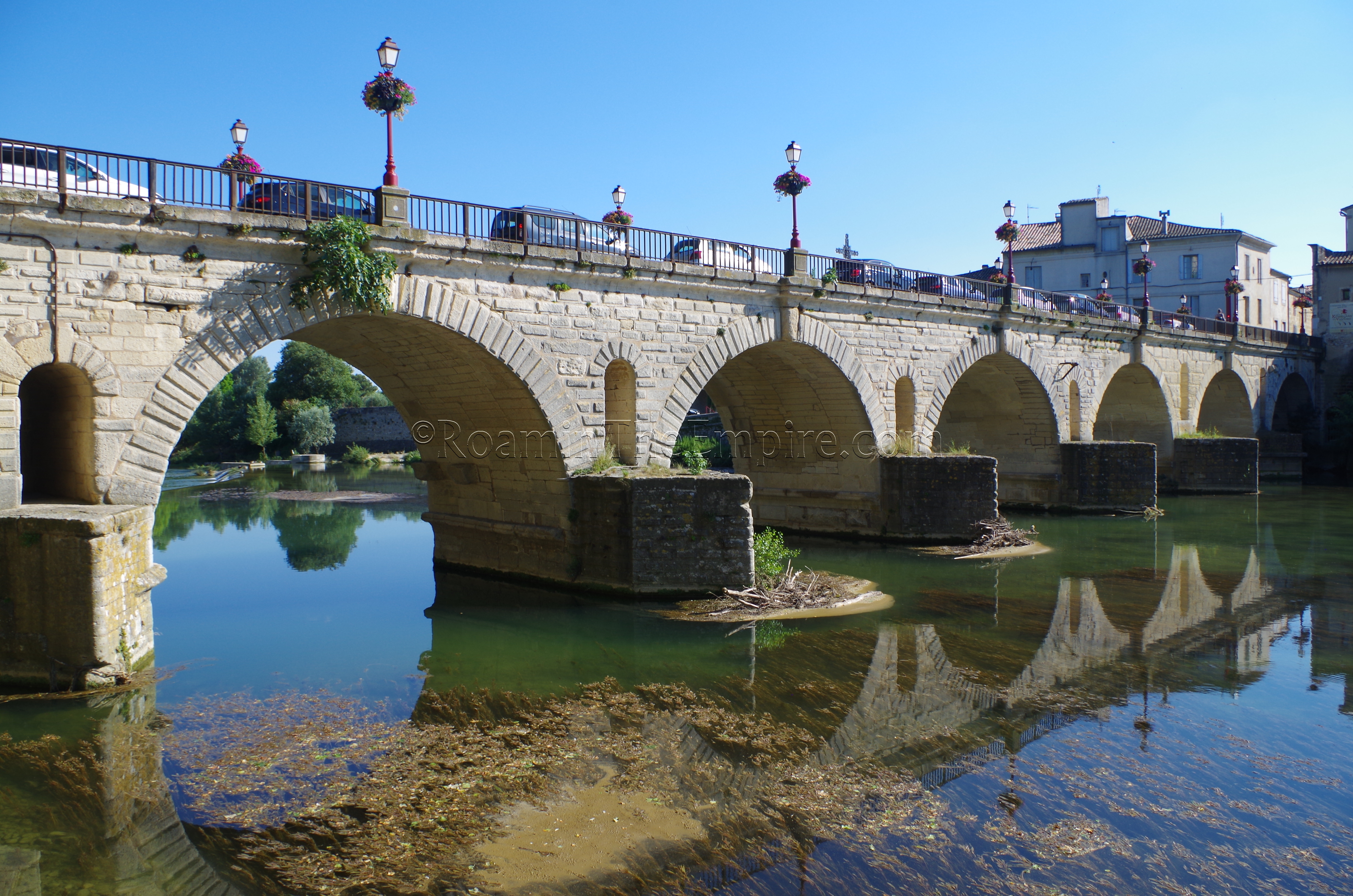
A few minutes up the D610 in Sommières is the Pont du Romain, spanning the Vidourle. Like the bridge in Boisseron, this on also still carries road traffic and as such has been heavily restored, most notably in the 18th century. The bridge was originally constructed in the 1st century CE during the reign of Tiberius and consisted of 17 arches, 8 of which are still visible as part of the present-day bridge. Some of the other original arches are essentially covered by the modern town and were used as cellars. Some of these are visible in a little plaza just off the north side of Rue Marx Dormoy, accessible by a stairway right after passing through the pedestrian gate toward the city center after crossing the bridge on the east side of the Vidourle.
Most Recent Visit: June 2018.


Sources:
Bromwich, James. The Roman Remains of Southern France: A Guidebook. London: Routledge, 1996.
Cresey, Edward. An Encyclopædia of Civil Engineering, Historical, Theoretical, and Practical, Volume 1. London: Longmans, Green, Co., 1865.
Grant, Michael. A Guide to the Ancient World: A Dictioniary of Classical Place Names. New York: Barnes & Noble Books, 1997.
Sparrow, Walter Shaw. A Book of Bridges. New York: John Lane Company, 1920.