Most Recent Visit: June 2018
Many of the sites I visited in my trip through the south of France either weren’t associated with any major or extensively conserved site or were the only remains of a significant urban area. As such, many didn’t warrant their own post, so as I did with the miscellaneous sites of the northern part of Gallia Narbonensis, I’ve put several sites together in this post that don’t fit neatly anywhere else. This post will cover four sites in the vicinity of Avennio and Glanum. Most of these are in relatively small towns, and as such, a private vehicle is essential in making the visits in a reasonable amount of time.
Carpentorate Meminorum (Carpentras)
The first site is located to the northeast of Avignon in the town of Carpentras. In antiquity the city of Carpentras was, early in the Roman period, a Latin oppidum called Carpentorate (or Carpentoracte) Meminorum. Prior to the arrival of the Romans, the site was occupied by the Memini tribe and seems to have been named after the local deity Carpentus. The name Carpentorate may have derived from a term referring to a sanctuary or fortress dedicated to the god. The original Roman name for the settlement includes the reference to the original Gallic name of the settlement and the tribe associated with it, of whom Carpentorate Meminorum became the capital of after the Romans gained hegemony over the area. Prior to the arrival of the Romans, it may also have served as a Greek trading outpost. In 46 BCE, a colony of veterans from Caesar’s legions was established at Carpentorate Meminorum by Tiberius Claudius Nero. By the time of Ptolemy, the settlement had been renamed Forum Neronis. There is little to not of Forum Neronis in the intervening centuries, but the city was sacked by the Ostrogoths, Franks, and Burgundians in succession in the 5th and 6th centuries CE.
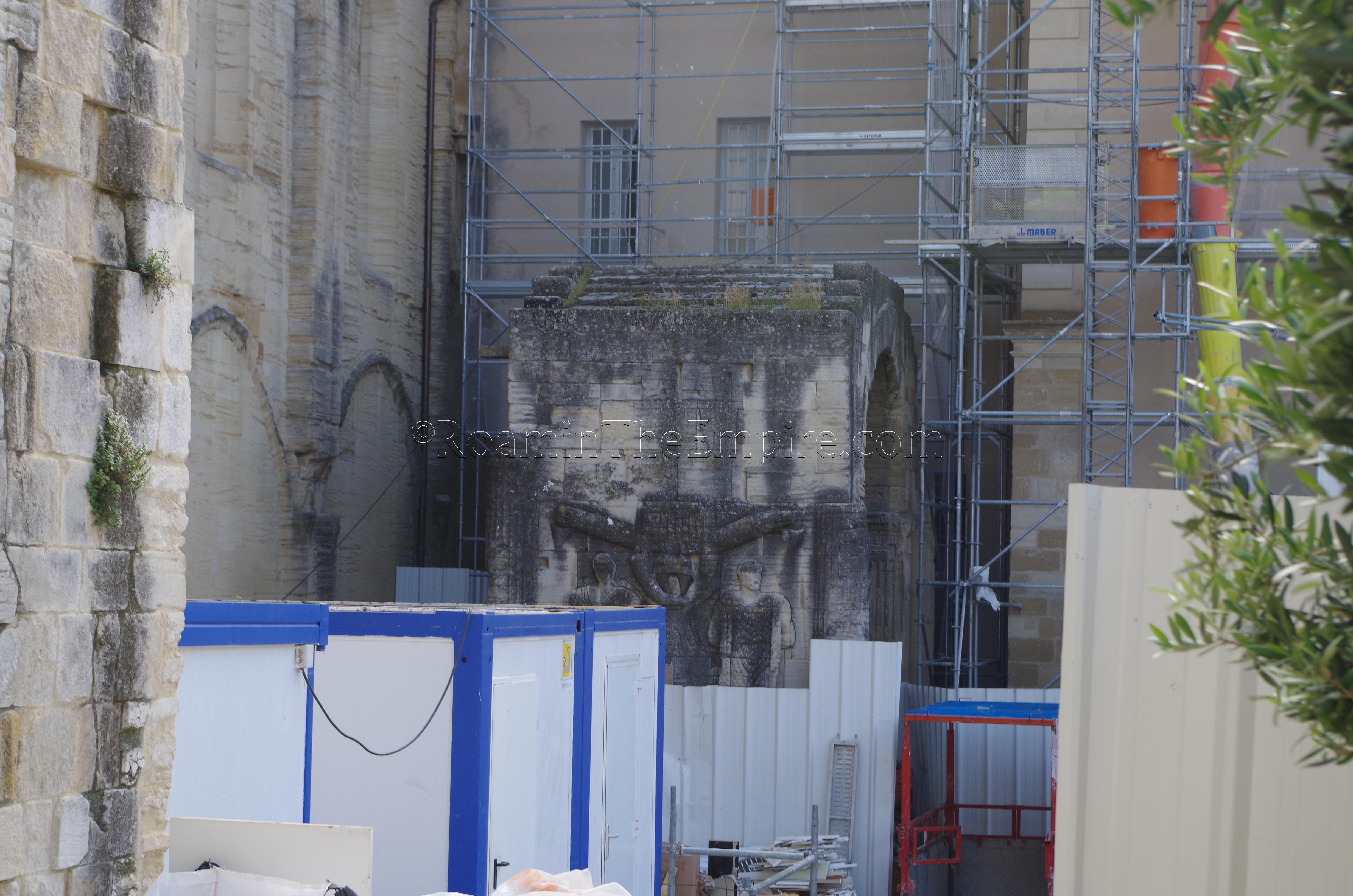
The only vestige of Roman Forum Neronis/Carpentorate Meminorum remaining is a triumphal arch dating to the 1st century CE. Currently located in the courtyard of the Palais de Justice, adjacent to the Cathédrale Saint-Siffrein, the arch was moved from its original location during the medieval period, probably from a cardo on the edges of town. Each side of the arch depicts prisoners of Germanic and Eastern origins as well as trophies. Unfortunately, when I visited, the arch and surrounding buildings were undergoing some sort of renovation, and so the arch was mostly obscured and not able to be approached closely. Part of the east side of the arch was visible from one point, though.
Caumont-sur-Durance
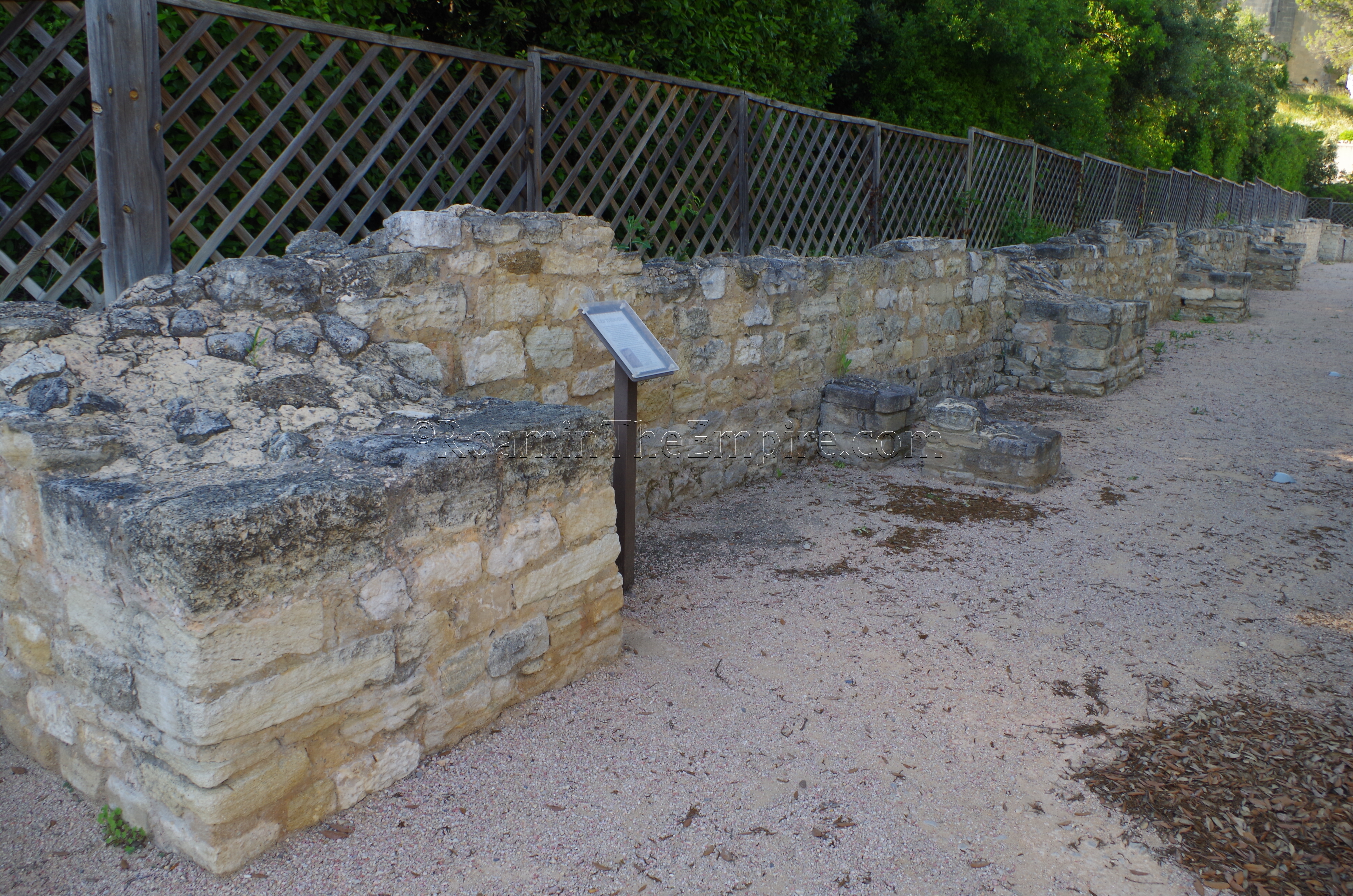
Continuing south to the small town of Caumont-sur-Durance, southeast of Avignon along the Durance River, are a set of remains in the aptly named Jardin Romain. The Jardin Romain is a small public park with no paid entrance. It is open between 8:00 and 19:00 from March through October and from 8:00 to 17:00 the rest of the year. There does not seem to have been an urban settlement here, but within the Jardin Romain are some Roman remains that seem to have been associated with a villa located here. The remains are scattered throughout the park, primarily along the north/northwest wall of the park. Among these are an opus reticulatum wall and the very fragmentary remains of a small bathing complex (most of which seems to have been excavated and then reburied). The bathing complex seems to have been constructed following a destruction of the villa in the late 3rd century CE. Small informational signs in French discuss the various different remains and their associated structures, as well as a small diagram of the baths area. In the very center of the park, though, is a 65 by 3 meter basin paved in opus spicatum with some wall painting remaining on the sides of the basin.
Cabellio (Cavaillon)
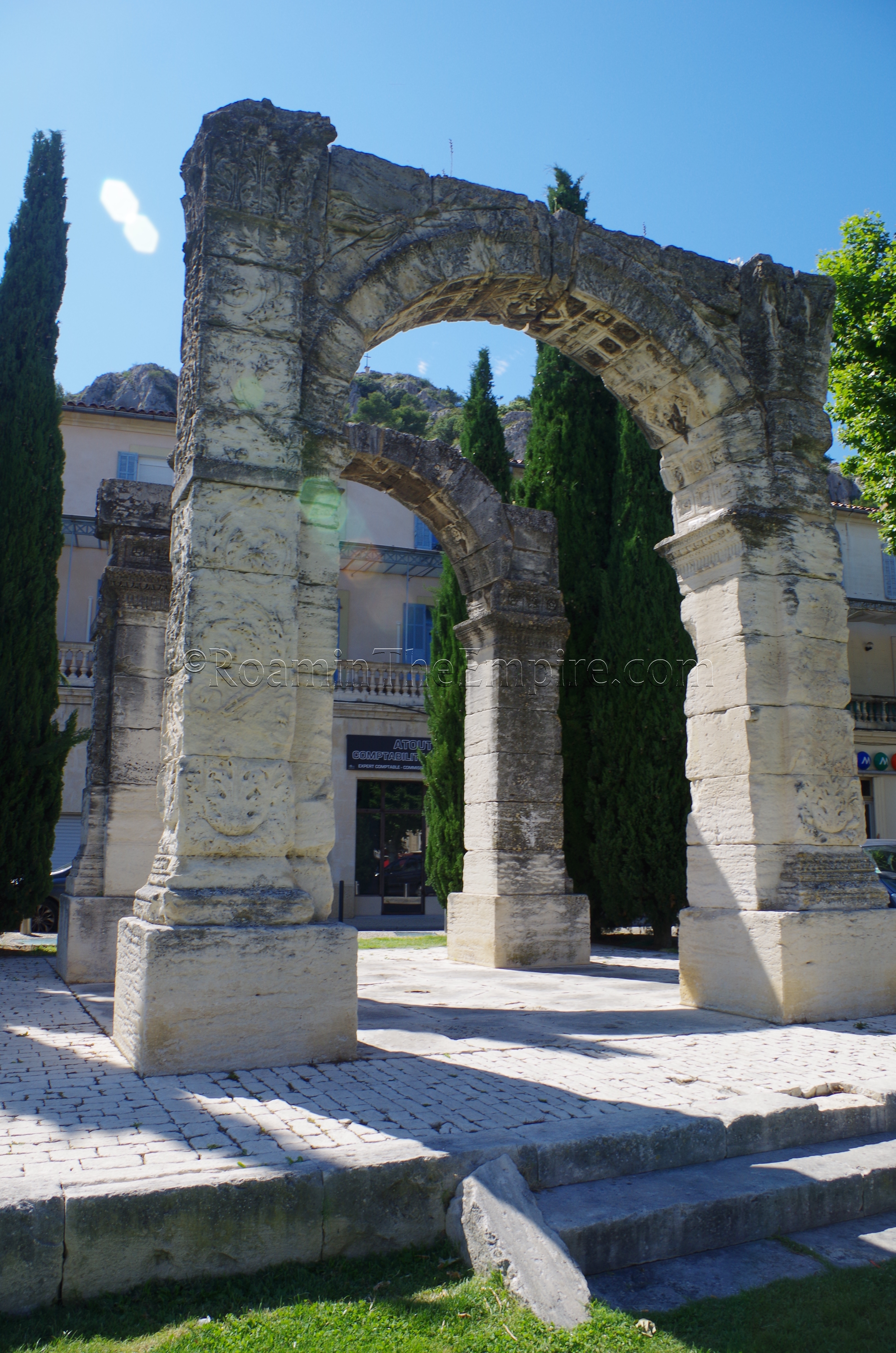
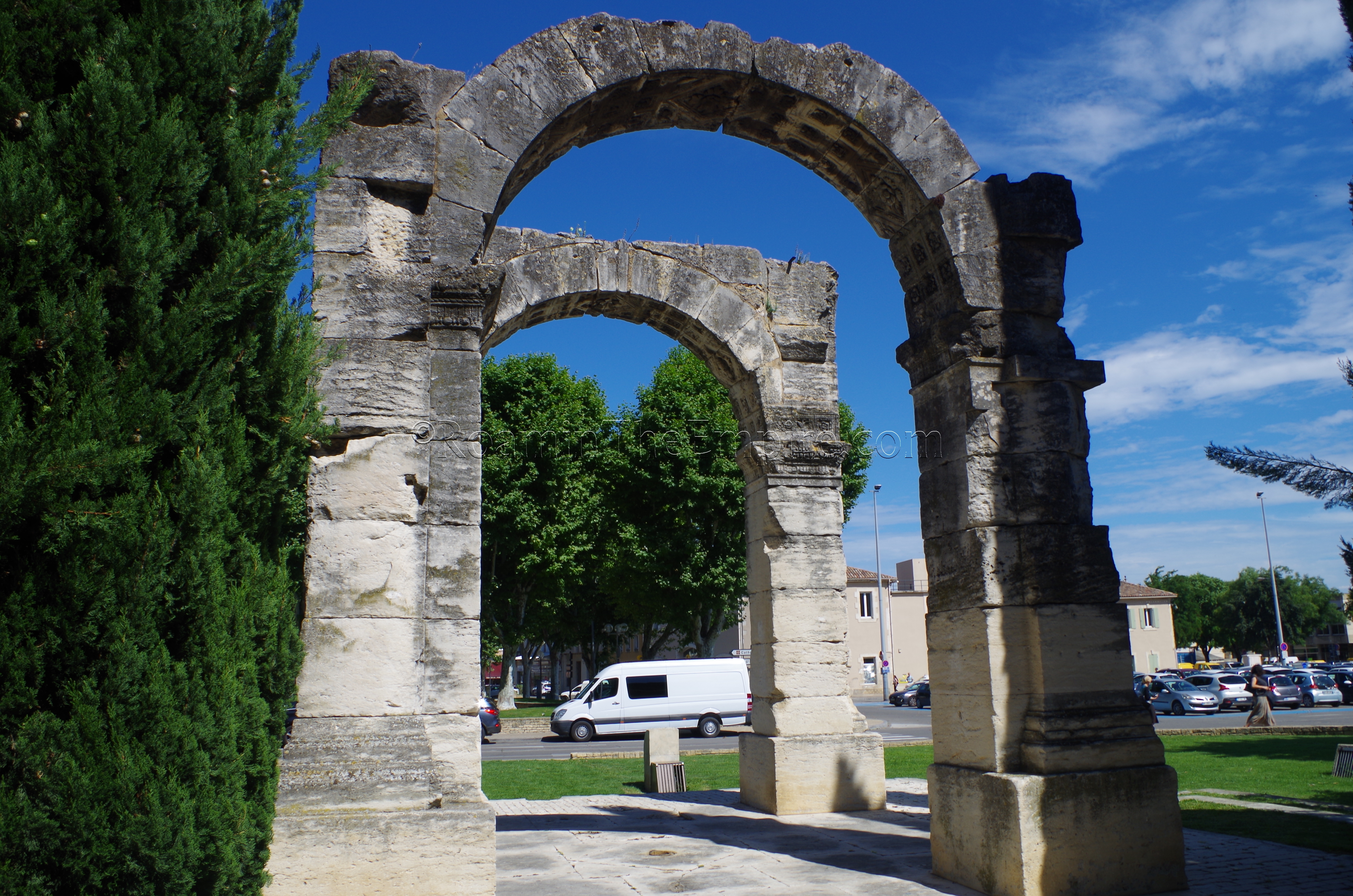
A bit further down the Durance River from Caumont-sur-Durance is the town of Cavaillon. Cavaillon was the site of a Cavari oppidum located on Saint-Jacques Hill, which overlooks the modern town from the west. The Cavri settlement seems to have been associated with Massalia by the time of the Roman arrival, and eventually a Roman settlement called Cabellio was established below the hill. Beyond that, little is known about the town, but like at Carpentras, the sole vestiges from the Roman period are the remains of a triumphal arch. In a small plaza on the western edge of town, at the foot of Saint-Jacques Hill, are two parallel arches, part of a quadrifrons arch dating to the 1st century CE. Hardly any of the imagery remains visible aside from some vegetal decoration and two Victories on the east side of the arch, so the exact nature of what it was commemorating remains unknown. The arch seems to be in its original location. An archaeological museum, the Musée Archéologique de l’Hôtel Dieu, is also located within Cavallion, but does not seem to have regular opening hours, but is rather only available by appointment.
Les Baux-de-Provence
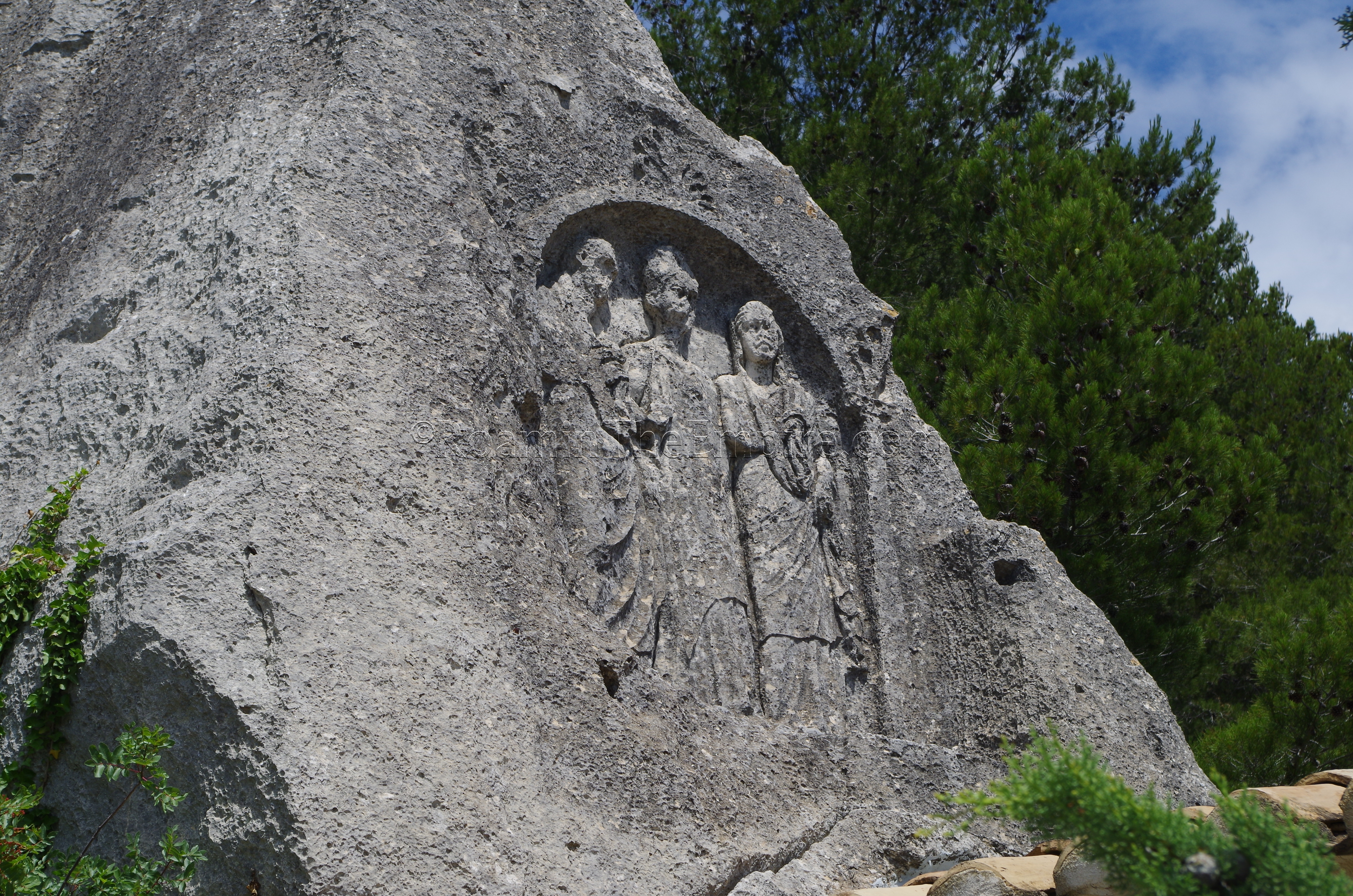
Swinging east to the vicinity of Glanum in the Parc Naturel Régional des Alpilles is the town of Les Baux-de-Provence. There does not seem to have been any major settlement located here in the Roman period, though there was probably a Gallic oppidum located there as early as the 2nd century CE. Habitation likely continued through the Roman period, but it does not seem to be large scale and there is no historical and little archaeological record of it. There is one fairly worthwhile vestige of the Roman period here, though, a bas-relief carved into the living rock below the town of two women and a man. Interpretation of the figures and purpose of the relief vary pretty widely, as one interpretation identifies it as being Marius, his wife, and his Syrian prophetess Martha, while another sees a strictly religious significance with one or more of the figures being a Gallo-Roman deity.
The modern name given to the relief, Les Trémaïé (the Three Marys) reflects the later Christian interpretation of the image being related to the Three Marys; Mary Magdalene, Marie Salome, and Marie Jacobé. The three are said to have visited Provence in the 1st century CE. As such, a chapel was constructed below the inscription, which is located two meters above ground, and remains there today. Unfortunately, this chapel blocks perhaps the best views of the relief. The relief is located along a trail about 350 meters from the D27A at a turn just before climbing up to the saddle at the foot of the town above. The trail is open and public, so there is no admission or restriction to Les Trémaïé.
Sources:
Bromwich, James. The Roman Remains of Southern France: A Guidebook. London: Routledge, 1996.
Stillwell, Richard, William L. MacDonald, and Marian Holland. McAllister. The Princeton Encyclopedia of Classical Sites. Princeton, NJ: Princeton U Press, 1976.


