


Continued From Tarraco Part II
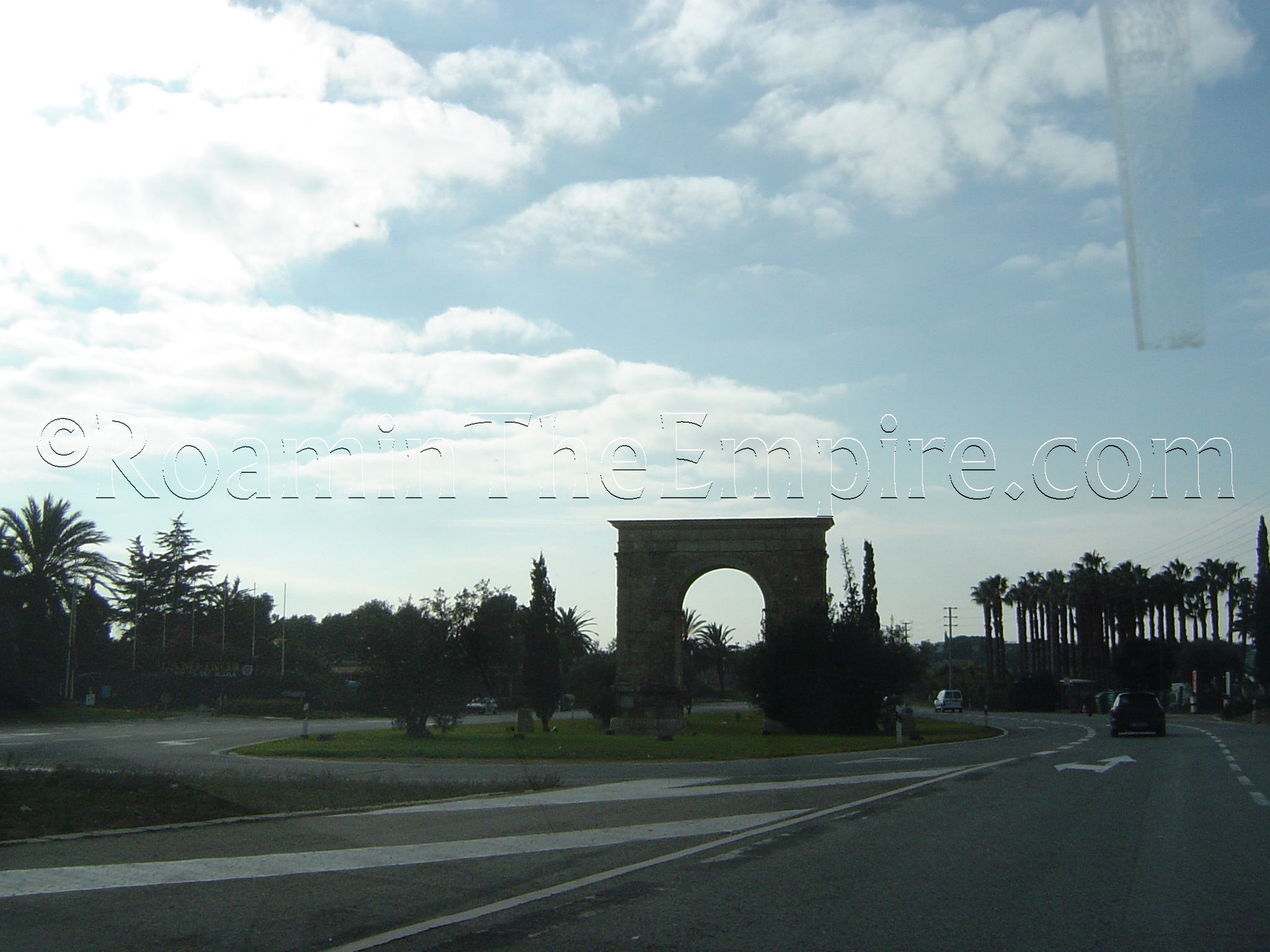
There are a number of interesting Roman sites in the area around Tarraco, most of them accessible with public transportation from Tarragona. The one exception to this is the Arc de Berà, an arch constructed in 13 BCE at the behest of Lucius Licinius Sura and dedicated to Augustus. This arch possibly marked the edge of the Tarraco district in this area. Unfortunately, there doesn’t seem to be any public transportation coming any closer than about 2.5 kilometers away. There may be some long-haul buses that stop nearby, but, the schedules don’t really make that a feasible option for visiting. On my first trip to Tarragona in 2008, though, I was fortunate enough to have a car and was able to see the arch while driving from Barcelona to Tarragona on the N-340, as it is clearly visible in a median of the highway about 20 kilometers outside of Tarragona.
A bit nearer to Tarragona is the Les Ferreres Aqueduct (Pont del Diable) bridge over the Barranc del Diable outside of Tarragona to the north. Because it’s such a big draw, getting there is actually fairly easy by bus. Buses 5 and 85 leave from Plaça de la Imperial Tarraco toward St. Salvador and both have stops at Pont del Diable. Between the two lines, there’s usually a bus leaving every 20 minutes or so, particularly during the middle of the day. It is best to check the schedule of the lines here. Fortunately, both leave from the same stop in Plaça de la Imperial Tarraco. The ride takes about 9 minutes, but, the bus will only stop at the Pont del Diable if the stop button is rung. The stops are called, and for visual reference, it is just past the underpass under the AP-7 highway. If in doubt, I’ve found that bus drivers are generally helpful, and if you tell the bus driver where you would like to get off, and sit close enough to the front that the driver can keep an eye on you, they will usually tell you where to get off. Getting back is a little more difficult, and I would recommend just getting back on the bus at the same stop. It’s a circular route, so eventually the bus will make its way back to Plaça de la Imperial Tarraco, though it will take about 45 minutes. I tried to catch a nearby bus back, to avoid this excess time on the bus, but, I picked the wrong stop and ended up taking the full circuit anyway. It’s just much easier to get back on where you got off and deal with the less than ideal time. Keep in mind that the schedule will be different on weekends and holidays. The fare is 1.50 Euro each way and can be purchased on the bus.
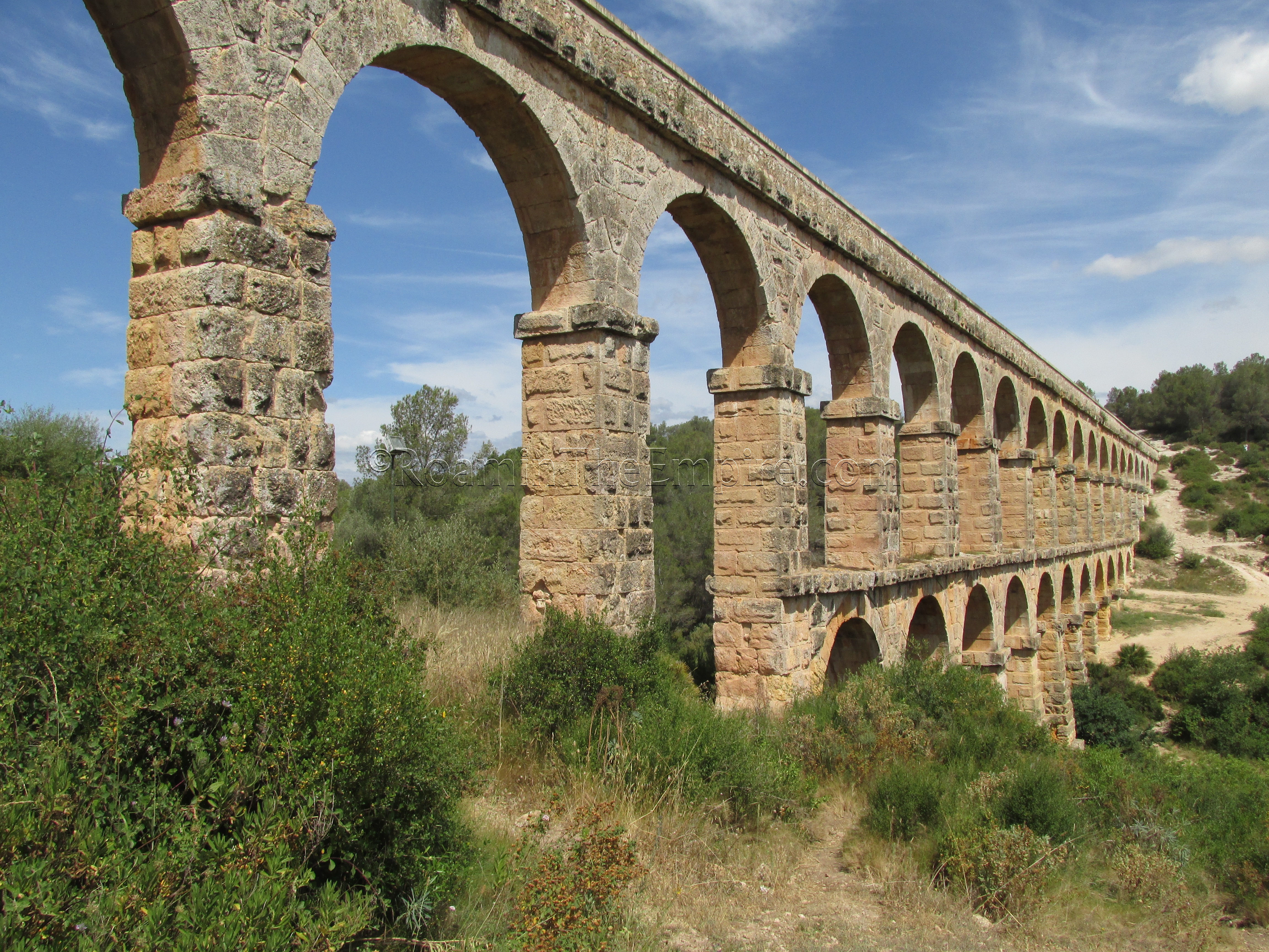
From the Pont del Diable bus stop, it is a short, signed walk to the aqueduct bridge. Probably built during the reign of Augustus, the aqueduct brought water from a point in the Francolí River, near present day Puigdelfí, about 15 kilometers to Tarraco. About 4 kilometers north of the city, a river valley necessitated the construction of this bridge. Built in un-mortared opus quadratum, the aqueduct bridge measures about 217 meters long and reaches a height of about 27 meters from the ground at its highest point. The upper section of the bridge consists of 25 arches at uniform heights, while the lower section is made up of 11 arches of varying height to make up for the slopes of the terrain.
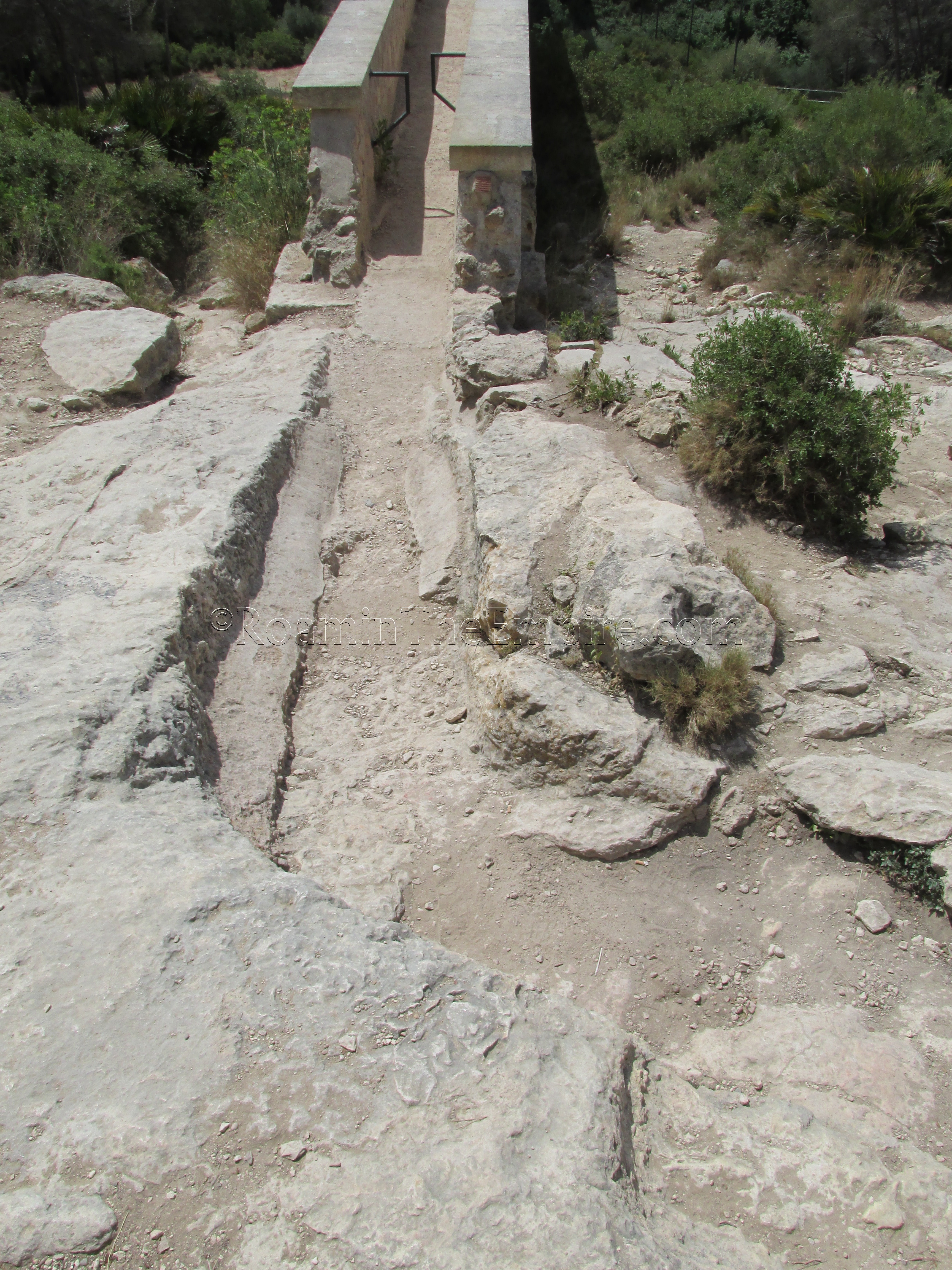
The main approach to the bridge is through the valley to the foot of it. On the keystone of the third lower arch from the south side, on the east side of the arch is a phallic symbol. From the valley, there are trails leading up to both sides of the aqueduct. I suggest going up toward the south side. On the south terminus of the bridge, the aqueduct course essentially disappears. One can walk across the bridge in the specus of the aqueduct to the north terminus of the bridge, or vice versa. On the north side of the bridge there is an informational sign about the aqueduct in English, Spanish and Catalan. The course of the aqueduct can actually be traced further north and west from this point for some distance. Though the channel is winding and is not very clear at points, I was able to follow it. It follows the course of a trail leading west for a little way, but eventually veers off from the trail and requires a little traversing through the forest, though it is not very rough terrain. After about 5 minutes or so, the course becomes less clear and disappears. I imagine it might be visible at other points in the area, though.
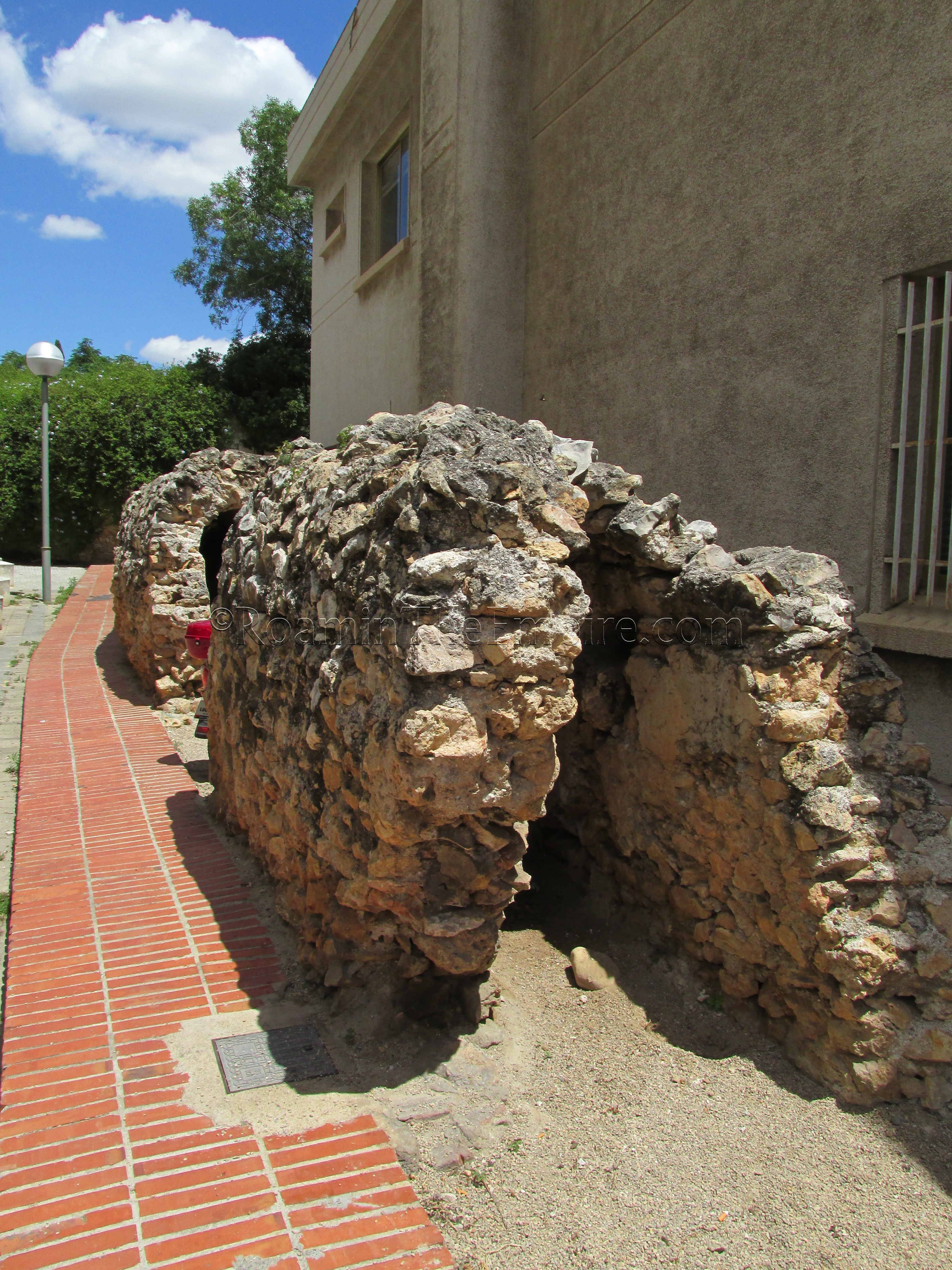
Back in town, a section of the aqueduct can also be seen. Near to Plaça de la Imperial, at Avinguda de Catalunya 49, a preserved section of a covered section of the aqueduct as it enters the city is present.
To the east of Tarragona there are four points of interest (not including the arch), three of which can essentially be seen in the same trip; the Tower of the Scipios, the Pedrera El Mèdol (quarry) and the Punta de la Creueta quarry. All three of these are within a reasonable distance of bus line 12, again leaving from Plaça de la Imperial Tarraco, this time at the stop just next to the 85 bus that went to the aqueduct. Take bus 12 going in the direction of Ferran, which leaves Plaça de la Imperial Tarraco every 40 minutes during the week, though check the exact schedule here. To get to the Tower of the Scipios, take bus 12 for about 16 minutes to the Mas Rabassa stop. Again, keep in mind that the bus will not stop unless prompted. This stop is about 700 meters west of the actual tower, so continue on along the highway for about 10 minutes, and the tower is on the north side of the road where there is a westbound pullout from the highway. Keep in mind there is no sidewalk and the shoulder is sparse in some areas, so use caution.
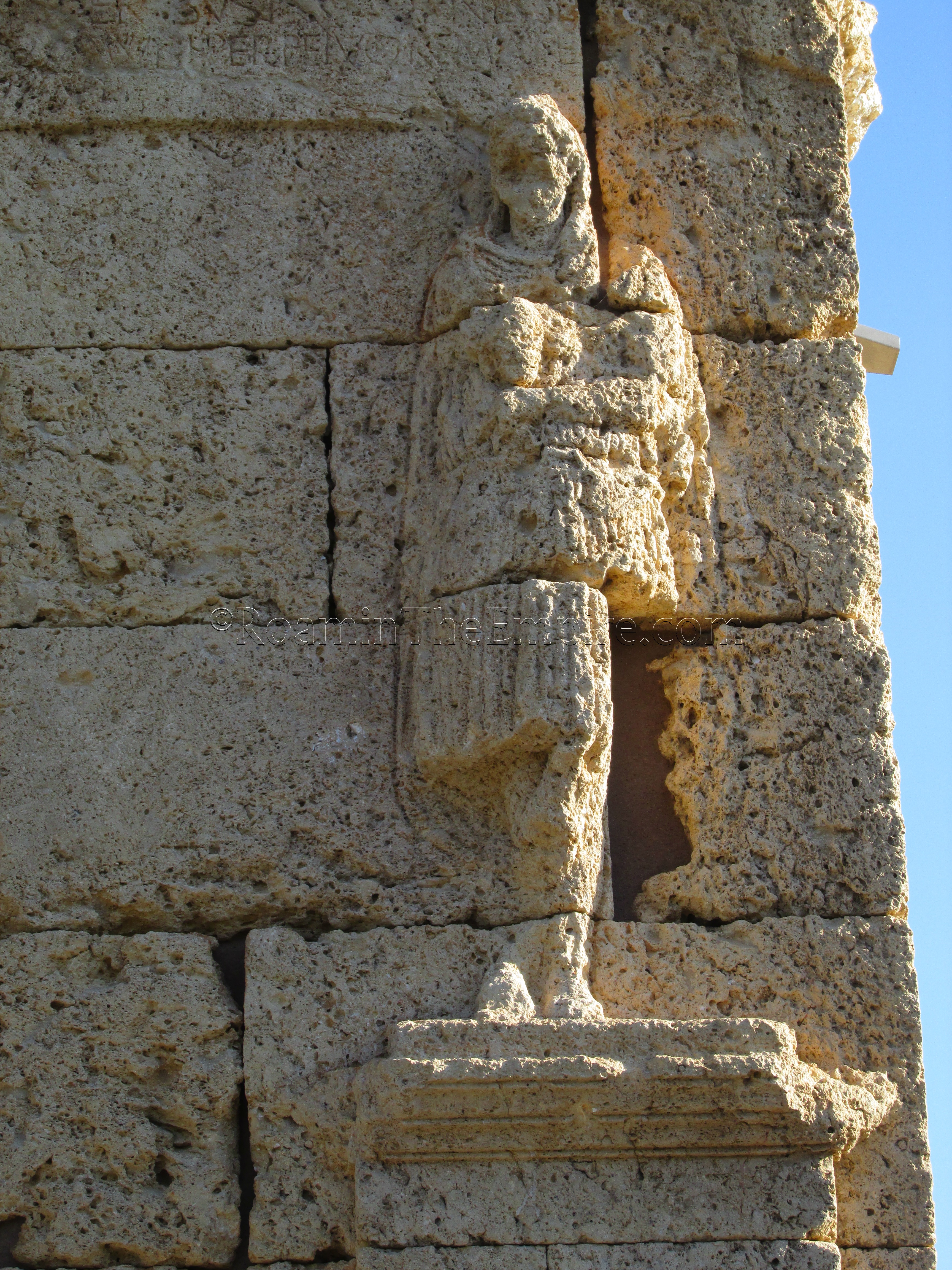
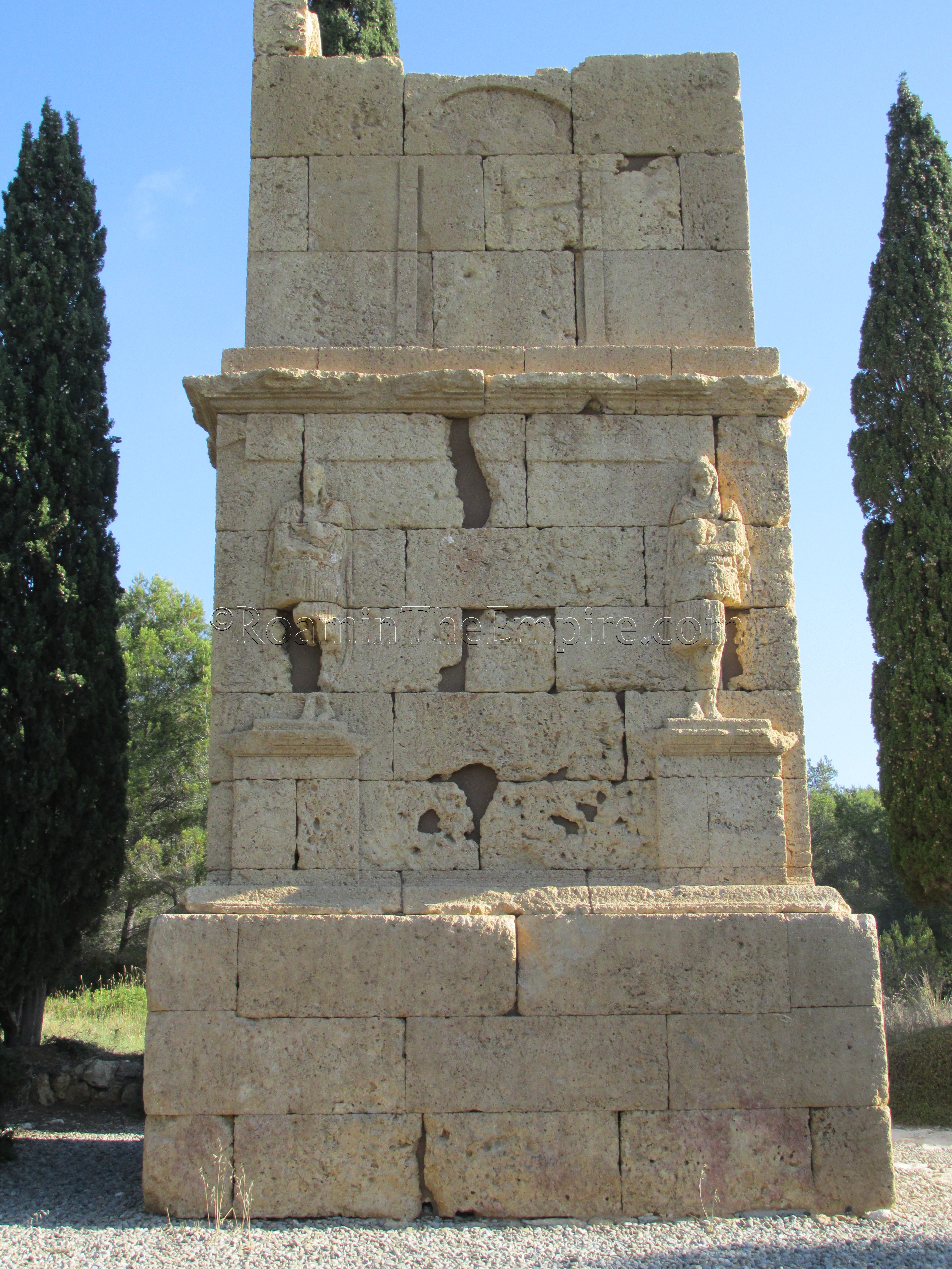
Despite the name, the Tower of the Scipios (Torre dels Escipions) has no definitive link to the Scipio family. The name comes from two reliefs of Attis on the south side of the monument which were originally thought to be representations of the Scipio brothers and a misinterpretation of one of the words on the inscription above the figures. The N-340 generally follows the route of the Via Augusta, and this tower was built in the first half of the 1st century CE funerary monument located along it. The monument currently stands just over 9 meters tall, though the very top of it is missing. On the highest register of the three levels of the monument, on the south side, which faced the Via Augusta, there is also an arch with a relief believed to be of those interred here. The relief of those figures is very difficult to make out. The tower would have originally been part of a larger necropolis, with other monuments located nearby.
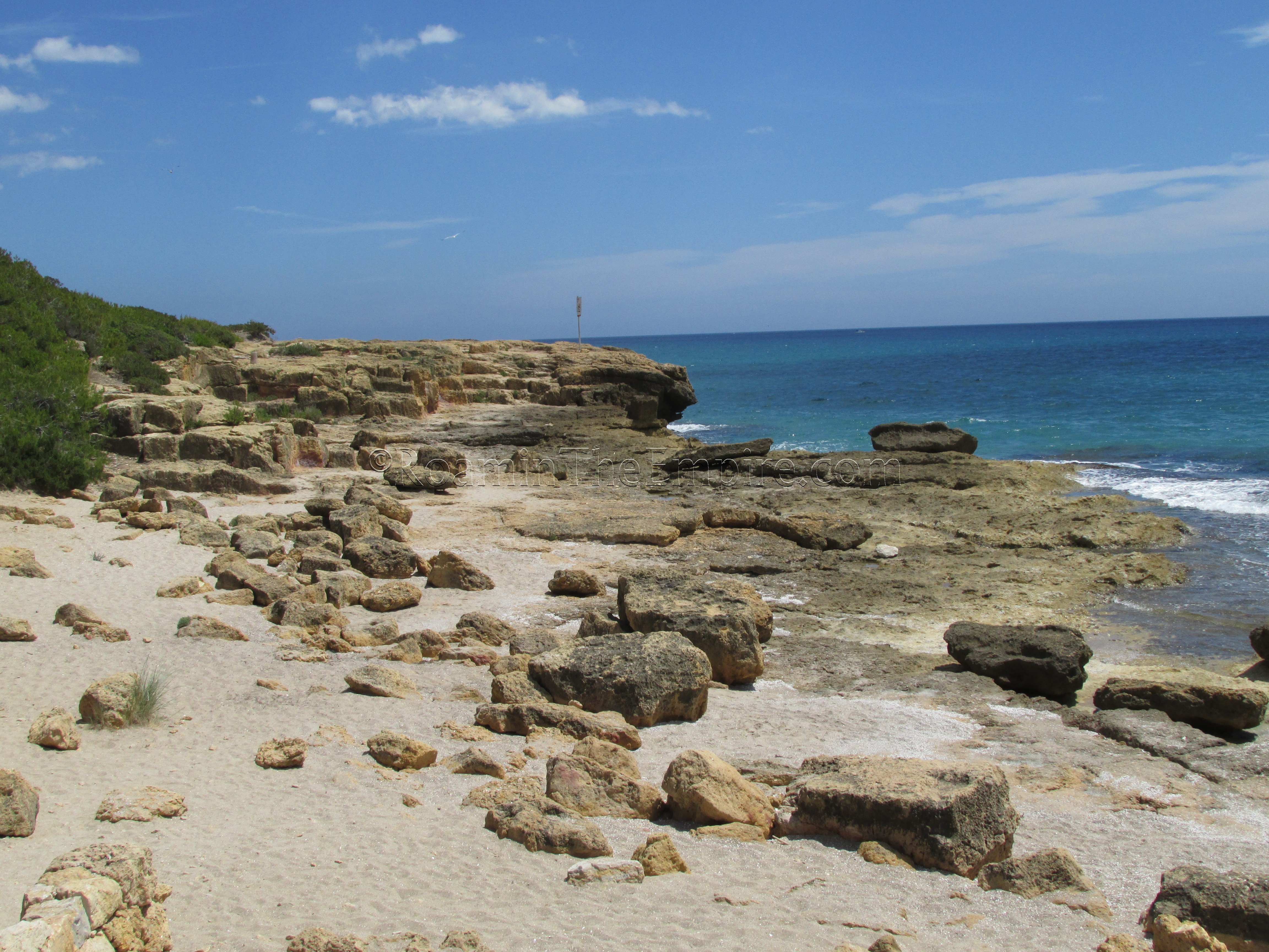
To get to the Punta de la Creueta quarry, head back to the bus stop. There is a road leading south from the turnout that the bus stop is at. Take that road south, passing under the railway tracks, to the entrance of Camping las Palmeras. I’m not sure exactly what beach access laws are like in Spain, but, regardless of whether people not staying at the campgrounds are allowed to access the beach here, there are enough people coming and going that if you just look like you know what you’re doing, no one seems to mind. Continue south until you hit the beach. Take a left at the water and continue east along the beach until it ends at some rocky terrain. Follow the shoreline as it curves south, and at the point where the shoreline cuts back to the east is the beginning of the area of the quarry.
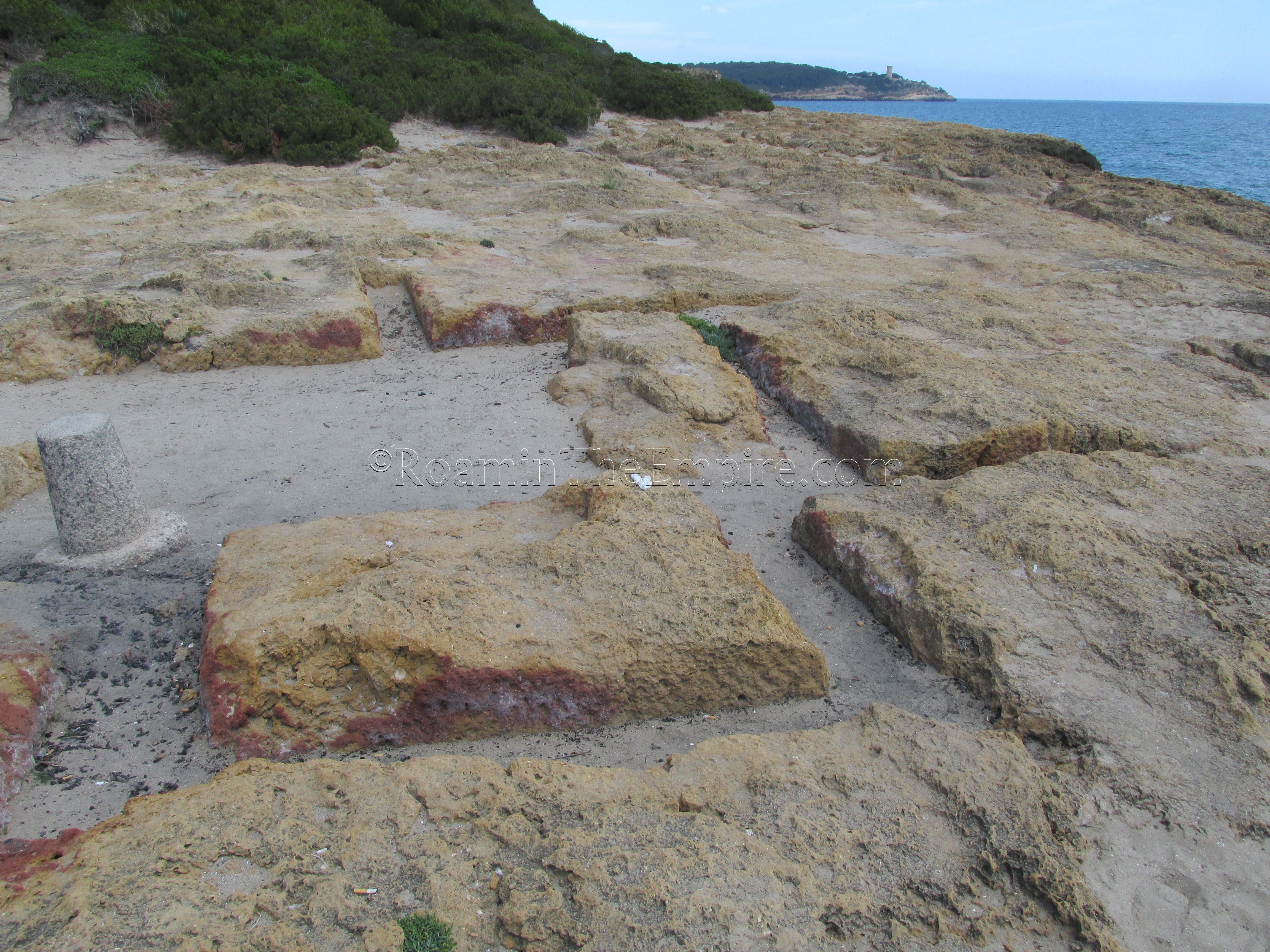
There are no signs indicating the presence of a Roman quarry here (though it is noted on some signs at the El Mèdol quarry), and I actually had to make a separate trip out here after I figured out where it was, after I had already been out to see the Tower of the Scipios and El Mèdol quarry! The quarry stretches for about 125 meters along this rocky part of the coastline. There are cuts in the rock for nearly every stage of the quarrying process visible. There are lots of straight edges in the rock or square voids to show where a block had been cut, as well as some partially cut blocks that were never finished and removed. There are also a few Roman numerals cut into the rock, possibly some sort of administrative or tallying system used at the quarry. The stone from this quarry was used to construct the nearby Tower of the Scipios.
To get to the final stop, head back the way you came to the bus stop. Since the bus runs about every 40 minutes, it’s probably best to know the schedule in advance, so you’re not left sitting and waiting for the bus for 35 minutes. It’s about a kilometer and a half between the Punta de la Creuta quarry and the bus stop, so, 20-25 minutes of walking is probably a reasonable estimate of the time needed. At the bus stop, again catch the 12 headed in the same direction away from Tarragona. You’ll only be going to the next stop, El Pont, so hit the call button for the top soon after you get on. This stop is in a little municipality just off the N-340, so, exiting the bus, head back the way you came towards the large roundabout. Keep heading north across the N-340 and eventually on to the overpass leading over the AP-7. Right after the end of the overpass, on the left side of the road, there is a trail leading to the west. Take this trail and after about 5-10 minutes you will reach the entrance to the Pedrera El Mèdol.
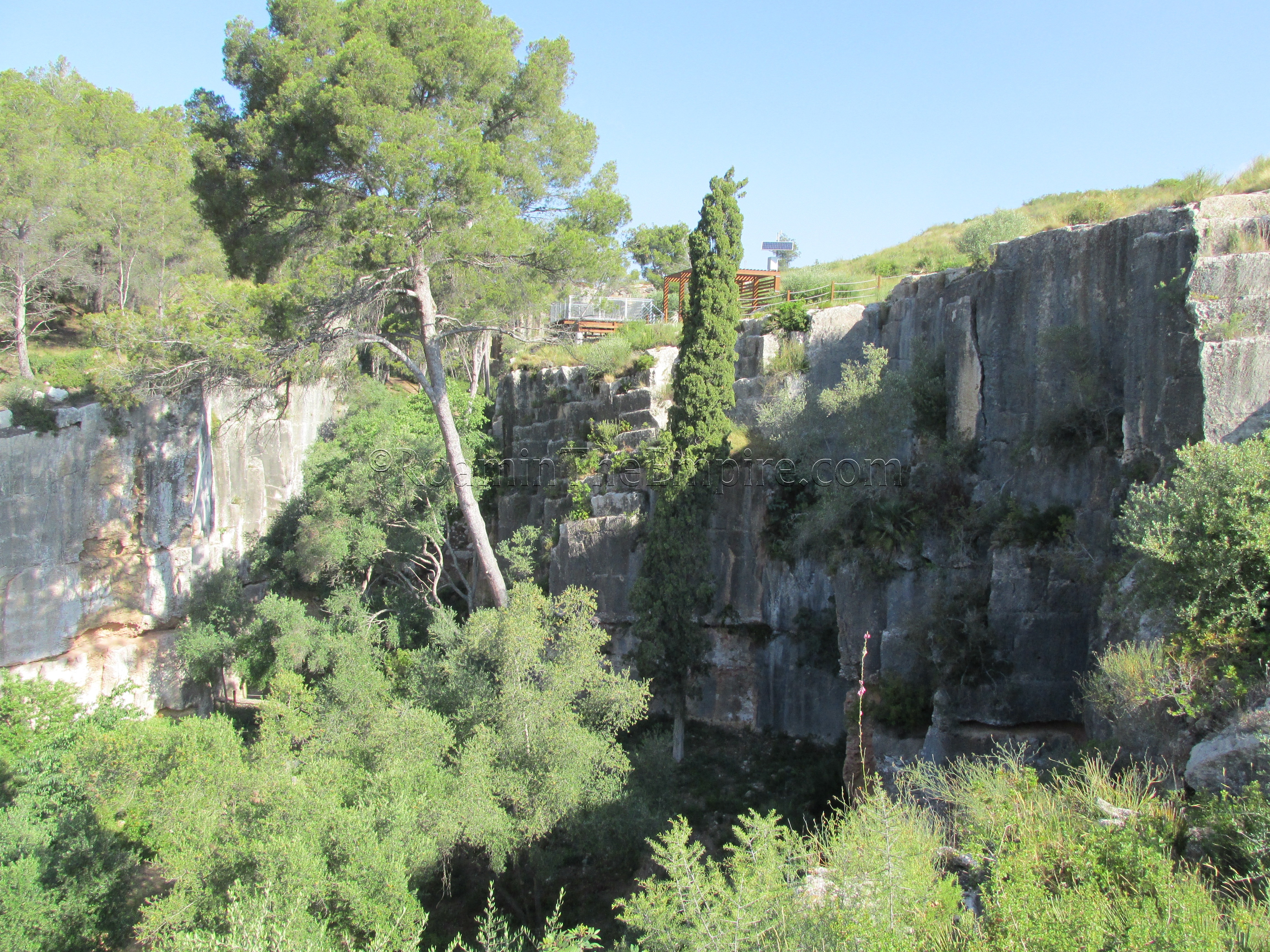
The visitor’s center and the entrance to the bottom of the quarry is free, but are only open Tuesday through Saturday from 9:00 to 14:00. Unfortunately, time constraints kept me from visiting between those hours, but, there is a circuit route along the outside of the quarry that gives good views and goes past some additional quarry sites. Access to this circuit route is not limited and it can be accessed at any time.
In all, over 150,000 cubic meters of limestone were removed from the El Mèdol quarry during Roman times. Activity possibly continued at the quarry through medieval times and perhaps even after that. Quarrying activity began here in the 3rd century BCE for the walls of Tarraco and continued into the 2nd century CE, being used for construction of the large monuments such as the circus and amphitheater.
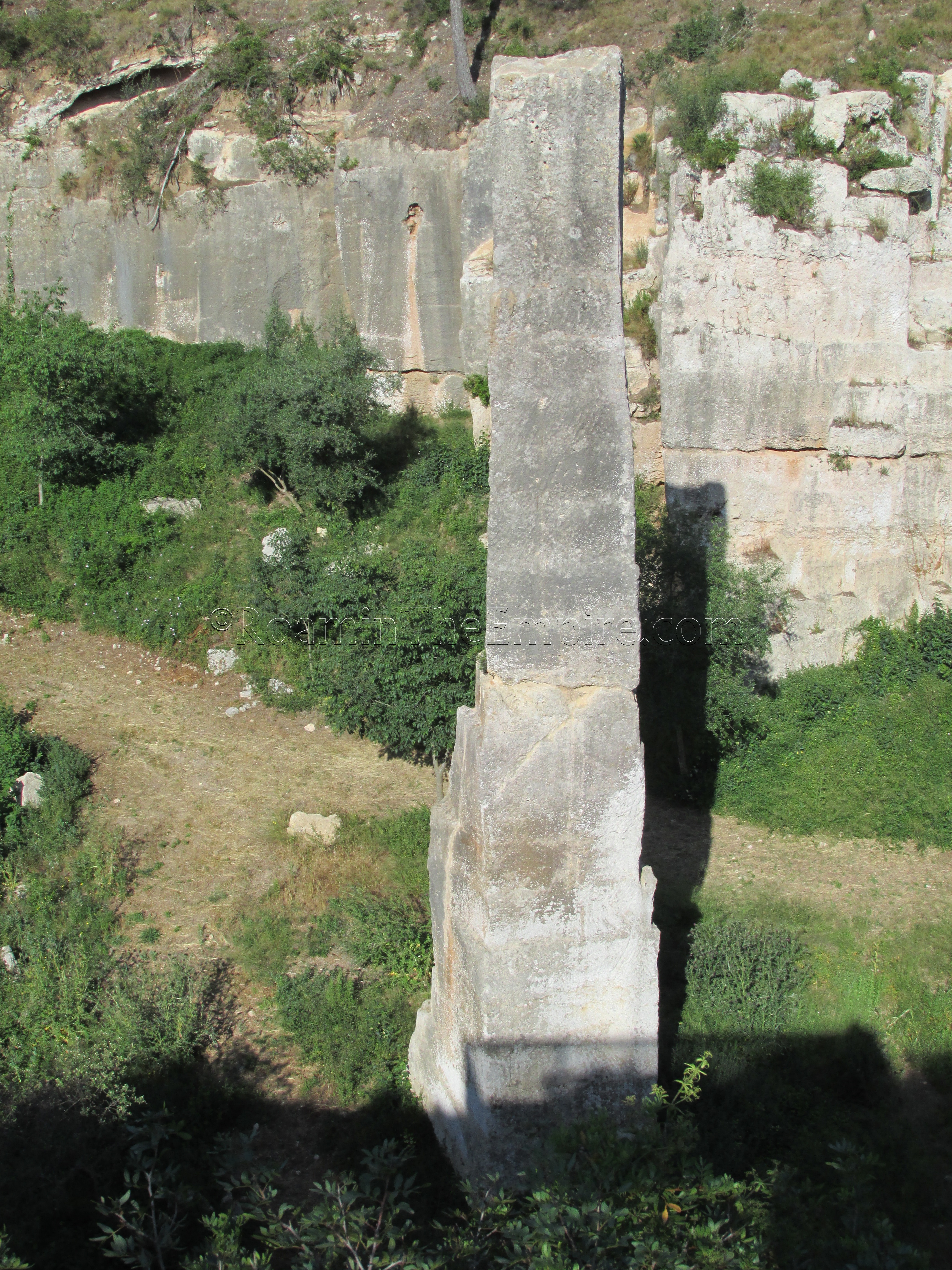
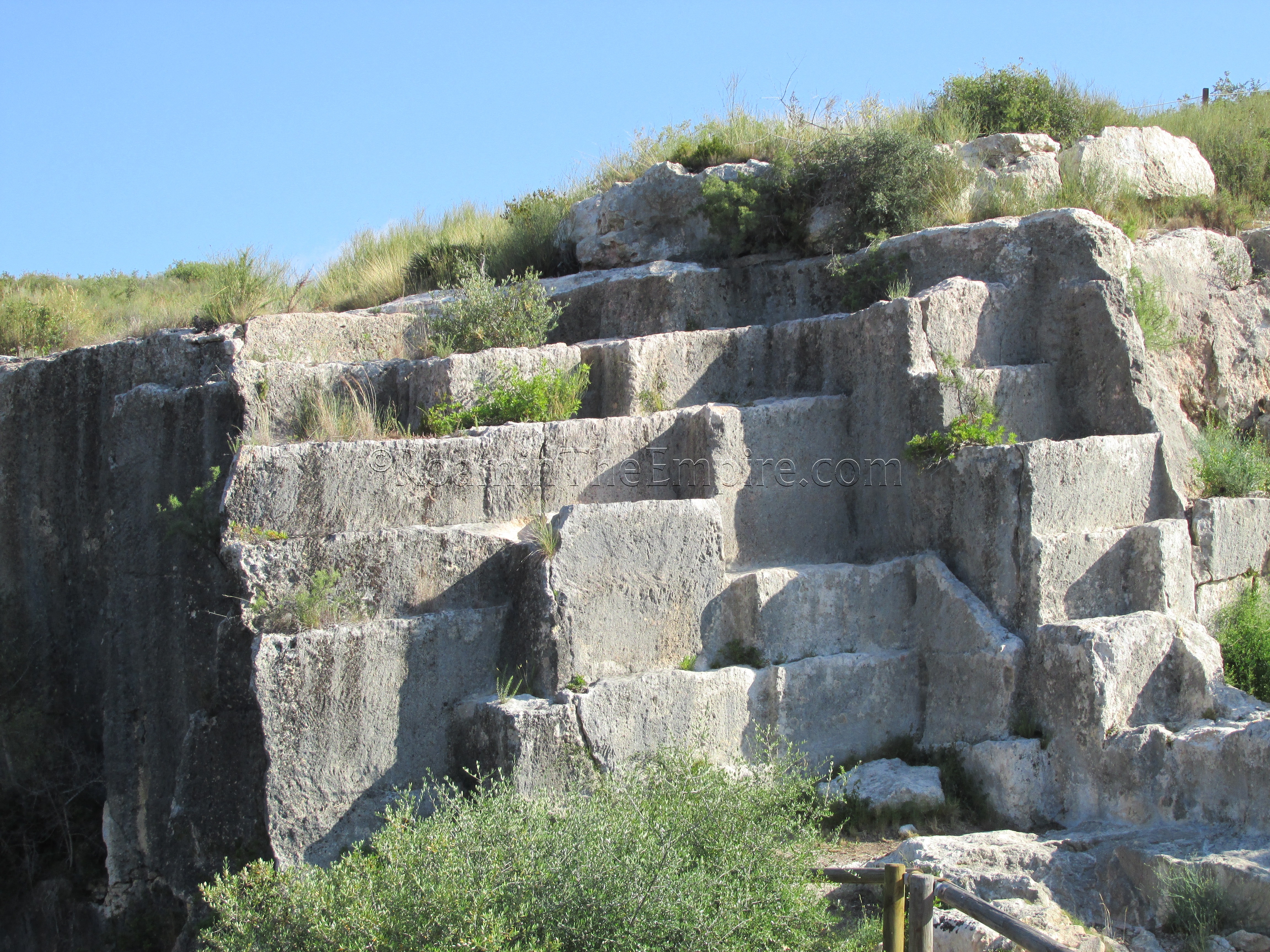
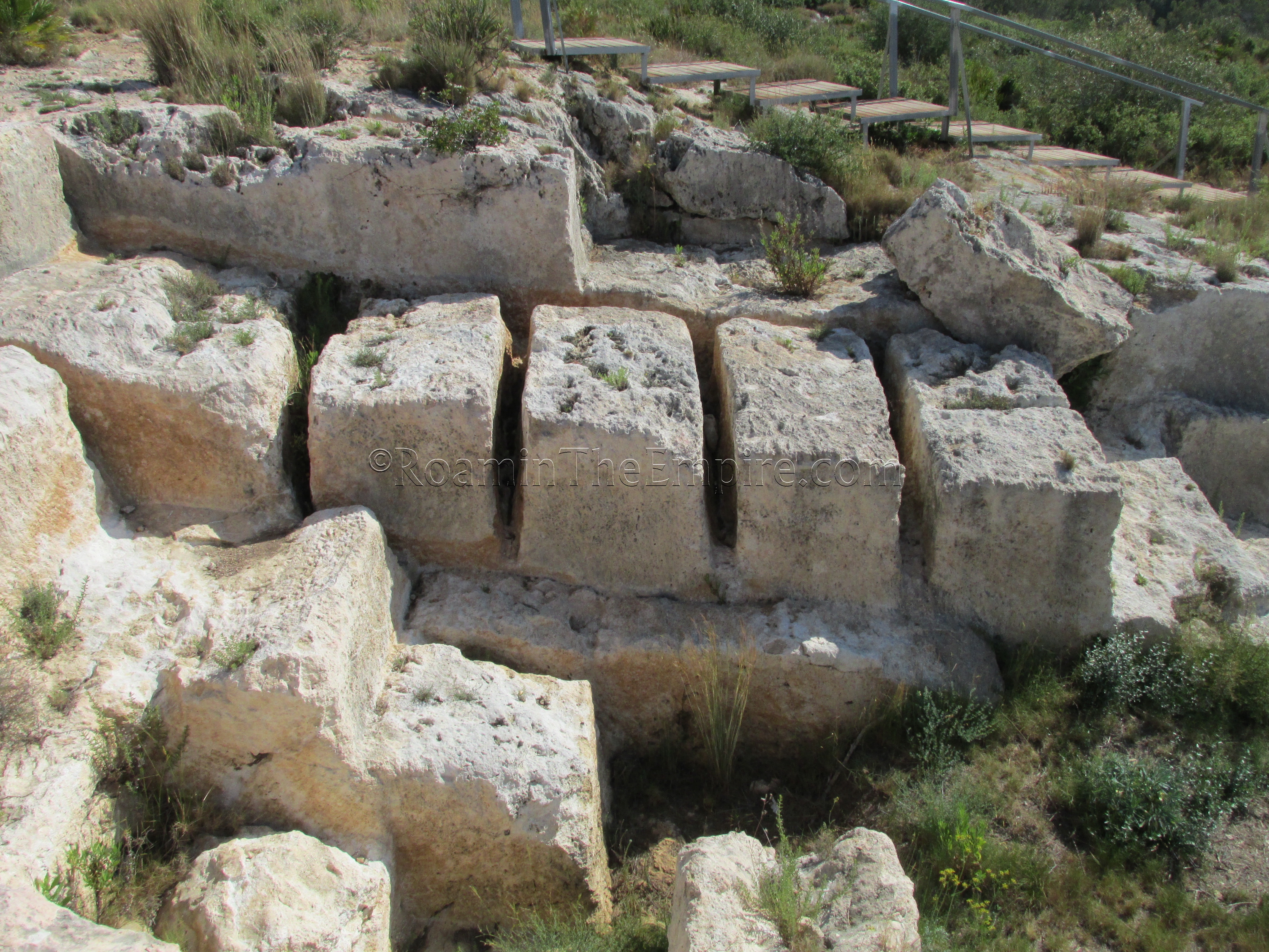
Fortunately there is still plenty to see even if you cannot gain entrance to the bottom of the quarry. A fire in 2010 revealed some of the quarrying activity and debris dumps along the hill to the east of the main quarry. It is this area that has examples of nearly every step of the quarrying process of stone blocks. Quarrying activity is evident all along the exterior, and signs with English, Spanish, and Catalan explain the process and point out interesting features along the route. The most interesting feature, el clot, the needle, is also visible. This 17 meter tall obelisk like object in the middle of the main quarry was kept to show the original level of the stone before it had been removed.
The last site I visited was the Villa Romana dels Munts. To get here, take the train from Tarragona to the Altafulla-Tamarit stop in the direction of Barcelona. Departures are fairly regular, usually at least once an hour, but are not on a periodic schedule, so check the Renfe website for the exact schedule. The journey only takes 7-8 minutes, and it is the first stop out of Tarragona. The fare should be about 2.85 Euros each way. From the train station, it’s about 1.2 kilometer, 15-20 minute walk through town to the eastern side of Altafulla. The villa is open during the summer (June to September) Tuesday to Saturday from 10:00 to 13:30 and 16:00 to 20:00, and on Sundays and holidays from 10:00 to 14:00. The rest of the year it is open Tuesday to Saturday from 10:00 to 13:30 and 15:00 to 17:30 and on Sundays and holidays from 10:00 to 14:00. It is closed on Monday year round. From March to May and in October, it is open a half an hour later in the evenings during the week, until 18:00. Admission is 2.50 Euro.
The villa seems to have originally been constructed in the 1st century CE. In the middle of the 2nd century CE, it seems to have been expanded and renovated, probably while owned by Gaius Valerius Avitus, a duumvir known from inscriptions in Tarraco and whose personal seal was found at the villa. The name is also mentioned on a painted inscription naming the owners of the villa, displayed in the museum. Sometime between 260 and 270 CE there seems to have been a fire that destroyed much of the residential area, and from then until the 6th or 7th century CE the villa seems to have functioned largely as a rustic agricultural villa.
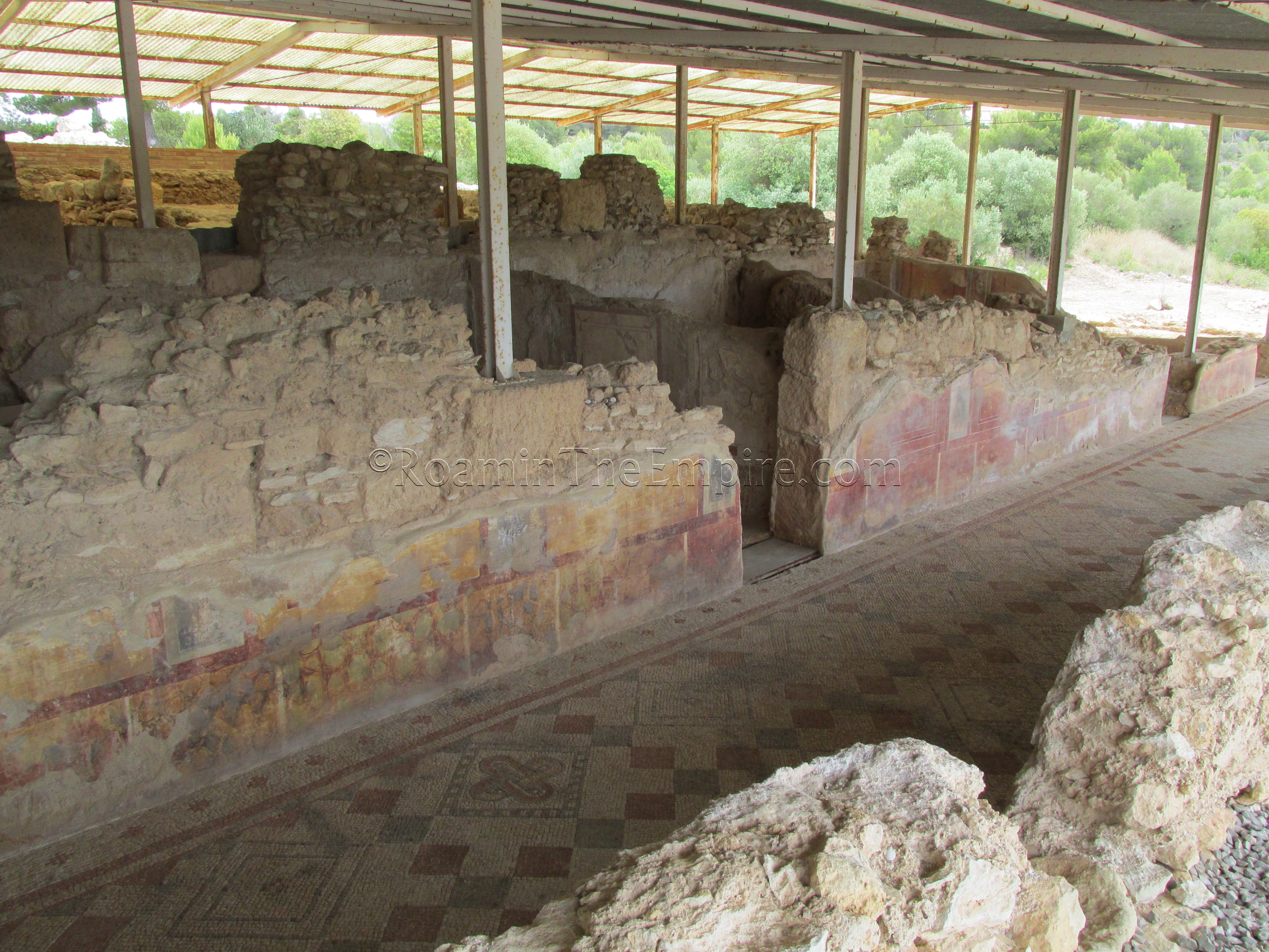
At the entrance there is a small museum with some finds from the villa, including a nice section of painted wall with a painted inscription. Unfortunately the glass over it and the many windows in the room detract significantly from appreciating it. A small model of the remains is also here. When entering, a small English language booklet can be obtained to use while visiting the museum and villa, as much of the information is not in English.
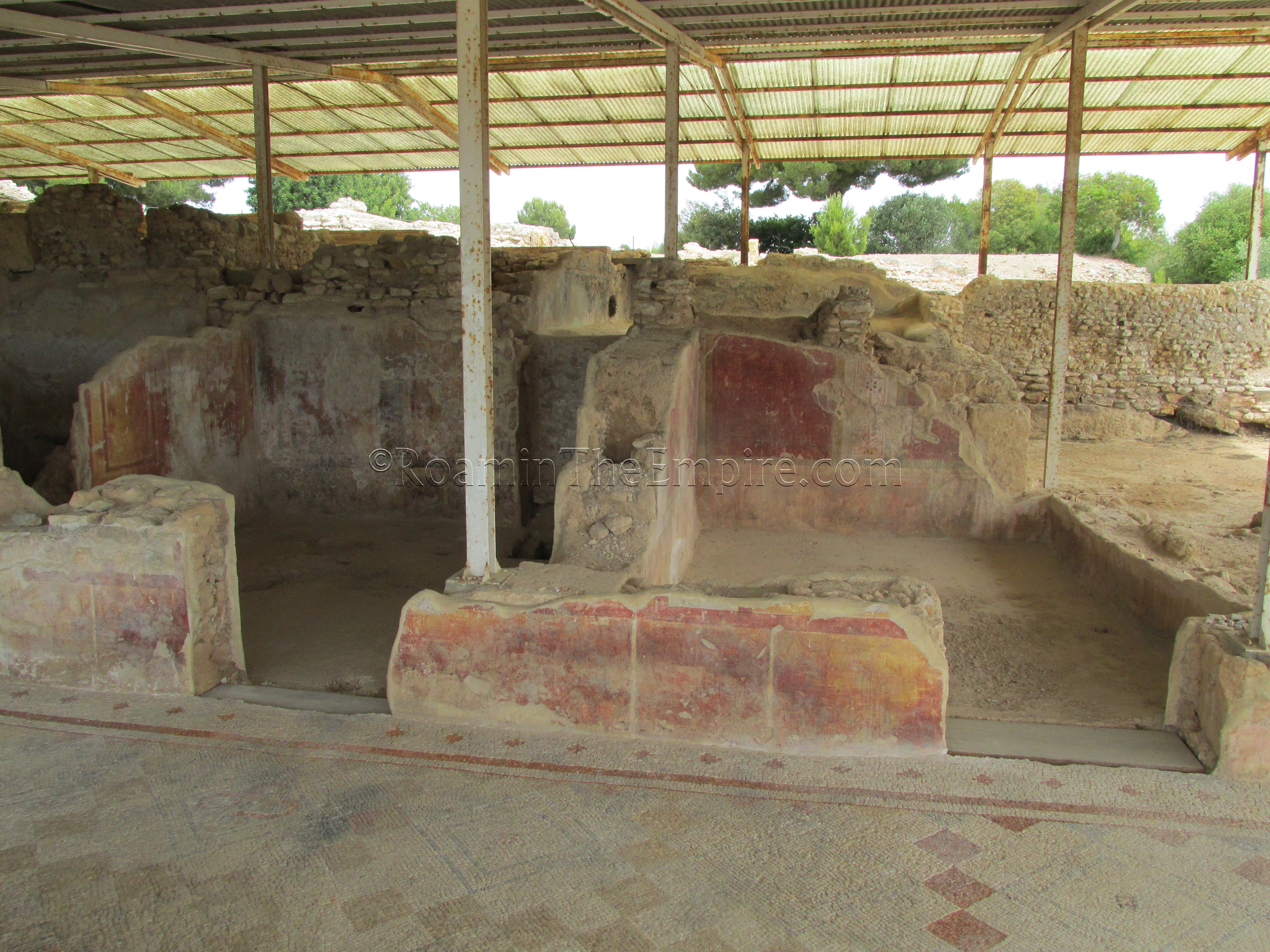
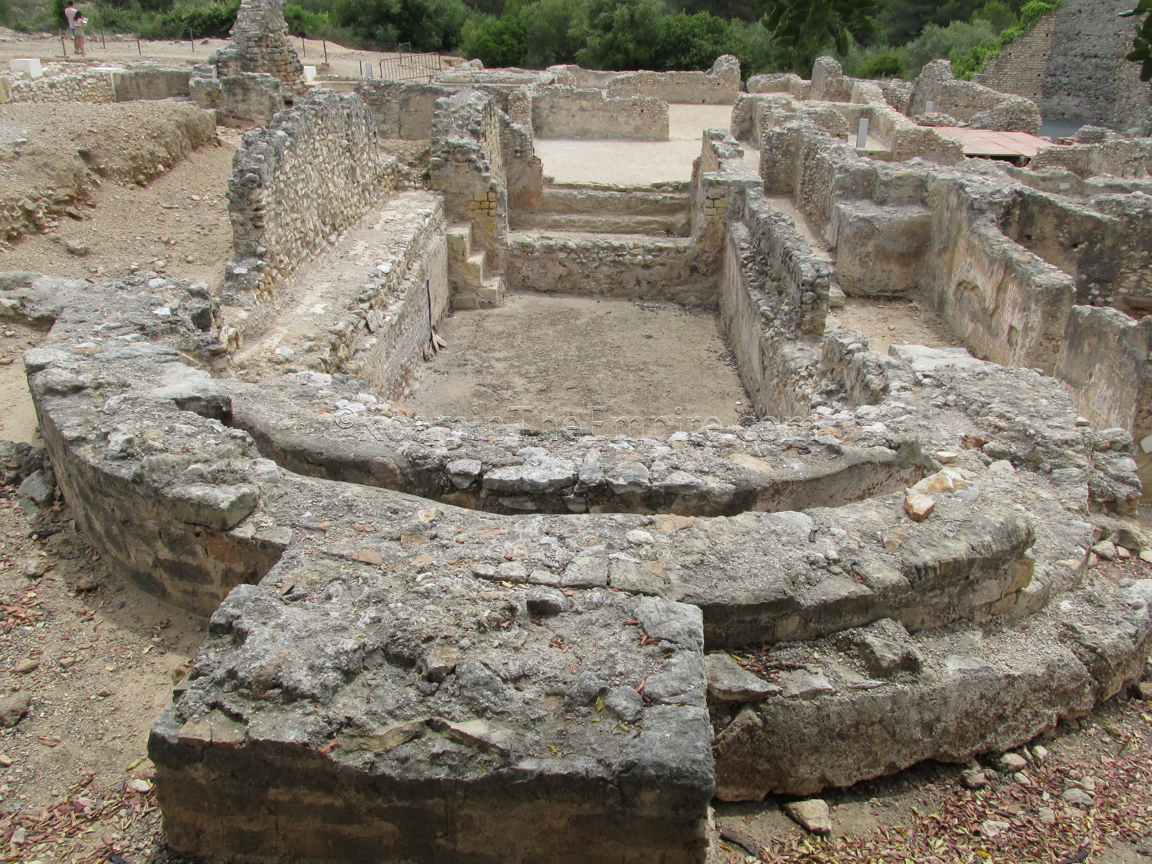
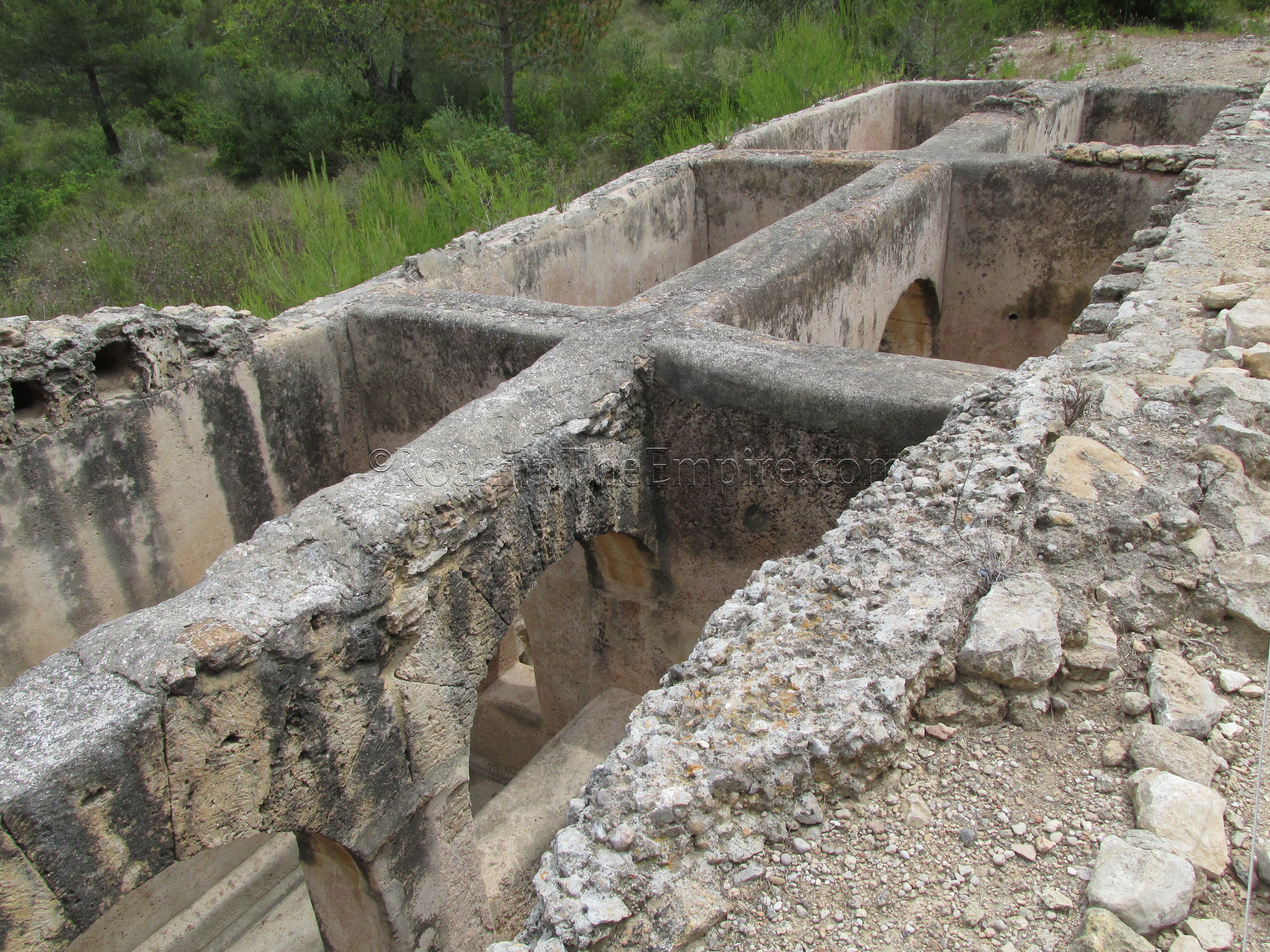
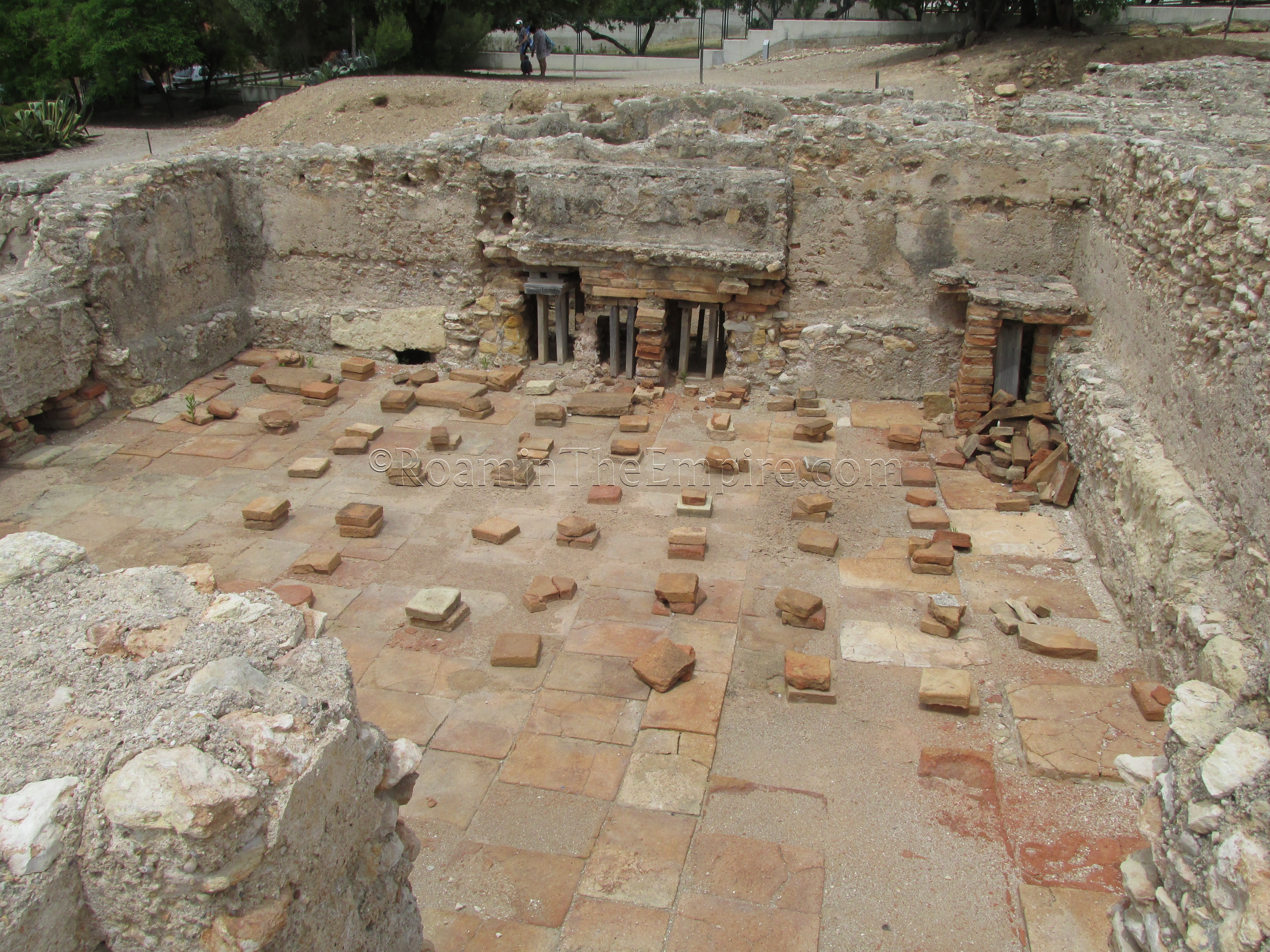
The villa is essentially divided into two primary parts. The furthest north, and mostly covered is the residential section of the villa, which includes a cryptoporticus with nice mosaic flooring and painted walls. Directly behind the covered portion is an industrial production area. Further north are two cisterns, one above ground on the right side of the road, and one sunk into the ground on the left side. The southern section is taken up by a fairly large bathing complex and the residential and bathing sections are connected by a large peristyle area, unfortunately with poor quality modern column reconstructions.
There is one other site near Tarragona that I did not have time to visit, and that is the 4th century Roman Villa of Centcelles. Two factors went into my decision to skip this and prioritize other sites; first that it was the most inconvenient as far as access to public transportation, and second that it was probably the latest of all the sites. The 85 bus could conceivably be taken into Sant Salvador and then about 3.5 kilometers of walking each way (possibly less if a shortcut over the Francolí River can be taken, though this depends on whether it is running in that area). Unfortunately, I can’t speak from personal experience as to the feasibility of either of the routes. In any case, the price and hours are the same as the Villa Romana dels Munts.


Sources:
Cassius Dio, Historia Romana, 53.25.
Curchin, Leonard A. Roman Spain: Conquest and Assimilation. New York: Routledge, 1991.
Fishwick, Duncan. “The ‘Temple of Augustus’ at Tarraco.” Latomas, vol. 58, no. 1, 1999, pp. 121–138.
MacKendrick, Paul. The Iberian Stones Speak: Archaeology in Spain and Portugal. New York: Funk & Wagnalls, 1969.
Pliny the Elder, Naturalis Historiae, 3.21
Polybius, Ab Urbe Condita, 3.76.
Pomponius Mela, Description of the World, 2.80.
Suetonius, Life of Augustus, 26, 81.
Tacitus, Annals, 1.78.