


Most Recent Visit: August 2015
Quick Info:
Address:
Museo Civico Archaeologico
Via di Villa Adele, 2
00042 Anzio RM
Villa Imperiale Neroniana
Viale Fanciulla D’Anzio, 20
0042 Anzio RM
Hours:
10:30-12:30, 16:00-18:00 (15:00-19:00 in July and August)
Closed on Monday, Wednesday, Friday
Admission: Free
Located about 50 kilometers south/southeast of Rome, Antium is located at the site of modern-day Anzio. According to some versions of Roman foundation myths, Antium was founded by Anteias, one of three sons (all of whom founded Italian cities that bear their name) of Odysseus and Circe, as Anteia. Archaic burials from the 8th and 7th centuries BCE have been found in the area, dating habitation back to at least that point. My synopsis of the history of Antium ended up being a little long, so I have created a separate page page for it here, should you care to read it.
Getting There: Anzio is well connected by train with Rome. The trip takes 1:06 on regional trains and costs 3.60 Euro each way. Trains leave from Termini about once an hour (or more) during the day, typically at 42 minutes past the hour (as of the writing of this). The schedule back from Anzio also leaves at least once an hour, typically at 12 minutes past the hour, though there seems to be a bit more variation. Trenitalia is where to find the full schedule. All the ancient sites in Anzio are within walking distance of the train station.
There are two admission controlled attractions in Anzio; the Museo Civico Archaeologico, which shares the Villa Pamphili with the Museo dello Sbarco di Anzio (which has a website with opening times and such, unlike the archaeological museum), and the Archaeological Park of the Imperial Villa of Nero. Though both are free admission, they do have opening and closing hours, which are scant. The museum is only open on Tuesday, Thursday, Saturday, and Sunday. On those days, it is open from 10:30-12:30, and then again from 16:00-18:00 (15:00-19:00 in July and August). The archaeological park seems to have the same hours, though some tourism sites for the area give longer hours, and there are none posted at the actual site. To be on the conservative side, however, I wouldn’t count on it being open outside the hours I have listed.
Given the constraints of the opening hours, making an outright circuit of the ancient remains and museum without backtracking is rather difficult, not to mention dependent on when one starts out. Since the museum and archaeological park do have controlled admission, it’s advisable to be sure to do those between the hours above. Otherwise, everything else can be visited at your leisure.
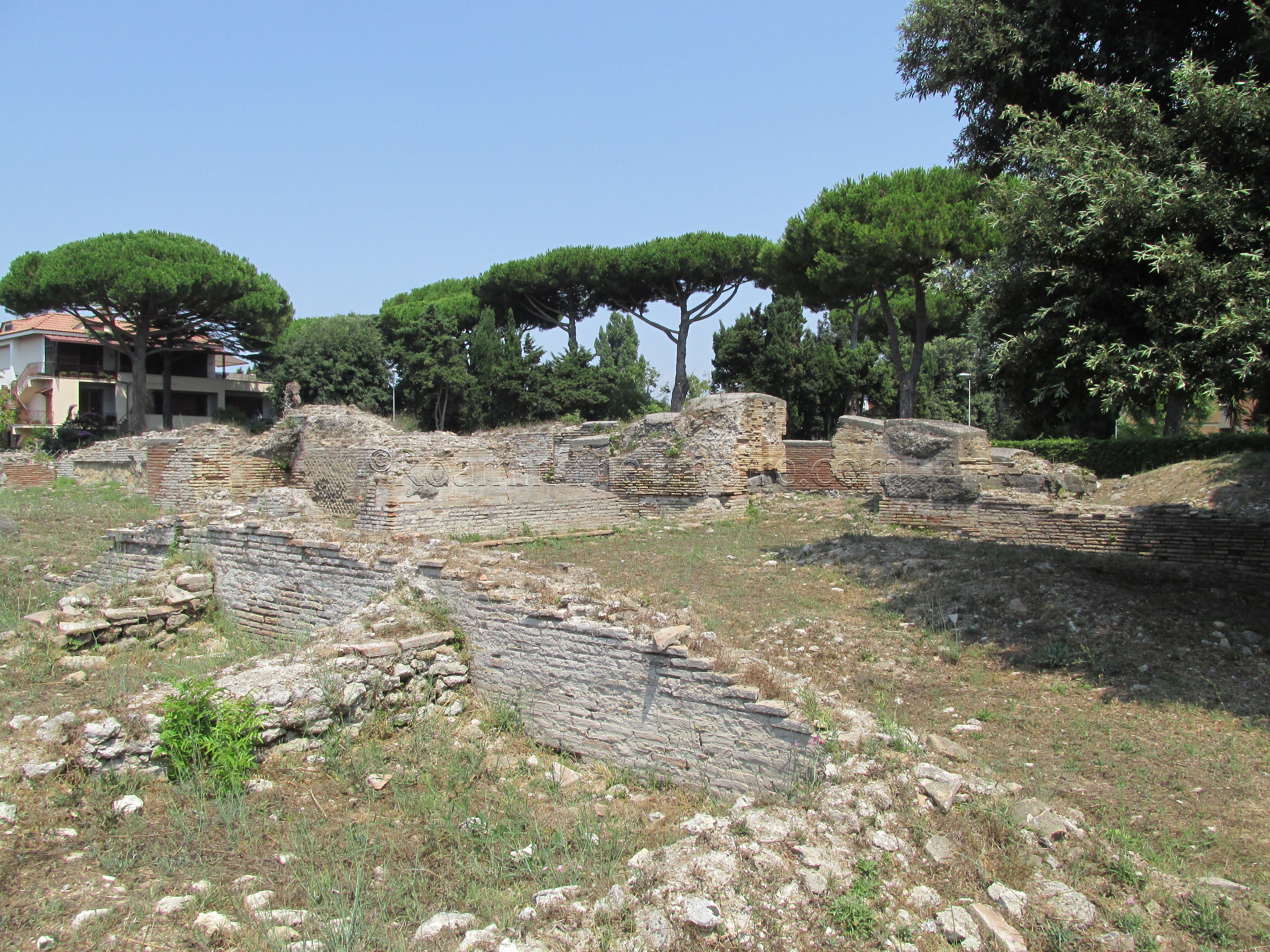
To the north of the train station are the remains of Antium’s theater. To get to it, one must cross over the train tracks, which can be done via a small pedestrian bridge to the west of the train station, or via a road to the east of the train station. I chose the street, because it was the easier to discern route. After the road crosses the train tracks, the first left (west) is Via degli Oleandri, which, after about 30 meters of following it, there is a long staircase on the north side of the road. Take this staircase up, and it will lead out to a small piazza, Piazzale Anteo. Take the road to the right of the exit of the staircase (west), Via Anteo. Follow this road until it comes to an intersection, and take a left (north) onto Via Enea. Via Enea will lead to the remains of the theater, which is on the east side of the road.
The area of the theater is fenced off and can only be observed from the streets running along the west and north of the theater. The form of the theater might be a little hard to discern, as the highest remaining wall is only about a meter above the current ground level. The cavea of the theater is facing west, with the portico behind the scenae running parallel with Via Enea. The on-site placard dates the theater to the middle of the 1st century CE, while information in the museum puts the construction to the first quarter of the 2nd century CE. Kilns dating to the 5th century CE, built after the theater was no longer in use, have also been found in the structure.
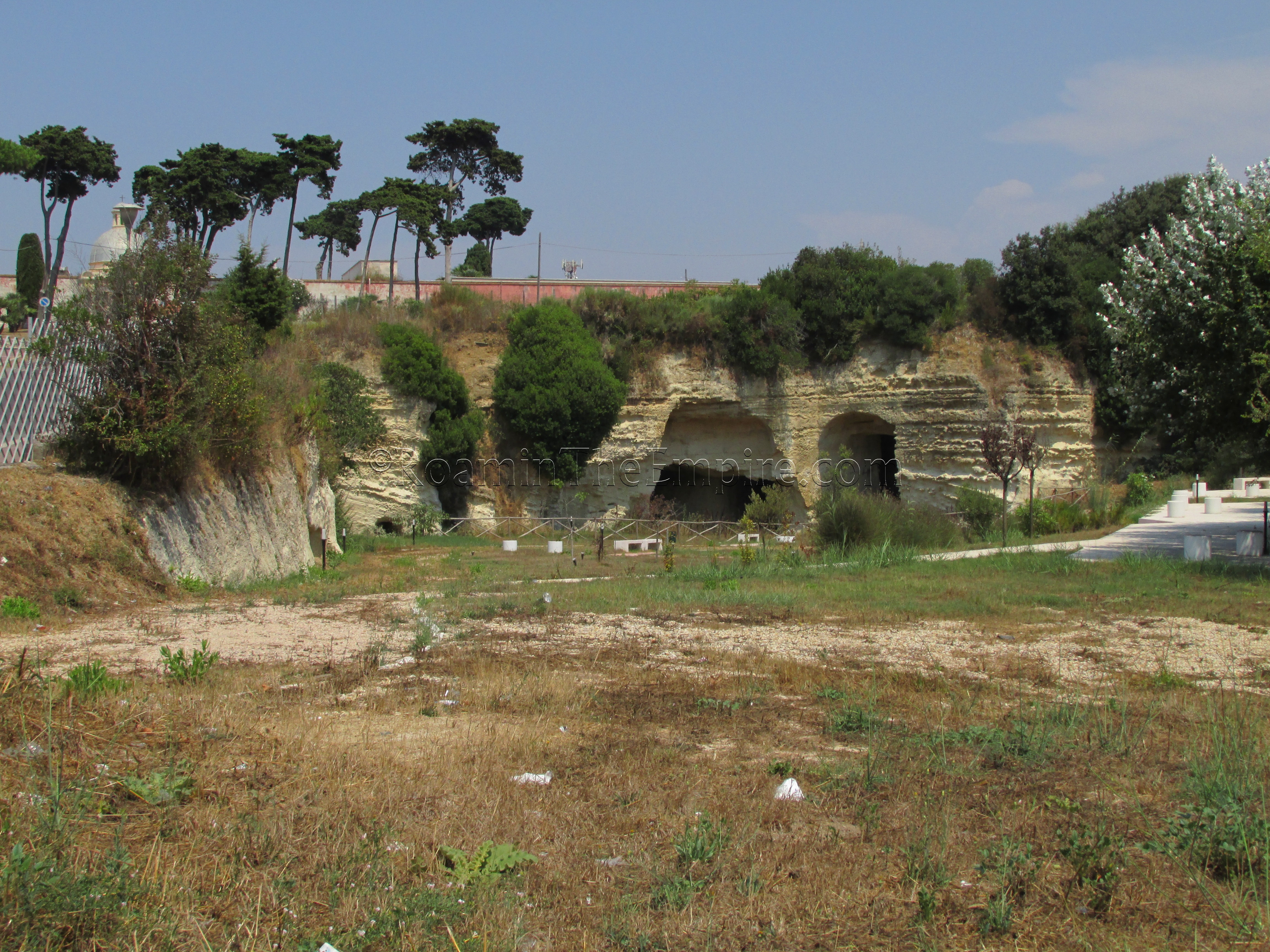
Follow the Via Teatro Romano, the road across from the theater to the west/southwest, past the large church (Santa Teresa) to where the road curves north and heads downhill. As the road reaches the bottom of the hill, on the left side (east) of the road, there is a large fenced off green area with a hill rising up on the northern side. This area is the site of the pre-Roman (possibly Volsci) earthen defensive works. There were a few access points that were closed and didn’t look like they had been open anytime recently, so entrance to the park does not seem to be possible.
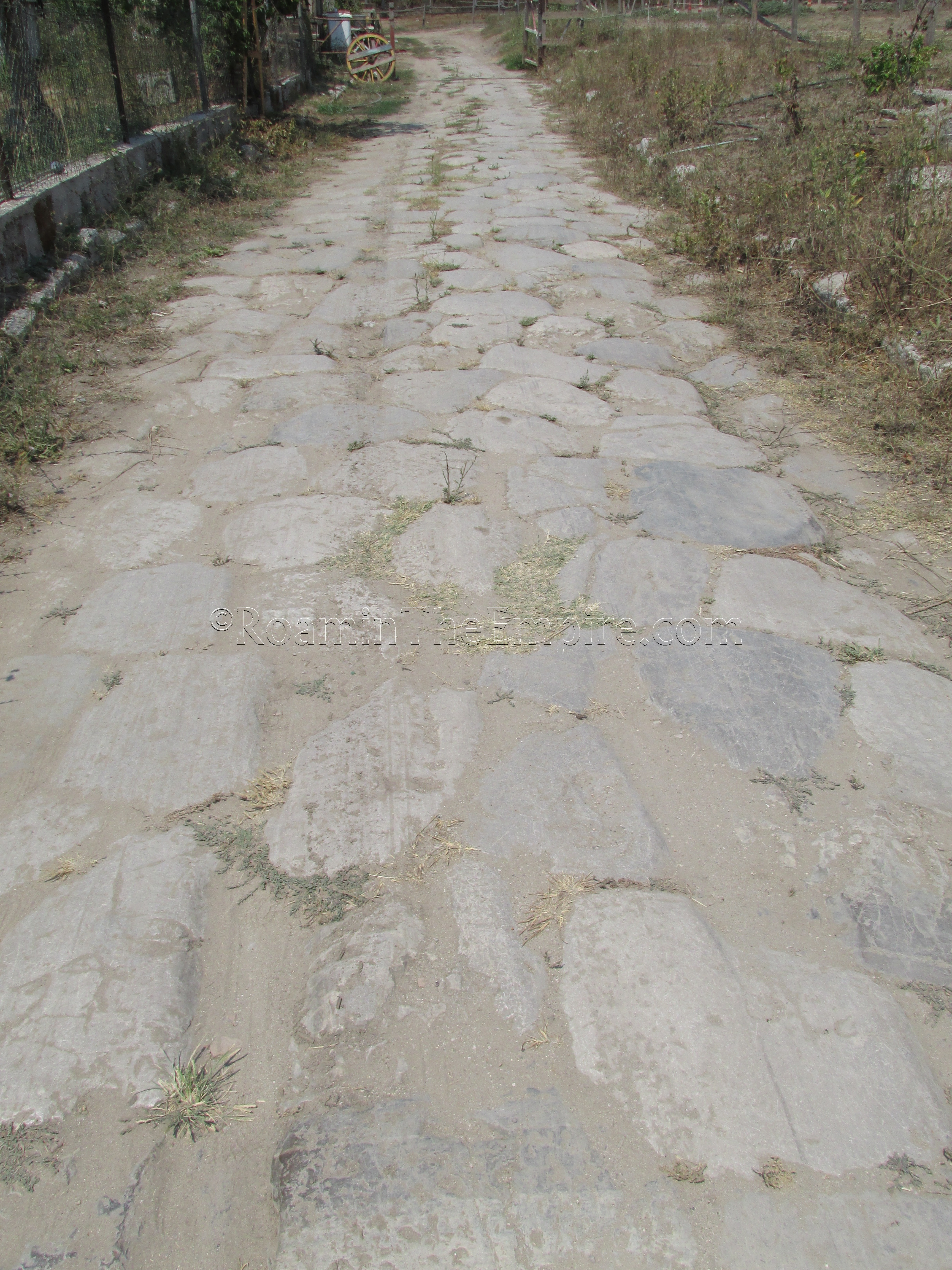
Across the street from the park is a Esso station, and on the other side of the Esso station is a road (Via Nettunese/SR207) that heads back south over the train tracks. Follow this road over the train tracks, and on the west side of the road is a staircase leading down off the road into an agricultural area. At the bottom of the staircase, to the left (north) is a small dirt road that leads a little ways to a stretch of Roman road. Burials found alongside the road date to from the 1st to 3rd centuries CE. Originally thought to be a stretch of the Via Severiana built in the 2nd century CE, it is now believed to be a much older road that connected Antium with Ardea and the villas to the northwest of the city, along the coast.
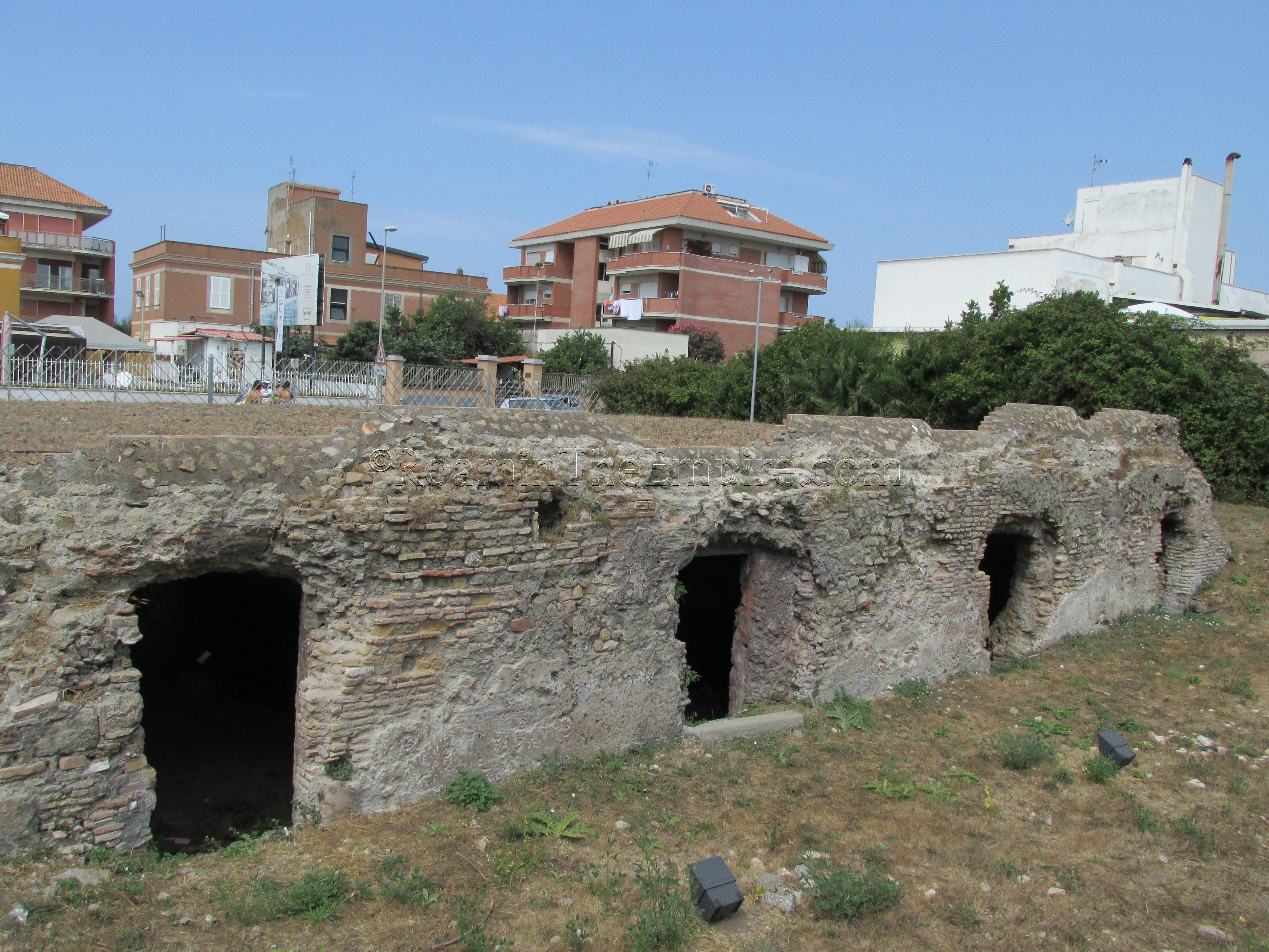
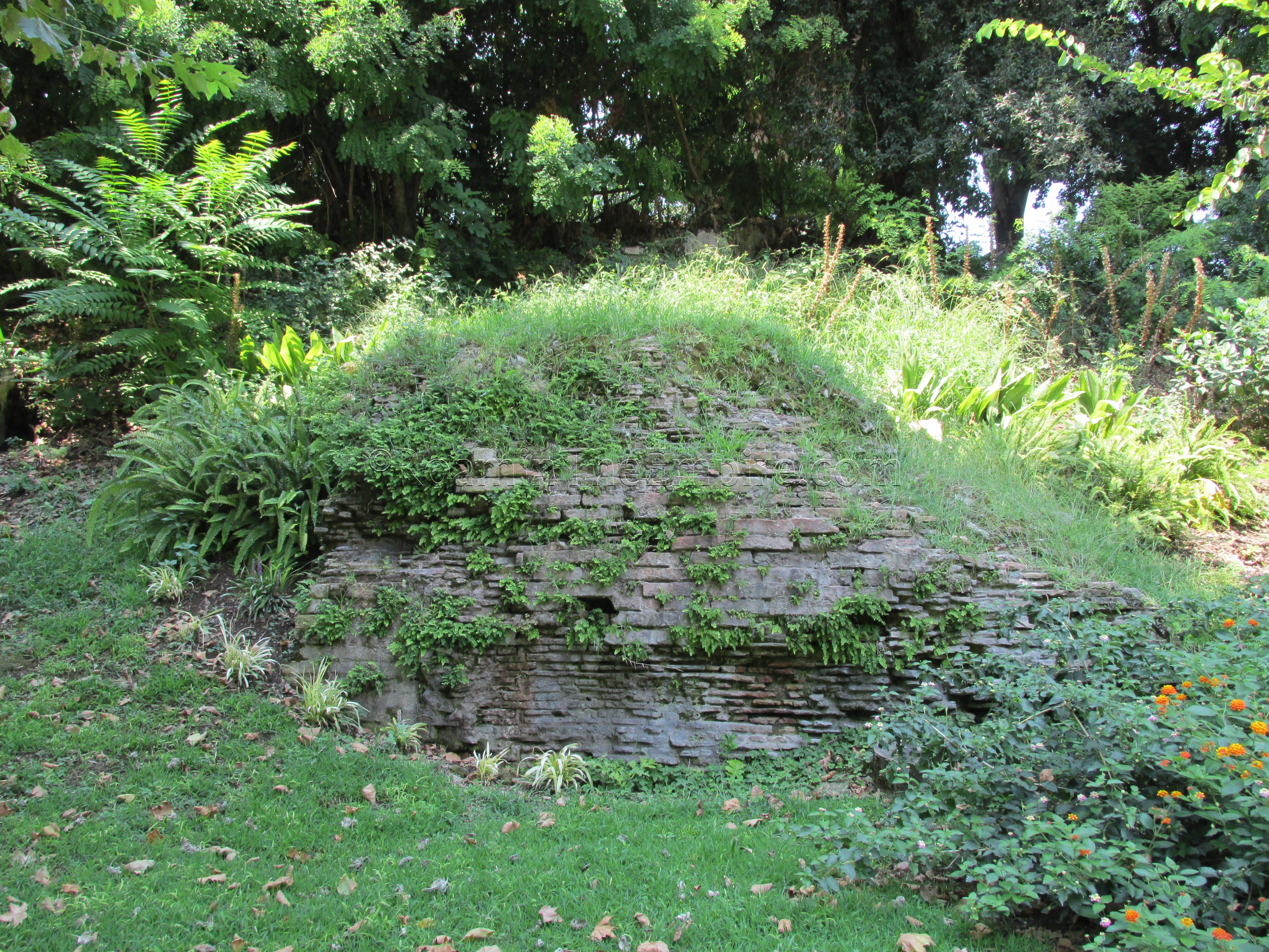
From there, head back on to the small road that meets the foot of the staircase, and head away from the staircase (west) until you meet the cross street of Via Elettra. Continue across the intersection onto Via S. Luigi Orione and follow that road. About 200 meters down the road will be the remains of a cistern on the right side of the road. The cistern was apparently originally built in the Republican period, but was later renovated and partially rebuilt during the Imperial period. The Republican phase, faced in opus reticulatum, doesn’t seem to be visible in its current state of excavation. The cistern originally belonged to a Republican villa, some remains of which are located to the west, but down a private, gated street, and seeming to be entirely on private property.
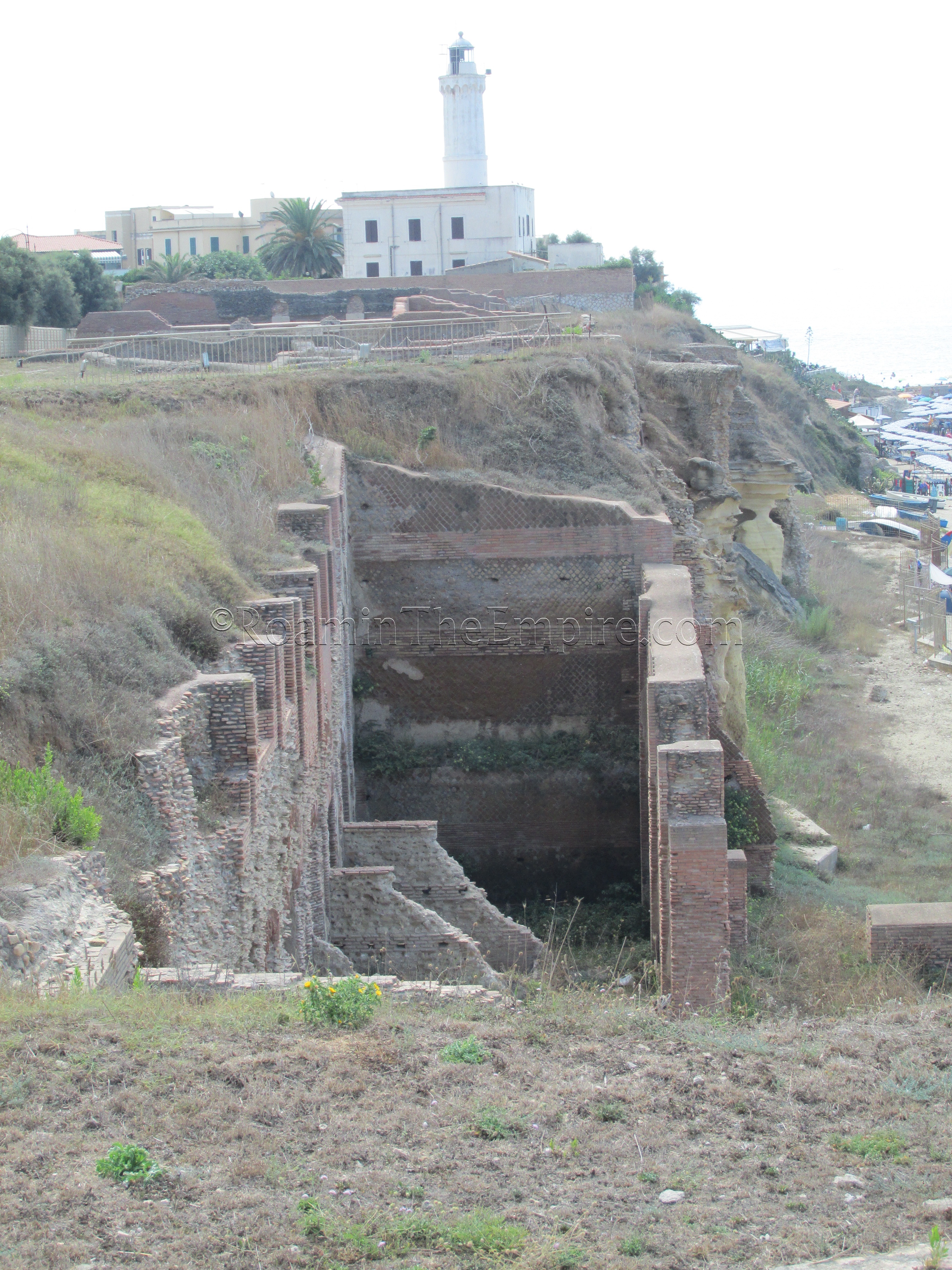
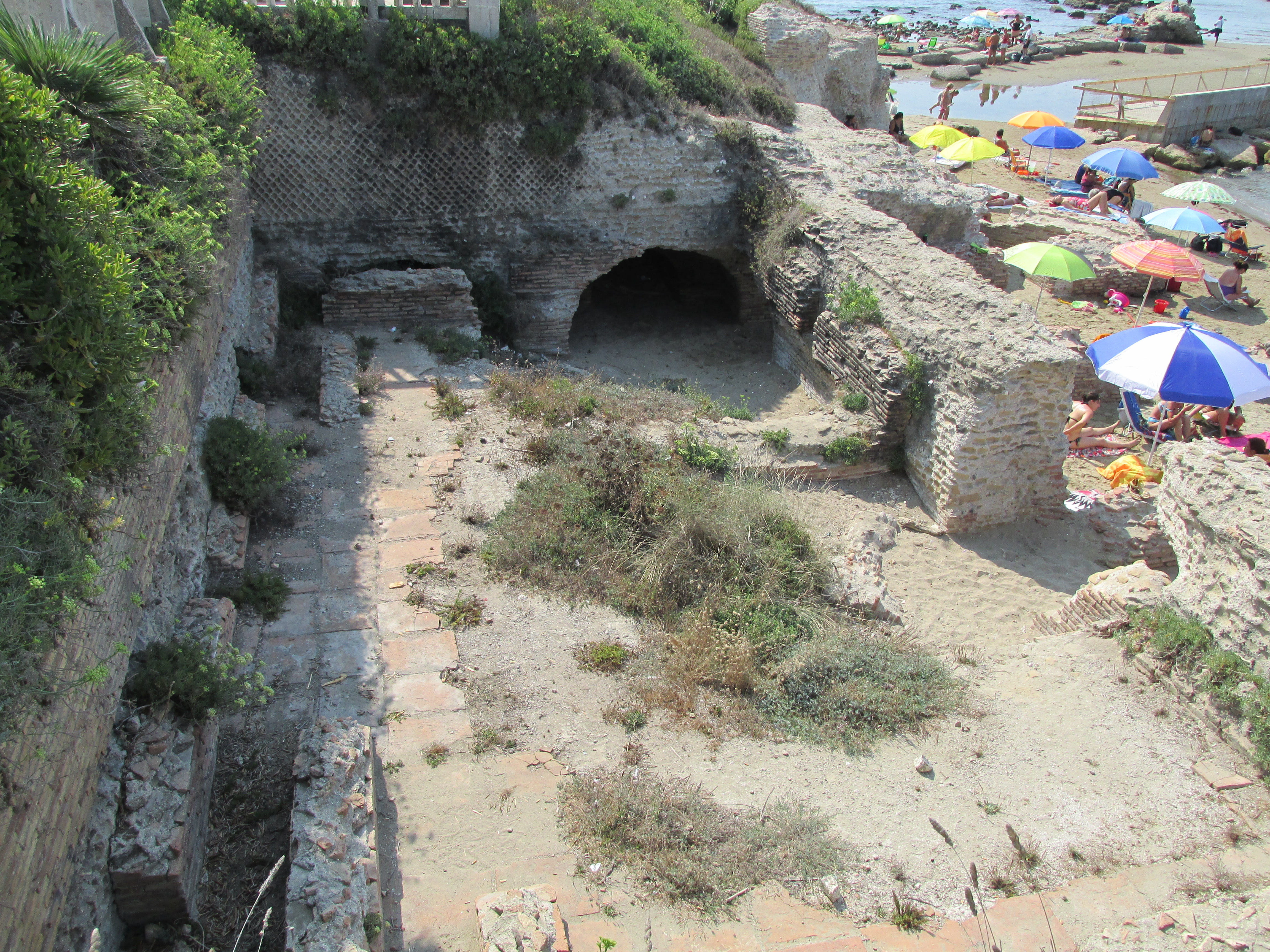
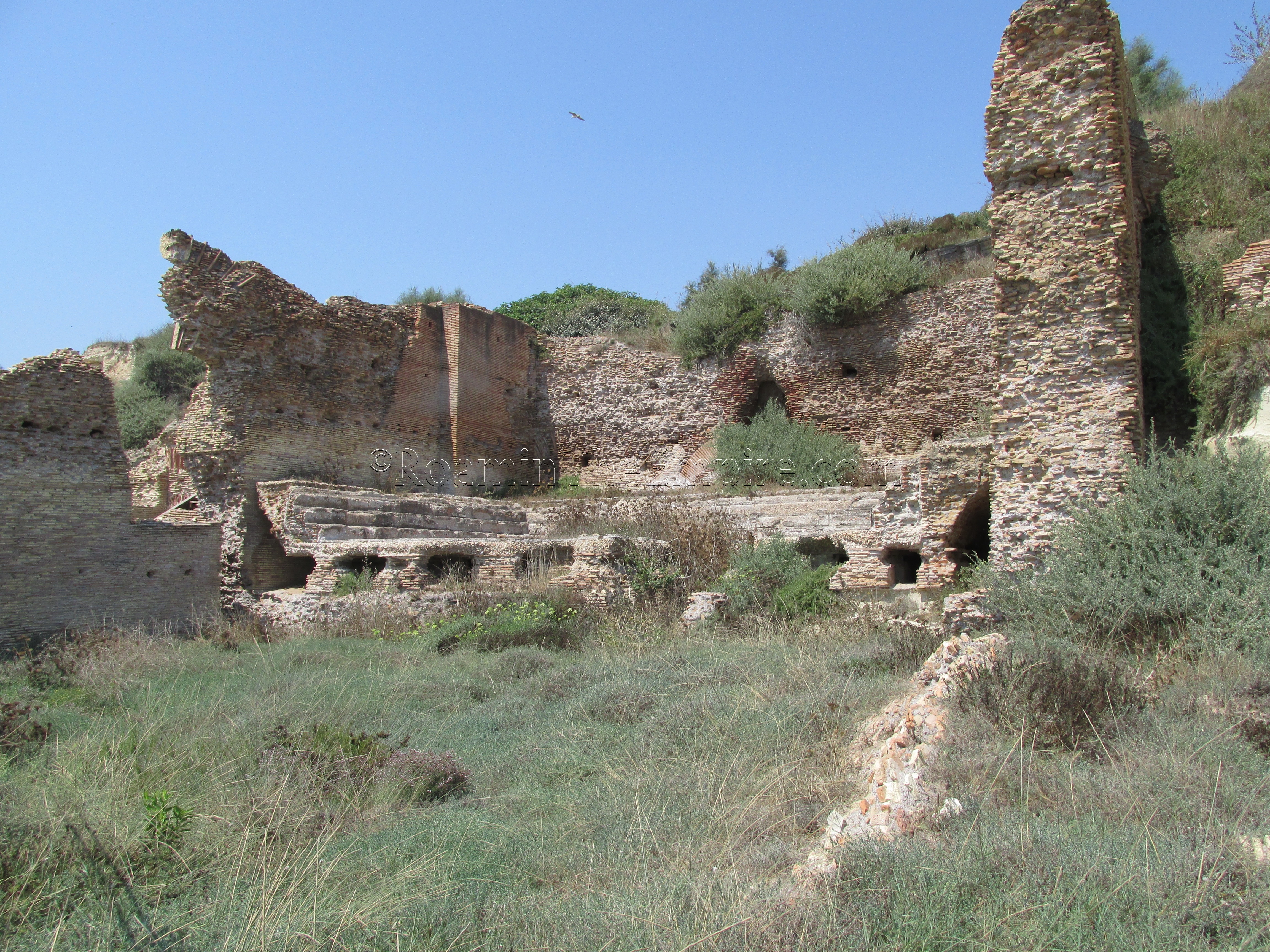
Continue down the road directly across from the Via S. Luigi Orione down the Via Fanciulla di Anzio/SP601 towards the south. About 240 meters down that road will be the entrance to the Archaeological Park of the Imperial Villa of Nero. There is a small interpretive center with a few artifacts and some diagrams explaining the remains of the villa. Once through that, there is a small path that leads to some of the remains to the south of the center. Unfortunately, though, there is no access to the remains in the Arco Muto area. There are a few placards explaining the remains, but the path doesn’t lead a whole lot closer than the public access along the parallel street, though there is one extension that offers a halfway decent view of the remaining structures from the bathing complex and library. Most of this dates to the second phase of Imperial era building, dated to the end of the 1st century CE to the 3rd century CE. The villa seems to have an original construction date of the 2nd century BCE, and was probably belonged to the Octavii family before becoming an Imperial property under Augustus. Some visible remains from the Republican and early Imperial building phases remain, but the vast majority is from improvements made under the reigns of Domitian and Hadrian.
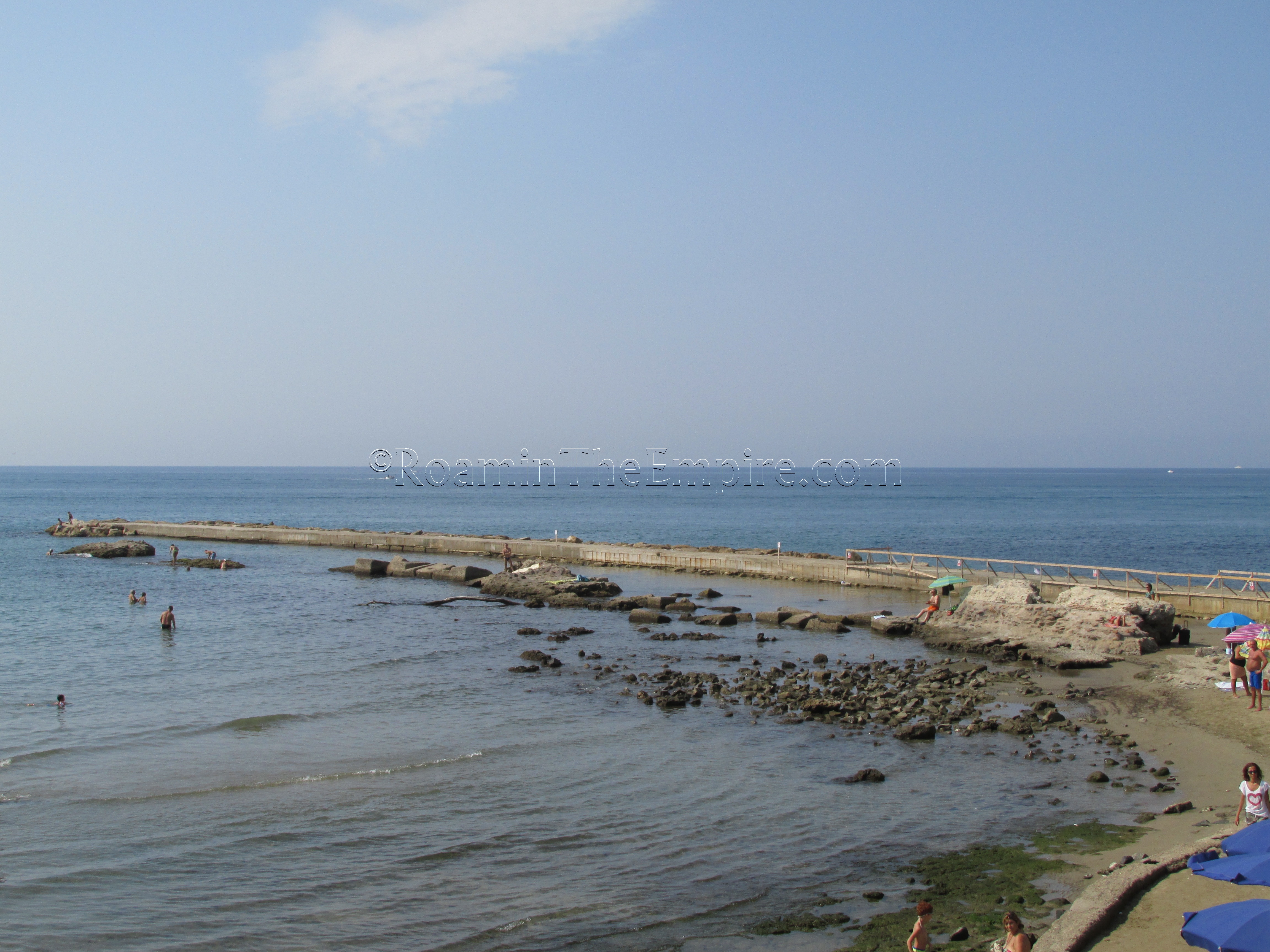
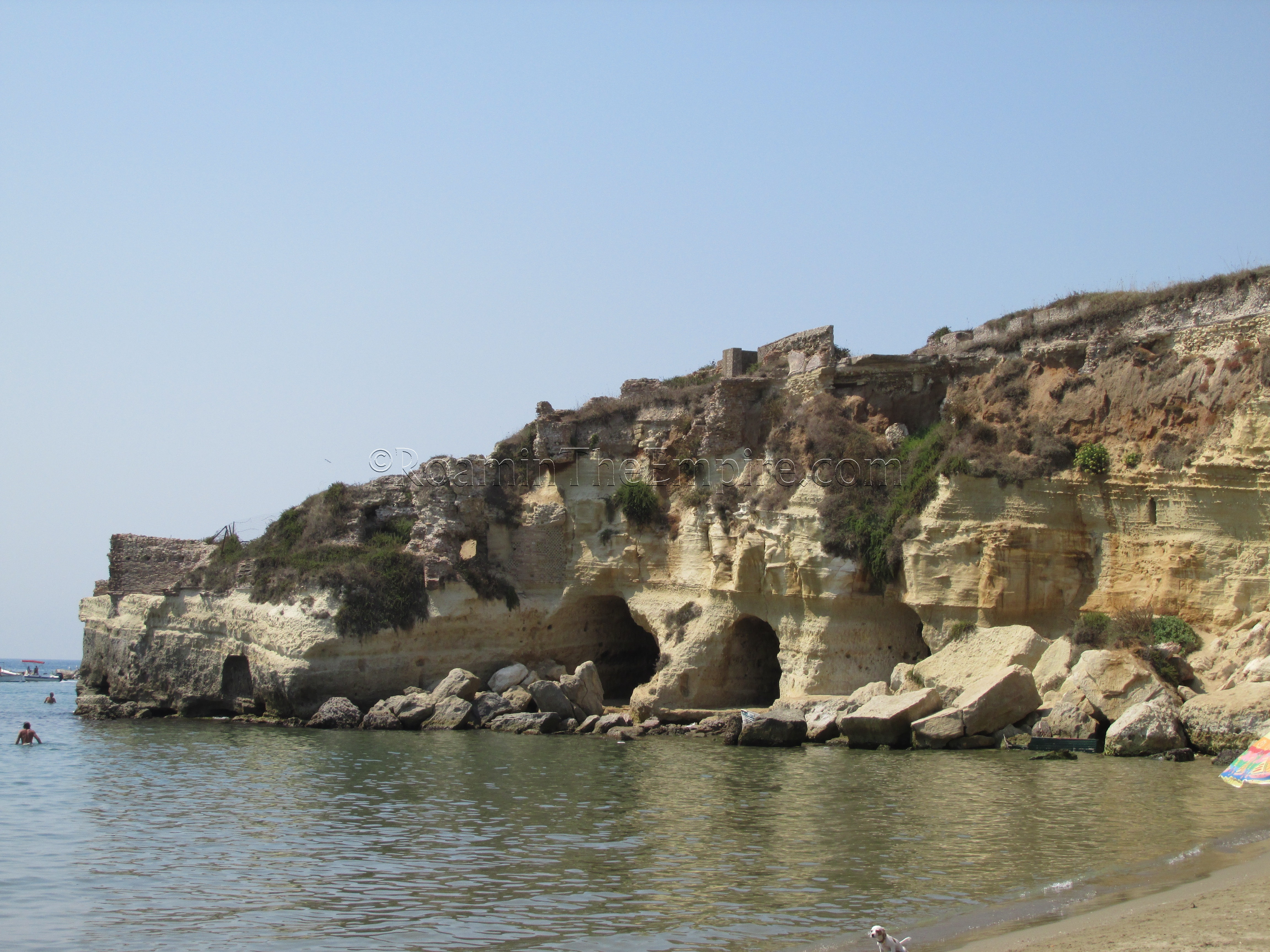
Exiting the park and continuing down the Via Fanciulla di Anzio, more remains can be seen along the street until the first right hand turn available onto Via Furia Anziate. Turning on to this street, a terrace from the Neronian port improvements can be seen along the right (west) side of the street. This street also leads out on to a promontory with a modern statue of Nero, from which a mole from the western side of the Neronian port can be seen running alongside the modern construction (a small portion of the eastern mole can be seen running out from the modern piers to the east as well, at the point in which the modern pier changes from a southern direction to an eastern direction). Below this overlook is the Grotta di Nerone, a series of magazines associated with the port. These can be seen somewhat from the overlook, but can also be viewed by going down to beach level.
Immediately to the east of the point, some structures can also be seen, but nothing really remains between the point at which the western and eastern moles can be discerned. Continuing north up the beach, back towards the direction of the Archaeological Park of the Imperial Villa of Nero, though, a good view of the lower portions of the structures visible from the archaeological part can be seen, including views of the Arco Munta area and that tunnel-like warehouses carved into the rock at about sea level there. Though some people seemed to be able to gain access to the tunnels via the beach or from the water, the lifeguards at the beach generally met attempts to access them, or even swim close to them, with scolding.
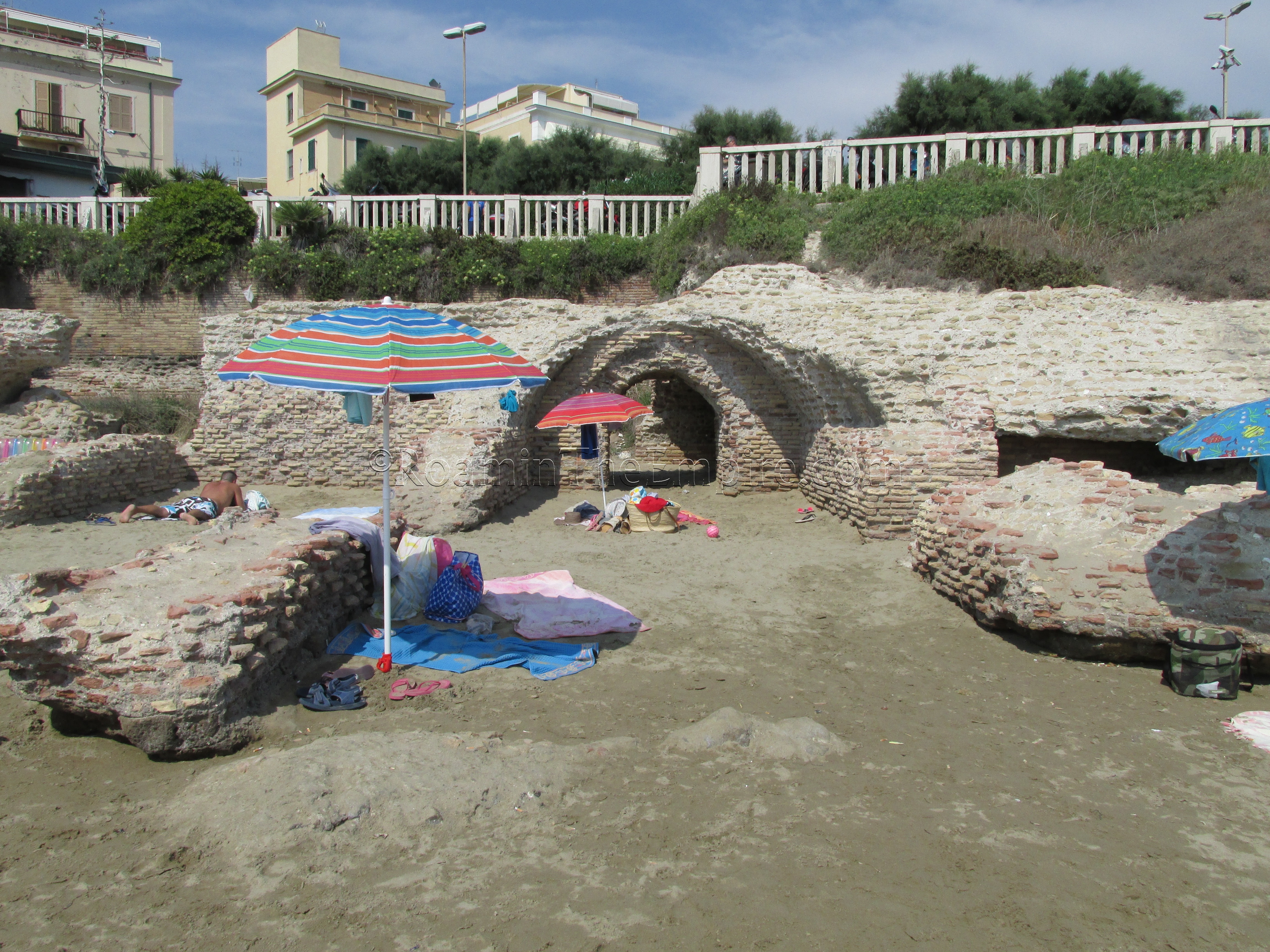
There are a myriad of ways to get back to the final stop, the Museo dello Sbarco di Anzio and the Villa Adele, which is just about 200 meters south on the street leading south from the train station (Viale Claudio Paolini). The easiest way is to head back towards the entrance to the archaeological park, take the next left north of the park entrance, and then take that street all the way to the train station. Going through town is a little shorter and more scenic, though less direct. Within the park that contains the museum, on the path between the southern entrance to the park and the museum, is the fragment of a wall dated to the 1st or 2nd century CE. This seems to be related to the heated room of a bathing complex belonging to a private residence which took up a good portion of the area of the park.
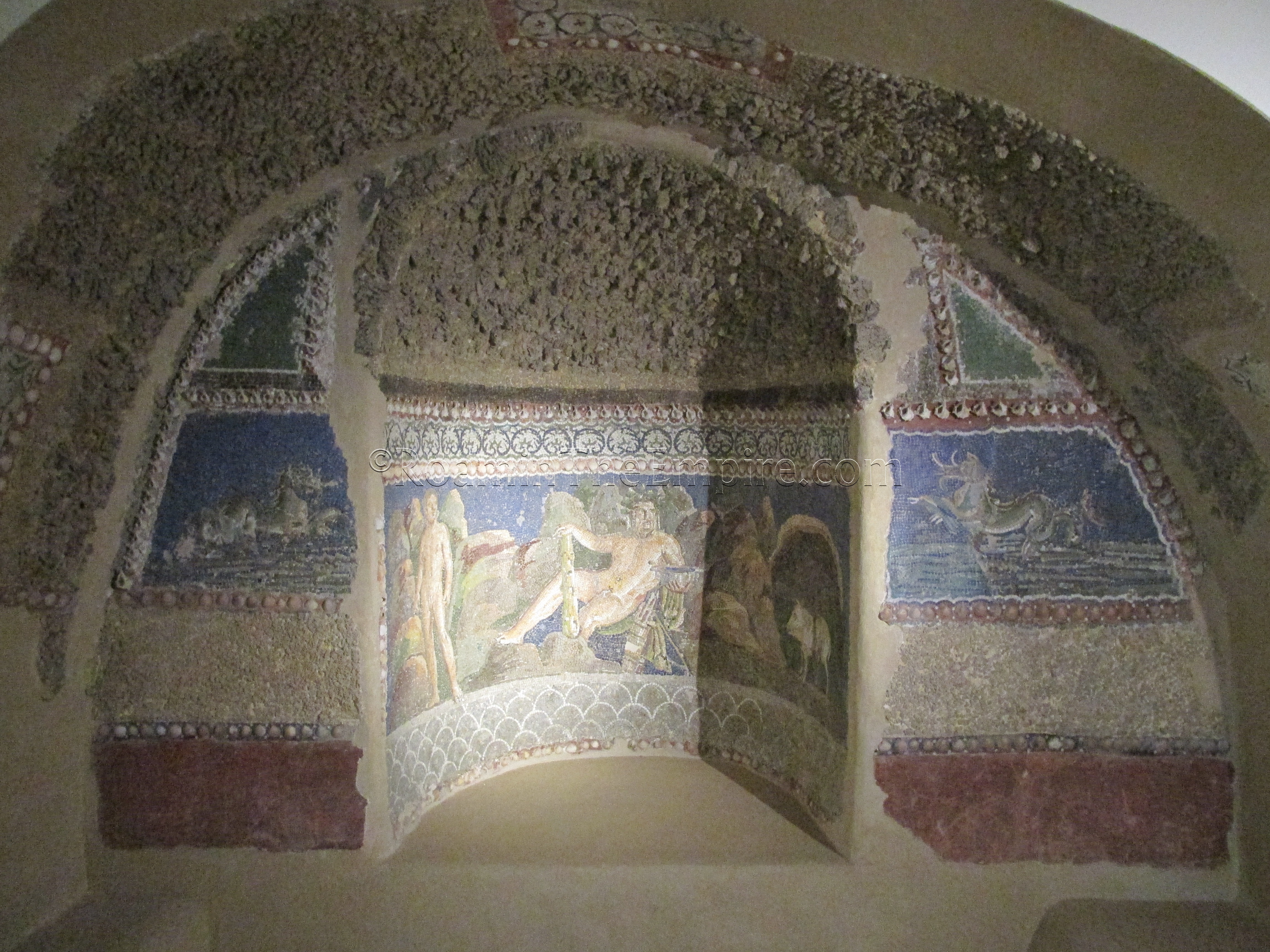
The museum is quite small, overall. There are some very nice pieces, including a large mosaic displayed in the entryway, which is unfortunately devoid of any useful contextual information. There are a few larger pieces of statuary and a few inscriptions, but the bulk of the collection is made up of statuary fragments and smaller finds. One particularly interesting display is the reconstruction of a mosaic fountain with an image of Hercules, found in Anzio, but displayed in Rome until 2008. There are also a few well-preserved sections of fresco, though again, they don’t have any useful provenance information with them. I spent about 45 minutes in the archaeological section of the museum, before being kicked out for the long siesta break. In that time, I saw just about the whole of the archaeological collection there, so it can likely be seen in about an hour at a nice, leisurely pace.
[Not a valid template]Sources:
Dionysus of Halicarnassus, Antiquitates Romanae, I.72.
Livy, Ab Urbe Condita, 2.33, 2.62-3.1, 3.4, 4.59, 6.6-33, 7.27, 8.1-14.
Marzano, Annalisa. Roman Villas in Central Italy: A Social and Economic History. Leiden: Brill, 2007.
Roselaar, Saskia T. Public Land in the Roman Republic: A ASocial and Economic History of Ager Publicus in Italy, 396-89 B.C. Oxford: Oxford U Press, 2010
Scullard, H. H. A History of the Roman world: 753 to 146 BC. London: Routledge, 1980.
Strabo, Geographica, 5.3.
Suetonius, Divus Augustus, 58.
Suetonius, Nero, 6-9.
Tacitus, Annals, 14.27, 15.23.