


Most Recent Visit: May 2021
In the first years of its founding, the water needs of Nicopolis were largely met by the construction of wells and the harnessing of local springs, one near the northern necropolis of the city that no longer runs, and one in the area of the nymphaeum of the Domus of Ekdikos Georgios, which can still be seen. It was originally believed that the aqueduct was built in the immediate years following the foundation of Nicopolis in the late 1st century BCE, or perhaps the very early 1st century CE. This is no longer believed to be the case. As the city grew, however, the water needs increased and in the 1st century CE, probably during the reign of Nero, an aqueduct was constructed to satisfy the growing consumption of water.
Springs that feed the Aphas (the modern Louros River) were chosen as the source for an aqueduct that would run a course of between 50 and 80 kilometers to Nicopolis with a elevation differential of 81 meters between the two. The Aphas itself ran a total course of about 80 kilometers, emptying into the Ambracius Sinus (the modern Ambracian Gulf) not far from Nicopolis. During the reign of Hadrian, renovations and restorations were made to various sections of the aqueduct. By the 4th century CE, the aqueduct had fallen into disrepair, probably due to the barbarian incursions in the area and had become blocked. Claudius Mamertinus makes note in his panegyric oration of 362 CE, that the emperor Julian was the benefactor of a various restorations to Nicopolis, including that of the aqueduct. But, the aqueduct once again fell into disrepair and ceased to function again in the 5th century CE as Nicopolis itself declined.
Getting There: There are various remains of the aqueduct between Nicopolis and Agios Georgios, the modern town near the source of the aqueduct. Given the nature of most of this, a personal vehicle is probably necessary. There might be some kind of local bus service to Agios Georgios at the source, but I’ve found that local Greek bus schedules outside of the major cities can be difficult to navigate and plan for ahead of time.
As previously discussed in Part III of Nicopolis, the aqueduct terminated in Nicopolis at the nymphaea flanking the west gate of the 1st century BCE wall circuit. From there it was distributed to the rest of the city, perhaps with the nearby extant water tower functioning in this task. A water tower near the stadium, uncovered in rescue excavations and no longer visible, seems to have run off the aqueduct to bring water to the area of the stadium and the theater.
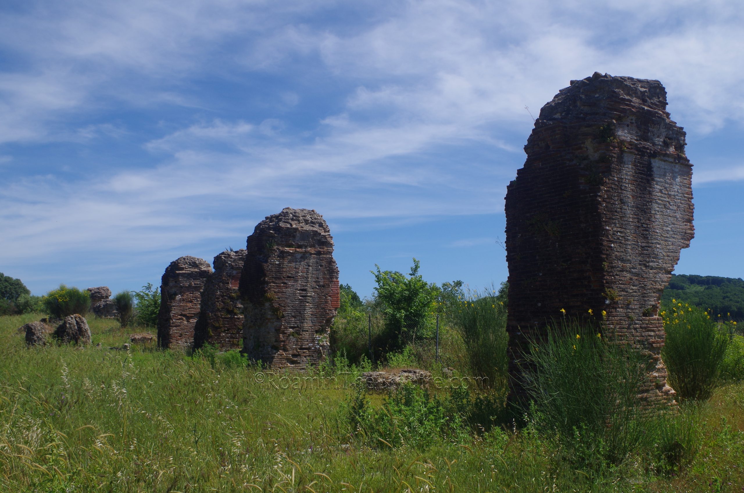
From the center of Nicopolis (the Archaeological Site of Nicopolis), the first remaining, visible vestiges of the aqueduct are about a 15 minute, 12 kilometer drive to the north, near the village of Archangelos, in the community of Nea Sinopi. Archangelos shows up as Nea Sinopi on most mapping engines, but it is the northernmost of the two villages labeled as Nea Sinopi. South of the village, right off the road connecting the National Road Preveza-Igoumenitsa and National Road Preveza-Filippiada, is a significant section of the aqueduct. This spot is sometimes referred to as the Kamares site.
In a field are the remains of thirteen pillars from an aqueduct bridge running from northwest to southeast over uneven terrain that necessitated its construction. More pillars were originally extant, but the construction of the road destroyed some. There are also a few pillars on the other side (south side) of the road, but these are not accessible nor visible from the road nor the main stretch of pillars. A dirt lot at the north end of the aqueduct affords a good place to park. This is also the location of an informational sign in Greek and English about the aqueduct; generally, not about this specific set of remains. The area around the piers is mostly overgrown, but a poorly maintained path allows some access closer to the aqueduct.
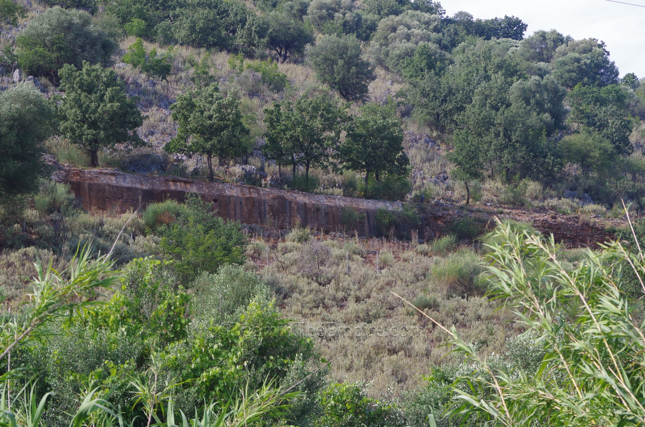
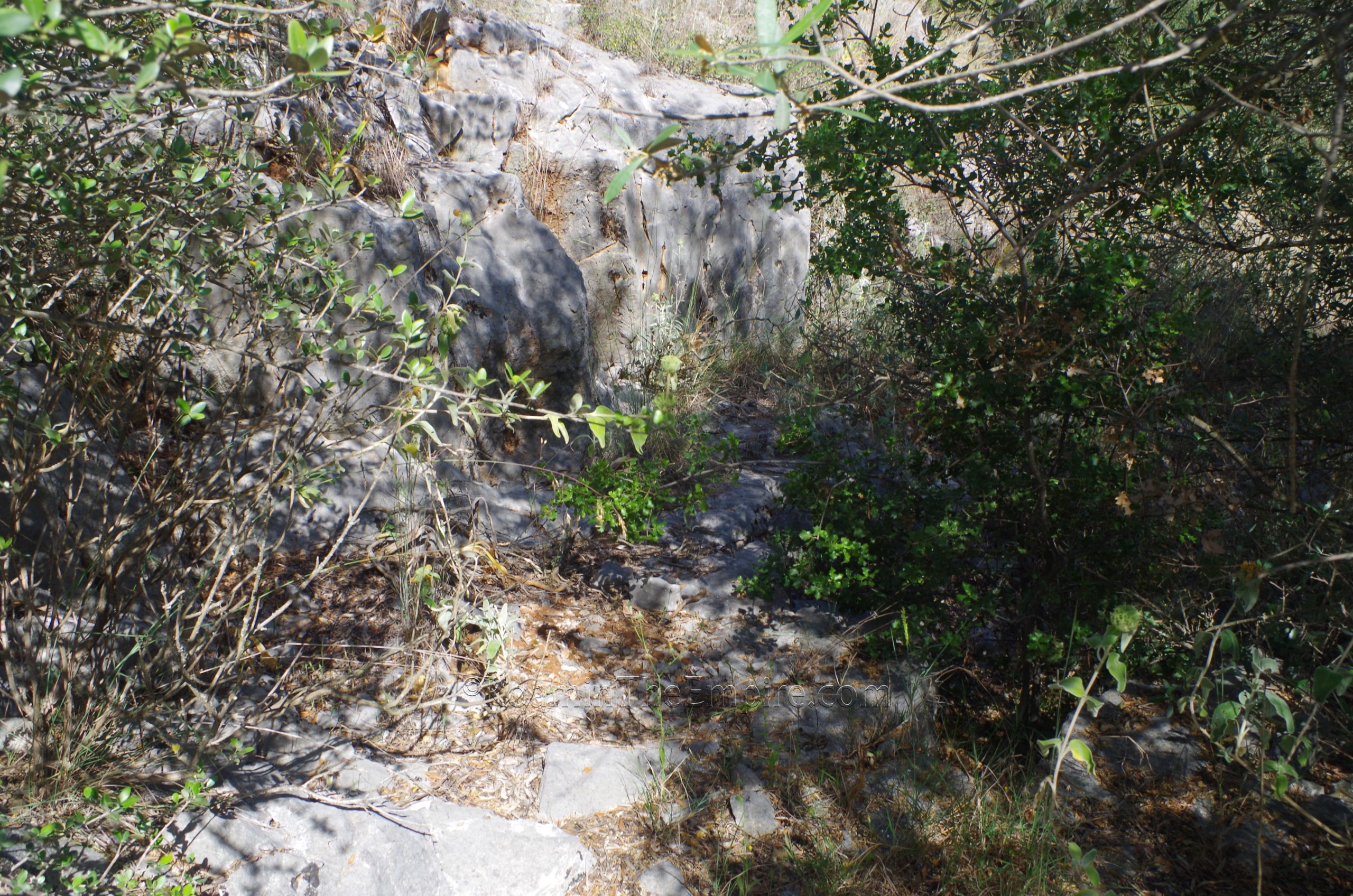
The next section of the aqueduct I was able to find is about an 18 minute and 18 kilometer drive from Archangelos, between the towns of Louros and Stefani Preveza. On the hillside that runs along the north side of the National Road Preveza-Filippiada the course of the aqueduct can be seen. It is particularly visible on the hillside when approaching Stefani Preveza from the east. Unfortunately, though, I could not find how to get direct access to the remains. There was, apparently, at one time an accessible path leading from the bus stop just west of the intersection of the National Road Preveza-Filippiada and the National Road Dervizianon-Stephanis, but when I visited the path had been crudely fenced off and rather unpleasant looking fellow was tending to the land within the fence and eying me suspiciously whenever I’d get near it. This particularly section consists of the retaining wall for the channel, but the channel itself is not preserved.
There is also supposed to be an access point at the Agia Paraskevi church located on the hillside just outside Louros, to the north. Here too, I was unable to find said path that was supposed to lead from the church to the aqueduct channel. So, unfortunately I was left with having to view the aqueduct from afar, but it is definitely there. This western part of this stretch of the aqueduct preserves the channel, apparently, though.
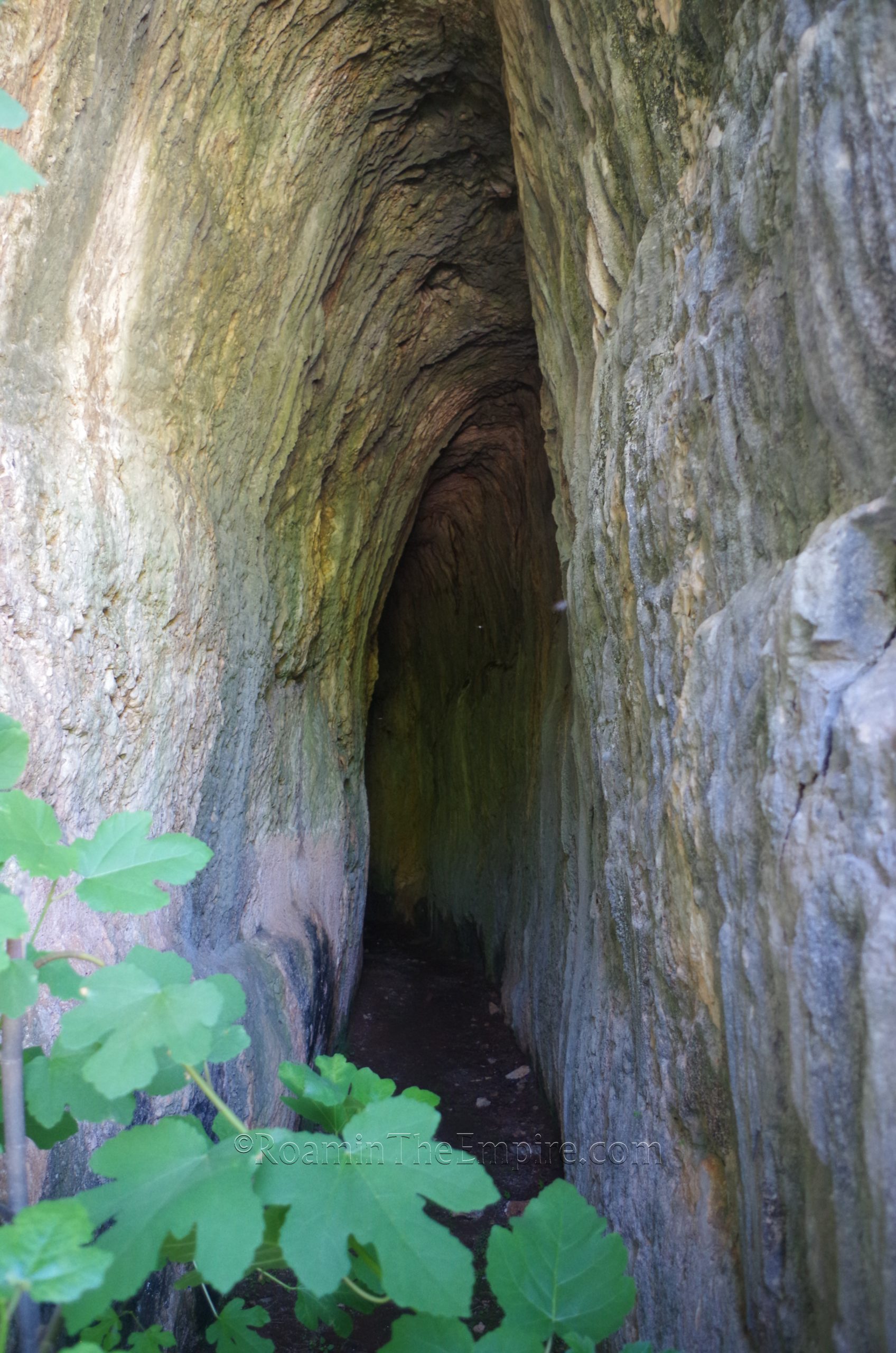
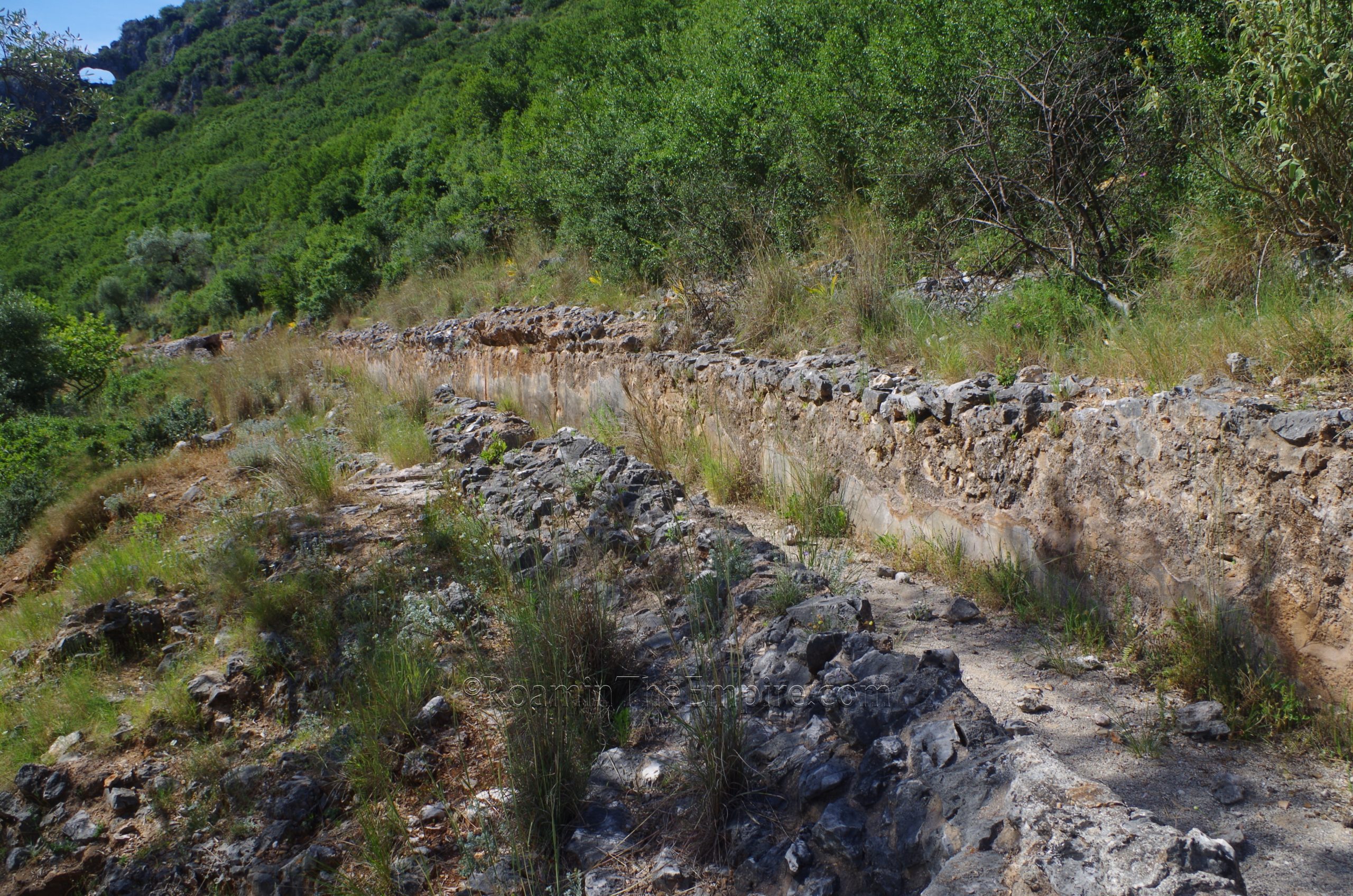
Continuing on the National Road Preveza-Filippiada past Filippiada and on toward Ioannina for 26 kilometers and about 25 minutes, the next stop is just before Agios Georgios. On the west side of the road is a tunnel through which the aqueduct traveled. There are places to park on both sides of the road here, though the west side (southbound toward Filippiada) is the side on which the tunnel is, so one doesn’t have to cross the road to get to it when parking on that side. The tunnel is visible from the road, and there are some steps to go up and get a closer look. Right outside the tunnel, some mortar and conglomerate that would have made up the covered part of the channel leading up to the tunnel are visible, as well as cuts in the rock leading up to the actual fully enclosed part of the channel in the rock. A sign in English and Greek near the entrance has information about this particular stretch of the aqueduct.
A gate prevents access into the tunnel, which goes through the rock for about 400 meters. At the entrance, it is about 4 meters in height, but at some point narrows to about 1.5 meters. Every 40-50 meters a ventilation/maintenance shaft was dropped from the surface above the underground tunnel. These can apparently be seen, or at least the places at which they were present can be seen, in the Kokkinopilos natural area in the hills above the aqueduct. Unfortunately the only access to the area is by dirt roads that can often times be in rather poor condition, and after taking a look, decided that it probably wasn’t the best adventure in a rental car.
From here, it’s just a short drive of a few minutes to the complex of the source of the aqueduct, just outside the modern town of Agios Georgios. The source of the aqueduct was apparently in the hillside behind the Holy Church of St. George (Ιερός Ναός Αγίου Γεωργίου) north of the town. And indeed, presently, the spring still runs and is visible rushing in channels out from under the paved square behind the church and running down into a large collecting area south of the church that then feeds into the Louros. Above this paved square on the north side of the church, up on the hillside, was the location of the collecting basin for the aqueduct. Nothing remains of the actual basin, though cuts in the rock can be seen that were presumably made to accommodate these tanks.
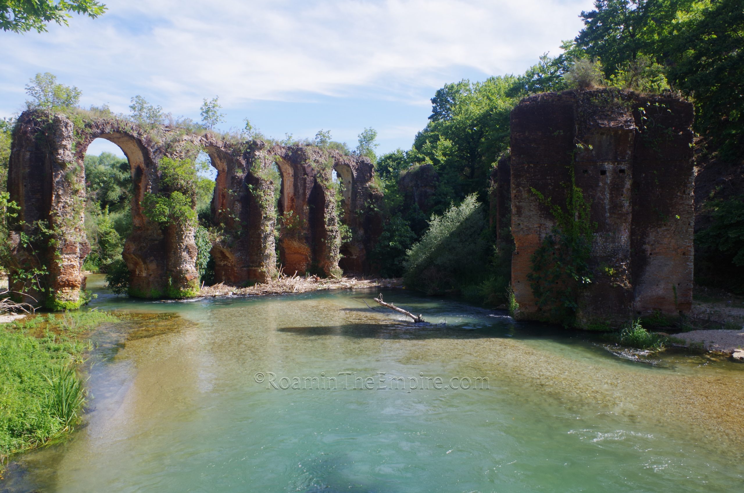
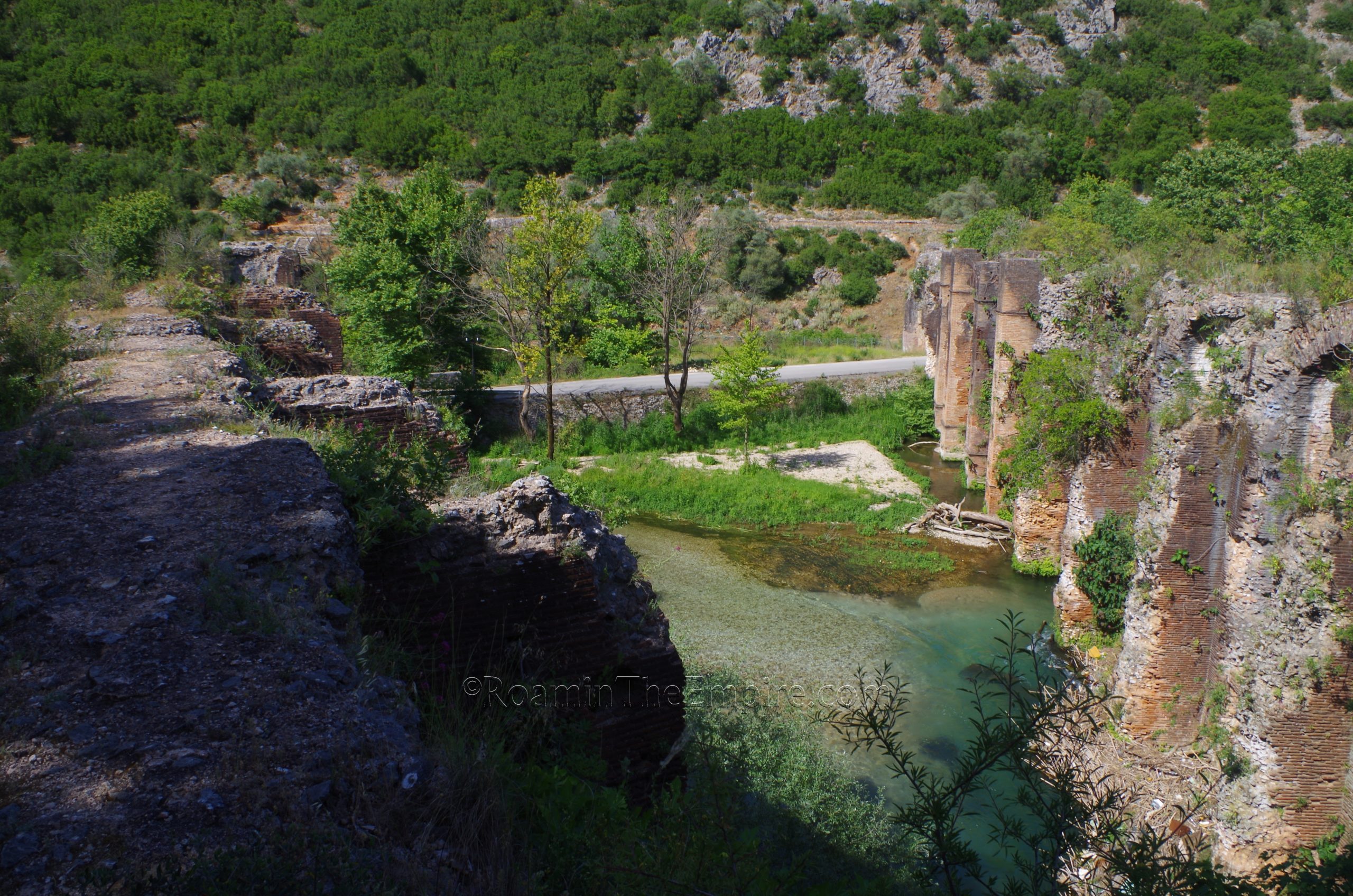
The water was then channeled westward along the hillside. The channel leading up to about the western gate of the church can’t be seen, but after that point the channel shows up and parallels the road, though it is inaccessible and not really visible from the ground here. It’s definitely there, though. About 120 meters from this point are perhaps the most impressive remains, two perpendicular aqueduct bridges that span the Louros. The south (or eastern) of these two bridges seems to have been an addition to the aqueduct during the reign of Hadrian, while the north (or western) bridge was part of the original construction.
Off to the north side of the road just before reaching the south bridge is a gated area around the pillars. The door to this is unlocked and it can be entered with the stipulation that the gate remain closed to keep animals out of the area. From there, one can take a path between the pillars of the first aqueduct bridge and up the hillside to the base of the north bridge where it intersects with the water channel A second path just to the right, before passing through the aqueduct pillars, leads up to the area at the base of the south bridge, though the connection between the bridge and the channel is not preserved. A sign prohibits access to the channel as it heads east back toward the source, but the channel can be walked between the two bridges, giving access to about 85 meters of the total 230 meters that is present along this hillside. In a few areas, the covering of the channel is also preserved. This area has a few informational signs in English and Greek about the aqueduct.
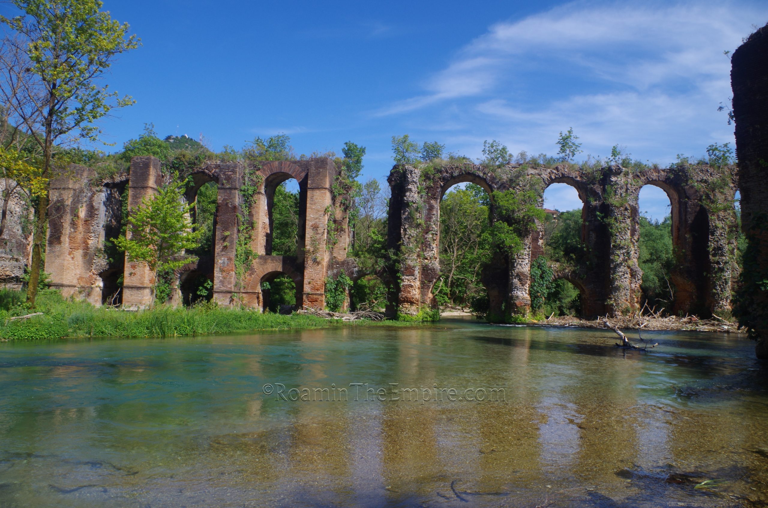
Most of the south bridge is preserved from the channel across the Louros to the west bank of the river, covering a total distance of about 120 meters. The maximum remaining height of the south bridge is about 14 meters. Only a few pillars on either side are preserved for the north bridge, which originally had a length of about 140 meters. Both bridges originally consisted of 14 piers. Crossing over to the west bank of the river, a short hike will take one up to the area where the bridges converge, though their actual point of convergence is no longer preserved, likely destroyed in the construction of the road that runs just a few meters above this point. Going down to the riverside near the road bridge that crosses the Louros offers great views of both aqueducts, but of the south bridge in particular.
In all, it took about 2 hours to visit the remains of the Nicopolis aqueduct, not counting the return trip back to Nicopolis. The aqueduct bridges near the source at Agios Georgios are obviously the highlight and are quite impressive. I was pleasantly surprised with the availability of informational signs at each of these major points as well. Though most of them were the same repeated information, it was still nice to have them there for those who don’t make all the stops.


 and south (left) bridges.")


Sources
Zachos, Konstantinos L. An Archaeological Guide to Nicopolis. Athens: Ministry of Culture & Sports, 2015.
Zachos, Konstantinos L. and Leonidas Leontaris. “The Aqueduct of Actian Nicopolis.” Great Waterworks in Roman Greece: Aqueducts and Monumental Fountain Structures: Function in Context. Oxford: Archeopress Publishing, 2018.