


Continued from Philippopolis Part II
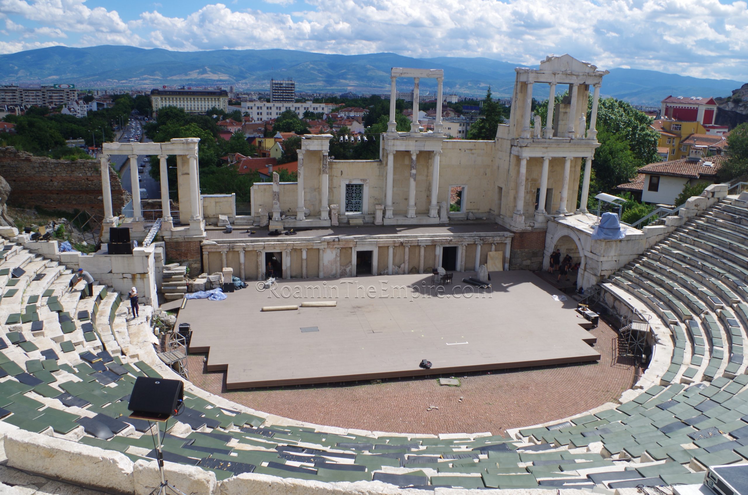
Theater
The ancient theater of Philippopolis is located on the saddle between Taksim Hill and Dzhambaz Hill (two of the three hills of Trimontium) straddling Boulevard Tsar Boris III Obedinitel, which runs through the hill directly below the theater. The actual address of the theater is Tsar Ivaylo Street 4. In the summer (April to October), the theater is open daily from 9:00 to 18:00. The rest of the year, daily from 9:00 to 17:30. Admission is 5 BGN.
The theater seems to have been constructed sometime in the final decade of the 1st century CE, under the benefaction of one Titus Flavius Cotis. For many years, it was believed to have been constructed during the reign of Trajan, but recently uncovered epigraphic evidence suggests the earlier date. The capacity of the theater seems to have been between 5,000 and 7,000 spectators. The theater seems to have been the venue for the meeting of the Thracian assembly, the koinon. Gladiator games are also believed to have been held in the theater as well, as evidence has been found of alterations in the 3rd century CE that would have made the theater more suitable for the hosting of spectacles. Notably, the higher drop off between the cavea and orchestra to create a little extra room between those seated in the first row of seats and the area in which games would take place. Philippopolis’ theater seems to have fell out of use sometime in the 4th century CE, and later incurred significant damage during Attila’s sack of the city in the 5th century CE.
Once again, like many theaters in Europe during the summer, the theater here is in use for modern performances. And as such, that means that parts of the ancient theater will be restricted or covered over with modern constructions to accommodate these contemporary performances. That is certainly the case here. It wasn’t as obtrusive as some constructions, though. Part of the orchestra was covered over with a modern stage, most of the scenae area was inaccessible (not sure if it is accessible in the off season), and the pulpitum itself had a modern matting on it to protect it. Much of the seating was covered by mats that had been put down for patrons, though they were fortunately being lifted while I was there. So while they were still there, they were no longer obscuring the seating.
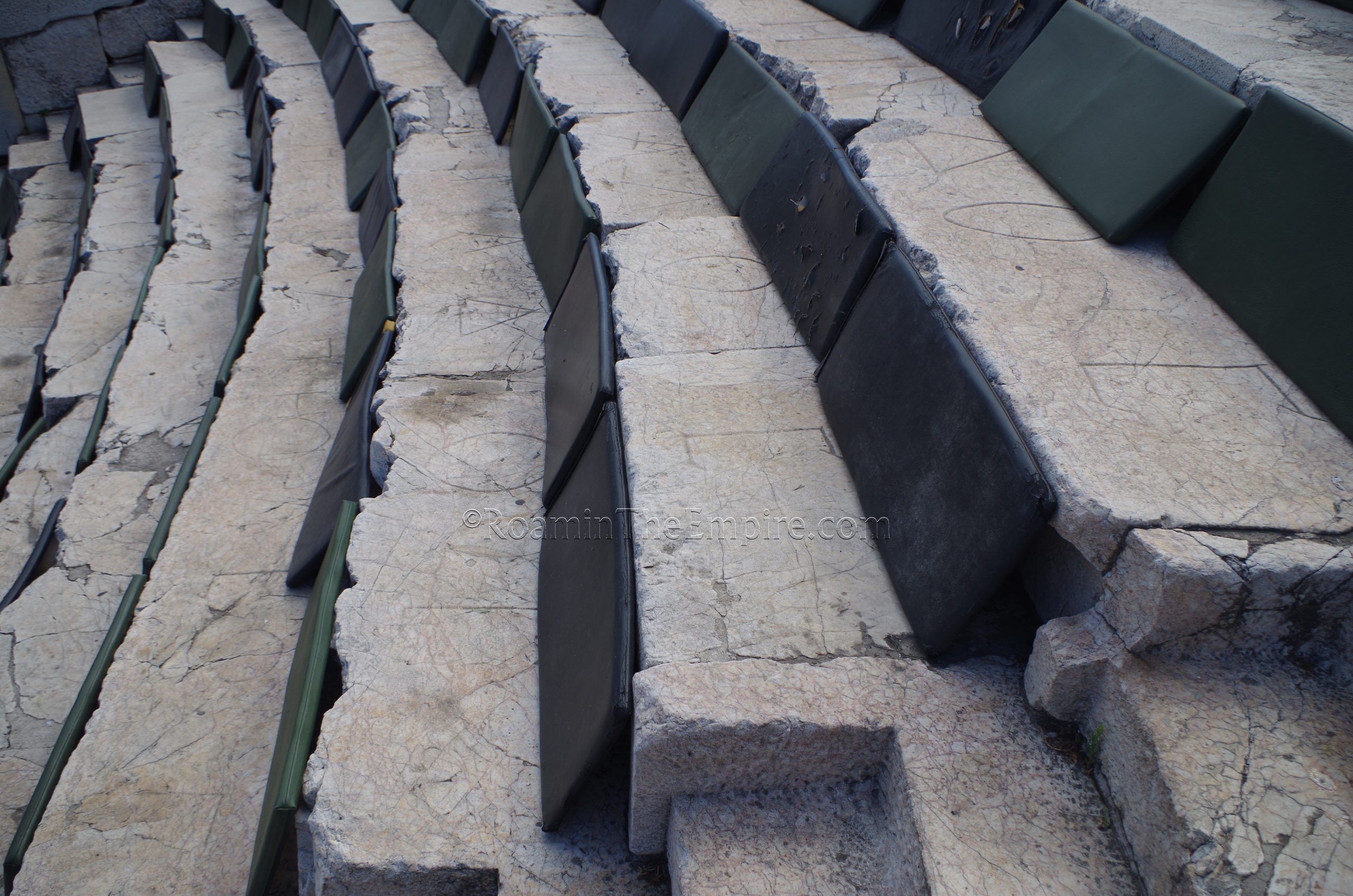
Being able to see the surface of the seating area is actually kind of a big deal here, because Greek letters are inscribed on many of the seats. Some of these are small inscriptions which noted assigned seating for certain individuals. It is from these inscriptions that it was determined that the koinon was meeting in the theater, apparently. Other seats have much larger Greek letters that essentially take up a whole seat with one letter. These larger inscriptions seem to note the names for neighborhoods in Philppopolis, assigning residents of these areas to particular sections of seating in the theater.
A good portion of the first story of the scenae frons is intact, though the columns look to be largely reconstructions with a few fragments of original column embedded in them. Some scant remains of the second story are also visible. Interestingly, the proscenium has three portals in it as well, something not completely out of place in eastern theaters. Despite using the topography of the hill for supports, the theater otherwise has a Roman forum with the completely enclosed orchestra accessible from passages on either side. There are no internal corridors within/under the cavea, though, aside from a corridor that leads into the theater and spills out among the summa cavea, near the middle of the theater.
As is often the case with theaters, particularly those with significant degradation of the scenae frons, the theater offers pretty spectacular views out onto the city with the Rodopi Mountains as a backdrop. This is probably the premier ancient monument of the city, and is certainly not to be missed.
Nebet Tepe and City Walls
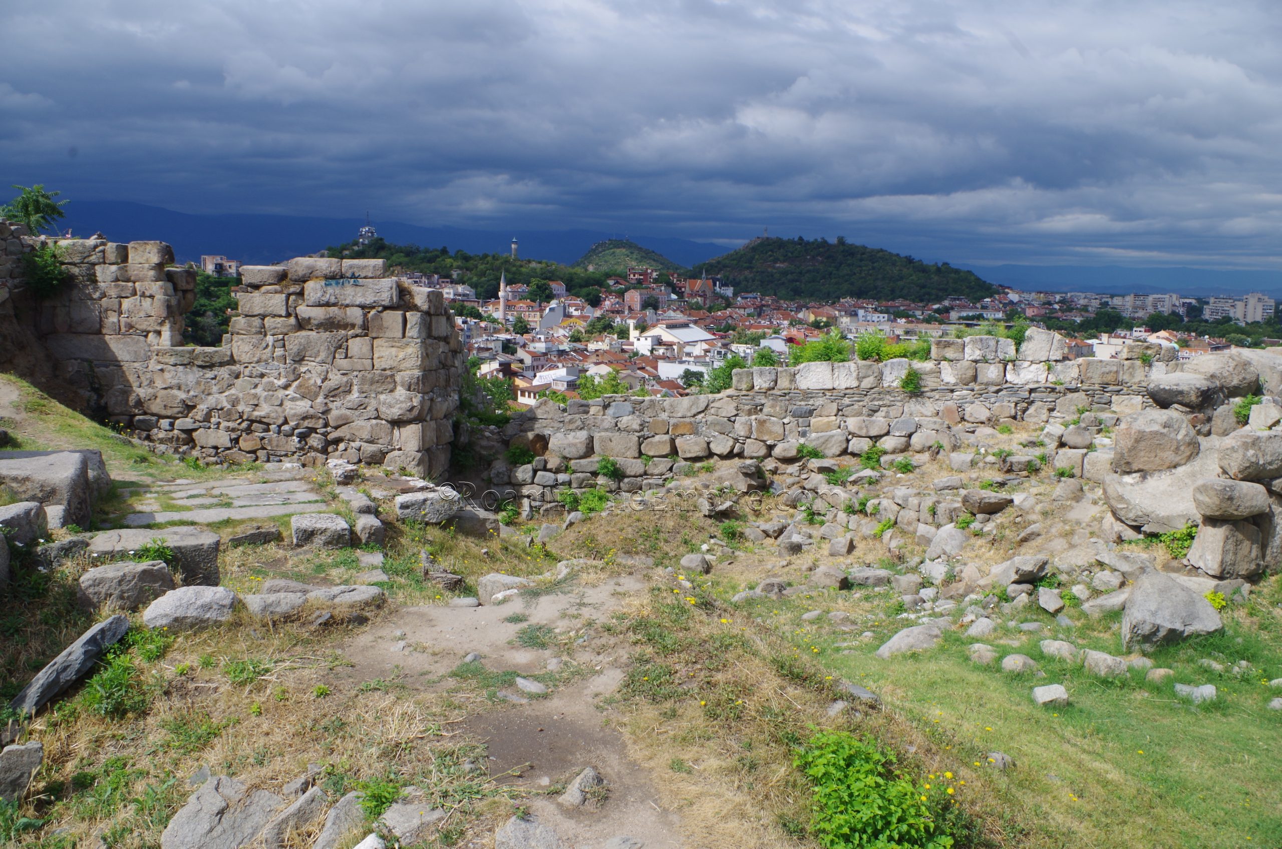
Heading north up the hill from the the Nebet Tepe, the Nebet hill. At the top of the hill is the location for the first major Thracian settlement at this location, Eumolpias. This park is open and there is no admission or any kind of restriction of access, so it can be visited at any time. There doesn’t seem to be much in the way of lights, though. Unfortunately it seems to be completely unsupervised as well, so there is a lot of graffiti and garbage; the location overlooking the city with few lights and no supervision seems to make it a prime spot for nighttime gatherings.
There are a lot of remains on the grounds of this park dating from the Thracian, Hellenistic, Roman, and Byzantine periods, and it can be hard to unpack as there is little contextual information on-site; the only thing that was labeled with any information was a medieval cistern. It was a fortified position through all of these periods, so there are some pretty robust fortification walls ringing the hilltop. The constructions with the largest blocks seem to date to the Thracian period. Significant portions of the western wall and the square tower located there are identified as being Hellenistic, as the hilltop was part of the fortified acropolis during that time. The telltale sign of Roman/Byzantine brickwork can be seen in elements of the northern wall, particularly in a postern (that seemed to be mostly blocked off with modern concrete during my visits) that apparently dates to the reign of Justinian I.
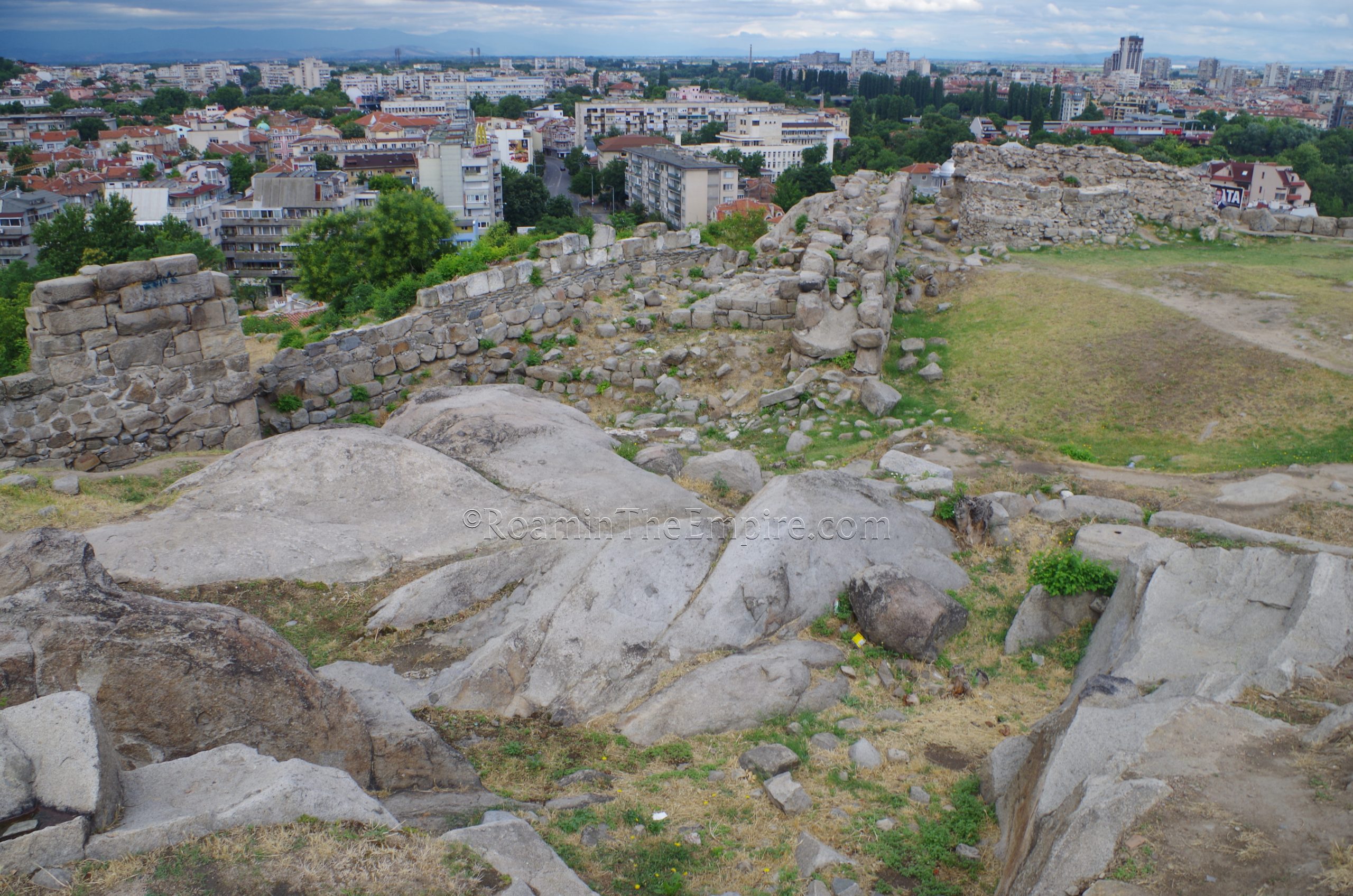
For the most part, the walls are a pretty big mish-mash of periods, as the same course was used over the centuries with subsequent constructions reinforcing and building upon the previous incarnations of the fortifications. The park is very popular for its views of the city. There are a few other hills around, but, the area leading up the slope is quite nice and there are a lot of shops and other cultural attractions, so it is naturally just more popular than the other hills around, which don’t offer much more than the view.
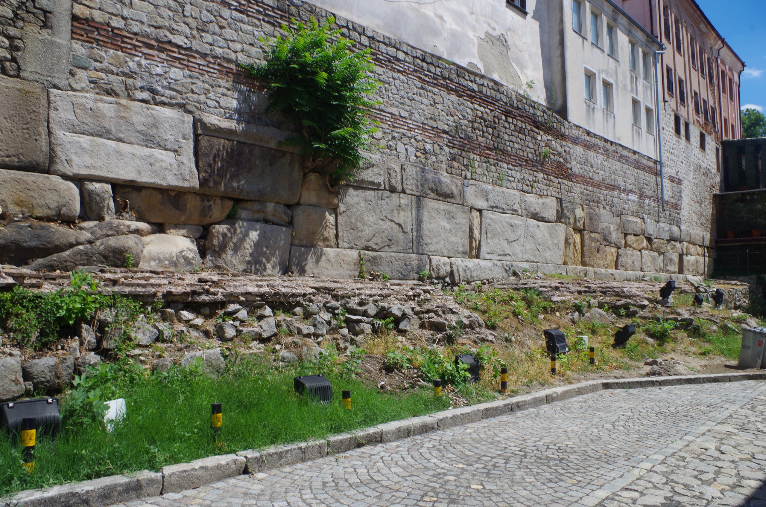
Heading back down Saborna Street from Nebet Tepe, back in the direction of the theater, there are a few remains from the city walls. The first is to the west of the main pedestrian street heading up the hill (Saborna Street), along Vitosha Street. On the west side of the square where Vitosha intersects with Chetvarti Yanuari Street, supporting some of the modern buildings that back to the square, is a large wall. The lower few courses of the wall constructed of ashlar blocks belongs to the Roman wall constructions of the 172 CE walls. On top of that in places are the walls from the 5th-6th century CE Byzantine fortress, distinguishable from the brick coursework among the opus mixtum. The foundations of two triangular towers belonging to the Byzantine walls are present at the far end of the street and at the end of the small lapidary park in front of the walls. A number of inscriptions are displayed in this little park area, though there is no information for any of them present. There is a small sign in Bulgarian and English describing the wall. Since this is a public area, there is no limit of access or admission.
At roughly the same point, on the opposite side of Saborna Street, down Tsanko Lavrenov Street, is the Hisar Kapia, a medieval gate from the city walls. What remains now is all of a later period, though the medieval gate was preceded by a gate in the 2nd century and Byzantine fortification walls. Down a small pedestrian side street to the south of the gate is the South Round Tower. This tower and small stretch of the walls dates primarily to the 5th-6th century fortress. It is in an open public area that can be visited at any time, and a small sign in Bulgarian and English explains a bit about the remains.
Heading back out to Tsanko Lavrenov Street and taking it down the hill (toward the southeast) about 100 meters, one encounters another small section of the Roman city walls. At the intersection with Petko R. Slaveykov Street, on the north side of the junction, is a small open space with a small section of Philippopolis’ walls, possibly a tower. This small section was part of the walls built in 172 CE. There’s no information for this, it’s just kind of there and there isn’t much to distinguish it from anything else. It is viewable from the public streets, so there is no admission or restriction of access. It is sunken from the street, though, so it can’t really be accessed directly.
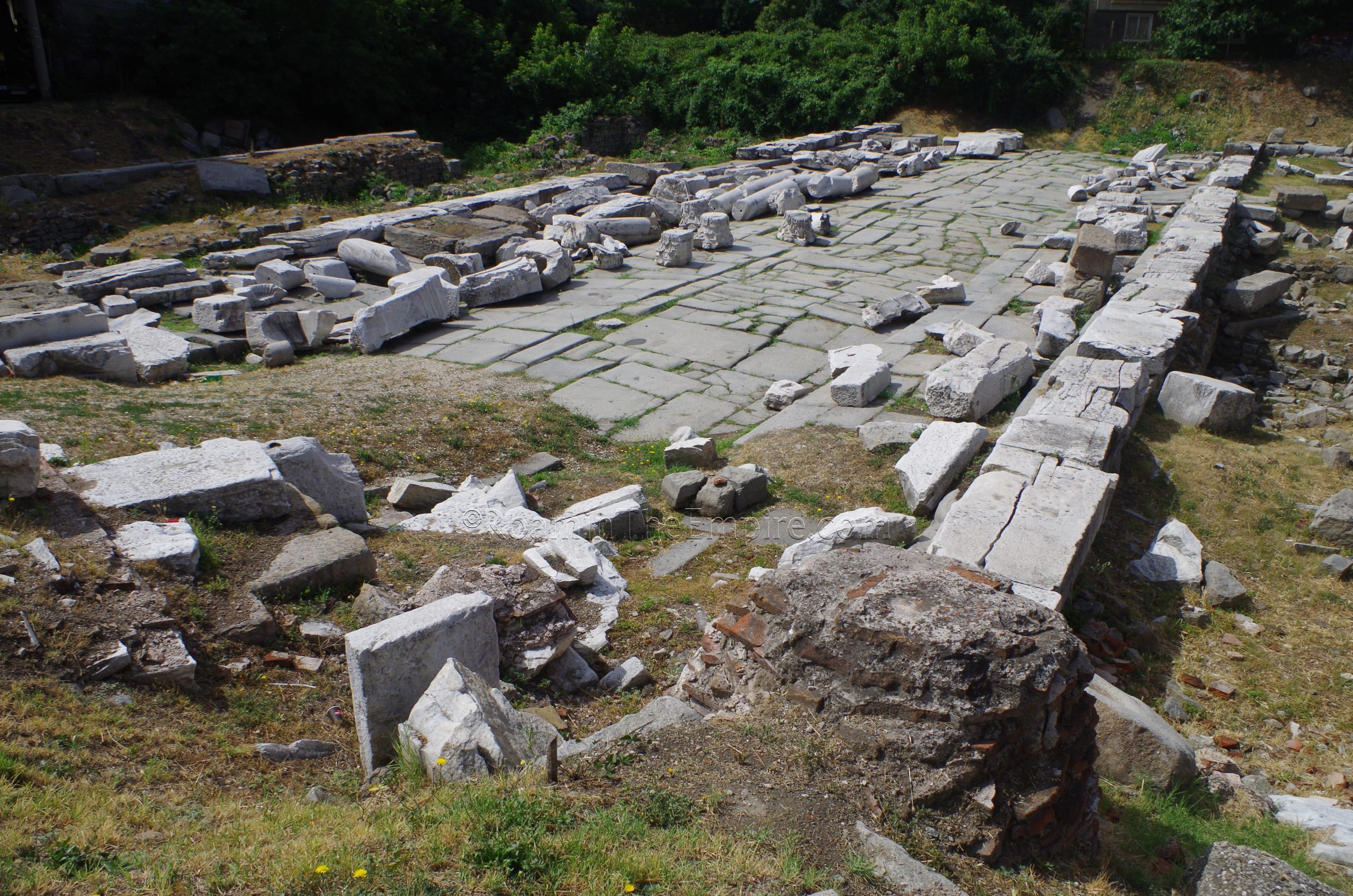
Another 120 meters down the road is the Eastern Gate. This monumental gate, as the name suggests, was the primary eastern entrance in Philippopolis’ walls. The gate was originally constructed as part of the 172 CE wall circuit. After the Germanic sack of the city in the 3rd century CE, the gate was reinforced and expanded to include an arch that was located about 20 meters outside the gate, incorporating the road just outside the original gate and flanking it with a colonnade. In the 4th century CE, the areas flanking the road were converted to barracks.
What can now mostly be seen in this area is the road and the flanking barracks. Some of the columns from the colonnade are scattered on the road. A small section of the outer wall is visible in the northeast part of the site. What would seem to be some later Byzantine reinforcement can be seen here as well. When I visited in 2017, the area was completely open without any kind of access restrictions, as it is basically a public area among some streets. It seems now that the area of the East Gate has been completely fenced off, though. It’s not a tall fence, maybe a meter high, so it doesn’t really obstruct the view at all, just prevents access directly to the remains.
Small Basilica
About a 5 minute walk to the southeast of the gate is the Small Basilica, located at Boulevard Knyaginya Maria Luiza 31. The basilica is open Monday through Sunday from 9:00 to 18:00 year round. Admission is 5 BGN.
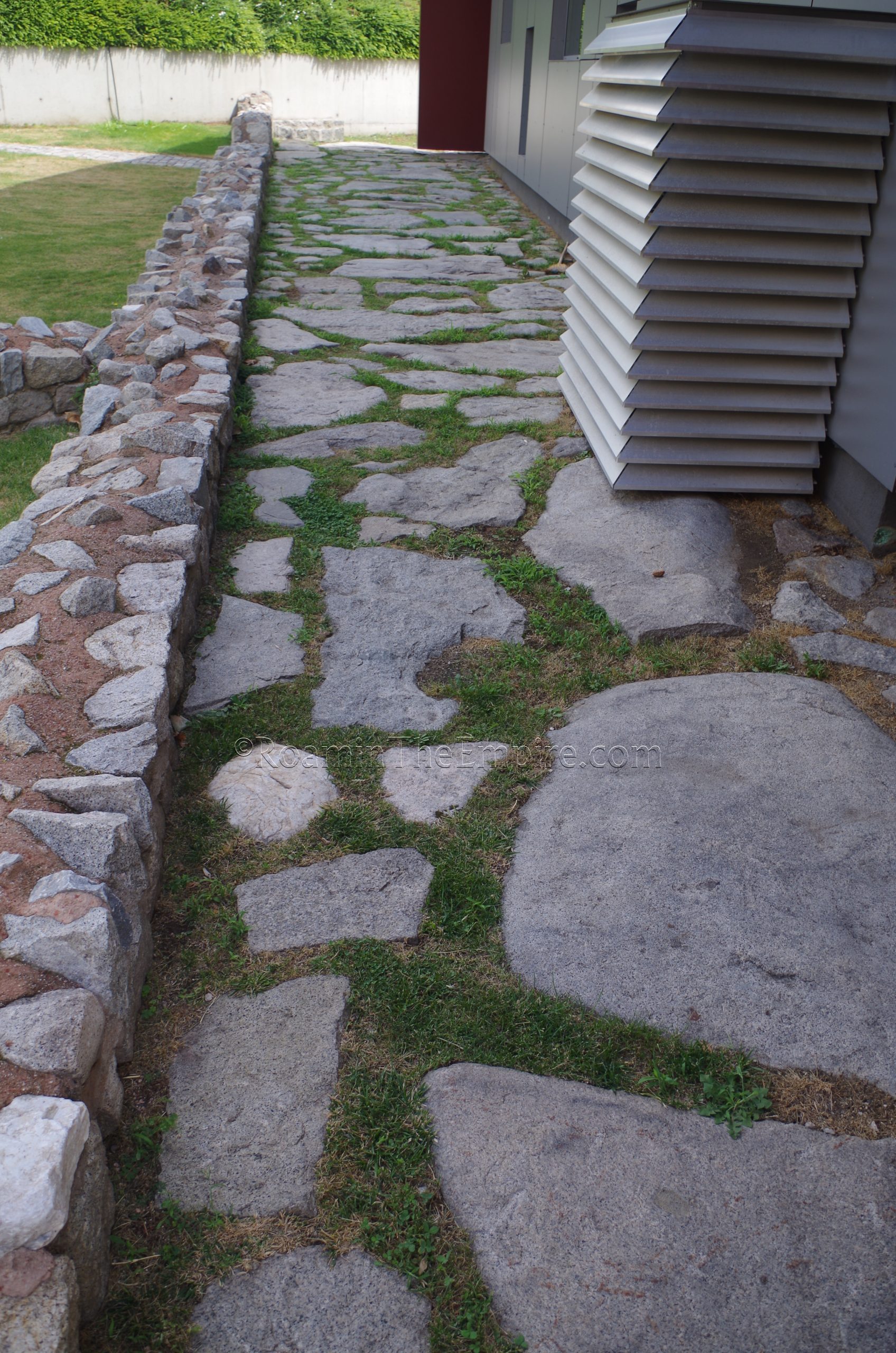
The basilica was constructed in the 2nd half of the 5th century CE, just inside Philippopolis’ 172 CE wall circuit. Outside the admission part of the basilica, but on the grounds are the remains of part of the wall and a tower, east of the basilica building. A small well is present near the wall. The remains of a Roman road also run along the west side of the building housing the basilica with a few bits of a building that was occupied between the 2nd and 5th century CE, but seemingly abandoned after the construction of the basilica. There are a few signs with Bulgarian and English information around this archaeological area outside the basilica.
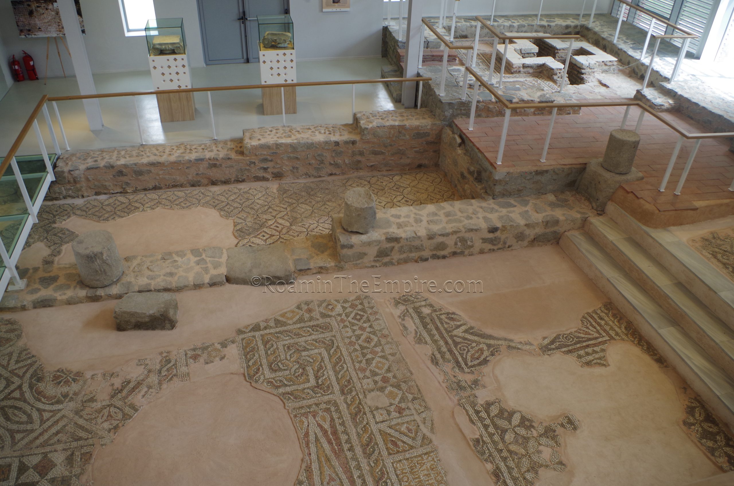
Inside the building are the remains of the basilica, which was destroyed by a fire in the early 6th century BCE. It was rebuilt afterward, but by the end of the 6th century CE had been abandoned. The floor of the basilica is paved by a number of interesting mosaics, including geometric designs, animals, and even inscriptions. One of the inscriptions originally noted the patronage of Basiliscus, who was a prominent figure in the area (and may have had a residence at Philippopolis) before briefly becoming the Eastern Roman Emperor. After Zeno succeeded him, the inscription was altered to remove the reference to Basiliscus.
The basilica is very well presented and modern in its approach to presentation. Transparent floors in some places help for mosaic viewing while elevated platforms give good views of other areas. There are a few informational signs with English and Bulgarian as well as a helpful illustrated plan of the basilica with certain aspects of the basilica and its mosaics highlighted.
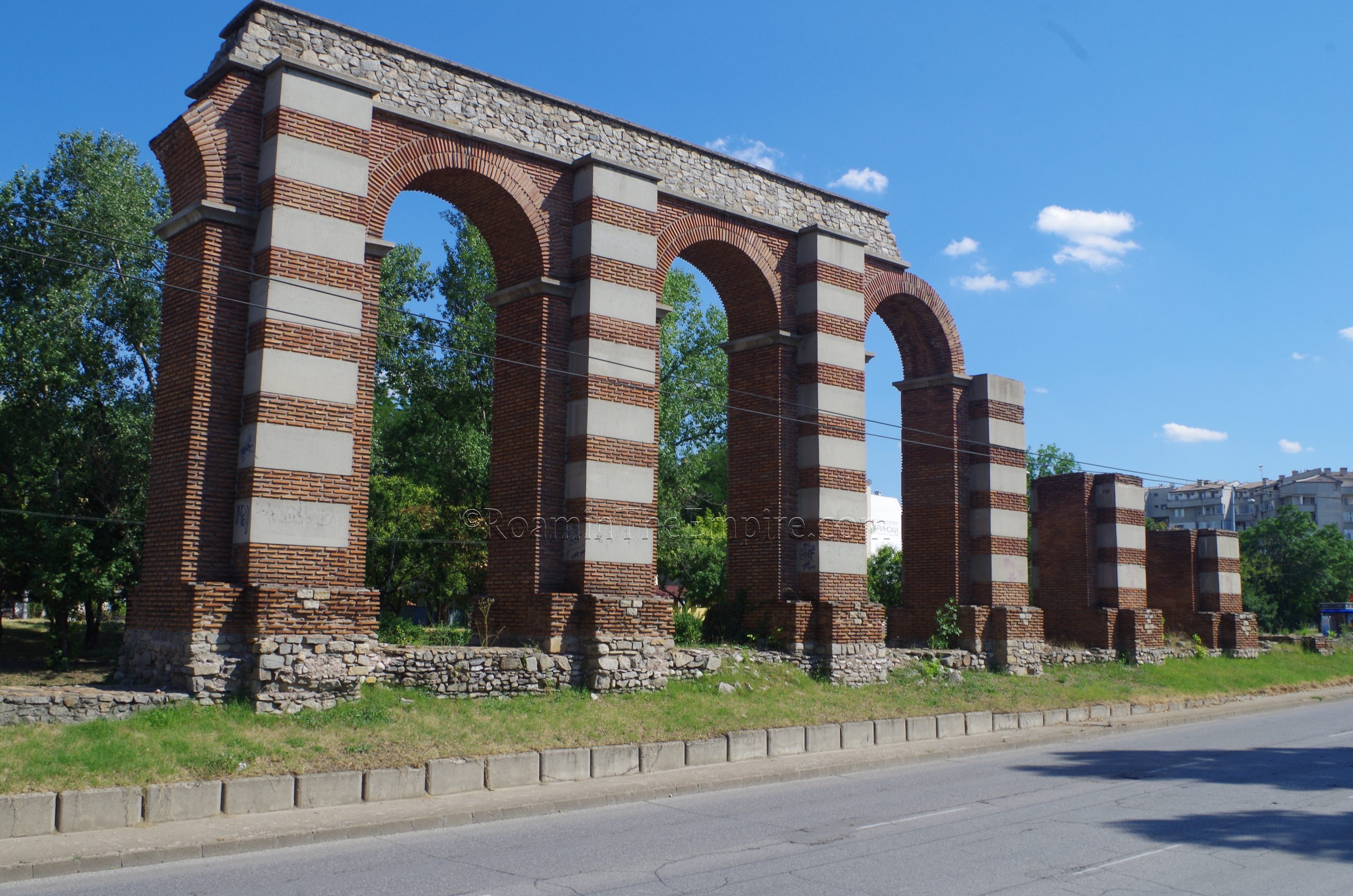
The last bit of Roman Philippopolis to see is a bit out of the central area where most of the sites are located. Toward the southwest edge of town, about 2.75 kilometers walking distance from the next closest site, the forum area, is a stretch of one of Philippopolis’ three aqueducts. The remains of the aqueduct are located in the median of Komatevsko Shose Street, also designated as highway 862. The aqueduct stretches for a distance of about 330 meters starting at the Boulevard Hadzhi Dimitar overpass.
Most of what remains here are the foundations of the piers, though in a couple places the piers and a few arches have been reconstructed to give an idea of the scale and form of the aqueduct. This stretch of aqueduct belongs to the same 4th century CE aqueduct that is visible near the circus, which is sourced further south in the Rodopi Mountains. The path of the 862 highway seems to have followed the path of the aqueduct for quite a ways, as remains of the aqueduct have been found along the road even farther to the south. Since this stretch is in the middle of a public road, it is visible and accessible at any time, and sidewalks flanking the median allow for a relatively safe close viewing of the aqueduct.


 on the Nebet Tepe.")


Sources:
Ammianus Marcellinus. Rerum Gestarum, 21.15, 26.10.4, 31.5.17.
Burrell, Barbara. Neokoroi: Greek Cities and Roman Emperors. Leiden: Brill, 2004.
Diodorus Siculus. Bibliotheca Historica, 16.71.2.
Livy. Ab Urbe Condita, 39.53.
Pliny the Elder. Historiae Naturalis, 4.18.
Ptolemy. Geographika, 3.11.
Tacitus. Annals, 3.38.
Topalilov, Ivo. (2014). An Aspect of the Political Propaganda in Philippopolis, Thrace, During II C. AD. In Studia Hungaro-Bulgarica III. Sumen-Szeged.
Valeva, Julia (ed.), Emil Nankov (ed.), and Denver Graninger (ed.). A Companion to Ancient Thrace. West Sussex: Wiley Blackwell, 2015.