


For the final roundup of miscellaneous sites on Sardinia, we focus on the most northern part of the island, or more accurately, the northwestern part of the island. This route will cover roughly the northern part of the Sassari region. As with the other itineraries of this nature, the caveat is that most of these sites are well outside of city centers or places easily accessible by public transport, and so access to a personal vehicle is highly recommended.
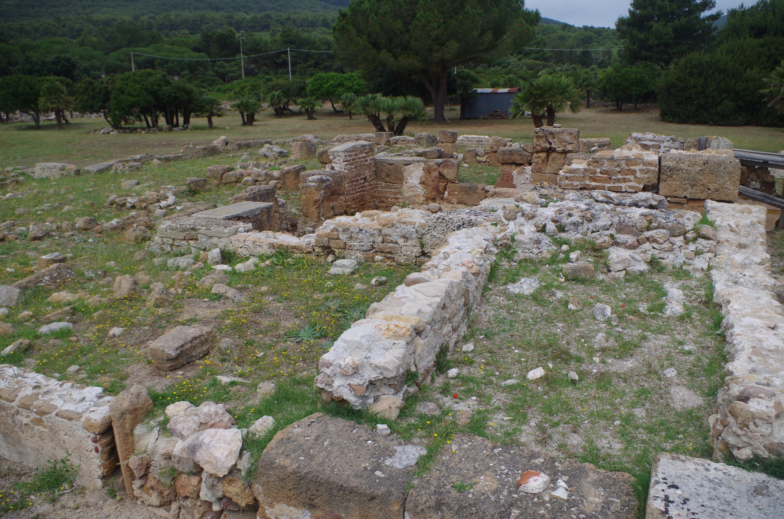
The first stop is the Villa Romana di Sant’Imbenia on the Porto Conte Bay (called the Portus Nymphaeus in antiquity). Unfortunately, the villa doesn’t seem to have any regular opening hours at present, and it was definitely closed when I visited in June 2019. The site is fairly well-maintained, though. Taking the trail along the north side of the site fence to the water, though, many elements of the villa can be seen walking along the fence that faces the water. The coastline has most definitely changed since antiquity and it’s pretty apparent that the villa has been eroding into the sea. Fortunately the coastline has been reinforced and covered in concrete to slow down the process where the villa meets the water. The villa seems to have been constructed in the 1st century CE and was in use through the 7th century CE. Apparently a total of 49 rooms have been excavated.
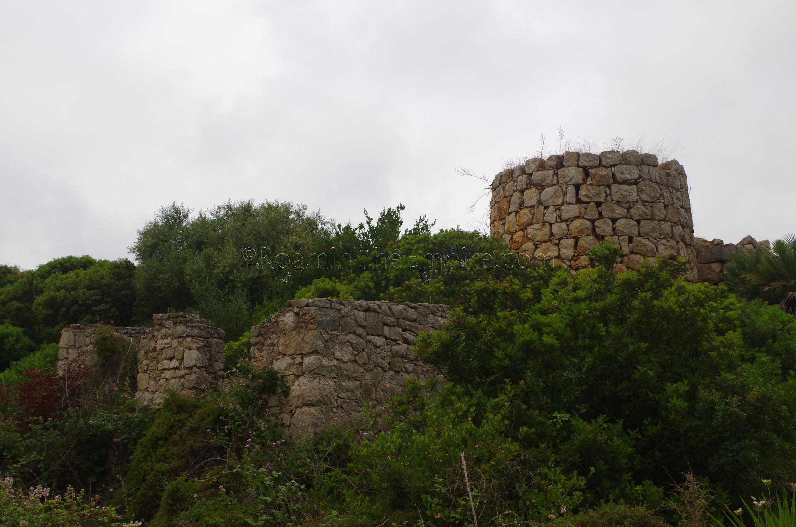
Less than 10 kilometers away (driving distance) are the remains of a large Roman era limekiln. There isn’t any sort of official site here, it’s just located off a small dirt road near the Aeroporto di Alghero. The limekiln is visible from the road, and there is a small place to pull off near it. Though it is technically on fenced land, the fence has been pulled down to allow a little closer access to the structure. Much of the base and the furnace area was quite overgrown, but the tower is fairly visible. I couldn’t find much information about this structure, including any conclusive dating, but, the construction of it does look similar to other Roman limekilns.

About 5 kilometers to south, in the town of Fertilia, are the remains of a Roman bridge. The Ponte Romano in Fertilia crosses the outlet of the Stagno di Calich into the Bay of Alghero, on the northeast side of town. There is a small parking area to access the bridge, and there is no admission or access control, allowing visits at any time. The bridge seems to be a part of the Tibulas Sulcis network, a road that ran along the western coast of the island from Sulcis to Turris Libysonis. Constructed in the Roman period, the bridge was pretty heavily restored in the medieval period, which is apparent, particularly in the upper portions of the bridge. Originally, the Ponte Romano had 24 arches, but 10 of them were destroyed in land reclamation projects in the 1930’s. There is a small informational sign at the start of the bridge in English, French, and Italian.
Heading northwest from Fertilia about 35 kilometers is the city of Sassari, the second most populous city on the island. The main sight in Sassari is the Museo Nazionale ‘Giovanni Antonio Sanna’, which was unfortunately closed for renovations when I visited (June 2019) and at the time of writing (April 2020). There doesn’t seem to be any timetable on a reopening, and I don’t think it had been closed very long by the time I visited; there was no mention of it being closed when I was researching stops a few months before traveling. The most recent functional hours I found were Tuesday through Saturday from 9:00 to 20:00 and Sunday from 9:00 to 13:00. Admission was 3 Euros.
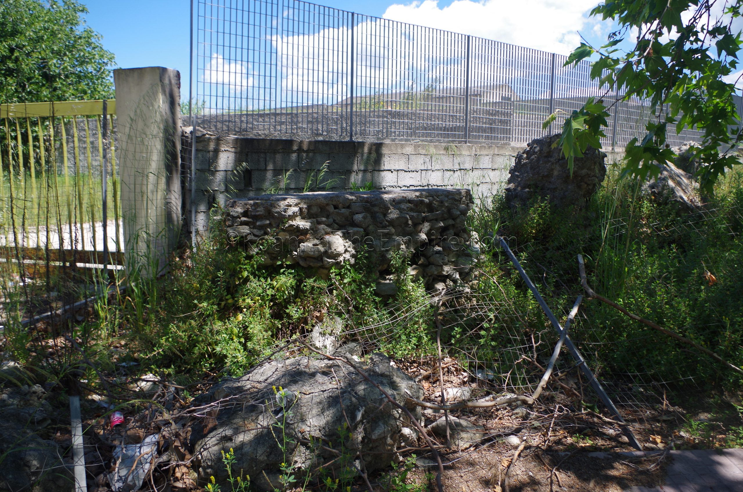
A small section of aqueduct can also be seen in the northwest part of Sassari along Via Predda Niedda Str. 21. The aqueduct is not very well taken care of; the area is a bit industrial and the remains are overgrown and look to be poorly taken care of. The picture is the most flattering view of it I could take. No signs note the presence and there doesn’t seem to be much effort taken to protect it. This seems to be part of an aqueduct that ran to Turris Libysonis. There is another section of the aqueduct apparently standing near Ottava, about halfway between Sassari and Porto Torres, but it is on private land and inaccessible.
Also between Sassari and Porto Torres (a bit closer to the latter) is another archaeological area that, while not Roman (nor even Punic), is certainly worth stopping to see, as it’s a fairly unique site in the western Mediterranean. Just off the SS131, is the Altare Monte d’Accoddi. This archaeological area is open Tuesday through Saturday from 9:00 to 18:00 in the summer, and from 9:00 to 14:00 in the winter. On Sundays it is open from 9:00 to 14:00 year round. The altar is closed on Mondays. Admission to the site is 4 Euros.
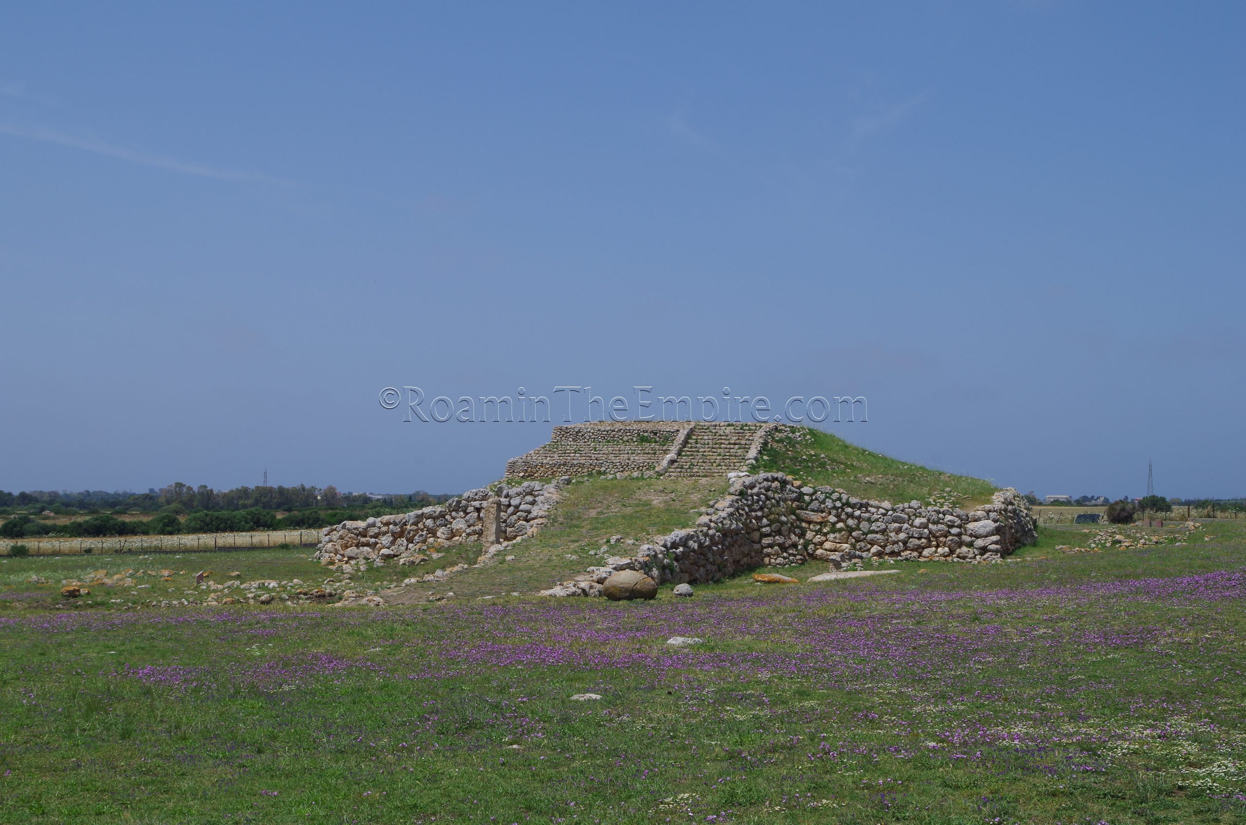
The Altare Monte d’Accoddi is a ziggurat-like altar that was constructed somewhere around 2800 BCE, predating the Nuragic culture. The site was in use as far back as the 5th millennium BCE as the site of a village. A later village was constructed about 3500 BCE. The menhir presently located on the left side of the altar’s ramp and the omphalos stone and altar on the right side of the ramp all seem to be objects dating from this earliest phase of occupation of the site, and are a testament to the earlier religious significance. Around the end of the 4th millennium BCE and start of the 3rd millennium BCE, the first phase of the altar was constructed; the ramp and the base level. On top of this base level would have been a small sanctuary. At about 2590, the original sanctuary was destroyed in a fire and the second phase of the altar was constructed with the addition of the upper terraces. The quality in construction between the two building phases is pretty apparent with the older phase being much rougher in quality. A small sanctuary was then built on top of that. About 1800 BCE, the site was abandoned.
The omphalos stone is interesting in that it was precisely carved to its current shape. Though it is called an omphalos, the precise nature of it is not completely clear. It may have been associated with a sun cult. The stone was originally found near the east wall of the archaeological park. The altar to the north of it is placed over a drainage cavity, perhaps meant to collect the blood from sacrifices. The menhir also seems to have served as a repository for burned animal bones and stones.
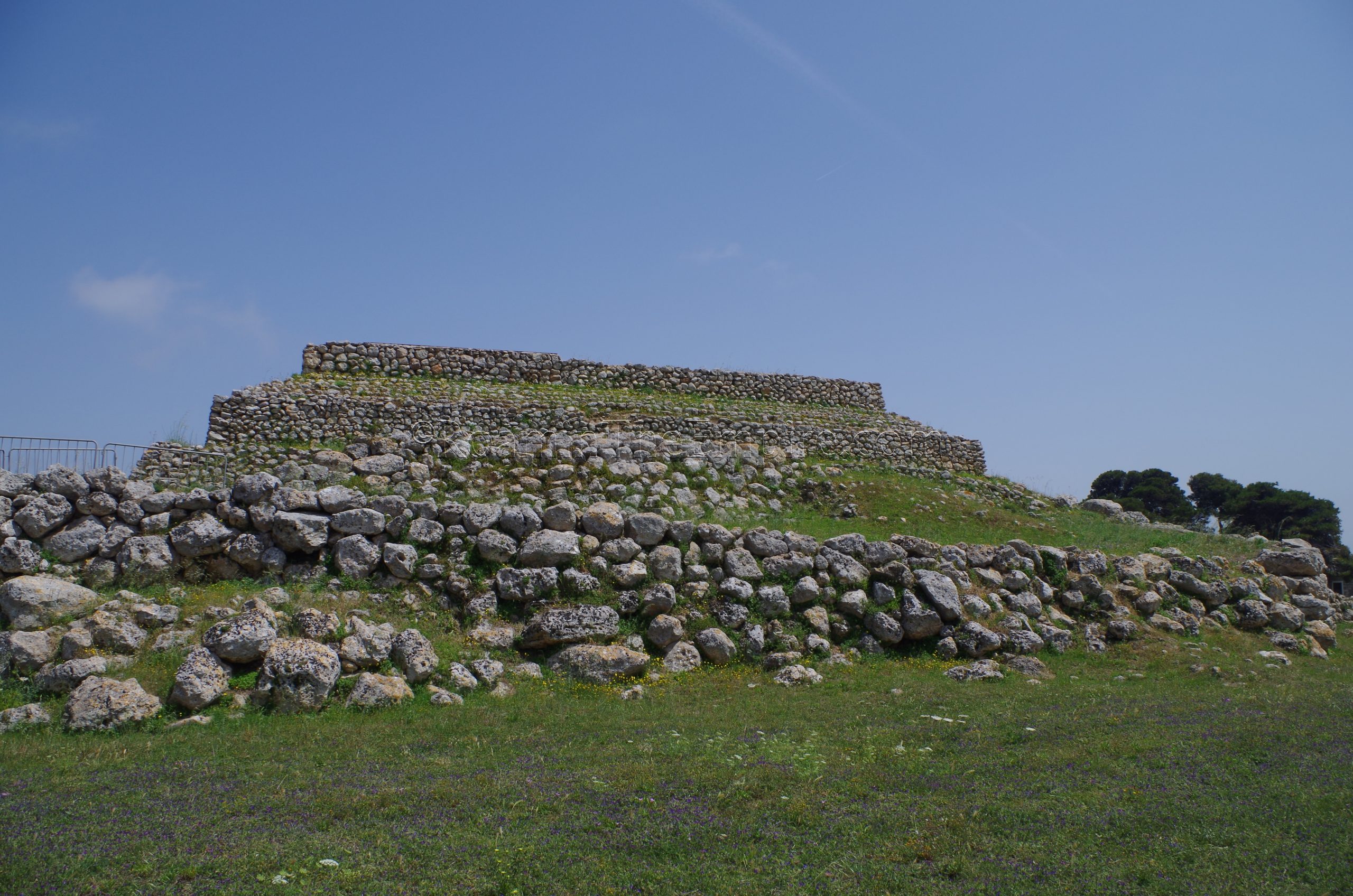
Visiting the Altare Monte d’Accoddi takes about 45 minutes to an hour. A small informational booklet in English (and I presume other languages are also available) is provided for the visit. Again, the site is pretty unique with there being no other similar structures known in the Western Mediterranean, and it’s definitely a recommended stop.
The final stop of this itinerary is about 22 kilometers up the coast near the small locality of Punta Tramonta. On the water, to the south, off of SS200 is the Villa Romana Santa Filitica. The road that leads off the SS200 is unmarked, narrow, and dirt; but it was decently graded when I visited. There is a small parking area on the east side of the site, but, the villa is fenced off. One can get pretty good views of the villa from outside the fence, and there do appear to be points near the beach (which wasn’t really accessible from the villa area and a little bit of a time crunch prevented me from going back to the beach access point a little ways down) where the fence was no longer standing. A good portion of the site was also covered by tarps. Apparently reservations can be made to gain access to the site with a guide (079 3055068 or iat@comune.sorso.ss.it) at no cost.
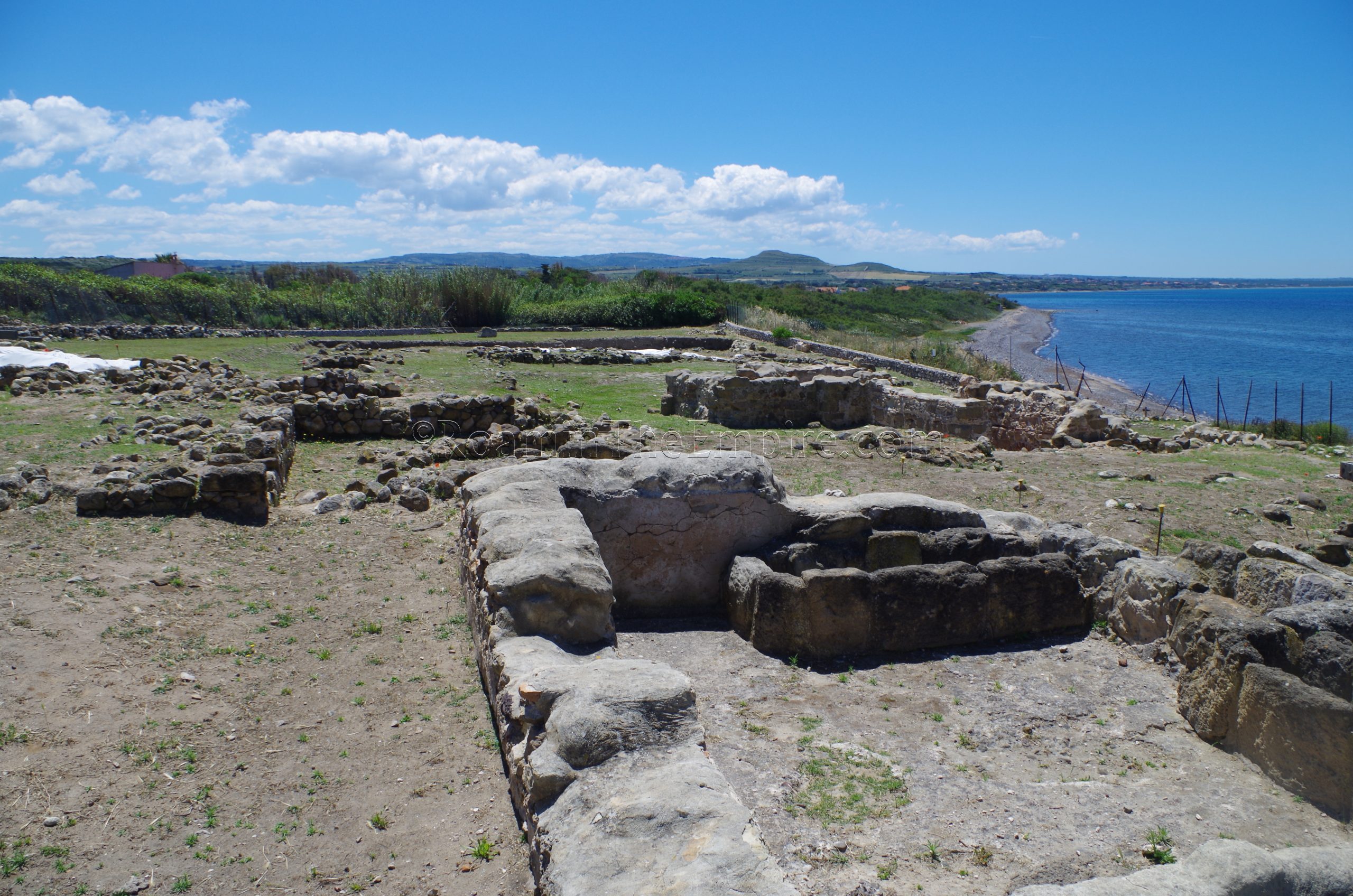
The villa was constructed sometime in the imperial age; some of the mosaics are dated to the 3rd-4th centuries CE. After the Vandal occupation, a small settlement grew up around the villa. One of the bathing rooms of the baths complex of the villa was converted into a Christian church in the 5th century CE. The villa site was abandoned by the 7th century CE, and a small Byzantine era settlement was built in the spot after sand deposits covered significant parts of the villa.
Without access to the villa, the stop might not be worth the time to most people. The villa is not especially large, so I would imagine visiting would take in the neighborhood of half an hour. Or, without access to the villa, more like 5-10 minutes. There’s no actual information on-site, including how to access the site; I had to find that online.


