


I intended for the miscellaneous sites in the Sassari region to be a single post, but, it ended up running a bit long and made more sense to divide it up into two separate routes. This first of two Sassari routes essentially covers sites in the southern part of the region. A personal vehicle is pretty much essential, as many of the sites are fairly rural and well off the public transportation routes.
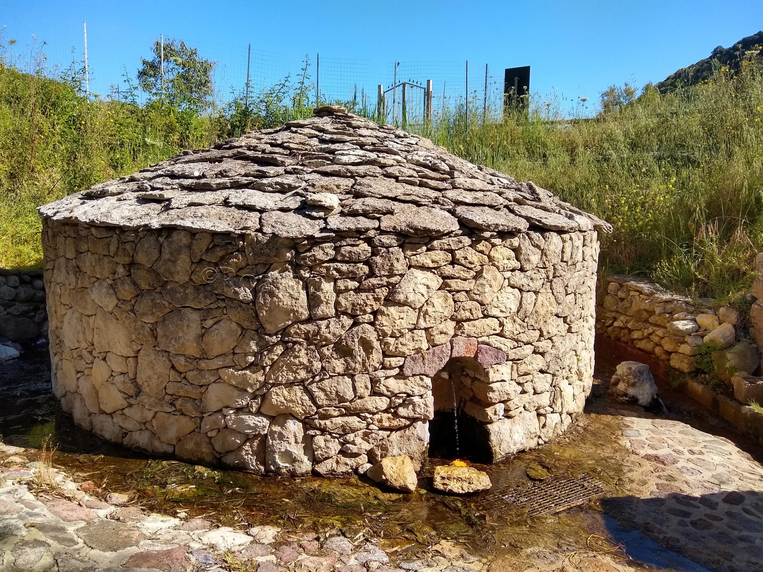
This itinerary starts out with a cluster of sites around the town Pozzomaggiore. The first, near the small town of Monteleone Rocca Doria is the Fonte di Abbarghente o Su Mudeju. Though the presently standing fountain houses on-site are of a later construction, the usage of the Abbarghente (alternatively called the Mudeju) volcanic spring dates back as far as the Nuragic age, with use also by the Phoenicians/Carthaginians and the Romans. There are two separate spring points, housed by circular stone buildings. Above the first one, in a fenced and unfortunately severely overgrown area, are some constructions dating to the Roman period. The Romans built a bathing complex here to utilize the mineral water spring. It was so overgrown, though, it was impossible to see anything when I visited. One might have more luck at other times of the year when the overgrowth is not so prolific. The springs are still running and apparently in use, and there is no admission to the site, so it can be visited at any time.
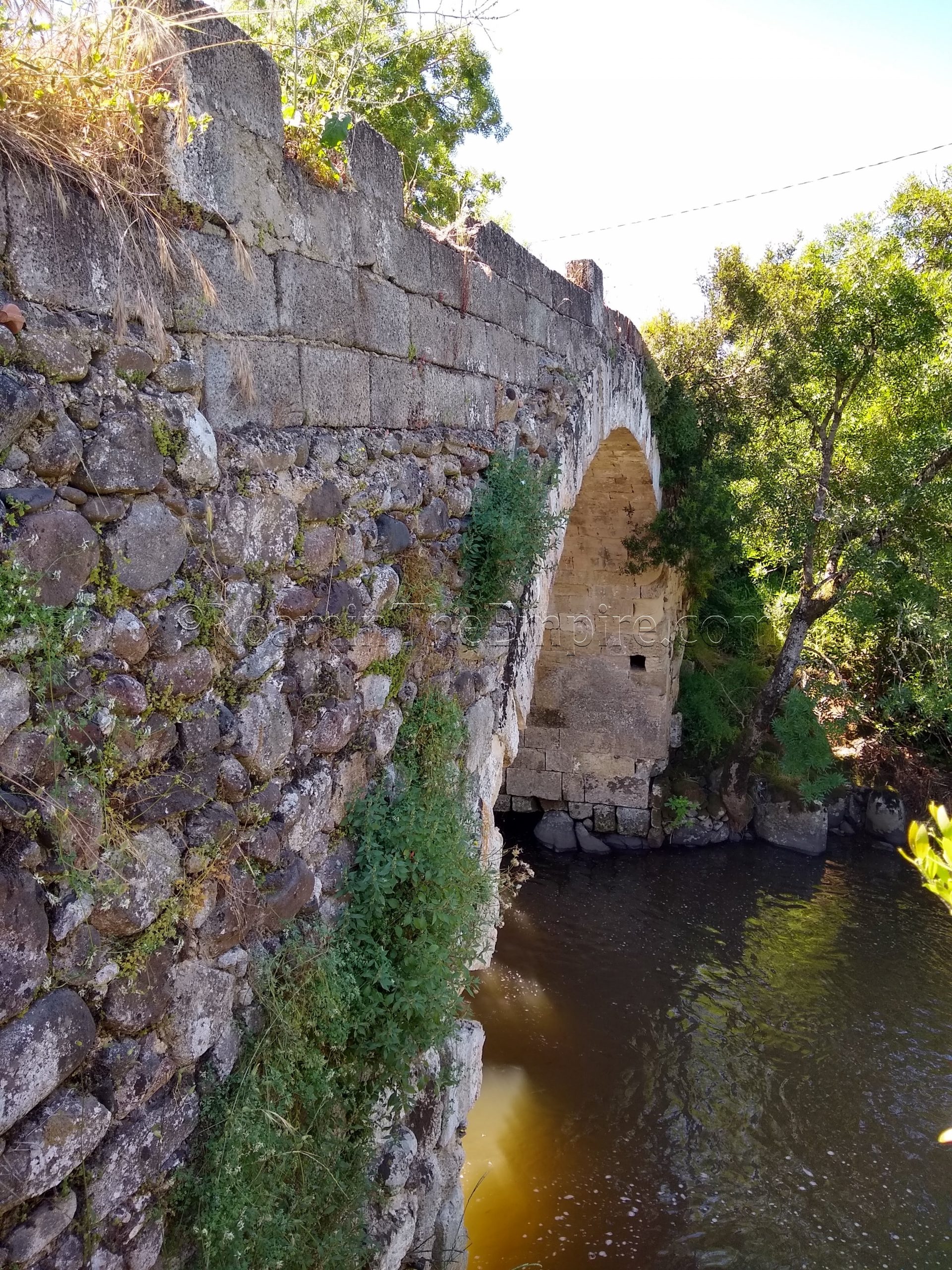
A short 15 minute drive to the south, along the course of the Temo River, are the remains of a Roman era bridge, the Ponte Ettori. The last half a kilometer is a dirt road, and the final 100 meters or so is pretty rough and at decline/incline. This bridge was a little bit of a disappointment because the foliage along the Temo was so thick, I could barely see through it to see the bridge remnants. The bridge is definitely there, but, I couldn’t get a very good view of it. The water in the river was high enough that I didn’t feel comfortable fording the crossing about 100 meter downstream to try and get to the other (west) bank, which probably offered a better view. Approaching from the west bank in the first place would need to make use of a lot more questionably conditioned roads, as opposed to approaching from the east which makes use of paved roads until that last half a kilometer. It might be best to view this in the fall/winter when the growth along the river is not as thick or the water level is low enough to allow a crossing to the other side. I suspect some of the rock packing on the road that leads up to the bridge may be Roman in origin, as that road lines up pretty well with the orientation of the bridge.
Another roughly 15 minute drive to the south is the Ponte Enas, a slightly less disappointing stop. The Ponte Enas is still actively in use, carrying a small back road leading south off the SP11 over the Rio Enas, a tributary of the Temo. There’s a little area to pull off the road to the north of the bridge. A couple small paths lead down the bank of the river a little bit to give views of the bridge profile. The Ponte Enas looks to have quite a bit of later reconstruction/renovation, but the Roman elements are fairly apparent.
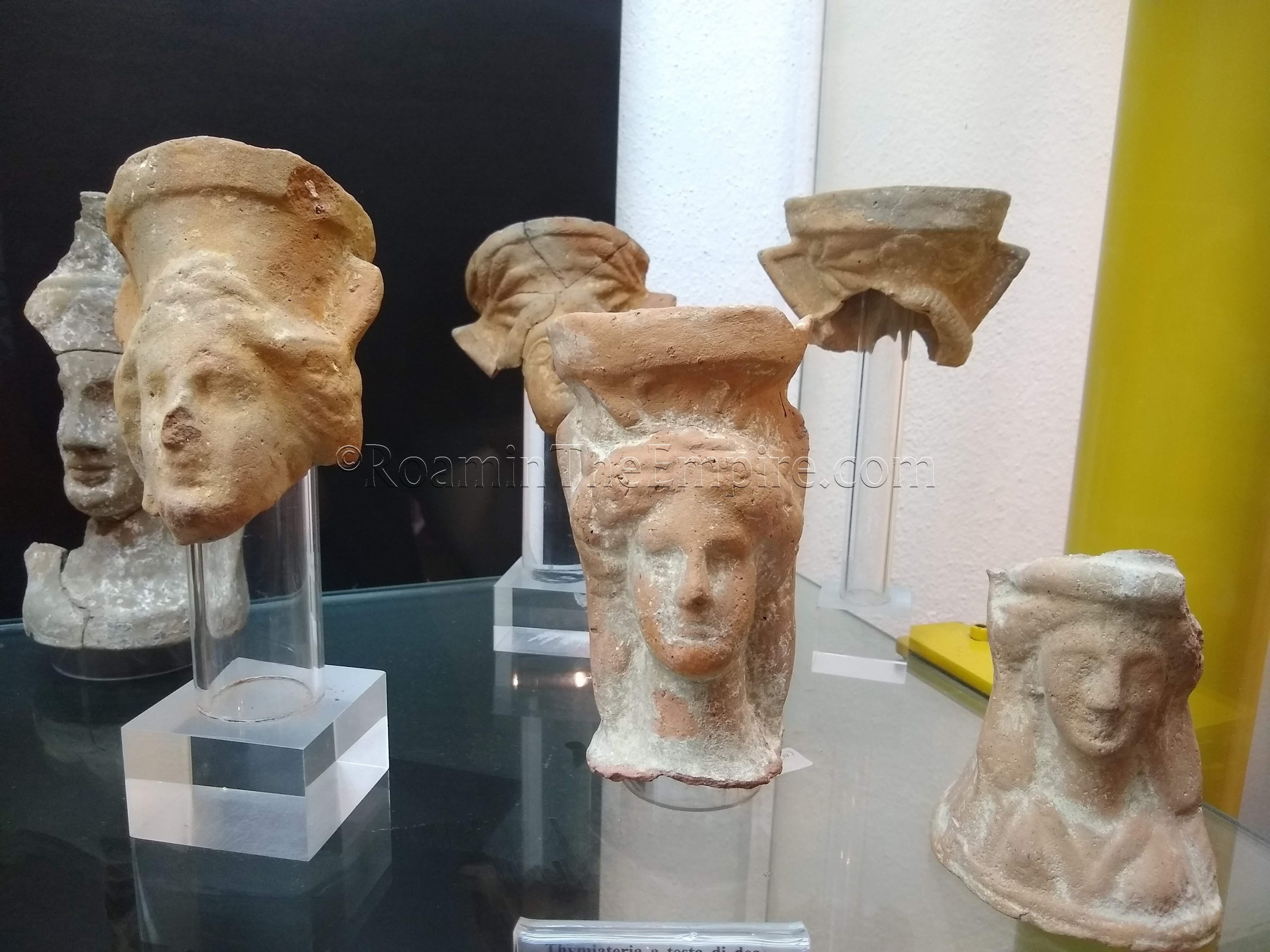
From the Ponte Enas, it’s a short drive to the northeast to the town of Padria for the next stop. Believed to be the location of the settlement Gurulis Vetus in antiquity, Padria has a small archaeological museum; the Museo Civico Archeologico Padria. The museum is open Tuesday through Sunday from 10:00 to 13:00 and 15:30 to 18:30. The museum might also go to reservation only in the offseason. Admission is 1 Euro. The museum is rather small, it only took me about 15-20 minutes to go through, and most of the post-Nuragic collection consists of Roman votive objects. Most of the information was in Italian, but there were a few English translations posted around the museum. There was a good panel on the area bridges (not translated) and a map of a reconstructed Roman Sardinia that was particularly interesting. The museum also had one Punic object, a decorated tile. For just a Euro, it’s certainly worth a stop if it’s open. It’s worth noting that there is supposedly a pretty large Roman retaining wall and some Punic wall remains at the Complesso Archeologico e Castello di ‘Palattu’ on the north side of town. Unfortunately it was closed when I visited, and I couldn’t find any schedule for opening.
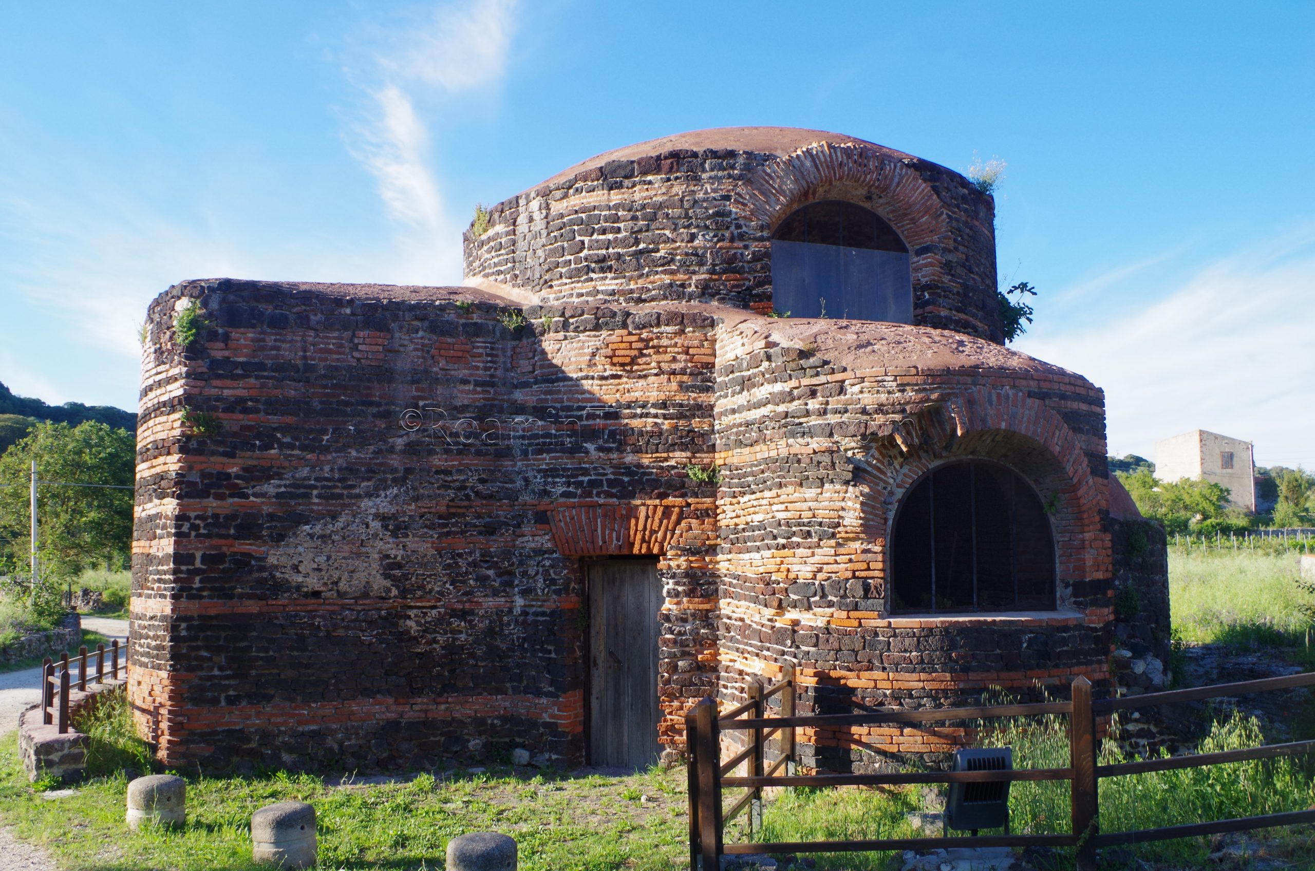
The next site is about 40 kilometers up the E25 near Siligo in the Comunità S’Aspru. Right off the E25 is the Chiesa Santa Maria di Bubalis (also called the Chiesa di Nostra Signora di Mesumundu), which was built on the site of a Roman bathing complex. There are the remains of part of the bathing complex to the east of the church, while the church itself, built in the 6th or 7th century CE, incorporates and reuses one of the areas of the baths as the structure of the church (including the dome and windows), where as other portions reuse the building materials of the baths (and of a nearby Nuraghe). Significantly later additions (11th century CE) are pretty apparent in the contrasting building style. The church doesn’t seem to be open on any sort of schedule. A water channel for the baths can be seen leading out of the church building on the northwest side. A portion of the aqueduct that brought water to the baths from the S’Abba Uddi spring to the baths is located across the road to the south of the church. The baths were fairly overgrown when I visited, but otherwise they are out in the open with no real restrictions other than a small wooden fence around them.
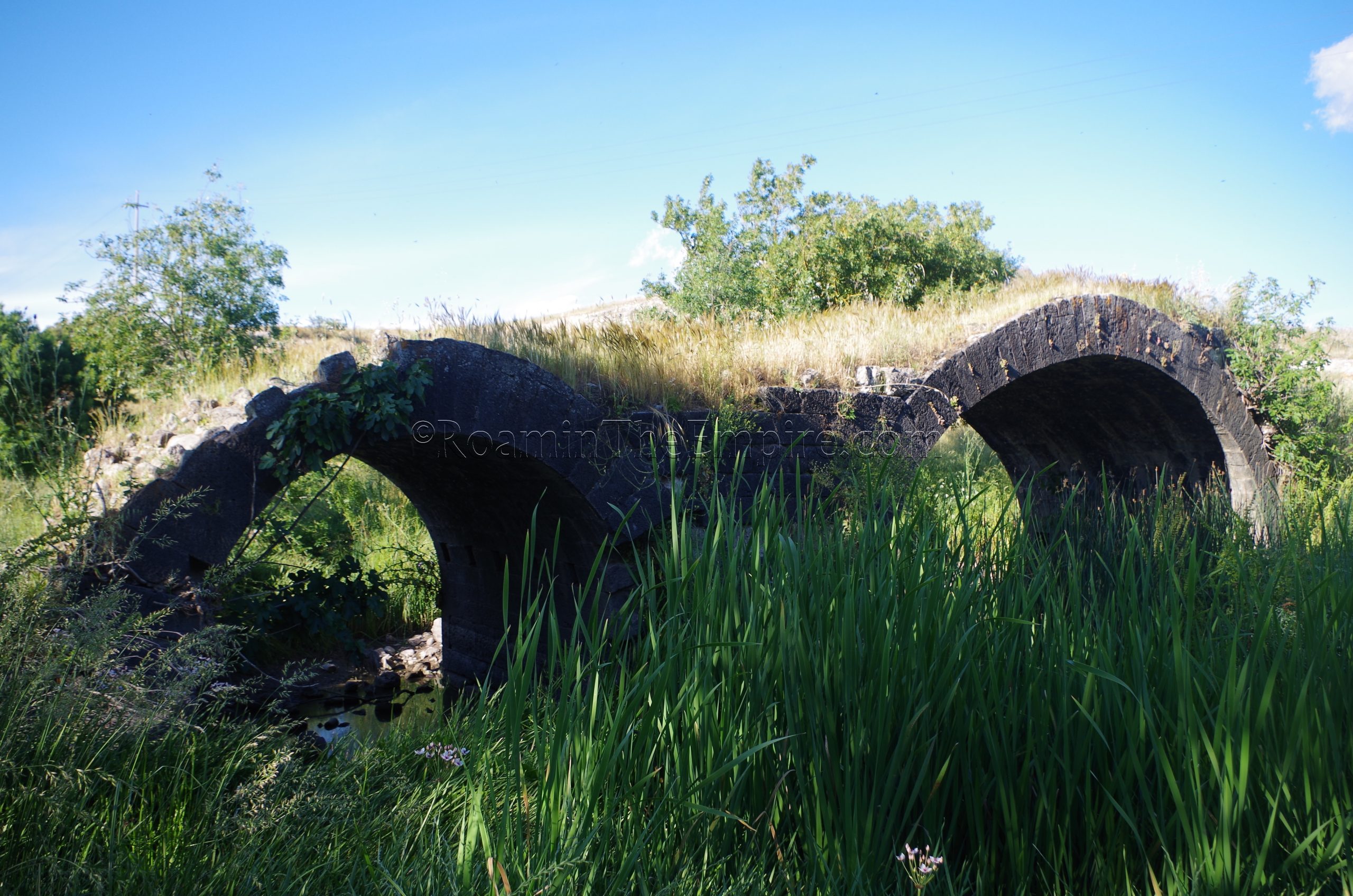
About 20 kilometers to the southeast is the next stop. Near the town of Ittireddu is the Pont’Ezzu, the remains of a Roman bridge crossing the Riu Mannu. Originally consisting of three arches, only two remain, and the course of the Mannu has changed and no longer flows under the bridge, but rather to the west. The road surface is almost completely gone; the bridge now consists of mostly just the arch structures and the pier between them. The bridge was probably part of the road that spurred off the Caralis–Turris Libysonis road toward Olbia. There’s a small parking area just east of the bridge with an informational sign in Italian. There are no access restrictions, so the bridge can be visited at any time.
From the Pont’Ezzu it is 20 kilometers northeast to the next destination; the Museo Archeologico Alle Clarisse in Ozieri (possibly Luguidunec/Castra Luguidonis in antiquity). The museum is located at Piazza Pietro Micca and is open every day except for Monday. From Tuesday to Friday the museum is open from 9:00 to 13:00 and 15:00 to 19:00. On Saturday and Sunday the hours are the same except it closes at 18:00 in the evening. Admission is 5 Euros.
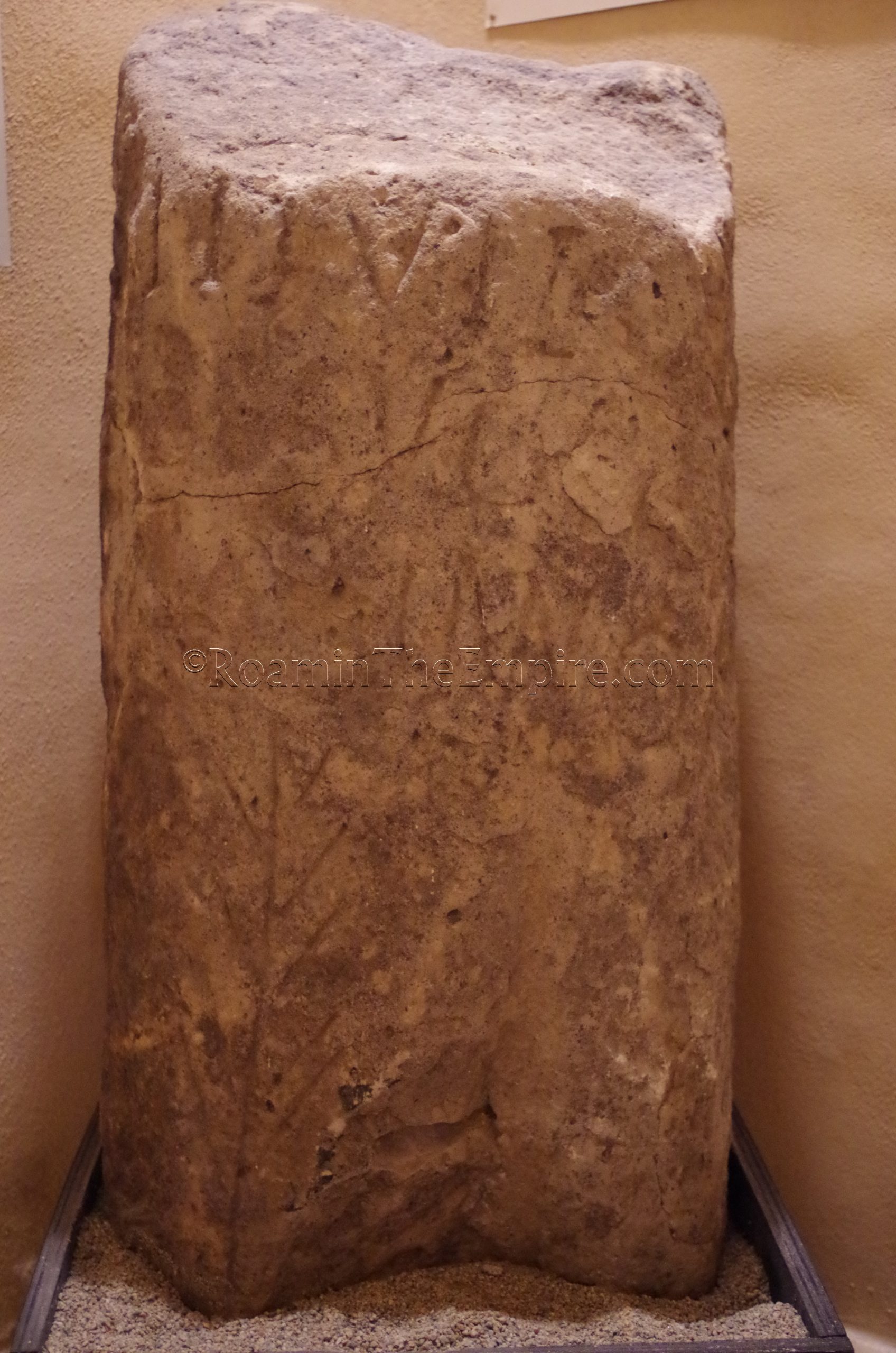
The museum is rather small as a whole, only a few rooms, and the ancient collection makes up a small portion of that. There are just a handful of objects from the Punic and Roman periods, though a few of these are decent inscriptions and stele. One particularly interesting object is a Roman stele with an inscribed image of a head, reminiscent of a Punic representation. There is supposedly a sizable numismatic collection here, but that section was not open to visit when I was there. The staff was very friendly and helpful, but, the price was a little steep for the size and quality of the collection. I imagine, however, they don’t get all that many visitors.
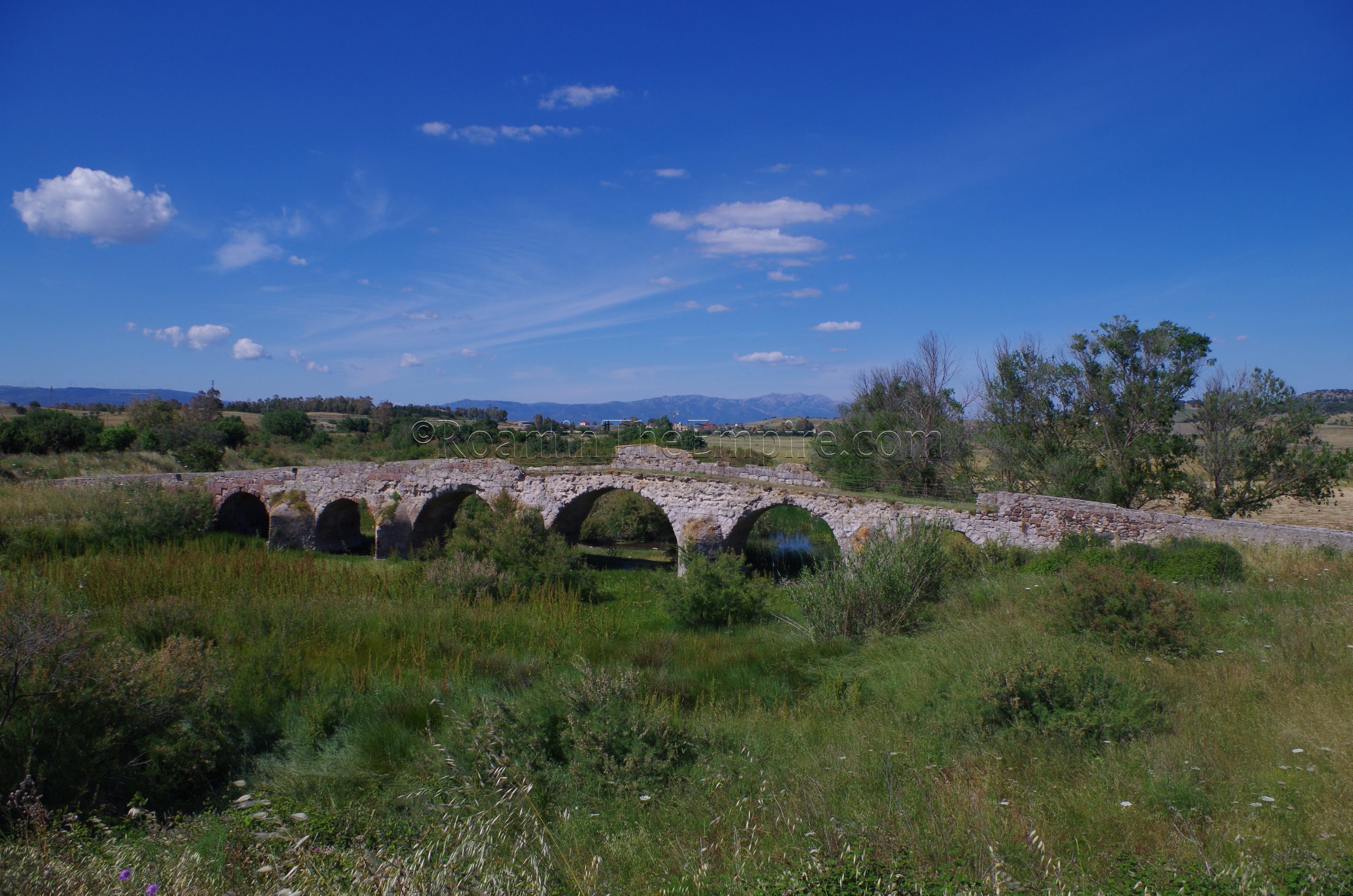
Just outside of Ozieri, about 5 kilometers to the north, is another Pont’Ezzu, not to be confused with the one near Ittireddu; the name Pont’Ezzu means ‘old bridge’ in Sardinian. Just north of the town of San Nicola, the Pont’Ezzu originally bridged the Riu Su Mannu di Ozieri, though the river has shifted course about 30 meters west of the bridge. Constructed in the 1st century CE, perhaps by soldiers from Castra Luguidonis (Ozieri), the Pont’Ezzu had a major restoration in the 3rd or 4th century CE, and then subsequent restorations in later periods. Interestingly, the red trachyte, which is used as a primary construction material on other Roman works on the island, is part of the medieval restorations and not part of the original construction. The bridge is still pretty complete, spanning nearly 90 meters over 6 arches, and can presently be traversed. The Pont’Ezzu is essentially in the middle of a field, and while there looks to be access, it was quite overgrown in the surrounding areas making access difficult. I have seen pictures of when the landscape is more manicured and it’s just an easy walk down a path from the road to the bridge.


.")


.")
.")

Sources:
Johnson, Mark K. “Santa Maria Di Mesumundu a Siligo e Gli Edifici Rotondi Nei Cimiteri Cristiani Della Tarda Antichità: Datazione e Funzione.” 2015, pp. 425–435.