


Most Recent Visit: June 2018
The Roman town of Aquae Sextiae Salluviorum, on the site of present-day Aix-en-Provence, was founded by the proconsul Gaius Sextius Calvinus in 122 BCE, making it the oldest Roman settlement in Gaul. The ‘Aquae’ referred to a hot spring nearby, the ‘Sextiae’ to the name of the founder, and the ‘Salluviorum’ to the Gallic Saluvii people that occupied the area. The site chosen was near the Salluvii settlement of Entremont, which had recently been sacked in the ongoing campaign against the Gallic tribes in the area that would conclude a few years later and bring the whole of the area under Roman control. The site of Aquae Sextiae was originally a Roman castellum used to guard several trade routes that passed nearby, but eventually grew into the primary settlement in the area as Entremont declined and was eventually abandoned in 90 BCE.
In 102 BCE the penultimate battle of the Cimbrian War was fought near Aquae Sextiae. A Roman force of six legions under the command of Gaius Marius met first an Ambrone force and later a Teutone force with a combined combat strength of over 100,000 warriors (and over 250,000 total including the non-combatants traveling in the group). The two engagements of the battle were overwhelming victories for the Romans and paved the way for the end of the war the next year when Marius defeated the Cimbri at Vercellae. After Massalia chose to support Pompey instead of Caesar in the Civil War, Aquae Sextiae was one of the recipients, along with Arelate, of Massalia’s territory when it was confiscated by Caesar as punishment for the transgression in 49 BCE. Aquae Sextiae would also become a Latin colony under Caesar, and later a Roman colony, probably under Augustus. During the reorganization of the late 4th century CE, Aquae Sextiae became the capital of the newly created Narbonensis Secunda.
Getting There: Aix-en-Provence is a relatively large city; not nearly as big as Marseille, but one of the larger cities in the area. As such, it’s pretty well connected to other cities in Provence by both bus and train. There are direct buses and trains from the Aéroport Marseille Provence as well, which is essentially the same distance from Aix-en-Provence as it is from Marseille. There are several sites discussed in this post that are in the hinterlands of Aix-en-Provence, though, which aren’t readily available by public transport, and so a private vehicle is recommended for those.
Villa Romaine Jardin de Grassi
Unfortunately, not much of the core of ancient Aquae Sextiae remains, and nearly all of that which does is inaccessible at present. The theater from the city has been uncovered, though the remains are currently on the property of a high school and cannot be viewed (and don’t appear to be very well taken care of anyhow). The archaeological collection that was once on display at the Musée Granet is currently in storage while plans for a new archaeological museum are in the works.
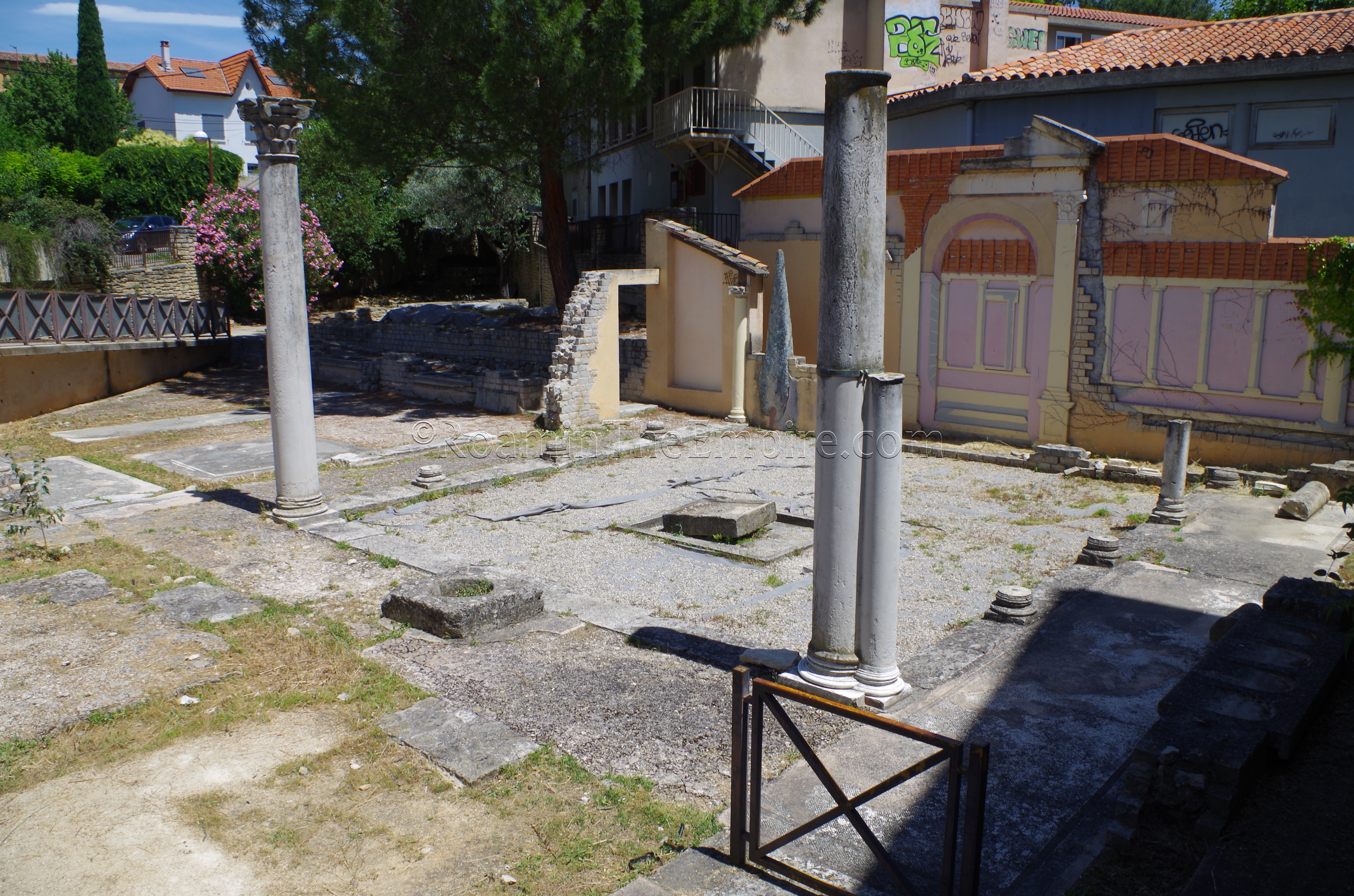
The one thing that is visible within the city of Aix-en-Provence from the Roman period, currently, is some remains from a villa. The Villa Romaine Jardin de Grassi is located off Rue des Nations, just north of the historic center of the city. There honestly isn’t a whole lot to see here, much of what remains (the atrium of a villa, essentially) is heavily reconstructed. There are also some artistic representations of what parts of the villa would have looked like surrounding the excavated area. The garden is located in a recessed area on private property, so there is no direct access, though it can be viewed from the street. Street parking in the area is a little difficult, but there is a parking garage about a block to the east.
Entremont
A few kilometers to the north of the villa remains are some pretty significant remains of the Entremont oppidum, the Gallic precursor to Aquae Sextiae. The opening hours for the site are a bit convoluted; It is open every day except Tuesday from June to September and is open Monday, Wednesday, Thursday and Friday the rest of the year. The hours of operation don’t follow quite the same yearly schedule. It is open year-round from 9:00 to 12:00, but the afternoon hours differ depending on the time of year. From April to August it is open in the afternoons from 14:00 to 18:00, and the rest of the year from 14:00 to 17:00. There is no admission fee. Getting in is a little convoluted, there is a gate that seems to be typically closed, even during regular opening hours, adjacent to the parking lot. It seems one can be buzzed in for entry, but during my visit, the gate just opened when I approached. I never saw nor talked to anyone working there.
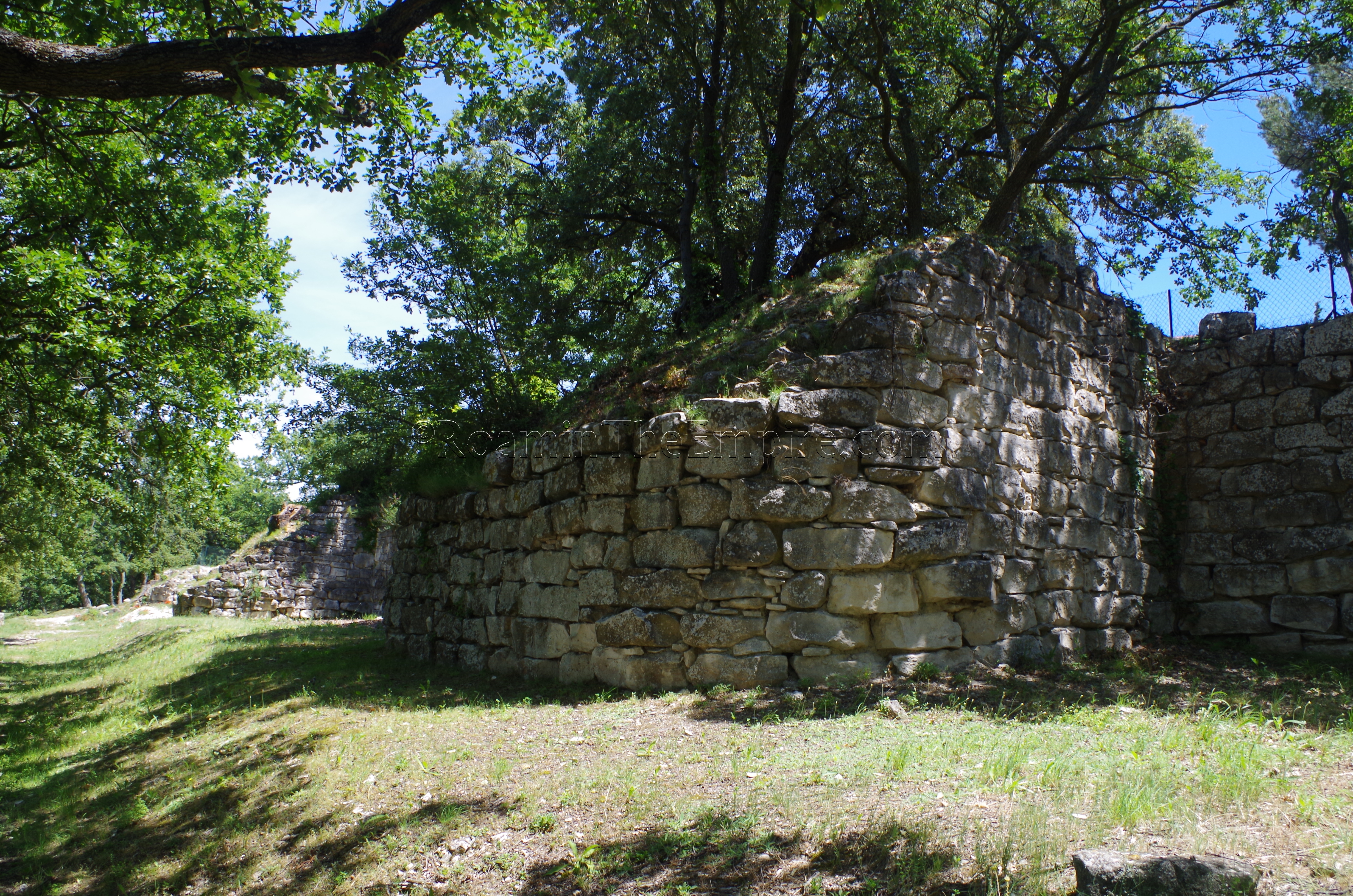
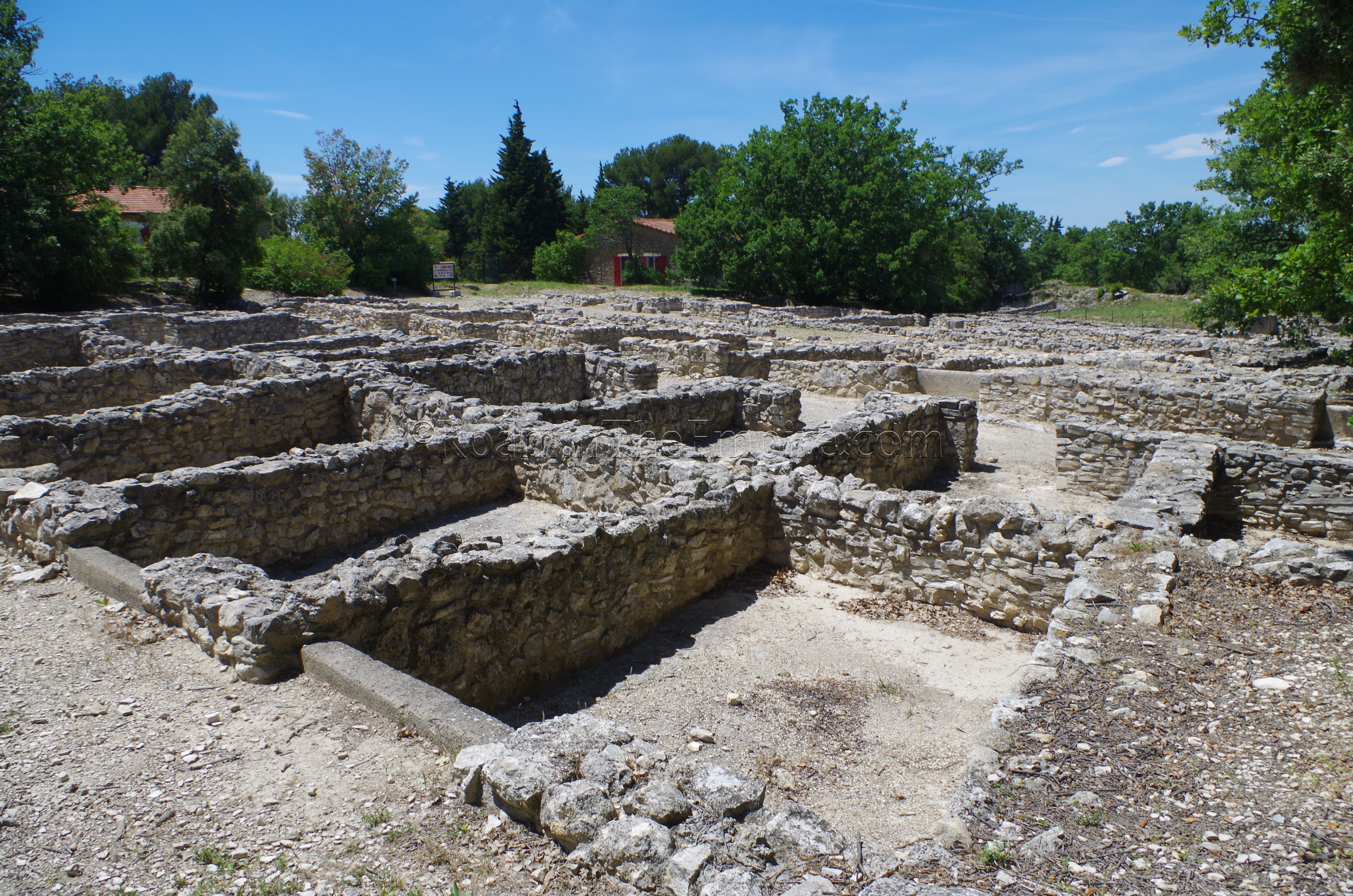
From the gate, it’s a short walk up a dirt path to the site. Along the way, some of the fortifications can be seen. There seems to be two primary construction phases; an initial settlement construction at the beginning of the 2nd century BCE, and then a significant enlargement in the middle of the 2nd century BCE. The fortifications date from the latter, as does most of what remains at the site, though there are some visible remains that date from the initial period of construction.
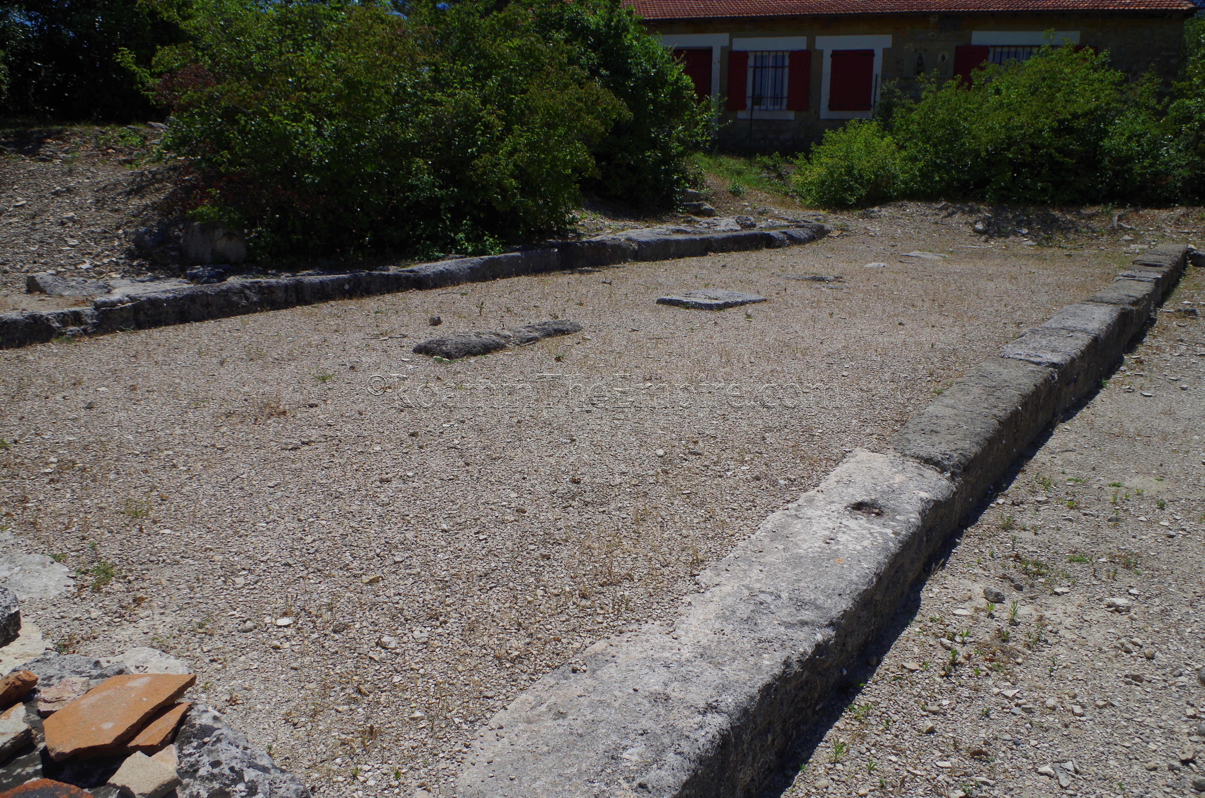
Most of the exposed architecture at Entremont belongs to habitations. The structures in the northern part of the site all date to the second period of construction, while the southern structures date to the initial period of construction. These two areas are separated by an open area. Along the course of the original walls is what is termed at the hypostyle hall, which is interpreted as a large, monumental public or religious building. A number of pierced skulls found there would seem to indicate that it was used to display decapitated head trophies which were common among the Gallic tribes of the area. Another unique building in the expanded section of the settlement is an area identified as an oil press.
One of the more peculiar things I noticed about the site was the use of brick/ceramic building material in some of the architecture. Given that the site was largely abandoned by 90 BCE, well before brick became a standard building material in the Roman world, I suspect this is just poorly advised reconstruction. The site is overall pretty bare. There’s one informational sign with an English translation, but the other few are in French only. Given that it’s free, it’s worth a visit if one has time, but I certainly wouldn’t categorize it as a high priority. It is interesting to see some pre-Roman vestiges, though.
Aquae Sextiae Aqueducts
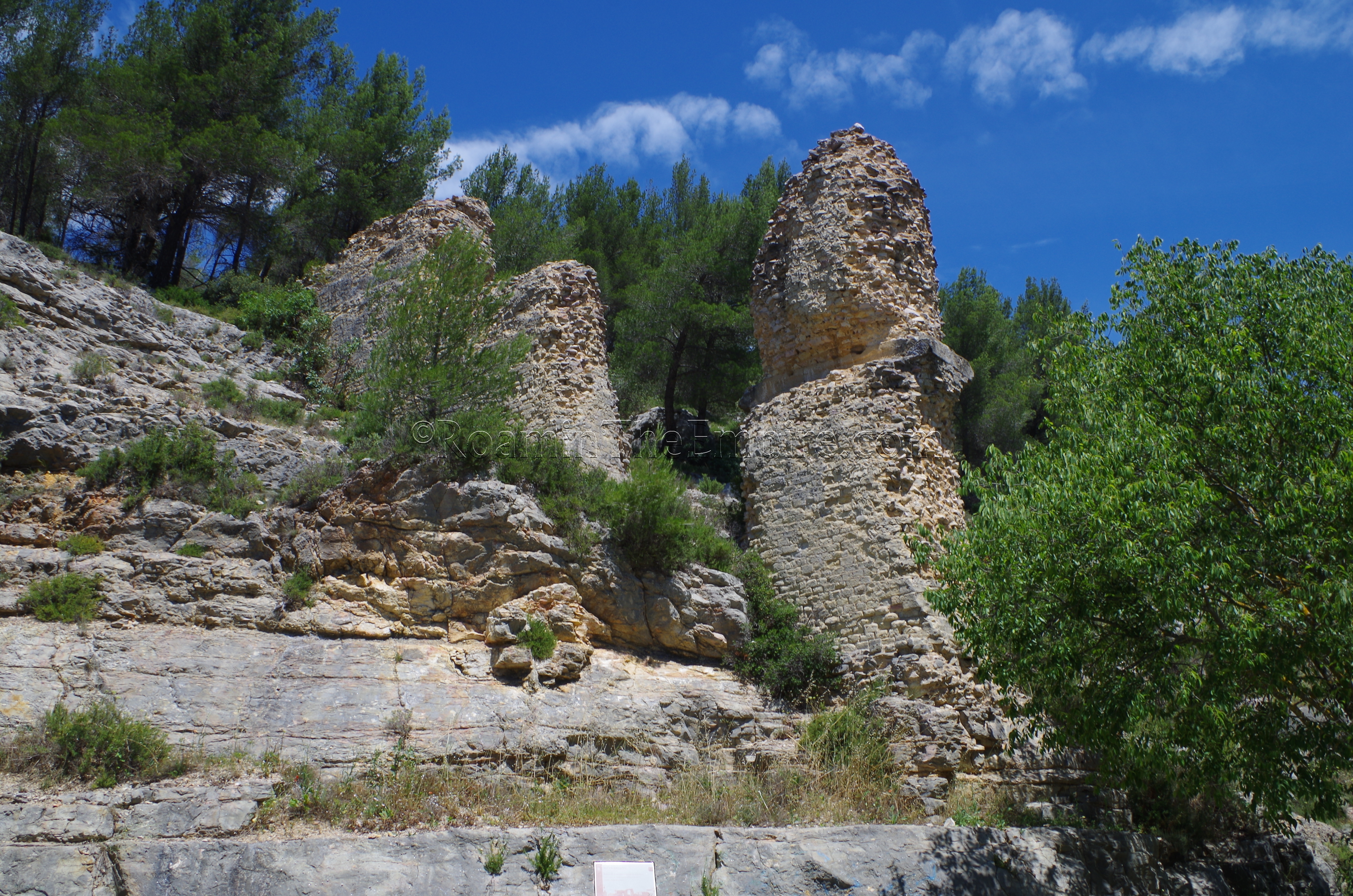
Scholarship suggests that there were at least five aqueducts that were feeding Aquae Sextiae, and stretches of two of those aqueducts are currently identified and visible. One of these, the so-called Traconnade Aqueduct stretched about 30 kilometers from near present-day Jouques to to Aquae Sextiae. There are apparently several points at which elements of the aqueduct can be viewed, but the most accessible and significant remains are in and around the town of Meyrargues, about 14 kilometers and a 15 minute drive from the Entremont site. There are two sets of remnants of the aqueduct; one on the west and one on the east side of the town. The Pilliers de Réclavier are located on the north side of a valley to the west of town; aqueduct bridge supports of significant size above the Chemin de la Plaine where it intersects with Avenue de la République, the main road running from the D96 into Meyrargues from the west. There are remains of the aqueduct on the south side of the valley as well, though they are not as easily visible from the publicly accessible areas.
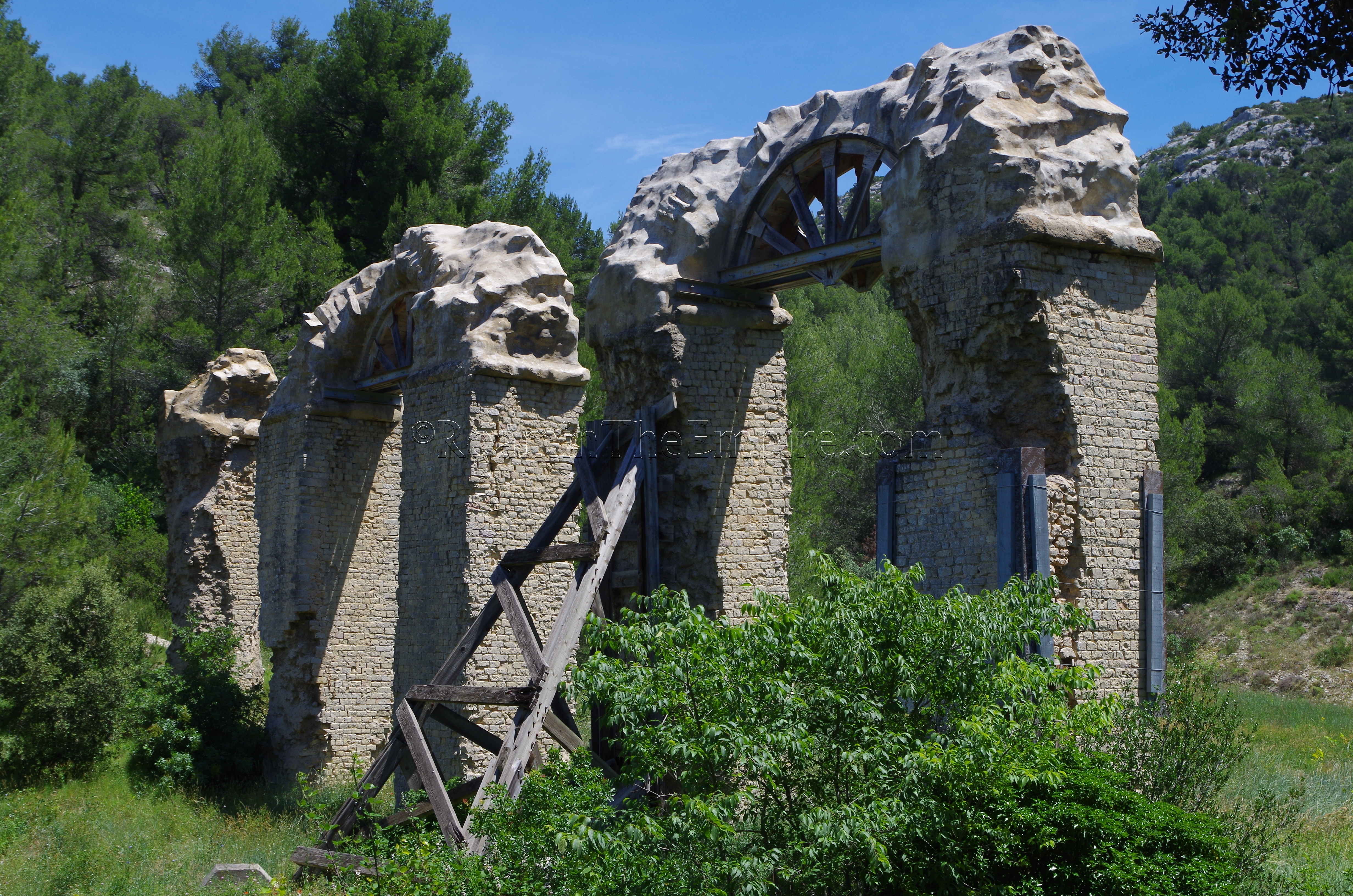
Southeast of Meyrargues in Le Pas de l’Étroit is another significant portion of the aqueduct. The aqueduct originally bridged this valley with a 40 meter long aqueduct bridge composed of 8 arches. Today, two of those arches and an additional pillar from a third remain. These remains are located on the north side of the Chemin du Passage de l’Étroit; and there is an area to park just a little past the arches on the south side of the road. The arches themselves are heavily conserved with lower braces helping to support them and some clearly modern consolidation of the actual arches. Braces of various construction also help to hold the pillars up.
The second of the two aqueducts with visible and identified remains is the so-called Saint-Antonin Aqueduct which sources from the southern slopes of Montagne Sainte-Victoire, relatively directly east from Aquae Sextiae. Like the Traconnade Aqueduct, there are various portions that are visible along the track, though in many cases are difficult to find or access. With a limited amount of time, I focused on a fairly productive stretch along the D17, which follows the route of the aqueduct for a pretty significant distances near the start.
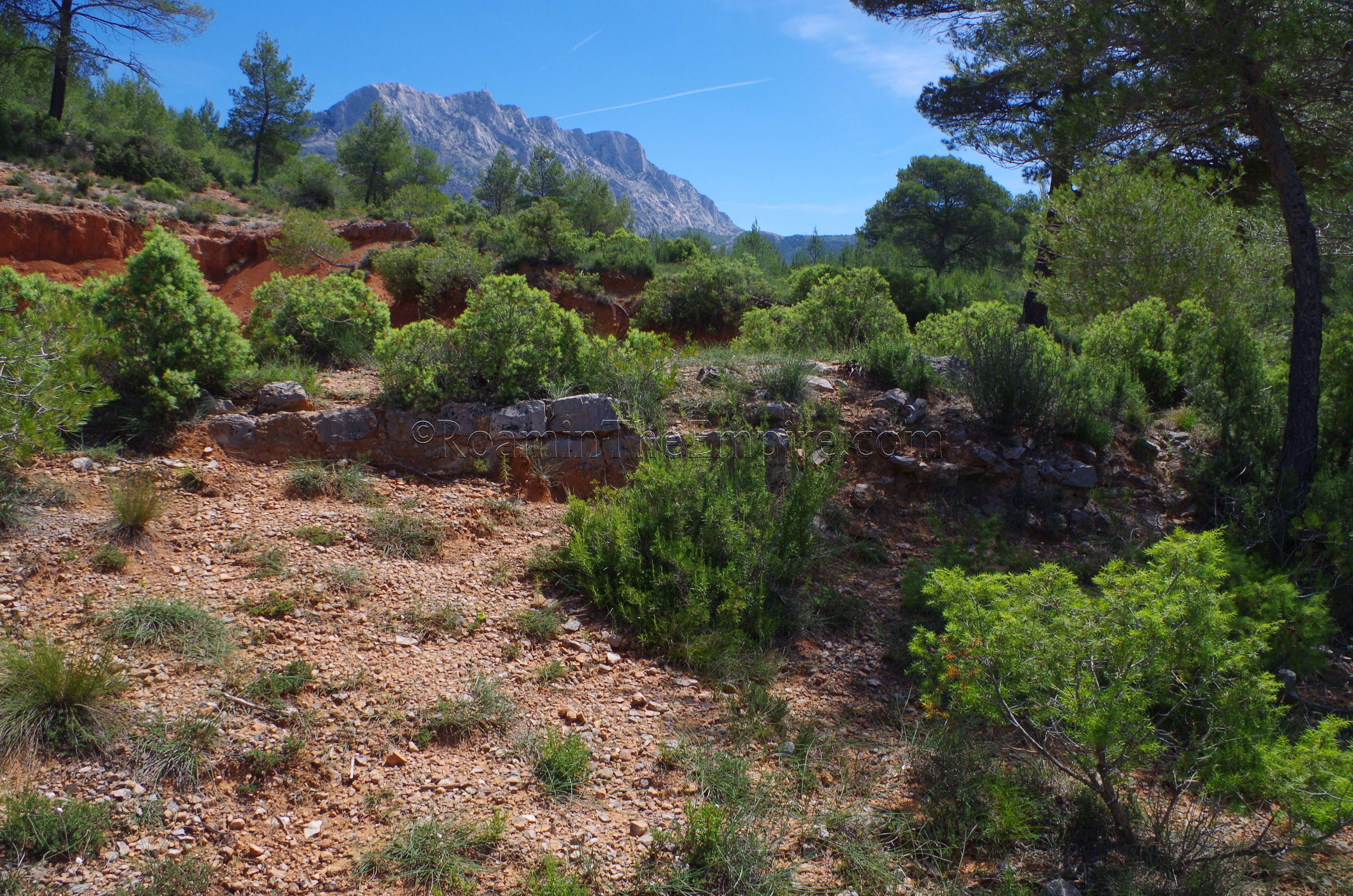
Parking at the Plan de l’Anchois parking lot, the path of the aqueduct can be pretty clearly followed for about 1.5 kilometers. Many parts of this stretch of the aqueduct are directly visible from the D17, while others require a little hiking on the north side of the D17 to see. But, aside from a few short stretches were it isn’t clearly visible, the channel of the aqueduct can be pretty well followed for the entire 1.5 kilometers. There are a couple points where the aqueduct channel ‘crosses’ the road, and these two can be pretty easily discerned for the purpose of following it. There are no large bridges visible here, most of the aqueduct seems to just be a channel supported by a low wall. In places, the whole channel is intact, including the arched covering. Towards the end of the stretch, at the entrance to the The path of the aqueduct runs roughly from the parking area to the entrance of the Parc Départemental de Roques Hautes. Just inside the entrance to the park, a few scattered and fragmentary pillars of the bridge that brought the aqueduct down from a rise.
Trophy of Marius
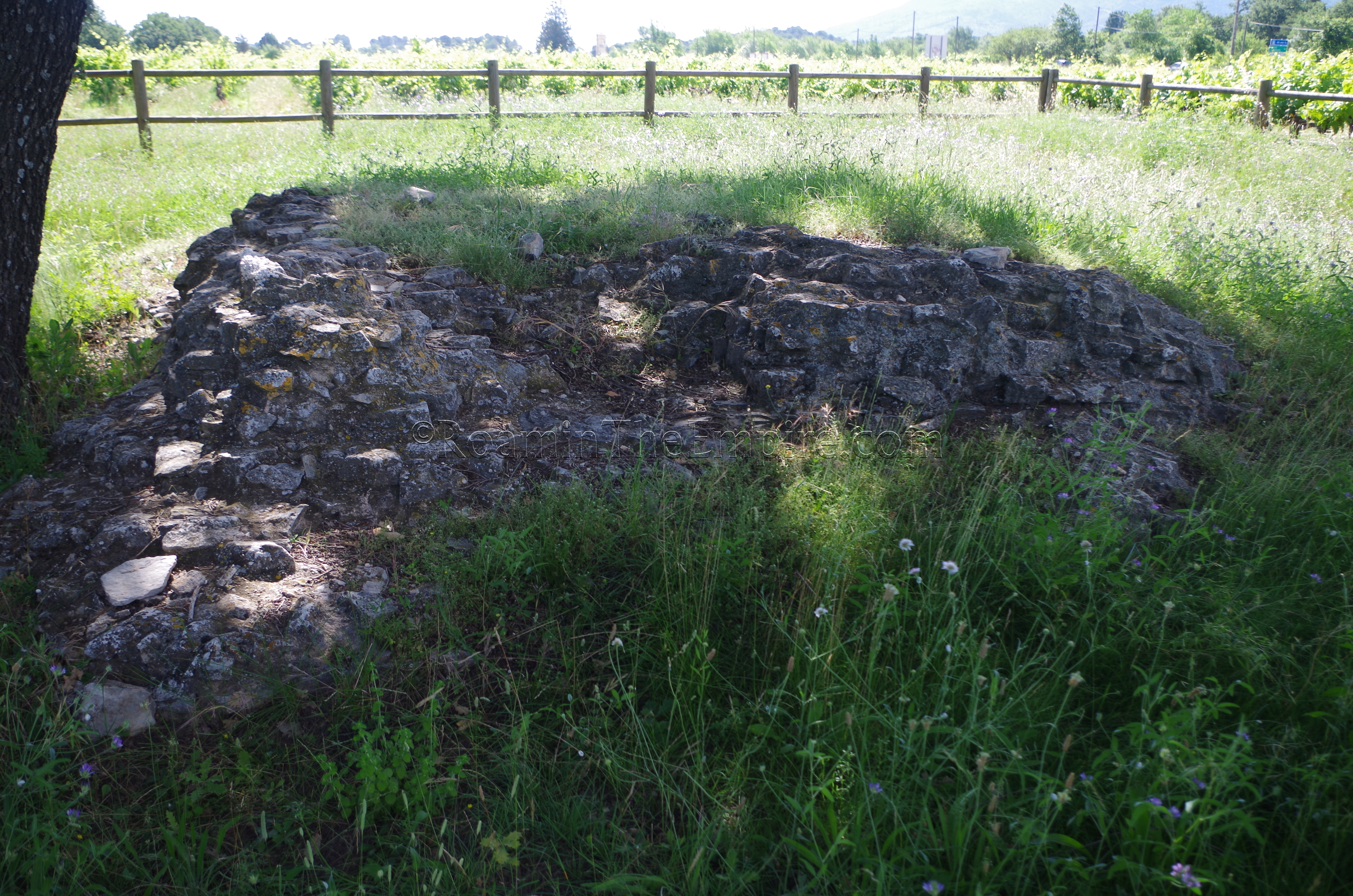
A little further afield, about 22 kilometers southeast of Aquae Sextiae near the intersection of the DN7 and D23, is the so-called Trophy of Marius. The colloquial name seems to derive from the victory of Marius in the Battle of Aquae Sextiae in 102 BCE. An official sign, in French, at the location parrots the line that it is the remains of a victory monument, but that identification is highly suspect. In reality, what remains here is likely related to a funerary monument and is almost certainly not a trophy of any sort. This is especially true considering the exceptionally poor level of preservation of this monument, whatever it was. All that remains are the foundations and some rubble/concrete core (preserved only up to a height of maybe 30 centimeters at its pinnacle) of a roughly square-shaped construction. It’s not much to look at, and given its remote location might not be worth visiting for anyone but the most committed.


Sources
Bromwich, James. The Roman Remains of Southern France: A Guidebook. London: Routledge, 1996.
King, Anthony. Roman Gaul and Germany. University of California Press, 1990.
Plutarch, Life of Marius, 17-19.
Stillwell, Richard, William L. MacDonald, and Marian Holland. McAllister. The Princeton Encyclopedia of Classical Sites. Princeton, NJ: Princeton U Press, 1976.
Website: entremont.culture.gouv.fr
Website: romanaqueducts.info