


Continued From Patrae Part I
A couple of blocks to the southwest of Patrae’s odeon, along Sisini, just south of the intersection with Georgiou Roufou, is another set of remains that I wasn’t able to get any conclusive identification of. I wasn’t able to get a very good look either, as it was in a fenced area that had a lot of growth of vines and such on the fence that obscured most of the site. It is definitely Roman in construction with the telltale brickwork. From the satellite imagery, it almost looks like another nymphaeum. One of the signs in the museum indicates the presence of the sanctuary of Dionysus Aisymnetes in this general area, so these could be associated with that. It looks to be some kind of storage area in addition to what is excavated here, with a small building and lots of loose architectural fragments and such strewn about.
A few blocks east, down Georgiou Roufou, and noted by a sign out front, are the remains of a section of Roman road. Unfortunately, these remains are within a building; and a building that doesn’t look like it has been open in quite some time. It looks pretty much just as bad on a Google street view capture from 2014. The windows are really dirty and covered in graffiti, but, I was able to peek in and somewhat see what was inside. It wasn’t a great look, but there’s definitely a road in there. The state of the windows didn’t really allow for a picture, though. It’s worth noting that this is here, particularly because it is in close proximity to the previous few stops, but other than that, it was mostly a disappointment.
The next stop is a bit further away, northeast of the odeon of Patrae and about 5-10 minutes from the building that houses the road. On Panagouli, about 45 meters south of Papadiamantopoulou are the remains of a public building of some sort. They’re also visible one street over on Illias, as the excavated area spans between the two streets. There’s actually a sign on Papadiamantopoulou that points in the direction, as well as an identifying sign on Panagouli in front of it. There are just a few brick walls here, though preserved well above the foundations. One of the walls has a filled in brickwork arch. I have seen it supposed that this may have been a mithraeum based on the form, but there does not seem to be anything beyond that to suggest the identification. The area is fenced and there is no access, but it was pretty well maintained and nothing was obscured.
The next street over, on Illias, just north of where the public building can be seen, but on the opposite (east) side of the street is a mostly covered excavated area. I actually walked right by this the first time because there is no sign out front, though there is one on Papadiamantopoulou, and it’s basically an excavation covered with corrugated metal roofing that almost completely obscures what is underneath except for a small corner of the site on the south. This is identified as a Sanctuary of Augustus. A little bit can be seen through the small opening beneath the roofing and through the fencing, but, there isn’t a whole lot to be seen, unfortunately. I could make out an opus reticulatum wall, though.
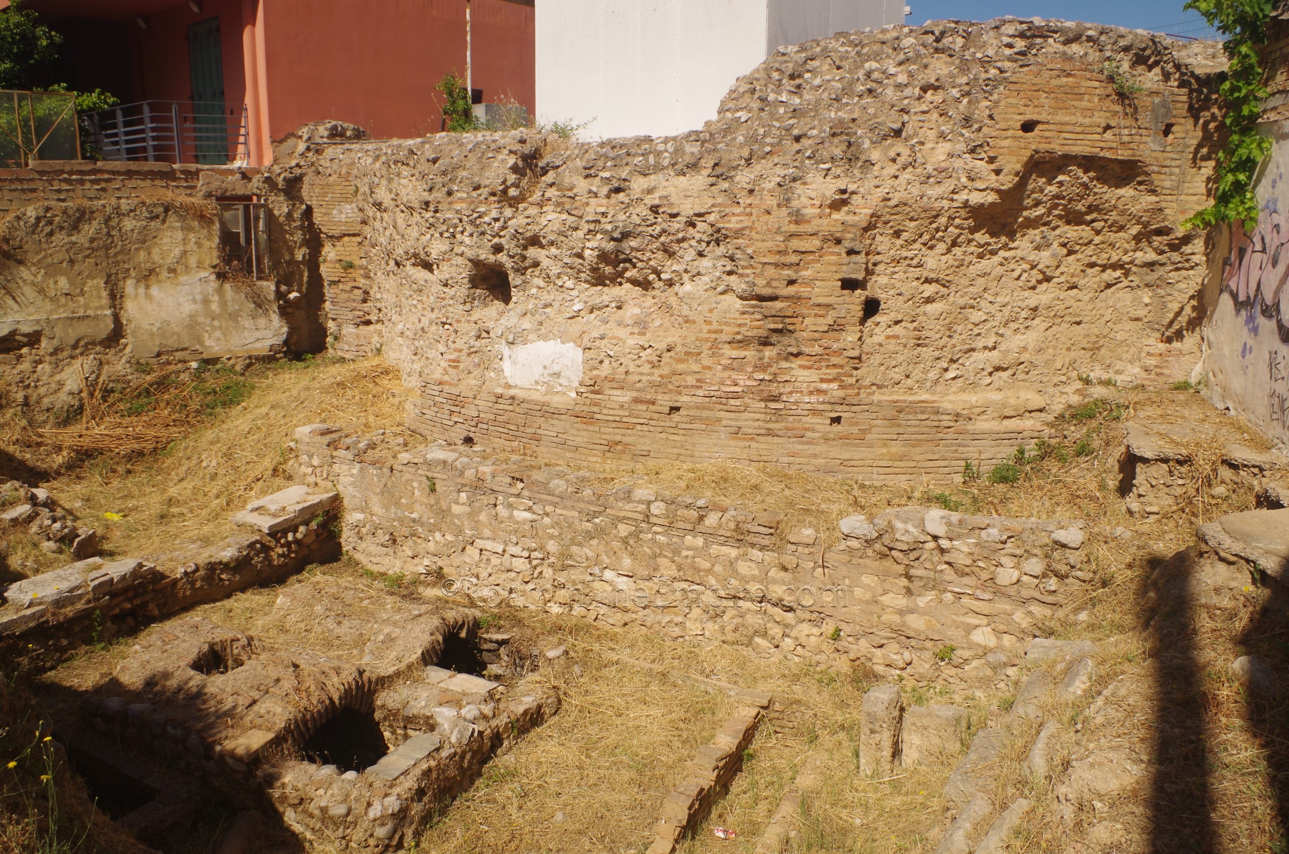
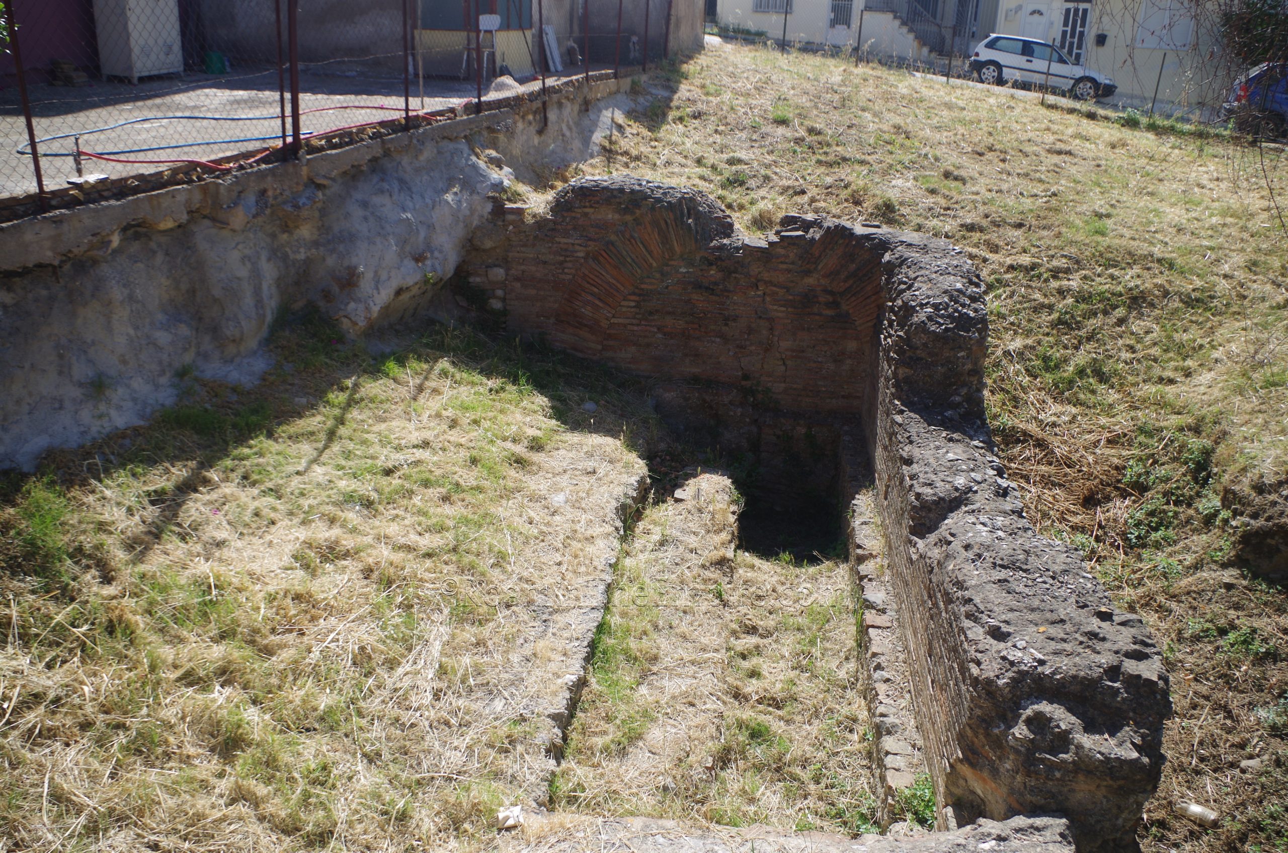
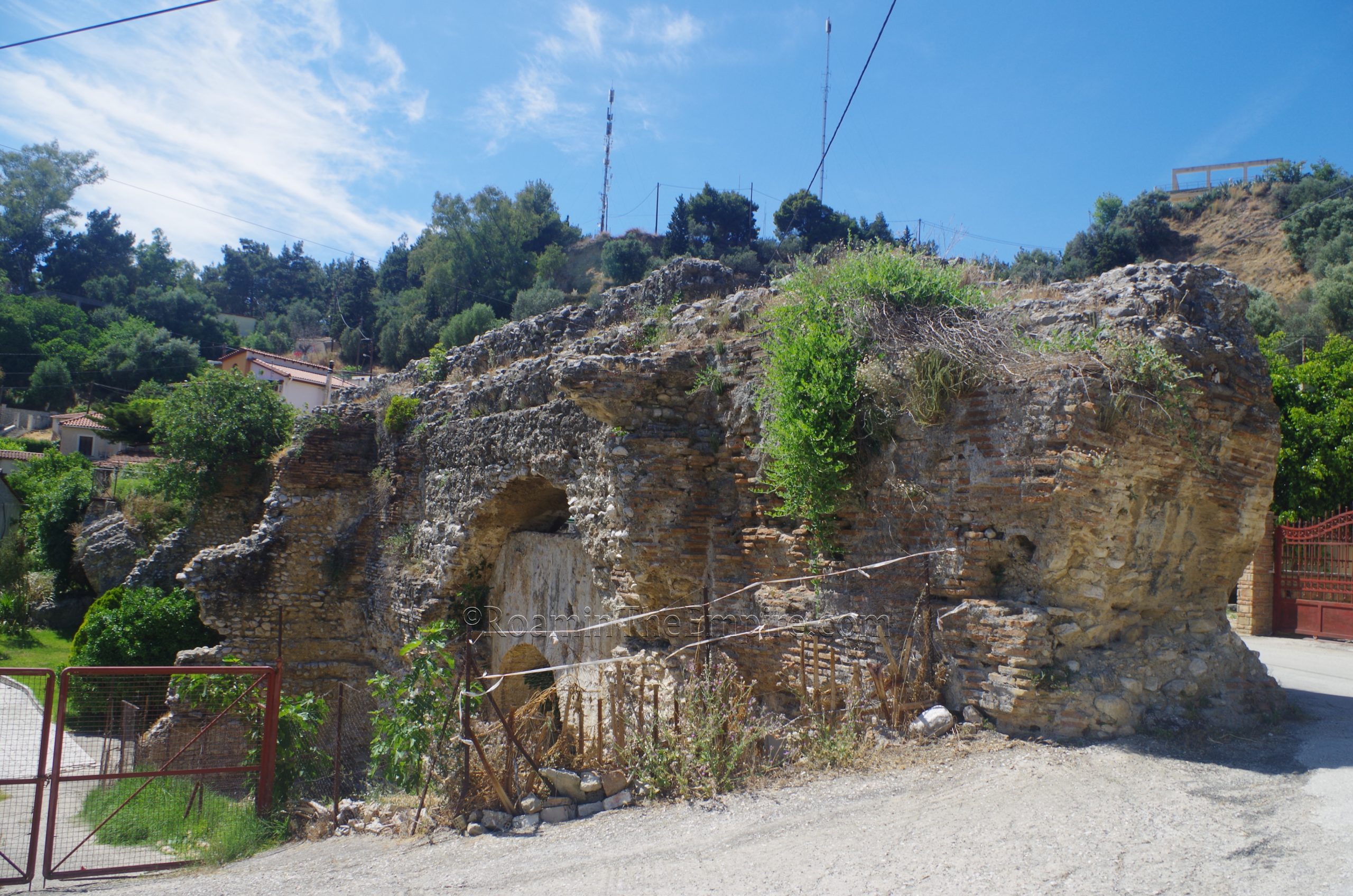
A couple of streets east of this is Lontou street. About 100 meters south of Papadiamantopoulou, on the west side of the street are some significant remains of the Roman period. There is a large semicircular brick construction above a sunken rectangular area. This area too, due to the find of a partial tauroctony relief, is identified by some to be a mithraeum. When compared to what must be the foundation of the semicircular structure, the rectangular structure would seem to be subterranean. The semicircular structure, which is at least a couple meters tall at its highest preserved point, would probably not have been related to a possible mithraeum. The area is fenced with no access, but was cleared of brush and everything was mostly visible.
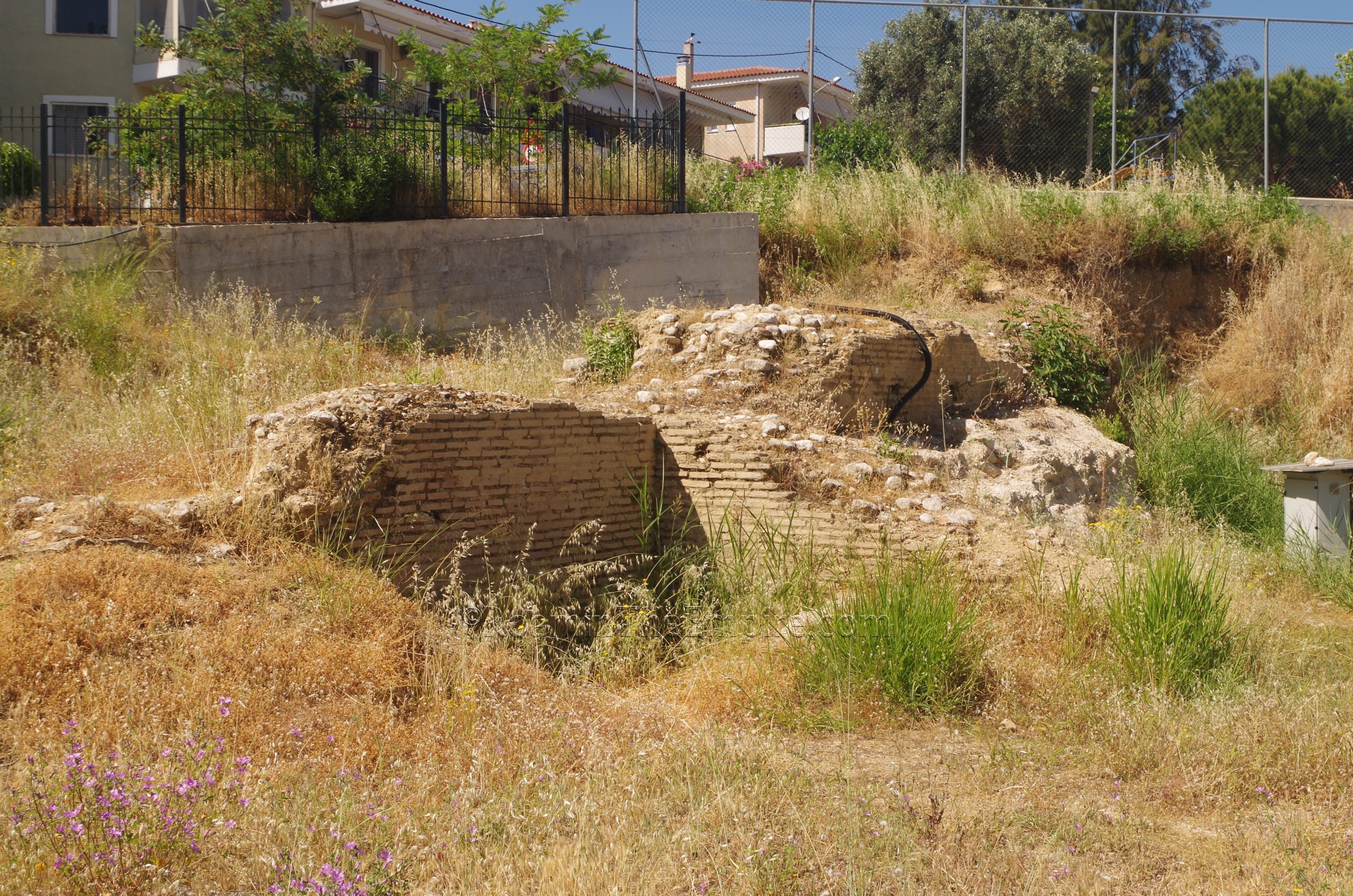
Just a few meters south on the opposite side of the road are the remains of what is identified as a cryptoporticus. These too are a little easy to miss, as it also has a low roof and fencing that mostly obscure it to the casual passerby. A sign out front does identify it, and unlike the Sanctuary of Augustus, the roof doesn’t come all the way to the ground for most of the length. It is easier to get a look here as well, and what can be seen is a few walls as well as what appears to be a water channel of some sort.
The final couple sites within the central area of Patras are located a few minutes to the northeast in an area that is still a bit of a hodgepodge on maps due to the recent construction of a new road and tunnel through the area (a project that seems to have brought to light a lot of remains in the process). A small construction survived the works along Agiou Dimitriou near the new road (Mikri Perimetriki Patron). Though there is nothing on site to identify this, it is in an area otherwise identified as being that to which Pausanias describes having a sanctuary to Dindymene and Attis in his description of Patrae. It is also possible that this is related to a bathing complex in the area, of which some remains can be seen about 135 meters to the east, along the north side of Gerani.
The remains at Gerani, though it is not really visible from the angle at which it can be viewed, also include part of an aqueduct channel running along the top of the wall. It has been proposed that the perpendicular walls may have just been supports for the channel rather than part of a bathing structure. The Aigou Dimitriou remains are open without any kind of fencing around them, while those on Gerani have a fence. Both were somewhat overgrown without any maintenance.
It is also worth noting that the nearby Kastro Patras (the location of the ancient acropolis of Patrae) apparently has a bit of spolia throughout. The most famous of which is the Patrinella, the remains of a Roman era statue that developed a local folktale regarding a young maiden turned into a man who watches over the city, keeping it safe from disease. I was unable to visit because, though it is free and functions as a sort of park, it still has the typical archaeological opening hours of 8:30 to 15:30; I prioritized the museum over the castle and ended up at the castle after the opening hours. There’s also an excavated area on the hill opposite the castle, but this appears to be private property and is fenced, so I was unable to view anything there.
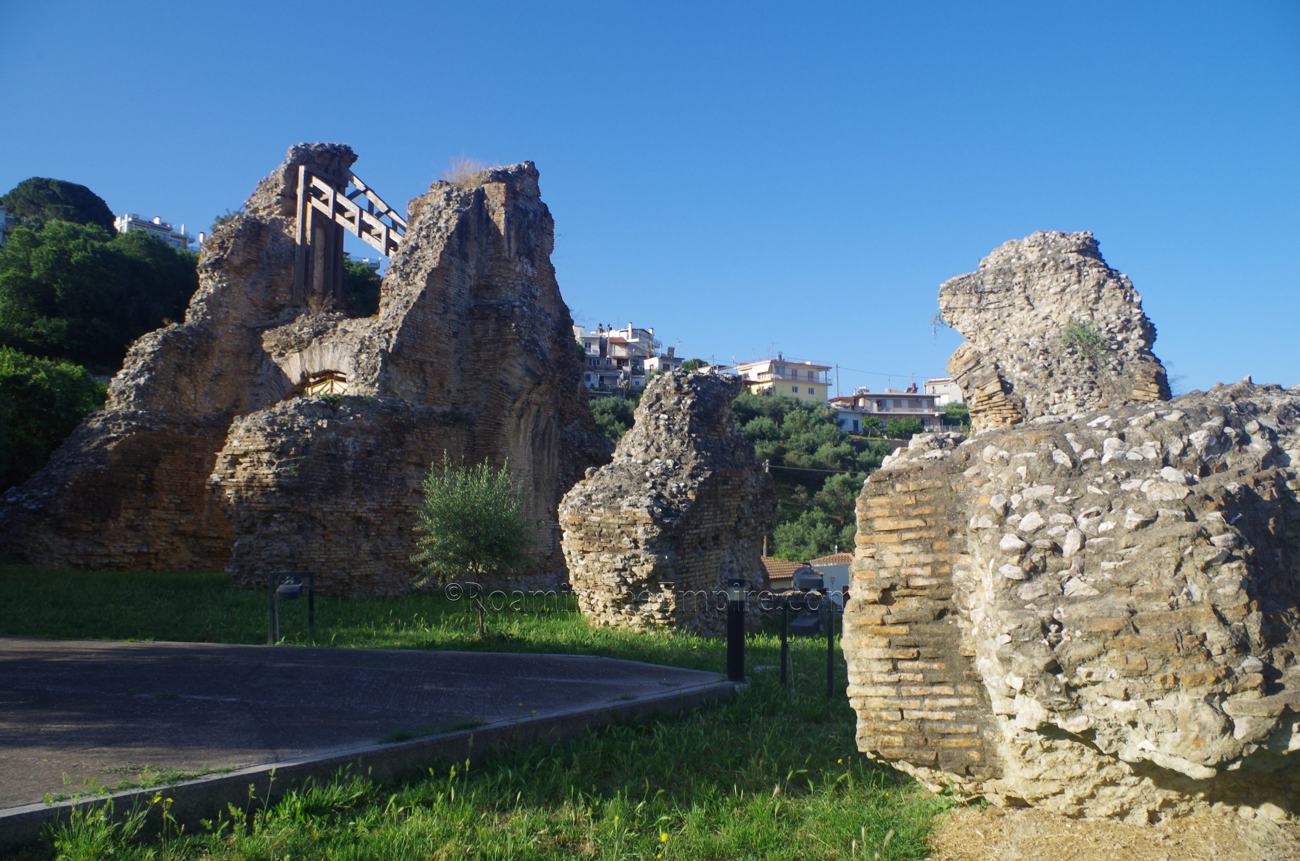
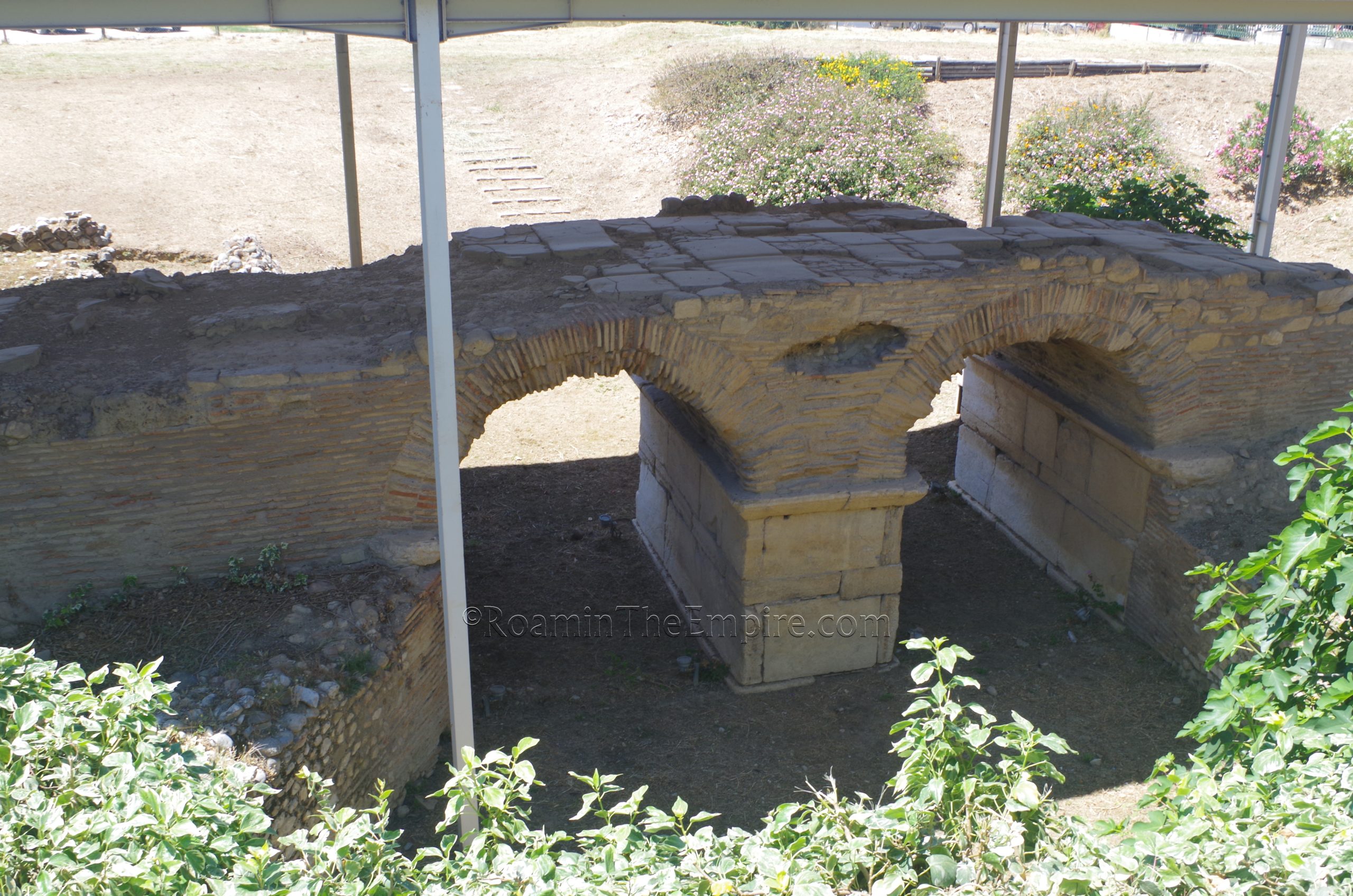
Not terribly far outside of the center of Patrae are a few areas with remains of the aqueduct. This aqueduct was constructed during the reign of Hadrian in the 2nd century CE. The system ran a total length of about 7 kilometers, from the area of the present day settlement of Romanos to the southeast and ending in the area of the castle. Some significant remains of the eastern part of a large aqueduct bridge spanning the Aroe Valley are located in a small archaeological area along Mikri Perimetriki Patron called the Roman and Medieval Aqueducts. This area is open Wednesday through Monday from 8:30 to 15:30 and is closed on Tuesdays. Admission is 3 Euros.
Although the actual channel of the aqueduct is not preserved, a number of the supports remain. The tallest of which is preserved to a height of about 14 meters. The visitor’s path weaves between a few of these. It is difficult to see from the archaeological area, but additional supports are present in private properties to the east of the park. In the north side of the park, part of the 15th century CE aqueduct, which was uncovered during the construction of the road, has been moved from its original location and is displayed.
On the hillside of the opposite side of the valley, to the west of the archaeological park, are a couple more points along Artemidos at which remains of the aqueduct can be seen. I’ve marked both areas on the map, as they can be a bit hard to just describe. The easternmost of these two are a couple of supports on either side of Artemidos where it hooks westward. A bit farther on is a relatively well preserved, roughly 70 meter stretch of the aqueduct. This section is broken up as Artemidos passes through it where an arch used to be. Another arch is present in the aqueduct on the west side of the road. Neither section of aqueduct is fenced in nor inaccessible, though the longer stretch does partially sit on private property that is fenced. Otherwise, both are pretty much out in the open.
The final two stops for Patrae are quite a bit out of the center. The first is the Archaeological Museum of Patras, located at New National Road Patras-Athens 38. The museum is open in the summer (March through October) from 8:00 to 20:00 daily except for Tuesday, when it is closed. The rest of the year it is open from 8:30 to 15:30. Admission in the summer is 6 Euros and the rest of the year is 3 Euros.
I was a bit unprepared for what a fantastic museum this is. Patras doesn’t really feature very high on lists regarding archaeology in Greece, perhaps because it is a primarily Roman site (though that doesn’t really stop Corinth from getting the attention it does). In any case, the archaeological museum doesn’t often seem to feature in the running among the best in Greece either. This was, however, easily among the top museums I saw in Greece over the course of the summer. I wouldn’t rank them, but this one can easily pull its weight among the other top museums in the country (aside from the National Archaeological Museum in Athens, which is in a class all its own).
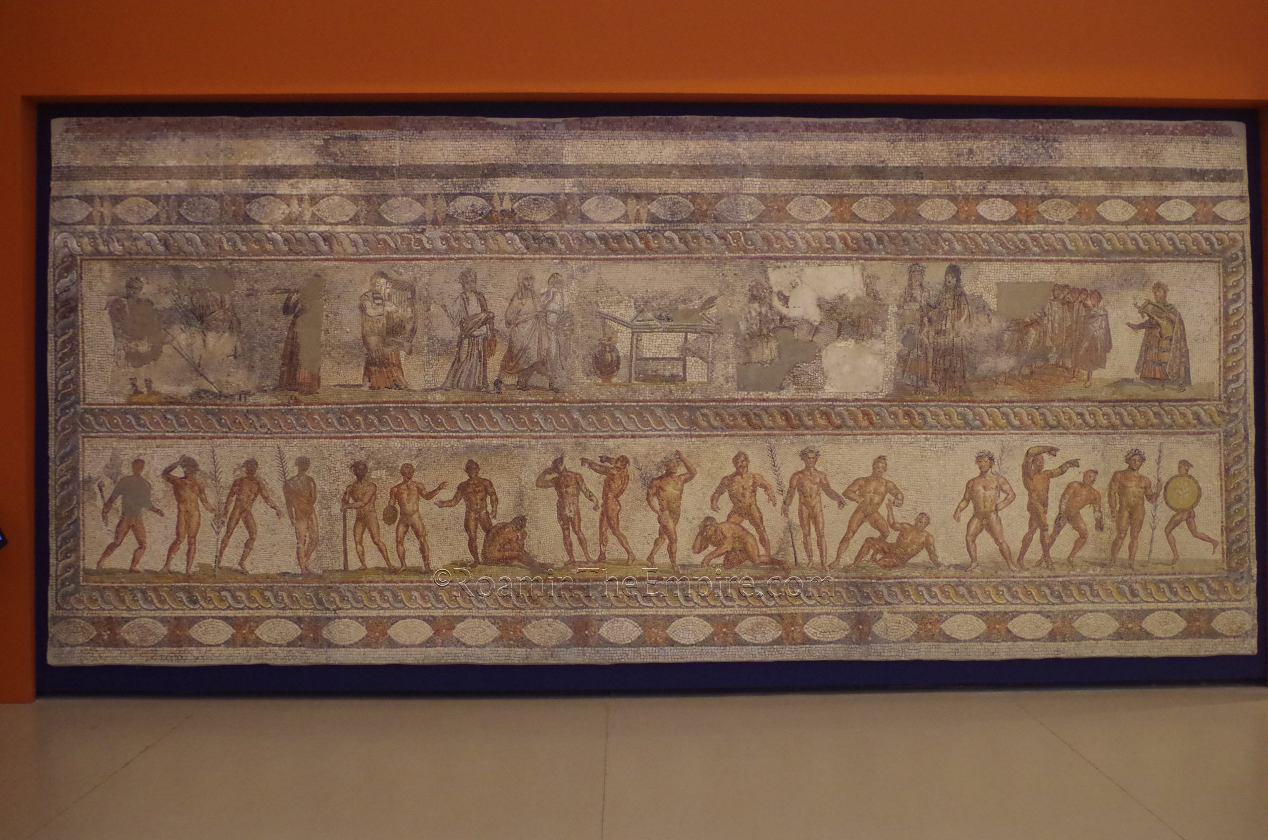
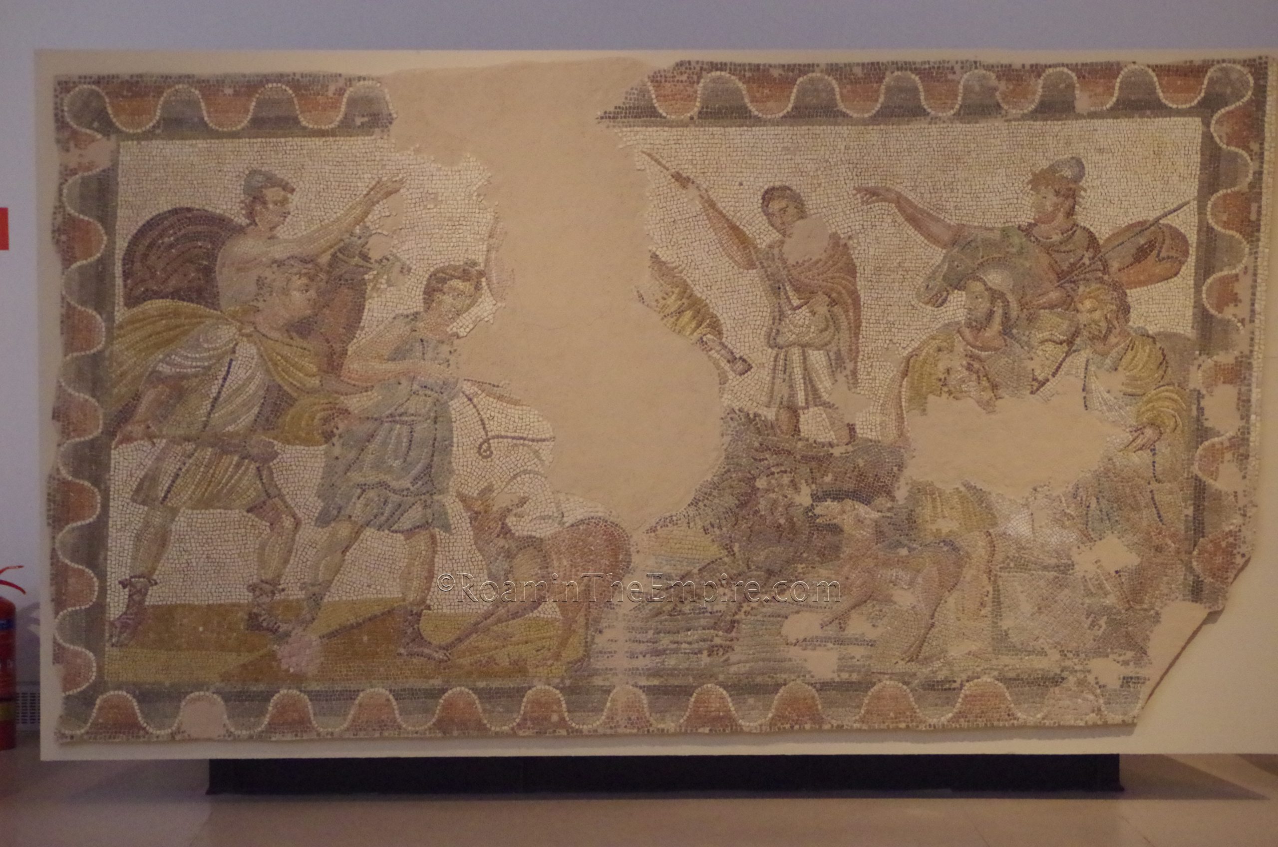
Firstly, the museum is very modern feeling in its presentation. It is largely divided up thematically, though some of the earlier pre-Roman stuff is kind of in its own area near the beginning. The mosaic collection here is stunning. There are a number of large, well preserved mosaics. Many of these are displayed on the walls, rather than the floor, allowing for a much better appreciation. An upper walkway above the main level of the museum does allow for a better view of those mosaics that are displayed on the ground, though.
Though the mosaics are certainly the highlight of the collection, it also features some great statuary and reliefs as well as various smaller artifacts. A few areas of villas, complete with flooring, as well as some larger funerary monuments have been relocated to the floor of the museum. Another highlight are the evocative skulls from Mycenean burials that preserves various flower and myrtle wreaths made of gold, gold plate, and terracotta still wrapped around the skull.
The museum took me a solid 2 and a half hours to get through. It’s large, but it isn’t jam packed like some museums. They definitely went for quality over quantity here. Nearly all the information here is in Greek and English, and in addition to the museum cards for individual artifacts, there was a lot of general information presented on panels around the museum.
The final stop for Patrae is just up the road (New National Road Patras-Athens) about a half a kilometer north of the museum. In a field on the east side of the street are the remains of a Roman bridge. The bridge was constructed in the 2nd or 3rd century CE , replacing a 1st century CE bridge, and spanned the Ameilichus (modern Milichos or Kallinaos River, which now flows 100 meters south of the bridge). This is the river noted by Pausanias at which occurred human sacrifice to Artemis Triclaria. The bridge was part of the road system between Patrae and Aigion. The bridge actually consists of two separate constructions, an earlier single arch bridge discernible by its stone arch (possibly part of the previous 1st century CE bridge), and a later double arch bridge with brick arches. Some sections of the road paving are visible on top of the bridge. Unfortunately the area is totally fenced off, but the best views of the bridge are from the small road running along the back side of the site. It appears as if the whole thing was once actually open, as there is an informational sign that would have been visible from inside, but can’t be read from outside the fence.
The remains of Patrae can probably be done in a single day. It actually took me a little bit more than a day (I did the aqueduct park first thing in the morning the day I left) because I walked everywhere (as I mentioned in the first post, traffic and parking in the city was a bit hectic) and the entrance sites were a bit spread out. Taking a car out to the archaeological museum and bridge, and to the aqueduct stuff would probably allow for everything to be done well within a single day.


Sources:
Diodorus Siculus. Bibliotheca Historic, 19.66.
Grant, Michael. A Guide to the Ancient World: A Dictionary of Classical Place Names. New York: Barnes & Noble Books, 1997.
Herodotus. Historiai, 1.145.
Koumoussi, Anastasia et al. Short Perimeter Road of Patras: A Road Changing the Archaeological Map of Patras. Patras, Greece: Hellenic Ministry of Culture and Sports, Ephorate of Antiquities Achaea, 2018.
Pausanias. Hellados Periegesis, 7.18-22.
Pliny the Elder. Naturalis Historia, 4.5.
Plutarch. Alcibiades, 15.
Smith, William. Dictionary of Greek and Roman Geography. Walton & Murray, 1870.
Stillwell, Richard, William L. MacDonald, and Marian Holland. McAllister. The Princeton Encyclopedia of Classical Sites. Princeton, NJ: Princeton U Press, 1976.
Thucydides. Historiai, 5.52.